Ship emissions and air pollution in Denmark
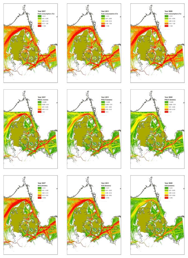
Figure 2.11 Maps of Fuel consumption (top row) and yearly emissions of PM2.5 and SO2 (subsequent rows). The unit is as indicated, but per km². Each row displays three scenarios: 2007, 2011 and 2020. The figure is continued on the subsequent pages.
Version 1.0 October 2009, © Danish Environmental Protection Agency