Pesticides in streams and subsurface drainage water within two arable catchments in Denmark: Pesticide application, concentration, transport and fate2 Description of the two investigated catchments2.1 Lillebæk on Funen2.2 Odderbæk stream in northern Jutland 2.1 Lillebæk on FunenThe catchment area of Lillebæk stream is situated on south-east Funen. The stream flows through the catchment area from NW to SE and discharges into the open sea, the Great Belt (Fig. 2.1). Geomorphologically, Lillebæk stream is characterized by moraine clay from the second-last glaciation and, in the northern part, also the last glaciation.
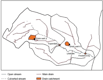
Figure 2.1. The upstream sampling station (upstream station of Lillebæk=Topenden) drains through a culverted stream, whereas the 1.4 km long section further downstream to the second monitoring station (downstream station of Lillebæk=Fredskovvej) is an open stream channel. The catchment area of Lillebæk can be divided into three sub-catchments as shown in Figure 2.1. Both of the two upper sub-catchments include tile stations in drained fields. The upper sub-catchment covers an area with drains connected to a culverted channel. Runoff at the upstream sampling station (upstream station of Lillebæk) mainly derives from subsurface runoff from the upper sub-catchment.
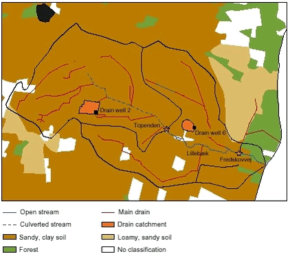
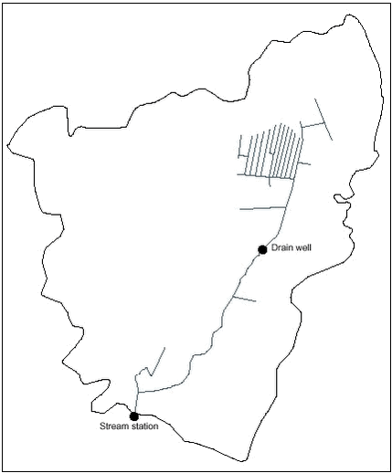
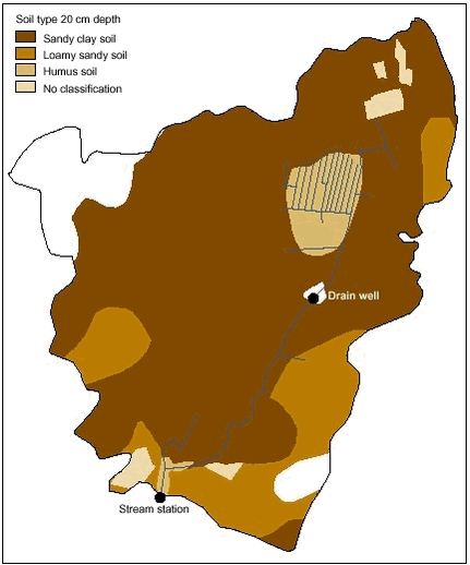
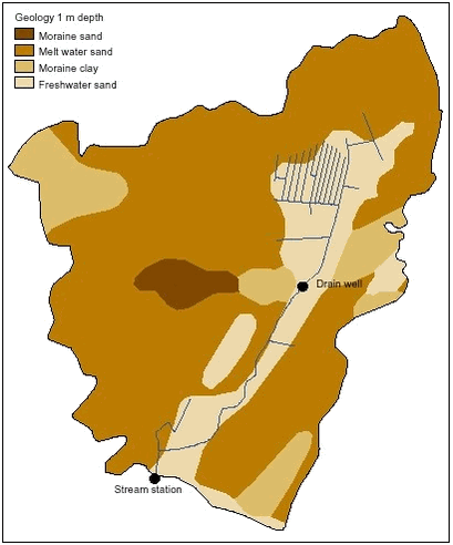
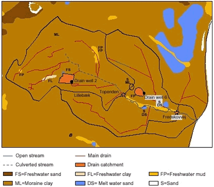 Figure 2.3. Surface geology up to one metre in depth of the catchment area of Lillebæk. Moraine clay is the dominant surface geology. Figur 2.3. Beskrivelse af overfladegeologien til en meters dybde i Lillebæk-oplandet, hvor moræneler er den typiske jordart. The catchment area of the downstream station of Lillebæk stream is 435 hectares with about 86 % being agricultural land. The upper sub-catchment is 229 hectares. The dominant soil of the upper 20 cm topsoil is sandy, clay soil (Fig. 2.2). Surface geology up to a depth of one metre is mainly moraine clay (Fig. 2.3). Catchment fields of the two tile stations are shown in Figure 2.1. Drain 2 is situated in the upper sub-catchment of Lillebæk stream and drains to the culverted channel. Drain 6 is situated in the downstream sub-catchment of Lillebæk stream and drains to the open channel. Drain 2 drains a catchment area of 4.2 hectares and drain 6 drains a catchment area of 2.1 hectares. 2.2 Odderbæk stream in northern JutlandThe Odderbæk stream catchment is situated in northern Jutland. The stream flows through the catchment area from N to S and discharges into the Lerkenfeldt stream (Fig 2.4) Odderbæk stream is characterized by a melt water river terrace and peripheral moraine. It is a moraine landscape formed during the last glaciation. Odderbæk stream drains a catchment area of 1,143 hectares. A larger drained sub-catchment of 32 hectares is located within the Odderbæk stream catchment. The catchment area of Odderbæk is 1,143 hectares with about 83% being agricultural land. The dominant soil type (upper 20 cm topsoil) is sandy soil (Fig. 2.5). Surface geology up to the depth of one metre is a mixture of sand and moraine clay (Fig. 2.6).
|