Pesticides Research No. 104 2006
Establishment of a basis for administrative use of PestSurf
Contents
- 4.1 Data interpretation in PestSurf
- 4.2 Main conclusions for each pesticide
- 4.3 Summary of concentrations generated by the three models
- 4.4 Patterns observed in PestSurf
- 4.5 Distribution of the contribution to groundwater
5 Proposed changes to PestSurf and its presentation programs
Annex 13 - Short guide to extraction of PestSurf results
Annex 14 - Corrections to earlier documentation
Preface
The exposure of organisms in surface water is a part of the risk assessment of pesticides as part of the approval procedure. In 1998 the Danish Environmental Protection Agency (DEPA) initiated a project to develop a model-based decision support system for exposure, to refine the pesticide exposure in surface water. The tool was build around the models MIKE SHE and MIKE 11 and included a user interface and a number of scenarios for sandy and sandy loam conditions. The system – called PestSurf – was available by the end of 2003, as a very flexible exposure modelling system.
The administrative use of PestSurf for national registration does, however, require experience with the use of PestSurf, development of criteria’s for deriving exposure values for surface water and assessment of the administrative consequences of using PestSurf.
The objective of this project is to clarify the possibilities and limitations of the PestSurf system through calculation and analysis of concentrations for 12 pesticides with different inherent properties and different use pattern. The reasons for pesticide occurrence in different parts of the scenarios and at different times are discussed. The PestSurf calculations are compared to similar calculations with the FOCUS Surface Water (FOCUS SW) tools, developed in an EU working group, and with the presently used practices.
The project was overseen by a steering committee. The committee consisted of:
- Jørn Kirkegaard, Danish Environmental Protection Agency
- Claus Hansen, Danish Environmental Protection Agency
- Alf Aagaard, Danish Environmental Protection Agency
Sammenfatning
Baggrund og Formål
Miljøstyrelsen iværksatte i 1998 et projekt vedrørende udvikling af et beslutningsstøttesystem til administration af pesticider i relation til deres effekter i overfladevand. Beslutningsstøttesystemet vedrørende eksponering blev bygget omkring modellerne MIKE SHE og MIKE 11 og inkluderede en brugerflade og et antal scenarier for sandede forhold og områder med sandblandet ler. Systemet kaldes PestSurf.
Erfaringen med brugen af PestSurf er begrænset, og da der genereres data for et helt opland, er der mange muligheder for at udtrække resultater på forskellig skala og for forskellige perioder. Dette gør systemet fleksibelt, men ikke let-fortolkeligt som administrativt værktøj. For eksempel kan høje koncentrationer findes i små, næsten tørre grøfter lige efter sprøjtning, men denne situation er måske ikke den, der er ønsket som basis for en administrativ beslutning. Den type situationer findes ikke i andre administrative værktøjer, der er baseret på mere standardiserede, men hypotetiske situationer. Formålet med dette projekt er at undersøge PestSurfs muligheder og begrænsninger gennem dets brug ved beregning af koncentrationer for 12 pesticider (alpha-cypermethrin, bentazon, bromoxynil, fluazinam, malathion, metamitron, pendimethalin, propiconazol, prosulfocarb, rimsulfuron, terbutylazin and tribenuron-methyl) i 54 scenarier.
Med henblik på sammenligning er pesticidkoncentrationer blevet beregnet på basis af direkte oversprøjtning, drift, tre FOCUS-overfladevandsscenarier (sandet D3-grøft, leret D4-vandhul og leret D4-å) og fire scenarier i PestSurf (sandet vandhul og å, vandhul og å i morænelersområde). De højeste koncentrationer blev genereret ved “direkte oversprøjtning” som forventet, bortset fra for en kombination af PestSurf-scenarie og pesticid. FOCUS-scenarierne genererede altid lavere koncentrationer end drift-beregningerne. For fire pesticider genererede PestSurfs “sandede vandhul” højere koncentrationer end de tilsvarende drift-beregninger (fluazinam, efterårsudbragt pendimethalin, terbutylazin og tribenuron methyl). For PestSurfs morænelers-vandhul genererede PestSurf lavere koncentrationer end driftberegningerne.
For PestSurfs sandede å og morænelers-å genererer PestSurf højere koncentrationer end driftberegningerne for alle pesticider. De højeste koncentrationer genereres altid i morænelers-åen. Det skal bemærkes, at til forskel fra de simple beregningsmetoder i FOCUS SW, hvor vanddybden i åer og vandhuller altid er 30 cm og 1 m, er vanddybden i PestSurf variabel, og i nogen tilfælde kun få cm.
FOCUS SW-D3-grøften er ikke helt sammenlignelig med de to sandede scenarier i PestSurf, mens FOCUS-D4-scenarier og PestSurfs morænelers-vandhul og å er sammenlignelige.
De højeste koncentrationer fundet i sammenlignelige scenarier er ikke nødvendigvis genereret af samme type proces. Den højeste koncentration i den sandede grøft skyldes altid drift. Det samme er også tilfældet for den sandede å (PestSurf). For forbindelser med lav sorption kan transport via grundvand imidlertid finde sted i dette scenarie. Bentazon, rimsulfuron og tribenuron methyl har lave Koc-værdier. De første to transporteres til grundvand i dette scenarie, mens tribenuron methyl med den laveste DT50-værdi af de tre synes at nedbrydes.
For det sandede vandhul (PestSurf), der er i direkte kontakt med højtliggende grundvand, er transport via grundvand den dominerende mekanisme. Drift spiller en rolle, hvis nedbrydningen er hurtig som for malathion. For bromoxynil samvirker sorptionen og den høje nedbrydningsrate til at gøre drift til en vigtig kilde. For alpha cypermethrin spiller sorption og den lille udbragte dosis en rolle. Da dette stof nedbrydes langsomt, vil der være tendens til stigende koncentrationer i grundvandet over tid. I FOCUS-scenarierne transporterer grundvand ikke pesticid. For efterårstildelinger spiller den mindre vanddybde en rolle i koncentrationsberegningen.
FOCUS-D4-åen modtager alle de største bidrag fra drift. Dette er også tilfældet for 11-12 af de 14 PestSurf-scenarier. To scenarier er stærkt påvirket af pesticid i tilstrømmende grundvand og i et scenarie skyldes maximumskoncentrationen en 20-års-nedbørshændelse. Imidlertid er drænkoncentrationer betydelige i en række af simuleringerne, og da simuleringsresultaterne tyder på, at forudsætningen for drift-beregningen bør revideres, er hovedkonklusionerne for dræntilstrømning beskrevet i det følgende.
For PestSurfs moræne-å’s scenarie er drift altid vigtigt for malathion, hvor den hurtige nedbrydning modvirker udvaskning. For den øvre del af oplandet spiller drift en rolle for alpha-cypermethrin og i nogen grad for bromoxynil, men tilførsler via dræn er betydende. For flere af stofferne findes den højeste dræn-koncentration, specielt i den opstrøms del af oplandet, i forbindelse med en ekstrem (20-års-) nedbørshændelse. Denne hændelse er ikke vigtig for malathion på grund af hurtig nedbrydning og for prosulfocarb på grund af udsprøjtningsdatoen, ca. en uge efter den ekstreme hændelse. For bromoxynil synes det at være en kombination af den høje nedbrydningsrate og tidspunktet for sprøjtning (april og oktober), der betyder, at den ekstreme hændelse ikke er vigtig. Ligeledes har tribenuron en lav DT50-værdi, udsprøjtes i april, og er ikke domineret af den ekstreme hændelse. FOCUS-overfladevandsscenarierne indeholder ikke sammenlignelige ekstreme hændelser og dette forhold er vigtigt for sammenligningerne. Når effekterne af den ekstreme hændelse skal vurderes, ikke mindst i administrativ sammenhæng, bør dens frekvens (1 pr 20 år) tages med i overvejelserne.
I den nedstrøms del af oplandet bliver tilførsler med grundvand vigtige for alle stoffer med en DT50-værdi større end 56 dage. Pendimethalin afviger med meget høje koncentrationer i den nedre del af oplandet. Som beskrevet i Styczen (2004a) menes det, at opbygningen i grundvandet er overdrevet på grund af den valgte beskrivelse af makroporerne, og meget høje koncentrationer i oplandets nedre ende bør derfor ikke være den eneste grund til at afskrive et stof. Imidlertid er det velkendt, at “gamle” pesticider kan findes i grundvandstilstrømning, og sprøjtning af 85-90 % af arealet 8 år i træk vil føre til en opbygning af koncentrationer i grundvandet, hvis stoffet udvaskes i væsentlige mængder. FOCUS overfladevands-beregninger forudsætter, at grundvandstilstrømning er fri for pesticider og kun medvirker til fortynding af koncentrationerne i åen.
For at undgå ovenstående problem bør værdier til administrativ brug kun udtrækkes i den øvre del af morænelersvandløbet (Øvre Lillebaek), mellem 500 (hvor åen er permanet) og 1700 m fra den opstrøms ende.
For morænevandhullet synes der at være god overensstemmelse mellem de to modeller. I ni ud af fjorten tilfælde er begge scenarier domineret af drift. I tre tilfælde spiller drænvand en rolle i begge modeller. Kun i to af de fjorten tilfælde er der uoverensstemmelse mellem årsagerne til den højeste koncentration, hvor FOCUS SW finder drænvand mest betydende, mens PestSurf finder drift mest betydende. I begge tilfælde er dræn også en kilde i PestSurf, og eftersom PestSurf-vandhullet er mindre – og dermed mere eksponeret for drift – er forskellen rimelig. PestSurf genererer systematisk højere koncentrationer for moræne-vandhuls-scenariet, end hvad der genereres i FOCUS-D4-vandhullet, når hovedkilden er drift. Forklaringen er den højere eksponering og for efterårsudbringninger, en mindre vanddybde. Hvis koncentrationerne skyldes drænvand, er de to modeller sammenlignelige.
FOCUS-D3-grøften er sammenlignet med PestSurf’s sandede vandhul og sandede å. Vandhullet domineres af helt andre mekanismer end grøften, og der er dårlig overensstemmelse mellem de genererede resultater. For åens vedkommende er der en næsten lineær korrelation mellem de to sæt modelresultater, men PestSurfs koncentrationer er en faktor 4.3 større. For åen er det sprøjtede areal ca. tre gange arealet sprøjtet for grøften og vanddybden i den øvre del er væsentlig mindre end 30 cm, men afstrømningen er meget større, og en del af åen er beskyttet af bufferzoner.
Nødvendige forbedringer
Undervejs i projektet blev identificeret en fejl i beregningen af opblandingen af drift i vandhuller og åer. Fejlen blev rettet, men for åerne blev de resulterende koncentrationer urealistisk høje. Det anbefales, at forudsætningerne vedrørende drift ændres til at repræsentere markforhold mere realistisk. De foreslåede ændringer er beskrevet i kapitel 5.
Undervejs i dataanalysen fandtes der fejl i programmet med hensyn til beregning af adsorption af stof til sediment. Disse fejl er rettet. Den maximale lagringsfrekvens i PestSurf er ændret fra 3 dage til 1 dag.
Det giver mulighed for mere hensigtsmæssige dataudtræk og gør sammenligningerne mellem FOCUS og PestSurf lettere. Det anbefales, at der bygges en udtrækningsrutine, der automatisk genererer de tabeller, der behøves til administrativ brug. Nogle simple makroer blev udviklet til dette projekt, og disse kunne forbedres til det formål.
PestSurfs resultat-præsentations-skabeloner er baseret på dataudtræk fra fordefinerede beregningspunkter. De valgte punkter repræsenterede ikke altid de maximale værdier fundet i å-systemerne. En ny version af præsentations-skabelonerne bør udarbejdes, hvor dataudtræk sker fra de beregningspunkter, hvor maximum-værdier oftest forekommer, identificeret undervejs i projektet. Skabelonerne indeholder ikke punkter fra tilløb til de to åer. Det anbefales ikke at ændre dette, da tilløbene løber tør i perioder. Det samme gælder den opstrøms ende af morænelersoplandet.
På nuværende tidspunkt er der stadig ingen klare retningslinier, vedrørende hvordan de spatielle data skal fortolkes, og hvordan dette bør inkluderes i en administrativ evaluering af et stof. Hvor meget af en å kan påvirkes, før det er vigtigt, og er alle dele af en å lige vigtige? Den konservative metode anvendt i denne rapport er at analysere maximumværdierne i oplandet uden at vægte deres rumlige udbredelse eller hvor i oplandet, de forekommer.
Det vil være muligt at generere en 3-D-graf, der viser åens udstrækning på x-aksen, tiden på y-aksen og concentration (store end eller lig med) på z-aksen. Den resulterende graf bliver en “bjerglignende” formation som for hvert tværsnit af z-aksen ville vise i hvilken tid et koncentrationsniveau var opnået eller overskredet for en vis længde af åen.
Det anbefales, at Miljøstyrelsen beslutter et ”tids-kriterie” i stil med, hvad der anvendes for grundvand. Hvis meget høje koncentrationer kun findes hver 20. år, må det være parallelt til en 95 %-fraktil under det nuværende klima. En lignende vurdering kunne tillægges det meget tørre år (1996), men eftersom sommerperioden i ”normalåret” som oftest er lige så tør, kan en undtagelse ikke rigtigt retfærdiggøres.
For at undgå, at et enkelt punkt med meget høj koncentration bliver udslagsgivende for en beregning, kunne et lignende kriterie implementeres for koncentrationernes rumlige udbredelse. Modellerne indeholder 133 og 72 beregningspunkter, af hvilke 96 og 40 findes i hovedåerne, og 15 af de 40 ligger mellem 500 og 1700-m punkterne. Et 95 %-kriterie ville svare til 4-5 punkter i det sandede opland og <1 punkt (60 m) i morænelersoplandet.
Det bør bemærkes, at hverken forhold som den ekstreme drænhændelse, grundvandstilstrømning, den varierende vanddybde i åen, den varierende vanddybde i vandhul eller vandhulsstørrelserne identificeret som relevante under danske forhold er repræsenteret i FOCUS SW. Vanddybderne er væsentligt mindre end 30 cm i løbet af sommer og efterår i danske 1.ordens åer, og vanddybden i vandhuller falder også i tørre perioder.
Den nuværende beskrivelse af kolloidtransport i makroporer fører til en overdreven flux af pesticid til groundvand. Et igangværende projekt arbejder med at forbedre beskrivelsen. Det anbefales, at den forbedrede beskrivelse inkluderes i modellen, når beskrivelsen foreligger.
Den nuværende version af modellen er bygget i 2002-versionen af MIKE SHE/MIKE 11. Modellerne har været gennem en kraftig revision siden, herunder en igangværende omprogrammering af advektions/dispersions-beregningerne i MIKE 11. Det anbefales at ændre modellen til den nye version, når og hvis andre ændringer skal implementeres. Da den gamle version ikke mere understøttes på kodeniveau, er det meget vanskeligt at indføre fundamentale ændringer i den nuværende version. Hvis Miljøstyrelsen vælger at fortsætte med PestSurf-systemet, anbefales det at opgradere det som beskrevet i kapitel 6.
Summary
Background and Objectives
The Danish Environmental Protection Agency (DEPA) initiated in 1998 a project concerning development of a decision support system for administration of pesticides in relation to their effects on surface water. The decision support system for exposure was build around the models MIKE SHE and MIKE 11 and included a user interface and a number of scenarios for sandy and sandy loam conditions. The system is called PestSurf.
The experience with the use of PestSurf is limited and as data are available for whole catchments, there are numerous possibilites of extracting results at different scales and for different periods. This makes the system flexible, but not easily interpreted as an administrative tool. As an example, high concentrations may occur in small, almost dry ditches just after spraying, but this case may not represent the situation wanted as a basis for the administrative decision. The same situation is not found in other administrative tools, which are based on more standardised but hypothetical situations. The objective of this project is to clarify the possibilities and limitations of the PestSurf system through use by calculation of concentrations for 12 pesticides (alpha-cypermethrin, bentazon, bromoxynil, fluazinam, malathion, metamitron, pendimethalin, propiconazol, prosulfocarb, rimsulfuron, terbutylazin and tribenuron-methyl) in 54 scenarios.
Pesticide concentrations were calculated based on direct spray, drift, three FOCUS Surface Water scenarios (sandy D3-ditch, sandy loam D4-pond and D4-stream) and four scenarios in PestSurf (sandy pond and stream, sandy loam pond and stream). The method generating the highest concentrations is “direct spray” as expected, except for one combination of PestSurf scenario and pesticide. The FOCUS scenarios always generate lower concentrations than the drift calculations. For four compounds, the PestSurf sandy pond generates higher concentrations than the corresponding drift calculation (fluazinam, pendimethalin autumn appl, terbutylazin and tribenuron methyl). For the Pestsurf sandy loam pond, all PestSurf simulations generates values that are lower than the drift calculations.
For the PestSurf sandy stream and sandy loam stream, PestSurf generates higher concentrations than the drift calculations for all pesticides. The highest concentrations in the simulations are always generated in the PestSurf sandy loam stream.
The ditch is not entirely comparable to the two sandy scenarios in PestSurf, while the sandy loam pond and stream must be judged to be comparable.
The maximum concentrations occurring in comparable water bodies may not be generated by the same type of process. The highest concentration in the sandy ditch is always caused by drift. This is also the case for the sandy stream. However, for compounds with a low sorption, transport to groundwater may take place in this scenario. Bentazon, Rimsulfuron and Tribenuron methyl have low Koc-values. The first two are transported to groundwater in this scenario, while Tribenuron methyl with the lowest DT50-value of the three seems to degrade.
For the PestSurf sandy pond, which is in direct contact with shallow groundwater, transport in groundwater is the dominating mechanism. Drift plays a role if the degradation is very fast, such as for malathion. For bromoxynil, the relatively high sorption and the fast degradation rate interacts to make drift an important source. For alphacypermethrin, the sorption and small dose play a role. As this compound degrades slowly, concentrations will tend to build up in groundwater over time. For the FOCUS SW-scenarios, groundwater does not transport pesticide. For autumn applications, the small water depth plays a role for the calculation of concentrations.
The FOCUS D4 stream receives all its major contributions from drift. This is also the case for 11-12 of the 14 PestSurf scenarios. Two scenarios are strongly affected by pesticide in groundwater contributions, and in one scenario, the maximum concentration is caused by a 20-year rainfall event. However, the drainage concentrations are significant in a number of the simulations, and because the simulation results indicate that the assumptions on which the drift calculation is based should be revised, the main conclusions concerning drain flow are described below.
For the PestSurf sandy loam stream scenario, drift is always important in case of malathion, where the fast breakdown counteracts leaching. For the upper part of the catchment, drift plays a role for alphacypermetrin and to some extent for bromoxynil, but drainage contributions are important. For several of the compounds, the highest concentration, particularly in the upstream part of the catchment, is generated by an extreme (20-year return period) precipitation event. The event is not important to malathion due to the fast degradation, and to prosulfoarb due to the spraying date, which is about a week after the extreme event. For bromoxynil it seems to be a combination of the high degradation rate and the time of spraying (april) or the autumn-application (october) that makes the extreme event unimportant. Similarly, tribenuron has a low DT50, is sprayed in april and is not dominated by the extreme event. FOCUS SW does not contain an extreme event of similar severity, and this should be taken into account in the comparison. The return period of the event (1 in 20 years) should be taken into account when judging the relevance of the event for administrative purposes.
In the lower part of the catchment, a contribution through groundwater becomes important for all substances with a DT50 value greater than 56 days in soil. Pendimethalin stands out with very high concentrations occurring at the lower end. As described in Styczen (2004a), it is believed that the buildup in groundwater is exaggerated in the model due to the description chosen for the macropores, and very high concentrations at the lower end of the catchment should therefore not be used as the only reason to discard a compound. However, occurrence of ”old” pesticides in baseflow is a known phenomena, and the spraying of 85-90 % of the catchment area eight successive years will cause a buildup of groundwater concentrations if the substance leaches in important amounts. FOCUS SW assumes that baseflow is free of pesticide and only contributes to dilution of the concentrations in the water body.
To avoid the described problem, values for administrative use should only be extracted in the upper part of the sandy loam stream (OvreLillebaek), between 500 m (where the stream is permanent) and 1700 m from the upstream end.
For the sandy loam pond, there seems to be good correspondence between the two models (FOCUS SW D4-pond and PestSurf sandy loam pond). In nine of the fourteen cases, both scenarios are dominated by drift. In three cases, drainage plays a role for both models. Only in two of the fourteen cases is there a discrepancy between the causes of the highest concentrations, which FOCUS SW considers drainage and PestSurf drift. In both cases drainage is also a source in PestSurf, and becaise the PestSurf pond is smaller, and therefore more exposed to drift, the difference is justified. The explanation is greater exposure and for the autumn applications a smaller water depth. If the concentration is due to drainage, the two models produce comparable results.
The FOCUS SW D3-ditch is compared to the sandy pond and sandy stream. The pond is dominated by entirely different mechanisms than the ditch and there is a poor correspondence between results generated. With respect to the stream, there is an almost linear correlation, but the concentration levels generated by PestSurf are a factor 4.3 larger. For the stream, the area sprayed is about three times the area sprayed for the ditch and the water depth in the upper part is considerably less than 30 cm, but the flow is much larger and part of the stream is protected by buffer zones.
Required improvements
During the project, an error was identified in the addition of drift to the waterbodies. The error was corrected, but for the streams, the generated concentrations became unrealistically high. It is recommende that the assumptions regarding drift be changed to represent field conditions more realistically.The proposed changes are described in Chapter 5.
During the process of data analysis, errors were found in the programme with respect to calculation of adsorption of substance to sediment in the stream. These errors are corrected. The maximum time step used for data storage for the stream has been changed from 3 days to 1 day. This makes the data extraction for PestSurf and FOCUS SW more comparable, and provides a better basis for calculation of key values. Further, it is recommended that an extraction routine is build that automatically generates the tables required for administrative use. Some simple macros were made for the present project that could be refined for this purpose.
The PestSurf result presentation templates are based on result presentation from pre-defined locations. The selected points did not always catch the maximum concentrations in the streams. A new version of the presentation templates should be made with data extraction in the points of maximum concentration identified as part of the present project. The templates do not contain points from the tributaries to the two streams. It is not recommended to change this, as the tributaries run dry for periods of the year. The same goes for the upstream end of the sandy loam catchment.
At present there are still no clear guidelines as to the interpretation of the spatial data, and how this should be included in an administrative evaluation of a compound. How much of the stream should be affected before it is important? And are all river stretches of equal importance? The very conservative method used in the report is to analyse the maximum values occurring in the catchment without any weight on the spatial and temporal occurrence or on where in the catchment they occur.
It would be possible to generate a 3-D-graph showing length of stream sections on the x-axis, time on the y-axis and concentrations (greater than or equal to) on the the z-axis. The resulting graph would be a “mountain-shaped” graph that for each cross section of the z-axis would show the time that a concentration level was “equal to or exceeded” for a given length of stream.
It is recommended that the Danish EPA at least decides on a “time criteria” like what is used for groundwater. If very high concentrations only occur during the 20-year-event, it must be considered equal to a 95 %-fractile according to the present climate. A similar consideration could be made for the very dry year (1996), but the simulations show that the summer period of the “normal year” was just as dry, and this event does therefore not really justify as an exception.
To avoid that a single point with a very high concentration becomes decisive for the simulation, a similar criterion could be implemented for the spatial distribution. The models contain 133 and 72 calculation points, of which 96 and 40 are present in the main streams, and 15 of the 40 lie between the 500-m-point and 1700 m point. A 95 %-criteria would be equal to 4-5 points in the sandy catchment and <1 point (60 m) in the sandy loam catchment.
It should be noticed that neither conditions such as the extreme drainage event, the groundwater contribution, the varying water level in the stream, the varying water level in the ponds nor the pond sizes identified as relevant under Danish conditions are represented in FOCUS SW. Water depths tend to be considerably lower than the 30 cm during summer and autumn in Danish 1. order streams, and the water depth in ponds also drop during dry periods.
The presently used description of colloid transport in macropores leads to an exaggerated flux of pesticide to groundwater. An ongoing project is working on an improvement of the description. It is recommended to include the improved description in the model when it becomes available.
The present version of the model was built in the 2002- version of MIKE SHE/MIKE 11. The models have been through rather strong revision since then, including an ongoing reprogramming exercise of the advection/dispersion scheme of MIKE 11. It is recommended to change the setup into the new version as and when other changes are to be implemented. Because the old version is not supported at code level anymore, it is extremely difficult to make fundamental changes in the present version. If the Danish EPA decides to continue with the PestSurf system, it is recommended to upgrade it as described in Chapter 6.
1 Background and Objectives
The Danish Environmental Protection Agency (DEPA) initiated in 1998 a project concerning development of a decision support system for administration of pesticides in relation to their effects on surface water. The decision support system for exposure was built around the models MIKE SHE and MIKE 11 and included a user interface and a number of scenarios for sandy and sandy loam conditions. The system is called PestSurf.
The experience with the use of PestSurf is limited and as data are available for whole catchments, there are numerous possibilites of extracting results at different scales and for different periods. This makes the system flexible, but not easily interpreted as an administrative tool. As an example, high concentrations may occur in small, almost dry ditches just after spraying, but this case may not represent the situation wanted as the basis for the administrative decision. The same situation is not found in other administrative tools, which are based on more standardised but hypothetical situations.
The objective of this project is to clarify the possibilities and limitations of the PestSurf system through calculation and analysis of concentrations for 12 pesticides. The reasons for pesticide occurrence and concentrations in different parts of the system and at different times is discussed. The PestSurf calculations are compared to similar calculations with the FOCUS Surface Water (FOCUS SW) tools, developed in an EU working group, and with the presently used practices. A procedure for data extraction and presentation has been established for the calculated scenarios and documented as examples of how simulation results could be handled in Annex 1-12. Suggestions for improvements of the data presentation and extraction tools are provided in Chapter ?5.
The project was carried out in close cooperation with the DEPA.
2 Models and scenarios
2.1 PestSurf models and scenarios
The PestSurf model and scenarios are documented in Styczen (2004a, 2004b and 2004c). PestSurf is based on two catchment models (for sandy and sandy loam conditions) that were developed and calibrated on measured data. The developed stream models were transformed into scenarios. For each catchment, a site with a natural water body was selected. A submodel was created and used as basis for a pond model that generated the water depth required by the DEPA. The ponds exist in two forms – a pond with macrophytes and an eutrophic pond with anaerobic sediment in the bottom.
The sandy loam catchment is 4.4 km² and the sandy catchment approximately 11.4 km². The layout of the stream system is shown in Figure 2.1 and Figure 2.2. The submodels for the sandy and sandy loam pond scenarios are 89 and 34 ha’s, respectively, but only part of the model area drains to the pond.
The pond is situated near the top end of Albjergbaek in the sandy loam catchment and north west of “Tilloeb” in the sandy catchment. In reality a small pond exists at that particular site in the sandy loam catchment, while the pond area in the sandy catchment is drained with ditches and receives groundwater from the western part of the catchment.
The processes included in PestSurf are wind drift, dry deposition, plant uptake, sorption, degradation and transport in the soil and groundwater, sorption to macrophytes and sediment in the stream as well as degradation, hydrolysis and photolysis. The effect of emission/dry deposition is minimized because only the amount that is deposited on the stream and buffer zones is allowed to leave the area. The rest is considered redeposited or substituted by deposition from surrounding areas.
The total agriculturally used area in the catchment is sprayed within half an hour when spraying occurs. The agricultural area makes up 82.3 % of the model area of the sandy loam catchment and 92.2 % of the sandy catchment. The rest is urban areas, roads or natural vegetation, which is never sprayed in the scenarios. For the pond scenarios, virtually 100 % of the surrounding area is sprayed (99.7 % for the sandy pond and 99.4 % for the sandy loam pond).
Click here to see Figure 2.1 and 2.2
Each of the streams are designated minimum buffer zones according to actual occurrence (Styczen et al., 2004b). The natural buffer zones cover approximately 50% and 27% of the sandy and sandy loam catchment. The zones are summarized in Table 2.1.
Table 2.1. Buffer zones present along the sandy and sandy loam streams. The length of the stream is measured from the upstream end.
Tabel 2.1. Bufferzoner langs med det sandede og moræne-vandløbet. Længden af vandløbet er målt fra den opstrøms ende.
| Sandy catchment | Sandy loam catchment | ||||
| Length M |
Acc. Length m |
Natural buffer zone M |
Length m |
Acc. Length m |
Natural buffer zone m |
| 320 | 320 | 20 | 1700 | 1700 | 0 |
| 1805 | 2125 | 0 | 390 | 2090 | 20 |
| 1267 | 3397 | 20 | 211 | 2301 | 10 |
| 494 | 3886 | 0 | 183 | 2484 | 3 |
| 608 | 4494 | 20 | 451 | 2935 | 0 |
Climatic conditions and soil types are documented in Styczen (2004a). The precipitation is almost identical in the two scenario catchments, 852 mm/y and 854 mm/y for the sandy and sandy loam catchment, respectively. The simulation runs over 2*4 years. Calendar years were selected from the period 1990-1999. The first two years are selected to represent a very wet winter, the third year represents a very dry year and the fourth year is a normal year with respect to precipitation. Further, it has been attempted to secure that the precipitation in two spring and two autumn seasons are above average and in two are below average within the four year period. The water balance of the four year period is very close to the water balance for the 90’es for each of the sites.
One particular rainfall event included in the weather file for the sandy loam catchment in September 1994 and 1998 requires particular attention. On the 16th and 17th September, 56.6 mm and 18.5 mm of rain fall in this scenario. These values are found in other rainfall records from Funen as well, and are as such realisic. However, such values do not occur very often. For the 24-hour rainfall the value equals a 10year-occurrence and for the combined 48 hour-rainfall, it equals a one in 20-year event. This event is referred to in the report as the 20-year event.
The sandy loam soils contain macropores while the sandy soils do not. In case of the scenarios, the water flow is calculated for a number of different crops on the agricultural land and the pesticide simulations are carried out using the water file representing the relevant crop. The interactions between surface and groundwater differ somewhat in the two catchments and scenarios. In the sandy catchment, part of the flow leaves the catchment through sandy layers, crossing the catchment boundary. Only shallow groundwater may contribute to the stream via baseflow or drainage. Drainage occurs mainly from agricultural areas close to the stream, but the water table may be fed from areas further away. Some of the areas along the stream are meadows. No drainage is implemented for the sandy pond – it only receives contributions through inflowing groundwater and drift, while the sandy loam pond receives drainwater and has no permanent contact to the groundwater. It is clear from the simulations that the high groundwater level present in the vincinity of the sandy pond due to absence of drainage to some extent may be unrealistic in combination with intensive agricultural use. The consequence of the high groundwater level is a very fast transport of sprayed compounds to the groundwater and the pond.
The sandy loam catchment is intensively drained. Below the moraine clay is a sandy layer (an aquifer) receiving water from upstream of the catchment and delivering water over the downstream boundary. The stream cuts through the sandy layer at the downstream end. The effect of the sandy layer is that the downstream end of the sandy loam stream receives a baseflow contribution that more or less represents the whole catchment.
Earlier results have shown that the macropores implemented in the sandy loam catchment are too effective (too continuous and with too little interaction with the matrix), resulting in a higher contribution to groundwater than deemed realistic. An ongoing project develops a better description of macropore- and colloid transport.
Macrophytes are present in the streams and the ponds simulated. They are able to sorb and desorb pesticide.
During the project, an error related to the calculation of wind drift was discovered. The error resulted in a serious underestimation of the drift contribution, particularly for for the stream scenarios. All scenarios were re-run, meaning that two sets of simulations were produced. The correct calculation of drift and the assumption that the whole agricultural area is sprayed within 30 minutes leads to very high concentrations in the stream. In the discussion of results, some examples from the first set of simulations, where drift is considerably less important, will be used to exemplify how the results are expected to change if the mentioned assumption is changed.
2.2 FOCUS models and scenarios – comparison to PestSurf
Only three of the FOCUS SW-scenarios are of relevance here. These are the FOCUS SW-D4 stream and pond and the FOCUS SW-D3 ditch. The D4 scenario resembles the sandy loam catchment used in PestSurf with respect to rainfall, soils and crops. The D3-scenario is the FOCUS SW-scenario that resembles the PestSurf sandy catchment the most. However, only a ditch is represented, while PestSurf contains a pond and a stream. For all FOCUS SW-scenarios, the default values are used for data extraction and presentation. For the stream and pond it means that data are extracted 100 m down the stream or ditch. For the pond, the concentration is taken at the outlet.
As for PestSurf the precipitation is almost identical in the two scenarios. It is, however, somewhat lower in the FOCUS SW-scenarios than in the PestSurf scenarios, 693 mm/y for D3 and 692 mm/y for D4. The main reason for the difference is probably that no correction factors are used on the precipitation – present Danish recommendations lead to a yearly correction of precipitation amounts of about 21 % (Allerup et al., 1998). In the FOCUS SW-scenarios, the waterbody simulation only covers about 1.3 year. The selected year is supposed to represent a 50 % leaching year.
The soil types for the FOCUS SW and PestSurf scenarios are listed in Table 2.2. The sandy soils in the FOCUS SW-scenarios are more sandy than the PestSurf sandy soils, but an important difference is that PestSurf contains a range of conditions rather than one single soil type. The sandy loam soils resemble each other, but again the variation in the PestSurf-conditions is rather large, particularly at depth.
The crops used in the two systems are very similar, and the same crops are used for simulations with the same compound.
In FOCUS SW, a minimum zone is defined between the sprayer and the water body [1 or 1.3 m for the ditch, 1.5 or 1.8 m for the stream and 3.5 or 3.8 m for the pond, depending on the crop. The same distance has been used in the PestSurf simulations. However, where natural buffer zones exist, they define the actual distance between the sprayer and the stream in PestSurf.
Table 2.2. Soil texture, carbon content and bulk density for soils used in FOCUS SW and PestSurf.
Tabel 2.2. Tekstur, carbonindhold og volumenvægt for jorde anvendt i FOCUS SW og PestSurf.
| FOCUS | Depth | Clay | Silt | Sand | OC | Bulk density | |
| Cm | % | % | % | % | G cm-3 | ||
| D3 Ap | 0-30 | 3 | 6 | 91 | 2.3 | 1.35 | |
| D3 Bw | 30-50 | 3 | 4 | 93 | 0.5 | 1.46 | |
| D3 C | 50-175 | 2 | 2 | 96 | 0.1 | 1.67 | |
| D4-Ap | 0-25 | 12 | 37 | 51 | 1.4 | 1.48 | |
| D4-Eb | 25-45 | 13 | 17 | 70 | 0.8 | 1.65 | |
| D4-Ebg | 45-75 | 13 | 18 | 67 | 0.3 | 1.65 | |
| D4-Btg | 75-120 | 28 | 39 | 33 | 0.2 | 1.76 | |
| D4-Bcg | 120-180 | 10 | 17 | 73 | 0.1 | 1.80 | |
| PestSurf | Depth | Clay | Silt | Sand | OC | Bulk density | |
| -sand | Cm | % | 2-20 mm | 20-63 mm | % | % | g cm-3 |
| Ap | 0/25-35 | 4.1-6.4 | 2.9-9.6 | 1,5-10.8 | 70.7-83.6 | 1.4-3.0 | 1.33-1.44 |
| A2,E andB-horizons | - /70-115 | 3.7-20.6 | 1.4-9.4 | 1.9-34.7 | 46.4-91.8 | 0.2-1.2 | 1.31-1.69 |
| C-horizons | - /115-190 | 3.9-25.8 | 0.5-13.2 | 1-29.8 | 31.0-94.5 | 0.1-0.2 | 1.61-1.91 |
| -Sandy loam | |||||||
| Ap | 0/25-30 | 14.8-18.6 | 11.4-21.0 | 8.1-16.1 | 43.8-60.4 | 1.0-1.8 | 1.38-1.75* |
| A2 and B-horizons | -/70-105 | 14.8-25.9 | 11.5-20.4 | 6,1-15.4 | 44.2-58.4 | 0.1-1.2 | 1.53-1.79 |
| C-horizons | -/150-200 | 4.9-30.5 | 0.5-14.3 | 1.0-52.9 | 23.0-93.5 | 0-0.2 | 1.52-1.82 |
*not judged as representative, an average of 1.45 used for modelling (Styczen et al. 2004a)
The amount of spray drift should be comparable in the two models. FOCUS SW uses a 90th percentile curve. In Pestsurf, the 95th percentile curve presented by BBA (2000) is used to represent average drift conditions. This assumption is based on the fact that the wind speed in Denmark, even early in the morning where farmers normally spray, is about double the wind speed used for the drift measurements on which the curve is based. The same drift calculation is applied to each of several sprayings in a year in PestSurf. This is not the case in FOCUS SW, where the amount of drift per application decreases with increased number of applications. In Pestsurf, the drift is calculated, taking into account buffer zones and applied linearily over 30 min to each calculation point in the MIKE 11 model.
The spraying area differs considerably between some scenarios for the two models. For the pond, 100 % of the area is treated in the FOCUS SW and PestSurf-scenarios. The catchment to the FOCUS SW pond is 0.45 ha while the sub-models for the PestSurf ponds are 89 ha and 34 ha for the sandy and sandy loam catchment. In FOCUS SW infiltration is not allowed and the pond is regulated by a 1 m weir. In PestSurf infiltration is allowed, but outflow is regulated by a weir.
The FOCUS SW ditch is 100 m long and 1 m wide. It has an upstream area of 2 ha, which is not treated. The contribution of pesticide comes from a 1 ha field along the ditch, and input is received from spray drift and drainage. The water stems from drainage and baseflow is received from 20 ha, but the baseflow does not contain pesticide. The water depth in the ditch is regulated by a weir to minimum 0.3 m depth. PestSurf does not contain a ditch scenario. Small tributaries may resemble ditches, but the water depth is not regulated and they often run dry during the summer. They seldom reach a water depth of 30 cm. The FOCUS SW water bodies have rectangular cross sections while the PestSurf water bodies have triangular or trapezoid cross sections. For the streams a number of cross sections were measured and implemented. For the ponds, the cross sections are described in Styczen et al. (2004b).
The FOCUS SW stream is 100 m long and 1 m wide. It has an upstream catchment of 100 ha, of which only 20 % is treated with pesticide. 1 ha is treated with pesticide below the 100 ha catchment. Input is received from drainage and spray drift. Baseflow does not include pesticide. A minimum depth of 0.3 m is kept in the stream. As mentioned earlier, the PestSurf catchments are considerably larger (with stream lengths of about 4.2 km in the sandy catchment and 3.2 km in the sandy loam catchment) and the sprayed area is considerably larger than in the FOCUS SW-scenarios. Baseflow contains pesticide if the pesticide reaches the groundwater. The water depth in the stream is variable and much more dynamic than in the FOCUS SW-streams. When the sandy catchment is compared to the FOCUS D3-ditch, it should be noted that the flow rates in the stream are generally higher than in the ditch.
Macrophytes are not present in FOCUS SW.
The application time is treated differently in the two models. In PestSurf it can be specified whether spraying during rain is allowed. In the presented simulations it is not allowed. In this case, the time of spraying is moved forward until spraying is possible. It may, however, rain later in the day (sandy loam catchment) or the next day (sandy catchment). FOCUS SW has a special function that specifies the day of spraying within a month of the date specified in the user interface.
The calculations regarding diffusion into sediment differ somewhat between the two models. In the stream, Pestsurf operates with one sediment compartment, while FOCUS SW has a number of sediment layers. The diffusion coefficient used in the two modes is identical. For the ponds, both models operate with a number of sediment layers, but PestSurf uses an experimentally derived effective diffusion coefficient (Helweg et al., 2003) of 3.6 x 10⁻² m²/d compared to the value of 4.3 x 10⁻⁵ m²/d used in FOCUS SW.
Other differences are summarised in Table 2.3.
Table 2.3. Differences between FOCUS SW and PestSurf not mentioned in the text.
Tabel 2.3. Forskelle mellem FOCUS SW og PestSurf, der ikke er nævnt i teksten.
| FOCUS SW | PestSurf | |
| Dry deposition | - | X |
| Washoff from plants | X | - |
| Photolysis | - | X |
| Hydrolysis | - | X |
3 Pesticides and parameters
The test cases defined by Danish Environmental Protection Agency (DEPA) are listed in Table 3.1. The pesticides were used as input to:
- four different scenarios in PestSurf, that is for a stream and a pond in a sandy and a sandy loam catchment respectively,
- FOCUS SW D3 ditch and D4 pond and stream,
- the standard waterhole scenario currently used in the Danish risk assessment.
3.1 Parameterisation for PestSurf
Information concerning the different pesticides were collected from EU monographies, the Pate database used by the DEPA and other available sources. As the aim of the exercise is to compare different methods rather than ensuring a perfect parameterisation of each pesticide, assumptions had to be made when the required data were not at hand.
Data requirement for Pestsurf and the status of the data are listed below.
Cas no.
The information was available for all compounds, see Table 3.2.
Molecular weight
The information was available for all compounds, see Table 3.2.
Information concerning the form: acid, basic, neutral
The molecular formula and pKa-value (if relevant) was available for all compounds, see Table 3.2.
pKa
The pKa-value was available for all compounds, where it was relevant. However, for pendimethalin, a pKa-value was given, while all other parameters indicated no dissociation. It was therefore assumed that the compound is neutral. The values used are listed in Table 3.2.
LogKow
If the compound is neutral, the listed Kow-value is used directly. If not, a Kow-value has to be calculated for the neutral and the dissociated species separately.
The assumed formula is:
Kow = KowAH* [AH] + KowA-*[A-]
If Kow is determined at more than one pH-value, it is possible to calculate KowAH and KowA- For two values, the equations can be solved. For three values, an optimised solution can be found. For a few compounds, only one value was reported and the missing value was set to ”1”. Values are shown in Table 3.3.
Water solubility
The information was available for all compounds. No attempt was made to change if the solubility was given at 25 °C instead of 20 °C. The values used are shown in Table 3.2.
Vapor pressure
A value was available for all compounds, but not always at 20 °C. If the vapor pressure was given at 25 °C, a recalculation was attempted. It was assumed that
Ln(P) = A – B/(t+273),
where P is the vapor pressure, t is temperature in °C and A and B are constants.
If vapour pressure was estimated at two temperatures, these were used for recalculation to 20 °C. If the boiling point was given, this was used together with a vapour pressure equal to 1 atmosphere. If the boiling point was not given because the compound disintegrates, the disintegration temperature was used. This is not correct, and must be considered a pragmatic solution. The values are shown in Table 3.4.
Henry’s law constant
The parameter was given for most compounds but for terbutylazin and fluazinam, the value is calculated from molar weight, vapor pressure and water solubility. For the rest of the values, the unit was changed, generally from Pa m³mol-1 to dimensionless. This was done by division with the gas constant and the absolute temperature (assumed to be 20 °C if no temperature was listed with the value). The values are given in Table 3.5.
Sorption parameters
The Freundlich exponent and the Koc-value were derived from the reported sorption studies. Values were selected as recommended by FOCUS (2001). If adequate data were not readily available, a choice was made. The values applied are shown in Table 3.6.
DT50
The DT50 was derived from studies and values from different studies were recalculated to 20 degrees and pF2 as recommended by FOCUS (2001). Finally values were selected as recommended by the above mentioned FOCUS report (Aritmetric mean, geometric mean or median value, depending on the number of observations). If adequate data were not readily available, a subjective choice was made.The values are shown in Table 3.6.
Water/Sediment studies
The water/sediment studies were generally poorly documented in the available material. A choice had to be made to what was actually used as input to PestSurf. In most cases the water/sediment study value is used with the reported sediment concentration or the default value from PestSurf. For strongly sorbing compounds, where breakdown only seems to take place in the water phase, the DT50-value for pesticide in water is used with a sediment concentration of 0. The selected values are shown in Table 3.7.
Hydrolysis
For all compounds information on hydrolysis was available at three different pH-values. Three equations with three unknown were solved.
First the half live value (T1/2, days) were converted to rates: ln(2)/(24*T1/2)
Then, the equations were made:
Measured ratε = Kacid*[H+] + Kneutral + Kbasic * [H-]
The equations were solved, and the three rates (Kacid, Kneutral, and Kbasic were found. If one of the rates became 0, the rate was kept to 0 and an optimal solution found for the two remaining parameters.
Thirdly, the rates were converted back to T1/2-values: ln(2)/(24*Kx). The original and recalculated values are shown in Table 3.8.
Photolysis
Only two compounds had sufficient data for full parameterisation: bentazon and metamitron. Five compounds are not degraded by photolysis, and a 6th is assumed not to degrade due to lack of information. The last six compounds were assigned a quantum yield and a spectrum that is poorly described. The selected values are shown in Table 3.9.
Plant uptake
Plant uptake was set to 0.5 for all pesticides.
3.2 Parameterisation for FOCUS SW
Information concerning the different pesticides to be used in FOCUS SW is generally similar to waht is required for PestSurf c.f. paragraph 3.1.
Molar mass and water solubility is parameterised according to estimates in Table 3.2, saturated vapour pressure according to estimates in Table 3.4, soil sorption coefficients, Freundlich exponents and half life in soil according to estimates in Table 3.6, and half life in water and sediment according to estimates in Table 3.7.
FOCUS SW require input of “molar enthalpy of vaporisation”. It was for all simulations set to 95000 J/mol. The “molar enthalpy of dissolution” was set to 27000 J/mol. These values were provided by the FOCUS SW software as default values. Similarly, FOCUS SW estimates for diffusion coefficients in water and air were used, these estimates obtained values of 4.3 × 10⁻⁵ m²/d and 0.43 m²/d, respectively.
For all FOCUS SW simulations the factor for the uptake by plant roots in soil were set to a 0.50 and the wash-off factor from crop was set to 0.05 mm-1 in MACRO (both default values).
Table 3.1. Pesticides and spraying conditions specified by DEPA for the study.
Tabel 3.1. Pesticider og udbringingsforhold specificeret af miljøstyrelsen for studiet.
| Active substance | Product | Crop | Time of treatment | Spraying date | Dose (kg as/ha) |
| Alpha-cypermethrin (h) | Fastac | Winter cereals | At attack | 1. June | 0.015 |
| Bentazon (h) | Masaran | Spring cereals | GS 12-21 acc. to. GAP – approx. 1. – 10. May Pest. Res. 63, App B | 5. May | 1.5 |
| Bromoxinil (h) | Oxytril | Winter wheat | 2-3 leaf stage till time of earing acc to. GAP – approx 15. Oct till 15 june jf. Pest. Res. 63, App. B | 1. April | 0.12 |
| Bromoxinil (h) | Oxytril | Winter wheat | 2-3 leaf stage till time of earing acc to. GAP Pest. Res. 63, App B | 7. Oct. | 0.18 |
| Fluazinam (f) | Shirlan | Potatoes | June to September | 1. June | 0.175 × 4 with 10 days between |
| Malathion (i) | Maladen | Peas | Vejl. Plantev: against aphids in pea | 15. June | 0.88 |
| Metamitron (h) | Goltix | Sugar Beets | Vejl. Plantev: dicotyledons at the cotyledon stage | 1. May | 0.7 |
| Pendimethalin (h) | Stomp | Winter wheat | PE acc to. GAP - Before 25. Sep,. Pest. Res. 63, App. B Vejl. Plantev: Just after sowing and in GS 11-12 (1. – 15. Oct). Dose: 1.6 kg as/ha |
20. September | 1.6 |
| Pendimethalin (h) | Stomp | Spring cereals | Vejl. Plantev: GS 11-13 (? – 5. May). Dose 0.4 kg as/ha | 1. May | 0.4 |
| Propiconazol (f) | Tilt | Spring cereals | Vejl. Plantev: at signs of meldew, rust etc.. | 1. June | 0.125 |
| Prosulfocarb (h) | Boxer | Winter cereals | From sowing to 2-leaf stage acc.to. Vejl. plantev. – around end of September. | 25. September | 2.4 |
| Rimsulforon (h) | Titus | Potatoes | Growth stage GS 30 jf. GAP - corr. to 17. June acc. to. Pest. Res. 63, App. B Vejl. Plantev: Gras 1-6 leaves / dicotyledons 1-2 leaves |
17. June | 0.03 |
| Terbutylazin (h) | Lido | Fodder maize | Vejl. Planteværn: when weeds have cotyledons | 15. May | 0.5 |
| Tribenuron methyl (h) | Express | Winter wheat | Growth stage GS 9-29 acc.to. GAP - approx. 1. Oct – 4. April acc.to. Pest. Res. 63, App B Vejl. Planteværn: Early spring |
1. Apr | 0.015 |
Vejl. Planteværn =Planteværn Landbrug 2005, Dansk Landbrugs Grovvareselskab, Axelborg, 1503 København V, www.dlg.dk.
Table 3.2. Cas.no, molecular weight and charge, pKa-value and water solubility of the selected pesticides.
Tabel 3.2. Cas. nr., molekylevægt og ladning, pKa-værdi og vandopløselighed af de udvalgte pesticider.
| Active substance | Cas-no. | Molecular weight | Form (acid, basic, neutral) | pKa | Water solubility |
| Alpha-cypermethrin (h) | 67375-30-8 | 416.3 | Neutral | 3.97 µg/l (pH7) | |
| Bentazon (h) | 25057-89-0 | 240.3 | Acid | 3.28 at 24°C | 570 mg/l at 20°C (pH 7) |
| Bromoxinil (h) | 1689-84-5 | 276.9 | Acid | 3.86 | 90 mg/l (distillled water) |
| Fluazinam (f) | 79622-59-6 | 465.1 | Neutral | 0.071 mg/l at 20°C and pH 7.0 | |
| Malathion (i) | 121-75-5 | 330.36 | Neutral | 148 mg/l at 25°C (unbuffered solution) | |
| Metamitron (h) | 41394-05-2 | 202.2 | Neutral | 1800 mg/L at 20°C | |
| Pendimethalin (h) | 40487-42-1 | 281.3 | Neutral | 0.33 mg/l l at 20°C (pH 7) | |
| Propiconazol (f) | 60207-90-1 | 342.2 | Acid | 1.09 at 20°C | 150 mg/l at 20°C (pH 5.2) |
| Prosulfocarb (h) | 52888-80-9 | 251.4 | Neutral | 13.0 mg/l at 20.0 ± 0.5°C | |
| Rimsulforon (h) | 122931-48-0 | 431.45 | Acid | 4.0 | 7.3 g/l (pH 7) |
| Terbutylazin (h) | 5915-41-3 | 229.71 | Basic | 2.0 | 8.5 mg/l |
| Tribenuron methyl (h) | 101200-48-0 | 395.4 | Acid | 4.7 | 2.04 g/l at 20°C (pH 7) |
Table 3.3. Listed and re-calculated values for Kow.
Tabel 3.3. Opgivne og beregnede Kow-værdier.
| Active substance | logKow | pH | logKow | pH | logKow | pH | Recalculated values | ||
| KowA- | KowAH | KowAH+ | |||||||
| Alpha-cypermethrin (h) | 5.5 | 5.5 | |||||||
| Bentazon (h) | 0.77 | 5 | -0.46 | 7 | -0.55 | 9 | -0.54 | 2.48 | |
| Bromoxinil (h) | 1.31 | 2 | 1.04 | 7 | 1.04 | 1.31 | |||
| Fluazinam (f) | 3.56 | 3.56 | |||||||
| Malathion (i) | 2.75 | 2.75 | |||||||
| Metamitron (h) | 0.83 | 0.83 | |||||||
| Pendimethalin (h) | 5.2 | 7 | 5.2 | ||||||
| Propiconazol (f) | 3.72 | 6.6 | 3.72 | 1 | |||||
| Prosulfocarb (h) | 4.48 | 4.48 | |||||||
| Rimsulforon (h) | 0.288 | 5 | -1.46 | 7 | -1.87 | 1.32 | |||
| Terbutylazin (h) | 3.21 | 3.21 | 1 | ||||||
| Tribenuron methyl (h) | 2.6 | 5 | 0.78 | 7 | 0.30 | 9 | 0.0094 | 3.08 | |
Table 3.4. Listed and re-calculated values for vapor pressure.
Tabel 3.4. Opgivne og beregnede værdier for damptryk.
| Active substance | Vapor pressure, Pa | Temperature °C |
Boiling/Decomp Temp., °C |
Recalculated vapor pressure, Pa |
| Alpha-cypermethrin (h) | 3.4 × 10⁻⁷ (97.3%) | 25 | 270 (Decomposition) | 1.25 × 10⁻⁷ |
| Bentazon (h) | 1.7 × 10⁻⁴ (100% purity) | 20 | ||
| Bromoxinil (h) | 1.7 × 10⁻⁴ | 25 | 318.7 (Boiling point) | 8.49 × 10⁻⁵ |
| Fluazinam (f) | 1,1 × 10⁻³ (study from 1991) 2,3 × 10⁻⁵ (study from 1992) 5.1 × 10⁻⁶ (RIVM) |
25 25 20 |
||
| Malathion (i) | 4.5 × 10⁻⁴ | 25 | 3.10 × 10⁻³ Pa at 35 °C | 1.63 × 10⁻⁴ |
| Metamitron (h) | 8.6 × 10⁻⁹ | 20 | ||
| Pendimethalin (h) | 1.94 x 10⁻³ | 25 | 330 (Boiling point) | 1.07 × 10⁻³ |
| Propiconazol (f) | 5.6 × 10⁻⁵ (99.1% pure) | 25 | 355 (Decomposition) | 2.80 × 10⁻⁵ |
| Prosulfocarb (h) | 7.9 × 10⁻⁴ | 20 | ||
| Rimsulforon (h) | 8.9 × 10⁻⁷ | 20 | ||
| Terbutylazin (h) | 1.5 × 10⁻⁴ | 20 | ||
| Tribenuron methyl (h) | 5.3 × 10⁻⁸ | 25 | 175 (Decomposition) | 1.25 × 10⁻⁸ |
Table 3.5. Listed and re-calculated values of Henry’s law constant.
Tabel 3.5. Opgivne og beregnede værdier for Henry’s konstant.
| Active substance | Henry’s law constant | Conditions | Recalculated value, dimensionless |
| Alpha-cypermethrin (h) | 0.069 Pa.m³ mol-1 | 20 °C | 2.83 × 10⁻⁵ |
| Bentazon (h) | 7.2 × 10⁻⁵ Pa m³ mol-1 | 2.96 × 10⁻⁸ | |
| Bromoxinil (h) | 5.3 × 10⁻⁴ Pa.m³. mol-1 | 2.18 × 10⁻⁷ | |
| Fluazinam (f) | Calculated in Pestsurf | ||
| Malathion (i) | 1.0 × 10⁻³ Pa m³ mol-1 | 4.11 × 10⁻⁷ | |
| Metamitron (h) | 9.53 × 10⁻¹³ atm-m³ mol-1 | 20 °C | 3.96 × 10⁻¹¹ |
| Pendimethalin (h) | 2.728 × 10⁻³ (Kpa x m³ / mol) | 25 °C | 1.10 × 10⁻³ |
| Propiconazol (f) | 9.2 × 10⁻⁵ Pa m³ mol -1 | 3.78 × 10⁻⁸ | |
| Prosulfocarb (h) | 1.52 × 10⁻² Pa m³ mol-1 | 6.24 × 10⁻⁶ | |
| Rimsulforon (h) | 4.6 × 10⁻⁶ Pa m³ mol-1 8,3 × 10⁻⁸ Pa m³ mol-1 1.1 × 10⁻⁷ Pa m³ mol-1 |
(pH 5, 25 °C) (pH 7, 25 °C) (pH 9, 25 °C) |
3.35 × 10⁻¹¹ |
| Terbutylazin (h) | Calculated in Pestsurf | ||
| Tribenuron methyl (h) | 1.0 × 10⁻⁸ Pa m³ mol-1 | pH7 | 4.11 × 10⁻¹² |
Table 3.6. Sorption and degradation parameters in soil.
Tabel 3.6. Sorptions- og nedbrydningsparametre i jorden.
| Active substance | Freundlich exp | Koc, l/kg | DT50, days |
| Alpha-cypermethrin (h) | 1 | 57889 | 103 |
| Bentazon (h) | 1 | 28.2 | 23.1 |
| Bromoxinil (h) | 0.8 | 183.6 | 0.54 |
| Fluazinam (f) | 1 | 1945 | 56.6 |
| Malathion (i) | 1 | 209 | 0.133 |
| Metamitron (h) | 0.87 | 110 | 18.4 |
| Pendimethalin (h) | 0.96 | 14471 | 148 |
| Propiconazol (f) | 0.86 | 688 | 61.5 |
| Prosulfocarb (h) | 0.96 | 1637 | 13.8 |
| Rimsulforon (h) | 1 | 42.4 | 16.8 |
| Terbutylazin (h) | 0.9 | 251 | 63.8 |
| Tribenuron methyl (h) | 0.95 | 22.2 | 9.01 |
Table 3.7. Degradation in water/sediment.
Tabel 3.7. Nedbrydning i vand/sediment.
| Active substance | DT50water | DT50sedment | DT50water/sediment | PestSurf input | |
| DT50, days | Sediment konc., mg/l | ||||
| Alpha-cypermethrin (h) | 1.25 days | Water/sediment value used due to strong sorption | 20.9 days method not described |
20.9 | 80 (default in PestSurf) |
| Bentazon (h) | 130.5 days | No breakdown | 716 method not described |
130.5 | 0 |
| Bromoxinil (h) | 5.9 dage | None mentioned | 5.9 days | 5.9 | 80 (default in PestSurf) |
| Fluazinam (f) | From experiment (0.8+1.2)/2 = 1 day |
High sorption, degradation on sediment | Exp 1: 1 and <7 d, 100 ml vand, 1 % sediment. Exp 2: (2.9+3.2)/2=3.05 d |
3.5 | 10000 |
| Malathion (i) | 9 hours | None mentioned | 9 hours | 0.375 | 80 (default in PestSurf) |
| Metamitron (h) | No information | None mentioned | 9 days | 9 | 80 (default in PestSurf) |
| Pendimethalin (h) | Fast sorption | None mentioned | range: 4-28 days: 16 days | 16 | 80 (default in PestSurf) |
| Propiconazol (f) | 77-85 d, 1% soil in Rhine water 25-35 d, 1 % soil in pond water study 2, 113 d. water+ 1% soil |
None mentioned | 70 days, wole system. | 75 | 10000 |
| Prosulfocarb (h) | 1.5day | None mentioned | 381 days | 1.5 | 0 |
| Rimsulforon (h) | 4 days | 10.5 days | 6 days | 6 | 80 (default in PestSurf) |
| Terbutylazin (h) | 6.5 days | No degradation | 80 (250 g sed+550 ml water 33 (220 g sed+ 550 ml water |
57 | 425000 |
| Tribenuron methyl (h) | 23.5 days | None mentioned | 25.5 days | 25.5 | 80 (default in PestSurf) |
Table 3.8. Listed and re-calculated values for hydrolysis.
Tabel 3.8. Opgivne og beregnede hydrolyse-parametre.
| Active substance | T1/2 | T1/2 | ||||
| pH 5 | pH 7 | pH 9 | (acid) | (neutral) | (basic) | |
| Alpha-cypermethrin (h) | None | 101 | 7.3 | indef | indef | 5.5 × 10⁻⁶ |
| Bentazon (h) | No hydrolysis | |||||
| Bromoxinil (h) | No hydrolysis | |||||
| Fluazinam (f) | None | 42 | 6 | indef | 65.2 | 6.94 × 10⁻⁵ |
| Malathion (i) | 107 | 6.21 | 0.49 | indef | 10.2 | 5.7 × 10⁻⁶ |
| Metamitron (h) | No hydrolysis assumed | |||||
| Pendimethalin (h) | No hydrolysis | |||||
| Propiconazol (f) | No hydrolysis | |||||
| Prosulfocarb (h) | No hydrolysis | |||||
| Rimsulforon (h) | 4.7 | 7.3 | 4.2 | 7.49 × 10⁻⁵ | 12.6 | 1.77 × 10⁻⁶ |
| Terbutylazin (h) | 73 | 204.6 | 194 | 9.90 × 10⁻⁴ | 279 | 8.32 × 10⁻⁵ |
| Tribenuron methyl (h) | Very fast | <1 day | >200 | 5.25 × 10⁻⁶ | 19.9 | indef |
Table 3.9. Photolysis.
Tabel 3.9. Fotolyse.
| Active substance | quantum yield | Spectrum | Other | ||||||||||||||||||||
| Alpha-cypermethrin (h) | φ = 8.12 × 10⁻³ | at λmax (276 nm) : ε = 2073 l.mol-1.cm-1 at 300 nm : ε = 38.64 l.mol-1.cm-1 |
at pH 5, 22 °C : DT50 = 1.2 d (Cp-label) – 2.2 d (Bz-label) | ||||||||||||||||||||
| Bentazon (h) | φ=4.38 × 10⁻⁴ – at 20°C calculated to 4.8 × 10⁻⁴. |
λmax: 216 nm, 310 nm Spectrum used
|
pH 5: 122 h at 25°C pH 7: 93 h at 25°C pH 9: 14 h at 25°C |
||||||||||||||||||||
| Bromoxinil (h) | φ = 4.8 × 10⁻² | λmax = 221.2, ε = 30343 l mol-1 cm-1 λmax = 287, ε = 18302 l mol-1 cm-1 – The value 18302 is implemented for 295-300, and the value is reduced by a factor of 5 for the next wavelengths: 295-300: 18302 300-310: 3660; 310-320: 732; 320-330: 146; 330-340: 30 340-350: 0 |
DT 50 <10 h (2 major by-products) | ||||||||||||||||||||
| Fluazinam (f) | φ = 2.60 × 10⁻⁴ | 3.86 l.mol-1.cm-1 at 342 nm. | DT50= 1-2 days at pH 5 and 3 days at pH 9. | ||||||||||||||||||||
| Malathion (i) | No absorbance above 290 nm, set to 0 | No absorbance above 290 nm | |||||||||||||||||||||
| Metamitron (h) | φ = 1.8 × 10 -2 | W.-U. Palm, M. Millet und C. Zetzsch. Photochemical reactions of metamitron. Chemosphere , 35 (1997) 1117--1130.
|
photolysis DT50 = 11.4 d natural sunlight | ||||||||||||||||||||
| Pendimethalin (h) | No relevant direct phototransformation observed, set to 0 | 238 nm ε = 28775 l.mol-1.cm-1 425 nm, ε = 5490 l.mol-1.cm-1 |
DT50 = 21 days (under 24 h daily exposure) pH not stated | ||||||||||||||||||||
| Propiconazol (f) | No absorption > 290 nm, set to 0 |
λmax: 220 nm, εmax: 11666 l.mol-1.cm-1 | DT50 = 47 – 984 days at 30 - 50 °N latitude | ||||||||||||||||||||
| Prosulfocarb (h) | Set to 0 due to too little information. | Half-life of 25.5 days with a rate constant of 2.72 × 10⁻² day-1 | |||||||||||||||||||||
| Rimsulforon (h) | φ = 0.0047 | pH 5.0 ε λ 240: 2.24e4 l.mol-1.cm-1 λ 290: 4.81e2 l.mol-1.cm-1 PestSurf allows spectrum to be defined from 295-300 nm: so 481 is specified for this range. |
Rimsulfuron (25 °C, natural sunlight: 39° 40’ N): pH 5: 1.1 d, pH 7: 11.7 d, pH 9: 11.1 h |
||||||||||||||||||||
| Terbutylazin (h) | Set to 0. DT50 = 172 d, practically 0 |
||||||||||||||||||||||
| Tribenuron methyl (h) | n.a. | 201 nm (log ε = 4.57) 256 nm (log ε = 4.26) no maxima beyond 290 nm |
stable |
4 Results and discussion
- 4.1 Data interpretation in PestSurf
- 4.2 Main conclusions for each pesticide
- 4.3 Summary of concentrations generated by the three models
- 4.4 Patterns observed in PestSurf
- 4.5 Distribution of the contribution to groundwater
The section includes a description of the general data interpretation in PestSurf, followed by a presentation of results from the scenario simulations. The results are presented in three ways in the following chapters. First, the summaries from the annexes concerning each pesticide are included. Secondly, the general trends from the comparisons between FOCUS SW and PestSurf simulations are described and thirdly, the patterns observed for each PestSurf scenario are outlined.
4.1 Data interpretation in PestSurf
The PestSurf result files consists of concentration levels for each stored timestep in each calculation location. The stream models contain 133 calculation points in the sandy catchment and 72 in the sandy loam catchment. The pond models only contain three points each within the pond. The simulations cover 2 * 4 years and data are saved every 10 minutes (or less) the first two hours after spraying, every hour up to 30 days after spraying and every day for the rest of the simulation.
Data can be extracted concerning the concentration of active substance in the water phase, the concentration on suspended matter, the concentration on colloids and the concentration on macrophytes. These concentrations are given as µg/m³ (equal to ng/l), and is calculated per m³ of water column. As there is no supply of suspended matter during the simulation and only very small amounts of colloids, the two items are of no interest in the simulations.
For all substances, there is a close correlation between the concentrations in the water phase and the concentration in macrophytes. The macrophyte concentration is assumed constant in the ponds and vary over the year in the streams (scaled with a factor 0-1[1]). The maximum concentration of biomass in the water is calculated to be 33 g/m³ for the sandy pond, 875 g/m³ for the sandy loam pond, 276 g/m³ for the sandy stream and 1380 g/m³ for the sandy loam stream. The concentration of active substance in the biomass can be obtained by dividing the concentration given for active substance on macrophytes in µg/m³ water column with the concentration of biomass present at the particular time. Furthermore, the concentration of pesticide is calculated for the pore water and the sediment. The porewater concentration is in µg/m³ porewater. The sediment concentration is shown in MIKE View as µg/m³, but the correct unit for the sediment concentration is µg/g, a unit that is not available in MIKE View.
The concentration of active substance in pore water is determined by diffusion. The sediment layer is 2 cm in the stream and 10 cm in the ponds. Sediment concentrations and porewater concentrations show the same pattern, and the amount of adsorbed pesticide is calculated as a function of the porewater concentration.
The concentration in the porewater is limited by diffusion. In reality, the concentration will be higher in the very top of the sediment,. The highest value can be found by calculating the sediment concentration in the very top of the sediment in a layered sediment model. Data are reported for the top 2-cm of sediment in both streams and ponds. In FOCUS, the reporting depth for sediment is 5 cm.
In PestSurf, the description of diffusion into sediment differs between the stream and pond models. A “single sediment layer” is used for the stream, while several layers are used in the ponds. When extracting sediment and pore water data from the ponds, it should be noted that the multilayer model used is associated with every other calculation point. For the pond, data can be extracted in the upstream end (0) or the downstream end (25 or 40 m, depending on which pond). Data regarding porewater concentrations and pesticide sorption to sediment is extracted at the end of the pond.
The aim of the data analysis in this study was to obtain a description of the occurrence of the active substance in time and space within the catchment. For each PestSurf simulation, the maximum values for all locations were extracted and a number of time series were selected, representing the maximum values. Typically, maximum values were obtained on different dates and/or times for different locations. Longitudinal profiles were extracted to show the concentration pattern on a particular day with occurrence of a maximum. The yearly maximum was extracted for each of the eight simulation years, and for the total simulation and averages were calculated for 1 hour (if the storage steps allows it), 1, 2, 4 and seven days.. PestSurf result presentation templates, which present data for pre-defined points, were evaluated and compared to the results for all locations. Details of each simulation is given in Annex 1-12.
The PestSurf scenarios will be refered to as sandy or sandy loam stream or pond, whereas the FOCUS-SW scenarios will be refered to as D3-ditch for the sandy scenario and D4-stream and D4-pond for the sandy loam scenario.
4.2 Main conclusions for each pesticide
Maximum actual water and sediment concentrations for the twelve pesticides are recorded in Table 4.2 and Table 4.3. The concentration in macrophytes and the ratio between pesticide in the macrophytes and in the water phase is shown in Table 4.4.
4.2.1 Alphacypermetrin
FOCUS SW and PestSurf generally agree that drift is an important source for alpha cypermethrin. However, groundwater contributes significantly to the concentration levels in the sandy pond and the sandy loam stream. The high groundwater table around the sandy pond in the undrained sandy soil leads to very fast transport from the surface to the top of the groundwater table, which again is in direct contact with the pond. For the sandy loam stream, the lower part of the stream is in contact with a sand layer that receives water from the upstream part of the catchment. A groundwater contribution is not included in FOCUS SW.
The sandy scenarios are not quite comparable for the two models. The concentrations generated by PestSurf for the two sandy scenarios are lower for the pond and higher for the stream than what is generated for the D3-ditch. As the pond is less exposed to drift than the ditch, the concentration difference is expected.
For the stream, the high concentration is caused by the fact that the whole catchment is sprayed within 30 minutes. This assumption is the determining factor for the result. The maximum concentration is reached about 1 km from the top end of the catchment. Further down dilution, and in some places presence of buffer zones, lead to lower concentrations.
For the point of maximum concentration, the following calculation was carried out: The dose is 15 g/ha, and the percentage calculated to enter the stream is 1.85 % of the dose. The resulting amount is 27.7 µg/m². The water depth at the time of spraying is 8.2 cm, but the cross section is triangular at this point, meaning that the average depth is 4.1 cm only. If the water was stationary and not flowing, the concentration would reach 0.68 µg/l. The maximum concentration reached is 0.41 µg/l. The resulting concentration at a given location becomes a balance between concentration in the inflow and outflow, and the addition in the given point.
If the concentrations are extracted 112 m from the upstream end of the sandy catchment (approximately the same distance from the top as the data extraction point in the FOCUS D3 ditch scenario), the concentration only reaches 37 ng/l, which is about 1/3 of the concentration in the D3 ditch. However, the concentrations are not directly comparable. At this point, the stream is protected by a 20 m buffer zone. The dose is therefore about 14.7 times lower than in the D3-ditch. The water depth, however, is only about 5 cm.
The sandy loam pond may be compared to the D4-pond-scenario. The concentration levels are comparable. In the PestSurf sandy loam pond 2/3 of the active substance in the water phase is sorbed to macrophytes, but the higher amount of substance can be explained by the fact that the PestSurf pond is considerably smaller than the FOCUS SW-pond (250 m² against 900 m²) and therefore more exposed. A rough estimate of the exposure is to assume that 20 m is sprayed in PestSurf sandy loam pond and 30 m in a FOCUS SW-pond. The dosis is then diluted in 250 and 900 m³, respectively: 20/250/(30/900) = 2.4. When comparing the two systems, it should be noted that part of the load on microphytes appear to stay in the pond from year to year.
The concentration in sediment is low in both models, but considerably lower in PestSurf than in FOCUS SW.
For the upstream part of the sandy loam catchment, the concentration of 560 ng/l generated by PestSurf is considerably higher than the concentration generated for the FOCUS D4-stream (79 ng/l), particularly when taking into account that the concentration is halved by macrophytes. The reason is again the assumption that all agricultural land is sprayed within 30 minutes, with a wind direction perpendicular to the stream. The maximum concentration in the upper part of the catchment is reached after 1425 m of the stream. On the following stretch, the concentration is lowered by additions of drainage water and the presence of bufferzones, but even higher concentrations (1.36 µg/l) are reached towards the end of the catchment, along a stretch that is also susceptible to wind drift.
Because the concentrations in the sandy loam catchment are so much higher than in the D4-catchment, a detailed evaluation of the longitudinal pattern of high concentrations was carried out. Evaluating from the upstream end, the concentration first increases and then decreases twice due to the tributaries Albjergbaek and Steensbaek. The concentration increases again and drops strongly around 1000 m from the upstream end due to the tributary Elholt baek. Just after 1700 m, a buffer zone of 20 m is present, leading to a drop in concentrations. This is followed by buffer zones of 10 and 3 m. The tributary Fredligbaek enters around 2400 m from the upstream end and Groftebaek around 2600 m from the upstream end.
The maximum concentrations generated by drift were then evaluated. The maximum reachable concentration should be the concentration obtained if the water was standing in the river strech.
Table 4.1. Maximum concentrations for drift calculated by PestSurf and assuming stationary conditions.
Tabel 4.1. Maximum-koncentrationer for drift beregnet med PestSurf og under forudsætning af stationære forhold.
| Location | Max concentration ng/l |
Water depth cm |
Cross section | Max concentr. calc. for stationary conditions. |
| OL 290 | 607 | 4.0 | Triangular | 1586 |
| OL 625 | 569 | 6.8 | Triangular | 925 |
| OL 1425 | 560 | 9.5 | Triangular | 668 |
| NL 330 | 625 | 6.4 | Triangular | 991 |
| NL 495 | 657 | 5.3 | Triangular | 1197 |
| NL 847 | 1065 | 7.3 | Triangular | 868 |
| NL 1279 | 1355 | 9.7 | Triangular | 729 |
The high concentrations found at the end of the catchment become higher than the theoretical considerations allow. No good explanation could be found for the up-concentration found at the end of the catchment, see discussion in chapter 4.3 and 4.4.3.
The concentration 125 m from the upstream end of the sandy loam catchment becomes 518 ng/, and is still higher than the 79 ng/l generated in the FOCUS SW D4-stream scenario, especially when the presence of macrophytes are considered. However, the water depth at the time of maximum is only 4.3 cm, and this accounts for most of the difference between the models. The maximum concentration on the stretch, where the stream is permanent and upstream of the groundwater influence is 583 µg/l, 855 m from the upstream end.
Macrophytes (Table 4.4) are significant in all scenarios, but particularly in the sandy loam catchment. Macrophytes are not included in the FOCUS scenarios.
Assuming that the drift contribution to the stream is overestimated, drainage events may be of interest in the sandy loam catchment. The 20-year event causes concentration of about 1.4 ng/l in the upstream part of the catchment, and the (overestimated- see section 2.1) groundwater contribution causes concentrations around 136 ng/l in the downstream part of the catchment, about one 6th of the maximum concentration caused by drift.
4.2.2 Bentazon
The sandy pond generates lower concentrations than the D3-ditch, which produce lower concentrations than the sandy stream. The sandy pond is influenced by groundwater, while the D3 ditch and stream are mainly influenced by drift, although the stream receives some drainage contribution.
The major reason for the high stream concentration of 39.3 µg/l is the fact that a very long stretch of water is sprayed at the same time. The theoretical maximum for a stationary situation in the point of maximum concentration reaches a concentration of 55.5 µg/l. If the concentration is extracted 112 m from the upstream end of the sandy catchment, it only reaches 1.89 µg/l, compared to 9.95 µg/l reached in the D3-ditch. However, this is a result of a difference of exposure of due to presence of 20 m wide buffer zones along this part of the stream (a factor of 14.7) and a water depth at the time of spraying of about 9-10 cm at the time of spraying.
The concentration of the D4-pond is about 30 % higher than for the sandy loam pond. Both ponds are mainly influenced by drainage. The fact that more soil types and groundwater levels are present in PestSurf, probably results in the lower concentration level.
The concentration in the sandy loam stream is 106 µg/l compared to 8.25 in the FOCUS D4-stream. Both values are generated by drift. With the same reservation on the maximum value as mentioned for alphacypermethrin, the maximum concentration on the stretch, where the stream is permanent and upstream of the groundwater influence is extracted. It is 51.6 µg/l, 625 m from the upstream end.
For the sandy loam catchment, the concentration 125 m from the upstream end is 55.3 µg/l, and thus still much higher than the 8.25 µg/l found in the FOCUS D4-stream. The water depth at this stretch is about 4.5 cm. The difference in water depth thus explains the difference in concentrations.
The macrophytes do not excert a strong influence on the concentration in the water phase in any of the scenarios scenarios due to the low potential for adsorption of bentazon.
With respect to sediment concentrations, all of the concentrations generated by PestSurf are lower than the concentrations generated by FOCUS SW.
Table 4.2. Summary of results regarding the concentration of pesticide in water from the 98 simulations. Comparable scenarios are highligted with the same colour.
Tabel 4.2. Sammenstilling af resultater af pesticidkoncentration i vand fra de 98 beregninger. Sammenlignelige scenarier er mærket med samme farve.
Table 4.3. Summary of results regarding the Sediment concentrations from the 98 simulations. Comparable scenarios are highligted with the same colour.
Tabel 4.3. Sammenstilling af resultater af pesticidkoncentration i sediment fra de 98 beregninger. Sammenlignelige scenarier er mærket med samme farve.
Table 4.4. Concentration in macrophytes compared to the concentration in the water phase. The extremely high values for pendimethalin are caused by extremely high and permanent concentrations in the water phase.
Tabel 4.4. Koncentration I makrofytter sammenligned med koncentrationen I vandfasen. Den ekstremt høje værdi for pendimethalin skyldes en ekstrem høj og permanent koncentration i vandfasen.
4.2.3 Bromoxynil
The concentration generated by PestSurf for the sandy pond is about 40 % of the concentration generated by FOCUS SW D3-ditch, while the concentration in the sandy stream is 3-4 times higher. The reason for the high concentrations in the stream is the simultaneous spraying of the total agricultural area. The maximum concentration level is reached 1111 and 1049 m from the upstream point, for the spring and autumn-applications, respectively. 112 m from the upstream end, the concentrations are 83 and 234 ng/l for the spring and autumn-application. These concentrations are considerably lower than the concentrations found in the D3-ditch (759 and 1143 ng/l). However, the concentrations cannot be compared directly because the top end of the PestSurf sandy catchment is protected by 20 m bufferzone. The water depth at the time of spraying is 14 and 9.5 cm for the spring and autumn-application time respectively, 112 m from the upstream end.
For the sandy loam pond, PestSurf generates a concentration that is about three times as high for the spring application and 12 times as high for the autumn application. For this particular autumn application, the water depth is only 21 cm (a factor 5), while the water depth for the spring application is 76 cm (a factor 1.3). A basic difference between the FOCUS D4-pond and the PestSurf sandy loam pond is the size, 900 m² against 250 m², which means that the PestSurf sandy loam pond is more exposed to wind drift. A rough estimate of the difference in exposure is a factor 2.4.
For the sandy loam stream, the PestSurf-concentrations are 10 and 18 times higher than the concentrations generated by FOCUS SW, for the spring and autumn applications, respectively. As for the sandy stream, this is due to the simultaneous spraying of the whole agricultural area and very limited water depth at the time of spraying, particularly for the autumn application during a dry autumn, where the water depth varied between 3 and 9 cm over the stream. The maximum value is reached near the end of the catchment. 125 m from the upstream end, the maximum concentration is 3990 and 7188 ng/l, with a corresponding water depth of 4.8 and 3.5 cm. Taking the difference in water concentration into account, the concentration levels correspond quite well. The maximum concentration on the stretch, where the stream is permanent and upstream of the groundwater influence is 3.13 µg/l and 7.74 µg/l, 625 m from the upstream end.
All maximum concentrations are generated by drift in both models Macrophyte concentration do not have a significant influence on the concentrations in the water phase in any of the scenarios, since bromoxynil has a low logKow. The sediment concentrations are very low in PestSurf for all scenarios, and considerably lower than the ones calculated in the FOCUS SW-scenarios. The concentrations correspond to the concentrations in the porewater, which are governed by the diffusion coefficient, and therefore also by the duration of high concentrations in the water phase.
4.2.4 Fluazinam
The concentrations generated by PestSurf differ considerably between catchments and scenarios. The concentration generated for the sandy pond and stream are much larger than for the FOCUS SW D3-ditch. The reason for the high pond concentration is the addition of fluazinam through the groundwater. For the sandy stream, the continuous spraying of a long stretch together with a limited water depth causes the high concentrations. The maximum concentration reached 112 m from the upstream end of the sandy stream is 370 ng/l, and this value is more comparable to the 614 ng/l found for the D3-ditch. In PestSurf, however, the stretch is protected by a 20-m buffer zone, causing a reduction in the dose of a factor 13.6[2]. The water depth at the time of spraying is about 7 cm. Part of the difference is due to the smaller dose used in the FOCUS SW-simulations for compounds with several applications.
The sandy loam pond and the FOCUS D4-pond is within a factor of 3.3 of each other. However, the sum of the concentration in macrophytes and in the water phase is 1471 ng/l. More solute is thus present in the PestSurf pond than in the D4-pond. One reason for the difference is the difference in size between the two ponds: 250 m² against 900 m² and the difference in water depth during the summer period. For this particular compound, the PestSurf pond receives more pesticide than the D4 pond, because FOCUS SW reduces the load per application when more applications per year are practised.
For the sandy loam stream, the maximum concentrations are generated by the 20-year event for most of the catchment. The maximum value is much larger than what is generated by FOCUS SW. A similar situation is not present in the FOCUS SW- scenarios. 125 m from the upstream end is a point with a maximum value caused by drift. The maximum value here is 5380 ng/l, which is considerably higher than the FOCUS value of 497 ng/l. The water depth in the PestSurf point at the time is only about 5 cm at the time of spraying, but the additional difference could be due to the reduction in drift dose with more application times in FOCUS SW (approximately 50% reduction).
In the downstream end of the sandy loam catchment, the effect of spraying long stretches becomes important. At the same time, the high concentrations occurring in the lower part of the sandy loam catchment are also caused by contributions from groundwater flow. Fluazinam has a a relatively high DT50 value, meaning that pesticide percolated below the plough layer degrades very slowly. However, as mentioned earlier (Section 2.1), the transport to groundwater is considered to be overestimated by the model (fluaziam is fairly strongly bound to soil particles and transported through macropores).
The highest concentration in the sandy loam catchment is reached in a tributary and is due to the 20-year-event. The water depth in June, at the time of spraying, is generally in the range of 5-8 cm.
Macrophytes influence all scenarios significantly, but particularly the sandy loam stream and pond. The concentrations in the water phase are strongly influenced and reduced by the presence of macrophytes.
The concentration in sediment in the sandy pond is considerably higher than in the D3-ditch, which is a function of the higher water concentration and the very long exposure time. Most of the simulation has water concentrations above 2 µg/l. For the sandy loam pond scenario, the sediment concentration is lower than in the corresponding FOCUS SW-scenario. Although the maximum water concentration is higher in the sandy loam loam pond than in the FOCUS D4-pond, it is still much lower than in the sandy pond and do not lead to similar sediment concentrations.
The groundwater buildup of active substance means that the concentration in the water phase is high for a long period of time and this influences the sediment concentration. As a result, the sediment concentration in the sandy loam stream is slightly higher than the concentration in the D4-stream.
The highly different conditions warrant an evaluation of what is more realistic. First of all, potatoes cannot be grown on the same piece of land year after year. The idea of spraying all agricultural land 8 years in a row with a compound used for potato is therefore not realistic. The high concentration found in the sandy pond is, as mentioned earlier, not so realistic because of the undrained conditions. The concentration in the sandy stream, however is realistic, assuming that a long streach of stream is sprayed.
The sandy loam pond is realistic too with respect to its physical description. For the sandy loam stream, the 20-year event included in the simulation has taken place, and as drainage contributions were quite well simulated during the calibration phase, it is, as such a realistic event. It occurs already in the first year of simulation and no strong buildup in groundwater concentrations have taken place at this time.
The groundwater concentration is exaggerated though. To avoid this influence it is recommended to extract values between 500 m and 1700 m from the upstream end. In this case, the value is 18.9 µg/l, and caused by drainage. Generally, the flow conditions and water depths used in FOCUS are not representative for 1. order stream systems in Denmark, particularl taking into account the catchment size they are supposed to represent.
4.2.5 Malathion
For malathion, the mechanism generating the maximum concentrations is drift in all instances. The concentrations generated for the sandy pond is smaller than the concentration generated for the D3 ditch, which again is smaller than the concentration in the sandy stream. The reason for the high exposure for the sandy stream is the accumulation of wind drift over a long stretch of the stream. 112 m from the upstream end, the maximum concentration generated is 1.96 µg/l, a value that is much more comparable to the concentration in the D3 ditch (4. 61 µg/l). The values are not directly comparable as the sandy stream is protected by a 20 m buffer zone along the stretch. The value is thus a combination of a reduced drift dose (a factor of 14.7) and a water depth of 7 cm.
The concentration in the sandy loam pond is higher than in the D4-pond due to its higher exposure and a water depth of about 70-cm at the time of spraying.
Compared to the FOCUS SW-stream-scenario for D4, the concentration level in the sandy loam stream is considerably higher (81.4 µg/l compared to 3.92 µg/l). A value of 31.3 µg/l is reached already 125 m from the upstream end. The water depth at this point is between 3.6 and 4.85 cm at the time of maximum concentration. The water depth alone thus causes a factor of >7 compared to the FOCUS concentration. Furthermore, the PestSurf stream does not have a square cross section as the FOCUS streams. The cross section at the upstream end are triangular. The maximum concentration reached on the streach 500 m to 1700 m from the upstream end is 35.0 µg/l, 625 m from the upstream end.
The FOCUS D4-stream reaches a sediment concentration of 168 ng/kg while the PestSurf sandy loam stream only reaches a concentration of 8 ng/kg, in spite of the much higher water concentrations.
Macrophytes have a limited influence on the concentration in the water phase.
4.2.6 Metamitron
All maximum concentrations are generated by drift in the FOCUS SW-scenarios while in PestSurf, the maximum concentration for the sandy pond is generated by groundwater contributions.
The concentration in the sandy pond is smaller than the concentration in the D3 ditch, which again is smaller than in the sandy stream. For the pond, this is mainly due to lower exposure. For the stream, the higher concentration is due to the spraying along the whole stream within 30 minutes. 112 m from the upstream end of the stream, the concentration only reaches 0.590 µg/l, considerably less than the 3.67 µg/l reached further in the FOCUS SW D3-ditch. The difference is due to protection from a 20 m buffer zone. The water depth at the time of maximum concentration is 12.5 cm.
The D4 pond (149 ng/l) and the sandy loam pond (0.355 ng/l) differ in concentration level due to differences in pond characteristics. The difference in concentration is very close to a factor of 2.4, as explained in section 4.1.
With respect to the sandy loam stream, the concentration is considerably higher in the PestSurf simulation than in the D4-stream (44.9 µg/l compared to 3.05 µg/l). This is due to spraying along a long stretch of the stream and the very small water depth present at the time of spraying. 125 m from the upstream end, a maximum concentration of 23.1 µg/l is found. The corresponding water depth is around 5 cm. The maximum value on the 500-1700 m streach is 21.6 µg/l.
Macrophyte adsorption is low and does not play a role for the final concentration in the water phase.
As for most of the other compounds, the sediment concentrations are higher in the FOCUS –scenarios are higher than in the PestSurf-scenarios. To judge the effect of the sorbed amounts on the water concentration, the amount per square meter can be calculated: For the D4-stream, the sediment concentration is 0.149 µg/kg. In 40 kg sediment[3]/m2,, the total amount is 5.96 mg. In the water phase, the concentration is 3.047 µg/l, in 300 l/m², resulting in 914 mg. The pesticide in sediment thus has a limited influence on the concentration in the water phase.
4.2.7 Pendimethalin
The application rate for the autumn application is four times higher than for the spring application. This causes drift contributions to differ between the spring and autumn scenarios in all instances.
Macrophytes significantly influence the water concentration in most simulations, and most strongly in the sandy loam stream.
The sandy pond has lower concentrations than the D3-ditch, which has lower concentrations than the sandy stream. The concentration in the stream is strongly influenced by wind drift, due to the fact that the whole agricultural area is sprayed within 30 minutes. This causes very high concentrations. 112 m from the upstream end the spring and autumn-concentrations are 0.357 and 4.076 µg/l, both of which are lower than the D3-ditch concentrations of 2.51 and 10.1 µg/l respectively. It is clearly noticeable, that while the spring- and autumn-concentration in the D3-ditch differ by almost exactly a factor 4, the concentrations generated by pestSurf differ more, due to mixing in different amounts of water. The low concentrations at the top end of the sandy catchment is caused by a buffer zone of 20 m, combined with a water depth of 12.4 cm and 7 cm for the spring and autumn application, respectively.
The concentration in the sandy loam pond can be compared to the concentration in the D4-pond. The concentration in the PestSurf sandy loam pond is highest, and the difference is caused by the greater exposure (a smaller pond) and for the autumn application, a difference in water level at the time of spraying.
The concentrations in the sandy loam stream are very high (153 and 337 µg/l for the spring and autumn application, respectively), and much higher than what is found in the D4-stream (2.07 og 8.65 µg/l, respectively). For both applications in PestSurf, the highest concentrations are found in the lower end of the catchment and are caused by a baseflow contribution. A high DT50 value causes accumulation of pesticide in the aquifer, and the water drains to the stream. The amount leaching to the aquifer is judged as unrealistically high, and so is the sorption to macrophytes in this case. For the autumn application, the winddrift takes place at the same time as the high concentrations occur due to the baseflow contribution, resulting in even higher concentrations in the stream. In the upstream part of the sandy loam catchment, the concentrations also become high, 14.4 and 58.6 µg/l, respectively, 125 m from the upstream end. This is due to wind drift into a small flow of water (about 6 cm depth). The high concentration during autumn is due to a four times higher application dose at this time of year.
Extracting the maximum concentration on the stretch 500-1700 m from the upstream end, where the baseflow concentration is avoided, the maximum concentration reached is 13.9 and 67.5 µg/l. These figures are caused by drift and are explainable based on water depth, flow, cross section and length of the stream sprayed.
Sediment concentrations generated by PestSurf are lower in all cases, even when the concentrations in the water phase are considerably higher than what is generated by FOCUS SW.
4.2.8 Propiconazol
For the sandy conditions, the PestSurf sandy pond generates lower concentrations than the ditch, which again generates lower concentrations than the stream. The global maximum value calculated by PestSurf for the sandy catchment in the water phase is 3.42 µg/l compared to 0.792 µg/l in the D3-ditch scenario. The high concentrations reached are a function of the simultaneous spraying of all agricultural land within 30 min. However, 100 m from the upstream end, the concentration reached in PestSurf is 0.245 µg/l, which is more comparable to the D3-ditch. These values are, however, not directly comparable as the top end of the sandy stream is protected by a 20 m buffer zone. The water depth at the time of maximum concentration is about 7 cm.
Compared to the FOCUS SW D4- pond the concentration levels generated by PestSurf are higher; 171 ng/l compared to 30 ng/l. The ponds differ in size, and that factor alone accounts for part of the difference. The difference in water depth accounts for the rest. The fact that the pond evaporates during the summer leads to an increase in concentration, which is not seen in the FOCUS simulations.
The FOCUS SW D4-stream-scenario for generates a concentration of 0.657 µg/l, while the PestSurf simulation reaches 11.8 µg/l. In both simulations, the maximum concentrations are generated by wind drift. The maximum concentrations in PestSurf are reached because a long stretch of stream receives drift simultaneously. 125 m from the upstream end, a concentration of 4.46 µg/l is reached. The water depth at this time is only about 5.2 cm, and the cross section is triangular. There is therefore a factor of 11.5 hidden in the difference in water depth and shape. The maximum concentration reached on the stretch from 500 to 1700 m from the upstream end is 5.02 µg/l.
The macrophyte concentrations were in all cases small compared to the concentration in the water phase.
Sediment concentrations are systematically lower in PestSurf than in FOCUS SW.
4.2.9 Prosulfocarb
The concentration in the sandy pond is lower than for the D3 ditch, which is lower than for the sandy stream. The high concentration in the sandy stream is caused by simultaneous spraying of all agricultural areas within 30 minutes. The concentration 112 m from the upstream end reaches 6.50 µg/l, which is more comparable to the 15.2 µg/l found in the D3-ditch. The PestSurf concentration is, however, caused by a combination of a reduced dose due to a buffer zone of 20 m and a water depth of 6-7 cm.
The FOCUS SW-scenario D4-pond generates a concentration of 0.524 µg/l, which is considerably lower than the PestSurf sandy loam pond-concentration of 4.17 µg/l. The water depth at the time of maximum concentration is 23 cm. The difference in exposure and depth accounts for a factor of about 10, and the difference between the two models is therefore justified.
Compared to the FOCUS SW D4- stream-scenario, the maximum concentration of PestSurf is much higher, 235 µg/l compared to 13.1 µg/l. The highest concentration reached in both models are caused by drift. The very high concentrations are caused by simultaneous spraying on the total agricultural area within 30 minutes. If the concentration is evaluated 125 m from the upstream end, the concentration reaches 88.0 µg/l. The water depth at the time of spraying is below 3.4 cm. The maximum concentration reached between 500 and 1700 m from the upstream end is 102 µg/l.
Macrophytes do influence the concentrations but only to a small extent. The concentrations in sediment are substantially lower than what is calculated by FOCUS SW.
4.2.10 Rimsulfuron
The concentration in the sandy pond is lower than for the D3-ditch, which is lower than for the sandy stream. The ditch-concentration is caused by wind drift, while the concentration in the sandy pond is caused by groundwater contribution. The sediment concentrations also differ, PestSurf reaching 1.8 ng/kg while FOCUS reaches 1.4 ng/kg. In both cases the figures are small.
The concentration in the sandy stream is strongly influenced by the fact that the whole agricultural area is sprayed within 30 minutes. This results in high concentrations. The maximum concentration reached 112 m from the upstream end is 64 ng/l, which is less than what is found in the D3 ditch (159 ng/l). The low concentration in PestSurf is, however, due to a combination of a buffer zone of 20 m width and a water depth of about 7 cm.
The concentration in the sandy loam pond is 22 ng/l, compared to 12 ng/l in the D4-pond. This difference can be explained by the difference in exposure between the ponds in the two systems.
Compared to the FOCUS SW-D4-stream, the maximum concentration of PestSurf is higher, 2.35 µg/l compared to 132 ng/l. The highest concentrations reached is caused by drift in both models, but drainage after the 20-year rain event does cause high concentrations to occur in PestSurf. The maximum concentration reached 125 m from the upstream end is 909 ng/l. The water depth at the time of spraying is about 4.5 cm, and the depth difference between the two models thus explains most of the difference. In addition, the PestSurf stream is triangular. The maximum concentration reached between 500 and 1700 m from the upstream end is 1.01 µg/l.
Macrophytes play a minor role for the concentration in the water phase in the sandy scenarios, but the role is significant for the sandy loam scenarios, because the concentration of macrophytes is considerably higher here than in the sandy scenarios.
Sediment concentrations are low in all simulations, but always higher in the FOCUS SW scenarios than in the PestSurf scenarios.
4.2.11 Terbutylazin
The maximum concentration reached for the D3-ditch is lower than the concentration reached for the sandy pond and for the sandy stream. The concentration reached in the D3-ditch and the sandy stream is caused by drift, while the concentration reached in the pond is caused by shallow groundwater. The high concentration reached in the sandy stream is caused by spraying of the total agricultural area within 30 minutes. However, 112 m from the upstream end, the concentration is only 695 ng/l in the sandy catchment, and thus considerably lower than in the D3-ditch scenario (2.62 µg/l). The difference is, however, due to a combination of a bufferzone of 20 m width and a water depth of 8-9 cm.
The concentration reached in D4-pond and the sandy loam pond are of the same level of magnitude. Both concentrations are reached during the drainage season and are caused by drainage contributions to the pond.
The concentrations reached in the D4 stream and the sandy loam stream are considerably different. PestSurf generates a maximum concentration of 32.1 µg/l compared to 2.28 µg/l generated by FOCUS SW. The highest values in PestSurf are found downstream where both a build up in groundwater concentrations and drift contributes. The buildup in groundwater is not represented by FOCUS SW. The same goes for the extreme rainfall event and the high concentrations seen in the upstream part after a dry summer. These events generate high- but not the highest concentrations. 125 m from the upstream end of the sandy loam catchment, the concentration reaches 15.8 µg/l. The corresponding water depth is about 4 cm. This difference explains the difference found between the two models.
With respect to the sediment concentrations, the concentration reached in the sandy pond is considerably higher than the concentration reached in the D3-ditch (6.72 compared to 0.864 µg/kg). Also for the sandy loam stream, the sediment concentration is much higher (6.56 µg/l) than the concentration reached in the D4-stream (1.86 µg/kg). However, for the sandy loam pond, the sediment concentration is lower (0.694 µg/kg) than for the D4-pond (2.13 µg/kg). If the maximum concentration is evaluated on the stretch between 500-1700 m, the maximum concentration is 15.5 µg/l.
The models differ substantially due to presence or absence of macrophytes. Particularly for the sandy loam pond and stream, the concentrations in the water phase are influenced by the presence of macrophytes.
4.2.12 Tribenuron
The concentrations generated for the sandy pond and stream are about a factor 3 higher than the concentrations generated for the FOCUS SW D3-ditch. The pond is influenced by groundwater, while the D3-ditch and the sandy stream are influenced by wind drift. The high concentration generated in the stream is caused by the fact that the total agricultural area is sprayed within 30 minutes. However, 112 m from the upstream end, the concentration only reaches 10 ng/l, which is considerably less than what is found in the D3-ditch (95 ng/l). The low concentration in PestSurf, however, is due to a combination of a 20 m wide buffer zone and a water depth at the time of maximum concentration of 13-14 cm.
The FOCUS SW D4-pond and the PestSurf sandy loam pond differ by a factor of 3. The diffence is caused by the higher exposure of the sandy loam pond and a lower water level during the dry year of the simulation.
With respect to the D4-stream and the sandy loam stream, FOCUS SW generates 76 ng/l while PestSurf generates 747 ng/l. Both models generate the maximum concentrations through wind drift. However, some drainage contribution does take place in the sandy loam stream. The high concentrations in PestSurf are generated due to accumulation of drift contributions along the stream. 125 m from the upstream end, the concentration reaches 553 ng/l. The water depth at the time of maximum concentration is around 4.8 cm. This, and the fact that the PestSurf stream is triangular, accounts for the difference between the two models.
The maximum value obtained between 500 and 1700 m from the upstream end is 390 ng/l.
Macrophytes influence the concentrations, particularly in the sandy loam pond, but to some extent also in the sandy loam stream.
With respect to sediment concentrations, the maximum value generated by FOCUS is 11 ng/kg and the maximum value generated by PestSurf 3.1 ng/kg. PestSurf values are consistently lower than the FOCUS-SW-values but both models results in low sorption values.
4.3 Summary of concentrations generated by the three models
The water concentrations generated by the different models “direct spray, ” “drift”, FOCUS SW and PestSurf, are shown in Table 4.2. The method generating the highest concentrations is “direct spray” as expected, except for the spring application of pendimethalin in one PestSurf scenario. The FOCUS scenarios always generate lower concentrations than the drift calculations with a minimum buffer zone. For the ponds, this is clearly due to dilution. For the ditch and stream, it is likely to be due to a smaller dose, as the average contribution over a meter of water body is less than the contribution just at the edge and because the water is flowing. For four compounds, the PestSurf sandy pond generates higher concentrations than the corresponding drift calculation (fluazinam, pendimethalin autumn appl, terbutylazin and tribenuron methyl). For the sandy loam pond, all PestSurf simulations generate values that are lower than the drift calculations.
For the Pestsurf sandy stream and sandy loam stream, PestSurf generates higher concentrations than the drift calculations for all pesticides. The highest concentrations in the simulations are always generated in the PestSurf sandy loam stream.
While the maximum concentrations for the simple calculation methods and in the FOCUS SW-scenarios are related to a water depth of 30 cm (or 1 m in a pond), a maximum concentration in PestSurf is related to the actual water depth for the particular waterbody at the time of spraying, in some cases only a few cm.
The FOCUS SW-D3 ditch is not entirely comparable to the two sandy scenarios in PestSurf, while the sandy loam pond and stream must be judged to be comparable.
The maximum concentrations occurring in comparable water bodies may not be generated by the same type of process. In Table 4.5, the processes generating the maximum concentrations are listed. The highest concentration in the D3- ditch is always caused by drift. This is also always the case for the sandy stream. However, for compounds with low sorption, transport to groundwater may take place in this scenario. Bentazon, rimsulfuron and tribenuron methyl have low Koc-values. The first two are transported to groundwater in this scenario, while tribenuron methyl with the lowest DT50-value of the three seems to degrade.
For the PestSurf sandy pond, where solute transport takes place through (very) shallow groundwater, transport in groundwater is the dominating mechanism. Drift plays a role if the degradation is very fast, such as for malathion. For bromoxynil, the relatively high sorption and the fast degradation rate interacts to make drift an important source. For alphacypermethrin, the sorption and small dose play a role. As this compound degrades slowly, it will tend to build up in groundwater. For the FOCUS SW-scenarios, groundwater does not transport pesticide. Drift also play a role for Prosulfocarb. This is mainly due to the fact that it is applied during periods with little water (10 cm ) in the pond at the time of spraying.
The FOCUS D4 stream receives almost all its major contributions from drift. For the first set of simulations of the PestSurf sandy loam stream scenario (where drift was underestimated), this was only the case in case of malathion, because the fast breakdown makes leaching almost impossible. For the upper part of the catchment, drift played a role for alphacypermetrin and to some extent for bromoxynil, but drainage was by far the dominating cause of high concentrations. For several of the compounds, the highest concentration, particularly in the upstream part of the catchment, was generated by an extreme (20-year return period) precipitation event. The event is not important to malathion due to the fast degradation, and to prosulfocarb due to the spraying date, which is about a week after the extreme event. For bromoxynil it seems to be a combination of the low DT50 and the time of spraying (April) or the autumn-application (October) that makes the extreme event less important. Similarly, tribenuron has a low DT50, is sprayed in April and is not dominated by the extreme event.
However, with the correction of the model code, drift became the dominating factor in most of the sandy loam stream-simulations. Only for fluazinam, the extreme event still dominates the upstream part of the catchment.
FOCUS SW does not include events of comparable severity and the importance of the event in administrative judgements must be considered with a view to the return period, which is “1in 20 years”.
In the lower part of the catchment, a contribution through groundwater becomes important for all substances with a DT50 value greater than 56 days. As described in Styczen (2004a), it is believed that the buildup in groundwater is exaggerated in the model due to the description chosen for the macropores. However, occurrence of ”old” pesticides in baseflow is a known phenomena, and the spraying of 85-90 % of the catchment area eight year in a row will cause a buildup of groundwater concentrations if the substance leaches in important amounts. FOCUS SW assumes that baseflow is free of pesticide and only contributes to dilution of the concentrations in the water body.
Table 4.5. Cause of the simulated maximum concentration. Comparable scenarios are highligted with the same colour.
Tabel 4.5. Årsag til den simulerede maximumskoncentration. Sammenlignelige scenarier er vist med samme farve.
Table 4.6. Comparison between concentrations generated before and after change in code. The yellow colur indicate the combinations, where the primary source creating the highest concentration has changed from groundwater or drainage contributions to drift. The ratio between the maximum concentrations generated in the second and the first simulation is indicated in the table.
Tabel 4.6. Sammenligning mellem koncentrationer genereret før og efter ændringen I modelkode. Den gule farve viser de kombinationer, hvor den primære årsag til høje koncentrationer er ændret fra grundvandstilførsel til drift. Forholdet mellem maximums-koncentrationerne genereret i anden og første simulering er vist i tabellen.
After the change in code, drift and the groundwater contribution co-operates in creating the highest concentrations for fluazinam and autumn-applied pendimethalin. For Alphacypermethrin, propiconazol and terbutylazin, the drift contribution is much more important than the groundwater contribution. For spring-applied pendimethalin, the highest concentrations are caused solely by the groundwater contribution.
For all other pesticides, drift is the dominating source after the change in code.
As shown in Table 4.5, the drift results on the lower part of the sandy loam stream are not fully explainable, and it was not possible without a rather large effort to identify whether it is due to an instability in the setup or an unwanted interaction with the sand layer in the lower part of the stream. As the problem is only found at this particular stretch, it is expected to be linked to the model setup and not to the software code as such. As the same stretch suffers from the unrealistically high concentrations from groundwater, it is recommended to extract data from the upper 1700 m of the stream only (see also section 4.4.3).
Table 4.6 shows a comparison between the concentration levels simulated before and after the change in code in PestSurf. In the first case, wind drift was severely underestimated. However, in the second set of simulations, the amount of drift appears to be seriously overestimated in the stream scenarios, because the whole stream receives drift within a period of 30 minutes. The scenarios, where the cause of the maximum concentration has changed from drainage or groundwater concentration to drift concentration are indicated with yellow in the table. Even if the assumptions regarding drift are changed, concentrations will not become lower than the concentrations generated by drainage or groundwater contributions.
For the sandy stream, concentration levels would be strongly influenced by a change in drift assumptions, while for the sandy pond, only three of the scenarios are significantly influenced. For the sandy loam stream, the ratio between the concentrations generated in the first and second simulation range from 1 to 1566, for a case where groundwater totally dominates to a case where drift totally dominates. All other cases have ratios between 1.2 and 429. For the sandy loam pond, five scenarios have changed status. For propiconazol, however, the concentrations are generated by a combination of drift and drainage.
The concentration levels of the sandy loam pond calculated by PestSurf and the FOCUS SW-D4-pond show reasonable correspondence. In nine of the fourteen cases, both scenarios are dominated by drift. In three cases, drainage is the dominating process for both models. Only in two of the fourteen cases there is a discrepancy between the causes of the highest concentrations, which FOCUS SW consider drainage and PestSurf drift. In both cases, drainage is also a source in PestSurf, and it should be considered that the PestSurf pond is more exposed to drift than the FOCUS SW ponds.
In Figure 4.1, the sandy loam pond concentrations (D4-pond and PestSurf sandy loam pond) are compared. PestSurf generates consistently higher concentrations than the FOCUS SW-D4-pond. However, the points fall in three groups, that is maximum concentrations generated by drift, by drainage, and two points, where the causes are mixed. When the concentrations are generated by drainage, the model simulations are in the same order of magnitude. When drift is the dominating factor, the PestSurf concentrations are higher than the D4-pond concentrations. The three points on or to the left of the trendline are all autumn-applications and are influenced by a low water level in the pond. The values to the right of the trend line are spring applications, and here the major reason for difference is that the FOCUS ponds are 900 m² and thus less exposed than the sandy loam pond of 250 m².
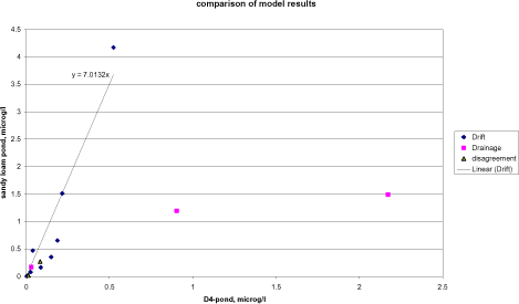
Figure 4.1. Comparison between the FOCUS SW- and PestSurf simulations for the D4- and sandy loam ponds. PestSurf generates generally higher concentrations than FOCUS SW. The points are divided according to the cause of maximum concentration.
Figur 4.1. Sammenligning mellem FOCUS-SW- og PestSurf-simuleringer af D4- og morænelersvandhullet. PestSurf genererer generelt højere koncentrationer end FOCUS SW. Punkterne er opdelt efter årsag til maximumskoncentration.
Figure 4.2 shows a similar plot for the sandy loam stream. Pendimethalin stands out with the two values high above the indicated line caused by a build-up of the concentration in groundwater. Fluazinam, with a PestSurf-generated concentration of 26 µg/l (occurring in a tributary) caused by the extreme drainage event, also appears above the line. Four differences between the models explain the difference in simulation results: 1. The area sprayed in the sandy loam catchment covers 82 % of the catchment compared to 20 % in the D4-stream. 2. The concentrations generated by drift in the FOCUS-simulations represent 100 m of stream, and not the full lengt of the catchment as in PestSurf. 3. The water depth in the stream is frequently much lower than 30 cm, and 4. no groundwater contribution is included in the FOCUS-SW-simulations.
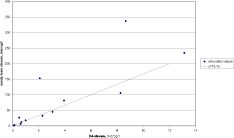
Figure 4.2. Comparison between the FOCUS SW- and PestSurf simulations for the D4- and sandy loam stream.
Figur 4.2. Sammenligning mellem FOCUS SW- og PestSurf-simuleringer af D4- og morænelersvandløbet.
Figure 4.4 shows a similar comparison based on the maximum concentrationobserved between 500 and 1700 m from the upstream end of the sandy loam catchment. The upper 500 m are excluded to avoid dry periods, see section 4.4.3. The only outlier observed is fluazinam, where the concentration is generated by the 20 year event rather than drift.
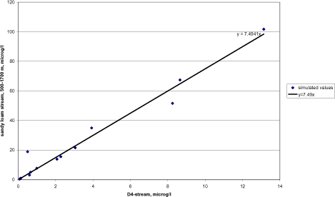
Figure 4.3. Comparison between the FOCUS SW- and PestSurf simulations for the D4- and sandy loam stream between 500 and 1700 m from the upstream end.
Figur 4.3. Sammenligning mellem FOCUS SW- og PestSurf-simuleringer af D4- og morænelersvandløbet mellem 500 og 1700 m fra den opstrøms ende.
The FOCUS SW D3-ditch is compared to the sandy pond in Figure 4.4 and to the sandy stream in Figure 4.5. The pond is dominated by entirely different mechanisms and there is a poor correspondence between the two simulations. With respect to the stream, there is an almost linear correlation, but the concentration levels generated by PestSurf are about 4.3 times as high as the concentrations generated in the D3-ditch. For the stream, the agricultural area sprayed is about three times the area sprayed for the D3-ditch, but the flow is much larger and part of the stream is protected by buffer zones. At the same time, the stream receives drift contribution along its entire length within 30 minutes. The contribution thus adds up compared to the FOCUS scenario, where only 100 m of stream or ditch is sprayed.
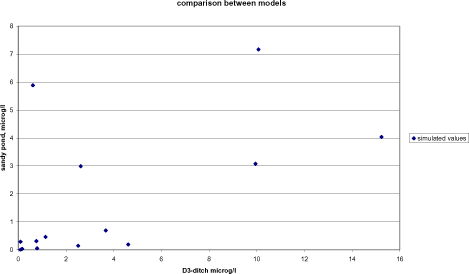
Figure 4.4. Comparison between the FOCUS SW D3-ditch and the PestSurf simulation for the sandy pond.
Figur 4.4. Sammenligning mellem FOCUS SW-D3-grøften og PestSurf-simuleringer af det sandede vandhul.
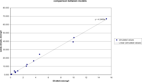
Figure 4.5. Comparison between the FOCUS SW D3-ditch and the PestSurf simulation for the sandy stream.
Figur 4.5. Sammenligning mellem FOCUS SW D3-grøften og PestSurf-simuleringerne for det sandede vandløb.
Macrophyte sorption depends on Kow, and the compounds with the highest Kow-values does show the highest macrophyte sorption. However, the comparison in Table 4.4 is obscured by the fact that the reported maxima are not necessarily happening at the same time or the same place, and a direct comparison of the two is therefore not always meaningful. Macrophyte sorption is always higher in the sandy loam scenarios than in the sandy scenarios due to a higher presence of macrophytes.
With respect to sediment concentration, attention was given to the fact that PestSurf systematically calculate lower concentrations than FOCUS. The explanation is not straight forward. As mentioned in section 2.1, the stream models differ as the PestSurf sediment is made up of one compartment, while FOCUS streams have several sediment compartments. The diffusion coefficient is identical in the two models. For the ponds, the sediment layer is described by a number of compartments in both models. The diffusion coefficient used in PestSurf is higher than the one used in TOXWA and determined from experiments carried out in an earlier project (Helweg et al. 2003). The findings of this project were that only traces of pesticides were found in the sediment in a pond with macrophytes. Without macrophytes present, the compounds (fenpropimorph and pendimethalin) were measurable in sediment. Kronvang et al. (2003) measured pesticide in sediment for the two streams. No pesticides were found in sediment above the detection limit in the sandy stream. In the sandy loam stream, five of the pesticides included in these simulations were also included in the analyses (alpha-cypermethrin, malathion, pendimethalin, propiconazol and terbutylazin), but only alpha-cypermethrin was detected. The concentration appear high, 3 and 6 ng/g dry weight – however, 10 ng/g DW is stated to be the detection limit for alpha-cypermethrin in sediment in the same study. With a detection limit of 10 ng/g DW, all simulated sediment concentrations are below detection limit.
In practice, macrophytes thus appear to lower the concentration in sediment, and in general, concentrations found in sediment are low.
The transport of pesticide from the water body to the porewater, which is in contact with the sediment, is described by an equation that, apart from the diffusion coefficient, also contain a boundary layer. It was attempted to change the parameter by a factor of 100 in PestSurf to evaluate the effect, but without a visible result on sediment concentration. It is not clear from the FOCUS SW-report what depth a boundary layer has in the FOCUS-scenarios.
4.4 Patterns observed in PestSurf
The following sections is a summary of the information given in Annex 1-12, for each of the PestSurf water bodies. The summary concentrates on the concentrations in the water phase of the waterbodies. Macrophyte concentrations, pore water and sediment concentrations generated by PestSurf are described in the Annexes.
4.4.1 Sandy catchment, stream
As listed in Table 4.5, high concentrations in the sandy catchment is typically caused by drift. A typical time series for a specific location in the stream is shown in Figure 4.6. The concentration varies from top to bottom of the catchment as shown in Figure 4.7. The longitudinal plots show the concentration as a thin black line. The thick black line shows the maximum concentrations reached in each location during the whole simulation period. Furthermore, the stream bottom and the two sides of the stream are indicated on the figure.
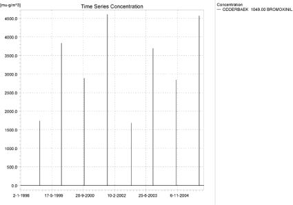
Figure 4.6. Concentration pattern over time for the autumn application of bromoxynil in the sandy catchment, 1049 m from the upstream end. (µg/m³ = ng/l)
Figur 4.6. Koncentrationsmønster som function af tid for efterårstildelingen af bromoxynil I det sandede opland, 1049 m fra den opstrøms ende. (µg/m³ = ng/l)
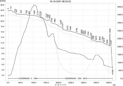
Figure 4.7. Concentrations (ng/l) of autumn-applied bromoxynil in the sandy catchment on 16. October 2001, just after spraying (thin black curve). The thick black line shows the maximum concentrations reached at each location for the total simulation period. Furthermore, the stream bottom and the two sides of the stream are indicated on the figure.
Figur 4.7. Koncentrationer (ng/l) af efterårstildelt bromoxynil in det sandede opland den 16. oktober 2001, lige efter udsprøjtning (tynd sort kurve). Den tykke sorte kurve viser maximumskoncentrationer opnået ved hver lokalitet for hele simuleringsperioden. Herudover er åbunden og de to åbrinker indikeret på figuren.
The middle section of the catchment is protected by natural buffer zones. The highest concentrations in the middle of the catchment are reached when the high concentrations from the upstream end move downstream, see Figure 4.8.
In the lower end of the catchment, drift enters the stream, but the amount of water is higher, and causes dilution.
The duration of the drift peaks differ depending on the amount of water in the stream and sorption by macrophytes, but Figure 4.8 shows a typical example of the change in concentration over time. Clearly, the duration of an event is longer in the lower part of the catchment than in the upper part, if the whole stream receives drift at the same time. For the shown event, it takes about 8-10 hours from the spraying begins before all pesticide has left the catchment.
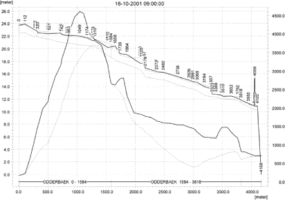
a)
b)
c)

d)
e)
f)
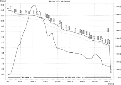
g)
Figure 4.8. Concentration (ng/l) of autumn-applied bromoxynil over time after a spray event in the sandy catchment. Spraying starts at 8.00, finishes at 8.30, and concentration levels are shown at 9.00, 10.00, 11.00, 12.00, 14.00, 16.00 and 18.00. Figure 4.7 show the concentration at 8.33 for the same event.
Figur 4.8. Koncentration (ng/l) af efterårstildelt bromoxynil som funktion af tid efter udsprøjtning i det sandede opland. Udsprøjtningen begynder kl. 8.00, afsluttes kl. 8.30, og koncentrationsniveauer er vist kl. 9.00, 10.00, 11.00, 12.00, 14.00, 16.00 og 18.00. Figur 4.7 viser koncentrationen kl. 8.33 for den samme udbringning.
Only two compounds display a sightly different pattern – bentazon and rimsulfuron. The results of the bentazon simulations are shown in Figure 4.9. In this case, the concentration pattern in the stream is influenced by drainage and groundwater contributions. The highest contributions are obtained in connection with the high-rainfall winter 1998/99 (which is identical to 2002-3) and the following season.
Table 4.8 lists the locations generating global and local maxima. Due to the fact that drift is the dominating cause of high concentrations in the sandy catchment, many of the locations are identical from simulation to simulation.
Table 4.9 shows the relative concentration levels at the different local maxima. However, the local maximum points were generally not selected in the first version of the PestSurf Excell presentation template and the concentrations generated by the tool are generally lower (producing maximum concentrations of about 0.55 of the true maximum). In Table 4.7 the global maxima and the maxima found for the pre-defined locations in the Excell result extraction tool are compared.
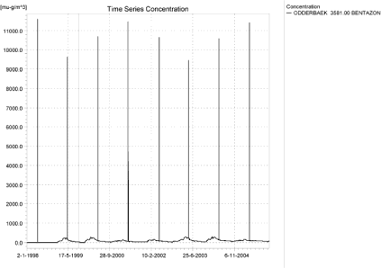
Figure 4.9. Concentration pattern over time for bentazon at the bottom of the sandy catchment (µg/m³ = ng/l).
Figur 4.9. Koncentrationsmønster som function af tid for bentazon nedstrøms i det sandede opland (µg/m³ = ng/l).
Table 4.7. Comparison between maximum values generated by the result extraction tool and the global maximum generated by PestSurf.
Tabel 4.7. Sammenligning mellem maximumværdier genereret ved hjælp af dataudtræk-ningsværktøjet og det globale aximum generet af PestSurf.
| Sandy catchment | ||||
| Compound Name | Global max | template max | ||
| Alpha-cypermethrin | 0.409 | µg/l | 0.226 | µg/l |
| Bentazon | 39.267 | µg/l | 21.289 | µg/l |
| Bromoxinil – spring appl. | 2.570 | µg/l | 1.500 | µg/l |
| Bromoxinil – autumn appl | 4.609 | µg/l | 2.666 | µg/l |
| Fluazinam | 4.492 | µg/l | 2.454 | µg/l |
| Malathion | 24.431 | µg/l | 13.308 | µg/l |
| Metamitron | 16.502 | µg/l | 9.057 | µg/l |
| Pendimethalin spring appl. | 10.248 | µg/l | 5.592 | µg/l |
| Pendimethalin autumn appl. | 44.349 | µg/l | 24.931 | µg/l |
| Propiconazol | 3.420 | µg/l | 1.884 | µg/l |
| Prosulfocarb | 66.867 | µg/l | 37.316 | µg/l |
| Rimusulfuron | 0.747 | µg/l | 0.414 | µg/l |
| Terbuthylazin | 12.315 | µg/l | 6.597 | µg/l |
| Tribenuron | 0.321 | µg/l | 0.187 | µg/l |
Because drift strongly dominates the simulations, a change in the assumptions concerning drift will exert a strong influence on the results of the generated concentrations for all simulated pesticides.
Figure 4.10, Figure 4.11, Table 4.10 and Table 4.11 show examples of the standard Pestsurf presentations. The template works with pre-defined data extraction locations. The plot requires specification of a “lowest detection value” (ldc), which defines when a pesticide occurrence is an event. The upper left “sub”-figure shows the concentration pattern of the full simulation, mapping time on the x-axis and the length of the stream on the y-axis. The upper right figure shows the maximum value obtained within a period of 24 hours before a peak arrives at the catchment outlet. A curve is generated when a downstream point reaches a concentration higher than the ldc. The programme then tracks the highest concentration for each location in the stream within the last 24 hours. The lower left figure is a normal time series plot for selected points and the lower right plot shows the number of events exceeding the user specified threshold. The tables list each event, a number of characteristics of each event (max. concentration, values on the descending limp after 6, 12, 30 and 60 minutes and 12, 24 and 38 hours, duration of the event before the maximum occurs, the total duration and the interval to the next event). Fractiles for the peak values are calculated, depending on the number of peaks present in the simulation.
Table 4.8. Locations (Chainages) with (local) maximum concentrations in the sandy catchment. The locations with the highest concentrations are shown in bold.
Tabel 4.8. Lokaliteter med (local) maximumskoncentration i det sandede opland. Lokaliteterne med højest koncentration er vist med ”fed”.
| Substance | Location, m from the upstream end | ||||||
| Alpha-cypermetrin | 1049 | 1739 | 3499.5 | ||||
| Bentazon | 1049 | 1801.5 | 3581 | ||||
| Bromoxinil – spring appl | 1111.5 | 1801.5 | 3510 | ||||
| Bromoxinil – Autumn appl. | 1049 | 1801.5 | 3510 | ||||
| Fluazinam | 1049 | 1739 | 3499.5 | ||||
| Malathion | 1049 | 1739 | 3499.5 | ||||
| Metamitron | 1049 | 1801.5 | 3581 | ||||
| Pendimenthalin Spring appl. | 1049 | 3510 | |||||
| Pendimenthalin autumn appl | 1049 | 1739 | 3499.5 | ||||
| Propiconazol | 1049 | 1739 | 1801.5 | 3499.5 | |||
| Prosulfocarb | 1049 | 1739 | 3499.5 | ||||
| Rimusulfuron | 1049 | 1739 | 3499.5 | ||||
| Terbuthylazin | 1049 | 1801.5 | 3510 | ||||
| Tribenuron | 1111.5 | 1801.5 | 3581 | ||||
Table 4.9. Relative concentration at each of the local maxima listed in Tabel 4.8.
Tabel 4.9. Relativ koncentration for hver af de lokale maxima vist i Tabel 4.8.
| Substance | 1049 | 1111.5 | 1739 | 1801.5 | 3499.5 | 3510 | 3581 |
| Alpha-cypermetrin | 1 | 0.60 | 0 | 0.33 | |||
| Bentazon | 1 | 0.60 | 0.30 | ||||
| Bromoxinil – spring appl | 1 | 0.62 | 0.29 | ||||
| Bromoxinil – Autumn appl. | 1 | 0.61 | 0.32 | ||||
| Fluazinam | 1 | 0.63 | 0 | 0.35 | |||
| Malathion | 1 | 0.62 | 0 | 0.34 | |||
| Metamitron | 1 | 0.60 | 0.29 | ||||
| Pendimenthalin Spring appl. | 1 | 0.60 | 0 | 0.36 | |||
| Pendimenthalin autumn appl | 1 | 0.60 | 0.29 | ||||
| Propiconazol | 1 | 0.60 | 0 | 0.33 | |||
| Prosulfocarb | 1 | 0.60 | 0 | 0.36 | |||
| Rimusulfuron | 1 | 0.60 | 0 | 0.33 | |||
| Terbuthylazin | 1 | 0.59 | 0.30 | ||||
| Tribenuron | 1 | 0.62 | 0.29 |
Click here to see Figure 4.10.
Figure 4.10. Example of result presentation overview by the PestSurf template for autumn-applied bromoxynil in the sandy catchment. The lowest detection concentration is set to 10 ng/l.
Figur 4.10. Eksempel på resultatoversigt præsenteret i PestSurf-skabelonen for den efterårsudbragte bromoxynil i det sandede opland. Detektionsgrænsen er sat til 10 ng/l.
Click here to see Figure 4.11.
Figure 4.11. Example of result presentation overview by the PestSurf template for bentazon in the sandy catchment. The lowest detection concentration was set to 100 ng/l.
Figur 4.11. Eksempel på resultatoversigt præsenteret i PestSurf-skabelonen for bentazon i det sandede opland. Detektionsgrænsen er sat til 100 ng/l.
Table 4.10. Part of the result sheet generated by the PestSurf Excel template for the autumn-application of bromoxynil. The selected table shows the results at the pre-defiend location along the stream with the highest concentration recorded. The limiting values applied in the generation of the table is lowest detection value = 10 ng/l, toxicity to fish, daphnies and algae are set to 100, 1000 and 2000 ng/l, respectively. The recorded peaks are shown in Figure 4.10.
Tabel 4.10. Uddrag fra resultatoversigt genereret af PestSurf-Excelskabelonen for den efterårsudbragte bromoxynil. Den udvalgte tabel viser resultaterne på den præ-definerede lokalitet langs med åen med den højeste koncentration. Grænseværdierne anvendt i simuleringen er detektionsgrænsen = 10 ng/l, toxicitet overfor fisk, daphnier og alger er sat til hendholdsvis 100, 1000 og 2000 ng/l. De beskrevne koncentrationstoppe er vist i Figur 4.10.
Table 4.11. Example of tables produced by the PestSurf template for bentazon in the sandy catchment. The selected table shows the results at the pre-defined location along the stream with the highest concentration recorded. The limiting values applied in the generation of the table is lowest detection value = 100 ng/l, toxicity to fish, daphnies and algae are set to 200, 400 and 1000 ng/, respectively. The recorded peaks can be seen in Figure 4.11.
Tabel 4.11. Uddrag fra resultatoversigt genereret af PestSurf-Excelskabelonen for Bentazon i det sandede opland. Den udvalgte tabel viser resultaterne på den præ-definerede lokalitet langs med åen med den højeste koncentration. Grænseværdierne anvendt i Tabelgenereringen er detektionsgrænsen = 100 ng/l, toxicitet overfor fisk, daphnier og alger er sat til hendholdsvis 200, 400 og 1000 ng/l. De beskrevne koncentrationstoppe er vist i Figur 4.11.
4.4.2 Sandy catchment, pond
High concentrations in the sandy pond can be caused by drift or by contributions through groundwater. The pond is situated in a sandy environment and is in direct contact with the groundwater in the surrounding area. The groundwater level is very high during winter in the area around the pond.
Figure 4.12 shows an example where the pond is influenced by drift and groundwater. Drift, however becomes very important at times where the water level in the pond is low (autumn applications after a dry summer. In this case the highest concentrations in the groundwater are reached during relatively dry periods.
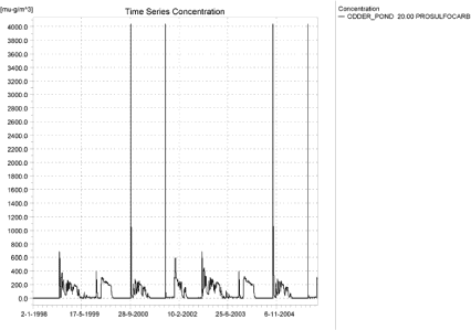
Figure 4.12. Concentrations of prosulfocarb in the sandy pond (µg/m³ = ng/l).
Figur 4.12. Koncentration af prosulfocarb i det sandede vandhul (µg/m³ = ng/l).
Figure 4.13 shows more or less the oppostite situation, where drift becomes important in the dry years, but the pond receives a contribution from groundwater during the wet years. Bromoxynil has a low to medium sorption and a very high degradation rate.
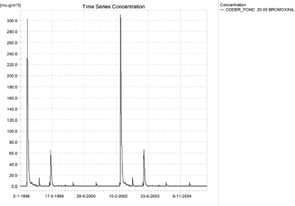
Figure 4.13. Concentrations of spring-applied bromoxynil in the sandy pond (µg/m³ = ng/l).
Figur 4.13. Konentration af forårsudbragt bromoxynil i det sandede vandhul (µg/m³ = ng/l).
Figure 4.14 and Figure 4.15 shows the pattern for two compounds with DT50-values above 50-60 days and medium sorption properties. Here the yearly spraying leads to a buildup in the groundwater concentrations, which then dominates the pattern in the pond.
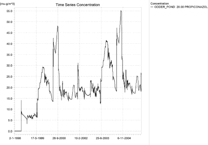
Figure 4.14. Concentrations of propiconazol in the sandy pond.
Figur 4.14. Koncentration af propiconzol i det sandede vandhul.
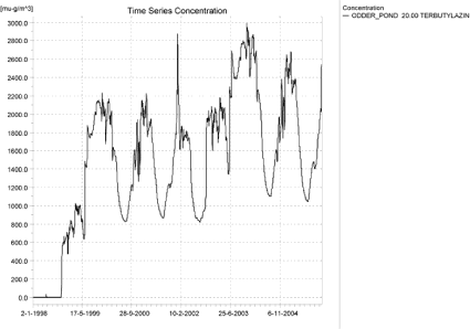
Figure 4.15. Concentrations of terbutylazin in the sandy pond (µg/m³ = ng/l).
Figur 4.15. Koncentration af terbutylazin i det sandede vandhul(µg/m³ = ng/l).
As indicated in Table 4.6, only four of the 14 sandy pond-scenarios were significantly influenced by the change in code. A change in assumptions regarding wind drift will thus only influence the concentration level for some of the pesticides included in the simulations.
The PestSurf templates extract data in the center point of the three pond nodes, which is also used for the above presentations. There is thus no diffence between the concentrations generated. Examples of result presentations using the template are shown in Figure 4.16 and Table 4.12.
Click here to see Figure 4.16.
Figure 4.16. Example of result presentation overview by the PestSurf template for prosulfocarb the sandy pond. The lowest detection value is set to 1 ng/l.
Figur 4.16. Eksempel på resultatoversigt præsenteret i PestSurf-skabelonen for prosulfocarb i det sandede vandhul. Detektionsgrænsen er sat til 1 ng/l.
Table 4.12. Example of tables produced by the PestSurf Excel Template, applied to prosulfocarb. The detection value used for generation of the table is 1 ng/l. The toxicity values were set to 10, 100 and 1000 ng/l, respectively. The recorded peaks are shown in Figure 4.16.
Tabel 4.12. Uddrag fra resultatoversigt genereret af PestSurf-Excelskabelonen for prosulfocarb. Grænseværdierne anvendt i tabelgenereringen er detektionsgrænsen = 10 ng/l, toxicitet overfor fisk, daphnier og alger er sat til hendholdsvis 10, 100 og 1000 ng/l. De beskrevne koncentrationstoppe er vist i Figur 4.16.
4.4.3 Sandy loam catchment, stream
The pattern found in the sandy loam stream was strongly affected by the change in code. Because the assumption concerning the present drift calculation may cause unrealistically high concentrations, conclusions from both the first and the second set of simulations will be highlighted.
The sandy loam catchment is complicated by the fact that the maximum concentration occurs in different places and are due to different local conditions from simulation to simulation. It is therefore somewhat difficult to derive simple patterns. However, in the second set of simulations, where drift dominates most of the runs, the pattern simplifies somewhat. The sites for the global maximum and local maxima are indicated in Table 4.13- Table 4.15.
It is clear from the tables that NedreLillebaek 1279 produces the maximum concentrations when the simulations are drift dominated. In the first set of simulations, no maximum concentrations were generated in this point. NedreLillebaek 847 generates the maximum values for pendimethalin, which is dominated by a groundwater contribution. In the first set of simulations, this point generated the maximum value for six of the simulations, typically the ones influenced by groundwater. Fluazinam generates its maximum value in a tributary (Steensbaek 412.5) in both simulations. The value is due to a drainage event. The highest value for fluazinam in the main stream system is generated in UpperLillebaek 437.5 in both sets of simulations.
Other points that generated maxima in the main stream system due to drainage events were UpperLillebaek 125 (spring application of bromoxynil), UpperLillebaek 352.5 (Malathion), UpperLillebaek 625 (bentazon and rimsulfuron), and UpperLillebaek 1650 (Metamitron).
Taking into consideration that NedreLillebaek sees to be influenced by an instability and is influenced by high groundwater concentrations, it is recommended that concentrations for administrative purposes are evaluated in OvreLillebaek only.
As the dynamics of the upper and lower part of the catchment may be different, the two stretches are treated separately.
For the upper part of the catchment, the maximum concentrations may be generated by drift as shown in Figure 4.17 for malathion.
Table 4.13. General overview of the location in the sandy loam catchment, whereglobal and local maximum values occurred in the 1.st set of simulations. The global maxima are shown with bold.. If the global maximum does not occur in the main stream, the highest value in the main stream is shown with italics.
Tabel 4.13. Generel oversight over lokaliteten i morænelersoplandet, hvor globale og lokale maxima fandes i 1. simulering. maxima er vist med ”fed”. Hvis det globale maximum ikke findes i hovedvandløbet, er den højeste værdi i hovedvandløbet vist med italics.
Table 4.14. General overview of the location in the sandy loam catchment, whereglobal and local maximum values occurred in the 2nd set of simulations. The global maxima are shown with bold. If the global maximum does not occur in the main stream, the highest value in the main stream is shown with italics.
Tabel 4.14. Generel oversight over lokaliteterne i morænelersoplandet, hvor globale og locale maxima fandtes i 2. sæt simuleringer. Maxima er vist med ”fed”. Hvis det globale maximum ikke findes i hovedvandløbet, er den største værdi i hovedvandløbet vist med italics.
Table 4.15. Relative concentration levels at each of the local maxima recorded in Table 4.14.
Tabel 4.15. Relative koncentrationsniveauer for hvert lokalt maximum vist i Tabel 4.14.
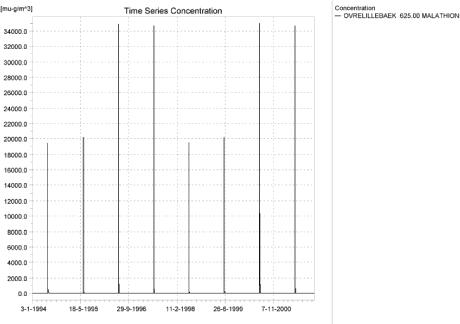
Figure 4.17. Typical concentration pattern for malathion in the upstream part of the sandy loam catchment (µg/m³ = ng/l).
Figur 4.17. Typisk koncentrationsmønster for malathion i den opstrøms del af morænelersoplandet (µg/m³ = ng/l).
Malathion is characterised by a very fast breakdown rate, and the drift is therefore the only contribution visible. Somewhat similar patterns are found for metamitron (Figure 4.18) and terbutylazin (Figure 4.19). In the last two cases, however, drainage contributions are visible due to either the 20-year event or rainfall events occurring after spraying.
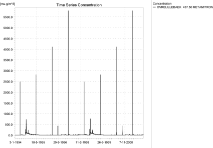
Figure 4.18. Typical concentration pattern for metamitron in the upstream end of the sandy loam catchment (µg/m³ = ng/l).
Figur 4.18. Typisk koncentrationsmønster for metamitron i den opstrøms del af morænelersoplandet (µg/m³ = ng/l).
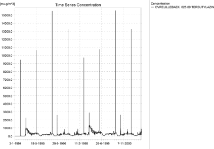
Figure 4.19. Concentration pattern for terbutazin in the upstream end of the sandy loam catchment (µg/m³ = ng/l).
Figur 4.19. Typisk koncentrationsmønster for terbutylazin i den opstrøms del af morænelersoplandet (µg/m³ = ng/l).
Figure 4.20 shows a drainage dominated time series from the upper part of the catchment for fluazinam. It is dominated by the extreme weather conditions generating a single large drainage event. In the first set of simulations, prosulfocarb and bromoxynil generated drainage events that were not influenced by the extreme event in September (as they are applied after the event or break down before the event).
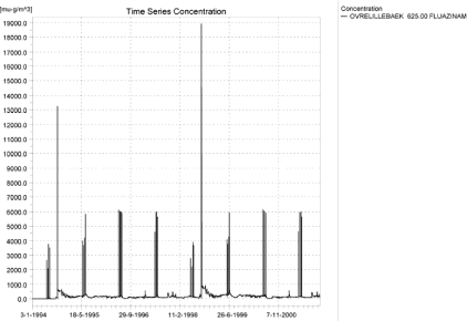
Figure 4.20. Concentration pattern for Fluazinam in the upstream part of the sandy loam catchment (µg/m³ = ng/l).
Figur 4.20. Typisk koncentrationsmønster for Fluazinam i den opstrøms del af morænelersoplandet (µg/m³ = ng/l).
The pattern displayed in the lower part of the sandy loam catchment may or may not resemble the upstream pattern. For malathion (Figure 4.21), the picture is identical. However, the fact that the whole stream is sprayed at the same time with 30 minutes causes a buildup of concentrations. For alpha-cypermethrin (Figure 4.22), however, the pattern is influenced by the groundwater contribution. This is the case for all the compounds with DT50-values higher than 56 days (fluazinam, propiconazol, terbutylazin, alpha-cypermethrin and pendimethalin). These compounds also have good sorption properties – they seem to enter the groundwater during strong leaching events and wash out over a long time.
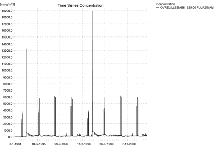
Figure 4.21. Concentration pattern for malathion in the downstream part of the sandy loam catchment (µg/m³ = ng/l).
Figur 4.21. koncentrationsmønster for malathion i den nedstrøms del af morænelersoplandet (µg/m³ = ng/l).
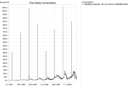
Figure 4.22. Typical concentration pattern for alpha cypermethrin in the downstream part of the sandy loam catchment. The wind drift events still dominates and the 20-year event does not result in particularly high concentrations (µg/m³ = ng/l).
Figur 4.22. Typisk koncentrationsmønster for alpha-cypermethrin i den nedstrøms del af morænelersoplandet. Vinddriften dominerer og 20-års-hændelsen resulterer ikke i specielt store koncentrationer (µg/m³ = ng/l).
Bromoxynil more or less follows the pattern of malathion – the DT50 value of 0.54 days does not lead to a buildup over time, and the 20-year event is not relevant in this case. The minimal drainage events that occur are due to rainfall occurring soon after spraying. The pattern for autumn-applied bromoxynil is almost identical to the pattern of prosulfocarb (Figure 4.23), which, however, show a higher degree of drainage contribution.
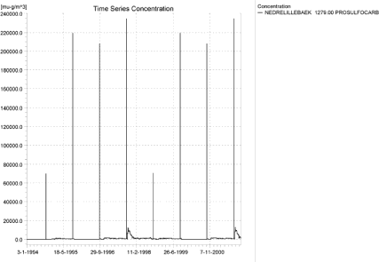
Figure 4.23. Concentration pattern for prosulfocarb in the downstream part of the sandy loam catchment (µg/m³ = ng/l).
Figur 4.23. koncentrationsmønster for prosulfocarb i den nedstrøms del af morænelersoplandet (µg/m³ = ng/l).
Figure 4.24 shows the pattern of groundwater contribution for pendimetalin. The groundwater has received a large contribution during the wet period and washes out over time. For the autumn-application, the high concentrations due to drift and groundwater co-incides. The concentration levels are unrealistically high. Bentazon (Figure 4.25) shows no buildup, and the pattern in the downstream end is identical to the pattern further upstream. However, the 20-year drainage event is visible.
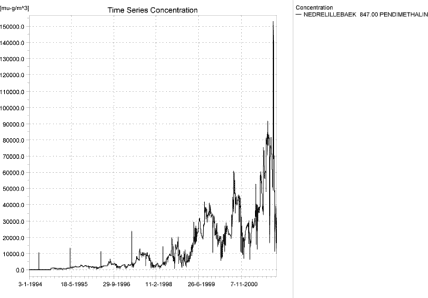
a)
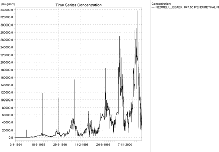
b)
Figure 4.24. Concentration pattern for spring (a)- and autumn (b)-applied pendimetahalin in the downstream part of the sandy loam catchment (µg/m³ = ng/l).
Figur 4.24. koncentrationsmønster for (a) forårsudbragt og (B) efterårsudbragt pedimethalin i den nedstrøms del af morænelersoplandet (µg/m³ = ng/l).
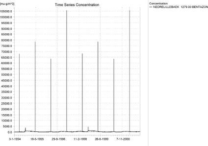
Figure 4.25. Concentration pattern for bentazon in the downstream part of the sandy loam catchment (µg/m³ = ng/l).
Figur 4.25. koncentrationsmønster for bentazon i den nedstrøms del af morænelersoplandet (µg/m³ = ng/l).
Figure 4.26 - Figure 4.28 show longitudinal profiles of typical events. Figure 4.26 represents a pure drift event. Tributaries, buffer zones and dilution influence the somewhat rugged picture of maximum concentrations.
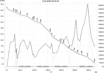
Figure 4.26. Concentrations of malathion in the sandy loam catchment on 14. June-2000, 8:30. The concentrations are generated by wind drift (µg/m³ = ng/l).
Figur 4.26. Koncentrationer af malathion i morænelersoplandet den 14. juni 2000, 8.30. Koncentrationerne er genereret af vinddrift (µg/m³ = ng/l).

Figure 4.27. Concentrations of fluazinam in the sandy loam catchment on 18. September-1998. The concentrations are generated by a rainfall event over two days with a return period of 1 in 20 years (µg/m³ = ng/l).
Figur 4.27. Koncentrationer af fluazinam I morænelersoplandet den 18. september 1998. Koncentrationen genereres af en nedbørshændelse over to dage med en hyppighed på 1 i 20 år (µg/m³ = ng/l).
Figure 4.27 shows the sandy loam catchment during the 20-year event fluazinam. The upper part of the catchment does not reach its maximum values at this time, but a considerable part of the catchment does.
Figure 4.28 shows the pattern occurring due to groundwater influence. Only the lower part of the catchment receives a groundwater contribution, and the highest concentrations are reached just after a dry summer, when the flow only consists of groundwater.

Figure 4.28. Concentrations of pendimethalin in the sandy loam catchment on 22. November 2001. The concentrations are dominated by the baseflow contribution to the drains just after a dry summer (µg/m³ = ng/l).
Figur 4.28. KOncentrationer af pendimethalin i morænelersoplandet den 22. november 2001. Koncentrationerne domineres af grundvandstilførslen til dræn lige efter en tør sommer (µg/m³ = ng/l).
A comparison of global maximum concentrations and the concentrations generated by the pre-defined locations in the PestSurf result templates is shown in Table 4.16. For the sandy loam stream, the maximum concentration was caught by the template in most cases, particularly when the cause was wind drift. Generally, the points were not caught when drainage and groundwater was the source of the maximum concentration.
Table 4.16. The maximum values generated by PestSurf, extracted by the extraction template and the maximum value reached in the main stream if different from the global max.
Tabel 4.16. Maximumværdier genereret i PestSurf, extraheret af resultatpræsentations-skabelonerne og maximumværdien i hovedvandløbet hvis det afviger fra det globale maximum.
| Sandy loam catchment | |||
| Compound Name | Global max µg/l |
template max µg/l |
max in main stream µg/l |
| Alpha-cypermetrin | 1.355 | 1.355 | |
| Bentazon | 105.741 | 105.741 | |
| Bromoxinil – april | 6.000 | 6.000 | |
| Bromoxinil – oktober | 17.805 | 17.805 | |
| Fluazinam | 26.398 | 19.551 | 19.551 |
| Malathion | 81.412 | 81.412 | |
| Metamitron | 44.935 | 44.935 | |
| Pendimenthalin hvede | 337.048 | 322.974 | |
| Pendimenthalin vaarbyg | 152.970 | 137.541 | |
| Propiconazol | 11.786 | 11.786 | |
| Prosulfocarb | 234.524 | 234.524 | |
| Rimusulfuron | 2.348 | 2.348 | |
| Terbuthylazin | 32.148 | 32.148 | |
| Tribenuron | 0.747 | 0.747 | |
Figure 4.29-Figure 4.32 and Table 4.17 - Table 4.20 show the output of the PestSurf result presentation templates based on pre-defined locations. The general principle is as described in 4.3.1. The tabulated results for fluazinam (Table 4.19 and Table 4.20) shows that the 80’es percentile of the concentration peaks is about 5 % of the maximum value for the upstream part of the catchment, and even the 95’th percentile is about 6 times lower than the maximum value. The differences are less pronounced for the lower part of the catchment. This illustrates the effect of the extreme event on the maximum concentrations generated. For the events where the 8 drift events dominate the picture, the maximum value and the 80’th percentile tend to be at the same level of magnitude.
Click here to see Figure 4.29.
Figure 4.29. Example of result presentation overview by the PestSurf template for fluazinam in the upper part of the sandy loam catchment. The lowest detection value was set to 100 ng/l.
Figur 4.29. Eksempel på resultatoversigt præsenteret i PestSurf-skabelonen for Fluazinam i den opstrøms del af moræneoplandet. Detektionsgrænsen er sat til 100 ng/l.
Click here to see Figure 4.30.
Figure 4.30. Example of result presentation overview by the PestSurf template forfluazinam in the lower part of the sandy loam catchment. The lowest detection value was set to 2000 ng/l.
Figur 4.30. Eksempel på resultatoversigt præsenteret i PestSurf-skabelonen for Fluazinam i den nedstrøms del af moræneoplandet. Detektionsgrænsen er sat til 2000 ng/l.
Click here to see Figure 4.31.
Figure 4.31. Example of result presentation overview by the PestSurf template for bentazon the upper part of the sandy loam catchment. The lowest detection concentration was set to 150 ng/l.
Figur 4.31. Eksempel på resultatoversigt præsenteret i PestSurf-skabelonen for Bentazon i den opstrøms del af moræneoplandet. Detektionsgrænsen er sat til 150 ng/l.
Click here to see Figure 4.32.
Figure 4.32. Example of result presentation overview by the PestSurf template for bentazon the lower part of the sandy loam catchment. The lowest detection concentration was set to 150 ng/l.
Figur 4.32. Eksempel på resultatoversigt præsenteret i PestSurf-skabelonen for bentazon i den nedstrøms del af moræneoplandet. Detektionsgrænsen er sat til 150 ng/l.
Table 4.17. Part of the result sheet generated by the PestSurf Excel sheet for the upstream part of the sandy loam catchment for fluazinam. The detection value used ofr generation of the table = 100 ng/l. The toxicity values for fish, daphnies and algae were set to 1000, 10000 and 10000 ng/l, respectively. The recorded peaks are shown in Figure 4.29.
Tabel 4.17. Uddrag fra resultatoversigt genereret af PestSurf-Excelskabelonen for den opstrøms del af morænelersoplandet for fluazinam. Grænseværdierne anvendt i tabelgenereringen er detektionsgrænsen = 100 ng/l, toxicitet overfor fisk, daphnier og alger er sat til hendholdsvis 1000, 10000 og 10000 ng/l. De beskrevne koncentrationstoppe er vist i Figur 4.29.
Table 4.18. Part of the result sheet generated by the PestSurf Excel sheet for the downstream part of the sandy loam catchment for fluazinam. The detection value used for generation of the table = 2000 ng/l. The toxicity values for fish, daphnies and algae were set to 5000, 10000 and 10000, respectively. The recorded peaks are shown in Figure 4.30.
Tabel 4.18. Uddrag fra resultatoversigt genereret af PestSurf-Excelskabelonen for den nedstrøms del af morænelersoplandet for fluazinam. Grænseværdierne anvendt i tabelgenereringen er detektionsgrænsen = 2000 ng/l, toxicitet overfor fisk, daphnier og alger er sat til hendholdsvis 5000, 10000 og 10000 ng/l. De beskrevne koncentrationstoppe er vist i Figur 4.30.
Table 4.19. Example of tables produced by the PestSurf template for bentazon for the upstream part of the sandy loam catchment. The limiting values applied in the Table generation is lowest detection value = 150 ng/l, toxicity to fish, daphnies and algae are set to 1000, 5000 and 10000 ng/, respectively. The recorded peaks are shown in Figure 4.31.
Tabel 4.19. Uddrag fra resultatoversigt genereret af PestSurf-Excelskabelonen for bentazon for den opstrøms ende af morænelersoplandet. Grænseværdierne anvendt i tabelgenereringen er detektionsgrænsen = 150 ng/l, toxicitet overfor fisk, daphnier og alger er sat til hendholdsvis 1000, 5000 og 10000 ng/l. De beskrevne koncentrationstoppe er vist i Figur 4.31.
Table 4.20. Example of tables produced by the PestSurf template for bentazon for the downstream part of the sandy loam catchment. The limiting values applied For generation of the table is lowest detection value = 150 ng/l, toxicity to fish, daphnies and algae are set to 1000, 5000 and 10000 ng/, respectively. The recorded peaks are shown in Figure 4.32.
Tabel 4.20. Uddrag fra resultatoversigt genereret af PestSurf-Excelskabelonen for bentazon for den nedstrøms del af morænelersoplandet. Grænseværdierne anvendt i tabelgenereringen er detektionsgrænsen = 150 ng/l, toxicitet overfor fisk, daphnier og alger er sat til hendholdsvis 1000, 5000 og 10000 ng/l. De beskrevne koncentrationstoppe er vist i Figur 4.32.
In one case (fluazinam), the highest concentration is generated in a tributary. For the first set of simulations, where drift was less important, this was the case for six of the sandy loam stream simulations. The tributaries do not receive drift – in reality they are put into pipes, but here they are simulated as ditches. However, the tributaries require a further study to evaluate whether concentrations in the tributaries are relevant for the overall evaluation of toxicity.
First of all, the general water levels in the tributaries identified is analysed. It is clear from Figure 4.33- Figure 4.37 that the stretches Steensbaek 0, Steensbaek 125, Albjergbaek and the first 600 m of Fredligbaek are dry or almost dry during the summer. The location of the tributaries can be seen in Figure 2.1.
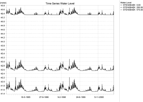
Figure 4.33. Water level in Steensbaek at point 0.00, 250 and 575, respectively.
Figur 4.33. Vandniveau i Steensbæk ved henholdsvis lokalitet 0.00, 250 og 575.
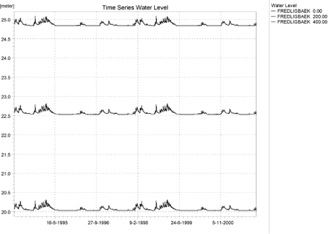
Figure 4.34. Water level in Fredligbaek at point 0.00, 200 and 400, respectively.
Figur 4.34. Vandniveau i Frediligbæk ved henholdsvis lokalitet 0.00, 200 og 400.
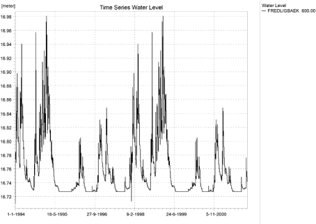
Figure 4.35. Water level in in Fredligbaek 600 m from the upstream end.
Figur 4.35. Vandniveau i Fredligbæk 600 m fra denopstrøms ende.
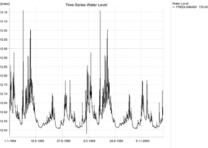
Figure 4.36. Water level in Fredligbaek, 735 m from the upstream end.
Figur 4.36. Vandniveau i Fredligbæk 735 m .fra den opstrøms ende.
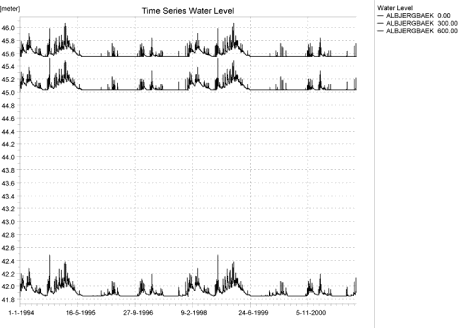
Figure 4.37. Water level in Albjergbaek at 0.00, 300 and 600 m, respectively.
Figur 4.37. Vandniveau i Aalbjergbæk ved henholdsvis lokalitet 0.00, 300 og 600.
At the most, the most downstream locations in Steensbaek and Fredligbaek can be said to have an almost continuous flow. Upstream of these points, toxicity values for fish would be of no interest here and most aquatic life would be stressed by the general living conditions in these tributaries.
A similar analysis of the main stream (Figure 4.38) shows that points upstream of and including“375 m” also run dry during the summer. “500” m is the first calculation point that does not show obvious drying. Thus, if the results are to be evaluated for a system that resembles a permanent stream, use of the results from the main stream upstream of at least 500 m is not recommended.
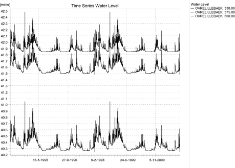
Figure 4.38. Water levels in the upstream end of OvreLillebaek, 330, 375 and 500 m from the upstream end.
Figur 4.38. Vandniveau i den opstrøms ende af OvreLillebaek ved henholdsvis lokalitet 330, 375 og 500.
Figure 4.39 and Figure 4.40 illustrates two of the cases where the highest concentrations were generated by drainage in tributaries in the first set of runs. The maximum concentrations are generated by sudden drainflow, in the first case during water level of 10 cm and a flow of 0.8 l/s, and in the second case a water level of 3 cm and a flow of about 0.4 l/s. The tributaries more or less act as an extended drain. Similarly, the maximum values generated on Figure 4.43 and Figure 4.44 coincide with water levels of 4 and 10 cm, respectively.
The same drainage concentrations are, of course, generated in the second set of simulations, but are no longer maximum values due to the increase in drift in the second set of simulations.
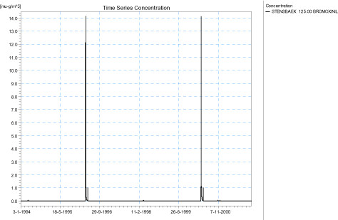
Figure 4.39. Maximum Drainage concentrations generated for spring applied bromoxynil at Steensbaek 125, 1 set of simulations (µg/m³ = ng/l).
Figur 4.39. Maximum drænkoncentration genereret for forårstilført bromoxynil i steensbaek 125 (µg/m³ = ng/l).
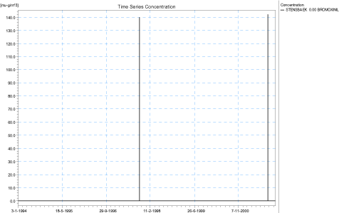
Figure 4.40. Maximum Drainage concentrations generated for autumn-applied bromoxynil at Steensbaek 0., 1 set of simulations (µg/m³ = ng/l).
Figur 4.40. Maximum drænkoncentration genereret for forårstilført bromoxynil i steensbaek 125 (µg/m³ = ng/l).
Figure 4.41 and Figure 4.42 show two cases where high drainage concentrations are generated in a tributary by the extreme event. During this event, water levels are high, 26 and 19 cm, respectively. However, as shown in the earlier figures, the tributaries are often drying out at these points. The fluazinam-concentration in Figure 4.41 is the maximum concentration generated in the whole catchment, also after the change in model code.
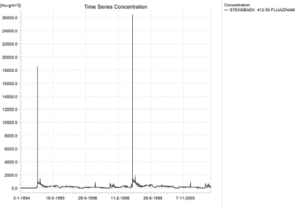
Figure 4.41. Maximum concentration (drainage and in total for the catchment) generated for fluazinam at Steensbaek 412.5 in the 1st set of simulations (µg/m³ = ng/l).
Figur 4.41. Maximum concentration (drænvand og totalt for oplandet) genereret for fluazinam I steensbæk 412.5 i 1. sæt simuleringer (µg/m³ = ng/l).
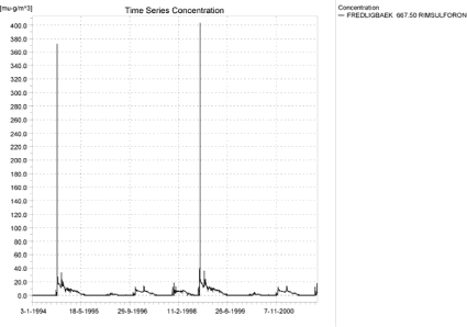
Figure 4.42. Maximum drainage concentrations generated for rimsulfuron at Fredligbaek 667.5 in the 1st set of simulations (µg/m³ = ng/l).
Figur 4.42. Maximum drænvandsconcentration genereret for Rimsulfuron i Fredligbæk 667.5 i 1. sæt simuleringer (µg/m³ = ng/l).
Figure 4.43 and Figure 4.44 show high drainage concentrations in tributaries just after a dry period.
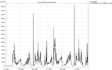
Figure 4.43. Maximum drainage concentrations generated for terbutylazin at Steensbaek 125 in the first set of simulations.
Figur 4.43. Maximum drainage concentration genereret for terbutylazin in steensbæk 125 i 1. sæt simuleringer.
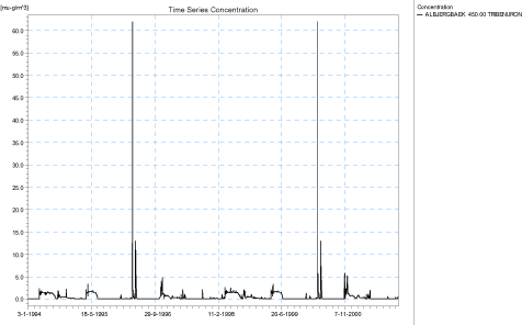
Figure 4.44. Maximum drainage concentrations generated for tribenuron methyl at Albjergbaek 450 in the 1st set of simulations (µg/m³ = ng/l).
Figur 4.44. Maximum drainage concentration(genereret for Tribenuron methyl i Aalbjergbæk 450 i 1. sæt simuleringer (µg/m³ = ng/l).
4.4.4 Sandy loam catchment, pond
The sandy loam pond is often dominated by drift events. Figure 4.45 shows an example of drift contributions to the sandy loam pond. However, the pond also receives drainage water and may in very wet periods have some interaction with groundwater. Figure 4.46 and Figure 4.47 shows the pattern obtained with propiconazol and fluazinam, where drainage contributes to the general concentration level in the pond, but the drift contribution is still visible and important.
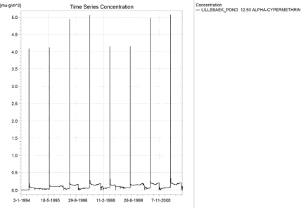
Figure 4.45. Concentrations of alpha-cypermethrin for the sandy loam pond (µg/m³ = ng/l).
Figur 4.45. Koncentrationer af alpha-cypermethrin i morænelersvandhullet (µg/m³ = ng/l).
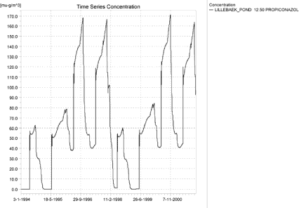
Figure 4.46. Concentrations of propiconazol for the sandy loam pond (µg/m³ = ng/l).
Figur 4.46. Koncentrationer af Propiconazol i morænelersvandhullet (µg/m³ = ng/l).
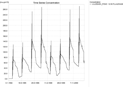
Figure 4.47. Concentrations of fluazinam for the sandy loam pond (µg/m³ = ng/l).
Figur 4.47. Koncentrationer af fluazinam i morænelersvandhullet (µg/m³ = ng/l).
Figure 4.48 shows the situation where the drainage contribution totally dominates the picture. There is no clear distinction of when a compound displays which pattern. In Figure 4.49, the patterns obtained are compared to Koc and DT50-values of the compounds. Generally, higher sorption values increases the probability that drift is most important because sorption increase retention in the soil and decrease the leached concentrations, but when DT50 is high, the importance of drainage increases, because most of the the solute leaches over time. However, time of application is of importance too.
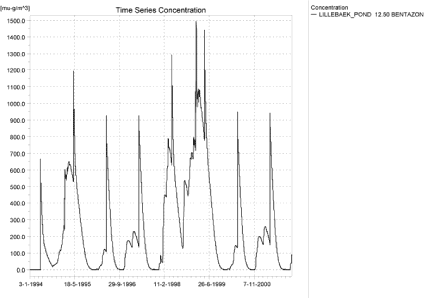
Figure 4.48. Concentrations of bentazon for the sandy loam pond (µg/m³ = ng/l).
Figur 4.48. Koncentrationer af bentazon i morænelersvandhullet (µg/m³ = ng/l).
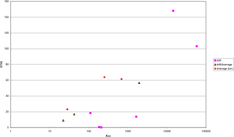
Figure 4.49. Comparison of the patterns of contribution to the sandy loam pond, Koc and DT50.
Figur 4.49. Sammenligning af mønstre for tilførsel til morænelersvandhullet og Koc og DT50.
Figure 4.50 and Table 4.21 shows the PestSurf presentation tool applied to the sandy loam pond simulation for fluazinam.
Click here to see Figure 4.50.
Figure 4.50. Example of result presentation overview by the PestSurf template for fluazinam in the sandy loam pond. The lowest detection value was swt to 75 ng/l.
Figur 4.50. Eksempel på resultatoversigt præsenteret i PestSurf-skabelonen for fluazinam i morænelersvandhullet. Detektionsgrænsen er sat til 75 ng/l.
Table 4.21. Example of tables produced by the PestSurf template for fluazinam For the sandy loam pond. The detection value used for table generation is set t 10 ng/l. The toxicity values for fish, daphnies and algae were set to 15, 20 and 25 ng/l, respectively.The recorded peaks are shown in Figure 4.50.
Tabel 4.21. Uddrag fra resultatoversigt genereret af PestSurf-Excelskabelonen for Flazinam i morænelersvandhullet. Grænseværdierne anvendt i tabelgenereringen er detektionsgrænsen = 10 ng/l, toxicitet overfor fisk, daphnier og alger er sat til hendholdsvis 15, 20 og 25 ng/l. De beskrevne koncentrationstoppe er vist iFigur 4.50.
4.5 Distribution of the contribution to groundwater
An attempt was made to evaluate and compare concentrations moving to surface water and to groundwater. The pre-specified storage frequencies and setup made it more difficult than anticipated, so rather than a detailed calculation, that would have involved an extraction of time series for every point in the model, a set of examples are made to show that the concentrations in drainage water and water moving to groundwater may differ.
First of all a water balance for the whole catchment was established for the water simulations with winter wheat and spring barley. The total flow from drains to river for the sandy loam catchment was summarised, and so was the total flow moving across from the upper saturated layer (which also generates drainflow) to the second saturated layer.
For 12 randomly selected locations (out of 1849 possible locations, excluding boundary cells) spread over the catchment, the concentration time series stored every 90 days only) were extracted for the upper saturated layer. The average flow components were then multiplied with the concentration to estimate the total transport. The average concentration in drain water was then established for the whole simulation period and for the last four years of the simulation period. The calculation was carried out for spring and autumn-applied pendimethalin and bromoxynil as well as for bentazon and propiconazol.
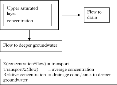
Figure 4.51. Key elements in the calculation of transport to drains and groundwater.
Figur 4.51. Nøgleelementer i beregningen af transport til dræn og grundvand.
The calculation is very rough due to the thickness of the calculation layer (typically about 3 m) and the storage frequency (90 days). It is likely that a calculation based on finer time steps would have given a greater distinction between concentrations in drainflow and flow to groundwater. The calculation does not at all take into account any additional degradation that may happen as the water level falls below drainage depth.
Figure 4.52 shows the flow components as they occur over four years. During very wet periods, the majority of the recharge to groundwater moves to the drains. In normal or dry years, the distribution is about half-half. For pesticides that mainly leach during periods dominated by drainage flow, the average concentration in drains could be expected to be higher than the average concentration moving to groundwater.
The concentration results are shown in Table 4.22. For pendimethalin, except for a single point, where the concentrations are very low, all calculation points show that higher average concentrations move to drains than to groundwater. The difference for pendimethalin is up to 40-50 %.
Pendimethalin sorbs strongly, but pesticide seems to move to the top of the saturated zone during the two wet years (year 5-6) in the second part of the simulation (Figure 4.53). Probably due to the sorption, the compound leaves the soil slowly, showing “tailing” over several years.
Bromoxynil, however, does not show the same picture. Concentrations in the groundwater are very low, and because bromoxynil breaks down very fast, the peaks arriving in groundwater are not caused by the general flow pattern but localised events taking place just after spraying (Figure 4.54 and Figure 4.55).
For spring-applied bentazon, the average relative concentration in drain is slightly higher than 1, while for the autumn-applied propiconazol, the concentration in drains is considerably higher for some points. In average, the concentration of propiconazol to drains is about 25 % higher than to groundwater.
The conclusion must be that very shortlived compounds do not follow the general flow pattern, but the more sorbing and long-lived compounds appear to generate higher average concentrations to drains than to groundwater – based on the flow patterns alone. In this rough estimate, the differences are relatively small. It is likely that finer storage steps and finer vertical discretisation would generate larger differences between concentrations in drainflow and water moving to deeper layers.
Any breakdown, filtering or sorption processes below drain depth would increase the difference between the two components further.
Click here to see Figure 4.52.
Figure 4.52. Comparison of flow components over four years of simulation. The period is repeated twice during the 8 years simulation.The wet period in the first two years of the simulation is followed by a dry and a normal year. Note that the total infiltration to groundwater (recharge) and the flow from the first to the second groundwater layer (recharge to layer 2) are indicated as negative while the drain flow is indicated as positive. Each point represents 30 days.
Figur 4.52. Sammenligning af strømningskomponenter over fire års simulering. Perioden er gentaget i 8-års-simuleringen. Den våde periode i de første to år af simuleringen følges af et tørt og et normalt år. Bemærk at den totale infiltration til grundvand (recharge) og strømningen fra første til andet grundvandsniveau (recharge to layer 2) er givet som negative mens drænflow er vist positivt. Hvert punkt repræsenterer 30 dage.
Table 4.22. Relative average concentration level (drain water/ groundwater) derived through a simple calculation based on flow patterns.
Tabel 4.22. Relativ gennemsnitskoncentration (drænvand/grundvand) på basis af en simpel beregning på grundlag af strømningsmønstre.
Click here to see Figure 4.53.
Figure 4.53 Comparison between flow components (groundwater to drain and groundwater to deeper groundwater) and concentration level in groundwater in a single point for the autumn-applied pendimethalin. Most pendimethalin reaches groundwater during a very wet period.
Figur 4.53. Sammenligning mellem strømningskomponenter (grundvand til dræn og grundvand til dybere grundvand) og koncentrationsniveauer i grundvand i et enkelt punkt for efterårsudbragt pendimethalin. Størstedelen af pendimethalinen når grundvandet i en meget våd periode.
Click here to see Figure 4.54.
Figure 4.54. Comparison between the flow components and the concentration levels in two points for the spring-applied bromoxynil. Due to the fast breakdown of bromoxynil, the presence of bromoxynil in the groundwater is due to the conditions just after spraying and not to the general groundwater recharge pattern. For both points, the highest concentration occurs during summer.
Figur 4.54. Sammenligning mellem strømningskomponenter og koncentrationsniveau i to punkter for forårsudbragt bromoxynil. På grund af hurtig nedbrydning af bromoxynil skyldes tilstedeværelsen af bromoxynil i grundvand forholdene lige efter udsprøjtning og ikke det generelle grundvands-tilstrømningsbillede. For begge punkter findes den højeste koncentration om sommeren.
Click here to see Figure 4.55.
Figure 4.55. Comparison between the flow components and the concentration levels in two points for the autumn-applied bromoxynil. Leaching is very localised in time and is caused by the conditions just after spraying rather than the general groundwater recharge pattern. Concentrations are very small.
Figur 4.55. Sammenligning mellem strømningskomponenter og koncentrationsniveau I to punkter for efterårsudbragt bromoxynil. Udvaskning er meget lokaliseret i tid og syldes forholdene lige efter udsprøjtning snarere end det generelle grundvandstilstrømningsmønster. Koncentrationerne er meget små.
Click here to see Figure 4.56.
Figure 4.56. Comparison between the flow components and the concentration levels in three points for the spring-applied bentazon. The three concentration curves show a maximum during the drainage period of the winter 1998-1999.
Figur 4.56. Sammenligning mellem strømningskomponenter og koncentrationsniveau I tre punkter for forårsudbragt bentazon. De tre koncentrationskurver viser et maximum i drænperioden i vinteren 1998-99.
Click here to see Figure 4.57.
Figure 4.57. Comparison between the flow components and the concentration levels in three points for the autumn-applied propiconazol. In this case there is a clear link between high concentrations moving to the groundwater and considerable recharge to groundwater.
Figur 4.57. Sammenligning mellem strømningskomponenter og koncentrationsniveauer i tre punkter for den efterårsudbragte propiconazol. I dette tilfælde er der en tydelig sammenhæng mellem høje koncentrationer, der bevæger sig til grundvand og væsentlig tilstrømning til grundvand.
Fodnoter
[1] The function is found in the ”Scenario”_Biomass.dfs0 file in the TIME directory made by the programme when running.
[2] The factor is crop dependent as it is the dose at 20 m compared to the dose at the edge of the stream, which depends on buffer zone with and thus the crop in question.
[3] The weight of sediment is calculated as 1m*1m*0.05 m * 800 kg/m³
5 Proposed changes to PestSurf and its presentation programs
During the process of data analysis, errors were found in the programme with respect to the calculation of adsorption of substance to sediment in the stream. These errors were corrected before the simulations were re-run. The required changes to the model documentation are described in Annex 14.
The originally used maximum time step for data storage for the stream was 3 days. This was changed to 1 day before the models were re-run in order to obtain a better description of the drainage peaks. However the storage frequency may be optimized further.
The variation of macrophytes over time is implemented in the streams only. This is in accordance with the text in Styczen et al. (2004b), but an issue to consider for an update. The change can be made by changing the templates used by the interface, and is thus a simple issue.
The PestSurf templates were updated with the points of maximum concentration identified as part of the present project. Furthermore, some minor errors in the spreadsheets were corrected as part of the project. The templates do not contain points from the tributaries to the two streams. It is not recommended to change this as the tributaries run dry for periods of the year. Nor is it recommended to use the data upstream of the “ovrelillebaek-500 m-location” for evaluations of toxicity, as the stretch may run dry during the summer. Any specific studies of results in other points can be analysed using the MIKE VIEW programme.
As mentioned earlier in the report an error was identified regarding the addition of wind drift to the water bodies. The error has been corrected and the simulations now generate values according to the assumptions made. However, for the streams, the assumptions that the whole stream system receives drift within 30 minutes is not realistic, and the concentrations generated, particularly in the sandy loam stream, are unrealistically high. Other assumptions are, of course, possible. The correct level is difficult to identify – not a single drift event was caught in the measurement programme set up during the PestSurf project (Styczen et al, 2004a).
- The drift could be added over a longer time. This would still lead to a buildup of concentrations downstream. However, spraying during two days of 12 hours would lead to concentrations that would be up to 48 times smaller than the drift calculations under the present assumption. The drift contribution could be spread over the whole time period, where spraying is relevant. A spraying window of one week and assuming 12 hours of spraying time per day would lead to a reduction by a factor of up to 168. In comparison, only two of the simulations in the sandy loam catchment have shown changes in maximum concentrations from before to after the code change of more than this value. Presently, the difference between the D3-ditch and the sandy stream is a factor 4.3. Even by changing the spraying period to 12 hours, the scenario would produce concentrations that are considerably lower that what is generated in the D3-ditch.
- A second method for reduction could be to consider wind directions and reduce the area contributing according to the time when wind directions are more than +/- 30 degrees away from the prevailing wind direction (and the directly opposite wind direction, as the stream may receive drift from both sides). We would then assume that farmers spray without taking into account the wind direction. In this case, the total dose going to the river would be reduced by the calculated fraction of time. This would lead to a reduction of less than a factor 2.
- The present model (including drift) operates with five stretches with different buffer zones for each stream. The stream could be divided into more stretches (of 100 to 500 m) and could be sprayed in a random manner over a selected period. Each spray drift addition is made within 1-5 minutes, depending on the length, assuming that the farmer drives parallel with the stream with a speed of 8 km/hr, or alternatively 5-20 minutes, assuming that he is driving perpendicular to the stream. This option could be combined with option 2 by statistically sampling a wind direction for each stretch. This would lead to a more realistic distribution of drift than option 1. The result is still depending on the time over which the spraying is allowed, but less so, because the individual additions are much more separated than in the present description. “One stretch of 100 m per hour” within 12 hours per day means that the spraying is finished within 3.5 day for the sandy stream, which is the longest. More specific field size statistics and probability of rainfall during different periods can be taken into account. However, the “random manner” should be decided once and for all to avoid that different runs produce different results.
Option 3 is the most realistic option of the above, and therefore recommended. High concentrations reached due to drift at the top end of a stream, caused by small water levels, will still occur. Because the option would limit the buildup seen in the present simulations in downstream points, the concentrations due to drift should be reduced significantly further down. The changes required to implement this option are located in the user interface and in the MIKE 11 setup.
The presently used description of colloid transport in macropores leads to an exaggerated flux of pesticide to groundwater. An ongoing project is working on an improvement of the description. It is recommended to include the improved description in the model when it becomes available.
The present version of the model was built in the 2002- version of MIKE SHE/MIKE 11. The models have been through rather strong revision since then, including an ongoing reprogramming exercise of the advection/dispersion scheme of MIKE 11. It is recommended to change the setup into the new version as and when other changes are to be implemented. Because the old version is not supported at code level anymore, it is extremely difficult to make fundamental changes in the present version.
If the recommendation is followed, special attention should be given to the lower end of the sandy loam catchment and to the calculation of diffusion into the porewater to ensure that they perform as expected.
A question was raised concerning the ability to make longer simulations. As MIKE SHE uses the same water data repeatedly and because the MIKE 11 water files may be doubled, it is possible to extend the simulations. However, presently the time series defining input, crop growth etc. are generated for 8 years only. An extended simulation would then require extension of all the time series used, which is a minor task.
6 Conclusions
PestSurf consequently generates higher concentrations than FOCUS SW. This is due to a number of differences between the scenarios.
The PestSurf sandy stream resembles the D3-ditch. The simulation results are almost linearly correlated, and the cause of maximum concentrations is similar. However, the presently used assumption regarding drift (spraying of the whole length of stream within 30 minutes) exaggerates the exposure and cause unrealistic concentration levels in the stream. The concentrations are about a factor of 4.3 higher than the concentrations in the D3-ditch. The water depth at the point of maximum concentration seldom reaches 30 cm.
The PestSurf sandy pond is strongly influenced by rather superficial groundwater, particularly in wet years. The mechanism is therefore completely different from the mechanism causing high concentrations in the D3 ditch. Generally the pond concentrations are lower than the concentrations in the D3-ditch.
The PestSurf sandy loam pond generates higher concentrations than the D4-pond when the cause is drift. This is explainable by a difference in pond size (250 m² compared to 900 m²) and therefore greater exposure. However, particularly for autumn applications, a low water level contributes to create higher concentrations.
For the PestSurf sandy loam stream, the concentrations are strongly influenced by the assumptions due to drift, causing a build-up at certain stretches. The water level in the stream is generally (much) below the 30 cm of the D4-stream, particularly for the autumn applications. This means that drift concentrations always will be higher in the PestSurf simulations than in the FOCUS SW-D4-stream simulations. It is recommended that the assumptions regarding drift be changed to represent field conditions more realistically.
The different causes of pesticide in the stream generate different patterns. With a more realistic drift simulation, the highest concentrations are most likely to occur in the upper end of the stream, where the water depth is small. The severe drainage event in the sandy loam catchment covered the whole catchment, except the very top end. The contributions from groundwater are only significant in the lower end of the sandy loam catchment. For two of the event types, the top end of the stream is thus not affected, and re-colonisation of downstream areas may occur. However, some small drainage events are observed, where very high concentrations occur in very small amounts of water in a single tributary.
It has already been argued that the contribution to the stream from the groundwater is exaggerated in the sandy loam catchment of PestSurf. The very high concentrations generated by some compounds in the lower end of this catchment are therefore likely to be unrealistically high, and should not be used as the only reason to discard a compound. On the other hand, the feature is closely linked to the long degradation times, and indicates that there is a danger of a build-up of concentrations in lower layers of the soil. This also indicates that the FOCUS approach assuming that the groundwater contribution is zero, is an underestimation. At the same time, the stretch appears to suffer from an instability problem. It is therefore recommended to avoid locations on the lower part of the stream, when data are extracted for administrative purposes.
It is recommended that stream results are used for the main stream only, and for the sandy loam stream, only from 500 m from the top end to avoid the stretches, which are dry during summer periods every year. This will also avoid the smallest drainage events, which are connected to very small amounts of water.
The high concentrations generated for some compounds by the 20-year event in the sandy loam catchment require consideration. A decision by the EPA is required with respect to the weight that should be given to this event in administrative decisions.
A major, still outstanding, issue is the lack of a method to interpret the spatial variation in results. How much of the stream should be affected before it is important? The very conservative method used in the report is to analyse the maximum values occurring in the catchment without any weight on the spatial occurrence may be too conservative.
It would be possible to generate a 3-D-graph showing length of stream sections on the x-axis, time on the y-axis and concentrations (greater than or equal to) on the the z-axis. The resulting graph would be a “mountain-shaped” and for each cross section of the z-axis it would show the time that a concentration level was “equal to or exceeded” for a given length of stream.
It is recommended that the Danish EPA at least decides on a “time criteria” like what is used for groundwater. If very high concentrations only occur during the 20-year-event, it must be considered equal to a 95 %-fractile according to the present climate. A similar consideration could be made for the very dry year (1996), but the simulations show that the summer period of the “normal year” was just as dry, and this event does therefore not really justify as an exception.
To avoid that a single point with a very high concentration becomes decisive for the simulation, a similar criterion could be implemented for the spatial distribution. The models contain 133 and 72 calculation points, of which 96 and 40 are present in the main streams, and 15 of the 40 lie between the 500-m-point and 1700 m point. A 95 %-criteria would be equal to 4-5 points in the sandy catchment and <1 point (60 m) in the sandy loam catchment.
It should be noticed that neither conditions such as the extreme drainage event, the groundwater contribution (which may be exaggerated, but nevertheless is relevant), the varying water level in the stream, the varying water level in the ponds nor the pond sizes identified as relevant under Danish conditions are represented in FOCUS SW. Water depths tend to be considerably lower than the 30 cm during summer and autumn in Danish 1. order streams, and the water level in ponds also drop during dry periods. FOCUS drift values will thus tend to underestimate the actual risk. One average year cannot catch all the different climatic conditions that may be relevant.
If the Danish EPA decides to continue with the PestSurf system, it is recommende that it is upgraded as described in Chapter 6.
7 References
Allerup, P., Madsen, H. og Vejen, F. (1998): Standardværdier (1961-90) af nedbørskorrektioner. DMI tech. Rep. 98-10, København.
BBA (2000): Bekanntmachung des Verzeichnisses risikomindernder Anwendungsbedingungen für Nichtzielorganismen. Bundesanzeiger Nr. 100, 9879-9880, Germany, May 26, 2000.
FOCUS (2001): FOCUS Surface Water Scenarios in the EU Evaluation Process under 91/414/EEC. Report of the FOCUS Working Group on Surface Water Scenarios, EC Document Reference SANCO/4802/2001-rev.2 245 p.
Helweg, C., Mogensen, B.B., Sørensen, P.B., Madsen, T., Rasmussen, D. and Petersen, S. (2003): Fate of pesticides in surface waters, Laboratory and Field Experiments. Ministry of Environment, Danish Environmental Protection Agency, Pesticides Research No. 68.
Kronvang, B., Iversen, H.L., Vejrup,L-. Mogensen, B.B., Hansen, A.M. and Hansen, L.B. (2003): Pesticides in streams and subsurface drainage water within two arable catchments in Denmark: Pesticide application, concentration, transport and fate. Pesticides research no. 69. pp. 141.
Styczen, M., Petersen, S., Christensen, M., Jessen, O.Z., Rasmussen, D., Andersen, M.B. and Sørensen, P.B. (2004a): Calibration of models describing pesticide fate and transport in Lillebæk and Odder Bæk Catchment. - Ministry of Environment, Danish Environmental Protection Agency, Pesticides Research No. 62.
Styczen, M., Petersen, S. Sørensen, P.B., Thomsen, M and Patrik, F. (2004b): Scenarios and model describing fate and transport of pesticides in surface water for Danish conditions. - Ministry of Environment, Danish Environmental Protection Agency, Pesticides Research No. 63.
Styczen, M., Petersen, S., Olsen, N.K. and Andersen, M.B. (2004c): Technical documentation of PestSurf, a model describing fate and transport of pesticides in surface water for Danish Conditions. - Ministry of Environment, Danish Environmental Protection Agency, Pesticides Research No. 64.
Annex 1
1 Comparison of risk assessment data produced by spray drift assessments, FOCUS SW and PestSurf
1.1 Chemical characteristics of the compound
| Compound: | Alpha-cypermethrin |
| Dose: | 15 g ai/ha |
| Spraying time: | 1st of June |
| Crop: | Winter wheat |
Table 1.1. Overview of chemical properties of alpha-cypermethrin and the parameters used in the simulations.
Tabel 1.1. Oversigt over alpha-cypermethrins kemiske egenskaber og parametrene brugt i simuleringerne.
| Chemical property | Condition | Recalculated values | |||
| Cas-no. | 67375-30-8 | ||||
| Molecular weight | 416.3 g/mol | ||||
| Form (acid, basic, neutral) | Neutral | ||||
| pKa | |||||
| Water solubility | 3.97 µg/l | pH 7 | |||
| log Kow | at pH | KowA- | |||
| log Kow | 5.5 | at pH | KowAH | 5.5 | |
| log Kow | at pH | KowAH+ | |||
| Vapor pressure, Pa | 3.4 × 10⁻⁷ (97.3%) | 25 °C | 270 °C (Decomposition) | vapor pressure, Pa, 20°C | 1.25 × 10⁻⁷ |
| Henry’s law constant | 0.069 Pa.m³ mol-1 | 20 °C | Recalculated value, dimensionless | 2.83 × 10⁻⁵ | |
| Sorption properties in soil | |||||
| Freundlich exp | 1 | ||||
| Koc, l/kg | 57889 | ||||
| DT50 in soil, days | 103 | ||||
| DT50water | 1.25 days | PestSurf input | |||
| DT50sedment | Water/sediment value used due to strong sorption |
||||
| DT50water/sediment | 20.9 days | method not described | DT50, days | 20.9 | |
| Sediment konc., µg/l | 80 (default in PestSurf) | ||||
| Hydrolysis | None | at pH 5 | (acid) | Indef | |
| 101 | at pH 7 | (neutral) | Indef | ||
| 7.3 | at pH 9 | (basic) | 5.5 × 10⁻⁶ | ||
| Photolysis | |||||
| quantum yield | φ = 8.12 × 10⁻³ | ||||
| Spectrum | at λmax (276 nm) : ε = 2073 l.mol-1.cm-1 | ||||
| at 300 nm : ε = 38.64 l.mol-1.cm-1 | |||||
| Other | at pH 5, 22 °C : DT50 = 1.2 d (Cp-label) – 2.2 d (Bz-label) | ||||
1.2 Concentration generated by spray
| Direct spray | FOCUS buffer zones | |||
| Ditch | Stream | Pond | ||
| [µg L-1] | [µg L-1] | [µg L-1] | [µg L-1] | |
| Alpha-cypermethrin | 5 | 0.138 | 0.093 | 0.041 |
1.3 Concentrations generated by FOCUS SW
1.3.1 D3 - Ditch
| Alpha-cypermethrin | Ditch, D3 | |||||||
| Water | Sediment | |||||||
| Date | PEC | Date | TWAEC | Date | PEC | Date | TWAEC | |
| [µg L-1] | [µg L-1] | [µg kg-1] | [µg kg-1] | |||||
| Global max | 21-jun-92 | 0.091 | 22-jun-92 | 0.223 | ||||
| 1 d | 22-jun-92 | 0.029 | 22-jun-92 | 0.048 | 23-jun-92 | 0.193 | 22-jun-92 | 0.219 |
| 2 d | 23-jun-92 | 0.011 | 23-jun-92 | 0.034 | 24-jun-92 | 0.156 | 23-jun-92 | 0.207 |
| 4 d | 25-jun-92 | 0.003 | 25-jun-92 | 0.02 | 26-jun-92 | 0.111 | 25-jun-92 | 0.178 |
| 7 d | 28-jun-92 | 0.001 | 28-jun-92 | 0.012 | 29-jun-92 | 0.079 | 28-jun-92 | 0.146 |
1.3.2 D4 – Pond
| Alpha-cypermethrin | Pond, D4 | |||||||
| Water | Sediment | |||||||
| Date | PEC | Date | TWAEC | Date | PEC | Date | TWAEC | |
| [µg L-1] | [µg L-1] | [µg kg-1] | [µg kg-1] | |||||
| Global max | 01-jun-85 | 0.003 | 03-jun-85 | 0.012 | ||||
| 1 d | 02-jun-85 | 0.002 | 02-jun-85 | 0.002 | 04-jun-85 | 0.012 | 04-jun-85 | 0.012 |
| 2 d | 03-jun-85 | 0.001 | 03-jun-85 | 0.002 | 05-jun-85 | 0.011 | 04-jun-85 | 0.012 |
| 4 d | 05-jun-85 | 0.001 | 05-jun-85 | 0.001 | 07-jun-85 | 0.009 | 06-jun-85 | 0.011 |
| 7 d | 08-jun-85 | 0 | 08-jun-85 | 0.001 | 10-jun-85 | 0.007 | 08-jun-85 | 0.01 |
1.3.3 D4 – Stream
| Alpha-cypermethrin | Stream, D4 | |||||||
| Water | Sediment | |||||||
| Date | PEC | Date | TWAEC | Date | PEC | Date | TWAEC | |
| [µg L-1] | [µg L-1] | [µg kg-1] | [µg kg-1] | |||||
| Global max | 30-maj-85 | 0.079 | 01-jun-85 | 0.119 | ||||
| 1 d | 02-jun-85 | 0 | 02-jun-85 | 0.015 | 02-jun-85 | 0.04 | 02-jun-85 | 0.073 |
| 2 d | 03-jun-85 | 0 | 03-jun-85 | 0.008 | 03-jun-85 | 0.028 | 03-jun-85 | 0.054 |
| 4 d | 05-jun-85 | 0 | 05-jun-85 | 0.004 | 05-jun-85 | 0.019 | 05-jun-85 | 0.039 |
| 7 d | 08-jun-85 | 0 | 08-jun-85 | 0.002 | 08-jun-85 | 0.014 | 08-jun-85 | 0.029 |
1.3.4 Conclusion – FOCUS SW
The highest concentration is generated in the ditch (D3). It is caused by wind drift and the concentration becomes 0.093 µg/l. The same scenario shows the highest concentration in the sediment, 0.223 µg/kg. For all scenarios, the concentrations are lower than what is generated by the simpler assessments.
1.4 PestSurf
1.4.1 Sandy catchment, stream
The distribution of concentrations were assessed in several steps. First, the maximum concentrations at each calculation point were listed, and the dates for the occurrence of the maximum was assessed. The points, for which the maximum value also represents a local maximum were selected for further analysis. The relevant values are listed in Table 1.2.
Table 1.2. Maximum concentrations (ng/l) of alpha-cypermethrin simulated for each calculation point in the sandy catchment.
Tabel 1.2. Maximumskoncentrationer (ng/l) af alpha-cypermethrin simuleret for hvert beregningspunkt i det sandede opland.
| ALPHA-CYPERMETHRIN | Maximum | Max.Time | max |
| ODDERBAEK 0.00 | 29 | 04-06-1998 09:18 | |
| ODDERBAEK 56.00 | 31 | 04-06-1998 09:18 | |
| ODDERBAEK 112.00 | 37 | 04-06-1998 09:00 | |
| ODDERBAEK 192.00 | 77 | 04-06-1998 08:41 | |
| ODDERBAEK 272.00 | 120 | 04-06-1998 08:33 | |
| ODDERBAEK 278.00 | 125 | 04-06-1998 08:33 | |
| ODDERBAEK 282.00 | 129 | 04-06-1998 08:33 | |
| ODDERBAEK 298.50 | 138 | 04-06-1998 08:33 | |
| ODDERBAEK 315.00 | 149 | 04-06-1998 08:33 | |
| ODDERBAEK 317.50 | 151 | 04-06-1998 08:33 | |
| ODDERBAEK 320.00 | 152 | 04-06-1998 08:33 | |
| ODDERBAEK 410.00 | 198 | 04-06-1998 08:33 | |
| ODDERBAEK 500.00 | 224 | 04-06-1998 08:33 | |
| ODDERBAEK 513.00 | 235 | 04-06-1998 08:33 | |
| ODDERBAEK 521.00 | 243 | 04-06-1998 08:33 | |
| ODDERBAEK 622.00 | 288 | 04-06-1998 08:33 | |
| ODDERBAEK 723.00 | 323 | 04-06-1998 08:33 | |
| ODDERBAEK 733.00 | 333 | 04-06-1998 08:33 | |
| ODDERBAEK 742.00 | 339 | 04-06-1998 08:33 | |
| ODDERBAEK 789.50 | 354 | 04-06-1998 08:33 | |
| ODDERBAEK 837.00 | 369 | 04-06-1998 08:33 | |
| ODDERBAEK 848.00 | 375 | 04-06-1998 08:33 | |
| ODDERBAEK 863.00 | 382 | 04-06-1998 08:33 | |
| ODDERBAEK 956.00 | 407 | 04-06-1998 08:33 | |
| ODDERBAEK 1049.00 | 409 | 04-06-1998 08:33 | x |
| ODDERBAEK 1111.50 | 392 | 10-06-2000 08:33 | |
| ODDERBAEK 1174.00 | 356 | 10-06-2000 08:33 | |
| ODDERBAEK 1226.00 | 334 | 10-06-2000 08:33 | |
| ODDERBAEK 1278.00 | 324 | 10-06-2000 08:41 | |
| ODDERBAEK 1293.50 | 321 | 10-06-2000 08:41 | |
| ODDERBAEK 1310.00 | 314 | 10-06-2004 08:41 | |
| ODDERBAEK 1421.00 | 299 | 10-06-2004 08:51 | |
| ODDERBAEK 1532.00 | 259 | 01-06-2001 08:33 | |
| ODDERBAEK 1558.06 | 235 | 04-06-1998 08:33 | |
| ODDERBAEK 1584.12 | 226 | 04-06-1998 08:41 | |
| ODDERBAEK 1584.12 | 226 | 04-06-1998 08:41 | |
| ODDERBAEK 1621.06 | 226 | 04-06-1998 08:33 | |
| ODDERBAEK 1658.00 | 232 | 04-06-1998 08:33 | |
| ODDERBAEK 1698.50 | 240 | 04-06-1998 08:33 | |
| ODDERBAEK 1739.00 | 245 | 04-06-1998 08:33 | x |
| ODDERBAEK 1801.50 | 236 | 04-06-1998 08:33 | |
| ODDERBAEK 1864.00 | 192 | 01-06-1999 08:32 | |
| ODDERBAEK 1977.00 | 145 | 01-06-2003 09:36 | |
| ODDERBAEK 2090.00 | 140 | 01-06-2003 09:45 | |
| ODDERBAEK 2098.00 | 140 | 01-06-2003 09:45 | |
| ODDERBAEK 2105.00 | 140 | 01-06-2003 09:45 | |
| ODDERBAEK 2131.00 | 138 | 01-06-2003 09:45 | |
| ODDERBAEK 2157.00 | 136 | 01-06-2003 09:53 | |
| ODDERBAEK 2168.00 | 135 | 01-06-2003 09:53 | |
| ODDERBAEK 2179.00 | 134 | 01-06-2003 09:53 | |
| ODDERBAEK 2268.50 | 132 | 01-06-2003 10:00 | |
| ODDERBAEK 2358.00 | 125 | 01-06-2003 10:00 | |
| ODDERBAEK 2363.50 | 125 | 01-06-2003 10:00 | |
| ODDERBAEK 2372.00 | 124 | 01-06-2003 10:00 | |
| ODDERBAEK 2427.00 | 122 | 01-06-2003 10:00 | |
| ODDERBAEK 2482.00 | 119 | 01-06-2003 10:00 | |
| ODDERBAEK 2609.00 | 116 | 01-06-2003 10:00 | |
| ODDERBAEK 2736.00 | 108 | 01-06-2001 11:00 | |
| ODDERBAEK 2831.00 | 107 | 01-06-2001 11:00 | |
| ODDERBAEK 2926.00 | 100 | 01-06-2001 11:00 | |
| ODDERBAEK 2958.50 | 98 | 01-06-2001 11:00 | |
| ODDERBAEK 2991.00 | 96 | 01-06-2001 11:00 | |
| ODDERBAEK 3029.50 | 92 | 01-06-2001 11:00 | |
| ODDERBAEK 3068.00 | 87 | 01-06-2003 11:00 | |
| ODDERBAEK 3131.00 | 82 | 01-06-2003 11:00 | |
| ODDERBAEK 3194.00 | 77 | 01-06-2003 11:00 | |
| ODDERBAEK 3250.50 | 77 | 04-06-1998 08:33 | |
| ODDERBAEK 3307.00 | 83 | 04-06-1998 08:33 | |
| ODDERBAEK 3315.00 | 84 | 04-06-1998 08:33 | |
| ODDERBAEK 3323.00 | 88 | 04-06-1998 08:33 | |
| ODDERBAEK 3355.50 | 98 | 04-06-1998 08:33 | |
| ODDERBAEK 3388.00 | 110 | 04-06-1998 08:33 | |
| ODDERBAEK 3438.50 | 127 | 04-06-1998 08:33 | |
| ODDERBAEK 3489.00 | 134 | 04-06-1998 08:33 | |
| ODDERBAEK 3499.50 | 135 | 04-06-1998 08:33 | x |
| ODDERBAEK 3510.00 | 135 | 04-06-1998 08:33 | |
| ODDERBAEK 3581.00 | 133 | 04-06-1998 08:33 | |
| ODDERBAEK 3652.00 | 119 | 04-06-1998 08:33 | |
| ODDERBAEK 3707.00 | 112 | 04-06-1998 08:41 | |
| ODDERBAEK 3762.00 | 104 | 04-06-1998 08:41 | |
| ODDERBAEK 3790.00 | 92 | 04-06-1998 08:41 | |
| ODDERBAEK 3818.00 | 73 | 04-06-1998 08:41 | |
| ODDERBAEK 3818.00 | 73 | 04-06-1998 08:41 | |
| ODDERBAEK 3884.00 | 70 | 04-06-1998 08:41 | |
| ODDERBAEK 3950.00 | 67 | 04-06-1998 08:51 | |
| ODDERBAEK 3998.00 | 62 | 04-06-1998 08:51 | |
| ODDERBAEK 4046.00 | 59 | 04-06-1998 09:00 | |
| ODDERBAEK 4047.50 | 58 | 04-06-1998 09:00 | |
| ODDERBAEK 4049.00 | 58 | 04-06-1998 09:00 | |
| ODDERBAEK 4052.50 | 58 | 04-06-1998 09:00 | |
| ODDERBAEK 4056.00 | 58 | 04-06-1998 09:00 | |
| ODDERBAEK 4058.00 | 58 | 04-06-1998 09:00 | |
| ODDERBAEK 4060.00 | 58 | 04-06-1998 09:00 | |
| ODDERBAEK 4080.00 | 58 | 04-06-1998 09:00 | |
| ODDERBAEK 4100.00 | 57 | 04-06-1998 09:00 | |
| ODDERBAEK 4134.00 | 57 | 04-06-1998 09:00 | |
| ODDERBAEK 4168.00 | 57 | 04-06-1998 09:08 | |
| GISLUM_ENGE_AFLOEB 0.00 | 0 | 04-06-1998 08:06 | |
| GISLUM_ENGE_AFLOEB 50.00 | 0 | 04-06-1998 08:06 | |
| GISLUM_ENGE_AFLOEB 100.00 | 0 | 04-06-1998 08:06 | |
| GISLUM_ENGE_AFLOEB 150.00 | 0 | 04-06-1998 08:06 | |
| GISLUM_ENGE_AFLOEB 200.00 | 0 | 04-06-1998 08:06 | |
| GISLUM_ENGE_AFLOEB 250.00 | 0 | 04-06-1998 08:06 | |
| GISLUM_ENGE_AFLOEB 300.00 | 0 | 09-02-2000 00:00 | |
| GISLUM_ENGE_AFLOEB 340.00 | 0 | 13-02-2000 00:00 | |
| GISLUM_ENGE_AFLOEB 380.00 | 0 | 27-12-2003 00:00 | |
| GISLUM_ENGE_AFLOEB 430.00 | 0 | 04-06-1998 08:06 | |
| GISLUM_ENGE_AFLOEB 480.00 | 0 | 04-06-1998 08:06 | |
| GISLUM_ENGE_AFLOEB 530.00 | 0 | 04-06-1998 08:06 | |
| GISLUM_ENGE_AFLOEB 580.00 | 0 | 04-06-1998 08:06 | |
| GISLUM_ENGE_AFLOEB 630.00 | 0 | 04-06-1998 08:06 | |
| GISLUM_ENGE_AFLOEB 680.00 | 0 | 04-06-1998 08:06 | |
| GISLUM_ENGE_AFLOEB 730.00 | 0 | 04-06-1998 08:06 | |
| GISLUM_ENGE_AFLOEB 780.00 | 0 | 04-06-1998 08:06 | |
| GISLUM_ENGE_AFLOEB 830.00 | 0 | 04-06-1998 09:08 | |
| GISLUM_ENGE_AFLOEB 880.00 | 0 | 04-06-1998 09:08 | |
| GISLUM_ENGE_AFLOEB 915.00 | 0 | 04-06-1998 09:08 | |
| GISLUM_ENGE_AFLOEB 950.00 | 0 | 04-06-1998 09:08 | |
| GISLUM_ENGE_AFLOEB 985.00 | 0 | 04-06-1998 09:08 | |
| GISLUM_ENGE_AFLOEB 1020.00 | 0 | 04-06-1998 09:00 | |
| GISLUM_ENGE_AFLOEB 1045.00 | 0 | 04-06-1998 09:00 | |
| GISLUM_ENGE_AFLOEB 1070.00 | 0 | 04-06-1998 09:00 | |
| GISLUM_ENGE_AFLOEB 1110.00 | 0 | 04-06-1998 09:00 | |
| GISLUM_ENGE_AFLOEB 1150.00 | 0 | 04-06-1998 09:00 | |
| GISLUM_ENGE_AFLOEB 1190.00 | 0 | 04-06-1998 09:00 | |
| GISLUM_ENGE_AFLOEB 1230.00 | 0 | 04-06-1998 09:00 | |
| GISLUM_ENGE_AFLOEB 1271.00 | 0 | 04-06-1998 08:51 | |
| GISLUM_ENGE_AFLOEB 1312.00 | 1 | 04-06-1998 08:51 | |
| GISLUM_ENGE_AFLOEB 1422.00 | 15 | 04-06-1998 08:51 | |
| GISLUM_ENGE_AFLOEB 1532.00 | 73 | 04-06-1998 08:41 | x |
| TILLOEB 0.00 | 217 | 04-06-1998 08:41 | |
| TILLOEB 20.16 | 222 | 04-06-1998 08:41 | |
| TILLOEB 40.31 | 226 | 04-06-1998 08:41 | x |
| Global max | 409 |
The pattern over time was the same for all calculation points. The peak values are generated by wind drift, see Figure 1.1.
Each of the events generated an almost identical pattern along the stream, see Figure 1.2, Figure 1.3 and Figure 1.4. The thin black line represents the concentration, while the full black line shows the maximum concentrations obtained during the simulations. In addition, the outline of the stream is shown. In the middle of the catchment, the stream is protected by unsprayed areas. The maximum values at the center of the catchment are obtained when the peak from upstream move through the catchment during the hour following spraying.
In order to present the data in a similar fashion to the FOCUS SW-results, data were extracted and recalculated for the time series marked in
Table 1.2. The global maxima and time weighted concentrations (up to 7 days) were extracted and are reported in Table 1.3 for actual and time weighted concentrations, respectively. Note that the unit is ng/l.
The amount of alpha-cypermethrin sorbed on macrophytes is shown in Figure 1.5. The amount is within a factor 6-7 of the concentration in the water phase. An example of pore water concentration is shown in Figure 1.6. The concentration level is very low (2.08*10-6 µg/l) and the highest adsorption to sediment is 0.155 ng/kg (Figure 1.7).
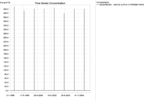
Figure 1.1. Concentration pattern over time for alphacypermethrin in the sandy catchment.
Figur 1.1. Koncentrationsmønster som funktion af tid for alpha-cypermethrin i det sandede opland.

Figure 1.2. Concentrations of alpha-cypermethrin in the sandy catchment on the day of spraying 1998, just at the end of the spraying period.
Figur 1.2. Koncentrationer af alpha-cypermethrin i det sandede opland på sprøjtedagen i 1998 lige efter endt sprøjtning.

Figure 1.3. Concentrations of alpha-cypermethrin in the sandy catchment on the day of spraying 2004.
Figur 1.3. Koncentrationer af alpha-cypermethrin i det sandede opland på sprøjtedagen i 2004.
Figure 1.4. Concentrations of alpha-cypermethrin in the sandy catchment on the day of spraying 2005.
Figur 1.4. Koncentrationer af alpha-cypermethrin i det sandede opland på sprøjtedagen i 2005 lige efter endt sprøjtning.
Figure 1.5. Concentration of alpha-cypermethrin on macrophytes in the point of maximum concentration in the water phase in the sandy catchment. The absolute maximum for macrophyte concentration, 59.8 ng/l, was reached further downstream (1421).
Figur 1.5. Koncentration af alpha-cypermethrin på makrofytter på lokaliteten med maximumskoncentration i vandfasen i det sandede opland. Det absolutte maximum for makrofytkoncentration, 59.8 ng/l fandtes længere nedstrøms (1421).
Figure 1.6. Pore water concentration for alpha-cypermethrin at the point of maximum concentration in the sandy catchment.
Figur 1.6. Porevandskoncentration for alpha-cypermethrin på lokaliteten med maximumskoncentration i det sandede opland.
Figure 1.7. Sediment concentration for alpha-cypermethrin at the point of maximum concentration in the sandy catchment. Note that the concentration is in µg/g and not µg/m³ as stated.
Figur 1.7. Sedimentkoncentration for alpha-cypermethrin på lokaliteten med maximumskoncentration I det sandede opland. Bemærk at koncentrationen er i µg/g og ikke i µg/m³ som angivet.
Table 1.3. Actual and time-weighted concentration of alpha-cypermethrin, ng/l, at selected points in the sandy stream.
Tabel 1.3. Beregnet og tidsvægtet koncentration af alpha-cypermetrhin, ng/l, på udvalgte lokaliteter i det sandede vandløb.
| Year | ODDERBAEK 1049.00 | ODDERBAEK 1739.00 | ODDERBAEK 3499.50 | |||||||
| Conc. | TWC | Date | Conc. | TWC | Date | Conc. | TWC | Date | ||
| 1998 | (global max) | 409 | 04-06-1998 08:33 | 245 | 04-06-1998 08:33 | 135 | 04-06-1998 08:33 | |||
| 1 hour (after max) | 270 | 333 | 185 | 200 | 47 | 75 | ||||
| 1 day after sp.in. | 1 | 36 | 1 | 33 | 1 | 20 | ||||
| 2 days | 1 | 12 | 1 | 11 | 1 | 7 | ||||
| 4 days | 0 | 9 | 1 | 9 | 1 | 5 | ||||
| 7 days | 0 | 6 | 0 | 5 | 0 | 3 | ||||
| 1999 | (global max) | 392 | 01-06-1999 08:32 | 231 | 01-06-1999 08:32 | 110 | 01-06-1999 08:32 | |||
| 1 hour (after max) | 192 | 284 | 183 | 197 | 35 | 58 | ||||
| 1 day after sp.in. | 0 | 20 | 0 | 20 | 0 | 15 | ||||
| 2 days | 0 | 7 | 0 | 7 | 0 | 5 | ||||
| 4 days | 0 | 5 | 0 | 5 | 0 | 4 | ||||
| 7 days | 0 | 3 | 0 | 3 | 0 | 2 | ||||
| 2000 | (global max) | 402 | 10-06-2000 08:33 | 235 | 10-06-2000 08:33 | 121 | 10-06-2000 08:33 | |||
| 1 hour (after max) | 209 | 297 | 187 | 199 | 40 | 65 | ||||
| 1 day after sp.in. | 0 | 22 | 0 | 23 | 1 | 17 | ||||
| 2 days | 0 | 7 | 0 | 8 | 0 | 6 | ||||
| 4 days | 0 | 6 | 0 | 6 | 0 | 4 | ||||
| 7 days | 0 | 3 | 0 | 4 | 0 | 3 | ||||
| 2001 | (global max) | 402 | 01-06-2001 08:33 | 237 | 01-06-2001 08:33 | 123 | 01-06-2001 08:33 | |||
| 1 hour (after max) | 218 | 302 | 190 | 201 | 41 | 66 | ||||
| 1 day after sp.in. | 0 | 23 | 0 | 24 | 1 | 18 | ||||
| 2 days | 0 | 8 | 0 | 8 | 0 | 6 | ||||
| 4 days | 0 | 6 | 0 | 6 | 0 | 5 | ||||
| 7 days | 0 | 4 | 0 | 4 | 0 | 3 | ||||
| 2002 | (global max) | 406 | 04-06-2002 08:33 | 239 | 04-06-2002 08:33 | 124 | 04-06-2002 08:33 | |||
| 1 hour (after max) | 240 | 316 | 185 | 199 | 41 | 67 | ||||
| 1 day after sp.in. | 0 | 28 | 0 | 27 | 1 | 17 | ||||
| 2 days | 0 | 9 | 0 | 9 | 0 | 6 | ||||
| 4 days | 0 | 7 | 0 | 7 | 0 | 5 | ||||
| 7 days | 0 | 4 | 0 | 4 | 0 | 3 | ||||
| 2003 | (global max) | 379 | 01-06-2003 08:33 | 226 | 01-06-2003 08:33 | 107 | 01-06-2003 08:33 | |||
| 1 hour (after max) | 171 | 268 | 177 | 194 | 34 | 55 | ||||
| 1 day after sp.in. | 0 | 17 | 0 | 18 | 0 | 14 | ||||
| 2 days | 0 | 6 | 0 | 6 | 0 | 5 | ||||
| 4 days | 0 | 4 | 0 | 5 | 0 | 4 | ||||
| 7 days | 0 | 3 | 0 | 3 | 0 | 2 | ||||
| 2004 | (global max) | 400 | 10-06-2004 08:33 | 232 | 10-06-2004 08:33 | 120 | 10-06-2004 08:33 | |||
| 1 hour (after max) | 201 | 292 | 184 | 197 | 39 | 64 | ||||
| 1 day after sp.in. | 0 | 21 | 0 | 22 | 1 | 16 | ||||
| 2 days | 0 | 7 | 0 | 8 | 0 | 6 | ||||
| 4 days | 0 | 5 | 0 | 6 | 0 | 4 | ||||
| 7 days | 0 | 3 | 0 | 3 | 0 | 3 | ||||
| 2005 | (global max) | 401 | 01-06-2005 08:33 | 235 | 01-06-2005 08:33 | 121 | 01-06-2005 08:33 | |||
| 1 hour (after max) | 212 | 298 | 188 | 200 | 40 | 65 | ||||
| 1 day after sp.in. | 0 | 23 | 0 | 24 | 1 | 17 | ||||
| 2 days | 0 | 8 | 0 | 8 | 0 | 6 | ||||
| 4 days | 0 | 6 | 0 | 6 | 0 | 5 | ||||
| 7 days | 0 | 3 | 0 | 4 | 0 | 3 | ||||
| Global max | 409 | 245 | 135 | |||||||
| 1 hour (after max) | 270 | 333 | 190 | 201 | 47 | 75 | ||||
| 1 day after sp.in. | 1 | 36 | 1 | 33 | 1 | 20 | ||||
| 2 days | 1 | 12 | 1 | 11 | 1 | 7 | ||||
| 4 days | 0 | 9 | 1 | 9 | 1 | 5 | ||||
| 7 days | 0 | 6 | 0 | 5 | 0 | 3 | ||||
Figure 1.8. Overview for alpha cypermethrin in the sandy catchment generated by the PestSurf excel template. The max concentrations generated over 24 hours are similar to the overviews in Figure 1.2, Figure 1.3 and Figure 1.4. The graph to the lower right shows how many events have concentrations higher than a given value for the selected monitoring point. Detection value was set to 1 ng/l.
Figur 1.8. Oversigt for alpha-cypermethrin i det sandede opland genereret med PestSurf-excel-skabelonen. Den maximale koncentration genereret over 24 timer svarer til oversigterne i Figur 1.2, Figur 1.3 og Figur 1.4. Grafen nederst til højre viser hvor mange hændelser, der har koncentrationer højere end en given værdi i et udvalgt punkt. Detektionsgrænsen var sat til 1 ng/l.
Figure 1.9. Same as Figure 1.8, but with a limiting value of 10 ng/l. The graph to the lower right shows how many events (above 10 ng/l) have a duration longer than the value on the Y-axis for the selected monitoring points.
Figur 1.9. Mage til figure Figur 1.8, men med en begrænsende værdi på 10 ng/l. Grafen nederst til højre viser hvor mange hændelser (over 10 ng/l) med længere varighed end værdien på Y-aksen, der er for udvalgte lokaliteter.
Table 1.4. Part of the result sheet generated by the PestSurf Excel sheet. The selected table shows the Pre-defined point along the stream with the highest concentration recorded. The lowest detection concentration is set to 1, while the toxicity values for fish, daphnies and algae are set to 10, 100 and 1000 ng/l, respectively.
Tabel 1.4. Uddrag af resultatpresentationen genereret af PestSurf-Excel-arket. Den udvalgte tabel viser det fordefinerede punkt langs med åen med højest koncentration. Detektionsgrænsen er sat til 1 mens toxicitetsværdierne for fisk, dafnier og alger er henholdsvis 10, 100 og 1000 ng/l.
The global maximum value calculated by PestSurf for the sandy catchment in the water phase is 409 ng/l. This is 4-5 times more than what is found in the D3-ditch scenario (91 ng/l). The pesticide was sorbed to macrophytes in the stream rather than to sediment.
Figure 1.8 shows the output of the PestSurf Excel template. The template works with pre-defined data extraction points. The plot requires specification of a “lowest detection value” (ldc), which defines when a pesticide occurrence is defined as an event. The time series plot is identical to the time series shown earlier, and the graph in the upper right corner resembles the plots in Figure 1.2, Figure 1.3 and Figure 1.4, but takes into account a longer period of time. A curve is generated when a downstream point reaches a concentration higher than the ldc. The programme then tracks the highest concentration for each calculation point in the stream within the last 24 hours. The plot in the lower right corner shows how many events have concentrations higher than a given toxicity value for the selected monitoring points. The curves are rather flat, showing little variation from year to year. Figure 1.9 shows the same picture, except that the figure to the lower right shows how many events have a duration longer than a given value for the selected monitoring points. In this case an event is defined by a concentration higher than 10 ng/l. Table 1.4 shows part of the result sheet generated by the PestSurf Excel sheet based on the ldc-value. The selected table shows the point along the stream (of the pre-defined points) with the highest concentration. This value was, however, only 226 ng/l. Thus, the pre-defined points have not caught the highest concentration of the simulation, which was 409 ng/l.
1.4.2 Sandy catchment, pond
The concentration pattern is evaluated in the middle of the pond only, see Figure 1.10. The pond receives drift and a contribution from groundwater. The drift peaks dominate in all years, however in the last two years, the dry and normal weather leads to significant concentrations through the baseflow contribution. The maximum concentration is still quite low, 2.1 ng/l.
In Table 1.5, global maxima and time weighted concentrations (up to 7 days) were extracted.
Figure 1.10. Concentrations of alpha-cypermethrin in the sandy pond.
Figur 1.10. Koncentration af alpha-cypermethrin i det sandede vandhul.
Table 1.5. Maximum actual and time-weighted concentrations of alpha-cypermethrin (ng/l) generated by drift and baseflow for the sandy pond.
Tabel 1.5. Beregnede og tidsvægtede maximumskoncentrationer af alpha-cypermethrin (ng/l) genereret af drift og grundvandstilstrømning for det sandede vandhul.
| Year | Alpha-cypermethrin | Conc | TWC | Date of occurrence |
| 1998 | Global max | 1.402 | 04-06-1998 08:30 | |
| 1 hour(after max) | 0.768 | 0.923 | ||
| 1 day after sp.in. | 0.206 | 0.349 | ||
| 2 days | 0.121 | 0.216 | ||
| 4 days | 0.107 | 0.190 | ||
| 7 days | 0.084 | 0.149 | ||
| 1999 | Global max | 1.237 | 01-06-1999 08:30 | |
| 1 hour | 0.698 | 0.826 | ||
| 1 day | 0.202 | 0.332 | ||
| 2 days | 0.118 | 0.209 | ||
| 4 days | 0.104 | 0.184 | ||
| 7 days | 0.080 | 0.144 | ||
| 2000 | Global max | 2.098 | 10-06-2000 08:30 | |
| 1 hour | 1.103 | 1.369 | ||
| 1 day | 0.307 | 0.497 | ||
| 2 days | 0.206 | 0.326 | ||
| 4 days | 0.191 | 0.293 | ||
| 7 days | 0.171 | 0.244 | ||
| 2001 | Global max | 1.360 | 01-06-2001 08:30 | |
| 1 hour | 0.764 | 0.907 | ||
| 1 day | 0.240 | 0.374 | ||
| 2 days | 0.162 | 0.250 | ||
| 4 days | 0.150 | 0.226 | ||
| 7 days | 0.138 | 0.190 | ||
| 2002 | Global max | 1.413 | 04-06-2002 08:30 | |
| 1 hour | 0.788 | 0.940 | ||
| 1 day | 0.242 | 0.380 | ||
| 2 days | 0.162 | 0.253 | ||
| 4 days | 0.149 | 0.228 | ||
| 7 days | 0.125 | 0.188 | ||
| 2003 | Global max | 1.243 | 01-06-2003 08:30 | |
| 1 hour | 0.710 | 0.836 | ||
| 1 day | 0.223 | 0.350 | ||
| 2 days | 0.141 | 0.230 | ||
| 4 days | 0.126 | 0.205 | ||
| 7 days | 0.102 | 0.165 | ||
| 2004 | Global max | 2.114 | 10-06-2004 08:30 | |
| 1 hour | 1.124 | 1.390 | ||
| 1 day | 0.334 | 0.522 | ||
| 2 days | 0.234 | 0.352 | ||
| 4 days | 0.220 | 0.321 | ||
| 7 days | 0.200 | 0.272 | ||
| 2005 | Global max | 1.364 | 01-06-2005 08:30 | |
| 1 hour | 0.772 | 0.914 | ||
| 1 day | 0.254 | 0.386 | ||
| 2 days | 0.178 | 0.264 | ||
| 4 days | 0.167 | 0.241 | ||
| 7 days | 0.156 | 0.206 | ||
| max values | ||||
| Global max | 2.114 | 0.000 | ||
| 1 hour | 1.124 | 1.390 | ||
| 1 day | 0.334 | 0.522 | ||
| 2 days | 0.234 | 0.352 | ||
| 4 days | 0.220 | 0.321 | ||
| 7 days | 0.200 | 0.272 |
The sorption to macrophytes is shown in Figure 1.11. The pattern generally follows the concentration in the water. However, concentration patterns of longer duration seem to have greater impact on the sorbed amount than the drift peaks. The concentration is specified per m³ water column. To find the value in biomass, the concentration should be divided by 33 g/m³.
The concentration of alpha-cypermethrin in porewater is shown in Figure 1.12. Here both the drift peaks and more permanent concentration patterns are visible. The concentration in sediment is below 0.01 ng/kg. Values below 0.01 ng/kg are stored as “0” in the model.
Figure 1.11. Sorption of alpha-cypermethrin to macrophytes in the sandy pond.
Figur 1.11. Sorption af alpha-cypermethrin til makrofytter i det sandede vandhul.
Figure 1.12. Pore water concentration of alpha-cypermethrin in the sandy pond.
Figur 1.12. Porevandskoncentration af alpha/cypermetrin i det sandede vandhul.
Figure 1.12 shows the output of the PestSurf Excel template. The template works with one pre-defined data extraction point for the pond (center of the pond). The plot requires specification of a “lowest detection value” (ldc) which defines when a pesticide occurrence is defined as an event. The time series plot is identical to the time series shown earlier. The plot to the right shows how many events have concentrations higher than a given toxicity value for the selected monitoring points.
Table 1.6 shows part of the result sheet generated by the PestSurf Excel sheet based on the ldc-value.
Click here to see Figure 1.13.
Figure 1.13. Overview for alpha cypermethrin in the sandy pond generated by the PestSurf excel template. The time series shown is identical to the one in Figure 1.10. Lowest detection value is set to 0.05 ng/l.
Figur 1.13. Oversigt for alpha-cypermethrin i det sandede vandhul genereret med PestSurf-excel-skabelonen. Den viste tidsserie er mage til den i Figur 1.10 Detektionsgrænsen er sat til 0.05 ng/l.
Table 1.6. Part of the result sheet generated by the PestSurf Excel sheet. The lowest detection value is 0.05 ng/l, toxicity to fish, daphnies and algae are 1, 10 and 100 ng/, respectively. The recorded peaks are shown in Figure 1.13.
Tabel 1.6. Uddrag af resultatpresentationen genereret af PestSurf-Excel-arket. Detektionsgrænsen er sat til 0.05 ng/l mens toxicitetsværdierne for fisk, dafnier og alger er henholdsvis 10, 100 og 1000 ng/l. De tabellerede hændelser er vist i Figur 1.13.
1.4.3 Sandy Loam catchment, stream
The distribution of concentrations were assessed in several steps. First, the maximum concentrations at each calculation point were listed, and the dates for the occurrence of the maximum was assessed (Table 1.7). The points, for which the maximum value also represents a local maximum, were selected for further analysis.
Table 1.7. Maximum concentrations (ng/l) of alpha-cypermethrin simulated for each calculation point in the Sandy loam catchment.
Tabel 1.7. Maximumskoncentrationer (ng/l) af alpha-cypermethrin simuleret for hvert beregningspunkt i morænelersoplandet.
| ALPHA-CYPERMETHRIN | Maximum | Max.Time | Local maxima |
| ALBJERGBAEK 0.00 | 0.04 | 23-10-1998 00:00 | |
| ALBJERGBAEK 150.00 | 0.08 | 26-10-1998 00:00 | |
| ALBJERGBAEK 300.00 | 0.32 | 31-05-1998 09:10 | |
| ALBJERGBAEK 450.00 | 0.06 | 26-10-1998 00:00 | |
| ALBJERGBAEK 600.00 | 176.68 | 31-05-2001 10:00 | |
| ELHOLTBAEK 0.00 | 0.43 | 31-05-1999 09:10 | |
| ELHOLTBAEK 165.00 | 0.00 | 01-06-1994 08:10 | |
| ELHOLTBAEK 330.00 | 273.35 | 31-05-2000 08:49 | |
| FREDLIGBAEK 0.00 | 0.06 | 18-09-1998 00:00 | |
| FREDLIGBAEK 100.00 | 0.09 | 18-09-1998 00:00 | |
| FREDLIGBAEK 200.00 | 0.09 | 18-09-1998 00:00 | |
| FREDLIGBAEK 300.00 | 0.09 | 18-09-1998 00:00 | |
| FREDLIGBAEK 400.00 | 0.10 | 18-09-1998 00:00 | |
| FREDLIGBAEK 500.00 | 0.06 | 31-10-1998 00:00 | |
| FREDLIGBAEK 600.00 | 0.27 | 31-05-1998 09:00 | |
| FREDLIGBAEK 667.50 | 0.58 | 25-08-1998 00:00 | |
| FREDLIGBAEK 735.00 | 461.11 | 31-05-2001 09:00 | |
| GROFTEBAEK 0.00 | 0.05 | 24-09-1998 00:00 | |
| GROFTEBAEK 155.00 | 103.78 | 09-10-2001 00:00 | |
| GROFTEBAEK 310.00 | 77.88 | 10-10-2001 00:00 | |
| GROFTEBAEK 465.00 | 130.50 | 09-10-2001 00:00 | |
| GROFTEBAEK 620.00 | 599.20 | 31-05-2000 09:00 | |
| STENSBAEK 0.00 | 0.05 | 13-02-2001 00:00 | |
| STENSBAEK 125.00 | 1.39 | 18-09-1998 00:00 | |
| STENSBAEK 250.00 | 0.86 | 18-09-1998 00:00 | |
| STENSBAEK 412.50 | 1.56 | 18-09-1998 00:00 | |
| STENSBAEK 575.00 | 55.49 | 31-05-2000 12:00 | |
| OVRELILLEBAEK 0.00 | 0.06 | 30-10-1998 00:00 | |
| OVRELILLEBAEK 125.00 | 517.89 | 31-05-1998 08:30 | |
| OVRELILLEBAEK 250.00 | 545.78 | 31-05-2000 08:30 | |
| OVRELILLEBAEK 290.00 | 606.65 | 31-05-1999 08:40 | X |
| OVRELILLEBAEK 330.00 | 176.68 | 31-05-2001 10:00 | |
| OVRELILLEBAEK 330.00 | 176.68 | 31-05-2001 10:00 | |
| OVRELILLEBAEK 352.50 | 362.80 | 31-05-2000 08:30 | |
| OVRELILLEBAEK 375.00 | 55.49 | 31-05-2000 12:00 | |
| OVRELILLEBAEK 375.00 | 55.49 | 31-05-2000 12:00 | |
| OVRELILLEBAEK 437.50 | 328.90 | 31-05-2000 08:30 | |
| OVRELILLEBAEK 500.00 | 526.19 | 31-05-2000 08:30 | |
| OVRELILLEBAEK 625.00 | 569.25 | 31-05-2000 08:30 | |
| OVRELILLEBAEK 750.00 | 419.73 | 31-05-2000 08:30 | |
| OVRELILLEBAEK 855.00 | 583.35 | 31-05-2000 08:30 | |
| OVRELILLEBAEK 960.00 | 273.35 | 31-05-2000 08:49 | |
| OVRELILLEBAEK 960.00 | 273.35 | 31-05-2000 08:49 | |
| OVRELILLEBAEK 980.00 | 292.71 | 31-05-2000 09:00 | |
| OVRELILLEBAEK 1000.00 | 220.82 | 31-05-2000 09:00 | |
| OVRELILLEBAEK 1062.50 | 230.55 | 31-05-2000 08:30 | |
| OVRELILLEBAEK 1125.00 | 336.54 | 31-05-2000 08:30 | |
| OVRELILLEBAEK 1187.50 | 463.80 | 31-05-2000 08:30 | |
| OVRELILLEBAEK 1250.00 | 478.96 | 31-05-2000 08:30 | |
| OVRELILLEBAEK 1425.00 | 559.99 | 31-05-2000 08:30 | X |
| OVRELILLEBAEK 1600.00 | 425.42 | 31-05-2000 08:30 | |
| OVRELILLEBAEK 1650.00 | 513.32 | 31-05-2000 08:30 | |
| OVRELILLEBAEK 1700.00 | 249.63 | 31-05-2001 08:49 | |
| NEDRELILLEBAEK 0.00 | 249.63 | 31-05-2001 08:49 | |
| NEDRELILLEBAEK 135.00 | 334.18 | 31-05-2000 08:30 | |
| NEDRELILLEBAEK 270.00 | 557.08 | 01-06-1996 08:30 | |
| NEDRELILLEBAEK 330.00 | 624.79 | 31-05-2000 08:30 | X |
| NEDRELILLEBAEK 390.00 | 573.84 | 31-05-2000 08:30 | |
| NEDRELILLEBAEK 495.50 | 656.80 | 31-05-2001 08:30 | X |
| NEDRELILLEBAEK 601.00 | 461.11 | 31-05-2001 09:00 | |
| NEDRELILLEBAEK 601.00 | 461.11 | 31-05-2001 09:00 | |
| NEDRELILLEBAEK 693.00 | 511.93 | 31-05-2000 08:30 | |
| NEDRELILLEBAEK 785.00 | 813.02 | 31-05-2000 08:30 | |
| NEDRELILLEBAEK 847.00 | 1065.24 | 31-05-2000 08:30 | X |
| NEDRELILLEBAEK 909.00 | 599.20 | 31-05-2000 09:00 | |
| NEDRELILLEBAEK 909.00 | 599.20 | 31-05-2000 09:00 | |
| NEDRELILLEBAEK 984.50 | 499.83 | 31-05-2000 09:19 | |
| NEDRELILLEBAEK 1060.00 | 924.80 | 31-05-2000 08:30 | |
| NEDRELILLEBAEK 1169.50 | 1073.28 | 31-05-2000 08:30 | |
| NEDRELILLEBAEK 1279.00 | 1355.24 | 31-05-2000 08:40 | X |
| NEDRELILLEBAEK 1409.50 | 634.51 | 31-05-2001 08:49 | |
| NEDRELILLEBAEK 1540.00 | 345.15 | 31-05-1998 09:10 | |
| Global max | 1355.24 |
All over the catchment, the wind drift contribution dominates. In the upper part of the catchment, only drift peaks are visible on Figure 1.14. In the downstream part of the system (Figure 1.15), winddrift still dominates, but a contribution through the groundwater (reaching the stream system via drains) can be seen. The concentrations build up over the 8 years simulated and become significant at the end of the summer of 2000 and 2001 (corresponding to a very dry year and a normal year, respectively). During these periods, the flow in the stream consists of base flow contributions through drain only. The downstream tributaries, Fredligbaek and Groeftebaek show exactly the same picture as the downstream part of stream with respect to groundwater buildup.
Figure 1.14. Typical concentration pattern as a function of time for alpha-cypermethrin in the upstream end of the sandy loam catchment.
Figur 1.14. Typisk koncentrationsmønster som funktion af tid for alpha-cypermethrin i den opstrøms ende af morænelersoplandet.
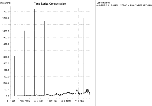
Figure 1.15. Typical concentration pattern in the downstream end of the sandy loam catchment. The wind drift events dominates, but a groundwater contribution is visible.
Figur 1.15. Typisk koncentrationsmønster i den nedstrøms ende af morænelersoplandet. Vinddriften dominerer, men grundvandstilstrømning kan ses.
Longitudinal concentration profiles for the sandy loam catchment are shown in Figure 1.16 and Figure 1.17 for 31. May 2000 and 27th August 2000, respectively. The thin black line represents the concentration, while full black line shows the maximum concentrations obtained during the simulations. In addition, the outline of the stream is shown.
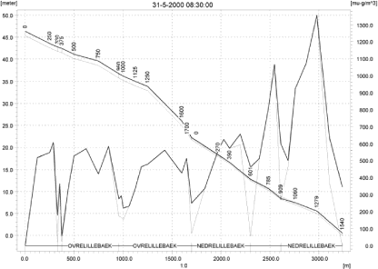
Figure 1.16. Concentrations in the sandy loam catchment on 31 May-2000. The concentrations are generated by wind drift. Note that the actual concentrations are shown with a thin black line and the maximum concentrations with a thicker black line.
Figur 1.16. Koncentrationer i morænelersoplandet den 31 maj-2000. Koncentrationerne genereres af vinddrift. Bemærk at den beregnede koncentration er vist med en tynd sort linie og maximumskoncentrationen med en tykkere sort linie.
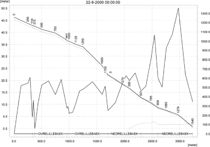
Figure 1.17. Concentrations caused by an increase of alpha-cypermethrin in the groundwater in the sandy loam catchment on 22.8-2000 (dry year).
Figur 1.17. Koncentrationer begrundet af alpha-cypermetrin i grundvandet i morænelersoplandet den 22.8-2000 (tørt år).
It is generally thought that the model overestimates the transport to groundwater, and, as a consequence of this, it overestimates the contribution through groundwater flow. The particularly high level of baseflow in the lower part of this catchment is due to occurrence of a sandy layer that transports solute horizontally through the catchment to the lower part of the stream.
To be able to extract comparable values to FOCUS SW, the global maxima and time weighted concentrations (up to 7 days) were extracted when these were meaningful (Table 1.8).
Figure 1.18 and Figure 1.19 shows the concentrations sorbed to macrophytes in the upper and lower section of the stream. The pattern follows the pattern of the water concentrations, but the more permanent patterns seem to have the largest influence on the macrophyt concentration. The concentrations are very high compared to the concentration in the water phase, particularly in the lower end of the catchment. The maximum value obtained in the upstream part is 617 ng/l, comparable to the maximum water concentration of 607 ng/l, and in the lower part, the concentration reaches 6.2 µg/l (Nedrelillebaek 847, with a maximum water concentration of 1.07 µg/l). This value is caused by the unrealistic buildup in the groundwater downstream. Macrophytes thus strongly regulate the concentration in the stream.
The concentration of alpha-cypermethrin in porewater is plotted in Figure 1.20 for the site of maximum concentration, and the concentration in sediment is shown in Figure 1.21. The maximum value reached in the upstream part of the catchment is from below 0.01 ng/kg to 0.12 ng/kg. In the downstream part a maximum value of 1.36 ng/kg is reached.
Compared to the FOCUS SW-stream-scenario for D4, the concentration level in the upper part of the stream is considerably higher (583 ng/l compared to 79 ng/l). Both concentrations are generated by drift. The high value of PestSurf is directly caused by the assumption that the total agricultural area is sprayed within 30 minutes. The stream has received drift along a stretch of 855 meter at this point. Concentrations decrease along the following stretch due to presence of buffer zones and drain contributions, but increases again at the end of the catchment due to direct drift, reaching a maximum value of 1.4 µg/l.
With respect to sediment concentrations, the concentration vary over the catchment - in the upstream part (<0.01 ng/kg-0.14 ng/kg compared to 0.119 µg/kg in the D4-scenario), and in the lower part of the catchment (1.36 ng/kg compared to 0.119 µg/kg). All sediment concentrations generated by PestSurf are lower than the concentrations generated by FOCUS.
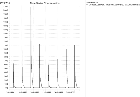
Figure 1.18. Concentration of alpha-cypermethrin on macrophytes in ng/l at 1425 m from the upstream point. The pattern is representative of the upper part of the sandy loam catchment.
Figur 1.18. Koncentration af alpha-cypermethrin på makrofytter 1425 m fra opstrøms ende. Mønsteret er repræsentativt for den øvre del af morænelersoplandet.
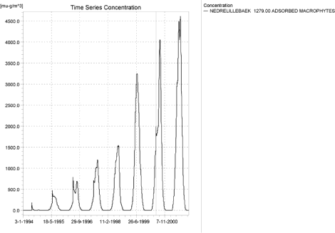
Figure 1.19. Concentration on macrophytes (ng/l) the lower part of the sandy loam stream. The pattern is representative of the lower part of the sandy loam catchment. The highest value reached is 6157 ng/l.
Figur 1.19. Koncentration på makrofytter i den nedstrøms del af morænelersoplandet. Mønsteret er repræsentativt for den nedstrøms del af oplandet. Den højest opnåede værdi er 6157 ng/l.
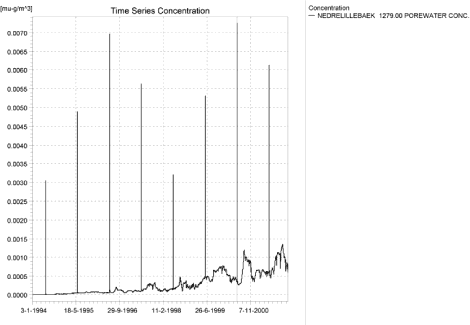
Figure 1.20. Pore water concentration in the downstream part of the sandy loam catchment.
Figur 1.20. Porevandskoncentration i den nedstrøms del af morænelersoplandet.
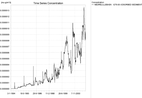
Figure 1.21. Concentration pattern of alpha cypermethrin sorbed to sediment at the downstream part of the sandy loam catchment. The concentration is in µg/g sediment and not µg/m³ as stated.
Figur 1.21. Koncentrationsmønster for alpha-cypermethrin sorberet til sediment i den nedstrøms ende af morænelersoplandet. Koncentrationen er i µg/g sediment og ikke µg/m³ som angivet.
Table 1.8. Instantaneous and time weighted concentrations (ng/l) of alpha-cypermethrin in the sandy loam catchment.
Tabel 1.8. Beregnet og tidsvægtede koncentrationer (ng/l) af alpha-cypermethrin i morænelersoplandet.
| Year | OVRELILLEBAEK 290.00 | OVRELILLEBAEK 1425.00 | NEDRELILLEBAEK 330.00 | NEDRELILLEBAEK 495.50 | |||||||||
| Conc. | TWC | Date | Conc | TWC | Date | Conc. | TWC | Date | Conc. | TWC | Date | ||
| 1994 | 1994 (global max) | 537 | 01-06-1994 | 217 | 01-06-1994 | 314 | 01-06-1994 | 436 | 01-06-1994 | ||||
| 1 hour (after max) | 154 | 321 | 92 | 132 | 91 | 182 | 117 | 226 | |||||
| 1 day after sp.in. | 2 | 26 | 0 | 7 | 0 | 11 | 0 | 13 | |||||
| 2 days | 2 | 10 | 0 | 2 | 0 | 4 | 0 | 4 | |||||
| 4 days | 2 | 8 | 0 | 2 | 0 | 3 | 0 | 3 | |||||
| 7 days | 1 | 5 | 0 | 1 | 0 | 2 | 0 | 2 | |||||
| 1995 | 1995 (global max) | 605 | 01-06-1995 | 337 | 01-06-1995 | 472 | 01-06-1995 | 625 | 01-06-1995 | ||||
| 1 hour (after max) | 407 | 517 | 136 | 183 | 197 | 267 | 156 | 371 | |||||
| 1 day after sp.in. | 4 | 58 | 0 | 11 | 1 | 17 | 4 | 25 | |||||
| 2 days | 3 | 21 | 0 | 4 | 1 | 6 | 4 | 11 | |||||
| 4 days | 3 | 17 | 0 | 3 | 1 | 5 | 4 | 9 | |||||
| 7 days | 3 | 11 | 0 | 2 | 1 | 3 | 4 | 7 | |||||
| 1996 | 1996 (global max) | 583 | 01-06-1996 | 559 | 01-06-1996 | 621 | 01-06-1996 | 589 | 01-06-1996 | ||||
| 1 hour (after max) | 520 | 555 | 141 | 359 | 259 | 460 | 474 | 553 | |||||
| 1 day after sp.in. | 8 | 87 | 1 | 26 | 3 | 37 | 7 | 52 | |||||
| 2 days | 7 | 33 | 1 | 10 | 2 | 14 | 7 | 22 | |||||
| 4 days | 7 | 27 | 1 | 7 | 2 | 11 | 7 | 18 | |||||
| 7 days | 6 | 18 | 1 | 5 | 2 | 7 | 6 | 13 | |||||
| 1997 | 1997 (global max) | 597 | 01-06-1997 | 380 | 01-06-1997 | 516 | 01-06-1997 | 641 | 01-06-1997 | ||||
| 1 hour (after max) | 479 | 547 | 137 | 206 | 215 | 277 | 184 | 446 | |||||
| 1 day after sp.in. | 6 | 65 | 1 | 13 | 2 | 20 | 7 | 32 | |||||
| 2 days | 6 | 25 | 1 | 5 | 2 | 7 | 8 | 16 | |||||
| 4 days | 6 | 20 | 1 | 4 | 2 | 6 | 8 | 14 | |||||
| 7 days | 5 | 14 | 0 | 2 | 2 | 4 | 8 | 11 | |||||
| 1998 | 1998 (global max) | 538 | 31-05-1998 | 218 | 31-05-1998 | 315 | 31-05-1998 | 445 | 31-05-1998 | ||||
| 1 hour (after max) | 156 | 323 | 92 | 132 | 92 | 184 | 127 | 235 | |||||
| 1 day after sp.in. | 2 | 26 | 0 | 7 | 1 | 11 | 9 | 21 | |||||
| 2 days | 2 | 10 | 0 | 2 | 1 | 5 | 10 | 13 | |||||
| 4 days | 2 | 8 | 0 | 2 | 1 | 4 | 10 | 12 | |||||
| 7 days | 1 | 5 | 0 | 1 | 1 | 3 | 11 | 11 | |||||
| 1999 | 1999 (global max) | 607 | 31-05-1999 | 337 | 31-05-1999 | 475 | 31-05-1999 | 654 | 31-05-1999 | ||||
| 1 hour (after max) | 411 | 519 | 137 | 184 | 202 | 271 | 185 | 400 | |||||
| 1 day after sp.in. | 4 | 58 | 0 | 11 | 5 | 20 | 31 | 50 | |||||
| 2 days | 3 | 21 | 0 | 4 | 4 | 9 | 27 | 36 | |||||
| 4 days | 3 | 17 | 0 | 3 | 4 | 8 | 26 | 33 | |||||
| 7 days | 3 | 11 | 0 | 2 | 4 | 6 | 27 | 30 | |||||
| 2000 | 2000 (global max) | 584 | 31-05-2000 | 560 | 31-05-2000 | 625 | 31-05-2000 | 612 | 31-05-2000 | ||||
| 1 hour (after max) | 506 | 551 | 142 | 361 | 263 | 464 | 446 | 559 | |||||
| 1 day after sp.in. | 8 | 88 | 1 | 26 | 5 | 40 | 28 | 73 | |||||
| 2 days | 7 | 34 | 1 | 10 | 5 | 16 | 28 | 42 | |||||
| 4 days | 7 | 27 | 1 | 8 | 5 | 13 | 28 | 39 | |||||
| 7 days | 6 | 18 | 1 | 5 | 4 | 10 | 28 | 34 | |||||
| 2001 | 2001 (global max) | 599 | 31-05-2001 | 381 | 31-05-2001 | 518 | 31-05-2001 | 657 | 31-05-2001 | ||||
| 1 hour (after max) | 451 | 535 | 138 | 206 | 218 | 280 | 200 | 463 | |||||
| 1 day after sp.in. | 6 | 66 | 1 | 13 | 3 | 21 | 22 | 47 | |||||
| 2 days | 6 | 25 | 1 | 5 | 3 | 9 | 24 | 31 | |||||
| 4 days | 6 | 20 | 1 | 4 | 4 | 8 | 25 | 29 | |||||
| 7 days | 5 | 14 | 0 | 2 | 4 | 6 | 27 | 28 | |||||
| Global max | 607 | 0 | 560 | 0 | 625 | 0 | 657 | 0 | |||||
| 1 hour (after max) | 520 | 555 | 142 | 361 | 263 | 464 | 474 | 559 | |||||
| 1 day after sp.in. | 8 | 88 | 1 | 26 | 5 | 40 | 31 | 73 | |||||
| 2 days | 7 | 34 | 1 | 10 | 5 | 16 | 28 | 42 | |||||
| 4 days | 7 | 27 | 1 | 8 | 5 | 13 | 28 | 39 | |||||
| 7 days | 6 | 18 | 1 | 5 | 4 | 10 | 28 | 34 | |||||
Table 1.8. continued. Instantaneous and time weighted concentrations (ng/l) of alpha-cypermethrin in the sandy loam catchment.
Tabel 1.8. fortsat. Beregnet og tidsvægtede koncentrationer (ng/l) af alpha-cypermethrin i morænelersoplandet.
| Year | NEDRELILLEBAEK 847.00 | NEDRELILLEBAEK 1279.00 | |||||
| Conc. | TWC | Date | Conc | TWC | Date | ||
| 1994 | 1994 (global max) | 408 | 01-06-1994 | 614 | 01-06-1994 | ||
| 1 hour (after max) | 177 | 289 | 188 | 281 | |||
| 1 day after sp.in. | 1 | 16 | 1 | 20 | |||
| 2 days | 1 | 6 | 1 | 7 | |||
| 4 days | 1 | 4 | 1 | 5 | |||
| 7 days | 0 | 3 | 1 | 3 | |||
| 1995 | 1995 (global max) | 692 | 01-06-1995 | 1002 | 01-06-1995 | ||
| 1 hour (after max) | 392 | 365 | 223 | 505 | |||
| 1 day after sp.in. | 5 | 32 | 5 | 36 | |||
| 2 days | 5 | 14 | 5 | 15 | |||
| 4 days | 5 | 12 | 5 | 12 | |||
| 7 days | 5 | 9 | 5 | 9 | |||
| 1996 | 1996 (global max) | 1039 | 01-06-1996 | 1331 | 01-06-1996 | ||
| 1 hour (after max) | 249 | 708 | 474 | 940 | |||
| 1 day after sp.in. | 9 | 62 | 8 | 70 | |||
| 2 days | 9 | 26 | 8 | 28 | |||
| 4 days | 8 | 22 | 7 | 23 | |||
| 7 days | 8 | 16 | 7 | 16 | |||
| 1997 | 1997 (global max) | 805 | 01-06-1997 | 1154 | 01-06-1997 | ||
| 1 hour (after max) | 371 | 356 | 290 | 614 | |||
| 1 day after sp.in. | 10 | 41 | 10 | 45 | |||
| 2 days | 10 | 20 | 10 | 21 | |||
| 4 days | 10 | 18 | 10 | 18 | |||
| 7 days | 10 | 14 | 10 | 15 | |||
| 1998 | 1998 (global max) | 420 | 31-05-1998 | 627 | 31-05-1998 | ||
| 1 hour (after max) | 190 | 303 | 202 | 294 | |||
| 1 day after sp.in. | 14 | 29 | 13 | 33 | |||
| 2 days | 14 | 19 | 14 | 20 | |||
| 4 days | 14 | 18 | 14 | 18 | |||
| 7 days | 15 | 16 | 14 | 16 | |||
| 1999 | 1999 (global max) | 734 | 31-05-1999 | 1038 | 31-05-1999 | ||
| 1 hour (after max) | 436 | 408 | 259 | 541 | |||
| 1 day after sp.in. | 46 | 69 | 39 | 68 | |||
| 2 days | 44 | 53 | 38 | 48 | |||
| 4 days | 43 | 51 | 37 | 46 | |||
| 7 days | 44 | 48 | 39 | 42 | |||
| 2000 | 2000 (global max) | 1065 | 31-05-2000 | 1355 | 31-05-2000 | ||
| 1 hour (after max) | 274 | 735 | 380 | 876 | |||
| 1 day after sp.in. | 33 | 87 | 29 | 91 | |||
| 2 days | 33 | 51 | 27 | 48 | |||
| 4 days | 33 | 46 | 26 | 43 | |||
| 7 days | 32 | 40 | 25 | 35 | |||
| 2001 | 2001 (global max) | 847 | 31-05-2001 | 1197 | 31-05-2001 | ||
| 1 hour (after max) | 415 | 399 | 332 | 657 | |||
| 1 day after sp.in. | 54 | 84 | 53 | 87 | |||
| 2 days | 53 | 63 | 54 | 63 | |||
| 4 days | 52 | 60 | 52 | 61 | |||
| 7 days | 49 | 56 | 48 | 56 | |||
| Global max | 1065 | 0 | 1355 | 0 | |||
| 1 hour (after max) | 436 | 735 | 474 | 940 | |||
| 1 day after sp.in. | 54 | 87 | 53 | 91 | |||
| 2 days | 53 | 63 | 54 | 63 | |||
| 4 days | 52 | 60 | 52 | 61 | |||
| 7 days | 49 | 56 | 48 | 56 | |||
Click here to see Figure 1.22.
Figure 1.22. Overview for alpha-cypermethrin in the sandy loam catchment generated by the PestSurf excel template for the upstream part of the catchment. The limiting value was set to 1 ng/l.
Figur 1.22. Oversigt for alpha-cypermethrin i morænelersoplandet genereret med PestSurf-excel-skabelonen for den opstrøms del af oplandet. Detektionsgrænsen var sat til 1 ng/l.
Click here to see Figure 1.232.
Figure 1.23. Overview for alpha-cypermethrin in the sandy loam catchment generated by the PestSurf excel template for the downstream part of the catchment. The limiting value was set to 20 ng/l.
Figur 1.23. Oversigt for alpha-cypermethrin i morænelersoplandet genereret med PestSurf-excel-skabelonen for den opstrøms del af oplandet. Detektionsgrænsen var sat til 1 ng/l.
Click here to see Figure 1.24.
Figure 1.24. As Figure 1.23, but the lower right figure shows the duration of events above 50 ng/l.
Figur 1.24. Som Figur 1.23, men figuren nederst til højre viser varigheden af hændelser over 50 ng/l.
Table 1.9. Part of the result sheet generated by the PestSurf Excel sheet for the upstream part of the sandy loam catchment. 10 events above 1 ng/l are recorded, all with a very short duration. Toxicity to fish, daphnies and algae are 10, 100 and 1000 ng/, respectively. The peaks are shown in Figure 1.22.
Tabel 1.9. Uddrag af resultatpresentationen genereret af PestSurf-Excel-arket for den opstrøms del af morænelersoplandet. 10 hændelser over 1 ng/l er registreret, alle af kort varighed. Toxicitetsværdierne for fisk, dafnier og alger er henholdsvis 10, 100 og 1000 ng/l. Hændelserne er vist i Figur 1.22.
Table 1.10. Part of the results generated by the PestSurf Excel sheet for the downstream part of the sandy loam catchment. The limiting value applied in the simulation is 20 ng/l, toxicity to fish, daphnies and algae are set to 50, 100 and 1000 ng/, respectively. The peaks are shown in Figure 1.23.
Tabel 1.10. Uddrag af resultatpresentationen genereret af PestSurf-Excel-arket for den nedstrøms del af morænelersoplandet. Den afgrænsende værdi anvendt i simuleringen er 20 ng/l, toxicitetsværdierne for fisk, dafnier og alger er henholdsvis 50, 100 og 1000 ng/l. Hændelserne er vist i Figur 1.22.
Figure 1.22-Figure 1.24, and Table 1.9 and Table 1.10 show the results as generated by the PestSurf templates. For the upper part of the catchment, one of the standard points is close to the point of maximum value, reaching a value of 513 ng/l compared to the maximum value of 560 ng/l. For the lower part of the stream, one of the selected standard points reach the maximum value of 1.36 µg/l.
1.4.4 Sandy Loam catchment, pond
The concentration pattern is evaluated in the middle of the pond only, see Figure 1.25. The pond receives contributions mainly through drift, in good correspondence with the fact that it is situated in the upper part of the sandy loam catchment. The maximum concentration is quite low, 5 ng/l.
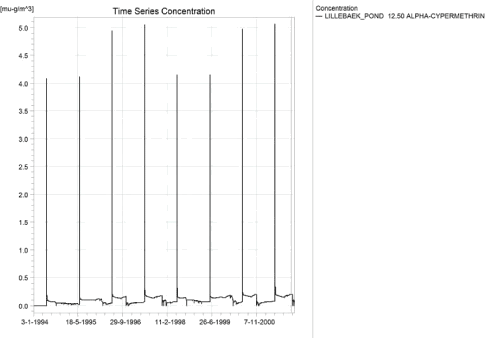
Figure 1.25. Concentrations of alpha-cypermethrin for the sandy loam pond.
Figur 1.25. Koncentration af alpha-cypermethrin i morænelersvandhullet.
Figure 1.26 shows that the macrophytes participate in the regulation of the concentrations in the pond. The concentration in macrophytes is expressed as concentration in the water phase and the concentration in the water phase and in the macrophytes are therefore comparable. About 2/3 of the alpha cypermethrin present above the sediment is present on the macrophytes. To obtain the concentration in the biomass, the figure has to be divided by 875 g/m³. Figure 1.27 shows the concentration in porewater. It is minute in comparison (1.32 *10-5 ng/l), and the concentrations in the sediment is below 0.01 ng/kg.
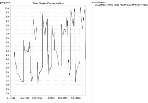
Figure 1.26. Alpha-cypermethrin sorbed to the macrophytes in the sandy loam pond.
Figur 1.26. Alpha-cypermethrin sorberet til makrofytter i morænelers-vandhullet.
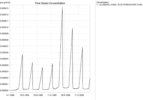
Figure 1.27. Pore water concentration of alpha-cypermethrin in the sandy loam pond.
Figur 1.27. Porevandskoncentration af alpha-cypermethrin i morænelersvandhullet.
In Table 1.11, global maxima and time weighted concentrations (up to 7 days) were extracted.
Table 1.11. Actual and time weighted concentrations (ng/l) of alpha-cypermethrin in the sandy loam pond.
Tabel 1.11. Beregnede og tidsvægtede koncentrationer (ng/l) af alpha-cypermethrin i morænelersvandhullet.
| Year | Alpha-cypermethrin | Actual | Time-weighted | Date |
| 1994 | global max | 4.09 | 01-06-1994 08:30 | |
| 1 hour(after max) | 2.15 | 2.85 | ||
| 1 day after sp.in. | 0.23 | 0.63 | ||
| 3 days | 0.12 | 0.31 | ||
| 4 days | 0.11 | 0.26 | ||
| 7 days | 0.10 | 0.19 | ||
| 1995 | Global max | 4.12 | 01-06-1995 08:30 | |
| 1 hour | 2.18 | 2.88 | ||
| 1 day | 0.26 | 0.66 | ||
| 2 days | 0.15 | 0.34 | ||
| 4 days | 0.14 | 0.29 | ||
| 7 days | 0.13 | 0.22 | ||
| 1996 | global max | 4.95 | 01-06-1996 08:30 | |
| 1 hour | 2.41 | 3.27 | ||
| 1 day | 0.35 | 0.78 | ||
| 2days | 0.21 | 0.43 | ||
| 4 days | 0.20 | 0.37 | ||
| 7 (6*)days | 0.19 | 0.29 | ||
| 1997 | global max | 5.05 | 01-06-1997 08:30 | |
| 1 hour | 2.45 | 3.33 | ||
| 1 day | 0.37 | 0.81 | ||
| 2days | 0.22 | 0.44 | ||
| 4 days | 0.21 | 0.39 | ||
| 7 (6*)days | 0.20 | 0.31 | ||
| 1998 | global max | 4.15 | 31-05-1998 08:30 | |
| 1 hour | 2.21 | 2.91 | ||
| 1 day | 0.30 | 0.69 | ||
| 2 days | 0.18 | 0.37 | ||
| 4 days | 0.17 | 0.32 | ||
| 7 (6*)days | 0.16 | 0.26 | ||
| 1999 | global max | 4.15 | 31-05-1999 08:30 | |
| 1 hour | 2.21 | 2.92 | ||
| 1 day | 0.30 | 0.69 | ||
| 2 days | 0.19 | 0.38 | ||
| 4 days | 0.18 | 0.33 | ||
| 7 (6*)days | 0.17 | 0.26 | ||
| 2000 | global max | 4.97 | 31-05-2000 08:30 | |
| 1 hour | 2.44 | 3.30 | ||
| 1 day | 0.37 | 0.81 | ||
| 2 days | 0.24 | 0.45 | ||
| 4 days | 0.22 | 0.40 | ||
| 7 (6*)days | 0.21 | 0.32 | ||
| 2001 | global max | 5.06 | 31-05-2001 08:30 | |
| 1 hour | 2.46 | 3.34 | ||
| 1 day | 0.38 | 0.82 | ||
| 2 days | 0.24 | 0.46 | ||
| 4 days | 0.22 | 0.40 | ||
| 7 (6*)days | 0.21 | 0.32 | ||
| max values | ||||
| global max | 5.06 | 0.00 | ||
| 1 hour | 2.46 | 3.34 | ||
| 1 day | 0.38 | 0.82 | ||
| 2 days | 0.24 | 0.46 | ||
| 4 days | 0.22 | 0.40 | ||
| 7 days | 0.21 | 0.32 |
Figure 1.28 and Table 1.12 show the output from the PestSurf template (page- lowest detection limit), with a time series identical to Figure 1.25.
Compared to the FOCUS SW-scenario D4-pond the concentrations are rather similar. D4 generates a concentration of 0.003 µg/l while PestSurf reaches 0.005 µg/l. This is consistent with the fact that both concentrations are generated by drift and with that the PestSurf pond is smaller than the FOCUS SW-D4-pond (250 and 900 m², respectively).
The concentration in the sediment is 0.012 µg/kg for FOCUS SW –D4-pond and < 0.01 ng/kg for the PestSurf sandy loam pond.
Click here to see Figure 1.28.
Figure 1.28. Overview for alpha cypermethrin in the sandy loam pond generated by the PestSurf excel template. The time series shown is identical to the one in Figure 1.25. The lowest detection value used is 1 ng/l.
Figur 1.28. Oversigt for alpha-cypermethrin i morænelersoplandet genereret med PestSurf-excel-skabelonen. Den viste tidsserie er mage til den i Figur 1.25. Detektionsgrænsen er sat til 1 ng/l.
Table 1.12. Part of the result sheet generated by the PestSurf Excel sheet. Lowest detection value is set to 1.0 ng/l, toxicity to fish, daphnies and algae are set to 10, 100 and 1000 ng/, respectively. The peaks recorded are visible inFigure 1.28.
Tabel 1.12. Uddrag af resultatpresentationen genereret af PestSurf-Excel-arket. Detektionsgrænsen er sat til 1.0 ng/l mens toxicitetsværdierne for fisk, dafnier og alger er henholdsvis 10, 100 og 1000 ng/l. De tabellerede hændelser er vist i Figur 1.28.
1.5 Summary of simulations
The maximum actual concentrations for all simulations are recorded in Table 1.14.
FOCUS SW and PestSurf generally agree that drift is an important source for alpha cypermethrin. However, groundwater contributes significantly to the concentration levels in the sandy pond and the sandy loam stream. The high groundwater table around the sandy pond in the undrained sandy soil leads to very fast transport from the surface to the top of the groundwater table, which again is in direct contact with the pond. For the sandy loam stream, the lower part of the stream is in contact with a sand layer that receives water from the upstream part of the catchment. A groundwater contribution is not included in FOCUS SW.
The sandy scenarios are not quite comparable for the two models. The concentrations generated by PestSurf for the two sandy scenarios are lower for the pond and higher for the stream than what is generated for the D3-ditch. As the pond is less exposed to drift than the ditch, the concentration difference is expected.
For the stream, the high concentration is caused by the fact that the whole catchment is sprayed within 30 minutes. This assumption is the determining factor for the result. The maximum concentration is reached about 1 km from the top end of the catchment. Further down dilution, and in some places presence of buffer zones, lead to lower concentrations.
For the point of maximum concentration, the following calculation was carried out: The dose is 15 g/ha, and the percentage calculated to enter the stream is 1.85 % of the dose. The resulting amount is 27.7 µg/m². The water depth at the time of spraying is 8.2 cm, but the cross section is triangular at this point, meaning that the average depth is 4.1 cm only. If the water was stationary and not flowing, the concentration would reach 0.68 µg/l. The maximum concentration reached is 0.41 µg/l. The resulting concentration ub a given location becomes a balance between concentration in the inflow and outflow, and the addition in the given point.
If the concentrations are extracted 112 m from the upstream end of the sandy catchment, the concentration only reaches 37 ng/l, which is about 1/3 of the concentration in the D3 ditch. However, the concentrations are not directly comparable. At this point, the stream is protected by a 20 m buffer zone. The dose is therefore about 14.7 times lower than in the D3-ditch. The water depth, however, is only about 5 cm.
The sandy loam pond may be compared to the D4-pond-scenario. The concentration levels are comparable. In the PestSurf sandy loam pond 2/3 of the active substance in the water phase is sorbed to macrophytes, but the higher amount of substance can be explained by the fact that the PestSurf pond is considerably smaller than the FOCUS SW-pond (250 m² against 900 m²) and therefore more exposed. A rough estimate of the exposure is to assume that 20 m is sprayed in PestSurf sandy loam pond and 30 m in a FOCUS SW-pond. The dosis is then diluted in 250 and 900 m³, respectively: 20/250/(30/900) = 2.4. When comparing the two systems, it should be noted that part of the load on microphytes appear to stay in the pond from year to year.
The concentration in sediment is low in both models, but considerably lower in PestSurf than in FOCUS SW.
For the upstream part of the sandy loam catchment, the concentration of 560 ng/l generated by PestSurf is considerably higher than the concentration generated for the FOCUS D4-stream (79 ng/l), particularly when taking into account that the concentration is halved by macrophytes. The reason is again the assumption that all agricultural land is sprayed within 30 minutes, with a wind direction perpendicular to the stream. The maximum concentration in the upper part of the catchment is reached after 1425 m of the stream. On the following stretch, the concentration is lowered by additions of drainage water and the presence of bufferzones, but even higher concentrations (1.36 µg/l) are reached towards the end of the catchment, along a stretch that is also susceptible to wind drift.
Because the concentrations in the sandy loam catchment are so much higher than in the D4-catchment, a detailed evaluation of the longitudinal pattern of high concentrations was carried out. Evaluating from the upstream end, the concentration first increases and then decreases twice due to the tributaries Albjergbaek and Steensbaek. The concentration increases again and drops strongly around 1000 m from the upstream end due to the tributary Elholt baek. Just after 1700 m, a buffer zone of 20 m is present, leading to a drop in concentrations. This is followed by buffer zones of 10 and 3 m. The tributary Fredligbaek enters around 2400 m from the upstream end and Groftebaek around 2600 m from the upstream end.
The maximum concentrations generated by drift were then evaluated. The maximum reachable concentration should be the concentration obtained if the water was standing in the river strech.
Table 1.13. Maximum concentrations for drift calculated by PestSurf and assuming stationary conditions.
Tabel 1.13. Maximum-koncentrationer for drift beregnet med PestSurf og under forudsætning af stationære forhold.
| Location | Max concentration Ng/l |
Water depth Cm |
Cross section | Max concentr. calc. for stationary conditions. |
| OL 290 | 607 | 4.0 | Triangular | 1586 |
| OL 625 | 569 | 6.8 | Triangular | 925 |
| OL 1425 | 560 | 9.5 | Triangular | 668 |
| NL 330 | 625 | 6.4 | Triangular | 991 |
| NL 495 | 657 | 5.3 | Triangular | 1197 |
| NL 847 | 1065 | 7.3 | Triangular | 868 |
| NL 1279 | 1355 | 9.7 | Triangular | 729 |
The high concentrations found at the end of the catchment become higher than the theoretical considerations allow. No good explanation could be found for the up-concentration found at the end of the catchment, see discussion in chapter 4.3 and 4.4.3.
The concentration 125 m from the upstream end of the sandy loam catchment becomes 518 ng/, and is still higher than the 79 ng/l generated in the FOCUS SW D4-stream scenario, especially when the presence of macrophytes are considered. However, the water depth at the time of maximum is only 4.3 cm, and this accounts for most of the difference between the models. The maximum concentration on the stretch, where the stream is permanent and upstream of the groundwater influence is 583 µg/l, 855 m from the upstream end.
Macrophytes are significant in all scenarios, but particularly in the sandy loam catchment. Macrophytes are not included in the FOCUS scenarios.
Assuming that the drift contribution to the stream is overestimated, drainage events may be of interest in the sandy loam catchment. The 20-year event causes concentration of about 1.4 ng/l in the upstream part of the catchment, and the (overestimated- see section 2.1) groundwater contribution causes concentrations around 136 ng/l in the downstream part of the catchment, about one 6th of the maximum concentration caused by drift.
Table 1.14. Summary of simulation results for alpha-cypermethrin.
Tabel 1.14. Opsummerede resultater for alpha-cypermethrin.
Annex 2
2 Comparison of risk assessment data produced by spray drift assessments, FOCUS SW and PestSurf
| Compound: | Bentazon |
| Dose: | 1.5 kg |
| Spraying time: | 5th May |
| Crop: | Spring barley |
Table 2.1. Overview of chemical properties of bentazon and the parameters used in the simulations.
Tabel 2.1. Oversigt over bentazons kemiske egenskaber og parametrene brugt i simuleringerne.
| Chemical property | Condition | Recalculated values | |||
| Cas-no. | 25057-89-0 | ||||
| Molecular weight | 240.3 | ||||
| Form (acid, basic, neutral) | Acid | ||||
| pKa | 3.28 at 24°C | ||||
| Water solubility | 570 µg/l | pH 7 | 20°C | ||
| log Kow | 0.77 | at pH | 5 | KowA- | -0.54 |
| log Kow | -0.46 | at pH | 7 | KowAH | 2.48 |
| log Kow | -0.55 | at pH | 9 | KowAH+ | |
| Vapor pressure, Pa | 1.7 × 10⁻⁴ (100% purity) | 20°C | Vapor pressure, Pa, 20°C | ||
| Henry’s law constant | 7.2 × 10⁻⁵ Pa m³ mol-1 | Recalculated value, dimensionless | 2.96 × 10⁻⁸ | ||
| Sorption properties in soil | |||||
| Freundlich exp | 1 | ||||
| Koc, l/kg | 28.2 | ||||
| DT50 in soil, days | 23.1 | ||||
| DT50water | 130.5 days | PestSurf input | |||
| DT50sedment | No breakdown | ||||
| DT50water/sediment | 716 days | method not described | DT50, days | 130.5 | |
| Sediment konc., µg/l | 0 | ||||
| Hydrolysis | no hydrolysis | at pH 5 | (acid) | ||
| at pH 7 | (neutral) | ||||
| at pH 9 | (basic) | ||||
| Photolysis | |||||
| quantum yield | φ=4.38 × 10⁻⁴ – at 20°C calculated to 4.8 × 10⁻⁴. . |
||||
| Spectrum | λmax: 216 nm, 310 nm | ||||
| l e | |||||
| 295-300 723 l.mol-1 .cm-1 | |||||
| 300-310 1246 | |||||
| 310-320 2088 | |||||
| 320-330 2767 | |||||
| 330-340 3362 | |||||
| 340-350 3079 | |||||
| 350-360 2210 | |||||
| 360-370 1341 | |||||
| 370-380 473 | |||||
| Other | pH 5: 122 h at 25°C; pH 7: 93 h at 25°C; pH 9: 14 h at 25°C |
||||
2.2 Concentration generated by spray
| Direct spray | FOCUS buffer zones | |||
| µg/l | ditch | Stream | Pond | |
| µg/l | µg/l | µg/l | µg/l | |
| Bentazon | 500.0 | 13.797 | 9.281 | 4.053 |
2.3 Concentrations generated by FOCUS SW
2.3.1 D3 - Ditch
| Bentazon | Ditch, D3 | |||||||
| Water | Sediment | |||||||
| Date | PEC | Date | TWAEC | Date | PEC | Date | TWAEC | |
| [µg L-1] | [µg L-1] | [µg kg-1] | [µg kg-1] | |||||
| Global max | 04-maj-92 | 9.947 | 05-maj-92 | 1.563 | ||||
| 1 d | 05-maj-92 | 5.101 | 05-maj-92 | 7.96 | 06-maj-92 | 1.28 | 05-maj-92 | 1.51 |
| 2 d | 06-maj-92 | 1.017 | 06-maj-92 | 5.307 | 07-maj-92 | 1.075 | 06-maj-92 | 1.404 |
| 4 d | 08-maj-92 | 0.448 | 08-maj-92 | 2.939 | 09-maj-92 | 0.923 | 08-maj-92 | 1.229 |
| 7 d | 11-maj-92 | 0.439 | 11-maj-92 | 1.869 | 12-maj-92 | 0.838 | 11-maj-92 | 1.088 |
2.3.2 D4 – Pond
| Bentazon | Pond, D4 | |||||||
| Water | Sediment | |||||||
| Date | PEC | Date | TWAEC | Date | PEC | Date | TWAEC | |
| [µg L-1] | [µg L-1] | [µg kg-1] | [µg kg-1] | |||||
| Global max | 31-jan-86 | 2.172 | 10-mar-86 | 2.797 | ||||
| 1 d | 01-feb-86 | 2.171 | 31-jan-86 | 2.172 | 11-mar-86 | 2.797 | 11-mar-86 | 2.797 |
| 2 d | 02-feb-86 | 2.168 | 01-feb-86 | 2.172 | 12-mar-86 | 2.797 | 11-mar-86 | 2.797 |
| 4 d | 04-feb-86 | 2.159 | 02-feb-86 | 2.171 | 14-mar-86 | 2.796 | 12-mar-86 | 2.797 |
| 7 d | 07-feb-86 | 2.138 | 04-feb-86 | 2.168 | 17-mar-86 | 2.793 | 14-mar-86 | 2.797 |
2.3.3 D4 –Stream
| Bentazon | Stream, D4 | |||||||
| Water | Sediment | |||||||
| Date | PEC | Date | TWAEC | Date | PEC | Date | TWAEC | |
| [µg L-1] | [µg L-1] | [µg kg-1] | [µg kg-1] | |||||
| Global max | 30-maj-85 | 8.25 | 28-jan-86 | 1.098 | ||||
| 1 d | 31-maj-85 | 0.364 | 17-dec-85 | 1.328 | 29-jan-86 | 1.097 | 29-jan-86 | 1.098 |
| 2 d | 01-jun-85 | 0.355 | 18-dec-85 | 1.311 | 30-jan-86 | 1.096 | 30-jan-86 | 1.098 |
| 4 d | 03-jun-85 | 0.336 | 18-dec-85 | 1.298 | 01-feb-86 | 1.089 | 31-jan-86 | 1.097 |
| 7 d | 06-jun-85 | 0.299 | 20-dec-85 | 1.284 | 04-feb-86 | 1.069 | 02-feb-86 | 1.094 |
2.3.4 Conclusion – FOCUS SW
The highest concentration is generated in the ditch (D3). It is caused by wind drift and the concentration becomes 95.9 µg/l. The pond scenario shows the highest concentration in the sediment, 2.80 µg/kg. For all scenarios, the concentrations are lower than what is generated by the simpler assessments.
2.4 PestSurf
2.4.1 Sandy Catchment, stream
The distribution of concentrations were assessed in several steps. First, the maximum concentrations at each calculation point were listed, and the dates for the occurrence of the maximum was assessed. The points, for which the maximum value also represents a local maximum were selected for further analysis. The relevant values are listed in Table 2.2.
Table 2.2. Maximum concentrations (ng/l) of bentazon simulated for each calculation point in the sandy catchment.
Tabel 2.2. Maximumskoncentrationer (ng/l) af bentazon simuleret for hvert beregningspunkt i det sandede opland.
| BENTAZON | Maximum | Max.Time | Local Maxima |
| ODDERBAEK 0.00 | 1409 | 13/05/1998 09:00 | |
| ODDERBAEK 56.00 | 1519 | 13/05/1998 09:00 | |
| ODDERBAEK 112.00 | 1887 | 13/05/1998 08:51 | |
| ODDERBAEK 192.00 | 5468 | 13/05/1998 08:33 | |
| ODDERBAEK 272.00 | 9607 | 13/05/1998 08:33 | |
| ODDERBAEK 278.00 | 10095 | 13/05/1998 08:33 | |
| ODDERBAEK 282.00 | 10410 | 13/05/1998 08:33 | |
| ODDERBAEK 298.50 | 11300 | 13/05/1998 08:33 | |
| ODDERBAEK 315.00 | 12301 | 13/05/1998 08:33 | |
| ODDERBAEK 317.50 | 12457 | 13/05/1998 08:33 | |
| ODDERBAEK 320.00 | 12599 | 13/05/1998 08:33 | |
| ODDERBAEK 410.00 | 16943 | 13/05/1998 08:33 | |
| ODDERBAEK 500.00 | 18700 | 13/05/1998 08:33 | |
| ODDERBAEK 513.00 | 19472 | 13/05/1998 08:33 | |
| ODDERBAEK 521.00 | 20040 | 13/05/1998 08:33 | |
| ODDERBAEK 622.00 | 24270 | 13/05/1998 08:33 | |
| ODDERBAEK 723.00 | 27343 | 13/05/1998 08:33 | |
| ODDERBAEK 733.00 | 28181 | 13/05/1998 08:33 | |
| ODDERBAEK 742.00 | 28790 | 13/05/1998 08:33 | |
| ODDERBAEK 789.50 | 30780 | 13/05/1998 08:33 | |
| ODDERBAEK 837.00 | 32668 | 13/05/1998 08:33 | |
| ODDERBAEK 848.00 | 33481 | 13/05/1998 08:33 | |
| ODDERBAEK 863.00 | 34517 | 13/05/1998 08:33 | |
| ODDERBAEK 956.00 | 38046 | 13/05/1998 08:33 | |
| ODDERBAEK 1049.00 | 39267 | 13/05/1998 08:33 | x |
| ODDERBAEK 1111.50 | 38420 | 08/05/2001 08:33 | |
| ODDERBAEK 1174.00 | 34921 | 08/05/2001 08:33 | |
| ODDERBAEK 1226.00 | 32810 | 08/05/2001 08:33 | |
| ODDERBAEK 1278.00 | 31931 | 08/05/2001 08:41 | |
| ODDERBAEK 1293.50 | 31548 | 08/05/2001 08:41 | |
| ODDERBAEK 1310.00 | 30799 | 08/05/2001 08:41 | |
| ODDERBAEK 1421.00 | 29903 | 08/05/2001 08:50 | |
| ODDERBAEK 1532.00 | 26023 | 08/05/2001 08:33 | |
| ODDERBAEK 1558.06 | 23008 | 08/05/2001 08:50 | |
| ODDERBAEK 1584.12 | 21381 | 08/05/2001 08:50 | |
| ODDERBAEK 1584.12 | 21381 | 08/05/2001 08:50 | |
| ODDERBAEK 1621.06 | 21289 | 08/05/2001 08:41 | |
| ODDERBAEK 1658.00 | 21655 | 08/05/2001 08:33 | |
| ODDERBAEK 1698.50 | 22468 | 08/05/2001 08:33 | |
| ODDERBAEK 1739.00 | 23197 | 08/05/2001 08:33 | |
| ODDERBAEK 1801.50 | 23514 | 08/05/2001 08:33 | x |
| ODDERBAEK 1864.00 | 19485 | 08/05/2001 08:33 | |
| ODDERBAEK 1977.00 | 15779 | 05/05/2000 09:35 | |
| ODDERBAEK 2090.00 | 15445 | 05/05/2000 09:45 | |
| ODDERBAEK 2098.00 | 15432 | 05/05/2000 09:45 | |
| ODDERBAEK 2105.00 | 15386 | 05/05/2000 09:54 | |
| ODDERBAEK 2131.00 | 15288 | 05/05/2000 09:54 | |
| ODDERBAEK 2157.00 | 15071 | 05/05/2000 09:54 | |
| ODDERBAEK 2168.00 | 15005 | 05/05/2000 09:54 | |
| ODDERBAEK 2179.00 | 14944 | 05/05/2000 09:54 | |
| ODDERBAEK 2268.50 | 14795 | 05/05/2000 10:00 | |
| ODDERBAEK 2358.00 | 14111 | 05/05/2000 10:00 | |
| ODDERBAEK 2363.50 | 14068 | 05/05/2000 10:00 | |
| ODDERBAEK 2372.00 | 14007 | 05/05/2000 10:00 | |
| ODDERBAEK 2427.00 | 13854 | 05/05/2000 10:00 | |
| ODDERBAEK 2482.00 | 13484 | 05/05/2000 10:00 | |
| ODDERBAEK 2609.00 | 13270 | 05/05/2004 10:00 | |
| ODDERBAEK 2736.00 | 12327 | 05/05/2004 10:00 | |
| ODDERBAEK 2831.00 | 11992 | 05/05/2004 10:00 | |
| ODDERBAEK 2926.00 | 11352 | 08/05/2001 11:00 | |
| ODDERBAEK 2958.50 | 11243 | 08/05/2001 11:00 | |
| ODDERBAEK 2991.00 | 11121 | 08/05/2001 11:00 | |
| ODDERBAEK 3029.50 | 10859 | 08/05/2005 11:00 | |
| ODDERBAEK 3068.00 | 10404 | 05/05/2000 11:00 | |
| ODDERBAEK 3131.00 | 10026 | 05/05/2004 11:00 | |
| ODDERBAEK 3194.00 | 9590 | 05/05/2004 11:00 | |
| ODDERBAEK 3250.50 | 9339 | 05/05/2004 11:00 | |
| ODDERBAEK 3307.00 | 9148 | 05/05/2004 11:00 | |
| ODDERBAEK 3315.00 | 9129 | 05/05/2004 11:00 | |
| ODDERBAEK 3323.00 | 9086 | 05/05/2004 11:00 | |
| ODDERBAEK 3355.50 | 8977 | 05/05/2004 11:00 | |
| ODDERBAEK 3388.00 | 9177 | 13/05/1998 08:33 | |
| ODDERBAEK 3438.50 | 10649 | 13/05/1998 08:33 | |
| ODDERBAEK 3489.00 | 11419 | 13/05/1998 08:33 | |
| ODDERBAEK 3499.50 | 11517 | 13/05/1998 08:33 | |
| ODDERBAEK 3510.00 | 11564 | 13/05/1998 08:33 | |
| ODDERBAEK 3581.00 | 11593 | 13/05/1998 08:33 | x |
| ODDERBAEK 3652.00 | 10667 | 13/05/1998 08:33 | |
| ODDERBAEK 3707.00 | 10071 | 13/05/1998 08:33 | |
| ODDERBAEK 3762.00 | 9459 | 13/05/1998 08:41 | |
| ODDERBAEK 3790.00 | 8540 | 13/05/1998 08:41 | |
| ODDERBAEK 3818.00 | 6962 | 13/05/1998 08:41 | |
| ODDERBAEK 3818.00 | 6962 | 13/05/1998 08:41 | |
| ODDERBAEK 3884.00 | 6833 | 13/05/1998 08:41 | |
| ODDERBAEK 3950.00 | 6431 | 13/05/1998 08:51 | |
| ODDERBAEK 3998.00 | 6237 | 13/05/1998 08:51 | |
| ODDERBAEK 4046.00 | 5768 | 13/05/1998 09:00 | |
| ODDERBAEK 4047.50 | 5769 | 13/05/1998 09:00 | |
| ODDERBAEK 4049.00 | 5770 | 13/05/1998 09:00 | |
| ODDERBAEK 4052.50 | 5770 | 13/05/1998 09:00 | |
| ODDERBAEK 4056.00 | 5771 | 13/05/1998 09:00 | |
| ODDERBAEK 4058.00 | 5771 | 13/05/1998 09:00 | |
| ODDERBAEK 4060.00 | 5771 | 13/05/1998 09:00 | |
| ODDERBAEK 4080.00 | 5783 | 13/05/1998 09:00 | |
| ODDERBAEK 4100.00 | 5785 | 13/05/1998 09:00 | |
| ODDERBAEK 4134.00 | 5784 | 13/05/1998 09:00 | |
| ODDERBAEK 4168.00 | 5781 | 13/05/1998 09:00 | |
| GISLUM_ENGE_AFLOEB 0.00 | 379 | 17/03/1999 00:00 | |
| GISLUM_ENGE_AFLOEB 50.00 | 466 | 17/03/1999 00:00 | |
| GISLUM_ENGE_AFLOEB 100.00 | 440 | 15/03/2003 00:00 | |
| GISLUM_ENGE_AFLOEB 150.00 | 475 | 15/03/2003 00:00 | |
| GISLUM_ENGE_AFLOEB 200.00 | 455 | 15/03/2003 00:00 | |
| GISLUM_ENGE_AFLOEB 250.00 | 480 | 16/03/2003 00:00 | |
| GISLUM_ENGE_AFLOEB 300.00 | 458 | 16/03/2003 00:00 | |
| GISLUM_ENGE_AFLOEB 340.00 | 470 | 16/03/2003 00:00 | |
| GISLUM_ENGE_AFLOEB 380.00 | 463 | 17/03/2003 00:00 | |
| GISLUM_ENGE_AFLOEB 430.00 | 472 | 17/03/2003 00:00 | |
| GISLUM_ENGE_AFLOEB 480.00 | 463 | 17/03/2003 00:00 | |
| GISLUM_ENGE_AFLOEB 530.00 | 472 | 27/03/2003 00:00 | |
| GISLUM_ENGE_AFLOEB 580.00 | 465 | 27/03/2003 00:00 | |
| GISLUM_ENGE_AFLOEB 630.00 | 474 | 27/03/2003 00:00 | |
| GISLUM_ENGE_AFLOEB 680.00 | 476 | 28/03/2003 00:00 | |
| GISLUM_ENGE_AFLOEB 730.00 | 492 | 28/03/2003 00:00 | |
| GISLUM_ENGE_AFLOEB 780.00 | 496 | 28/03/2003 00:00 | |
| GISLUM_ENGE_AFLOEB 830.00 | 514 | 28/03/2003 00:00 | |
| GISLUM_ENGE_AFLOEB 880.00 | 515 | 28/03/2003 00:00 | |
| GISLUM_ENGE_AFLOEB 915.00 | 529 | 28/03/2003 00:00 | |
| GISLUM_ENGE_AFLOEB 950.00 | 527 | 28/03/2003 00:00 | |
| GISLUM_ENGE_AFLOEB 985.00 | 537 | 28/03/2003 00:00 | |
| GISLUM_ENGE_AFLOEB 1020.00 | 527 | 28/03/2003 00:00 | |
| GISLUM_ENGE_AFLOEB 1045.00 | 534 | 28/03/2003 00:00 | |
| GISLUM_ENGE_AFLOEB 1070.00 | 533 | 28/03/2003 00:00 | |
| GISLUM_ENGE_AFLOEB 1110.00 | 534 | 28/03/2003 00:00 | |
| GISLUM_ENGE_AFLOEB 1150.00 | 534 | 28/03/2003 00:00 | |
| GISLUM_ENGE_AFLOEB 1190.00 | 538 | 28/03/2003 00:00 | |
| GISLUM_ENGE_AFLOEB 1230.00 | 521 | 28/03/2003 00:00 | |
| GISLUM_ENGE_AFLOEB 1271.00 | 525 | 28/03/2003 00:00 | |
| GISLUM_ENGE_AFLOEB 1312.00 | 522 | 28/03/2003 00:00 | |
| GISLUM_ENGE_AFLOEB 1422.00 | 888 | 13/05/1998 08:51 | |
| GISLUM_ENGE_AFLOEB 1532.00 | 6962 | 13/05/1998 08:41 | |
| TILLOEB 0.00 | 20237 | 08/05/2001 08:50 | |
| TILLOEB 20.16 | 20916 | 08/05/2001 08:50 | |
| TILLOEB 40.31 | 21381 | 08/05/2001 08:50 | |
| Global Max | 39267 |
The pattern over time was dominated by wind drift for all calculation points. A baseflow contribution is, however, visible. The pattern is identical all through the stream, see Figure 2.1, Figure 2.2 and Figure 2.3. The baseflow contribution is mainly seen late in the drainage season, particularly in 2003, which represents the end of a very wet winter.
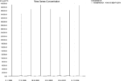
Figure 2.1. Concentration pattern over time for bentazon at the top of the sandy catchment.
Figur 2.1. Koncentrationsmønster som funktion af tid for bentazon i det sandede opland.
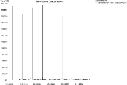
Figure 2.2. Concentration pattern over time for bentazon in the middle part of the sandy catchment.
Figur 2.2. Koncentrationsmønster som funktion af tid for bentazon i midten af det sandede opland.
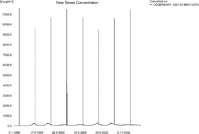
Figure 2.3. Concentration pattern over time for bentazon at the bottom of the sandy catchment.
Figur 2.3. Koncentrationsmønster som funktion af tid for bentazon i den nedstrøms ende af det sandede opland.
Figure 2.4 and Figure 2.5 show logitudinal profiles of the stream on the dates of maximum concentrations for the upper, middle and lower parts of the stream in the sandy catchment. The thin black line represents the concentration, while the thick black line shows the maximum concentrations obtained during the simulations. In addition, the outline of the stream is shown.

Figure 2.4. Concentrations of bentazon in the sandy catchment on 13. May 1998, where maximum concentrations are reached in the upper end and lower end.
Figur 2.4. Koncentrationer af bentazon i det sandede opland den 13. maj 1998, hvor maximumskoncentrationer nås i den øvre og nedre del.

Figure 2.5. Concentrations of bentazon in the sandy catchment on 8. May 2001, where maximum values are reached in the middle part, 1.5 to 2.5 hours after the end of the spray event shown above.
Figur 2.5. Koncentrationer af bentazon i det sandede opland den 8. maj 2001, hvor maximumskoncentrationer nås i den midterste del af oplandet, 1.5 til 2.5 timer efter den viste drifthændelse er afsluttet.
In order to present the data in a similar fashion to the FOCUS SW-results, data were extracted and recalculated for the time series marked in Table 2.2. The global maxima and time weighted concentrations (up to 7 days) were extracted and are reported in Table 2.3. Note that the unit is ng/l.
Bentazon does not sorb strongly, and the concentrations on macrophytes are relatively small in comparison, 115 ng/l (Figure 2.6), compared to 39.3 µg/l in the water phase. The concentrations in pore water and adsorbed on sediment are shown in Figure 2.7 and Figure 2.8. The concentration in porewater reaches its maximum, 28.5 ng/l, 56 m from the upstream point of Odder Baek, while the concentration in sediment reaches 80 ng/kg at the maximum point. The pore water and sediment concentrations are highest during the year with low flow, and the concentrations thus seem more affected by the base flow contribution than by the drift.
Table 2.3. Instantaneous and time weighted concentrations (ng/l) of bentazon at selected points in the sandy catchment.
Tabel 2.3. Beregnet og tidsvægtet concentration af bentazon, ng/l, på udvalgte lokaliteter i det sandede vandløb.
| Year | ODDERBAEK 1049.00 | ODDERBAEK 1801.50 | ODDERBAEK 3581.00 | |||||||
| Conc. | TWA | Date | Conc. | TWA | Date | Conc. | TWA | Date | ||
| 1998 | global max | 39267 | 13-05-1998 | 23193 | 13-05-1998 | 11593 | 13-05-1998 | |||
| 1 hour (after max) | 20288 | 29005 | 17901 | 18971 | 4060 | 6652 | ||||
| 1 day after sp.in. | 0 | 2111 | 0 | 2172 | 0 | 1875 | ||||
| 2 days | 0 | 693 | 0 | 713 | 0 | 616 | ||||
| 4 days | 0 | 519 | 0 | 534 | 0 | 461 | ||||
| 7 days | 0 | 296 | 0 | 304 | 0 | 263 | ||||
| 1999 | global max | 34346 | 05-05-1999 | 20711 | 05-05-1999 | 9627 | 05-05-1999 | |||
| 1 hour (after max) | 12615 | 22769 | 15723 | 17660 | 3135 | 5094 | ||||
| 1 day after sp.in. | 333 | 1560 | 265 | 1669 | 170 | 1390 | ||||
| 2 days | 326 | 734 | 258 | 724 | 162 | 568 | ||||
| 4 days | 321 | 631 | 253 | 606 | 157 | 465 | ||||
| 7 days | 310 | 496 | 244 | 452 | 149 | 331 | ||||
| 2000 | global max | 36793 | 05-05-2000 | 22657 | 05-05-2000 | 10683 | 05-05-2000 | |||
| 1 hour (after max) | 15927 | 25795 | 18144 | 19235 | 3530 | 5897 | ||||
| 1 day after sp.in. | 162 | 1707 | 135 | 1981 | 87 | 1640 | ||||
| 2 days | 159 | 668 | 131 | 740 | 84 | 595 | ||||
| 4 days | 157 | 540 | 129 | 587 | 83 | 466 | ||||
| 7 days | 151 | 374 | 124 | 389 | 79 | 301 | ||||
| 2001 | global max | 39174 | 08-05-2001 | 23514 | 08-05-2001 | 11475 | 08-05-2001 | |||
| 1 hour (after max) | 19841 | 28845 | 18629 | 19474 | 3964 | 6543 | ||||
| 1 day after sp.in. | 82 | 2089 | 66 | 2281 | 50 | 1866 | ||||
| 2 days | 80 | 740 | 64 | 792 | 49 | 646 | ||||
| 4 days | 79 | 574 | 64 | 609 | 48 | 495 | ||||
| 7 days | 76 | 359 | 61 | 373 | 47 | 302 | ||||
| 2002 | global max | 36888 | 13-05-2002 | 22118 | 13-05-2002 | 10658 | 13-05-2002 | |||
| 1 hour (after max) | 16480 | 26005 | 17129 | 18468 | 3545 | 5888 | ||||
| 1 day after sp.in. | 118 | 1737 | 93 | 1865 | 76 | 1614 | ||||
| 2 days | 115 | 648 | 90 | 674 | 74 | 580 | ||||
| 4 days | 113 | 514 | 89 | 527 | 73 | 453 | ||||
| 7 days | 111 | 341 | 87 | 338 | 71 | 289 | ||||
| 2003 | global max | 32563 | 05-05-2003 | 20117 | 05-05-2003 | 9446 | 05-05-2003 | |||
| 1 hour (after max) | 11188 | 21156 | 15069 | 17216 | 3120 | 4968 | ||||
| 1 day after sp.in. | 338 | 1438 | 279 | 1579 | 205 | 1366 | ||||
| 2 days | 332 | 698 | 272 | 704 | 195 | 583 | ||||
| 4 days | 326 | 605 | 267 | 594 | 193 | 485 | ||||
| 7 days | 318 | 483 | 259 | 452 | 185 | 357 | ||||
| 2004 | global max | 36280 | 05-05-2004 | 22288 | 05-05-2004 | 10584 | 05-05-2004 | |||
| 1 hour (after max) | 15097 | 25101 | 17774 | 18952 | 3504 | 5825 | ||||
| 1 day after sp.in. | 178 | 1644 | 148 | 1908 | 127 | 1637 | ||||
| 2 days | 175 | 658 | 145 | 724 | 124 | 621 | ||||
| 4 days | 173 | 536 | 143 | 578 | 123 | 495 | ||||
| 7 days | 167 | 379 | 137 | 390 | 120 | 334 | ||||
| 2005 | global max | 38888 | 08-05-2005 | 23298 | 08-05-2005 | 11417 | 08-05-2005 | |||
| 1 hour (after max) | 19350 | 28462 | 18358 | 19260 | 3956 | 6507 | ||||
| 1 day after sp.in. | 96 | 2043 | 78 | 2214 | 94 | 1872 | ||||
| 2 days | 94 | 734 | 76 | 778 | 93 | 676 | ||||
| 4 days | 94 | 573 | 76 | 602 | 93 | 529 | ||||
| 7 days | 90 | 365 | 73 | 374 | 91 | 340 | ||||
| max values | ||||||||||
| global max | 39267 | 0 | 23514 | 0 | 11593 | 0 | ||||
| 1 hour | 20288 | 29005 | 18629 | 19474 | 4060 | 6652 | ||||
| 1 day | 338 | 2111 | 279 | 2281 | 205 | 1875 | ||||
| 2 days | 332 | 740 | 272 | 792 | 195 | 676 | ||||
| 4 days | 326 | 631 | 267 | 609 | 193 | 529 | ||||
| 7 days | 318 | 496 | 259 | 452 | 185 | 357 | ||||
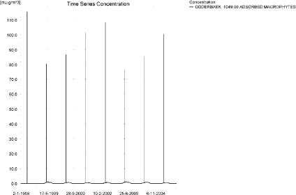
Figure 2.6. Concentration of bentazon adsorbed to macrophytes. As the sorption properties of bentazon are poor, the values are low compared to concentrations in the water phase.
Figur 2.6. Koncentration af bentazon asorberet på makrofytter. Da sorptionsegenskaberne af bentazon er dårlige, er værdierne lave sammenlignet med koncentrationerne i vandfasen.
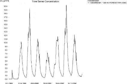
Figure 2.7. Pore water concentration of bentazon in the upstream part of the sandy catchment. The maximum pore water concentration of 28.5 ng/l is reached 56 m from upstream.
Figur 2.7. Porevandskoncentration for bentazon i den opstrøms del af sandede opland. Den maximale porevandskoncentration på 28.5 ng/l opnås 56 m fra den opstrøms ende.
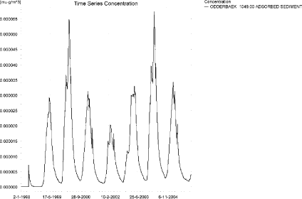
Figure 2.8. Bentazon adsorbed to sediment. The concentration is in µg/g sediment and not µg/m³ as stated. The maximum concentration of 80 ng/kg is reached 56 m from the upstream end.
Figur 2.8. Bentazon sorberet til sediment. Koncentrationen er i µg/g sediment og ikke i µg/m³ som angivet. Maximumskoncentrationen på 80 ng/kg opnås 56 m fra den opstrøms ende.
The global maximum value calculated by PestSurf for the sandy catchment in the water phase is 39.3 µg/l. This is considerably more than what is found in the D3-ditch scenario (9.95 µg/l), and it is due to the fact that a long stretch of stream is sprayed at the same time. 112 m from the upstream end of the stream, the concentration only reaches 1.89 µg/l. The sorption to macrophytes is small compared to the concentration in the water phase. The concentration in the sediment is lower than the concentration in the FOCUS SW-D3-ditch, 80 ng/kg compared to 1.56 µg/kg.
Figure 2.9 shows the output of the PestSurf Excel template. The template works with pre-defined data extraction points. The plot requires specification of a “lowest detection value” (ldc), which defines when a pesticide occurrence is defined as an event. The time series plot is identical to the time series shown earlier, and the graph in the upper right corner resembles the plots in Figure 2.4 and Figure 2.5, but takes into account a longer period of time. A curve is generated when a downstream point reaches a concentration higher than the ldc. The programme then tracks the highest concentration for each calculation point in the stream within the last 24 hours. The plot in the lower right corner shows how many events have concentrations higher than a given toxicity value for the selected monitoring points. The curves show some variation from year to year.
Table 2.4 shows the output of the PestSurf Excel template generated by the PestSurf Excel sheet based on the ldc-value. The selected table shows the point along the stream (of the pre-defined points) with the highest concentration. The highest concentration extracted by the PestSurf Excel sheet was 21.3 µg/l. This is only about half the maximum value of the simulation, which was 39.3 µg/l.
Figure 2.9. Overview for bentazon in the sandy catchment generated by the PestSurf excel template. The max concentrations generated over the 24 hours are similar to the overviews in Figure 2.4 and Figure 2.5. The lowest detection value was set to 100 ng/l.
Figur 2.9. Oversigt for alpha-cypermethrin i det sandede opland genereret med PestSurf-excel-skabelonen. Den maximale koncentration genereret over 24 timer svarer til oversigterne i Figure 2.4og Figure 2.5. Detektionsgrænsen var sat til 100 ng/l.
Table 2.4. Part of the result sheet generated by the PestSurf Excel sheet. The selected table shows the pre-defined point along the stream with the highest concentration recorded. Lowest detection value is set to 100 ng/l, toxicity to fish, daphnies and algae are set to 200, 400 and 1000 ng/, respectively. The recorded peaks can be seen in Figure 2.9.
Tabel 2.4. Uddrag af resultatpresentationen genereret af PestSurf-Excel-arket. Den udvalgte tabel viser det fordefinerede punkt langs med åen med højest koncentration. Detektionsgrænsen er sat til 1 ng/l mens toxicitetsværdierne for fisk, dafnier og alger er henholdsvis 200, 400 og 1000 ng/l. De viste hændelser kan ses i Figur 2.9.
2.4.2 Sandy Catchment, pond
The concentration pattern is evaluated in the middle of the pond only, see Figure 2.10. The pond receives the major contribution from groundwater. The drift peaks are hardly visible. The maximum concentration is quite high, 3.1 µg/l, and occurs at the end of the drainage season of a very wet winter.
Figure 2.10. Concentrations of bentazon in the sandy pond.
Figur 2.10. Koncentration af bentazon i det sandede vandhul.
In Table 2.5, global maxima and time weighted concentrations (up to 7 days) were extracted.
Table 2.5. Maximum concentrations (ng/l) of bentazon for the sandy pond.
Tabel 2.5. Maximumskoncentrationer af bentazon (ng/l) det sandede vandhul.
| Year | Bentazon | Actual Max. conc. | Time-weighted conc. | Date of occurence |
| 1998 | global max | 446 | 30-12-1998 | |
| 1 hour (after max) | ||||
| 1 day after sp.in. | 433 | 439 | ||
| 2 days | 405 | 424 | ||
| 4 days | 405 | 419 | ||
| 7 days | 421 | 415 | ||
| 1999 | global max | 3035 | 09-07-1999 | |
| 1 hour (after max) | ||||
| 1 day after sp.in. | 3010 | 3023 | ||
| 2 days | 2965 | 2999 | ||
| 4 days | 2942 | 2988 | ||
| 7 days | 2873 | 2954 | ||
| 2000 | global max | 1841 | 02-01-2000 | |
| 1 hour (after max) | ||||
| 1 day after sp.in. | 1772 | 1807 | ||
| 2 days | 1653 | 1741 | ||
| 4 days | 1632 | 1717 | ||
| 7 days | 1516 | 1646 | ||
| 2001 | global max | 1001 | 13-01-2001 | |
| 1 hour (after max) | ||||
| 1 day after sp.in. | 1000 | 1000 | ||
| 2 days | 969 | 990 | ||
| 4 days | 953 | 983 | ||
| 7 days | 885 | 952 | ||
| 2002 | global max | 688 | 06-01-2002 | |
| 1 hour (after max) | ||||
| 1 day after sp.in. | 657 | 672 | ||
| 2 days | 610 | 646 | ||
| 4 days | 588 | 635 | ||
| 7 days | 574 | 606 | ||
| 2003 | global max | 3078 | 09-07-2003 | |
| 1 hour (after max) | ||||
| 1 day after sp.in. | 3052 | 3065 | ||
| 2 days | 3005 | 3041 | ||
| 4 days | 2982 | 3029 | ||
| 7 days | 2911 | 2994 | ||
| 2004 | global max | 1879 | 02-01-2004 | |
| 1 hour (after max) | ||||
| 1 day after sp.in. | 1808 | 1844 | ||
| 2 days | 1687 | 1777 | ||
| 4 days | 1665 | 1752 | ||
| 7 days | 1547 | 1680 | ||
| 2001 | global max | 1019 | 13-01-2005 | |
| 1 hour (after max) | ||||
| 1 day after sp.in. | 1018 | 1019 | ||
| 2 days | 987 | 1008 | ||
| 4 days | 970 | 1001 | ||
| 7 days | 901 | 969 | ||
| max values | ||||
| global max | 3078 | |||
| 1 hour | 0 | |||
| 1 day | 3052 | 3065 | ||
| 2 days | 3005 | 3041 | ||
| 4 days | 2982 | 3029 | ||
| 7 days | 2911 | 2994 | ||
The sorption to macrophytes is shown in Figure 2.11. The concentration is considerably lower than the concentration in the water phase. The porewater concentration in the sediment reaches a concentration of 429 ng/l, coinciding with the highest concentration in the pond, see Figure 2.12. The amount of bentazon sorbed to sediment is shown in Figure 2.13. The concentration in sediment reaches 0.40 µg/kg.
Compared to the FOCUS D3-ditch, the concentration in the PestSurf sandy pond is lower, 3.08 µg/l compared to 9.95 µg/l. The sediment concentration is also significantly lower, 0.400 µg/kg compared to 1.56 µg/kg.
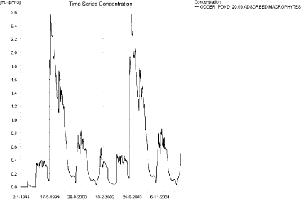
Figure 2.11. Sorption of bentazon to macrophytes in the sandy pond.
Figur 2.11. Sorption af bentazon til makrofytter i det sandede vandhul.
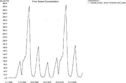
Figure 2.12. Pore water concentration of bentazon in the sandy pond.
Figur 2.12. Porevandskoncentration af bentazon i det sandede vandhul.

Figure 2.13. Sorption of bentazon to sediment in the sandy pond. The concentration is in µg/g sediment and not µg/m³ as stated.
Figur 2.13. Sorption af bentazon til sediment id et sandede vandhul. Koncentrationen er i µg/g sediment og ikke µg/m³ som angivet.
Figure 2.14 shows the output of the PestSurf Excel template. The template works with one pre-defined data extraction point for the pond (center of the pond). The plot requires specification of a “lowest detection value” (ldc) which defines when a pesticide occurrence is defined as an event. The time series plot is identical to the time series shown earlier. The plot to the right shows how many events have concentrations higher than a given toxicity value for the selected monitoring points.
Table 2.6 shows part of the result sheet generated by the PestSurf Excel sheet based on the ldc-value.
Click here to see Figure 2.14.
Figure 2.14. Overview for bentazon in the sandy pond generated by the PestSurf excel template. The time series shown is identical to the one in Figure 2.10. The lowest detection value is set to 250 ng/l.
Figur 2.14. Oversigt for bentazon i det sandede opland genereret med PestSurf-excel-skabelonen. Den viste tidsserie er mage til den i Figur 2.10 Detektionsgrænsen er sat til 250 ng/l.
Table 2.6. Part of the result sheet generated by the PestSurf Excel sheet. Lowest detection value is set to 250 ng/l, toxicity to fish, daphnies and algae are set to 500, 1000 and 2000 ng/, respectively. The recorded peaks are shown in Figure 2.14.
Tabel 2.6. Uddrag af resultatpresentationen genereret af PestSurf-Excel-arket. Detektionsgrænsen er sat til 250 ng/l mens toxicitetsværdierne for fisk, dafnier og alger er henholdsvis 500, 1000 og 2000 ng/l. De tabellerede hændelser er vist i Figur 2.14.
2.4.3 Sandy Loam Catchment, stream
The distribution of concentrations was assessed in several steps. First, the maximum concentrations at each calculation point were listed, and the dates for the occurrence of the maximum was assessed, see Table 2.7. The points, for which the maximum value also represents a local maximum were selected for further analysis.
Some points were disregarded in the first analysis. If more points peaked on the same date, generally only one was analyzed.
Table 2.7. Maximum concentrations (ng/l) of bentazon simulated for each calculation point in the Sandy loam catchment.
Tabel 2.7. Maximumskoncentrationer (ng/l) af bentazon simuleret for hvert beregningspunkt i morænelersoplandet.
| BENTAZON | Maximum | Max.Time | Local Maxima |
| ALBJERGBAEK 0.00 | 1808 | 09/10/2001 00:00 | |
| ALBJERGBAEK 150.00 | 6704 | 03/09/1998 00:00 | |
| ALBJERGBAEK 300.00 | 6021 | 11/12/2001 00:00 | |
| ALBJERGBAEK 450.00 | 6071 | 11/12/2001 00:00 | |
| ALBJERGBAEK 600.00 | 29111 | 04/05/2001 09:49 | |
| ELHOLTBAEK 0.00 | 865 | 18/09/1998 00:00 | |
| ELHOLTBAEK 165.00 | 903 | 26/01/1999 00:00 | |
| ELHOLTBAEK 330.00 | 23223 | 04/05/2001 08:40 | |
| FREDLIGBAEK 0.00 | 1601 | 18/09/1998 00:00 | |
| FREDLIGBAEK 100.00 | 2541 | 18/09/1998 00:00 | |
| FREDLIGBAEK 200.00 | 2722 | 18/09/1998 00:00 | |
| FREDLIGBAEK 300.00 | 2743 | 18/09/1998 00:00 | |
| FREDLIGBAEK 400.00 | 2789 | 18/09/1998 00:00 | |
| FREDLIGBAEK 500.00 | 2610 | 18/09/1998 00:00 | |
| FREDLIGBAEK 600.00 | 3098 | 18/09/1998 00:00 | |
| FREDLIGBAEK 667.50 | 2518 | 17/09/1998 00:00 | |
| FREDLIGBAEK 735.00 | 49601 | 04/05/2001 08:49 | x |
| GROFTEBAEK 0.00 | 1017 | 18/09/1998 00:00 | |
| GROFTEBAEK 155.00 | 1712 | 17/09/1998 00:00 | |
| GROFTEBAEK 310.00 | 1849 | 18/09/1998 00:00 | |
| GROFTEBAEK 465.00 | 1353 | 19/09/1998 00:00 | |
| GROFTEBAEK 620.00 | 47446 | 04/05/2001 08:40 | x |
| STENSBAEK 0.00 | 1345 | 03/11/2000 00:00 | |
| STENSBAEK 125.00 | 5474 | 30/10/1998 00:00 | |
| STENSBAEK 250.00 | 2339 | 30/10/1998 00:00 | |
| STENSBAEK 412.50 | 4831 | 18/09/1998 00:00 | |
| STENSBAEK 575.00 | 9942 | 04/05/2001 11:00 | |
| OVRELILLEBAEK 0.00 | 1015 | 25/05/1998 08:00 | |
| OVRELILLEBAEK 125.00 | 55341 | 04/05/1999 08:30 | |
| OVRELILLEBAEK 250.00 | 52490 | 04/05/2001 08:30 | |
| OVRELILLEBAEK 290.00 | 67272 | 04/05/2001 08:49 | x |
| OVRELILLEBAEK 330.00 | 29111 | 04/05/2001 09:49 | |
| OVRELILLEBAEK 330.00 | 29111 | 04/05/2001 09:49 | |
| OVRELILLEBAEK 352.50 | 39303 | 04/05/2001 10:00 | |
| OVRELILLEBAEK 375.00 | 9942 | 04/05/2001 11:00 | |
| OVRELILLEBAEK 375.00 | 9942 | 04/05/2001 11:00 | |
| OVRELILLEBAEK 437.50 | 13426 | 04/05/2001 08:30 | |
| OVRELILLEBAEK 500.00 | 29782 | 04/05/2001 08:30 | |
| OVRELILLEBAEK 625.00 | 51648 | 04/05/2001 08:30 | x |
| OVRELILLEBAEK 750.00 | 33441 | 04/05/2001 08:30 | |
| OVRELILLEBAEK 855.00 | 44939 | 04/05/2001 08:30 | |
| OVRELILLEBAEK 960.00 | 23223 | 04/05/2001 08:40 | |
| OVRELILLEBAEK 960.00 | 23223 | 04/05/2001 08:40 | |
| OVRELILLEBAEK 980.00 | 24584 | 04/05/2001 08:49 | |
| OVRELILLEBAEK 1000.00 | 20937 | 04/05/2001 08:49 | |
| OVRELILLEBAEK 1062.50 | 20263 | 04/05/1999 08:49 | |
| OVRELILLEBAEK 1125.00 | 19699 | 04/05/2001 08:30 | |
| OVRELILLEBAEK 1187.50 | 24537 | 04/05/2001 08:30 | |
| OVRELILLEBAEK 1250.00 | 25429 | 04/05/2001 08:30 | |
| OVRELILLEBAEK 1425.00 | 35362 | 04/05/2001 08:30 | |
| OVRELILLEBAEK 1600.00 | 29856 | 04/05/2001 08:30 | |
| OVRELILLEBAEK 1650.00 | 38526 | 04/05/2001 08:30 | |
| OVRELILLEBAEK 1700.00 | 27427 | 04/05/2001 08:40 | |
| NEDRELILLEBAEK 0.00 | 27427 | 04/05/2001 08:40 | |
| NEDRELILLEBAEK 135.00 | 26868 | 04/05/2001 08:30 | |
| NEDRELILLEBAEK 270.00 | 38815 | 04/05/2001 08:30 | |
| NEDRELILLEBAEK 330.00 | 48965 | 04/05/2001 08:30 | |
| NEDRELILLEBAEK 390.00 | 51268 | 04/05/2001 08:30 | |
| NEDRELILLEBAEK 495.50 | 66840 | 04/05/2001 08:30 | x |
| NEDRELILLEBAEK 601.00 | 49601 | 04/05/2001 08:49 | |
| NEDRELILLEBAEK 601.00 | 49601 | 04/05/2001 08:49 | |
| NEDRELILLEBAEK 693.00 | 48152 | 04/05/2001 09:00 | |
| NEDRELILLEBAEK 785.00 | 48785 | 04/05/2001 09:10 | |
| NEDRELILLEBAEK 847.00 | 72137 | 04/05/2001 08:30 | x |
| NEDRELILLEBAEK 909.00 | 47446 | 04/05/2001 08:40 | |
| NEDRELILLEBAEK 909.00 | 47446 | 04/05/2001 08:40 | |
| NEDRELILLEBAEK 984.50 | 44341 | 04/05/2001 08:49 | |
| NEDRELILLEBAEK 1060.00 | 56389 | 04/05/2001 08:30 | |
| NEDRELILLEBAEK 1169.50 | 72268 | 04/05/2001 08:30 | |
| NEDRELILLEBAEK 1279.00 | 105741 | 04/05/2001 08:30 | x |
| NEDRELILLEBAEK 1409.50 | 68528 | 04/05/2001 09:00 | |
| NEDRELILLEBAEK 1540.00 | 46609 | 04/05/2001 10:00 | |
| Global max | 105741 |
All maximum concentrations are caused by drift events. The concentration pattern for the upper and lower part of the stream is shown in Figure 2.15 and Figure 2.16. The upstream ends of the system is totally dominated by the drift events, but some drainage contribution with a rather peaky pattern is visible in wet periods. Drift also dominated the lower part of the stream, but the extreme rainfall event around 16-17. September 1998 is visible in several of the time series. It stands out least clearly in the very upstream ends of the tributaries. Due to the relatively high degradation rate of bentazon, there is no buildup in the groundwater visible at the lower end of Lillebaek.
The high concentrations caused by drift is due to a buildup of concentrations over a long stretch receiving bentazon within 30 minutes, reaching a maximum value of 106 µg/l. At the same time, the water depth is small, particularly in the upstream part of the stream. The water depth during the event of 4. May 2001 is 6 cm 330 m from the upstream end and 13 cm in the maximum point “Nedrelillebaek 1279”.
The extreme event in September 1998 causes the maximum drainage concentration of around 11 µg/l.
Other high drainage concentrations (5.5 µg/l) are found in Steensbaek, which is not a permanent stream - it could be viewed as a drainage ditch. The highest concentration here occurs during the wet winter. Apart from the drift events and the mentioned drainage events, the maximum concentrations are in the range 1.5-2.0 µg/l.
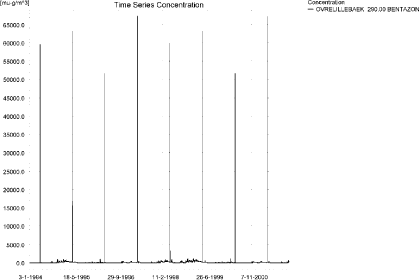
Figure 2.15. Concentration pattern for bentazon in the upstream part of the sandy loam catchment.
Figur 2.15. Koncentrationsmønster for bentazon i den opstrøms ende af morænelersoplandet.
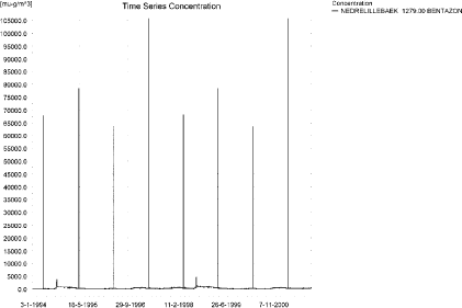
Figure 2.16. Concentration pattern for bentazon in the lower end of the sandy loam catchment.
Figur 2.16. Koncentrationsmønster for bentazon i den nedstrøms ende af morænelersoplandet.
The concentrations in the sandy loam catchment on selected dates (18. September 1998 and 4. May 2001) are shown in Figure 2.18 and Figure 2.18. The thin black line represents the concentration, while the thick black line shows the maximum concentrations obtained during the simulations. In addition, the outline of the stream is shown. The patterns shown for the drainage event differ significantly from the pattern of the drift event.
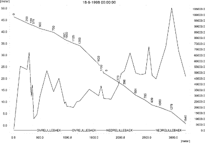
Figure 2.17. Concentrations in the sandy loam catchment on 18. September 1998, due to drainage.
Figur 2.17. Koncentrationer i morænelersoplandet den 18.September 1998. Koncentrationerne skyldes drænvand.
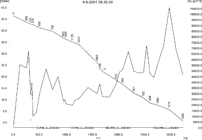
Figure 2.18. Concentrations in the sandy loam catchment on 4. May 2001, due to drift.
Figur 2.18. KOncentrationer i morænelersoplandet den 4. maj 2001. Koncentrationerne skyldes drift.
To be able to extract comparable values to FOCUS SW, the global maxima and time weighted concentrations (up to 7 days) were extracted when these were meaningful. They are shown in Table 2.8.
The concentrations of bentazon sorbed to macrophytes are shown in Figure 2.19 and Figure 2.20 for the upper and lower part of the sandy loam catchment, respectively. The concentration reaches 1.21 µg/l and does not significantly influence the concentration in the water phase. The pattern of bentazon in porewater is shown in Figure 2.21. The maximum value reached in the catchment was 165 ng/l in Steensbaek 125, and the maximum value in the main stream was 80 ng/l (Ovrelillebaek 1187). The concentration of bentazon adsorbed to sediment is shown in Figure 2.22. The maximum concentration reached is about 0.13 µg/kg in Steensbaek and 65 ng/kg in the main stream.
The maximum concentration level generated by PestSurf is much higher (106 µg/l) than the concentration generated by the FOCUS SW-stream-scenario for D4-stream (8.25 µg/l). This is due to the fact that the whole agricultural area is sprayed simultaneously. An additional factor is the very shallow water depth in the stream at the time of spraying. A depth of 6 cm will lead to concentrations at least 5 times the concentration at 30 cm’s depth. The concentration 100 m from the upstream end is 55 µg/l, 6-7 times the value found in FOCUS SW.
As mentioned earlier, an additional high value is found during the extreme event. With respect to sediment, the PestSurf value of 65 ng/kg in the main stream or 130 ng/kg in a tributary is considerably lower than the FOCUS SW-value of 1.1 µg/kg. This is due to the fact that the presence of high concentrations is very short in PestSurf, and the diffusion into porewater is slow.
Figure 2.23, Figure 2.24, Table 2.9 and Table 2.10 show the results generated by the PestSurf templates. The maximum value generated by the templates for the upper part of the stream is 38.5 µg/l and 106 µg/l for the lower part. The maximum value generated in the upstream part of the catchment is 67.3 µg/l in OvreLillebaek (290) while the maximum in the spreadsheet and in the main stream is 106 µg/l. The templates thus did catch the maximum value of the simulation.
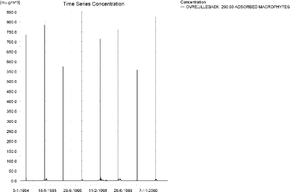
Figure 2.19. Concentration of bentazon on macrophytes in the upstream part of the sandy loam catchment.
Figur 2.19. Koncentration af bentazon på makrofytter i den opstrøms del af morænelersoplandet.
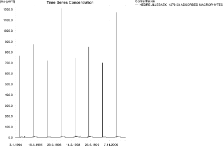
Figure 2.20. Concentration on macrophytes in the downstream part of the sandy loam catchment.
Figur 2.20. Koncentration på makrofytter i den nedstrøms del af morænelersoplandet.
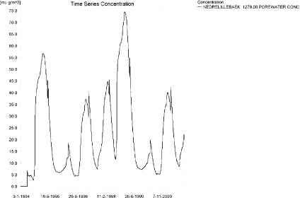
Figure 2.21. Maximum pore water concentration of bentazon in the sandy loam catchment.
Figur 2.21. Maximum porevandskoncentration af bentazon i morænelersoplandet.
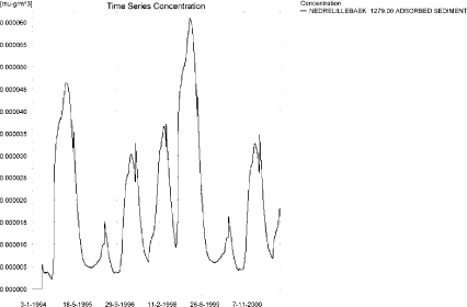
Figure 2.22. Maximum concentration of bentazon sorbed to sediment in the sandy loam catchment. The concentration is in µg/g sediment and not µg/m³ as stated.
Figur 2.22. Maximumskoncentration af bentazon sorberet på sediment i morænelersoplandet. Koncentrationen er i µg/g sediment og ikke µg/m³ som angivet.
Table 2.8. Instantaneous and time weighted concentrations (ng/l) of bentazon in the sandy loam catchment.
Tabel 2.8. Beregnet og tidsvægtede koncentrationer (ng/l) af bentazon i morænelersoplandet.
Click here to see Figure 2.23.
Figure 2.23. Overview for bentazon in the sandy loam catchment generated by the PestSurf excel template for the upstream part of the catchment. The limiting value was set to 150 ng/l.
Figur 2.23. Oversigt for Bentazon i morænelersoplandet genereret med PestSurf-excel-skabelonen for den opstrøms del af oplandet. Detektionsgrænsen var sat til 150 ng/l.
Click here to see Figure 2.24.
Figure 2.24. Overview for bentazon in the sandy loam catchment generated by the PestSurf excel template for the downstream part of the catchment. The limiting value was set to 150 ng/l.
Figur 2.24. Oversigt for bentazon i morænelersoplandet genereret med PestSurf-excel-skabelonen for den nedstrøms del af oplandet. Detektionsgrænsen var sat til 150 ng/l.
Table 2.9. Part of the result sheet generated by the PestSurf Excel sheet for the upstream part of the sandy loam catchment. Lowest detection value is set to 150 ng/l, toxicity to fish, daphnies and algae are set to 1000, 5000 and 10000 ng/, respectively. The recorded peaks are shown in Figure 2.23.
Tabel 2.9. Uddrag af resultatpresentationen genereret af PestSurf-Excel-arket for den opstrøms del af morænelersoplandet. Detektionsgrænsen er sat til 150 ng/l, toxicitetsværdierne for fisk, dafnier og alger er henholdsvis 1000, 5000 og 10000 ng/l. Hændelserne er vist i Figur 2.23.
Table 2.10. Part of the result sheet generated by the PestSurf Excel sheet for the downstream part of the sandy loam catchment. Lowest detection value is set to 150 ng/l, toxicity to fish, daphnies and algae are set to 1000, 5000 and 10000 ng/, respectively. The recorded peaks are shown in Figure 2.24.
Tabel 2.10. Uddrag af resultatpresentationen genereret af PestSurf-Excel-arket for den nedstrøms del af morænelersoplandet. Detektionsgrænsen anvendt i simuleringen er 150 ng/l, toxicitetsværdierne for fisk, dafnier og alger er henholdsvis 1000, 5000 og 10000 ng/l. Hændelserne er vist i Figur 2.23.
2.4.4 Sandy Loam Catchment, pond
The concentration pattern is evaluated in the middle of the pond only, see Figure 2.25. The pond receives contributions through drift and drain flow, in good correspondence with the fact that it is situated in the upper part of the sandy loam catchment. The maximum concentration is 1493 ng/l. The largest contribution occurs during the wet winter between 1998 and 1999.
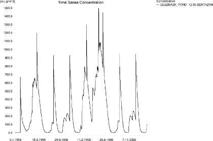
Figure 2.25. Concentrations of bentazon for the sandy loam pond.
Figur 2.25. Koncentration af bentazon i morænelersvandhullet.
Figure 2.26 shows the concentration of bentazon on macrophytes in the pond. It follows the concentration pattern in the water phase, the maximum concentration reaching around 33 ng/l. This does not influence the concentration in the water phase significantly. The concentration in pore water reaches 167 ng/l, see Figure 2.27 at the time where the water concentration in the pond is at maximum. The amount of bentazon sorbed to sediment is shown in Figure 2.28. The maximum concentration reached is 155 ng/kg.
In Table 2.11, global maxima and time weighted concentrations (up to 7 days) are extracted.
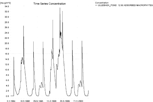
Figure 2.26. Bentazon sorbed to the macrophytes in the sandy loam pond.
Figur 2.26. Bentazon sorberet til makrofytter i morænelersvandhullet.
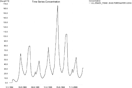
Figure 2.27. Pore water concentration of bentazon in the sandy loam pond.
Figur 2.27. Porevandskoncentration af bentazon i morænelersvandhullet.
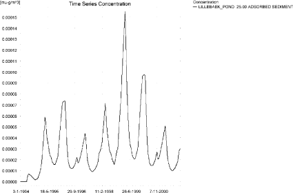
Figure 2.28. Bentazon sorbed to sediment in the sandy loam pond. Note that the concentration is in µg/g and not µg/m³ as indicated.
Figur 2.28. Bentazon sorberet til sediment i morænelersvandhullet. Bemærk at koncentrationen er i µg/g og ikke µg/m³ som angivet.
Table 2.11. Actual and time weighted concentrations (ng/l) of bentazon in the sandy loam pond.
Tabel 2.11. Beregnede og tidsvægtede koncentrationer (ng/l) af bentazon i morænelersvandhullet.
| Year | Bentazon | Actual Max. conc. | Time-weighted conc. | Date of occurence |
| 1994 | global max | 666 | 05-05-1994 | |
| 1 hour (after max) | 650 | 658 | ||
| 1 day after sp.in. | 587 | 605 | ||
| 2 days | 540 | 577 | ||
| 4 days | 518 | 565 | ||
| 7 days | 456 | 531 | ||
| 1995 | global max | 1194 | 05-05-1995 | |
| 1 hour (after max) | 1178 | 1186 | ||
| 1 day after sp.in. | 1103 | 1127 | ||
| 2 days | 1033 | 1087 | ||
| 4 days | 1001 | 1069 | ||
| 7 days | 912 | 1020 | ||
| 1996 | global max | 928 | 05-05-1996 | |
| 1 hour (after max) | 903 | 915 | ||
| 1 day after sp.in. | 827 | 845 | ||
| 2 days | 794 | 822 | ||
| 4 days | 779 | 813 | ||
| 7 days | 738 | 789 | ||
| 1997 | global max | 926 | 05-05-1997 | |
| 1 hour (after max) | 903 | 914 | ||
| 1 day after sp.in. | 833 | 849 | ||
| 2 days | 804 | 828 | ||
| 4 days | 790 | 820 | ||
| 7 days | 748 | 798 | ||
| 1998 | global max | 1293 | 04-05-1998 | |
| 1 hour (after max) | 1276 | 1284 | ||
| 1 day after sp.in. | 1197 | 1223 | ||
| 2 days | 1120 | 1180 | ||
| 4 days | 1083 | 1160 | ||
| 7 days | 982 | 1105 | ||
| 1999 | global max | 1493 | 01-02-1999 | |
| 1 hour (after max) | ||||
| 1 day after sp.in. | 1442 | 1467 | ||
| 2 days | 1163 | 1335 | ||
| 4 days | 1130 | 1288 | ||
| 7 days | 1065 | 1205 | ||
| 2000 | global max | 949 | 04-05-2000 | |
| 1 hour (after max) | 925 | 936 | ||
| 1 day after sp.in. | 848 | 866 | ||
| 2 days | 815 | 843 | ||
| 4 days | 800 | 834 | ||
| 7 days | 759 | 810 | ||
| 2001 | global max | 941 | 04-05-2001 | |
| 1 hour (after max) | 918 | 929 | ||
| 1 day after sp.in. | 847 | 864 | ||
| 2 days | 818 | 843 | ||
| 4 days | 803 | 835 | ||
| 7 days | 761 | 812 | ||
| max values | ||||
| global max | 1493 | |||
| 1 hour | 1276 | 1284 | ||
| 1 day | 1442 | 1467 | ||
| 2 days | 1163 | 1335 | ||
| 4 days | 1130 | 1288 | ||
| 7 days | 1065 | 1205 |
Figure 2.29 and Table 2.12 show output from the PestSurf template, with a time series identical to Figure 2.25.
The concentration generated in the FOCUS SW-scenario D4-pond and the PestSurf sand loam pond are comparable. D4 generates a concentration of 2.17 µg/l while PestSurf reaches 1.49 µg/l. The sediment concentration generated in PestSurf is, however, somewhat lower (0.155 µg/kg) than the concentration reached in the corresponding FOCUS SW-scenario (2.80 µg/kg).
Click here to see Figure 2.29.
Figure 2.29. Overview for bentazon in the sandy loam pond generated by the PestSurf excel template. The time series shown is identical to the one in Figure 2.25. The limiting value is set to 100 ng/l.
Figur 2.29. Oversigt for bentazon i morænelersoplandet genereret med PestSurf-excel-skabelonen. Den viste tidsserie er mage til den i Figur 2.25. Detektionsgrænsen er sat til 100 ng/l.
Table 2.12. Part of the result sheet generated by the PestSurf Excel sheet. Lowest detection value is set to 100 ng/l, toxicity to fish, daphnies and algae are set to 500, 1000 and 2000 ng/, respectively.
Tabel 2.12. Uddrag af resultatpresentationen genereret af PestSurf-Excel-arket. Detektionsgrænsen er sat til 100 ng/l mens toxicitetsværdierne for fisk, dafnier og alger er henholdsvis 500, 1000 og 2000 ng/l.
Table 2.13. Summary of simulation results for bentazon.
Tabel 2.13. Opsummerede resultater for bentazon.
2.5 Summary of simulations
The maximum actual concentrations for all simulations are recorded in Table 2.13.
The sandy pond generates lower concentrations than the D3-ditch, which produce lower concentrations than the sandy stream. The sandy pond is influenced by groundwater, while the D3 ditch and stream are mainly influenced by drift, although the stream receives some drainage contribution.
The major reason for the high stream concentration of 39.3 µg/l is the fact that a very long stretch of water is sprayed at the same time. The theoretical maximum for a stationary situation in the point of maximum concentration reaches a concentration of 55.5 µg/l. If the concentration is extracted 112 m from the upstream end of the sandy catchment, it only reaches 1.89 µg/l, compared to 9.95 µg/l reached in the D3-ditch. However, this is a result of a difference of exposure of due to presence of 20 m wide buffer zones along this part of the stream (a factor of 14.7) and a water depth at the time of spraying of about 9-10 cm at the time of spraying.
The concentration of the D4-pond is about 30 % higher than for the sandy loam pond. Both ponds are mainly influenced by drainage. The fact that more soil types and groundwater levels are present in PestSurf, probably results in the lower concentration level.
The concentration in the sandy loam stream is 106 µg/l compared to 8.25 in the FOCUS D4-stream. Both values are generated by drift. With the same reservation on the maximum value as mentioned for alphacypermethrin, the maximum concentration on the stretch, where the stream is permanent and upstream of the groundwater influence is extracted. It is 51.6 µg/l, 625 m from the upstream end.
The major reason for the high stream concentration is the fact that a very long stretch of water is sprayed at the same time. If the concentration is extracted 112 m from the upstream end of the sandy catchment, it only reaches 1.9 µg/l, compared to 9.9 µg/l reached in the D3-ditch. However, this is a result of a difference of exposure of due to presence of 20 m wide buffer zones along this part of the stream (a factor of 14.7) and a water depth at the time of spraying of about 9-10 cm at the time of spraying.
For the sandy loam catchment, the concentration 125 m from the upstream end is 55.3 µg/l, and thus still much higher than the 8.25 µg/l found in the FOCUS D4-stream. The water depth at this stretch is about 4.5 cm. The difference in water depth thus explains the difference in concentrations.
The macrophytes do not excert a strong influence on the concentration in the water phase in any of the scenarios scenarios due to the low potential for adsorption of bentazon.
With respect to sediment concentrations, all of the concentrations generated by PestSurf are lower than the concentrations generated by FOCUS SW. With respect to the streams, the diffusion description differ between FOCUS and PestSurf and that could be part of the explanation for the difference. The diffusion coefficient used in the two models is similar. Another difference could be lower contact time between the high concentrations and the porewater due to higher flow velocities in PestSurf. For the ponds, however, the diffusion description is similar in the two models. The diffusion coefficient in PestSurf ponds stem from dam experiments.
Annex 3
3 Comparison of risk assessment data produced by spray drift assessments, FOCUS SW and PestSurf
3.1 Chemical characteristics of the compound
| Compound: | Bromoxynil |
| Dose: | 0.12 kg ai./ha |
| Spraying time: | 1. April |
| Crop: | Winter wheat |
| Dose: | 0.18 kg ai./ha |
| Spraying time: | 7. October |
| Crop: | Winter wheat |
Table 3.1. Overview of chemical properties of Bromxynil and the parameters used in the simulations.
Tabel 3.1. Oversigt over bromoxynils kemiske egenskaber og parametrene brugt i simuleringerne.
| Chemical property | Condition | Recalculated values | |||
| Cas-no. | 1689-84-5 | ||||
| Molecular weight | 276.9 | ||||
| Form (acid, basic, neutral) | acid | ||||
| pKa | 3.86 | ||||
| Water solubility | 90 µg/l | (distillled water) | |||
| log Kow | 1.31 | at pH | 2 | KowA- | 1.04 |
| log Kow | 1.04 | at pH | 7 | KowAH | 1.31 |
| log Kow | at pH | KowAH+ | |||
| Vapor pressure, Pa | 1.7 × 10⁻⁴ | 25°C | 318.7 (Boiling point) | vapor pressure, Pa, 20°C | 8.49 × 10⁻⁵ |
| Henry’s law constant | 5.3 × 10⁻⁴ Pa.m³. mol-1 | Recalculated value, dimensionless | 2.18 × 10⁻⁷ | ||
| Sorption properties in soil | |||||
| Freundlich exp | 0.8 | ||||
| Koc, l/kg | 183.6 | ||||
| DT50 in soil, days | 0.54 | ||||
| DT50water | 5.9 dage | PestSurf input | |||
| DT50sedment | None mentioned | ||||
| DT50water/sediment | 5.9 days | DT50, days | 5.9 | ||
| Sediment konc., µg/l | 80 (default in PestSurf) | ||||
| Hydrolysis | no hydrolysis | at pH 5 | (acid) | ||
| at pH 7 | (neutral) | ||||
| at pH 9 | (basic) | ||||
| Photolysis | |||||
| quantum yield | φ = 4.8 x 10⁻² ? | ||||
| Spectrum | λmax = 221.2, ε = 30343 l mol-1 cm-1 | ||||
| λmax = 221.2, ε = 30343 l mol-1 cm-1 λmax = 287, ε = 18302 l mol-1 cm-1 – The value 18302 is implemented for 295-300, and the value is reduced by a factor of 5 for the next wavelengths: |
|||||
| 295-300: 18302 | |||||
| 300-310: 3660; | |||||
| 320-330: 146; | |||||
| 330-340: 30 | |||||
| 340-350: 0 | |||||
| Other | DT 50 <10 h (2 major by-products) |
3.2 Concentrations generated drift
| Compound | Direct spray | FOCUS buffer zones | ||
| Ditch | Stream | Pond | ||
| [µg·l-1] | [µg·l-1] | [µg·l-1] | [µg·l-1] | |
| Spring application | 40.0 | 1.104 | 0.742 | 0.324 |
| Autumn app | 60.0 | 1.656 | 1.114 | 0.486 |
3.3 Concentrations generated by FOCUS SW
3.3.1 D3- Ditch
| Bromoxynil, spring appl. | Ditch, D3 | |||||||
| Water | Sediment | |||||||
| Date | PEC | Date | TWAEC | Date | PEC | Date | TWAEC | |
| [µg L-1] | [µg L-1] | [µg kg-1] | [µg kg-1] | |||||
| Global max | 04-apr-92 | 0.759 | 05-apr-92 | 0.306 | ||||
| 1 d | 05-apr-92 | 0.304 | 05-apr-92 | 0.561 | 06-apr-92 | 0.237 | 06-apr-92 | 0.294 |
| 2 d | 06-apr-92 | 0.034 | 06-apr-92 | 0.348 | 07-apr-92 | 0.178 | 06-apr-92 | 0.268 |
| 4 d | 08-apr-92 | 0.002 | 08-apr-92 | 0.179 | 09-apr-92 | 0.122 | 08-apr-92 | 0.22 |
| 7 d | 11-apr-92 | 0.001 | 11-apr-92 | 0.103 | 12-apr-92 | 0.084 | 11-apr-92 | 0.174 |
| Bromoxynil, autumn appl. | Ditch, D3 | |||||||
| Water | Sediment | |||||||
| Date | PEC | Date | TWAEC | Date | PEC | Date | TWAEC | |
| [µg L-1] | [µg L-1] | [µg kg-1] | [µg kg-1] | |||||
| Global max | 10-oct-92 | 1.143 | 11-oct-92 | 0.57 | ||||
| 1 d | 11-oct-92 | 0.767 | 11-oct-92 | 0.957 | 12-oct-92 | 0.488 | 12-oct-92 | 0.559 |
| 2 d | 12-oct-92 | 0.275 | 12-oct-92 | 0.736 | 13-oct-92 | 0.386 | 13-oct-92 | 0.531 |
| 4 d | 14-oct-92 | 0.021 | 14-oct-92 | 0.418 | 15-oct-92 | 0.267 | 14-oct-92 | 0.459 |
| 7 d | 17-oct-92 | 0.003 | 17-oct-92 | 0.242 | 18-oct-92 | 0.184 | 17-oct-92 | 0.374 |
3.3.2 D4 – Pond
| Bromoxynil, spring application | Pond, D4 | |||||||
| Water | Sediment | |||||||
| Date | PEC | Date | TWAEC | Date | PEC | Date | TWAEC | |
| [µg L-1] | [µg L-1] | [µg kg-1] | [µg kg-1] | |||||
| Global max | 18-apr-85 | 0.026 | 01-may-85 | 0.049 | ||||
| 1 d | 19-apr-85 | 0.024 | 19-apr-85 | 0.025 | 02-may-85 | 0.048 | 01-may-85 | 0.049 |
| 2 d | 20-apr-85 | 0.023 | 20-apr-85 | 0.024 | 03-may-85 | 0.047 | 01-may-85 | 0.049 |
| 4 d | 22-apr-85 | 0.021 | 22-apr-85 | 0.023 | 05-may-85 | 0.045 | 02-may-85 | 0.049 |
| 7 d | 25-apr-85 | 0.018 | 25-apr-85 | 0.021 | 08-may-85 | 0.041 | 03-may-85 | 0.048 |
| Bromoxynil, autumn appl. | Pond, D4 | |||||||
| Water | Sediment | |||||||
| Date | PEC | Date | TWAEC | Date | PEC | Date | TWAEC | |
| [µg L-1] | [µg L-1] | [µg kg-1] | [µg kg-1] | |||||
| Global max | 26-oct-85 | 0.039 | 08-nov-85 | 0.065 | ||||
| 1 d | 27-oct-85 | 0.036 | 27-oct-85 | 0.037 | 09-nov-85 | 0.065 | 09-nov-85 | 0.065 |
| 2 d | 28-oct-85 | 0.033 | 28-oct-85 | 0.036 | 10-nov-85 | 0.065 | 09-nov-85 | 0.065 |
| 4 d | 30-oct-85 | 0.029 | 30-oct-85 | 0.033 | 12-nov-85 | 0.064 | 10-nov-85 | 0.065 |
| 7 d | 02-nov-85 | 0.024 | 02-nov-85 | 0.03 | 15-nov-85 | 0.062 | 12-nov-85 | 0.065 |
3.3.3 D4 – Stream
| Bromoxynil, spring appl. | Stream, D4 | |||||||
| Water | Sediment | |||||||
| Date | PEC | Date | TWAEC | Date | PEC | Date | TWAEC | |
| [µg L-1] | [µg L-1] | [µg kg-1] | [µg kg-1] | |||||
| Global max | 18-apr-85 | 0.603 | 18-apr-85 | 0.029 | ||||
| 1 d | 19-apr-85 | 0 | 19-apr-85 | 0.041 | 19-apr-85 | 0.02 | 19-apr-85 | 0.024 |
| 2 d | 20-apr-85 | 0 | 20-apr-85 | 0.02 | 20-apr-85 | 0.015 | 20-apr-85 | 0.021 |
| 4 d | 22-apr-85 | 0 | 22-apr-85 | 0.01 | 22-apr-85 | 0.01 | 22-apr-85 | 0.017 |
| 7 d | 25-apr-85 | 0 | 25-apr-85 | 0.006 | 25-apr-85 | 0.007 | 25-apr-85 | 0.013 |
| Bromoxynil, autumn appl. | Stream, D4 | |||||||
| Water | Sediment | |||||||
| Date | PEC | Date | TWAEC | Date | PEC | Date | TWAEC | |
| [µg L-1] | [µg L-1] | [µg kg-1] | [µg kg-1] | |||||
| Global max | 26-oct-85 | 0.987 | 26-oct-85 | 0.176 | ||||
| 1 d | 27-oct-85 | 0.002 | 27-oct-85 | 0.286 | 27-oct-85 | 0.111 | 27-oct-85 | 0.152 |
| 2 d | 28-oct-85 | 0.001 | 28-oct-85 | 0.144 | 28-oct-85 | 0.08 | 28-oct-85 | 0.127 |
| 4 d | 30-oct-85 | 0 | 30-oct-85 | 0.072 | 30-oct-85 | 0.053 | 30-oct-85 | 0.098 |
| 7 d | 02-nov-85 | 0 | 02-nov-85 | 0.041 | 02-nov-85 | 0.037 | 02-nov-85 | 0.076 |
3.3.4 Conclusion – FOCUS SW
The highest concentration is generated in the ditch (D3) for the autumn application. It is caused by wind drift and the concentration becomes 1.14 µg/l. The same scenario shows the highest concentration in the sediment, 0.570 µg/kg. For all scenarios, the concentrations are lower than what is generated by the simpler assessments.
3.4 Concentrations generated by PestSurf
3.4.1 Sandy Catchment, stream
The distribution of concentrations were assessed in several steps. First, the maximum concentrations at each calculation point were listed, and the dates for the occurrence of the maximum were assessed. The points, for which the maximum value also represents a local maximum were selected for further analysis. The relevant values are listed in Table 3.2.
Table 3.2. Maximum concentrations (ng/l) of bromoxynil simulated for each calculation point in the sandy catchment.
Tabel 3.2. Maximumskoncentrationer (ng/l) af bromoxynil simuleret for hvert beregningspunkt i det sandede opland.
The pattern over time was dominated by drift for both applications and all calculation points, see Figure 3.1 to Figure 3.4.
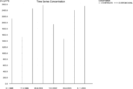
Figure 3.1. Concentration pattern over time for the spring application of bromoxynil in the sandy catchment, 1111.5 m from the upstream end.
Figur 3.1. Koncentrationsmønster som funktion af tid for forårsudbragt bromoxynil i det sandede opland, 1111.5 m fra den opstrøms ende.
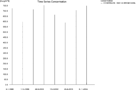
Figure 3.2. Concentration pattern over time for the spring application of bromoxynil in the sandy catchment, 3581 m from the upstream end.
Figur 3.2. Koncentrationsmønster som funktion af tid for bromoxynil i det sandede opland, 3581 m fra den opstrøms ende.
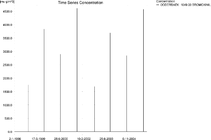
Figure 3.3. Concentration pattern over time for the autumn application of bromoxynil in the sandy catchment, 1049 m from the upstream end.
Figur 3.3. Koncentrationsmønster som funktion af tid for efterårsudbragt bromoxynil i det sandede opland, 1049 m fra den opstrøms ende.
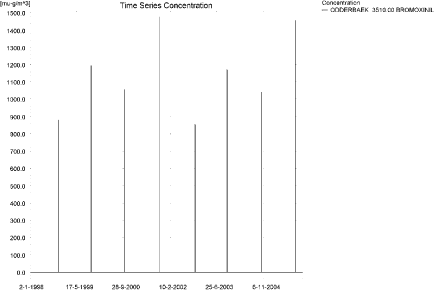
Figure 3.4. Concentration pattern over time for the autumn application of bromoxynil in the sandy catchment, 3510 m from the upstream end.
Figur 3.4. Koncentrationsmønster som funktion af tid for efterårsudbragt bromoxynil i det sandede opland, 3510 m fra den opstrøms ende.
Each of the drift-events generated an almost identical pattern along the stream, see Figure 3.5 and Figure 3.6. The thin black line represents the concentration, while the full black line shows the maximum concentrations obtained during the simulations. In addition, the outline of the stream is shown. In the middle of the catchment, the stream is protected by unsprayed areas.
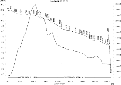
Figure 3.5. Concentrations of spring-applied bromoxynil in the sandy catchment on 1. April 2001, just after spraying.
Figur 3.5. Koncentrationer af forårsudbragt bromoxynil i det sandede opland den 1. april 2001, lige efter endt sprøjtning.
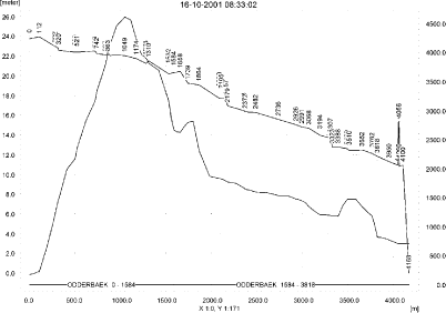
Figure 3.6. Concentrations of autumn-applied bromoxynil in the sandy catchment on 16. October 2001, just after spraying.
Figur 3.6. Koncentrationer af efterårsudbragt bromoxynil i det sandede opland den 16. oktober 2001, lige efter endt sprøjtning.
In order to present the data in a similar fashion to the FOCUS SW-results, data were extracted and recalculated for the time series marked in Table 3.2. The global maxima and time weighted concentrations (up to 7 days) were extracted and are reported in Table 3.3 and Table 3.4. Note that the unit is ng/l.
The concentrations of bromoxynil adsorbed to macrophytes for the spring application is shown in Figure 3.7 and Figure 3.8. The maximum concentration is 1.44 ng/l. For the autumn-application, the value only reaches 0.593 ng/l due to presence of fewer macrophytes at that time of the year. The concentration in the water phase is only marginally affected by macrophytes.
The amount of bromoxynil in porewater is shown in Figure 3.9 for the spring application and in Figure 3.10 for the autumn application. The maximum concentrations reached are 0.028 and 0.071 ng/l for the spring and autumn applications respectively, both values 1421 m from the upstream end. The corresponding max concentration in sediment is 0.59 ng/kg and 1.27 ng/kg.
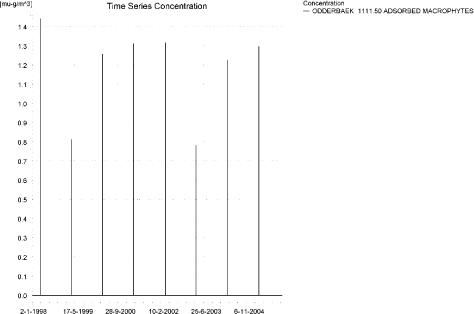
Figure 3.7. Macrophyte-bound concentration of spring-applied bromoxynilin the sandy catchment.
Figur 3.7. Koncentration af forårsudbragt bromoxynil på makrofytter i det sandede opland.
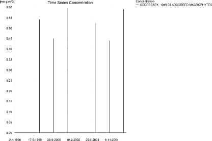
Figure 3.8. Macrophyte-bound concentration of Autumn-applied bromoxynil in the sandy catchment.
Figur 3.8. Koncentration af efterårsudbragt bromoxynil på makrofytter i det sandede opland.
Table 3.3. Concentration of spring-applied bromoxynil, ng/l, at selected points in the sandy stream.
Tabel 3.3. Koncentration af forårsudbragt bromoxynil, ng/l, på udvalgte lokaliteter i det sandede vandløb.
| Year | ODDERBAEK 1111.50 | ODDERBAEK 1801.50 | ODDERBAEK 3581.00 | |||||||
| Conc | TWC | Date | Conc. | TWC | Date | Conc. | TWC | Date | ||
| 1998 | (global max) | 2132 | 07-04-1998 | 1420 | 07-04-1998 | 723 | 07-04-1998 | |||
| 1 hour (after max) | 626 | 1328 | 924 | 1173 | 258 | 373 | ||||
| 1 day after sp.in. | 0 | 66 | 0 | 76 | 0 | 83 | ||||
| 2 days | 0 | 22 | 0 | 25 | 0 | 27 | ||||
| 4 days | 0 | 16 | 0 | 19 | 0 | 20 | ||||
| 7 days | 0 | 9 | 0 | 11 | 0 | 12 | ||||
| 1999 | (global max) | 1526 | 02-04-1999 | 1177 | 02-04-1999 | 596 | 02-04-1999 | |||
| 1 hour (after max) | 305 | 873 | 578 | 889 | 274 | 293 | ||||
| 1 day after sp.in. | 0 | 39 | 0 | 48 | 0 | 55 | ||||
| 2 days | 0 | 13 | 0 | 16 | 0 | 18 | ||||
| 4 days | 0 | 10 | 0 | 12 | 0 | 13 | ||||
| 7 days | 0 | 5 | 0 | 7 | 0 | 8 | ||||
| 2000 | (global max) | 2461 | 01-04-2000 | 1570 | 01-04-2000 | 713 | 01-04-2000 | |||
| 1 hour (after max) | 878 | 1644 | 1156 | 1346 | 223 | 361 | ||||
| 1 day after sp.in. | 0 | 86 | 0 | 99 | 0 | 86 | ||||
| 2 days | 0 | 28 | 0 | 32 | 0 | 28 | ||||
| 4 days | 0 | 21 | 0 | 24 | 0 | 21 | ||||
| 7 days | 0 | 12 | 0 | 14 | 0 | 12 | ||||
| 2001 | (global max) | 2570 | 01-04-2001 | 1581 | 01-04-2001 | 752 | 01-04-2001 | |||
| 1 hour (after max) | 956 | 1727 | 1179 | 1352 | 242 | 391 | ||||
| 1 day after sp.in. | 0 | 94 | 0 | 103 | 0 | 95 | ||||
| 2 days | 0 | 31 | 0 | 34 | 0 | 31 | ||||
| 4 days | 0 | 23 | 0 | 25 | 0 | 23 | ||||
| 7 days | 0 | 13 | 0 | 14 | 0 | 13 | ||||
| 2002 | (global max) | 1946 | 07-04-2002 | 1347 | 07-04-2002 | 663 | 07-04-2002 | |||
| 1 hour (after max) | 514 | 1183 | 816 | 1089 | 247 | 332 | ||||
| 1 day after sp.in. | 0 | 56 | 0 | 67 | 0 | 70 | ||||
| 2 days | 0 | 19 | 0 | 22 | 0 | 23 | ||||
| 4 days | 0 | 14 | 0 | 16 | 0 | 17 | ||||
| 7 days | 0 | 8 | 0 | 9 | 0 | 10 | ||||
| 2003 | (global max) | 1469 | 02-04-2003 | 1149 | 02-04-2003 | 587 | 02-04-2003 | |||
| 1 hour (after max) | 274 | 826 | 544 | 859 | 282 | 289 | ||||
| 1 day after sp.in. | 0 | 36 | 0 | 45 | 0 | 53 | ||||
| 2 days | 0 | 12 | 0 | 15 | 0 | 17 | ||||
| 4 days | 0 | 9 | 0 | 11 | 0 | 13 | ||||
| 7 days | 0 | 5 | 0 | 6 | 0 | 7 | ||||
| 2004 | (global max) | 2404 | 01-04-2004 | 1542 | 01-04-2004 | 706 | 01-04-2004 | |||
| 1 hour (after max) | 833 | 1593 | 1118 | 1316 | 223 | 356 | ||||
| 1 day after sp.in. | 0 | 83 | 0 | 95 | 0 | 84 | ||||
| 2 days | 0 | 27 | 0 | 31 | 0 | 28 | ||||
| 4 days | 0 | 20 | 0 | 23 | 0 | 21 | ||||
| 7 days | 0 | 12 | 0 | 13 | 0 | 12 | ||||
| 2005 | (global max) | 2544 | 01-04-2005 | 1566 | 01-04-2005 | 748 | 01-04-2005 | |||
| 1 hour (after max) | 934 | 1702 | 1160 | 1336 | 241 | 388 | ||||
| 1 day after sp.in. | 0 | 92 | 0 | 101 | 0 | 94 | ||||
| 2 days | 0 | 30 | 0 | 33 | 0 | 31 | ||||
| 4 days | 0 | 23 | 0 | 25 | 0 | 23 | ||||
| 7 days | 0 | 13 | 0 | 14 | 0 | 13 | ||||
| global max | 2570 | 0 | 1581 | 0 | 752 | 0 | ||||
| 1 hour | 956 | 1727 | 1179 | 1352 | 282 | 391 | ||||
| 1 day | 0 | 94 | 0 | 103 | 0 | 95 | ||||
| 2 days | 0 | 31 | 0 | 34 | 0 | 31 | ||||
| 4 days | 0 | 23 | 0 | 25 | 0 | 23 | ||||
| 7 days | 0 | 13 | 0 | 14 | 0 | 13 | ||||
Table 3.4. Concentration of autumn-applied bromoxynil, ng/l, at selected points in the sandy stream.
Tabel 3.4. Koncentration af efterårsudbragt bromoxynil, ng/l, på udvalgte lokaliteter i det sandede vandløb.
| Year | ODDERBAEK 1049.00 | ODDERBAEK 1801.50 | ODDERBAEK 3510.00 | |||||||
| Conc. | TWC | Date | Conc | TWC | Date | Conc. | TWC | Date | ||
| 1998 | (global max) | 1743 | 02-11-1998 | 1469 | 02-11-1998 | 879 | 02-11-1998 | |||
| 1 hour (after max) | 191 | 840 | 554 | 1030 | ||||||
| 1 day after sp.in. | 0 | 35 | 0 | 50 | 0 | 35 | ||||
| 2 days | 0 | 11 | 0 | 16 | 0 | 12 | ||||
| 4 days | 0 | 9 | 0 | 12 | 0 | 9 | ||||
| 7 days | 0 | 5 | 0 | 7 | 0 | 5 | ||||
| 1999 | (global max) | 3832 | 15-10-1999 | 2362 | 15-10-1999 | 1195 | 15-10-1999 | |||
| 1 hour (after max) | 1283 | 2466 | 1797 | 2025 | 418 | 620 | ||||
| 1 day after sp.in. | 0 | 130 | 0 | 158 | 0 | 167 | ||||
| 2 days | 0 | 43 | 0 | 52 | 0 | 55 | ||||
| 4 days | 0 | 32 | 0 | 39 | 0 | 41 | ||||
| 7 days | 0 | 18 | 0 | 22 | 0 | 23 | ||||
| 2000 | (global max) | 2894 | 14-10-2000 | 2077 | 14-10-2000 | 1055 | 14-10-2000 | |||
| 1 hour (after max) | 692 | 1704 | 1372 | 1737 | 416 | 533 | ||||
| 1 day after sp.in. | 0 | 80 | 0 | 110 | 0 | 128 | ||||
| 2 days | 0 | 26 | 0 | 36 | 0 | 42 | ||||
| 4 days | 0 | 20 | 0 | 27 | 0 | 31 | ||||
| 7 days | 0 | 11 | 0 | 15 | 0 | 18 | ||||
| 2001 | (global max) | 4609 | 16-10-2001 | 2813 | 16-10-2001 | 1475 | 16-10-2001 | |||
| 1 hour (after max) | 2312 | 3370 | 2272 | 2346 | 529 | 817 | ||||
| 1 day after sp.in. | 0 | 239 | 0 | 279 | 0 | 254 | ||||
| 2 days | 0 | 78 | 0 | 91 | 0 | 84 | ||||
| 4 days | 0 | 59 | 0 | 68 | 0 | 63 | ||||
| 7 days | 0 | 33 | 0 | 39 | 0 | 36 | ||||
| 2002 | (global max) | 1682 | 02-11-2002 | 1429 | 02-11-2002 | 856 | 02-11-2002 | |||
| 1 hour (after max) | 167 | 792 | 514 | 991 | ||||||
| 1 day after sp.in. | 0 | 33 | 0 | 47 | 0 | 32 | ||||
| 2 days | 0 | 11 | 0 | 15 | 0 | 11 | ||||
| 4 days | 0 | 8 | 0 | 12 | 0 | 8 | ||||
| 7 days | 0 | 5 | 0 | 7 | 0 | 5 | ||||
| 2003 | (global max) | 3694 | 15-10-2003 | 2307 | 15-10-2003 | 1171 | 15-10-2003 | |||
| 1 hour (after max) | 1186 | 2347 | 1723 | 1971 | 413 | 603 | ||||
| 1 day after sp.in. | 0 | 122 | 0 | 149 | 0 | 160 | ||||
| 2 days | 0 | 40 | 0 | 49 | 0 | 52 | ||||
| 4 days | 0 | 30 | 0 | 37 | 0 | 39 | ||||
| 7 days | 0 | 17 | 0 | 21 | 0 | 22 | ||||
| 2004 | (global max) | 2835 | 14-10-2004 | 2035 | 14-10-2004 | 1039 | 14-10-2004 | |||
| 1 hour (after max) | 660 | 1657 | 1317 | 1690 | 418 | 524 | ||||
| 1 day after sp.in. | 0 | 77 | 0 | 106 | 0 | 124 | ||||
| 2 days | 0 | 25 | 0 | 35 | 0 | 41 | ||||
| 4 days | 0 | 19 | 0 | 26 | 0 | 30 | ||||
| 7 days | 0 | 11 | 0 | 15 | 0 | 17 | ||||
| 2005 | (global max) | 4567 | 16-10-2005 | 2795 | 16-10-2005 | 1457 | 16-10-2005 | |||
| 1 hour (after max) | 2243 | 3316 | 2243 | 2327 | 521 | 807 | ||||
| 1 day after sp.in. | 0 | 232 | 0 | 269 | 0 | 249 | ||||
| 2 days | 0 | 76 | 0 | 88 | 0 | 82 | ||||
| 4 days | 0 | 57 | 0 | 66 | 0 | 61 | ||||
| 7 days | 0 | 32 | 0 | 38 | 0 | 35 | ||||
| Global max | 4609 | 2813 | 1475 | |||||||
| 1 hour (after max) | 2312 | 3370 | 2272 | 2346 | 529 | 817 | ||||
| 1 day after sp.in. | 0 | 239 | 0 | 279 | 0 | 254 | ||||
| 2 days | 0 | 78 | 0 | 91 | 0 | 84 | ||||
| 4 days | 0 | 59 | 0 | 68 | 0 | 63 | ||||
| 7 days | 0 | 33 | 0 | 39 | 0 | 36 | ||||
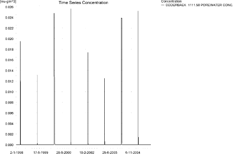
Figure 3.9. Example of Pore water concentration of spring-applied bromoxynil in the sandy catchment.
Figur 3.9. Porevandskoncentration for forårsudbragt bromoxynil i det sandede opland.
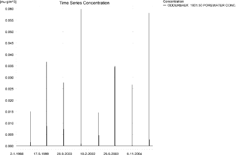
Figure 3.10. Example of Pore water concentration of autumn-applied bromoxynil in the sandy catchment.
Figur 3.10. Porevandskoncentration for efterårsudbragt bromoxynil i det sandede opland.
The global maximum value calculated by PestSurf for the sandy catchment in the water phase is 2.57 µg/l for the spring application and 4.61 µg/l for the autumn application. This is somewhat more than what is found in the D3-ditch scenario (0.759 and 1.143 µg/l for the spring and autumn-application, respectively). All maximum concentrations are reached through wind drift. The concentration in sediment in the D3-scenario is 0.31 and 0.57 µg/kg for the spring and autumn application, and thus much higher than the values calculated by Pestsurf.
Figure 3.11, Figure 3.12, Table 3.5 and Table 3.6 show the output of the PestSurf Excel template for the two applications of bromoxynil. The figure template works with pre-defined data extraction points. The plot requires specification of a “lowest detection value” (ldc) which defines when a pesticide occurrence is defined as an event. The time series plot is identical to the time series shown earlier, and the graph in the upper right corner resembles the plots in Figure 3.5 and Figure 3.6, but takes into account a longer period of time. A curve is generated when a downstream point reaches a concentration higher than the ldc. The programme then tracks the highest concentration for each calculation point in the stream within the last 24 hours. The plot in the lower right corner shows how many events have concentrations higher than a given toxicity value for the selected monitoring points. The curves are rather flat, showing little variation from year to year.
The tables shows part of the result sheet generated by the PestSurf Excel sheet based on the ldc-value. The selected table shows the point along the stream (of the pre-defined points) with the highest concentration.The highest concentration extracted by the PestSurf Excel sheet was 1.50 and 2.64 µg/l for the spring and autumn-simulation respectively. Thus, the pre-defined points have not caught the highest concentration of the simulation.
Click here to see Figure 3.11.
Figure 3.11. Overview for spring applied bromoxynil in the sandy catchment generated by the PestSurf excel template. The max concentrations generated over the 24 hours are similar to the overview in Figure 3.5. Detection value was set to 10 ng/l.
Figur 3.11. Oversigt for forårsudbragt bromoxynil i det sandede opland genereret med PestSurf-excel-skabelonen. Den maximale koncentration genereret over 24 timer svarer til oversigten i Figur 3.5. Detektionsgrænsen var sat til 10 ng/l.
Click here to see Figure 3.12.
Figure 3.12. Overview for autumn applied bromoxynil in the sandy catchment generated by the PestSurf excel template. The max concentrations generated over the 24 hours are similar to the overview in Figure 3.6. Detection value was set to 10 ng/l.
Figur 3.12. Oversigt for efterårsudbragt bromoxynil i det sandede opland genereret med PestSurf-excel-skabelonen. Den maximale koncentration genereret over 24 timer svarer til oversigten i Figur 3.5. Detektionsgrænsen var sat til 10 ng/l.
Table 3.5. Part of the result sheet generated by the PestSurf Excel sheet for the spring-application of bromoxynil. The selected table shows the point along the stream with the highest concentration recorded. Lowest detection value is set to 10 ng/l, toxicity to fish, daphnies and algae are set to 100, 1000 and 2000 ng/, respectively. The recorded peaks are shown in Figure 3.11.
Tabel 3.5. Uddrag af resultatpresentationen genereret af PestSurf-Excel-arket for forårsudbragt bromoxynil. Den udvalgte tabel viser det fordefinerede punkt langs med åen med højest koncentration. Detektionsgrænsen er sat til 10 mens toxicitetsværdierne for fisk, dafnier og alger er henholdsvis 100, 1000 og 2000 ng/l. De tabellerede hændelserne er vist i Figur 3.11.
Table 3.6. Part of the result sheet generated by the PestSurf Excel sheet for the autumn-application of bromoxynil. The selected table shows the point along the stream with the highest concentration recorded. The limiting values applied in the simulation is lowest detection valuε = 10 ng/l, toxicity to fish, daphnies and algae are set to 100, 1000 and 2000 ng/, respectively. The recorded peaks are shown in Figure 3.12.
Tabel 3.6. Uddrag af resultatpresentationen genereret af PestSurf-Excel-arket for efterårsudbragt bromoxynil. Den udvalgte tabel viser det fordefinerede punkt langs med åen med højest koncentration. Detektionsgrænsen er sat til 10 mens toxicitetsværdierne for fisk, dafnier og alger er henholdsvis 100, 1000 og 2000 ng/l. De tabellerede hændelserne er vist i Figur 3.11.
3.4.2 Sandy Catchment, pond
The concentration pattern is evaluated in the middle of the pond only, see Figure 3.13 and Figure 3.14. The pond receives drift and a contribution from groundwater. The drift peaks are just visible at the shown scale. The baseflow contribution is dominating the picture. The concentrations reached from a spring and and autumn application are almost identical, 0.311 and 0.462 µg/l, respectively. The peaks are caused by two different mechanisms. For the spring application, drainage causes the main peaks to occur. For the autumn application, the two highest peaks are caused by drift. The autumn is unusually dry this year and the water level in the pond is 10 cm at the time of spraying. The second highest peaks are caused by drainage. In both the spring and the autumn drainage case, rain occurs soon after spraying.
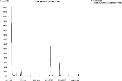
Figure 3.13. Concentrations of spring-applied bromoxynil in the sandy pond.
Figur 3.13. Koncentration af forårsudbragt bromoxynil i det sandede vandhul.
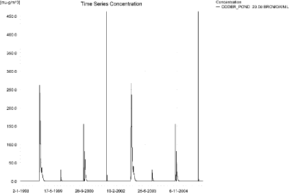
Figure 3.14. Concentrations of autumn-applied bromoxynil in the sandy pond.
Figur 3.14. Koncentration af efterårsudbragt bromoxynil i det sandede vandhul.
Table 3.7. Maximum concentrations of bromoxynil (ng/l) generated by drift and baseflow for the sandy pond for spring and autumn applications.
Tabel 3.7. Maximumskoncentrationer af bromoxynil (ng/l) genereret af drift og grundvandstilstrømning for det sandede vandhul for forårs- og efterårsudbringning.
| Year | Spring application | Autumn application | |||||
| Conc. | TWC | Date | Conc. | TWC | Date | ||
| 1998 | (global max) | 303 | 18-04-1998 | 261 | 12-11-1998 | ||
| 1 hour (after max) | 261 | 261 | |||||
| 1 day after sp.in. | 295 | 298 | 256 | 260 | |||
| 2 days | 257 | 283 | 230 | 247 | |||
| 4 days | 240 | 275 | 225 | 242 | |||
| 7 days | 193 | 249 | 173 | 223 | |||
| 1999 | (global max) | 65 | 18-04-1999 | 31 | 15-10-1999 | ||
| 1 hour (after max) | 24 | 25 | |||||
| 1 day after sp.in. | 64 | 65 | 17 | 20 | |||
| 2 days | 56 | 62 | 12 | 16 | |||
| 4 days | 51 | 60 | 10 | 15 | |||
| 7 days | 43 | 54 | 6 | 12 | |||
| 2000 | (global max) | 7 | 01-04-2000 | 155 | 14-10-2000 | ||
| 1 hour (after max) | 5 | 6 | 126 | 135 | |||
| 1 day after sp.in. | 5 | 5 | 54 | 78 | |||
| 2 days | 4 | 4 | 23 | 50 | |||
| 4 days | 3 | 4 | 16 | 42 | |||
| 7 days | 2 | 4 | 6 | 28 | |||
| 2001 | (global max) | 7 | 01-04-2001 | 462 | 16-10-2001 | ||
| 1 hour (after max) | 5 | 6 | 305 | 358 | |||
| 1 day after sp.in. | 5 | 5 | 76 | 134 | |||
| 2 days | 4 | 4 | 22 | 74 | |||
| 4 days | 3 | 4 | 12 | 59 | |||
| 7 days | 2 | 4 | 2 | 36 | |||
| 2002 | (global max) | 311 | 18-04-2002 | 267 | 12-11-2002 | ||
| 1 hour (after max) | 311 | 311 | 267 | 267 | |||
| 1 day after sp.in. | 303 | 306 | 257 | 265 | |||
| 2 days | 265 | 291 | 236 | 251 | |||
| 4 days | 248 | 282 | 231 | 247 | |||
| 7 days | 201 | 257 | 178 | 228 | |||
| 2003 | (global max) | 66 | 18-04-2003 | 31 | 15-10-2003 | ||
| 1 hour (after max) | 66 | 66 | 24 | 25 | |||
| 1 day after sp.in. | 65 | 66 | 17 | 20 | |||
| 2 days | 57 | 63 | 12 | 16 | |||
| 4 days | 52 | 61 | 10 | 15 | |||
| 7 days | 44 | 55 | 6 | 12 | |||
| 2004 | (global max) | 7 | 01-04-2004 | 155 | 14-10-2004 | ||
| 1 hour (after max) | 5 | 6 | 126 | 135 | |||
| 1 day after sp.in. | 5 | 5 | 54 | 78 | |||
| 2 days | 4 | 4 | 23 | 50 | |||
| 4 days | 3 | 4 | 16 | 42 | |||
| 7 days | 2 | 4 | 6 | 28 | |||
| 2005 | (global max) | 7 | 01-04-2005 | 462 | 16-10-2005 | ||
| 1 hour (after max) | 5 | 6 | 305 | 358 | |||
| 1 day after sp.in. | 5 | 5 | 76 | 134 | |||
| 2 days | 4 | 4 | 22 | 74 | |||
| 4 days | 3 | 4 | 12 | 59 | |||
| 7 days | 2 | 4 | 2 | 36 | |||
| Global max | 311 | 462 | |||||
| 1 hour (after max) | 311 | 311 | 305 | 358 | |||
| 1 day after sp.in. | 303 | 306 | 257 | 265 | |||
| 2 days | 265 | 291 | 236 | 251 | |||
| 4 days | 248 | 282 | 231 | 247 | |||
| 7 days | 201 | 257 | 178 | 228 | |||
The sorption to macrophytes is shown in Figure 3.15 and Figure 3.16. The maximum sorption is 0.27 and 0.35 ng/l, respectively, which is negligible compared to the concentration in the water phase. The max. concentrations reached for pore water concentration was 0.20 and 1.18 ng/l for the spring and autumn-application, respectively, see Figure 3.17 and Figure 3.19. No significant amounts were adsorbed to sediment, as shown in Figure 3.18 and Figure 3.20. The resulting sediment concentrations become 1.2 and 7.1 ng/kg, respectively.
Compared to the FOCUS D3-ditch, the concentration in the PestSurf sandy pond is slightly lower, 0.311 µg/l compared to 0.759 µg/l – for the spring-application and 0.462 µg/l compared to 1.143 µg/l for the autumn-application. In the pond-case, there is no difference between the results of PestSurf and the results extracted by the templates.
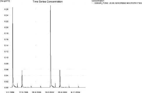
Figure 3.15. Sorption of spring-applied bromoxynil to macrophytes in the sandy pond.
Figur 3.15. Sorption af forårsudbragt bromoxynil til makrofytter i det sandede vandhul.
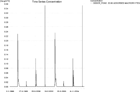
Figure 3.16. Sorption of autumn-applied bromoxynil to macrophytes in the sandy pond.
Figur 3.16. Sorption af efterårsudbragt bromoxynil til makrofytter i det sandede vandhul.
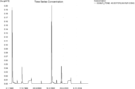
Figure 3.17. Pore water concentration of spring-applied bromoxynil in the sandy pond.
Figur 3.17. Porevandskoncentration af forårsudbragt bromoxynil i det sandede vandhul.
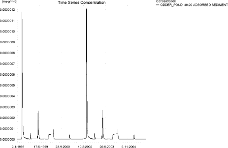
Figure 3.18. Sorption of spring-applied bromoxynil to sediment in the sandy pond. The concentration is in µg/g sediment and not µg/m³ as stated.
Figur 3.18. Sorption af forårsudbragt bromoxynil på sediment i det sandede vandhul. Koncentrationen er i µg/g sediment og ikke µg/m³ som angivet.
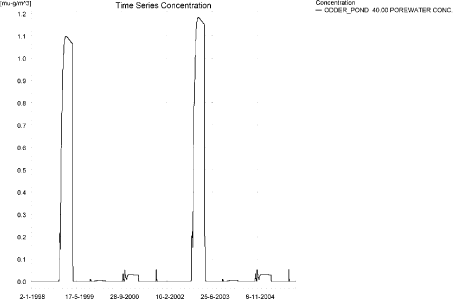
Figure 3.19. Pore water concentration of autumn-applied bromoxynil in the sandy pond.
Figur 3.19. Porevandskoncentration af efterårsudbragt bromoxynil i det sandede vandhul.
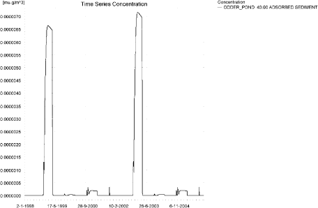
Figure 3.20. Sorption of autumn-applied bromoxynil to sediment in the sandy pond. The concentration is in µg/g sediment and not µg/m³ as stated.
Figur 3.20. Sorption af efterårsårsudbragt bromoxynil på sediment i det sandede vandhul. Koncentrationen er i µg/g sediment og ikke µg/m³ som angivet.
Click here to see Figure 3.21.
Figure 3.21. Overview for spring-applied bromoxynil in the sandy pond generated by the PestSurf excel template. The time series shown is identical to the one in Figure 3.13. The lowest detection value is 0.1 ng/l.
Figur 3.21. Oversigt for forårsudbragt bromoxynil i det sandede vandhul genereret med PestSurf-excel-skabelonen. Den viste tidsserie er mage til den i Figur 3.13. Detektionsgrænsen er sat til 0.1 ng/l.
Click here to see Figure 3.22.
Figure 3.22. Overview for autumn-applied bromoxynil in the sandy pond generated by the PestSurf excel template.. The time series shown is identical to the one in Figure 3.14. The lowest detection value is 0.1 ng/l.
Figur 3.22. Oversigt for efterårsudbragt bromoxynil i det sandede vandhul genereret med PestSurf-excel-skabelonen. Den viste tidsserie er mage til den i Figur 3.13. Detektionsgrænsen er sat til 0.1 ng/l.
Table 3.8. Part of the result sheet generated by the PestSurf Excel sheet, applied to the spring application of bromoxynil. The limiting value used for generation of the table is 0.1 ng/l. Lowest effect value for fish, daphnies and algaes were set to 1, 10 and 100 ng/l, respectively. The recorded peaks are shown in Figure 3.21.
Tabel 3.8. Uddrag af resultatpresentationen genereret af PestSurf-Excel-arket. Grænseværdien anvendt til generering af tabellen er 0.1 ng/l mens toxicitetsværdierne for fisk, dafnier og alger er henholdsvis 1, 10 og 100 ng/l. De tabellerede hændelser er vist i Figur 3.21.
Table 3.9. Part of the result sheet generated by the PestSurf Excel sheet, applied to the autumn application of bromoxynil. The limiting value used for generation of the table is 0.1 ng/l. Lowest effect value for fish, daphnies and algaes were set to 1, 10 and 100 ng/l, respectively. The recorded peaks are shown in Figure 3.22.
Tabel 3.9. Uddrag af resultatpresentationen genereret af PestSurf-Excel-arket. Grænseværdien anvendt til generering af tabellen er 0.1 ng/l mens toxicitetsværdierne for fisk, dafnier og alger er henholdsvis 1, 10 og 100 ng/l. De tabellerede hændelser er vist i Figur 3.21.
3.4.3 Sandy Loam Catchment, stream
The distribution of concentrations was assessed in several steps. First, the maximum concentrations at each calculation point were listed, and the dates for the occurrence of the maximum was assessed. The points, for which the maximum value also represents a local maximum were selected for further analysis. The relevant values are listed in Table 3.10.
All maximum values are caused by drift and are due to the assumption that all agricultural land is sprayed within 30 minutes. The maximum values are reached during a period with low flow in the stream. To illustrate that the level of magnitude is correct, the following calculation can be carried out: The amount sprayed for the spring application is 0.12 kg a.s./ha, equal to 12 µg/m². With a buffer zone of 1.5 m, 2.11 % reaches the stream. This equals 0.253 µg/m². The water depth between Ovrelillebaek 0 and 250 m varies between 3.5 and 6 cm, increasing to 8.5 at 300 m and 16.5 cm at the end of the stream. 0.253 µg/m² / 0.06 m equals 4.2 µg/l. The maximum values reached further downstream occurs when water, already loaded with pesticide, continues to receive drift. For 7.10. 1997, the water levels are about half of these values and the dosage is higher. The cross section in the upstream end is triangular.
Time series for the spring application are shown in Figure 3.23 and Figure 3.24, and for the autumn application in Figure 3.25 and Figure 3.26.
Table 3.10. Maximum concentrations (ng/l) of bromoxynil simulated for each calculation point in the sandy loam catchment, for spring and autumn applications respectively.
Tabel 3.10. Maximumskoncentrationer (ng/l) af bromoxynil simuleret for hvert beregningspunkt i morænelersoplandet, for henholdsvis forårs- og efterårsudbringingen.
| BROMOXYNIL | Spring Application | Autumn Application | ||||
| Maximum | Max.Time | Local Maxima | Maximum | Max.Time | Local Maxima | |
| ALBJERGBAEK 0.00 | 4 | 02-04-1996 20:00 | 1 | 09-10-2001 15:00 | ||
| ALBJERGBAEK 150.00 | 7 | 03-04-1996 05:00 | 1 | 09-10-2001 16:00 | ||
| ALBJERGBAEK 300.00 | 5 | 05-04-1996 20:00 | 5 | 07-10-1994 09:09 | ||
| ALBJERGBAEK 450.00 | 5 | 05-04-1996 21:00 | 1 | 09-10-2001 21:00 | ||
| ALBJERGBAEK 600.00 | 2076 | 31-03-2000 09:00 | 4012 | 07-10-1997 12:00 | ||
| ELHOLTBAEK 0.00 | 4 | 31-03-2001 09:00 | 8 | 07-10-1995 09:19 | ||
| ELHOLTBAEK 165.00 | 2 | 02-04-1996 20:00 | 0 | 08-10-2001 05:00 | ||
| ELHOLTBAEK 330.00 | 1652 | 31-03-2001 08:40 | 3347 | 07-10-1997 08:49 | ||
| FREDLIGBAEK 0.00 | 2 | 02-04-1996 18:00 | 0 | 09-10-2001 03:00 | ||
| FREDLIGBAEK 100.00 | 3 | 02-04-1996 18:00 | 0 | 30-10-1998 16:00 | ||
| FREDLIGBAEK 200.00 | 3 | 02-04-1996 18:00 | 0 | 30-10-1998 04:00 | ||
| FREDLIGBAEK 300.00 | 3 | 02-04-1996 18:00 | 0 | 30-10-1998 04:00 | ||
| FREDLIGBAEK 400.00 | 3 | 02-04-1996 18:00 | 0 | 30-10-1998 04:00 | ||
| FREDLIGBAEK 500.00 | 3 | 02-04-1996 18:00 | 0 | 30-10-1998 04:00 | ||
| FREDLIGBAEK 600.00 | 7 | 01-04-1998 00:40 | 7 | 07-10-1994 09:00 | ||
| FREDLIGBAEK 667.50 | 3 | 02-04-1996 19:00 | 3 | 10-10-1997 11:00 | ||
| FREDLIGBAEK 735.00 | 3440 | 31-03-2000 08:40 | x | 6199 | 07-10-1995 09:10 | |
| GROFTEBAEK 0.00 | 1 | 02-04-1996 17:00 | 0 | 11-10-1997 02:00 | ||
| GROFTEBAEK 155.00 | 3 | 02-04-1996 17:00 | 1 | 09-10-2001 21:00 | ||
| GROFTEBAEK 310.00 | 11 | 31-03-2000 09:19 | 13 | 07-10-1996 09:00 | ||
| GROFTEBAEK 465.00 | 2 | 02-04-1996 14:00 | 0 | 31-10-1998 07:00 | ||
| GROFTEBAEK 620.00 | 2845 | 31-03-2000 08:40 | 8240 | 07-10-1997 09:00 | x | |
| STENSBAEK 0.00 | 9 | 02-04-1996 17:00 | 142 | 09-10-2001 04:00 | ||
| STENSBAEK 125.00 | 14 | 03-04-1996 05:00 | 111 | 09-10-2001 05:00 | ||
| STENSBAEK 250.00 | 4 | 02-04-1996 18:00 | 47 | 09-10-2001 06:00 | ||
| STENSBAEK 412.50 | 4 | 02-04-1996 19:00 | 32 | 09-10-2001 07:00 | ||
| STENSBAEK 575.00 | 700 | 31-03-2000 09:19 | 2468 | 07-10-1997 14:00 | ||
| OVRELILLEBAEK 0.00 | 5 | 02-04-1996 22:00 | 0 | 11-12-2001 00:00 | ||
| OVRELILLEBAEK 125.00 | 4447 | 31-03-2000 08:30 | 6638 | 07-10-1995 08:30 | ||
| OVRELILLEBAEK 250.00 | 3490 | 31-03-2000 08:30 | 7188 | 07-10-1997 08:49 | ||
| OVRELILLEBAEK 290.00 | 5037 | 31-03-2000 08:30 | x | 9334 | 07-10-1996 10:00 | x |
| OVRELILLEBAEK 330.00 | 2076 | 31-03-2000 09:00 | 4012 | 07-10-1997 12:00 | ||
| OVRELILLEBAEK 330.00 | 2076 | 31-03-2000 09:00 | 4012 | 07-10-1997 12:00 | ||
| OVRELILLEBAEK 352.50 | 2632 | 31-03-2000 09:10 | 5296 | 07-10-1995 12:00 | ||
| OVRELILLEBAEK 375.00 | 700 | 31-03-2000 09:19 | 2468 | 07-10-1997 14:00 | ||
| OVRELILLEBAEK 375.00 | 700 | 31-03-2000 09:19 | 2468 | 07-10-1997 14:00 | ||
| OVRELILLEBAEK 437.50 | 776 | 31-03-2001 09:10 | 4142 | 07-10-1997 08:30 | ||
| OVRELILLEBAEK 500.00 | 1590 | 31-03-2000 08:30 | 6781 | 07-10-1997 08:30 | ||
| OVRELILLEBAEK 625.00 | 3132 | 31-03-2000 08:30 | x | 7735 | 07-10-1996 08:39 | |
| OVRELILLEBAEK 750.00 | 2046 | 31-03-2000 08:30 | 5100 | 07-10-1997 08:30 | ||
| OVRELILLEBAEK 855.00 | 2725 | 31-03-2000 08:30 | 7410 | 07-10-1997 08:30 | ||
| OVRELILLEBAEK 960.00 | 1652 | 31-03-2001 08:40 | 3347 | 07-10-1997 08:49 | ||
| OVRELILLEBAEK 960.00 | 1652 | 31-03-2001 08:40 | 3347 | 07-10-1997 08:49 | ||
| OVRELILLEBAEK 980.00 | 1751 | 31-03-2000 08:40 | 3580 | 07-10-1997 08:49 | ||
| OVRELILLEBAEK 1000.00 | 1456 | 31-03-2001 08:40 | 2964 | 07-10-1997 09:00 | ||
| OVRELILLEBAEK 1062.50 | 1481 | 31-03-2001 08:49 | 2838 | 07-10-1997 09:00 | ||
| OVRELILLEBAEK 1125.00 | 1379 | 31-03-2001 08:49 | 3797 | 07-10-1997 08:30 | ||
| OVRELILLEBAEK 1187.50 | 1579 | 31-03-2000 08:30 | 4956 | 07-10-1997 08:30 | ||
| OVRELILLEBAEK 1250.00 | 1525 | 31-03-2000 08:30 | 6032 | 07-10-1997 08:30 | ||
| OVRELILLEBAEK 1425.00 | 2211 | 31-03-2000 08:30 | x | 7287 | 07-10-1997 08:30 | x |
| OVRELILLEBAEK 1600.00 | 1905 | 31-03-2000 08:30 | 5690 | 07-10-1997 08:30 | ||
| OVRELILLEBAEK 1650.00 | 2316 | 31-03-2000 08:30 | 7038 | 07-10-1997 08:40 | ||
| OVRELILLEBAEK 1700.00 | 1829 | 31-03-2000 08:40 | 4074 | 07-10-1997 09:19 | ||
| NEDRELILLEBAEK 0.00 | 1829 | 31-03-2000 08:40 | 4074 | 07-10-1997 09:19 | ||
| NEDRELILLEBAEK 135.00 | 1987 | 31-03-2000 08:30 | 4187 | 07-10-1997 08:30 | ||
| NEDRELILLEBAEK 270.00 | 2587 | 31-03-2000 08:30 | 7046 | 07-10-1997 08:30 | ||
| NEDRELILLEBAEK 330.00 | 3132 | 31-03-2000 08:30 | 8015 | 07-10-1997 08:30 | ||
| NEDRELILLEBAEK 390.00 | 3155 | 31-03-2000 08:30 | 7119 | 07-10-1997 08:40 | ||
| NEDRELILLEBAEK 495.50 | 4391 | 31-03-2000 08:30 | x | 8448 | 07-10-1995 08:40 | x |
| NEDRELILLEBAEK 601.00 | 3440 | 31-03-2000 08:40 | 6199 | 07-10-1995 09:10 | ||
| NEDRELILLEBAEK 601.00 | 3440 | 31-03-2000 08:40 | 6199 | 07-10-1995 09:10 | ||
| NEDRELILLEBAEK 693.00 | 3454 | 31-03-2000 08:49 | 6011 | 07-10-1996 09:50 | ||
| NEDRELILLEBAEK 785.00 | 3286 | 31-03-2000 09:00 | 9696 | 07-10-1997 08:30 | ||
| NEDRELILLEBAEK 847.00 | 4120 | 31-03-2000 08:30 | x | 13367 | 07-10-1997 08:30 | x |
| NEDRELILLEBAEK 909.00 | 2845 | 31-03-2000 08:40 | 8240 | 07-10-1997 09:00 | ||
| NEDRELILLEBAEK 909.00 | 2845 | 31-03-2000 08:40 | 8240 | 07-10-1997 09:00 | ||
| NEDRELILLEBAEK 984.50 | 2808 | 31-03-2000 09:19 | 7601 | 07-10-1997 09:19 | ||
| NEDRELILLEBAEK 1060.00 | 3409 | 31-03-2000 08:30 | 10891 | 07-10-1997 08:30 | ||
| NEDRELILLEBAEK 1169.50 | 4220 | 31-03-2000 08:30 | 13147 | 07-10-1997 08:30 | ||
| NEDRELILLEBAEK 1279.00 | 6000 | 31-03-2000 08:30 | x | 17805 | 07-10-1997 08:40 | x |
| NEDRELILLEBAEK 1409.50 | 4954 | 31-03-2000 08:40 | 8586 | 07-10-1996 09:09 | ||
| NEDRELILLEBAEK 1540.00 | 3541 | 31-03-2000 09:19 | 5512 | 07-10-1996 11:00 | ||
| Global max | 6000 | 17805 | ||||
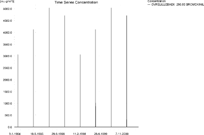
Figure 3.23. Concentration pattern for the spring application of bromoxynil in the upstream end of the sandy loam catchment, 290 m from the upstream end.
Figur 3.23. Koncentrationsmønster for forårsudbragt bromoxynil i den opstrøms ende af morænelersoplandet, 290 m fra den opstrøms ende.
<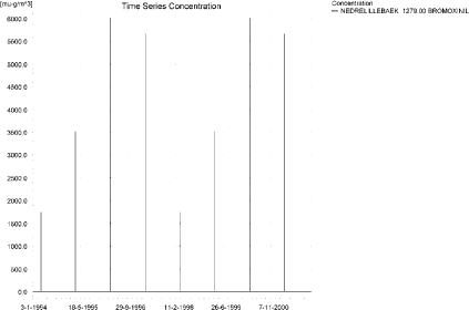 /p>
/p>
Figure 3.24. Concentration pattern for the spring application of bromoxynil in the lower end of the sandy loam catchment.
Figur 3.24. Koncentrationsmønster for forårsudbragt bromoxynil i den opstrøms ende af morænelersoplandet, 290 m fra den opstrøms ende.
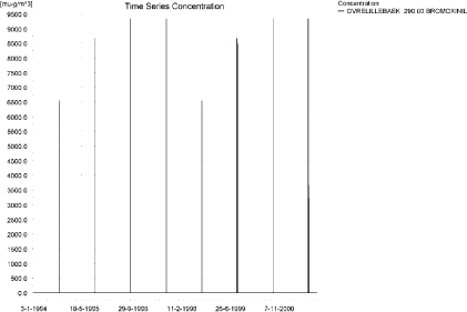
Figure 3.25. Concentration pattern for the autumn application of bromoxynil in the upstream end of the sandy loam catchment.
Figur 3.25. Koncentrationsmønster for efterårsudbragt bromoxynil i den opstrøms ende af morænelersoplandet.
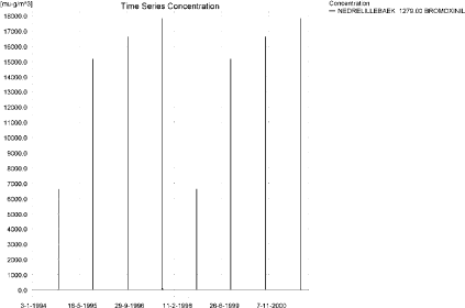
Figure 3.26. Concentration pattern for the autumn application of bromoxynil in the downstream end of the sandy loam catchment.
Figur 3.26. Koncentrationsmønster for efterårsudbragt bromoxynil i den nedstrøms ende af morænelersoplandet.
The longitudinal profile of the concentrations in the sandy loam catchment is shown in Figure 3.27 for the spring-application and Figure 3.28 for the autumn-application, respectively. The thin black line represents the concentration, while the thick black line shows the maximum concentrations obtained during the simulations. In addition, the outline of the stream is shown.
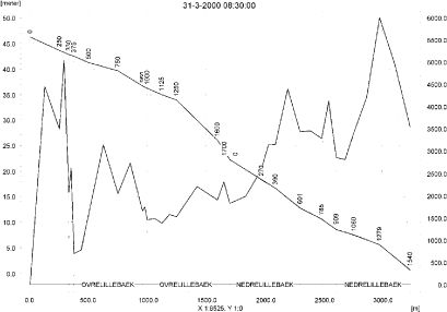
Figure 3.27. Concentrations in the sandy loam catchment on 31. March 2000 after spring applications. The concentrations are generated by wind drift.
Figur 3.27. Koncentrationer i morænelersoplandet den 31 marts-2000. efter forårsudbringning. Koncentrationerne genereres af vinddrift.
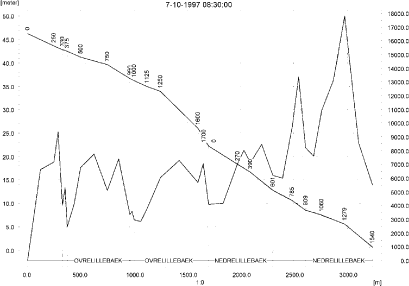
Figure 3.28. Concentrations in the sandy loam catchment on 7.October 1997 after autumn application.
Figur 3.28. Koncentrationer i morænelersoplandet den 7. oktober-1997. efter efterårsårsudbringning.
To be able to extract comparable values to FOCUS SW, the global maxima and time weighted concentrations (up to 7 days) were extracted when these were meaningful.
Figure 3.29 to Figure 3.32 show the concentrations sorbed to macrophytes, which had a maximum of 14 ng/l and 25 ng/l for the spring and autumn-application, respectively. The pattern follows the pattern of the water concentrations. The concentrations are insignificant compared to the concentrations in the water phase.
Figure 3.33 and Figure 3.34 show the concentration of bromoxynil in porewater at the place of maximum concentration. Figure 3.35 and Figure 3.36 show the corresponding concentration of bromoxynil adsorbed to sediment. The concentrations are quite low, 2.8 and 7.3 ng/kg, respectively.
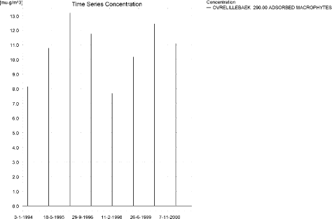
Figure 3.29. Concentration on macrophytes in ng/l in the upper part of the sandy loam catchment (290 m from the upstream end) after spring application of bromoxynil.
Figur 3.29. Koncentration på makrofytter 290 m fra opstrøms ende af morænelersoplandet efter forårsudbringning af bromoxynil.
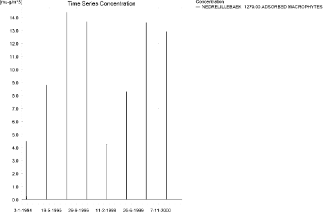
Figure 3.30. Concentration on macrophytes near the bottom of the sandy loam catchment after spring application of bromoxynil.
Figur 3.30. Koncentration på makrofytter nær udløbet fra morænelersoplandet efter forårsudbringning af bromoxynil.
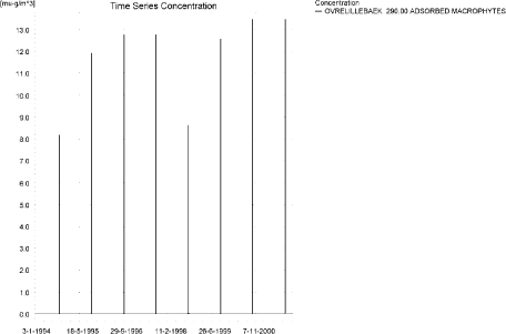
Figure 3.31. Concentration on macrophytes in ng/l in the upper part of the sandy loam catchment after autumn application of bromoxynil (290 m from the upstream end).
Figur 3.31. Koncentration på makrofytter 290 m fra opstrøms ende af morænelersoplandet efter efterårsudbringning af bromoxynil.
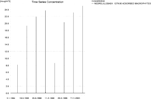
Figure 3.32. Concentration on macrophytes in at the end of the sandy loam catchment after autumn application of bromoxynil.
Figur 3.32. Koncentration på makrofytter nær udløbet fra morænelersoplandet efter efterårsudbringning af bromoxynil.
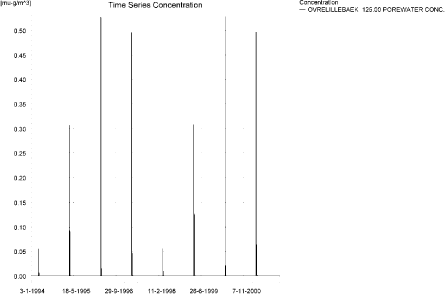
Figure 3.33. Pore water concentration of spring-applied bromoxynil in the sandy loam catchment.
Figur 3.33. Porevandskoncentration af forårsudbragt bromoxynil i morænelersoplandet.
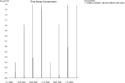
Figure 3.34. Pore water concentration of autumn-applied bromoxynil in the sandy loam catchment.
Figur 3.34. Porevandskoncentration af efterårsudbragt bromoxynil i morænelersoplandet.

Figure 3.35. Sediment concentration of spring-applied bromoxynil in the sandy loam catchment. Note that the concentration is in µg/g sediment and not µg/m² as indicated.
Figur 3.35. sedimentkoncentrations for forårsudbragt bromoxynil i morænelersoplandet. Bemærk at koncentrationen er i µg/g sediment og ikke µg/m³ som angivet.
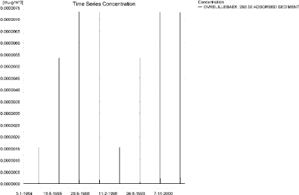
Figure 3.36. Sediment concentration of autumn-applied bromoxynil in the sandy loam catchment. Note that the concentration is in µg/g sediment and not µg/m² as indicated.
Figur 3.36. sedimentkoncentrations for efterårsudbragt bromoxynil i morænelersoplandet. Bemærk at koncentrationen er i µg/g sediment og ikke µg/m³ som angivet.
The FOCUS SW-D4 stream-scenario generates concentrations of 0.603 and 0.987 µg/l, for spring and autumn applications, respectively. PestSurf generates concentrations of 6.00 and 17.8 µg/l for the same applications. The difference in water depth account for a factor 2-5 and 3.5-10, respectively, and the contribution from the whole catchment explains the rest of the difference between the two models. The sediment concentrations are much lower in PestSurf, 3 and 7 ng/kg compared to 29 and 176 ng/kg in FOCUS for the two application times, respectively.
In comparison, drainage events resulted, at maximum, in concentrations of 14 and 142 ng/l, in both cases caused by rainfall occurring just after spraying.
Figure 3.37 to Figure 3.40 and Table 3.13 to Table 3.16 show the results as generated by the PestSurf templates. The maximum value generated by the templates for the upper part of the stream is 2.32 and 7.04 µg/l for the spring and the autumn-application, respectively, and for the lower part, 6.00 and 17.8 µg/l, respectively. In this case, the templates thus catch the actual maximum values simulated.
Table 3.11. Maximum concentrations (ng/l) of spring-applied bromoxynil simulated for selected calculation point in the sandy loam catchment.
Tabel 3.11. Maximum-koncentrationer (ng/l) af forårsudbragt bromoxynil beregnet for udvalgte lokaliteter i morænelersoplandet.
| Year | FREDLIGBAEK 735.00 | OVRELILLEBAEK 290.00 | OVRELILLEBAEK 625.00 | OVRELILLEBAEK 1425.00 | |||||||||
| Conc. | TWA | Date | Conc. | TWA | Date | Conc. | TWA | Date | Conc. | TWA | Date | ||
| 1994 | 1994 (global max) | 1143 | 02-04-1994 | 3060 | 02-04-1994 | 763 | 02-04-1994 | 876 | 02-04-1994 | ||||
| 1 hour (after max) | 333 | 664 | 495 | 1566 | 165 | 306 | 116 | 485 | |||||
| 1 day after sp.in. | 0 | 35 | 0 | 80 | 0 | 17 | 0 | 26 | |||||
| 2 days | 0 | 11 | 0 | 26 | 0 | 6 | 0 | 9 | |||||
| 4 days | 0 | 9 | 0 | 20 | 0 | 4 | 0 | 6 | |||||
| 7 days | 0 | 5 | 0 | 11 | 0 | 2 | 0 | 4 | |||||
| 1995 | 1995 (global max) | 2135 | 01-04-1995 | 4119 | 01-04-1995 | 1463 | 01-04-1995 | 1438 | 01-04-1995 | ||||
| 1 hour (after max) | 731 | 1258 | 1813 | 2954 | 305 | 505 | 595 | 1008 | |||||
| 1 day after sp.in. | 0 | 88 | 1 | 335 | 0 | 45 | 0 | 55 | |||||
| 2 days | 0 | 29 | 0 | 110 | 0 | 15 | 0 | 18 | |||||
| 4 days | 0 | 21 | 0 | 82 | 0 | 11 | 0 | 13 | |||||
| 7 days | 0 | 12 | 0 | 47 | 0 | 6 | 0 | 8 | |||||
| 1996 | 1996 (global max) | 3439 | 01-04-1996 | 5036 | 01-04-1996 | 3132 | 01-04-1996 | 2211 | 01-04-1996 | ||||
| 1 hour (after max) | 1423 | 2281 | 2208 | 3692 | 401 | 1423 | 1103 | 1335 | |||||
| 1 day after sp.in. | 1 | 147 | 7 | 578 | 4 | 158 | 1 | 99 | |||||
| 2 days | 1 | 49 | 0 | 191 | 1 | 53 | 1 | 34 | |||||
| 4 days | 1 | 37 | 0 | 143 | 1 | 40 | 1 | 25 | |||||
| 7 days | 0 | 21 | 0 | 81 | 0 | 23 | 0 | 15 | |||||
| 1997 | 1997 (global max) | 3233 | 01-04-1997 | 4710 | 01-04-1997 | 2646 | 01-04-1997 | 2023 | 01-04-1997 | ||||
| 1 hour (after max) | 1306 | 2136 | 1518 | 2835 | 509 | 1098 | 1090 | 1278 | |||||
| 1 day after sp.in. | 2 | 136 | 28 | 460 | 6 | 122 | 2 | 89 | |||||
| 2 days | 0 | 45 | 0 | 153 | 0 | 41 | 0 | 29 | |||||
| 4 days | 0 | 33 | 0 | 115 | 0 | 30 | 0 | 22 | |||||
| 7 days | 0 | 19 | 0 | 66 | 0 | 17 | 0 | 13 | |||||
| 1998 | 1998 (global max) | 1143 | 01-04-1998 | 3060 | 01-04-1998 | 763 | 01-04-1998 | 876 | 01-04-1998 | ||||
| 1 hour (after max) | 333 | 663 | 495 | 1566 | 165 | 306 | 116 | 486 | |||||
| 1 day after sp.in. | 0 | 35 | 0 | 80 | 0 | 17 | 0 | 26 | |||||
| 2 days | 0 | 11 | 0 | 26 | 0 | 6 | 0 | 9 | |||||
| 4 days | 0 | 8 | 0 | 20 | 0 | 4 | 0 | 6 | |||||
| 7 days | 0 | 5 | 0 | 11 | 0 | 2 | 0 | 4 | |||||
| 1999 | 1999 (global max) | 2135 | 31-03-1999 | 4120 | 31-03-1999 | 1463 | 31-03-1999 | 1438 | 31-03-1999 | ||||
| 1 hour (after max) | 732 | 1257 | 1813 | 2956 | 305 | 506 | 595 | 1009 | |||||
| 1 day after sp.in. | 0 | 88 | 1 | 335 | 0 | 45 | 0 | 55 | |||||
| 2 days | 0 | 29 | 0 | 110 | 0 | 15 | 0 | 18 | |||||
| 4 days | 0 | 21 | 0 | 83 | 0 | 11 | 0 | 13 | |||||
| 7 days | 0 | 12 | 0 | 47 | 0 | 6 | 0 | 8 | |||||
| 2000 | 2000 (global max) | 3440 | 31-03-2000 | 5037 | 31-03-2000 | 3132 | 31-03-2000 | 2211 | 31-03-2000 | ||||
| 1 hour (after max) | 1155 | 2113 | 2208 | 3697 | 401 | 1426 | 1103 | 1336 | |||||
| 1 day after sp.in. | 1 | 147 | 7 | 579 | 4 | 158 | 1 | 99 | |||||
| 2 days | 1 | 49 | 0 | 191 | 1 | 53 | 1 | 34 | |||||
| 4 days | 1 | 37 | 0 | 143 | 1 | 40 | 1 | 25 | |||||
| 7 days | 0 | 21 | 0 | 82 | 0 | 23 | 0 | 15 | |||||
| 2001 | 2001 (global max) | 3234 | 31-03-2001 | 4711 | 31-03-2001 | 2646 | 31-03-2001 | 2024 | 31-03-2001 | ||||
| 1 hour (after max) | 1027 | 1971 | 1518 | 2839 | 510 | 1100 | 1090 | 1279 | |||||
| 1 day after sp.in. | 2 | 136 | 28 | 461 | 6 | 122 | 2 | 89 | |||||
| 2 days | 0 | 45 | 0 | 154 | 0 | 41 | 0 | 29 | |||||
| 4 days | 0 | 33 | 0 | 115 | 0 | 30 | 0 | 22 | |||||
| 7 days | 0 | 19 | 0 | 66 | 0 | 17 | 0 | 13 | |||||
| Global max | 3440 | 5037 | 3132 | 2211 | |||||||||
| 1 hour (after max) | 1423 | 2281 | 2208 | 3697 | 510 | 1426 | 1103 | 1336 | |||||
| 1 day after sp.in. | 2 | 147 | 28 | 579 | 6 | 158 | 2 | 99 | |||||
| 2 days | 1 | 49 | 0 | 191 | 1 | 53 | 1 | 34 | |||||
| 4 days | 1 | 37 | 0 | 143 | 1 | 40 | 1 | 25 | |||||
| 7 days | 0 | 21 | 0 | 82 | 0 | 23 | 0 | 15 | |||||
Table 3.11 –continued. Maximum concentrations (ng/l) of spring-applied bromoxynil simulated for selected calculation point in the sandy loam catchment.
Tabel 3.11. Maximum-koncentrationer (ng/l) af forårsudbragt bromoxynil beregnet for udvalgte lokaliteter i morænelersoplandet.
| Year | NEDRELILLEBAEK 495.50 | NEDRELILLEBAEK 847.00 | NEDRELILLEBAEK 1279.00 | |||||||
| Conc. | TWA | Date | Conc. | TWA | Date | Conc. | TWA | Date | ||
| 1994 | 1994 (global max) | 1405 | 02-04-1994 | 1450 | 02-04-1994 | 1741 | 02-04-1994 | |||
| 1 hour (after max) | 438 | 779 | 538 | 933 | 706 | 1049 | ||||
| 1 day after sp.in. | 0 | 41 | 0 | 54 | 0 | 70 | ||||
| 2 days | 0 | 13 | 0 | 18 | 0 | 23 | ||||
| 4 days | 0 | 10 | 0 | 13 | 0 | 17 | ||||
| 7 days | 0 | 6 | 0 | 8 | 0 | 10 | ||||
| 1995 | 1995 (global max) | 2653 | 01-04-1995 | 2452 | 01-04-1995 | 3511 | 01-04-1995 | |||
| 1 hour (after max) | 861 | 1523 | 1300 | 1946 | 1827 | 1896 | ||||
| 1 day after sp.in. | 0 | 95 | 0 | 123 | 0 | 146 | ||||
| 2 days | 0 | 31 | 0 | 41 | 0 | 48 | ||||
| 4 days | 0 | 23 | 0 | 30 | 0 | 36 | ||||
| 7 days | 0 | 13 | 0 | 17 | 0 | 21 | ||||
| 1996 | 1996 (global max) | 4391 | 01-04-1996 | 4120 | 01-04-1996 | 5999 | 01-04-1996 | |||
| 1 hour (after max) | 1525 | 2468 | 2419 | 3253 | 2159 | 3058 | ||||
| 1 day after sp.in. | 1 | 156 | 0 | 228 | 1 | 261 | ||||
| 2 days | 1 | 52 | 1 | 76 | 1 | 87 | ||||
| 4 days | 1 | 39 | 1 | 57 | 1 | 65 | ||||
| 7 days | 0 | 23 | 0 | 33 | 0 | 37 | ||||
| 1997 | 1997 (global max) | 4095 | 01-04-1997 | 3785 | 01-04-1997 | 5658 | 01-04-1997 | |||
| 1 hour (after max) | 1402 | 2320 | 2195 | 3029 | 2103 | 2859 | ||||
| 1 day after sp.in. | 2 | 148 | 2 | 207 | 2 | 245 | ||||
| 2 days | 0 | 49 | 0 | 68 | 0 | 81 | ||||
| 4 days | 0 | 36 | 0 | 51 | 0 | 60 | ||||
| 7 days | 0 | 21 | 0 | 29 | 0 | 34 | ||||
| 1998 | 1998 (global max) | 1405 | 01-04-1998 | 1450 | 01-04-1998 | 1742 | 01-04-1998 | |||
| 1 hour (after max) | 438 | 779 | 538 | 934 | 706 | 1050 | ||||
| 1 day after sp.in. | 0 | 41 | 0 | 54 | 0 | 70 | ||||
| 2 days | 0 | 13 | 0 | 18 | 0 | 23 | ||||
| 4 days | 0 | 10 | 0 | 13 | 0 | 17 | ||||
| 7 days | 0 | 6 | 0 | 8 | 0 | 10 | ||||
| 1999 | 1999 (global max) | 2653 | 31-03-1999 | 2452 | 31-03-1999 | 3511 | 31-03-1999 | |||
| 1 hour (after max) | 862 | 1525 | 1301 | 1948 | 1828 | 1897 | ||||
| 1 day after sp.in. | 0 | 95 | 0 | 123 | 0 | 146 | ||||
| 2 days | 0 | 31 | 0 | 41 | 0 | 48 | ||||
| 4 days | 0 | 23 | 0 | 30 | 0 | 36 | ||||
| 7 days | 0 | 13 | 0 | 17 | 0 | 21 | ||||
| 2000 | 2000 (global max) | 4391 | 31-03-2000 | 4120 | 31-03-2000 | 6000 | 31-03-2000 | |||
| 1 hour (after max) | 1526 | 2472 | 2420 | 3258 | 2160 | 3062 | ||||
| 1 day after sp.in. | 1 | 156 | 0 | 228 | 1 | 262 | ||||
| 2 days | 1 | 52 | 1 | 76 | 1 | 87 | ||||
| 4 days | 1 | 39 | 1 | 57 | 1 | 65 | ||||
| 7 days | 0 | 23 | 0 | 33 | 0 | 37 | ||||
| 2001 | 2001 (global max) | 4096 | 31-03-2001 | 3786 | 31-03-2001 | 5659 | 31-03-2001 | |||
| 1 hour (after max) | 1402 | 2323 | 2195 | 3034 | 2104 | 2862 | ||||
| 1 day after sp.in. | 2 | 148 | 2 | 207 | 2 | 245 | ||||
| 2 days | 0 | 49 | 0 | 68 | 0 | 81 | ||||
| 4 days | 0 | 36 | 0 | 51 | 0 | 60 | ||||
| 7 days | 0 | 21 | 0 | 29 | 0 | 34 | ||||
| Global max | 4391 | 4120 | 6000 | |||||||
| 1 hour (after max) | 1526 | 2472 | 2420 | 3258 | 2160 | 3062 | ||||
| 1 day after sp.in. | 2 | 156 | 2 | 228 | 2 | 262 | ||||
| 2 days | 1 | 52 | 1 | 76 | 1 | 87 | ||||
| 4 days | 1 | 39 | 1 | 57 | 1 | 65 | ||||
| 7 days | 0 | 23 | 0 | 33 | 0 | 37 | ||||
Table 3.12. Maximum concentrations (ng/l) of autumn-applied bromoxynil simulated for selected calculation point in the sandy loam catchment.
Tabel 3.12. Maximum-koncentrationer (ng/l) af efterårsudbragt bromoxynil beregnet for udvalgte lokaliteter i morænelersoplandet.
Click here to see Figure 3.37.
Figure 3.37. Overview for spring- applied bromoxynil generated by the PestSurf excel template for the upstream part of the sandy loam catchment. The detection value was set to 10 ng/l.
Figur 3.37. Oversigt for forårsudbragt bromoxynil genereret med PestSurf-excel-skabelonen for den opstrøms del af morænelersoplandet. Detektionsgrænsen var sat til 10 ng/l.
Click here to see Figure 3.38.
Figure 3.38. Overview for spring- applied bromoxynil generated by the PestSurf excel template for the downam part of the sandy loam catchment. The detection value was set to 10 ng/l.
Figur 3.38. Oversigt for forårsudbragt bromoxynil genereret med PestSurf-excel-skabelonen for den nedstrøms del af morænelersoplandet. Detektionsgrænsen var sat til 10 ng/l.
Click here to see Figure 3.39.
Figure 3.39. Overview for autumn- applied bromoxynil generated by the PestSurf excel template for the upstream part of the sandy loam catchment. The detection value was set to 10 ng/l.
Figur 3.39. Oversigt for efterårsudbragt bromoxynil genereret med PestSurf-excel-skabelonen for den opstrøms del af morænelersoplandet. Detektionsgrænsen var sat til 10 ng/l.
Click here to see Figure 3.40.
Figure 3.40. Overview for autumn- applied bromoxynil generated by the PestSurf excel template for the downstream part of the sandy loam catchment. The detection value was set to 10 ng/l.
Figur 3.40. Oversigt for efterårsudbragt bromoxynil genereret med PestSurf-excel-skabelonen for den nedstrøms del af morænelersoplandet. Detektionsgrænsen var sat til 10 ng/l.
Table 3.13. Part of the result sheet generated by the PestSurf Excel sheet for the upstream part of the sandy loam catchment for the spring application of bromoxynil. The limiting values applied in the simulation is lowest detection valuε = 10 ng/l, toxicity to fish, daphnies and algae are set to 100, 1000 and 5000 ng/, respectively. The recorded peaks are shown in Figure 3.37.
Tabel 3.13. Uddrag af resultatpresentationen genereret af PestSurf-Excel-arket for den opstrøms del af morænelersoplandet for forårsudbragt bromoxynil. Grænseværdien anvendt ved tabelgenerering er detektionsgrænsen: 10 ng/l. Toxicitetsværdierne for fisk, dafnier og alger er henholdsvis 100, 1000 og 5000 ng/l. Hændelserne er vist i Figur 3.37.
Table 3.14. Part of the result sheet generated by the PestSurf Excel sheet for the downstream part of the sandy loam catchment for the spring application of bromoxynil. The limiting values applied in the simulation is lowest detection valuε = 10 ng/l, toxicity to fish, daphnies and algae are set to 100, 1000 and 5000 ng/, respectively. The recorded peaks are shown in Figure 3.38.
Tabel 3.14. Uddrag af resultatpresentationen genereret af PestSurf-Excel-arket for den nedstrøms del af morænelersoplandet for forårsudbragt bromoxynil. Grænseværdien anvendt ved tabelgenerering er detektionsgrænsen: 10 ng/l. Toxicitetsværdierne for fisk, dafnier og alger er henholdsvis 100, 1000 og 5000 ng/l. Hændelserne er vist iFigur 3.38.
Table 3.15. Part of the result sheet generated by the PestSurf Excel sheet for the upstream part of the sandy loam catchment for the autumn application of bromoxynil. The limiting values applied in the simulation is lowest detection valuε = 10 ng/l, toxicity to fish, daphnies and algae are set to 100, 1000 and 5000 ng/, respectively. The recorded peaks are shown in Figure 3.39.
Tabel 3.15. Uddrag af resultatpresentationen genereret af PestSurf-Excel-arket for den opstrøms del af morænelersoplandet for efterårsudbragt bromoxynil. Grænseværdien anvendt ved tabelgenerering er detektionsgrænsen: 10 ng/l. Toxicitetsværdierne for fisk, dafnier og alger er henholdsvis 100, 1000 og 5000 ng/l. Hændelserne er vist i Figur 3.39.
Table 3.16. Part of the result sheet generated by the PestSurf Excel sheet for the downstream part of the sandy loam catchment for the autumn application of bromoxynil. The limiting values applied in the simulation is lowest detection valuε = 10 ng/l, toxicity to fish, daphnies and algae are set to 100, 1000 and 5000 ng/, respectively. The recorded peaks are shown in Figure 3.40.
Tabel 3.16. Uddrag af resultatpresentationen genereret af PestSurf-Excel-arket for den nedstrøms del af morænelersoplandet for efterårsudbragt bromoxynil. Grænseværdien anvendt ved tabelgenerering er detektionsgrænsen: 10 ng/l. Toxicitetsværdierne for fisk, dafnier og alger er henholdsvis 100, 1000 og 5000 ng/l. Hændelserne er vist iFigur 3.40.
3.4.4 Sandy Loam Catchment, pond
The concentration pattern is evaluated in the middle of the pond only, see Figure 3.41 and Figure 3.42. For both applications, the pond receives contributions mainly through drift, in good correspondence with the fact that it is situated in the upper part of the sandy loam catchment. The maximum concentrations are 83 and 471 ng/l for the two application times, respectively. The concentrations are closely connected to the water level in the pond at the time of spraying.
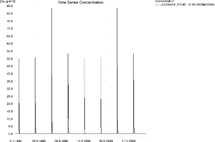
Figure 3.41. Concentrations of spring-applied bromoxynil in sandy loam pond.
Figur 3.41. Koncentration af forårsudbragt bromoxynil i morænelersvandhullet.
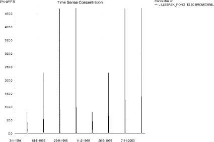
Figure 3.42. Concentrations of autumn- applied bromoxynil in sandy loam pond.
Figur 3.42. Koncentration af autumn-applied bromoxynil i morænelersvandhullet.
Figure 3.43 and Figure 3.44 show the concentration of bromoxynil on macrophytes in the pond. The concentrations are significantly lower than the concentrations in the water phase. Porewater concentrations are shown in Figure 3.45 and Figure 3.46. They are quite small, and the concentration adsorbed to sediment is 0.17 ng/kg for the spring application and <0.01 ng/kg for the autumn application.
Figure 3.43. Spring-applied bromoxynil sorbed to the macrophytes in the sandy loam pond.
Figur 3.43. forårsudbragt bromoxynil sorberet til makrofytter i morænelers-vandhullet.
Figure 3.44. Autumn-applied bromoxynil sorbed to the macrophytes in the sandy loam pond.
Figur 3.44. Efterårsudbragt bromoxynil sorberet til makrofytter i morænelers-vandhullet.
Figure 3.45. Pore water concentration following spring-application of bromoxynil in the sandy loam pond.
Figur 3.45. Porevandskoncentration efter forårsudbragt bromoxynil i morænelersvandhullet.
Figure 3.46. Pore water concentration following autumn-application of bromoxynil in the sandy loam pond.
Figur 3.46. Porevandskoncentration efter efterårsårsudbragt bromoxynil i morænelersvandhullet.
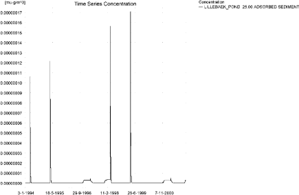
Figure 3.47. Concentration of bromoxynil in sediment following spring-application in the sandy loam pond. Note that the unit is µg/g sediment and not µg/m³ as indicated.
Figur 3.47. Koncentration af bromoxynil i sediment efter forårsudbringning i morænelersvandhullet. Koncentrationen er i µg/g sediment og ikke µg/m³ som angivet.
In Table 3.17, global maxima and time weighted concentrations (up to 7 days) are extracted.
Table 3.17. Actual and time weighted concentrations of bromoxynil, ng/l, in the sandy loam pond.
Tabel 3.17. Beregnede og tidsvægtede koncentrationer (ng/l) af bromoxynil i morænelersvandhullet.
| Spring application | Autumn application | |||||||
| Year | Bromoxynil | Actual | Time-weighted | Date | actual | Time-weighted | Date | |
| 1994 | global max | 50 | 02-04-1994 | 80 | 07-10-1994 | |||
| 1 hour(after max) | 47 | 48 | 76 | 78 | ||||
| 1 day after sp.in. | 30 | 37 | 54 | 62 | ||||
| 3 days | 16 | 27 | 36 | 50 | ||||
| 4 days | 11 | 24 | 30 | 46 | ||||
| 7 days | 4 | 16 | 17 | 36 | ||||
| 1995 | Global max | 51 | 01-04-1995 | 228 | 07-10-1995 | |||
| 1 hour | 48 | 50 | 198 | 211 | ||||
| 1 day | 33 | 39 | 89 | 124 | ||||
| 2 days | 19 | 30 | 40 | 82 | ||||
| 4 days | 14 | 26 | 26 | 69 | ||||
| 7 days | 6 | 19 | 8 | 46 | ||||
| 1996 | global max | 83 | 01-04-1996 | 469 | 07-10-1996 | |||
| 1 hour | 77 | 80 | 348 | 396 | ||||
| 1 day | 46 | 58 | 100 | 166 | ||||
| 2 (3*)days | 27 | 43 | 33 | 95 | ||||
| 4 days | 20 | 38 | 19 | 78 | ||||
| 7 (6*)days | 9 | 28 | 4 | 48 | ||||
| 1997 | global max | 53 | 01-04-1997 | 471 | 07-10-1997 | |||
| 1 hour | 51 | 52 | 349 | 397 | ||||
| 1 day | 36 | 42 | 100 | 166 | ||||
| 2 (3*)days | 25 | 34 | 33 | 95 | ||||
| 4 days | 20 | 31 | 19 | 78 | ||||
| 7 (6*)days | 11 | 24 | 4 | 48 | ||||
| 1998 | global max | 50 | 01-04-1998 | 80 | 06-10-1998 | |||
| 1 hour | 47 | 48 | 76 | 78 | ||||
| 1 day | 30 | 37 | 54 | 62 | ||||
| 2 (3*)days | 16 | 27 | 36 | 50 | ||||
| 4 days | 11 | 24 | 30 | 46 | ||||
| 7 (6*)days | 4 | 16 | 17 | 36 | ||||
| 1999 | global max | 51 | 31-03-1999 | 228 | 06-10-1999 | |||
| 1 hour | 48 | 50 | 198 | 211 | ||||
| 1 day | 33 | 39 | 89 | 124 | ||||
| 2 (3*)days | 19 | 30 | 40 | 82 | ||||
| 4 days | 14 | 26 | 26 | 69 | ||||
| 7 (6*)days | 6 | 19 | 8 | 46 | ||||
| 2000 | global max | 83 | 31-03-2000 | 469 | 06-10-2000 | |||
| 1 hour | 77 | 80 | 348 | 396 | ||||
| 1 day | 46 | 58 | 100 | 166 | ||||
| 2 (3*)days | 27 | 43 | 33 | 95 | ||||
| 4 days | 20 | 38 | 19 | 78 | ||||
| 7 (6*)days | 9 | 28 | 4 | 48 | ||||
| 2001 | global max | 53 | 31-03-2001 | 471 | 06-10-2001 | |||
| 1 hour | 51 | 52 | 349 | 397 | ||||
| 1 day | 36 | 42 | 100 | 166 | ||||
| 2 (3*)days | 25 | 34 | 33 | 95 | ||||
| 4 days | 20 | 31 | 19 | 78 | ||||
| 7 (6*)days | 11 | 24 | 4 | 48 | ||||
| max values | ||||||||
| global max | 83 | 471 | ||||||
| 1 hour | 77 | 80 | 349 | 397 | ||||
| 1 day | 46 | 58 | 100 | 166 | ||||
| 2 days | 27 | 43 | 40 | 95 | ||||
| 4 days | 20 | 38 | 30 | 78 | ||||
| 7 days | 11 | 28 | 17 | 48 | ||||
Figure 3.48, Figure 3.49, Table 3.18 and Table 3.19 show the output from the PestSurf template with time series identical toFigure 3.41 an Figure 3.42.
The concentrations of the FOCUS SW-scenario D4, pond are 26 ng/l for the spring application and 39 ng/l for the autumn application. PestSurf reaches 83 and 471 ng/l for the spring and autumn application, respectively. The highest concentrations are reached during dry periods, with relatively low water levels. A systematic difference between the D4-pond and the PestSurf pond is the size, The sandy loam pond is 250m² while the D4 pond is 900 m². It is therefore expected that the concentration level in the PestSurf sandy loam pond should be higher than for the D4 pond, when the major source is wind drift.
The concentrations in the sediment were 49 and 65 ng/kg for the FOCUS-D4-pond-scenarios, while they were 0.17 and below 0.01 ng/kg for the PestSurf simulations. The low concentrations in the pond and the fast disappearance does not allow time for much diffusion to the porewater and sorption to the sediment.
Click here to see Figure 3.48.
Figure 3.48. Overview for spring applied bromoxynil in the sandy loam pond generated by the PestSurf excel template. The time series shown is identical to the one in Figure 3.41. The detection value was set to 1 ng/l.
Figur 3.48. Oversigt for forårsudbragt bromoxynil i morænelersoplandet genereret med PestSurf-excel-skabelonen. Den viste tidsserie er mage til den i Figur 3.41. Detektionsgrænsen er sat til 1 ng/l.
Click here to see Figure 3.49.
Figure 3.49. Overview for autumn-applied bromoxynil in the sandy loam pond generated by the PestSurf excel template. The time series shown is identical to the one in Figure 3.42. The detection value was set to 1 ng/l.
Figur 3.49. Oversigt for efterårsudbragt bromoxynil i morænelersoplandet genereret med PestSurf-excel-skabelonen. Den viste tidsserie er mage til den i Figur 3.42. Detektionsgrænsen er sat til 1 ng/l.
Table 3.18. Part of the result sheet generated by the PestSurf Excel sheet for spring application of bromoxynil. The limiting values applied in the table is lowest detection valuε = 1 ng/l, toxicity to fish, daphnies and algae are set to 10, 100 and 1000 ng/, respectively. The recorded peaks are shown in Figure 3.48.
Tabel 3.18. Uddrag af resultatpresentationen genereret af PestSurf-Excel-arket for forårsudbragt bromoxynil. Grænseværdien anvendt i tabellen er detektionsgrænsen, 1 ng/l mens toxicitetsværdierne for fisk, dafnier og alger er henholdsvis 10, 100 og 1000 ng/l. De tabellerede hændelser er vist i Figur 3.48.
Table 3.19. Part of the result sheet generated by the PestSurf Excel sheet for autumn- applied bromoxynil. The limiting values applied in the simulation is lowest detection valuε = 1 ng/l, toxicity to fish, daphnies and algae are set to 10, 100 and 1000 ng/, respectively. The recorded peaks are shown in Figure 3.49.
Tabel 3.19. Uddrag af resultatpresentationen genereret af PestSurf-Excel-arket for efterårsudbragt bromoxynil. Grænseværdien anvendt i tabellen er detektionsgrænsen, 1 ng/l mens toxicitetsværdierne for fisk, dafnier og alger er henholdsvis 10, 100 og 1000 ng/l. De tabellerede hændelser er vist i Figur 3.49.
Table 3.20. Summary of simulation results for bromoxynil.
Tabel 3.20. Opsummerede resultater for bromoxynil.
3.5 Summary of Simulations
The maximum actual concentrations for all simulations are recorded in Table 3.20.
The concentration generated by PestSurf for the sandy pond is about 40 % of the concentration generated by FOCUS SW D3-ditch, while the concentration in the sandy stream is 3-4 times higher. The reason for the high concentrations in the stream is the simultaneous spraying of the total agricultural area. The maximum concentration level is reached 1111 and 1049 m from the upstream point, for the spring and autumn-applications, respectively. 112 m from the upstream end, the concentrations are 83 and 234 ng/l for the spring and autumn-application. These concentrations are considerably lower than the concentrations found in the D3-ditch (759 and 1143 ng/l). However, the concentrations cannot be compared directly because the top end of the PestSurf sandy catchment is protected by 20 m bufferzone. The water depth at the time of spraying is 14 and 9.5 cm for the spring and autumn-application time respectively, 112 m from the upstream end.
For the sandy loam pond, PestSurf generates a concentration that is about three times as high for the spring application and 12 times as high for the autumn application. For this particular autumn application, the water depth is only 21 cm (a factor 5), while the water depth for the spring application is 76 cm (a factor 1.3). A basic difference between the FOCUS D4-pond and the PestSurf sandy loam pond is the size, 900 m² against 250 m², which means that the PestSurf sandy loam pond is more exposed to wind drift. A rough estimate of the difference in exposure is a factor 2.4.
For the sandy loam stream, the PestSurf-concentrations are 10 and 18 times higher than the concentrations generated by FOCUS SW, for the spring and autumn applications, respectively. As for the sandy stream, this is due to the simultaneous spraying of the whole agricultural area and very limited water depth at the time of spraying, particularly for the autumn application during a dry autumn, where the water depth varied between 3 and 9 cm over the stream. The maximum value is reached near the end of the catchment. 125 m from the upstream end, the maximum concentration is 3990 and 7188 ng/l, with a corresponding water depth of 4.8 and 3.5 cm. Taking the difference in water concentration into account, the concentration levels correspond quite well. The maximum concentration on the stretch, where the stream is permanent and upstream of the groundwater influence is 3.13 µg/l and 7.74 µg/l, 625 m from the upstream end.
All maximum concentrations are generated by drift in both models Macrophyte concentration do not have a significant influence on the concentrations in the water phase in any of the scenarios, since bromoxynil has a low logKow. The sediment concentrations are very low in PestSurf for all scenarios, and considerably lower than the ones calculated in the FOCUS SW-scenarios. The concentrations correspond to the concentrations in the porewater, which are governed by the diffusion coefficient, and therefore also by the duration of high concentrations in the water phase.
Annex 4
4 Comparison of risk assessment data produced by spray drift assessments, FOCUS SW and PestSurf
4.1 Chemical characteristics of the compound
| Compound: | Fluazinam |
| Dose: | 175 g ai/ha 4 times with approx. 10 days interval |
| Spraying time: | 1. June and forward |
| Crop: | Potatoes |
Table 4.1. Overview of chemical properties of fluazinam and the parameters used in the simulations.
Tabel 4.1. Oversigt over fluazinams kemiske egenskaber og parametrene brugt i simuleringerne.
| Chemical property | Condition | Recalculated values | |||
| Cas-no. | 79622-59-6 | ||||
| Molecular weight | 465.1 | ||||
| Form (acid, basic, neutral) | neutral | ||||
| pKa | |||||
| Water solubility | 0.071 µg/l | pH 7.0 | 20°C | ||
| log Kow | at pH | KowA- | |||
| log Kow | 3.56 | at pH | KowAH | 3.56 | |
| log Kow | at pH | KowAH+ | |||
| Vapor pressure, Pa | 1,1 × 10⁻³ (study from 1991) | 25°C | vapor pressure, Pa, 20°C | ||
| 2,3 × 10⁻⁵ (study from 1992) | 25°C | ||||
| 5.1 × 10⁻⁶ (RIVM) | 20°C | ||||
| Henry’s law constant | Calculated in Pestsurf | Recalculated value, dimensionless | |||
| Sorption properties in soil | |||||
| Freundlich exp | 1 | ||||
| Koc, l/kg | 1945 | ||||
| DT50 in soil, days | 56.6 | ||||
| DT50water | From experiment (0.8+1.2)/2=1 day | PestSurf input | |||
| DT50sedment | High sorption, degradation on sediment | ||||
| DT50water/sediment | Exp 1: 1 and <7 d, 100 ml vand, 1 % sediment. Exp 2: (2.9+3.2)/2=3.05 d | DT50, days | 3.5 | ||
| Sediment konc., µg/l | 10000 | ||||
| Hydrolysis | None | at pH 5 | (acid) | Indef | |
| 42 | at pH 7 | (neutral) | 65.2 | ||
| 6 | at pH 9 | (basic) | 6.94 × 10⁻⁵ | ||
| Photolysis | |||||
| quantum yield | φ = 2.60 × 10⁻⁴ | ||||
| Spectrum | 3.86 l.mol-1.cm-1 at 342 nm. | ||||
| Other | DT50= 1-2 days at pH 5 and 3 days at pH 9. | ||||
4.2 Concentration generated by spray
| Direct spray | FOCUS buffer zones | |||
| µg/l | Ditch | Stream | Pond | |
| µg/l | µg/l | µg/l | µg/l | |
| Fluazinam | 58.3 | 0.839 | 0.608 | 0.291 |
4.3 Concentrations generated by FOCUS SW
4.3.1 D3- Ditch
| Fluazinam | Ditch, D3 | |||||||
| Water | Sediment | |||||||
| Date | PEC | Date | TWAEC | Date | PEC | Date | TWAEC | |
| µg l-1 | µg l-1 | µg kg-1 | µg kg-1 | |||||
| Global max | 08-jul-92 | 0.614 | 27-jun-92 | 0.367 | ||||
| 1 d | 09-jul-92 | 0.131 | 27-jun-92 | 0.367 | 28-jun-92 | 0.162 | 27-jun-92 | 0.207 |
| 2 d | 10-jul-92 | 0.009 | 28-jun-92 | 0.211 | 29-jun-92 | 0.109 | 28-jun-92 | 0.186 |
| 4 d | 12-jul-92 | 0.001 | 30-jun-92 | 0.107 | 01-jul-92 | 0.054 | 30-jun-92 | 0.144 |
| 7 d | 15-jul-92 | 0 | 03-jul-92 | 0.062 | 04-jul-92 | 0.022 | 03-jul-92 | 0.102 |
4.3.2 D4 – Stream
| Fluazinam | Stream, D4 | |||||||
| Water | Sediment | |||||||
| Date | PEC | Date | TWAEC | Date | PEC | Date | TWAEC | |
| µg l-1 | µg l-1 | µg kg-1 | µg kg-1 | |||||
| Global max | 01-jun-85 | 0.497 | 07-dec-85 | 0.366 | ||||
| 1 d | 02-jun-85 | 0.005 | 05-dec-85 | 0.31 | 08-dec-85 | 0.324 | 10-dec-85 | 0.362 |
| 2 d | 03-jun-85 | 0.005 | 06-dec-85 | 0.26 | 09-dec-85 | 0.365 | 11-dec-85 | 0.349 |
| 4 d | 05-jun-85 | 0.004 | 08-dec-85 | 0.226 | 11-dec-85 | 0.299 | 11-dec-85 | 0.344 |
| 7 d | 08-jun-85 | 0.01 | 11-dec-85 | 0.18 | 14-dec-85 | 0.231 | 13-dec-85 | 0.317 |
4.3.3 D4 - Pond
| Fluazinam | Pond, D4 | |||||||
| Water | Sediment | |||||||
| Date | PEC | Date | TWAEC | Date | PEC | Date | TWAEC | |
| µg l-1 | µg l-1 | µg kg-1 | µg kg-1 | |||||
| Global max | 07-dec-85 | 0.083 | 12-dec-85 | 0.148 | ||||
| 1 d | 08-dec-85 | 0.074 | 08-dec-85 | 0.081 | 13-dec-85 | 0.146 | 12-dec-85 | 0.148 |
| 2 d | 09-dec-85 | 0.08 | 09-dec-85 | 0.077 | 14-dec-85 | 0.14 | 13-dec-85 | 0.147 |
| 4 d | 11-dec-85 | 0.062 | 11-dec-85 | 0.076 | 16-dec-85 | 0.128 | 14-dec-85 | 0.145 |
| 7 d | 14-dec-85 | 0.039 | 12-dec-85 | 0.069 | 19-dec-85 | 0.116 | 16-dec-85 | 0.139 |
4.3.4 Conclusion – FOCUS SW
The highest concentration is generated in the ditch (D3). It is caused by wind drift and the concentration becomes 0.614 µg/l. The D4 stream scenario shows the highest concentration in the sediment, 0.366 µg/kg. For all scenarios, the concentrations are lower than what is generated by the simpler assessments, but for the ditch and stream-scenarios the difference between the simple drift calculation and the FOCUS SW-simulation is rather small. For the ditch and the stream the concentrations are generated by drift, while for the pond the concentration peaks in December, and must be due to drainage contributions.
4.4 PestSurf
4.4.1 Sandy Catchment, stream
The distribution of concentrations was assessed in several steps. First, the maximum concentrations at each calculation point were listed, and the dates for the occurrence of the maximum were assessed. The points, for which the maximum value also represents a local maximum were selected for further analysis. The relevant values are listed in Table 4.2.
Table 4.2. Maximum concentrations (ng/l) of fluazinam simulated for each calculation point in the sandy catchment.
Tabel 4.2. Maximumskoncentrationer (ng/l) af fluazinam simuleret for hvert beregningspunkt i det sandede opland.
| FLUAZINAM | Maximum | Max.Time | Local maxima |
| ODDERBAEK 0.00 | 284 | 03-07-1998 09:09 | |
| ODDERBAEK 56.00 | 305 | 03-07-1998 09:09 | |
| ODDERBAEK 112.00 | 370 | 03-07-1998 09:00 | |
| ODDERBAEK 192.00 | 801 | 03-07-1998 08:39 | |
| ODDERBAEK 272.00 | 1241 | 03-07-1998 08:30 | |
| ODDERBAEK 278.00 | 1317 | 03-07-1998 08:30 | |
| ODDERBAEK 282.00 | 1368 | 03-07-1998 08:30 | |
| ODDERBAEK 298.50 | 1518 | 03-07-1998 08:30 | |
| ODDERBAEK 315.00 | 1672 | 03-07-1998 08:30 | |
| ODDERBAEK 317.50 | 1694 | 03-07-1998 08:30 | |
| ODDERBAEK 320.00 | 1715 | 03-07-1998 08:30 | |
| ODDERBAEK 410.00 | 2231 | 03-07-1998 08:30 | |
| ODDERBAEK 500.00 | 2502 | 03-07-1998 08:30 | |
| ODDERBAEK 513.00 | 2619 | 03-07-1998 08:30 | |
| ODDERBAEK 521.00 | 2695 | 03-07-1998 08:30 | |
| ODDERBAEK 622.00 | 3159 | 03-07-1998 08:30 | |
| ODDERBAEK 723.00 | 3498 | 03-07-1998 08:30 | |
| ODDERBAEK 733.00 | 3590 | 03-07-1998 08:30 | |
| ODDERBAEK 742.00 | 3639 | 03-07-1998 08:30 | |
| ODDERBAEK 789.50 | 3796 | 03-07-1998 08:30 | |
| ODDERBAEK 837.00 | 3959 | 03-07-1998 08:30 | |
| ODDERBAEK 848.00 | 4030 | 03-07-1998 08:30 | |
| ODDERBAEK 863.00 | 4120 | 03-07-1998 08:30 | |
| ODDERBAEK 956.00 | 4420 | 03-07-1998 08:30 | |
| ODDERBAEK 1049.00 | 4492 | 03-07-1998 08:30 | X |
| ODDERBAEK 1111.50 | 4304 | 23-07-2004 08:30 | |
| ODDERBAEK 1174.00 | 3873 | 23-07-2004 08:30 | |
| ODDERBAEK 1226.00 | 3636 | 23-07-2004 08:40 | |
| ODDERBAEK 1278.00 | 3539 | 23-07-2004 08:40 | |
| ODDERBAEK 1293.50 | 3494 | 23-07-2004 08:40 | |
| ODDERBAEK 1310.00 | 3418 | 23-07-2004 08:40 | |
| ODDERBAEK 1421.00 | 3248 | 13-07-2000 08:50 | |
| ODDERBAEK 1532.00 | 2882 | 03-07-1998 08:30 | |
| ODDERBAEK 1558.06 | 2559 | 03-07-1998 08:39 | |
| ODDERBAEK 1584.12 | 2461 | 03-07-1998 08:39 | |
| ODDERBAEK 1584.12 | 2461 | 03-07-1998 08:39 | |
| ODDERBAEK 1621.06 | 2454 | 03-07-1998 08:39 | |
| ODDERBAEK 1658.00 | 2529 | 03-07-1998 08:30 | |
| ODDERBAEK 1698.50 | 2696 | 03-07-1998 08:30 | |
| ODDERBAEK 1739.00 | 2813 | 03-07-1998 08:30 | X |
| ODDERBAEK 1801.50 | 2729 | 03-07-1998 08:30 | |
| ODDERBAEK 1864.00 | 2228 | 10-06-2000 08:30 | |
| ODDERBAEK 1977.00 | 1556 | 01-06-2001 09:50 | |
| ODDERBAEK 2090.00 | 1509 | 01-06-2001 10:00 | |
| ODDERBAEK 2098.00 | 1508 | 01-06-2001 10:00 | |
| ODDERBAEK 2105.00 | 1502 | 01-06-2001 10:00 | |
| ODDERBAEK 2131.00 | 1489 | 01-06-2001 10:00 | |
| ODDERBAEK 2157.00 | 1468 | 10-06-2000 10:00 | |
| ODDERBAEK 2168.00 | 1461 | 10-06-2000 10:00 | |
| ODDERBAEK 2179.00 | 1454 | 10-06-2000 10:00 | |
| ODDERBAEK 2268.50 | 1433 | 10-06-2000 10:00 | |
| ODDERBAEK 2358.00 | 1358 | 10-06-2004 10:00 | |
| ODDERBAEK 2363.50 | 1352 | 10-06-2004 10:00 | |
| ODDERBAEK 2372.00 | 1346 | 10-06-2004 10:00 | |
| ODDERBAEK 2427.00 | 1330 | 10-06-2004 10:00 | |
| ODDERBAEK 2482.00 | 1297 | 10-06-2004 10:00 | |
| ODDERBAEK 2609.00 | 1268 | 10-06-2004 10:00 | |
| ODDERBAEK 2736.00 | 1181 | 01-06-2003 10:00 | |
| ODDERBAEK 2831.00 | 1153 | 01-06-2003 10:00 | |
| ODDERBAEK 2926.00 | 1083 | 01-06-2001 11:00 | |
| ODDERBAEK 2958.50 | 1070 | 01-06-2001 11:00 | |
| ODDERBAEK 2991.00 | 1055 | 01-06-2001 11:00 | |
| ODDERBAEK 3029.50 | 1024 | 01-06-2005 11:00 | |
| ODDERBAEK 3068.00 | 971 | 01-06-2005 11:00 | |
| ODDERBAEK 3131.00 | 907 | 01-06-2005 11:00 | |
| ODDERBAEK 3194.00 | 871 | 01-06-2003 11:00 | |
| ODDERBAEK 3250.50 | 857 | 03-07-1998 08:30 | |
| ODDERBAEK 3307.00 | 934 | 03-07-1998 08:30 | |
| ODDERBAEK 3315.00 | 956 | 03-07-1998 08:30 | |
| ODDERBAEK 3323.00 | 1031 | 03-07-1998 08:30 | |
| ODDERBAEK 3355.50 | 1205 | 03-07-1998 08:30 | |
| ODDERBAEK 3388.00 | 1371 | 03-07-1998 08:30 | |
| ODDERBAEK 3438.50 | 1534 | 03-07-1998 08:30 | |
| ODDERBAEK 3489.00 | 1582 | 03-07-1998 08:30 | |
| ODDERBAEK 3499.50 | 1587 | 03-07-1998 08:30 | X |
| ODDERBAEK 3510.00 | 1582 | 03-07-1998 08:30 | |
| ODDERBAEK 3581.00 | 1437 | 03-07-1998 08:30 | |
| ODDERBAEK 3652.00 | 1258 | 03-07-1998 08:39 | |
| ODDERBAEK 3707.00 | 1254 | 03-07-1998 08:39 | |
| ODDERBAEK 3762.00 | 1147 | 03-07-1998 08:39 | |
| ODDERBAEK 3790.00 | 998 | 03-07-1998 08:39 | |
| ODDERBAEK 3818.00 | 787 | 04-06-1998 08:40 | |
| ODDERBAEK 3818.00 | 787 | 04-06-1998 08:40 | |
| ODDERBAEK 3884.00 | 759 | 03-07-1998 08:50 | |
| ODDERBAEK 3950.00 | 727 | 04-06-1998 08:49 | |
| ODDERBAEK 3998.00 | 682 | 04-06-1998 08:49 | |
| ODDERBAEK 4046.00 | 638 | 04-06-1998 09:00 | |
| ODDERBAEK 4047.50 | 638 | 04-06-1998 09:00 | |
| ODDERBAEK 4049.00 | 638 | 04-06-1998 09:00 | |
| ODDERBAEK 4052.50 | 638 | 04-06-1998 09:00 | |
| ODDERBAEK 4056.00 | 637 | 04-06-1998 09:00 | |
| ODDERBAEK 4058.00 | 637 | 04-06-1998 09:00 | |
| ODDERBAEK 4060.00 | 637 | 04-06-1998 09:00 | |
| ODDERBAEK 4080.00 | 633 | 04-06-1998 09:00 | |
| ODDERBAEK 4100.00 | 629 | 04-06-1998 09:00 | |
| ODDERBAEK 4134.00 | 627 | 25-06-2005 09:00 | |
| ODDERBAEK 4168.00 | 628 | 25-06-2005 09:00 | |
| GISLUM_ENGE_AFLOEB 0.00 | 0 | 04-06-1998 08:10 | |
| GISLUM_ENGE_AFLOEB 50.00 | 0 | 04-06-1998 08:10 | |
| GISLUM_ENGE_AFLOEB 100.00 | 0 | 04-06-1998 08:10 | |
| GISLUM_ENGE_AFLOEB 150.00 | 0 | 04-06-1998 08:10 | |
| GISLUM_ENGE_AFLOEB 200.00 | 0 | 04-06-1998 08:10 | |
| GISLUM_ENGE_AFLOEB 250.00 | 0 | 04-06-1998 08:10 | |
| GISLUM_ENGE_AFLOEB 300.00 | 0 | 04-06-1998 08:10 | |
| GISLUM_ENGE_AFLOEB 340.00 | 0 | 04-06-1998 08:10 | |
| GISLUM_ENGE_AFLOEB 380.00 | 0 | 04-06-1998 08:10 | |
| GISLUM_ENGE_AFLOEB 430.00 | 0 | 04-06-1998 08:10 | |
| GISLUM_ENGE_AFLOEB 480.00 | 0 | 04-06-1998 08:10 | |
| GISLUM_ENGE_AFLOEB 530.00 | 0 | 04-06-1998 08:10 | |
| GISLUM_ENGE_AFLOEB 580.00 | 0 | 04-06-1998 08:10 | |
| GISLUM_ENGE_AFLOEB 630.00 | 0 | 04-06-1998 08:10 | |
| GISLUM_ENGE_AFLOEB 680.00 | 0 | 04-06-1998 08:10 | |
| GISLUM_ENGE_AFLOEB 730.00 | 0 | 04-06-1998 08:10 | |
| GISLUM_ENGE_AFLOEB 780.00 | 0 | 03-07-1998 09:09 | |
| GISLUM_ENGE_AFLOEB 830.00 | 0 | 03-07-1998 09:09 | |
| GISLUM_ENGE_AFLOEB 880.00 | 0 | 03-07-1998 09:09 | |
| GISLUM_ENGE_AFLOEB 915.00 | 0 | 03-07-1998 09:09 | |
| GISLUM_ENGE_AFLOEB 950.00 | 0 | 03-07-1998 09:09 | |
| GISLUM_ENGE_AFLOEB 985.00 | 0 | 03-07-1998 09:00 | |
| GISLUM_ENGE_AFLOEB 1020.00 | 0 | 03-07-1998 09:00 | |
| GISLUM_ENGE_AFLOEB 1045.00 | 0 | 03-07-1998 09:00 | |
| GISLUM_ENGE_AFLOEB 1070.00 | 0 | 03-07-1998 09:00 | |
| GISLUM_ENGE_AFLOEB 1110.00 | 0 | 03-07-1998 09:00 | |
| GISLUM_ENGE_AFLOEB 1150.00 | 0 | 03-07-1998 09:00 | |
| GISLUM_ENGE_AFLOEB 1190.00 | 1 | 03-07-1998 09:00 | |
| GISLUM_ENGE_AFLOEB 1230.00 | 2 | 03-07-1998 09:00 | |
| GISLUM_ENGE_AFLOEB 1271.00 | 5 | 03-07-1998 08:50 | |
| GISLUM_ENGE_AFLOEB 1312.00 | 15 | 03-07-1998 08:50 | |
| GISLUM_ENGE_AFLOEB 1422.00 | 164 | 03-07-1998 08:50 | |
| GISLUM_ENGE_AFLOEB 1532.00 | 787 | 04-06-1998 08:40 | |
| TILLOEB 0.00 | 2372 | 03-07-1998 08:39 | |
| TILLOEB 20.16 | 2425 | 03-07-1998 08:39 | |
| TILLOEB 40.31 | 2461 | 03-07-1998 08:39 | |
| global max | 4492 |
The pattern over time was the same for all calculation points. The peak values are generated by wind drift, see Figure 4.1.
Each of the events generated an almost identical pattern along the stream, see Figure 4.2 and Figure 4.3. The thin black line represents the concentration, while the thick line shows the maximum concentrations obtained during the simulations. In addition, the outline of the stream is shown. In the middle of the catchment, the stream is protected by unsprayed areas.The maximum values at the center of the catchment are obtained when the peak from upstream move through the catchment during the hours following spraying.
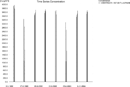
Figure 4.1. Concentration pattern over time for fluazinam in the sandy catchment.
Figur 4.1. Koncentrationsmønster som funktion af tid for fluazinam i det sandede opland.

Figure 4.2. Concentrations of fluazinam in the sandy catchment on 3.July, 1998, at the end of 30 minutes’ spraying.
Figur 4.2. Koncentrationer af fluazinam i det sandede opland den 3. juli 1998 lige efter endt sprøjtning.
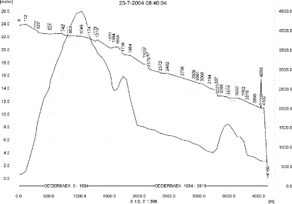
Figure 4.3. Concentrations of fluazinam in the sandy catchment on 23.July, 2004, 10 minutes after spraying ended.
Figur 4.3. Koncentrationer af fluazinam i det sandede opland den 23. juli 2004 10 minutter efter endt sprøjtning.
In order to present the data in a similar fashion to the FOCUS SW-results, data were extracted and recalculated for the time series marked in Table 4.2. The global maxima and time weighted concentrations (up to 7 days) were extracted and are reported in Table 4.3. Note that the unit is ng/l.
Table 4.3. Concentration of fluazinam, ng/l, at selected points in the sandy stream.
Tabel 4.3. Beregnet og tidsvægtet koncentration af fluazinam, ng/l, på udvalgte lokaliteter i det sandede vandløb.
An example of the amount of pesticide sorbed to macrophytes is shown in Figure 4.4. In this case, about 1/7 of the solute in the water phase is present in the macrophytes. The concentration in the water phase is therefore significantly influenced by the presence of macrophytes. The porewater concentrations are shown in Figure 4.5. The concentrations are very low. The maximum sorption to sediment is 2 ng/kg.
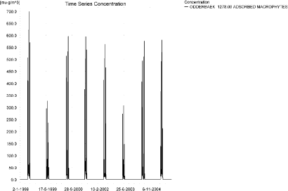
Figure 4.4. Concentration pattern for fluazinam sorbed on macrophytes. The maximum value, 704 ng/l, is reached 1421 m from the top end.
Figur 4.4. Koncentrationsmønster for fluazinam sorberet på makrofytter. Maximumsværdien, 704 ng/l nås 1421 m fra topenden.
Figure 4.5. Porewater concentration of fluazinam in the sandy catchment. The maximum value, 0.025 ng/l, is reached 1049 m from the top end.
Figur 4.5. Porevandskoncentration for fluazinam i det sandede opland. Maximumsværdien, 0.025 ng/l opnås 1049 m fra topenden.
Figure 4.6. Sediment concentration of fluazinam in the sandy catchment. Note that the unit is µg/g and not µg/m³ as indicated.
Figur 4.6. Sedimentkoncentration for fluazinam i det sandede opland. Bemærk at koncentrationen er i µg/g og ikke i µg/m³ som angivet.
The global maximum value calculated by PestSurf for the sandy catchment in the water phase is 4.492 µg/l. This is considerably more than what is found in the D3-ditch scenario (614 ng/l), particularly when the macrophyte influence is taken into account. This is due to the accumulation of drift over a considerable length of the stream. However, 100 m from the upstream end, which could be compared to the ditch scenario, the concentration is only 370 ng/l.
The sediment concentration is much higher in the FOCUS SW D3-ditch (367 ng/kg) than in the PestSurf calculation (2 ng/kg).
Figure 4.7 shows the output of the PestSurf Excel template. The template works with pre-defined data extraction points. The plot requires specification of a “lowest detection value” (ldc) which defines when a pesticide occurrence is defined as an event.
The time series plot is identical to the time series shown earlier, and the graph in the upper right corner resembles the plots in Figure 4.2 and Figure 4.3, but takes into account a longer period of time. A curve is generated when a downstream point reaches a concentration higher than the ldc. The programme then tracks the highest concentration for each calculation point in the stream within the last 24 hours. The plot in the lower right corner shows how many events have concentrations higher than a given value for the selected monitoring points.
Table 4.4 shows part of the result sheet generated by the PestSurf Excel sheet. The selected table shows the point along the stream (of the pre-defined points) with the highest concentration. This value was, however, only 2.45 µg/l. Thus, the pre-defined points have not caught the highest concentration of the simulation, which was 4.49 µg/l.
Figure 4.7. Overview for fluazinam in the sandy catchment generated by the PestSurf excel template. The max concentrations generated over the 24 hours are similar to the overviews in Figure 4.2 and Figure 4.3. The graph to the lower right shows how many events have concentrations higher than a given value for the selected monitoring points. Detection value was 1 ng/l.
Figur 4.7. Oversigt for fluazinam i det sandede opland genereret med PestSurf-excel-skabelonen. Den maximale koncentration genereret over 24 timer svarer til oversigterne i Figur 4.2 og Figur 4.3. Grafen nederst til højre viser hvor mange hændelser, der har koncentrationer højere end en given værdi i et udvalgt punkt. Detektionsgrænsen var sat til 1 ng/l.
Table 4.4. Part of the result sheet generated by the PestSurf Excel sheet. The selected table shows the point along the stream with the highest concentration recorded. The detection values applied in the table is 1 ng/l, toxicity to fish, daphnies and algae are set to 10, 100 and 1000 ng/, respectively. The recorded peaks are shown in Figure 4.7.
Tabel 4.4. Uddrag af resultatpresentationen genereret af PestSurf-Excel-arket. Den udvalgte tabel viser det fordefinerede punkt langs med åen med højest koncentration. Detektionsgrænsen er sat til 1 mens toxicitetsværdierne for fisk, dafnier og alger er henholdsvis 10, 100 og 1000 ng/l. De tabellerede hændelser er vist i Figur 4.7.
4.4.2 Sandy Catchment, pond
The concentration pattern is evaluated in the middle of the pond only, see Figure 4.8. The pond receives drift but the contribution through groundwater dominates the picture. The highest concentrations are found in the early spring after a wet period. The maximum concentration is 5.88 µg/l.
Figure 4.8. Concentrations of fluazinam in the sandy pond.
Figur 4.8. Koncentration af fluazinam i det sandede vandhul.
In Table 4.5, global maxima and time weighted concentrations (up to 7 days) were extracted.
Table 4.5. Maximum concentrations of fluazinam (ng/l) generated for the sandy pond.
Tabel 4.5. maximumkoncentrationer af fluazinam(ng/l) genereret for det sandede vandhul.
| Year | ODDER_POND 20.00, | |||
| Conc. | TWA | Date | ||
| 1998 | 1998 (global max) | 845 | 29/12/1998 | |
| 1 hour (after max) | ||||
| 1 day after sp.in. | 828 | 836 | ||
| 2 (3*) days | 804 | 820 | ||
| 4 days | 820 | 818 | ||
| 7 (6*) days | 898 | 832 | ||
| 1999 | 1999 (global max) | 2486 | 29/03/1999 | |
| 1 hour (after max) | ||||
| 1 day after sp.in. | 2417 | 2452 | ||
| 2 (3*) days | 2428 | 2414 | ||
| 4 days | 2392 | 2413 | ||
| 7 (6*) days | 2417 | 2414 | ||
| 2000 | 2000 (global max) | 4469 | 10/03/2000 | |
| 1 hour (after max) | ||||
| 1 day after sp.in. | 4426 | 4447 | ||
| 2 (3*) days | 4255 | 4402 | ||
| 4 days | 4057 | 4341 | ||
| 7 (6*) days | 3731 | 4155 | ||
| 2001 | 2001 (global max) | 4422 | 26/02/2001 | |
| 1 hour (after max) | ||||
| 1 day after sp.in. | 4417 | 4420 | ||
| 2 (3*) days | 4000 | 4308 | ||
| 4 days | 3699 | 4193 | ||
| 7 (6*) days | 3977 | 4072 | ||
| 2002 | 2002 (global max) | 4271 | 07/03/2002 | |
| 1 hour (after max) | ||||
| 1 day after sp.in. | 4033 | 4152 | ||
| 2 (3*) days | 3937 | 4017 | ||
| 4 days | 3941 | 3998 | ||
| 7 (6*) days | 3952 | 3977 | ||
| 2003 | 2003 (global max) | 4968 | 29/03/2003 | |
| 1 hour (after max) | ||||
| 1 day after sp.in. | 4826 | 4897 | ||
| 2 (3*) days | 4840 | 4818 | ||
| 4 days | 4768 | 4814 | ||
| 7 (6*) days | 4830 | 4818 | ||
| 2004 | 2004 (global max) | 5883 | 10/03/2004 | |
| 1 hour (after max) | ||||
| 1 day after sp.in. | 5823 | 5853 | ||
| 2 (3*) days | 5595 | 5791 | ||
| 4 days | 5336 | 5710 | ||
| 7 (6*) days | 4905 | 5465 | ||
| 2005 | 2005 (global max) | 5097 | 26/02/2005 | |
| 1 hour (after max) | ||||
| 1 day after sp.in. | 5086 | 5091 | ||
| 2 (3*) days | 4607 | 4961 | ||
| 4 days | 4259 | 4829 | ||
| 7 (6*) days | 4566 | 4686 | ||
| Global max | 5883 | |||
| 1 hour (after max) | ||||
| 1 day after sp.in. | 5823 | 5853 | ||
| 2 (3*) days | 5595 | 5791 | ||
| 4 days | 5336 | 5710 | ||
| 7 (6*) days | 4905 | 5465 | ||
The sorption to macrophytes is shown in Figure 4.9. The pattern follows closely the concentration in the water, and the concentration is 1/4-1/5 of the concentration in the water phase. The concentration in the water phase is therefore significantly influenced by the presence of macrophytes. Time series of porewater concentration and fluazinam sorbed to sediment are shown in Figure 4.10 and Figure 4.11. The highest concentration recorded is 2.84 µg/kg sediment.
Figure 4.9. Sorption of fluazinam to macrophytes in the sandy pond.
Figur 4.9. Sorption af fluazinam til makrofytter i det sandede vandhul.
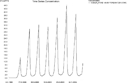
Figure 4.10. Pore water concentration of fluazinam in the sandy pond.
Figur 4.10. Porevandskoncentration af fluazinam i det sandede vandhul.
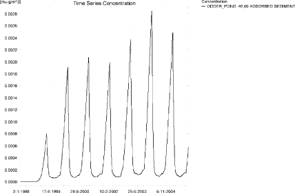
Figure 4.11. Sorption of fluazinam to sediment in the sandy pond. The concentration is in µg/g sediment and not µg/m³ as stated.
Figur 4.11. Sorption af fluazinam til ediment i det sandede vandhul. Bemærk at koncentrationen er i µg/g og ikke i µg/m³ som angivet.
Compared to the FOCUS D3 ditch, the concentration in the PestSurf sandy pond is considerably higher, 5.88 µg/l compared to 0.131 µg/l. The ditch-concentration is caused by wind drift while the concentration in the sandy pond is caused by groundwater contribution. The concentration in the sediment is also higher in PestSurf, 2.84 µg/kg compared to 0.367 µg/kg in the FOCUS SW-D3-ditch.
Figure 4.12 shows the output of the PestSurf Excel template. The template works with one pre-defined data extraction point for the pond (center of the pond). The plot requires specification of a “lowest detection value” (ldc) which defines when a pesticide occurrence is defined as an event. The time series plot is identical to the time series shown earlier. The plot to the right shows how many events have concentrations higher than a given toxicity value for the selected monitoring points. In the pond-case, there is no difference between the results of PestSurf and the results extracted by the templates.
Table 4.12 shows part of the result sheet generated by the PestSurf Excel sheet based on the ldc-value.
Click here to see Figure 4.12.
Figure 4.12. Overview for fluazinam in the sandy pond generated by the PestSurf excel template. The time series shown is identical to the one in Figure 4.8. The detection value is set to 3000 ng/l.
Figur 4.12. Oversigt for fluazinam i det sandede vandhul genereret med PestSurf-excel-skabelonen. Den viste tidsserie er mage til den i Figur 4.8. Detektionsgrænsen er sat til 3000 ng/l.
Table 4.6. Part of the result sheet generated by the PestSurf Excel sheet, applied to fluazinam. The limiting values applied in the simulation is lowest detection valuε = 3000 ng/l, toxicity to fish, daphnies and algae are set to 4000, 5000 and 10000 ng/, respectively. The recorded peaks are shown in Figure 4.12. EOF: End of File.
Tabel 4.6. Uddrag af resultatpresentationen genereret af PestSurf-Excel-arket anvendt på fluazinam. Grænseværdien anvendt til tabelgenerering er sat til 3000 ng/l mens toxicitetsværdierne for fisk, dafnier og alger er henholdsvis 4000, 5000 og 10000 ng/l. De tabellerede hændelser er vist i Figur 4.12. EOF: slutning af filen.
4.4.3 Sandy Loam catchment, Stream
The distribution of concentrations was assessed in several steps. First, the maximum concentrations at each calculation point were listed, and the dates for the occurrence of the maximum were assessed. The points, for which the maximum value also represents a local maximum were selected for further analysis.
All points show the same type of time series pattern. The eight points with highest maximum values were analysed further.
Table 4.7. Maximum concentrations (ng/l) of fluazinam simulated for each calculation point in the sandy loam catchment.
Tabel 4.7. Maximumskoncentrationer (ng/l) af fluazinam simuleret for hvert beregningspunkt i morænelersoplandet.
| FLUAZINAM | Maximum | Max.Time | Local Maxima |
| ALBJERGBAEK 0.00 | 646 | 28-12-2001 00:00 | |
| ALBJERGBAEK 150.00 | 876 | 26-12-2001 00:00 | |
| ALBJERGBAEK 300.00 | 712 | 28-12-2001 00:00 | |
| ALBJERGBAEK 450.00 | 775 | 28-12-2001 00:00 | |
| ALBJERGBAEK 600.00 | 2407 | 31-05-2001 09:10 | |
| ELHOLTBAEK 0.00 | 116 | 30-10-1998 00:00 | |
| ELHOLTBAEK 165.00 | 77 | 29-08-1998 00:00 | |
| ELHOLTBAEK 330.00 | 11366 | 18-09-1998 00:00 | |
| FREDLIGBAEK 0.00 | 12413 | 18-09-1998 00:00 | |
| FREDLIGBAEK 100.00 | 19683 | 18-09-1998 00:00 | |
| FREDLIGBAEK 200.00 | 20975 | 18-09-1998 00:00 | |
| FREDLIGBAEK 300.00 | 21266 | 18-09-1998 00:00 | |
| FREDLIGBAEK 400.00 | 21059 | 18-09-1998 00:00 | |
| FREDLIGBAEK 500.00 | 21428 | 18-09-1998 00:00 | |
| FREDLIGBAEK 600.00 | 20259 | 18-09-1998 00:00 | |
| FREDLIGBAEK 667.50 | 23327 | 18-09-1998 00:00 | X |
| FREDLIGBAEK 735.00 | 14346 | 18-09-1998 00:00 | |
| GROFTEBAEK 0.00 | 835 | 26-10-1998 00:00 | |
| GROFTEBAEK 155.00 | 1405 | 26-10-1998 00:00 | |
| GROFTEBAEK 310.00 | 1448 | 26-10-1998 00:00 | |
| GROFTEBAEK 465.00 | 993 | 03-11-2000 00:00 | |
| GROFTEBAEK 620.00 | 12771 | 18-09-1998 00:00 | |
| STENSBAEK 0.00 | 379 | 08-09-1998 00:00 | |
| STENSBAEK 125.00 | 25025 | 18-09-1998 00:00 | X |
| STENSBAEK 250.00 | 14775 | 18-09-1998 00:00 | |
| STENSBAEK 412.50 | 26398 | 18-09-1998 00:00 | X |
| STENSBAEK 575.00 | 18248 | 18-09-1998 00:00 | |
| OVRELILLEBAEK 0.00 | 159 | 30-10-1998 00:00 | |
| OVRELILLEBAEK 125.00 | 5380 | 31-05-1998 08:30 | |
| OVRELILLEBAEK 250.00 | 5653 | 21-06-1996 08:30 | |
| OVRELILLEBAEK 290.00 | 6353 | 31-05-1999 08:30 | |
| OVRELILLEBAEK 330.00 | 2407 | 31-05-2001 09:10 | |
| OVRELILLEBAEK 330.00 | 2407 | 31-05-2001 09:10 | |
| OVRELILLEBAEK 352.50 | 3826 | 21-06-1996 08:30 | |
| OVRELILLEBAEK 375.00 | 18248 | 18-09-1998 00:00 | |
| OVRELILLEBAEK 375.00 | 18248 | 18-09-1998 00:00 | |
| OVRELILLEBAEK 437.50 | 19551 | 18-09-1998 00:00 | X |
| OVRELILLEBAEK 500.00 | 17023 | 18-09-1998 00:00 | |
| OVRELILLEBAEK 625.00 | 18916 | 18-09-1998 00:00 | X |
| OVRELILLEBAEK 750.00 | 13581 | 18-09-1998 00:00 | |
| OVRELILLEBAEK 855.00 | 13674 | 18-09-1998 00:00 | |
| OVRELILLEBAEK 960.00 | 11366 | 18-09-1998 00:00 | |
| OVRELILLEBAEK 960.00 | 11366 | 18-09-1998 00:00 | |
| OVRELILLEBAEK 980.00 | 12757 | 18-09-1998 00:00 | |
| OVRELILLEBAEK 1000.00 | 12681 | 18-09-1998 00:00 | |
| OVRELILLEBAEK 1062.50 | 13931 | 18-09-1998 00:00 | |
| OVRELILLEBAEK 1125.00 | 13633 | 18-09-1998 00:00 | |
| OVRELILLEBAEK 1187.50 | 14349 | 18-09-1998 00:00 | x |
| OVRELILLEBAEK 1250.00 | 12170 | 18-09-1998 00:00 | |
| OVRELILLEBAEK 1425.00 | 12589 | 18-09-1998 00:00 | |
| OVRELILLEBAEK 1600.00 | 10818 | 18-09-1998 00:00 | |
| OVRELILLEBAEK 1650.00 | 10679 | 18-09-1998 00:00 | |
| OVRELILLEBAEK 1700.00 | 10234 | 18-09-1998 00:00 | |
| NEDRELILLEBAEK 0.00 | 10234 | 18-09-1998 00:00 | |
| NEDRELILLEBAEK 135.00 | 10224 | 18-09-1998 00:00 | |
| NEDRELILLEBAEK 270.00 | 9985 | 18-09-1998 00:00 | |
| NEDRELILLEBAEK 330.00 | 10587 | 18-09-1998 00:00 | |
| NEDRELILLEBAEK 390.00 | 12132 | 18-09-1998 00:00 | |
| NEDRELILLEBAEK 495.50 | 13339 | 18-09-1998 00:00 | |
| NEDRELILLEBAEK 601.00 | 14346 | 18-09-1998 00:00 | |
| NEDRELILLEBAEK 601.00 | 14346 | 18-09-1998 00:00 | |
| NEDRELILLEBAEK 693.00 | 14503 | 18-09-1998 00:00 | |
| NEDRELILLEBAEK 785.00 | 14235 | 18-09-1998 00:00 | |
| NEDRELILLEBAEK 847.00 | 15554 | 20-06-2001 08:30 | x |
| NEDRELILLEBAEK 909.00 | 12771 | 18-09-1998 00:00 | |
| NEDRELILLEBAEK 909.00 | 12771 | 18-09-1998 00:00 | |
| NEDRELILLEBAEK 984.50 | 12799 | 18-09-1998 00:00 | |
| NEDRELILLEBAEK 1060.00 | 12794 | 18-09-1998 00:00 | |
| NEDRELILLEBAEK 1169.50 | 13529 | 20-06-2001 08:30 | |
| NEDRELILLEBAEK 1279.00 | 17167 | 20-06-2001 08:30 | x |
| NEDRELILLEBAEK 1409.50 | 12941 | 18-09-1998 00:00 | |
| NEDRELILLEBAEK 1540.00 | 13002 | 18-09-1998 00:00 | |
| global max | 26398 |
Most maximum concentrations are caused by drainage events. Figure 4.13, Figure 4.14 and Figure 4.15 show the concentration pattern as it appears in the upper and lower part of the stream. Three patterns stand out: the extreme event in September 1998, the drift contribution and a buildup in groundwater over time. The extreme event causes maximum concentrations almost all over the catchment. Drift is important in some upstream-points in Ovrelillebaek and in the lower part of the catchment, where the combined effect of groundwater contribution and drift causes high concentrations. In this part of the stream, high concentrations are reached during the last summer, where the flow in the stream in the lower part of the catchment is generated mainly by baseflow. The concentration level falls again at the end of the simulation, so no further buildup of concentration levels would be expected.
The maximum value is generated in a tributary to the main stream. For the main stream, the three maximum concentrations are generated between 375 and 625 m from the top end by the extreme event. Slightly lower concentrations are generated near the end of the catchment by a combination of drift and groundwater contribution.
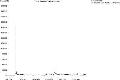
Figure 4.13. Concentration pattern for fluazinam in the upstream part of the sandy loam catchment, which represents OvreLillebaek, Fredligbaek and Steensbaek.
Figur 4.13. Koncentrationsmønster for fluazinam i den opstrøms ende af morænelersoplandet, der repræsenterer Øvre lillebæk, fredligbæk og steensbæk.
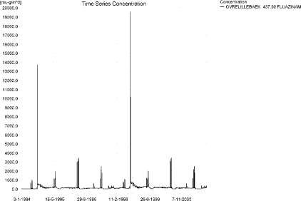
Figure 4.14. Concentration pattern for fluazinam inthe upstream part of OvreLillebaek The drift contributions increase in importance as the effect accumulates.
Figur 4.14. Koncentrationsmønster for fluazinam i den opstrøms ende af Øvre lillebæk. Drifttilskuddets betydning øges efterhånden som effekten akkumuleres.
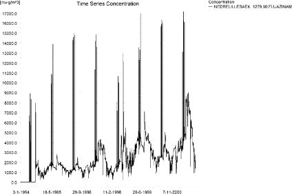
Figure 4.15. Concentration pattern for Fluazinam in NedreLillebaek, representing the lower part of the sandy loam catchment.
Figur 4.15. Koncentrationsmønster for fluazinam i Nedre Lillebæk, der repræsenterer den nedstrøms ende af morænelersoplandet.
Two concentration profiles are presented in this case to illustrate the extreme event and the joint impact of drift and groundwater contribution. The thin black line represents the concentration, while the thick black line shows the maximum concentrations obtained during the simulations. In addition, the outline of the stream is shown.
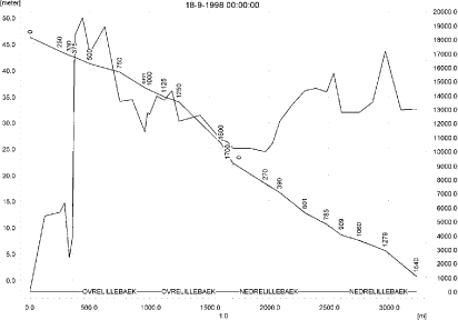
Figure 4.16. Concentrations in the sandy loam catchment on 18. September-1998. The concentrations are generated by the 20-year event, and most of the catchment reaches it maximum value at this date.
Figur 4.16. Koncentrationer i morænelersoplandet den 18 september-1998. Koncentrationerne genereres af 20-års-hændelsen, og størstedelen af oplandet opnår maximumsværdier på denne dato.
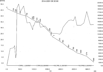
Figure 4.17. Concentrations in the sandy loam catchment on 20. June 2001. Concentrations in the top of the catchment are generated by drift alone, while the groundwater contribution is important in most of Nedrelillebaek.
Figur 4.17. Koncentrationer i morænelersoplandet den 20. juni-2001. Koncentrationer i topenden af oplandet genereres alene af drift mens grundvandstilstrømning er væsentlig i det meste af nedre Lillebæk.
To be able to extract comparable values to FOCUS SW, the global maxima and time weighted concentrations (up to 7 days) were extracted when these were meaningful.
Figure 4.18 and Figure 4.19 show the concentrations sorbed to macrophytes and Figure 4.20 the concentration of pesticide in porewater. The amount of pesticide sorbed to sediment is shown in Figure 4.21. The pattern of sorption to macrophytes follows the pattern of the water concentrations. The concentration level at the maximum point is more than five times the concentration in the water phase and the simulation results are therefore strongly influenced by the presence of macrophytes. At other sites the concentration in macrophytes and in the water phase are similar. The adsorption to sediment follows the concentration in the porewater. The maximum concentration reached is about 485 ng/kg in the downstream end of the catchment.
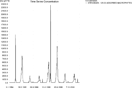
Figure 4.18. Pattern for concentration of fluazinam on macrophytes in the upstream part of the sandy loam catchment, which represents OvreLillebaek, Fredligbaek and Steensbaek.
Figur 4.18. Koncentrationsmønster af fluazinam på makrofytter i den opstrøms ende af morænelersoplandet, der repræsenterer Øvre Lillebæk, Fredligbæk og Steensbæk.
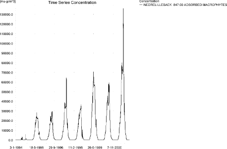
Figure 4.19. Concentration of fluazinam on macrophytes in the lower part of the sandy loam catchment.
Figur 4.19. Koncentration af fluazinam på makrofytter i den nedstrøms ende af morænelersoplandet.
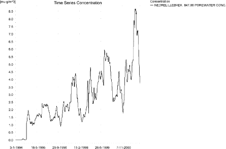
Figure 4.20. Concentration of fluazinam in porewater The highest concentration, 8.71 ng/l is reached 60 m further downstream from this point.
Figur 4.20. Porevandskoncentration i den nedstrøms del af morænelersoplandet. Den højeste koncentration, 8.71 ng/l opnås 60 m nedstrøms af det viste punkt.
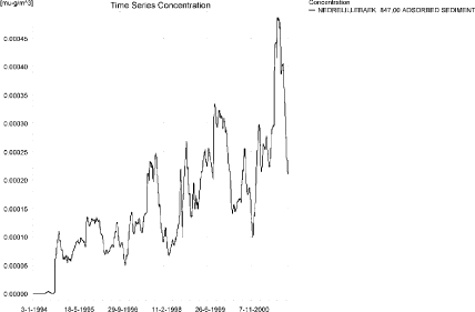
Figure 4.21. Concentration of fluazinam adsorbed to sediment in the downstream end of the sandy loam catchment for the point with the highest concentration reached. The concentration is in µg/g sediment and not µg/m³ as stated.
Figur 4.21. Koncentration af fluazinam sorberet til sediment i den nedstrøms ende af morænelersoplandet i lokaliteten med den højeste opnåede koncentration. Koncentrationen er i µg/g sediment og ikke µg/m³ som angivet.
The FOCUS SW-prediction and the PestSurf prediction for a sandy loam stream are quite different. FOCUS SW generates 497 ng/l while PestSurf generates 26.4 µg/l, or – in the main stream, 19.6 µg/l. In FOCUS SW, the maximum values are generated by wind drift while they are generated by the extreme (20-years) drainage event in PestSurf. The groundwater contribution, which is not included in FOCUS SW, contributes to the high concentrations in the lower part of the catchment. Although the concentration in the water phase is much higher in PestSurf, the concentration in sediment are comparable, 485 ng/kg compared to 366 ng/kg in FOCUS SW-D4 stream.
Figure 4.22 and Figure 4.23 and Table 4.9 and Table 4.10 show the results as generated by the PestSurf templates. The maximum value generated by the templates for the upper part of the stream is 19.6 µg/l, and for the lower part 17.2 µg/l. The maximum value generated in the upstream part of the catchment is 26.4 µg/l, however, in the main stream 19.6 µg/l is the maximum value. For the lower part, 17.2 µg/l is the maximum value generated by PestSurf. Thus, the templates did not catch the maximum concentration of the PestSurf simulation, but it did in this case catch the maximum value for the main stream.
The PestSurf template also calculates fractiles of events. For the upper part of the catchment, the 95 % fractile is 3.34 µg/l, which is somewhat closer to the FOCUS SW-value of 497 ng/l. As the water depth at this point, situated 437 m from the top end, often lies between 6 and 8 cm in the spraying period, a difference by a factor 4-5 is explainable by the water depth alone. In addition, the total load received is more than four times as high as in FOCUS SW.
The buildup of concentrations seen in the lower part of the catchment is not represented in the FOCUS SW-simulation, and it is to some extent seen as an artefact due to an overestimated macropore transport. In addition, this part of the catchment has a buildup of concentrations also due to drift.
Table 4.8. Maximum concentrations (ng/l) of fluazinam for selected calculation points in the sandy loam catchment.
Tabel 4.8. Maximumskoncentrationer (ng/l) af fluazinam for udvalgte lokaliteter i morænelersoplandet.
Click here to see Figure 4.22.
Figure 4.22. Overview for fluazinam in the sandy loam catchment generated by the PestSurf excel template for the upstream part of the catchment. The detection value was set to 100 ng/l.
Figur 4.22. Oversigt for fluazinam i morænelersoplandet genereret med PestSurf-excel-skabelonen for den opstrøms del af oplandet. Detektionsgrænsen var sat til 100 ng/l.
Click here to see Figure 4.23.
Figure 4.23. Overview for fluazinam in the sandy loam catchment generated by the PestSurf excel template for the downstream part of the catchment. The detection value was set to 2000 ng/l.
Figur 4.23. Oversigt for fluazinam i morænelersoplandet genereret med PestSurf-excel-skabelonen for den nedstrøms del af oplandet. Detektionsgrænsen var sat til 2000 ng/l.
Table 4.9. Part of the result sheet generated by the PestSurf Excel sheet for the upstream part of the sandy loam catchment. The detection value for generation of the table is set to 100 ng/l. The toxicity values for fish, daphnies and algae were set to 1000, 10000 and 10000 ng/l, respectively. The recorded peaks are shown in Figure 4.22.
Tabel 4.9. Uddrag af resultatpresentationen genereret af PestSurf-Excel-arket for den opstrøms del af morænelersoplandet. Detektionsgrænsen for tabelgenerering er sat til 100 ng/l. Toxicitetsværdierne for fisk, dafnier og alger er henholdsvis 1000, 10000 og 10000 ng/l. Hændelserne er vist i Figur 4.22.
Table 4.10. Part of the result sheet generated by the PestSurf Excel sheet for the downstream part of the sandy loam catchment. The detection value for generation of the table is specified as 2000 ng/l. The toxicity values for fish, daphnies and algae were set to 5000, 10000 and 10000, respectively. The recorded peaks are shown in Figure 4.23.
Tabel 4.10. Uddrag af resultatpresentationen genereret af PestSurf-Excel-arket for den nedstrøms del af morænelersoplandet. Detektionsgrænsen for tabelgenerering er sat til 2000 ng/l. Toxicitetsværdierne for fisk, dafnier og alger er henholdsvis 5000, 10000 og 10000 ng/l. Hændelserne er vist i Figur 4.23.
4.4.4 Sandy loam catchment, pond
The concentration pattern is evaluated in the middle of the pond only, see Figure 4.24. The pond receives contributions through drift and to some extent from drainage water, in good correspondence with the fact that it is situated in the upper part of the sandy loam catchment. The drift contribution can be seen as the very sharp peaks occurring four at a time. However, drainage contributions are visible and influence the general concentration level. The maximum concentration is 272 ng/l.
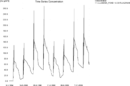
Figure 4.24. Concentrations of fluazinam for the sandy loam pond.
Figur 4.24. Koncentration af fluazinam i morænelersvandhullet.
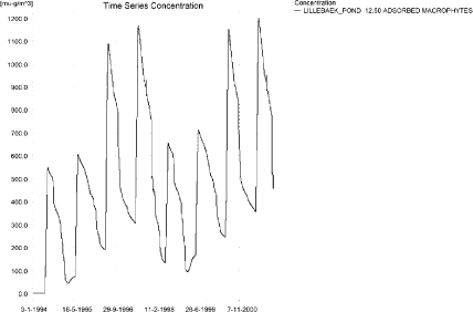
Figure 4.25. Fluazinam sorbed to the macrophytes in the sandy loam pond.
Figur 4.25. fluazinam sorberet til makrofytter i morænelers-vandhullet.
Figure 4.25 shows that the macrophytes participate strongly in the regulation of the concentrations in the pond. The maximum concentration is very high in relative terms, 1199 ng/l, about four times the water concentration, and thus influences the simulation results significantly. The concentration in the porewater is shown in Figure 4.26 and the concentration in sediment in Figure 4.27. The maximum value is 40 ng/kg.
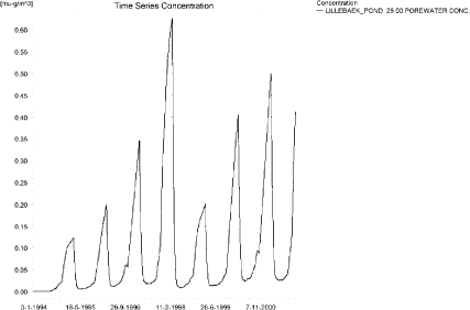
Figure 4.26. Porewater concentration of fluazinam in the sandy loam pond.
Figur 4.26. Porevandskoncentration af fluazinam i morænelersvandhullet.
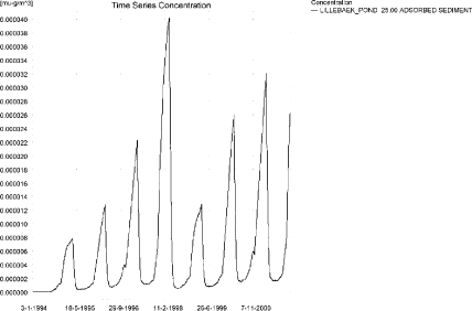
Figure 4.27. Fluazinam adsorbed to sediment in the sandy loam pond. The concentration is in µg/g sediment and not µg/m³ as stated.
Figur 4.27. Fluazinam adsorberet til sediment i morænelersvandhullet. Koncentrationen er i µg/g sediment of ikke µg/m³ som angivet.
In Table 4.11, global maxima and time weighted concentrations (up to 7 days) were extracted.
Table 4.11. Actual and time weighted concentrations of fluazinam, ng/l, in the sandy loam pond.
Tabel 4.11. Beregnede og tidsvægtede koncentrationer (ng/l) af fluazinam i morænelersvandhullet.
| Year | Fluazinam | actual | Time-weighted | Date |
| 1994 | global max | 128 | 01-07-1994 08:30 | |
| 1 hour(after max) | 108 | 116 | ||
| 1 day after sp.in. | 71 | 78 | ||
| 3 days | 70 | 73 | ||
| 4 days | 70 | 72 | ||
| 7 days | 71 | 71 | ||
| 1995 | Global max | 136 | 01-07-1995 08:30 | |
| 1 hour | 115 | 124 | ||
| 1 day | 79 | 86 | ||
| 2 days | 78 | 80 | ||
| 4 days | 78 | 80 | ||
| 7 days | 79 | 79 | ||
| 1996 | global max | 252 | 01-07-1996 08:30 | |
| 1 hour | 202 | 222 | ||
| 1 day | 141 | 153 | ||
| 2 (3*)days | 138 | 143 | ||
| 4 days | 139 | 142 | ||
| 7 (6*)days | 142 | 141 | ||
| 1997 | global max | 268 | 01-07-1997 08:30 | |
| 1 hour | 216 | 237 | ||
| 1 day | 153 | 165 | ||
| 2 (3*)days | 150 | 155 | ||
| 4 days | 150 | 154 | ||
| 7 (6*)days | 152 | 152 | ||
| 1998 | global max | 142 | 30-06-1998 08:30 | |
| 1 hour | 122 | 130 | ||
| 1 day | 85 | 92 | ||
| 2 (3*)days | 84 | 87 | ||
| 4 days | 84 | 86 | ||
| 7 (6*)days | 85 | 85 | ||
| 1999 | global max | 149 | 30-06-1999 08:30 | |
| 1 hour | 129 | 137 | ||
| 1 day | 92 | 99 | ||
| 2 (3*)days | 91 | 94 | ||
| 4 days | 91 | 93 | ||
| 7 (6*)days | 92 | 93 | ||
| 2000 | global max | 259 | 30-06-2000 08:30 | |
| 1 hour | 209 | 229 | ||
| 1 day | 148 | 160 | ||
| 2 (3*)days | 146 | 150 | ||
| 4 days | 147 | 149 | ||
| 7 (6*)days | 150 | 149 | ||
| 2001 | global max | 272 | 30-06-2001 08:30 | |
| 1 hour | 220 | 240 | ||
| 1 day | 157 | 169 | ||
| 2 (3*)days | 153 | 159 | ||
| 4 days | 154 | 157 | ||
| 7 (6*)days | 156 | 156 | ||
| max values | ||||
| global max | ||||
| 1 hour | 272 | |||
| 1 day | 220 | 240 | ||
| 2 days | 157 | 169 | ||
| 4 days | 153 | 159 | ||
| 7 days | 154 | 157 |
Figure 4.28 shows the output from the PestSurf template (page- lowest detection limit), with a time series identical to Figure 4.24.
The FOCUS SW-scenario D4-pond generates a concentration of 83 ng/l, which is lower, but in the same order of magnitude, as the PestSurf sandy loam pond-concentration of 272 ng/l. However, the sum of the concentration in macrophytes and in the water phase is 1471 ng/l. More solute is thus present in the PestSurf pond than in the D4-pond. One reason for the difference is the difference in size between the two ponds: 250 m² against 900 m² and the difference in water depth during the summer period. For this particular compound, the PestSurf pond receives more pesticide than the D4 pond, because FOCUS SW reduces the load per application when more applications are relevant.
The sediment concentration in PestSurf is lower that in the D4-pond, 40 ng/kg against 148 ng/kg.
The FOCUS SW concentration is generated through drift, while the PestSurf concentration is generated through a combination of drift and drainage.
Click here to see Figure 4.28.
Figure 4.28. Overview for Fluazinam in the sandy loam pond generated by the PestSurf excel template. The time series shown is identical to the one in Figure 4.24. The detection value was set to 75 ng/l.
Figur 4.28. Oversigt for fluazinam i morænelersoplandet genereret med PestSurf-excel-skabelonen. Den viste tidsserie er mage til den i Figur 4.24. Detektionsgrænsen er sat til 75 ng/l.
Table 4.12. Part of the result sheet generated by the PestSurf Excel sheet. The detection value is set t 75 ng/l. The toxicity values for fish, daphnies and algae were set to 15, 20 and 25 ng/l, respectively. The recorded peaks are shown in Figure 4.28.
Tabel 4.12. Uddrag af resultatpresentationen genereret af PestSurf-Excel-arket. Detektionsgrænsen er sat til 75 ng/l. Toxicitetsværdierne for fisk, dafnier og alger er henholdsvis 15, 20 og 25 ng/l. De tabellerede hændelser er vist i Figur 4.28.
Table 4.13. Summary of simulation results for Fluazinam.
Tabel 4.13. Opsummerede resultater for fluazinam.
4.5 Summary of simulations
The maximum actual concentrations for all simulations are recorded in Table 4.13.
The concentrations generated by PestSurf differ considerably between catchments and scenarios. The concentration generated for the sandy pond and stream are much larger than for the FOCUS SW D3-ditch. The reason for the high pond concentration is the addition of fluazinam through the groundwater. For the sandy stream, the continuous spraying of a long stretch together with a limited water depth causes the high concentrations. The maximum concentration reached 112 m from the upstream end of the sandy stream is 370 ng/l, and this value is more comparable to the 614 ng/l found for the D3-ditch. In PestSurf, however, the stretch is protected by a 20-m buffer zone, causing a reduction in the dose of a factor 13.6[1]. The water depth at the time of spraying is about 7 cm. Part of the difference is due to the smaller dose used in the FOCUS SW-simulations for compounds with several applications.
The sandy loam pond and the FOCUS D4-pond is within a factor of 3.3 of each other. However, the sum of the concentration in macrophytes and in the water phase is 1471 ng/l. More solute is thus present in the PestSurf pond than in the D4-pond. One reason for the difference is the difference in size between the two ponds: 250 m² against 900 m² and the difference in water depth during the summer period. For this particular compound, the PestSurf pond receives more pesticide than the D4 pond, because FOCUS SW reduces the load per application when more applications per year are practised.
For the sandy loam stream, the maximum concentrations are generated by the 20-year event for most of the catchment. The maximum value is much larger than what is generated by FOCUS SW. A similar situation is not present in the FOCUS SW- scenarios. 125 m from the upstream end is a point with a maximum value caused by drift. The maximum value here is 5380 ng/l, which is considerably higher than the FOCUS value of 497 ng/l. The water depth in the PestSurf point at the time is only about 5 cm at the time of spraying, but the additional difference could be due to the reduction in drift dose with more application times in FOCUS SW.
In the downstream end of the sandy loam catchment, the effect of spraying long stretches becomes important. At the same time, the high concentrations occurring in the lower part of the sandy loam catchment are also caused by contributions from groundwater flow. Fluazinam has a a relatively high DT50 value, meaning that pesticide percolated below the plough layer degrades very slowly. However, as mentioned earlier, the transport to groundwater is considered to be overestimated by the model (fluaziam is fairly strongly bound to soil particles and transported through macropores).
The highest concentration in the sandy loam catchment is reached in a tributary and is due to the 20-year-event. The water depth in June, at the time of spraying, is generally in the range of 5-8 cm.
Macrophytes influence all scenarios significantly, but particularly the sandy loam stream and pond. The concentrations in the water phase are strongly influenced and reduced by the presence of macrophytes.
The concentration in sediment in the sandy pond is considerably higher than in the D3-ditch, which is a function of the higher water concentration and the very long exposure time. Most of the simulation has water concentrations above 2 µg/l. For the sandy loam pond scenario, the sediment concentration is lower than in the corresponding FOCUS SW-scenario. Although the maximum water concentration is higher in the sandy loam loam pond than in the FOCUS D4-pond, it is still much lower than in the sandy pond and do not lead to similar sediment concentrations.
The groundwater buildup of active substance means that the concentration in the water phase is high for a long period of time and this influences the sediment concentration. As a result, the sediment concentration in the sandy loam stream is slightly higher than the concentration in the D4-stream.
The highly different conditions warrant an evaluation of what is more realistic. First of all, potatoes cannot be grown on the same piece of land year after year. The idea of spraying all agricultural land 8 years in a row with a compound used for potato is therefore not realistic. The high concentration found in the sandy poind is, as mentioned earlier, not so realistic because of the undrained conditions. The concentration in the sandy stream, however, is realistic, assuming that a long streach of stream is sprayed.
The sandy loam pond is realistic too with respect to its physical description. For the sandy loam stream, the 20-year event included in the simulation has taken place, and as drainage contributions were quite well simulated during the calibration phase, it is, as such a realistic event. It occurs already in the first year of simulation and no strong buildup in groundwater concentrations has taken place at this time.
The groundwater concentration is exaggerated though. To avoid this influence it is recommended to extract values between 500 m and 1700 m from the upstream end. In this case, the value is 18.9 µg/l, and caused by drainage. Generally, the flow conditions and water depths used in FOCUS are not representative for 1. order stream systems in Denmark, particularl taking into account the catchment size they are supposed to represent.
Footnotes
[1] The factor is crop dependent as it is the dose at 20 m compared to the dose at the edge of the stream, which depends on buffer zone with and thus the crop in question.
Annex 5
5 Comparison of risk assessment data produced by spray drift assessments, FOCUS SW and PestSurf
5.1 Chemical characteristics of the compound
| Compound: | Malathion |
| Dose: | 880 g ai/ha |
| Spraying time: | 15. june |
| Crop: | Peas |
Table 5.1. Overview of chemical properties of malathion and the parameters used in the simulations.
Tabel 5.1. Oversigt over malathions kemiske egenskaber og parametrene brugt i simuleringerne.
| Chemical property | Condition | Recalculated values | |||
| Cas-no. | 121-75-5 | ||||
| Molecular weight | 330.36 | ||||
| Form (acid, basic, neutral) | neutral | ||||
| pKa | |||||
| Water solubility | 148 µg/l | (unbuffered solution) | 25°C | ||
| log Kow | at pH | KowA- | |||
| log Kow | 2.75 | at pH | KowAH | 2.75 | |
| log Kow | at pH | KowAH+ | |||
| Vapor pressure, Pa | 4.5 × 10⁻⁴ | 25°C | 3.10 × 10⁻³ Pa at 35°C | vapor pressure, Pa, 20°C | 1.63 × 10⁻⁴ |
| Henry’s law constant | 1.0 × 10⁻³ Pa m³ mol-1 | Recalculated value, dimensionless | 4.11 × 10⁻⁷ | ||
| Sorption properties in soil | |||||
| Freundlich exp | 1 | ||||
| Koc, l/kg | 209 | ||||
| DT50 in soil, days | 0.133 | ||||
| DT50water | 9 hours | PestSurf input | |||
| DT50sedment | None mentioned | ||||
| DT50water/sediment | 9 hours | method not described | DT50, days | 0.375 | |
| Sediment konc., µg/l | 80 (default in PestSurf) | ||||
| Hydrolysis | 107 | at pH 5 | (acid) | indef | |
| 6.21 | at pH 7 | (neutral) | 10.2 | ||
| 0.49 | at pH 9 | (basic) | 5.7 × 10⁻⁶ | ||
| Photolysis | |||||
| quantum yield | No absorbance above 290 nm, set to 0 | ||||
| Spectrum | No absorbance above 290 nm | ||||
| Other | |||||
5.2 Concentration generated by spray
| Direct spray | FOCUS buffer zones | |||
| mg/l | ditch | Stream | Pond | |
| µg l-1 | µg l-1 | µg l-1 | µg l-1 | |
| Malathion | 293.3 | 6.262 | 4.556 | 2.194 |
5.3 Concentrations generated by FOCUS SW
5.3.1 D3- Ditch
| Malathion | Ditch, D3 | |||||||
| Water | Sediment | |||||||
| Date | PEC | Date | TWAEC | Date | PEC | Date | TWAEC | |
| µg l-1 | µg l-1 | µg kg-1 | µg kg-1 | |||||
| Global max | 21-jun-92 | 4.612 | 21-jun-92 | 0.469 | ||||
| 1 d | 22-jun-92 | 0.568 | 22-jun-92 | 2.117 | 22-jun-92 | 0.149 | 22-jun-92 | 0.382 |
| 2 d | 23-jun-92 | 0.022 | 23-jun-92 | 1.155 | 23-jun-92 | 0.025 | 23-jun-92 | 0.253 |
| 4 d | 25-jun-92 | 0 | 25-jun-92 | 0.579 | 25-jun-92 | 0.001 | 25-jun-92 | 0.133 |
| 7 d | 28-jun-92 | 0 | 27-jun-92 | 0.331 | 28-jun-92 | 0 | 28-jun-92 | 0.076 |
5.3.2 D4 – Stream
| Malathion | Stream, D4 | |||||||
| Water | Sediment | |||||||
| Date | PEC | Date | TWAEC | Date | PEC | Date | TWAEC | |
| µg l-1 | µg l-1 | µg kg-1 | µg kg-1 | |||||
| Global max | 18-jun-85 | 3.922 | 18-jun-85 | 0.168 | ||||
| 1 d | 19-jun-85 | 0 | 19-jun-85 | 0.314 | 19-jun-85 | 0.016 | 19-jun-85 | 0.067 |
| 2 d | 20-jun-85 | 0 | 20-jun-85 | 0.157 | 20-jun-85 | 0.004 | 20-jun-85 | 0.038 |
| 4 d | 22-jun-85 | 0 | 22-jun-85 | 0.078 | 22-jun-85 | 0 | 22-jun-85 | 0.02 |
| 7 d | 25-jun-85 | 0 | 22-jun-85 | 0.045 | 25-jun-85 | 0 | 25-jun-85 | 0.011 |
5.3.3 D4 – Pond
| Malathion | Pond, D4 | |||||||
| Water | Sediment | |||||||
| Date | PEC | Date | TWAEC | Date | PEC | Date | TWAEC | |
| µg l-1 | µg l-1 | µg kg-1 | µg kg-1 | |||||
| Global max | 18-jun-85 | 0.187 | 18-jun-85 | 0.024 | ||||
| 1 d | 19-jun-85 | 0.059 | 19-jun-85 | 0.111 | 19-jun-85 | 0.013 | 19-jun-85 | 0.021 |
| 2 d | 20-jun-85 | 0.019 | 20-jun-85 | 0.074 | 20-jun-85 | 0.006 | 20-jun-85 | 0.017 |
| 4 d | 22-jun-85 | 0.002 | 22-jun-85 | 0.041 | 22-jun-85 | 0.001 | 22-jun-85 | 0.011 |
| 7 d | 25-jun-85 | 0 | 25-jun-85 | 0.024 | 25-jun-85 | 0 | 25-jun-85 | 0.006 |
5.3.4 Conclusion – FOCUS SW
The highest concentration is generated in the ditch (D3). It is caused by wind drift and the concentration becomes 4.6 µg/l. The same scenario shows the highest concentration in the sediment, 0.469 µg/kg. For all scenarios, the concentrations are lower than what is generated by the simpler assessments.
5.4 PestSurf
5.4.1 Sandy Catchment, stream
The distribution of concentrations was assessed in several steps. First, the maximum concentrations at each calculation point were listed, and the dates for the occurrence of the maximum were assessed. The points, for which the maximum value also represents a local maximum, were selected for further analysis. The relevant values are listed in Table 5.2.
Table 5.2. Maximum concentrations (ng/l) of malathion simulated for each calculation point in the sandy catchment.
Tabel 5.2. Maximumkoncentrationer (ng/l) af malathion simuleret for hvert beregningspunkt i det sandede opland.
| MALATHION | Maximum | Max.Time | Local maxima |
| ODDERBAEK 0.00 | 1534 | 15-06-1998 09:19 | |
| ODDERBAEK 56.00 | 1637 | 15-06-1998 09:10 | |
| ODDERBAEK 112.00 | 1961 | 15-06-1998 09:00 | |
| ODDERBAEK 192.00 | 4252 | 15-06-1998 08:40 | |
| ODDERBAEK 272.00 | 6613 | 15-06-1998 08:30 | |
| ODDERBAEK 278.00 | 7021 | 15-06-1998 08:30 | |
| ODDERBAEK 282.00 | 7298 | 15-06-1998 08:30 | |
| ODDERBAEK 298.50 | 8112 | 15-06-1998 08:30 | |
| ODDERBAEK 315.00 | 8949 | 15-06-1998 08:30 | |
| ODDERBAEK 317.50 | 9074 | 15-06-1998 08:30 | |
| ODDERBAEK 320.00 | 9186 | 15-06-1998 08:30 | |
| ODDERBAEK 410.00 | 11981 | 15-06-1998 08:30 | |
| ODDERBAEK 500.00 | 13374 | 15-06-1998 08:30 | |
| ODDERBAEK 513.00 | 14000 | 15-06-1998 08:30 | |
| ODDERBAEK 521.00 | 14415 | 15-06-1998 08:30 | |
| ODDERBAEK 622.00 | 16936 | 15-06-1998 08:30 | |
| ODDERBAEK 723.00 | 18768 | 15-06-1998 08:30 | |
| ODDERBAEK 733.00 | 19278 | 15-06-1998 08:30 | |
| ODDERBAEK 742.00 | 19561 | 15-06-1998 08:30 | |
| ODDERBAEK 789.50 | 20474 | 15-06-1998 08:30 | |
| ODDERBAEK 837.00 | 21400 | 15-06-1998 08:30 | |
| ODDERBAEK 848.00 | 21798 | 15-06-1998 08:30 | |
| ODDERBAEK 863.00 | 22308 | 15-06-1998 08:30 | |
| ODDERBAEK 956.00 | 24019 | 15-06-1998 08:30 | |
| ODDERBAEK 1049.00 | 24432 | 15-06-1998 08:30 | x |
| ODDERBAEK 1111.50 | 23356 | 15-06-2005 08:30 | |
| ODDERBAEK 1174.00 | 20906 | 15-06-2005 08:30 | |
| ODDERBAEK 1226.00 | 19680 | 15-06-2005 08:40 | |
| ODDERBAEK 1278.00 | 19138 | 15-06-2005 08:40 | |
| ODDERBAEK 1293.50 | 18893 | 15-06-2005 08:40 | |
| ODDERBAEK 1310.00 | 18503 | 15-06-2005 08:49 | |
| ODDERBAEK 1421.00 | 17821 | 17-06-2000 08:50 | |
| ODDERBAEK 1532.00 | 15696 | 15-06-1998 08:30 | |
| ODDERBAEK 1558.06 | 13932 | 15-06-1998 08:40 | |
| ODDERBAEK 1584.12 | 13342 | 15-06-1998 08:40 | |
| ODDERBAEK 1584.12 | 13342 | 15-06-1998 08:40 | |
| ODDERBAEK 1621.06 | 13308 | 15-06-1998 08:40 | |
| ODDERBAEK 1658.00 | 13608 | 15-06-1998 08:30 | |
| ODDERBAEK 1698.50 | 14525 | 15-06-1998 08:30 | |
| ODDERBAEK 1739.00 | 15205 | 15-06-1998 08:30 | x |
| ODDERBAEK 1801.50 | 14896 | 15-06-1998 08:30 | |
| ODDERBAEK 1864.00 | 12162 | 17-06-2004 08:30 | |
| ODDERBAEK 1977.00 | 9226 | 17-06-2000 10:00 | |
| ODDERBAEK 2090.00 | 9058 | 17-06-2000 10:00 | |
| ODDERBAEK 2098.00 | 9051 | 17-06-2000 10:00 | |
| ODDERBAEK 2105.00 | 9027 | 17-06-2000 10:00 | |
| ODDERBAEK 2131.00 | 8968 | 17-06-2000 10:00 | |
| ODDERBAEK 2157.00 | 8865 | 17-06-2000 10:00 | |
| ODDERBAEK 2168.00 | 8818 | 17-06-2000 10:00 | |
| ODDERBAEK 2179.00 | 8775 | 17-06-2000 10:00 | |
| ODDERBAEK 2268.50 | 8633 | 17-06-2000 10:00 | |
| ODDERBAEK 2358.00 | 8185 | 17-06-2004 10:00 | |
| ODDERBAEK 2363.50 | 8149 | 17-06-2004 10:00 | |
| ODDERBAEK 2372.00 | 8107 | 17-06-2004 10:00 | |
| ODDERBAEK 2427.00 | 7999 | 17-06-2004 10:00 | |
| ODDERBAEK 2482.00 | 7877 | 15-06-2001 11:00 | |
| ODDERBAEK 2609.00 | 7921 | 17-06-2000 11:00 | |
| ODDERBAEK 2736.00 | 7505 | 17-06-2000 11:00 | |
| ODDERBAEK 2831.00 | 7445 | 17-06-2000 11:00 | |
| ODDERBAEK 2926.00 | 6991 | 17-06-2000 11:00 | |
| ODDERBAEK 2958.50 | 6905 | 17-06-2000 11:00 | |
| ODDERBAEK 2991.00 | 6813 | 17-06-2004 11:00 | |
| ODDERBAEK 3029.50 | 6615 | 17-06-2004 11:00 | |
| ODDERBAEK 3068.00 | 6262 | 17-06-2004 11:00 | |
| ODDERBAEK 3131.00 | 5830 | 17-06-2004 11:00 | |
| ODDERBAEK 3194.00 | 5581 | 17-06-2000 12:00 | |
| ODDERBAEK 3250.50 | 5543 | 17-06-2000 12:00 | |
| ODDERBAEK 3307.00 | 5498 | 17-06-2004 12:00 | |
| ODDERBAEK 3315.00 | 5496 | 17-06-2004 12:00 | |
| ODDERBAEK 3323.00 | 5489 | 17-06-2004 12:00 | |
| ODDERBAEK 3355.50 | 6305 | 15-06-1998 08:30 | |
| ODDERBAEK 3388.00 | 7186 | 15-06-1998 08:30 | |
| ODDERBAEK 3438.50 | 8072 | 15-06-1998 08:30 | |
| ODDERBAEK 3489.00 | 8338 | 15-06-1998 08:30 | |
| ODDERBAEK 3499.50 | 8370 | 15-06-1998 08:30 | x |
| ODDERBAEK 3510.00 | 8354 | 15-06-1998 08:30 | |
| ODDERBAEK 3581.00 | 7612 | 15-06-1998 08:30 | |
| ODDERBAEK 3652.00 | 6726 | 15-06-1998 08:40 | |
| ODDERBAEK 3707.00 | 6731 | 15-06-1998 08:40 | |
| ODDERBAEK 3762.00 | 6201 | 15-06-1998 08:40 | |
| ODDERBAEK 3790.00 | 5436 | 15-06-1998 08:40 | |
| ODDERBAEK 3818.00 | 4301 | 15-06-1998 08:40 | |
| ODDERBAEK 3818.00 | 4301 | 15-06-1998 08:40 | |
| ODDERBAEK 3884.00 | 4192 | 15-06-1998 08:49 | |
| ODDERBAEK 3950.00 | 4010 | 15-06-1998 08:49 | |
| ODDERBAEK 3998.00 | 3738 | 15-06-1998 08:49 | |
| ODDERBAEK 4046.00 | 3541 | 15-06-1998 09:00 | |
| ODDERBAEK 4047.50 | 3539 | 15-06-1998 09:00 | |
| ODDERBAEK 4049.00 | 3538 | 15-06-1998 09:00 | |
| ODDERBAEK 4052.50 | 3537 | 15-06-1998 09:00 | |
| ODDERBAEK 4056.00 | 3535 | 15-06-1998 09:00 | |
| ODDERBAEK 4058.00 | 3533 | 15-06-1998 09:00 | |
| ODDERBAEK 4060.00 | 3531 | 15-06-1998 09:00 | |
| ODDERBAEK 4080.00 | 3500 | 15-06-1998 09:00 | |
| ODDERBAEK 4100.00 | 3471 | 15-06-1998 09:00 | |
| ODDERBAEK 4134.00 | 3480 | 15-06-2005 09:00 | |
| ODDERBAEK 4168.00 | 3486 | 15-06-2005 09:00 | |
| GISLUM_ENGE_AFLOEB 0.00 | 0 | 15-06-1998 08:10 | |
| GISLUM_ENGE_AFLOEB 50.00 | 0 | 15-06-1998 08:10 | |
| GISLUM_ENGE_AFLOEB 100.00 | 0 | 15-06-1998 08:10 | |
| GISLUM_ENGE_AFLOEB 150.00 | 0 | 15-06-1998 08:10 | |
| GISLUM_ENGE_AFLOEB 200.00 | 0 | 15-06-1998 08:10 | |
| GISLUM_ENGE_AFLOEB 250.00 | 0 | 15-06-1998 08:10 | |
| GISLUM_ENGE_AFLOEB 300.00 | 0 | 15-06-1998 08:10 | |
| GISLUM_ENGE_AFLOEB 340.00 | 0 | 15-06-1998 08:10 | |
| GISLUM_ENGE_AFLOEB 380.00 | 0 | 15-06-1998 08:10 | |
| GISLUM_ENGE_AFLOEB 430.00 | 0 | 15-06-1998 08:10 | |
| GISLUM_ENGE_AFLOEB 480.00 | 0 | 15-06-1998 08:10 | |
| GISLUM_ENGE_AFLOEB 530.00 | 0 | 15-06-1998 08:10 | |
| GISLUM_ENGE_AFLOEB 580.00 | 0 | 15-06-1998 08:10 | |
| GISLUM_ENGE_AFLOEB 630.00 | 0 | 15-06-1998 08:10 | |
| GISLUM_ENGE_AFLOEB 680.00 | 0 | 15-06-1998 08:10 | |
| GISLUM_ENGE_AFLOEB 730.00 | 0 | 15-06-1998 09:10 | |
| GISLUM_ENGE_AFLOEB 780.00 | 0 | 15-06-1998 09:10 | |
| GISLUM_ENGE_AFLOEB 830.00 | 0 | 15-06-1998 09:10 | |
| GISLUM_ENGE_AFLOEB 880.00 | 0 | 15-06-1998 09:10 | |
| GISLUM_ENGE_AFLOEB 915.00 | 0 | 15-06-1998 09:10 | |
| GISLUM_ENGE_AFLOEB 950.00 | 0 | 15-06-1998 09:10 | |
| GISLUM_ENGE_AFLOEB 985.00 | 0 | 15-06-1998 09:00 | |
| GISLUM_ENGE_AFLOEB 1020.00 | 0 | 15-06-1998 09:00 | |
| GISLUM_ENGE_AFLOEB 1045.00 | 0 | 15-06-1998 09:00 | |
| GISLUM_ENGE_AFLOEB 1070.00 | 0 | 15-06-1998 09:00 | |
| GISLUM_ENGE_AFLOEB 1110.00 | 0 | 15-06-1998 09:00 | |
| GISLUM_ENGE_AFLOEB 1150.00 | 1 | 15-06-1998 09:00 | |
| GISLUM_ENGE_AFLOEB 1190.00 | 3 | 15-06-1998 09:00 | |
| GISLUM_ENGE_AFLOEB 1230.00 | 7 | 15-06-1998 09:00 | |
| GISLUM_ENGE_AFLOEB 1271.00 | 24 | 15-06-1998 08:49 | |
| GISLUM_ENGE_AFLOEB 1312.00 | 72 | 15-06-1998 08:49 | |
| GISLUM_ENGE_AFLOEB 1422.00 | 858 | 15-06-1998 08:49 | |
| GISLUM_ENGE_AFLOEB 1532.00 | 4301 | 15-06-1998 08:40 | |
| TILLOEB 0.00 | 12836 | 15-06-1998 08:40 | |
| TILLOEB 20.16 | 13138 | 15-06-1998 08:40 | |
| TILLOEB 40.31 | 13342 | 15-06-1998 08:40 | |
| global max | 24432 |
The pattern over time was the same for all calculation points. The peak values are generated by wind drift, see Figure 5.1.
Each of the events generated an almost identical pattern along the stream; see the longitudinal profile in Figure 5.2. The thin black line represents the concentration, while the thick black line shows the maximum concentrations obtained during the simulations. In addition, the outline of the stream is shown. In the middle of the catchment, the stream is protected by unsprayed areas. The maximum values at the center of the catchment are obtained when the peak from upstream move through the catchment during the hour following spraying.
In order to present the data in a similar fashion to the FOCUS SW-results, data were extracted and recalculated for the time series marked in Table 5.2. The global maxima and time weighted concentrations (up to 7 days) were extracted and are reported in Table 5.3. Note that the unit is ng/l.
The highest concentration of malathion on macrophytes (343 ng/l) is shown in Figure 5.3. It has a limited influence on the concentration in the water phase. The maximum pore water concentration is shown in Figure 5.4. The sediment concentration is 2.9 ng/kg.
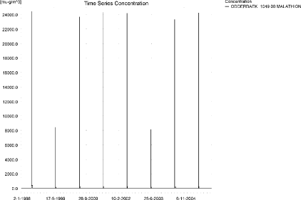
Figure 5.1. Concentration pattern over time for malathion in the sandy catchment.
Figur 5.1. Koncentrationsmønster som funktion af tid for malathion i det sandede opland.
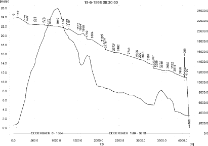
Figure 5.2. Concentrations of malathion in the sandy catchment on 15. June, 1998 after spraying.
Figur 5.2. Koncentrationer malathion i det sandede opland den 15. juni 1998 lige efter endt sprøjtning.
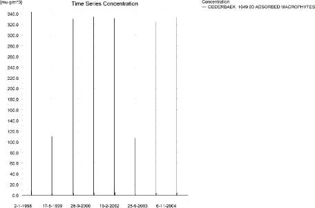
Figure 5.3. The concentration of malathion sorbed on macrophytes.
Figur 5.3. Koncentration af malathion sorberet på makrofytter.
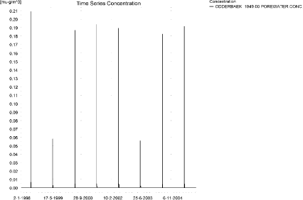
Figure 5.4. Pore water concentrations of malathion in the sandy catchment.
Figur 5.4. Porevandskoncentration for malathion i det sandede opland.
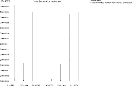
Figure 5.5. Sediment concentrations of malathion in the sandy catchment. Note that the unit is in µg/g instead of µg/m³ as indicated.
Figur 5.5. Sedimentkoncentration for malathion i det sandede opland. Bemærk at koncentrationen er i µg/g og ikke i µg/m³ som angivet.
The global maximum value calculated by PestSurf for the sandy catchment in the water phase is 24.4 µg/l. This is considerably higher than what is found in the D3-ditch scenario (4.61 µg/l). A small amount of pesticide was sorbed to macrophytes (0.343 µg/l) in the stream. The high concentration is caused by the long stretch of stream that is sprayed simultaneously. A more comparable value could be the concentration 112 m from the upstream end. Here drift causes a concentration of 1.96 µg/l.
Table 5.3. Concentration (ng/l)of malathion at selected points in the sandy stream.
Tabel 5.3. Koncentration af malathion, ng/l, på udvalgte lokaliteter i det sandede vandløb.
Figure 5.6. Overview for malathion in the sandy catchment generated by the PestSurf excel template. The max concentrations generated over the 24 hours are similar to the overview in Figure 5.2. The graph to the lower right shows how many events have concentrations higher than a given value for the selected monitoring points. Detection value was set to 10 ng/l.
Figur 5.6. Oversigt for malathion i det sandede opland genereret med PestSurf-excel-skabelonen. Den maximale koncentration genereret over 24 timer svarer til oversigten i Figur 5.2. Grafen nederst til højre viser hvor mange hændelser, der har koncentrationer højere end en given værdi i et udvalgt punkt. Detektionsgrænsen var sat til 10 ng/l.
Table 5.4. Part of the result sheet generated by the PestSurf Excel sheet. The selected table shows the point along the stream with the highest concentration recorded. The detection values applied in the table is 10 ng/l, toxicity to fish, daphnies and algae are set to 100, 1000 and 10000 ng/, respectively. The recorded peaks are shown in Figure 5.6.
Tabel 5.4. Uddrag af resultatpresentationen genereret af PestSurf-Excel-arket. Den udvalgte tabel viser det fordefinerede punkt langs med åen med højest koncentration. Detektionsgrænsen er sat til 10 mens toxicitetsværdierne for fisk, dafnier og alger er henholdsvis 100, 1000 og 10000 ng/l. De tabellerede hændelser er vist i Figur 5.6.
Figure 5.6 and Table 5.4 show the output of the PestSurf Excel template. The template works with pre-defined data extraction points. The plot requires specification of a “lowest detection value” (ldc) which defines when a pesticide occurrence is defined as an event. The time series plot is identical to the time series shown earlier, and the graph in the upper right corner resembles the plots in Figure 5.2, but takes into account a longer period of time. A curve is generated when a downstream point reaches a concentration higher than the ldc. The programme then tracks the highest concentration for each calculation point in the stream within the last 24 hours. The plot in the lower right corner shows how many events have concentrations higher than a given value for the selected monitoring points. Table 5.4 shows the table representing the point along the stream (of the pre-defined points) with the highest concentration. This value was, however, only 13.3 µg/l. Thus, the pre-defined points have not caught the highest concentration of the simulation, which was 24.4 µg/l.
5.4.2 Sandy Catchment, pond
The concentration pattern is evaluated in the middle of the pond only, see Figure 5.7. The pond receives drift and in 1999 and 2003 a contribution from groundwater, due to rainfall in the beginning of July. The drift peaks are visible in all years. The maximum concentration is 188 ng/l.
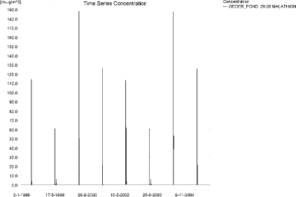
Figure 5.7. Concentrations of malathion in the sandy pond.
Figur 5.7. Koncentration af malathion i det sandede vandhul.
In Table 5.5, global maxima and time weighted concentrations (up to 7 days) were extracted.
Table 5.5. Maximum concentrations (ng/l) of malathion generated by drift for the sandy pond.
Tabel 5.5. maximumkoncentrationer af malathion(ng/l) genereret for det sandede vandhul.
| Year | ODDER_POND 20.00 | |||
| Conc. | TWC | Date | ||
| 1998 | 1998 (global max) | 114 | 15-06-1998 | |
| 1 hour (after max) | 81 | 86 | ||
| 1 day after sp.in. | 17 | 45 | ||
| 2 days | 1 | 17 | ||
| 4 days | 1 | 13 | ||
| 7 days | 3 | 8 | ||
| 1999 | 1999 (global max) | 61 | 15-06-1999 | |
| 1 hour (after max) | 40 | 44 | ||
| 1 day after sp.in. | 1 | 9 | ||
| 2 days | 1 | 3 | ||
| 4 days | 1 | 3 | ||
| 7 days | 1 | 2 | ||
| 2000 | 2000 (global max) | 188 | 17-06-2000 | |
| 1 hour (after max) | 144 | 152 | ||
| 1 day after sp.in. | 63 | 95 | ||
| 2 days | 44 | 64 | ||
| 4 days | 46 | 59 | ||
| 7 days | 51 | 54 | ||
| 2001 | 2001 (global max) | 126 | 15-06-2001 | |
| 1 hour (after max) | 90 | 96 | ||
| 1 day after sp.in. | 30 | 55 | ||
| 2 days | 11 | 29 | ||
| 4 days | 13 | 25 | ||
| 7 days | 21 | 22 | ||
| 2002 | 2002 (global max) | 114 | 15-06-2002 | |
| 1 hour (after max) | 81 | 86 | ||
| 1 day after sp.in. | 17 | 45 | ||
| 2 days | 1 | 17 | ||
| 4 days | 1 | 13 | ||
| 7 days | 3 | 8 | ||
| 2003 | 2003 (global max) | 61 | 15-06-2003 | |
| 1 hour (after max) | 40 | 44 | ||
| 1 day after sp.in. | 1 | 9 | ||
| 2 days | 1 | 3 | ||
| 4 days | 1 | 3 | ||
| 7 days | 1 | 2 | ||
| 2004 | 2004 (global max) | 187 | 17-06-2004 | |
| 1 hour (after max) | 144 | 151 | ||
| 1 day after sp.in. | 63 | 95 | ||
| 2 days | 44 | 64 | ||
| 4 days | 46 | 59 | ||
| 7 days | 51 | 54 | ||
| 2005 | 2005 (global max) | 126 | 15-06-2005 | |
| 1 hour (after max) | 90 | 96 | ||
| 1 day after sp.in. | 30 | 55 | ||
| 2 days | 11 | 29 | ||
| 4 days | 13 | 25 | ||
| 7 days | 21 | 22 | ||
| Global max | 188 | |||
| 1 hour (after max) | 144 | 152 | ||
| 1 day after sp.in. | 63 | 95 | ||
| 2 days | 44 | 64 | ||
| 4 days | 46 | 59 | ||
| 7 days | 51 | 54 | ||
As for the previous simulation, some sorption to the macrophytes is observed, see Figure 5.8. The concentration is quite small, with a maximum of 0.301 ng/l. The max. concentrations reached for pore water is 0.003 ng/l (see Figure 5.9) and the concentration of malathion adsorbed to sediment is<0.01 ng/kg.
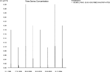
Figure 5.8. Sorption of malathion to macrophytes in the sandy pond.
Figur 5.8. Sorption af malathion til makrofytter i det sandede vandhul.
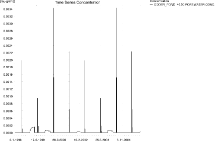
Figure 5.9. Pore water concentration of malathion in the sandy pond.
Figur 5.9. Porevandskoncentration af malathion i det sandede vandhul.
Compared to the FOCUS D3 ditch, the concentration in the PestSurf sandy pond is considerably lower, 0.188 µg/l compared to 4.61 µg/l. Wind drift is significant in both cases. The dilution is far greater in the pond than in the ditch.
In the pond-case, there is no difference between the results of Pestsurf and the results extracted by the templates.
Figure 5.10 shows the output of the PestSurf Excel template. The template works with one pre-defined data extraction point for the pond (center of the pond). The plot requires specification of a “lowest detection value” (ldc) which defines when a pesticide occurrence is defined as an event. The time series plot is identical to the time series shown earlier. The plot to the right shows how many events have concentrations higher than a given toxicity value for the selected monitoring points.
Table 5.6 shows part of the result sheet generated by the PestSurf Excel sheet based on the ldc-value.
Click here to see Figure 5.10.
Figure 5.10. Overview for malathion in the sandy pond generated by the PestSurf excel template. The time series shown is identical to the one in Figure 5.7. The detection value is set to 1 ng/l.
Figur 5.10. Oversigt for malathion i det sandede vandhul genereret med PestSurf-excel-skabelonen. Den viste tidsserie er mage til den i Figur 5.7. Detektionsgrænsen er sat til 1 ng/l.
Table 5.6. Part of the result sheet generated by the PestSurf Excel sheet, applied to malathion. The limiting values applied for table generation is 1 ng/l, toxicity to fish, daphnies and algae are set to 10, 50 and 100 ng/, respectively. The recorded peaks are shown in Figure 5.10.
Tabel 5.6. Uddrag af resultatpresentationen genereret af PestSurf-Excel-arket anvendt på malathion. Grænseværdien anvendt til tabelgenerering er sat til 1 ng/l mens toxicitetsværdierne for fisk, dafnier og alger er henholdsvis 10, 50 og 100 ng/l. De tabellerede hændelser er vist i Figur 5.10.
5.4.3 Sandy Loam catchment, Stream
The distribution of concentrations was assessed in several steps. First, the maximum concentrations at each calculation point were listed in Table 5.7, and the dates for the occurrence of the maximum were assessed. The points, for which the maximum value also represents a local maximum, were selected for further analysis.
All points show the same type of time series pattern. The six points with highest maximum values were analyzed further.
Table 5.7. Maximum concentrations (ng/l) of malathion simulated for each calculation point in the sandy loam catchment.
Tabel 5.7. Maximumskoncentrationer (ng/l) af malathion simuleret for hvert beregningspunkt i morænelersoplandet.
| MALATHION | Maximum | Max.Time | Local Maxima |
| ALBJERGBAEK 0.00 | 0 | 14-06-1998 11:00 | |
| ALBJERGBAEK 150.00 | 0 | 26-06-1996 01:00 | |
| ALBJERGBAEK 300.00 | 8 | 14-06-1998 10:00 | |
| ALBJERGBAEK 450.00 | 0 | 24-06-1996 21:00 | |
| ALBJERGBAEK 600.00 | 18021 | 14-06-2000 13:00 | |
| ELHOLTBAEK 0.00 | 17 | 14-06-2001 09:30 | |
| ELHOLTBAEK 165.00 | 0 | 03-02-1999 00:00 | |
| ELHOLTBAEK 330.00 | 14707 | 14-06-2000 08:49 | |
| FREDLIGBAEK 0.00 | 0 | 15-06-2000 05:00 | |
| FREDLIGBAEK 100.00 | 0 | 09-07-1996 08:00 | |
| FREDLIGBAEK 200.00 | 0 | 14-06-1998 13:00 | |
| FREDLIGBAEK 300.00 | 0 | 12-07-2000 18:00 | |
| FREDLIGBAEK 400.00 | 0 | 14-06-1998 11:00 | |
| FREDLIGBAEK 500.00 | 0 | 13-07-1996 21:00 | |
| FREDLIGBAEK 600.00 | 5 | 14-06-1998 09:49 | |
| FREDLIGBAEK 667.50 | 0 | 13-10-2000 00:00 | |
| FREDLIGBAEK 735.00 | 27893 | 14-06-2000 09:40 | |
| GROFTEBAEK 0.00 | 0 | 14-06-1998 09:30 | |
| GROFTEBAEK 155.00 | 0 | 23-06-2001 16:00 | |
| GROFTEBAEK 310.00 | 32 | 14-06-1998 09:19 | |
| GROFTEBAEK 465.00 | 0 | 13-07-1997 14:00 | |
| GROFTEBAEK 620.00 | 36543 | 14-06-2000 08:49 | |
| STENSBAEK 0.00 | 0 | 14-06-1999 11:00 | |
| STENSBAEK 125.00 | 0 | 05-02-2000 00:00 | |
| STENSBAEK 250.00 | 6 | 14-06-1999 09:49 | |
| STENSBAEK 412.50 | 0 | 25-06-1996 04:00 | |
| STENSBAEK 575.00 | 10153 | 14-06-2000 14:00 | |
| OVRELILLEBAEK 0.00 | 0 | 24-06-2000 16:00 | |
| OVRELILLEBAEK 125.00 | 31296 | 14-06-1999 08:30 | |
| OVRELILLEBAEK 250.00 | 32998 | 14-06-2000 08:30 | |
| OVRELILLEBAEK 290.00 | 42364 | 14-06-2000 11:00 | x |
| OVRELILLEBAEK 330.00 | 18021 | 14-06-2000 13:00 | |
| OVRELILLEBAEK 330.00 | 18021 | 14-06-2000 13:00 | |
| OVRELILLEBAEK 352.50 | 23542 | 14-06-2000 13:00 | |
| OVRELILLEBAEK 375.00 | 10153 | 14-06-2000 14:00 | |
| OVRELILLEBAEK 375.00 | 10153 | 14-06-2000 14:00 | |
| OVRELILLEBAEK 437.50 | 18582 | 14-06-2000 08:30 | |
| OVRELILLEBAEK 500.00 | 30198 | 14-06-2000 08:30 | |
| OVRELILLEBAEK 625.00 | 34979 | 14-06-2000 08:40 | x |
| OVRELILLEBAEK 750.00 | 22170 | 14-06-2000 08:30 | |
| OVRELILLEBAEK 855.00 | 32734 | 14-06-2000 08:30 | |
| OVRELILLEBAEK 960.00 | 14707 | 14-06-2000 08:49 | |
| OVRELILLEBAEK 960.00 | 14707 | 14-06-2000 08:49 | |
| OVRELILLEBAEK 980.00 | 16106 | 14-06-2000 08:49 | |
| OVRELILLEBAEK 1000.00 | 12997 | 14-06-2000 08:49 | |
| OVRELILLEBAEK 1062.50 | 12443 | 14-06-2000 09:00 | |
| OVRELILLEBAEK 1125.00 | 16217 | 14-06-2000 08:30 | |
| OVRELILLEBAEK 1187.50 | 21491 | 14-06-2000 08:30 | |
| OVRELILLEBAEK 1250.00 | 23751 | 14-06-2000 08:30 | |
| OVRELILLEBAEK 1425.00 | 29939 | 14-06-2000 08:30 | x |
| OVRELILLEBAEK 1600.00 | 23282 | 14-06-2000 08:30 | |
| OVRELILLEBAEK 1650.00 | 30058 | 14-06-2000 08:30 | x |
| OVRELILLEBAEK 1700.00 | 17277 | 14-06-2000 09:10 | |
| NEDRELILLEBAEK 0.00 | 17277 | 14-06-2000 09:10 | |
| NEDRELILLEBAEK 135.00 | 17815 | 14-06-2000 08:30 | |
| NEDRELILLEBAEK 270.00 | 30583 | 14-06-2000 08:30 | |
| NEDRELILLEBAEK 330.00 | 36673 | 14-06-2000 08:30 | x |
| NEDRELILLEBAEK 390.00 | 33922 | 14-06-2000 08:30 | |
| NEDRELILLEBAEK 495.50 | 39321 | 14-06-2001 08:40 | x |
| NEDRELILLEBAEK 601.00 | 27893 | 14-06-2000 09:40 | |
| NEDRELILLEBAEK 601.00 | 27893 | 14-06-2000 09:40 | |
| NEDRELILLEBAEK 693.00 | 26782 | 14-06-2000 10:00 | |
| NEDRELILLEBAEK 785.00 | 40952 | 14-06-2000 08:30 | |
| NEDRELILLEBAEK 847.00 | 60968 | 14-06-2000 08:30 | x |
| NEDRELILLEBAEK 909.00 | 36543 | 14-06-2000 08:49 | |
| NEDRELILLEBAEK 909.00 | 36543 | 14-06-2000 08:49 | |
| NEDRELILLEBAEK 984.50 | 32758 | 14-06-2000 09:00 | |
| NEDRELILLEBAEK 1060.00 | 47113 | 14-06-2000 08:30 | |
| NEDRELILLEBAEK 1169.50 | 58727 | 14-06-2000 08:30 | |
| NEDRELILLEBAEK 1279.00 | 81412 | 14-06-2000 08:30 | x |
| NEDRELILLEBAEK 1409.50 | 38697 | 14-06-2001 09:10 | |
| NEDRELILLEBAEK 1540.00 | 25571 | 14-06-2001 11:00 | |
| global max | 81412 |
All maximum concentrations are caused by drift. Figure 5.11 and Figure 5.12 show the concentration pattern as it appears for the whole stream.
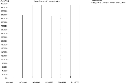
Figure 5.11. Concentration pattern for malathion in the sandy loam catchment.
Figur 5.11. Koncentrationsmønster for malathion i morænelersoplandet.
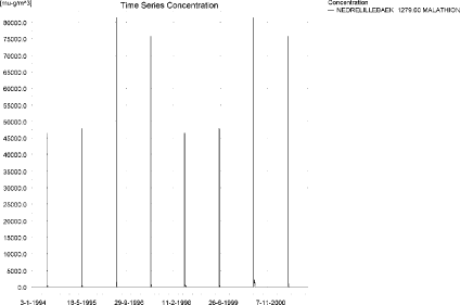
Figure 5.12. Concentration pattern for malathion in the sandy loam catchment.
Figur 5.12. Koncentrationsmønster for malathion i morænelersoplandet.
Longitudinal profiles of the concentrations in the sandy loam catchment on 14. June 2000, 8.30, 8.40 and 11.00 hours are shown in Figure 5.13, Figure 5.14 and Figure 5.15, respectively. The thin black line represents the concentration, while the thick black line shows the maximum concentrations obtained during the simulations. In addition, the outline of the stream is shown. The peak concentrations move downstream as the time passes.
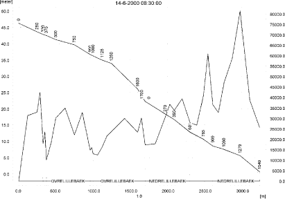
Figure 5.13. Concentrations in the sandy loam catchment on 14. June 2000, 8:30. The concentrations are generated by wind drift.
Figur 5.13. Koncentrationer i morænelersoplandet den 14. juni-2000. 8.30. Koncentrationerne genereres af drift.
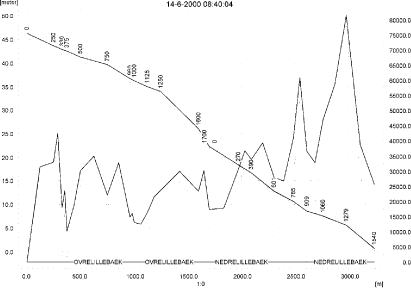
Figure 5.14. Concentrations in the sandy loam catchment on 14. June 2000, 8:40.
Figur 5.144. Koncentrationer i morænelersoplandet den 14. juni-2000. 8.40.
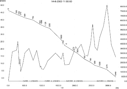
Figure 5.15. Concentrations in the sandy loam catchment on 14. June-2000, 11:00.
Figur 5.15. Koncentrationer i morænelersoplandet den 14. juni-2000. 11.00.
To be able to extract comparable values to FOCUS SW, the global maxima and time weighted concentrations (up to 7 days) were extracted when these were meaningful.
Table 5.8. Instantaneous and time weighted concentrations (ng/l) of malathion for selected points in the sandy loam catchment.
Tabel 5.8. Beregnede og tidsvægtede maximumskoncentrationer (ng/l) af malathion for udvalgte lokaliteter i morænelersoplandet.
Figure 5.16 shows the concentrations sorbed to macrophytes. The maximum concentration only reaches 5.77 µg/l, and the importance for the stream concentration appears significant but limited. The pattern follows the pattern of the water concentrations. The pore water concentration is shown in Figure 5.17. The concentration in sediment reaches 8.2 ng/kg at the upper end of the Ovrelillebaek.
Compared to the FOCUS SW-stream-scenario for D4, the concentration level in the sandy loam stream is considerably higher (81.4 µg/l compared to 3.92 µg/l). A value of 31.3 µg/l is reached already 125 m from the upstream end. The water depth at this point is between 3.6 and 4.85 cm at the time of maximum concentration. The water depth alone thus causes a factor of >7 compared to the FOCUS concentration. Furthermore, the stream does not have a square cross section as the FOCUS streams. The FOCUS D4-stream reaches a sediment concentration of 168 ng/kg while the FOCUS stream only reaches a concentration of 8 ng/kg, in spite of the much higher water concentrations.
Figure 5.19 to Figure 5.21 and Table 5.9 and Table 5.10 show the results as generated by the PestSurf templates. The maximum value generated by the templates for the upper part of the stream is 30.0 µg/l, and for the lower part, 81.4 µg/l. The maximum value generated in the upstream part of the catchment is 35.0 µg/l and in the downstream part 81.4 µg/l. Thus, the templates did catch the maximum concentration of the PestSurf simulation.
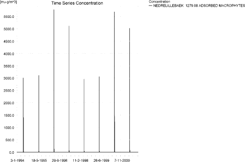
Figure 5.16. Concentration of malathion on macrophytes near the end of the sandy loam catchment. The pattern represents the whole stream.
Figur 5.16. Koncentration af malathion på makrofytter i den nedstrøms ende af morænelersoplandet. Mønsteret representerer hele åen.
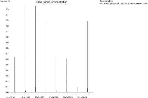
Figure 5.17. Maximum values of pore water concentration of malathion in the sandy loam catchment.
Figur 5.17. maximale værdier for porevandskoncentrationen af malathion i morænelersoplandet.
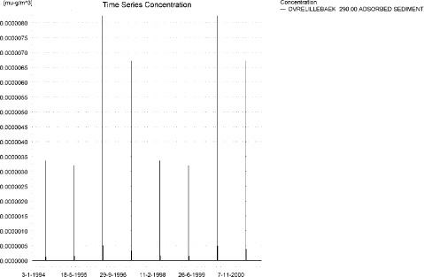
Figure 5.18. Sediment concentration of malathion in the sandy loam catchment. Note that the unit is in µg/g and not in µg/m³ as indicated.
Figur 5.18. Sedimentkoncentration af malathion i morænelersoplandet i Bemærk at enheden er µg/g sediment og ikke µg/m³ som angivet.
Click here to see Figure 5.19.
Figure 5.19. Overview for malathion in the sandy loam catchment generated by the PestSurf excel template for the upstream part of the catchment. The detection value was set to 10 ng/l.
Figur 5.19. Oversigt for malathion i morænelersoplandet genereret med PestSurf-excel-skabelonen for den opstrøms del af oplandet. Detektionsgrænsen var sat til 10 ng/l.
Click here to see Figure 5.20.
Figure 5.20. Overview for malathion in the sandy loam catchment generated by the PestSurf excel template for the upstream part of the catchment. The limiting value (in this case a toxicity value) was set to 100 ng/l. The figure to the lower right differs from Figure 5.19.
Figur 5.20. Oversigt for malathion i morænelersoplandet genereret med PestSurf-excel-skabelonen for den opstrøms del af oplandet. Grænseværdien (i dette tilfælde en toxicitetsværdi) var sat til 100 ng/l.Figuren nederst til højre er forskellig fra Figur 5.19.
Click here to see Figure 5.21.
Figure 5.21. Overview for malathion in the sandy loam catchment generated by the PestSurf excel template for the downstream part of the catchment. The detection value was set to 10 ng/l.
Figur 5.21. Oversigt for malathion i morænelersoplandet genereret med PestSurf-excel-skabelonen for den nedstrøms del af oplandet. Detektionsgrænsen var sat til 10 ng/l.
Table 5.9. Part of the result sheet generated by the PestSurf Excel sheet for the upstream part of the sandy loam catchment. The limiting values applied for generation of the table is 10 ng/l, toxicity to fish, daphnies and algae are set to 100, 1000 and 10000 ng/, respectively. The recorded peaks are shown in Figure 5.19.
Tabel 5.9. Uddrag af resultatpresentationen genereret af PestSurf-Excel-arket for den opstrøms del af morænelersoplandet. Detektionsgrænsen for tabelgenerering er sat til 10 ng/l. Toxicitetsværdierne for fisk, dafnier og alger er henholdsvis 100, 1000 og 10000 ng/l. Hændelserne er vist i Figur 5.19.
Table 5.10. Part of the result sheet generated by the PestSurf Excel sheet for the downstream part of the sandy loam catchment. The limiting values applied for generation of the table is 10 ng/l, toxicity to fish, daphnies and algae are set to 100, 1000 and 10000 ng/, respectively. The recorded peaks are shown in Figure 5.21.
Tabel 5.10. Uddrag af resultatpresentationen genereret af PestSurf-Excel-arket for den nedstrøms del af morænelersoplandet. Detektionsgrænsen for tabelgenerering er sat til 10 ng/l. Toxicitetsværdierne for fisk, dafnier og alger er henholdsvis 100, 1000 og 10000 ng/l. Hændelserne er vist i Figur 5.21.
5.4.4 Sandy loam catchment, pond
The concentration pattern is evaluated in the middle of the pond only, see Figure 5.22. The pond receives contributions through drift, in good correspondence with the fact that it is situated in the upper part of the sandy loam catchment. The maximum concentration is quite high, 655 ng/l.
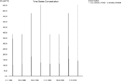
Figure 5.22. Concentrations of malathion in the sandy loam pond.
Figur 5.22. Koncentration af malathion i morænelersvandhullet.
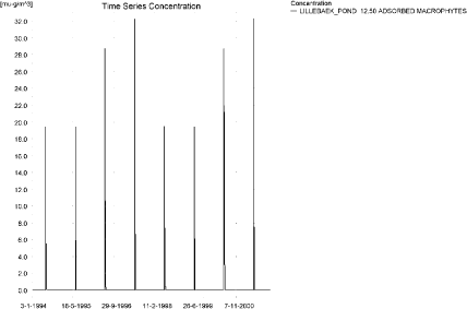
Figure 5.23. Malathion sorbed to the macrophytes in the sandy loam pond.
Figur 5.23. malathion sorberet til makrofytter i morænelers-vandhullet.
Figure 5.23 shows the concentration of malathion on macrophytes in the pond. The concentration reaches 32 ng/l, and it thus has a limited influence on the concentration in the water phase. Figure 5.24 shows the concentration of malathion in the porewater. The concentration is low, and the concentration adsorbed to sediment is <0.01 ng/kg.
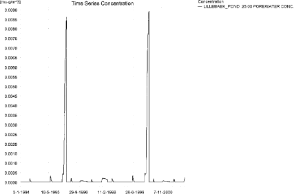
Figure 5.24. Pore water concentration of malathion in the sandy loam pond.
Figur 5.24. Porevandskoncentration af malathion i morænelersvandhullet.
In Table 5.11, global maxima and time weighted concentrations (up to 7 days) were extracted.
Table 5.11. Actual and time weighted concentrations (ng/l) of malathion in the sandy loam pond.
Tabel 5.11. Beregnede og tidsvægtede koncentrationer (ng/l) af malathion i morænelersvandhullet.
| Year | Malathion | actual | Time-weighted | Date |
| 1994 | global max | 384 | 15-06-1994 08:30 | |
| 1 hour(after max) | 355 | 367 | ||
| 1 day after sp.in. | 170 | 248 | ||
| 3 days | 101 | 163 | ||
| 4 days | 97 | 147 | ||
| 7 days | 96 | 125 | ||
| 1995 | Global max | 383 | 15-06-1995 08:30 | |
| 1 hour | 356 | 367 | ||
| 1 day | 180 | 254 | ||
| 2 days | 113 | 173 | ||
| 4 days | 110 | 157 | ||
| 7 days | 109 | 137 | ||
| 1996 | global max | 576 | 15-06-1996 08:30 | |
| 1 hour | 520 | 542 | ||
| 1 day | 221 | 335 | ||
| 2 (3*)days | 164 | 229 | ||
| 4 days | 164 | 213 | ||
| 7 (6*)days | 164 | 192 | ||
| 1997 | global max | 654 | 15-06-1997 08:30 | |
| 1 hour | 577 | 609 | ||
| 1 day | 181 | 327 | ||
| 2 (3*)days | 123 | 199 | ||
| 4 days | 123 | 180 | ||
| 7 (6*)days | 123 | 155 | ||
| 1998 | global max | 384 | 14-06-1998 08:30 | |
| 1 hour | 356 | 367 | ||
| 1 day | 182 | 256 | ||
| 2 (3*)days | 116 | 175 | ||
| 4 days | 112 | 160 | ||
| 7 (6*)days | 112 | 139 | ||
| 1999 | global max | 384 | 14-06-1999 08:30 | |
| 1 hour | 356 | 367 | ||
| 1 day | 183 | 256 | ||
| 2 (3*)days | 117 | 176 | ||
| 4 days | 113 | 161 | ||
| 7 (6*)days | 113 | 140 | ||
| 2000 | global max | 577 | 14-06-2000 08:30 | |
| 1 hour | 519 | 542 | ||
| 1 day | 216 | 332 | ||
| 2 (3*)days | 157 | 224 | ||
| 4 days | 157 | 207 | ||
| 7 (6*)days | 158 | 186 | ||
| 2001 | global max | 655 | 14-06-2001 08:30 | |
| 1 hour | 579 | 610 | ||
| 1 day | 195 | 336 | ||
| 2 (3*)days | 138 | 212 | ||
| 4 days | 138 | 193 | ||
| 7 (6*)days | 139 | 170 | ||
| max values | ||||
| global max | ||||
| 1 hour | 655 | |||
| 1 day | 579 | 610 | ||
| 2 days | 221 | 336 | ||
| 4 days | 164 | 229 | ||
| 7 days | 164 | 213 |
Figure 5.25 and Table 5.12 show output from the PestSurf template, with a time series identical to Figure 5.22.
The FOCUS SW-scenario D4-pond generates a concentration of 0.187 µg/l, which is somewhat lower than the PestSurf sandy loam pond-concentration of 0.655 µg/l. Important reasons for the difference is the higher exposure of the PestSurf compared to the FOCUS SW D4-pond, and the water level at the time of spraying. The concentration in the sediment is lower than the value calculated by FOCUS SW for the D4-pond.
Click here to see Figure 5.25.
Figure 5.25. Overview for malathion in the sandy loam pond generated by the PestSurf excel template. The time series shown is identical to the one in Figure 5.22. The detection limit used in 1 ng/l.
Figur 5.25. Oversigt for malathion i morænelersoplandet genereret med PestSurf-excel-skabelonen. Den viste tidsserie er mage til den i Figur 5.22. Detektionsgrænsen er sat til 1 ng/l.
Table 5.12. Part of the result sheet generated by the PestSurf Excel sheet. The lowest detection valuε = 1 ng/l, toxicity to fish, daphnies and algae are set to 10, 100 and 1000 ng/, respectively. The recorded peaks are shown in Figure 5.25.
Tabel 5.12. Uddrag af resultatpresentationen genereret af PestSurf-Excel-arket. Detektionsgrænsen er sat til 1 ng/l. Toxicitetsværdierne for fisk, dafnier og alger er henholdsvis 10, 100 og 1000 ng/l. De tabellerede hændelser er vist i Figur 5.25.
Table 5.13. Summary of simulation results for malathion.
Tabel 5.13. Opsummerede resultater for malathion.
5.5 Summary of simulations
The maximum actual concentrations for all simulations are recorded in Table 5.13. For malathion, the mechanism generating the maximum concentrations is drift in all instances. The concentrations generated for the sandy pond is smaller than the concentration generated for the D3 ditch, which again is smaller than the concentration in the sandy stream. The reason for the high exposure for the sandy stream is the accumulation of wind drift over a long stretch of the stream. 112 m from the upstream end, the maximum concentration generated is 1.96 µg/l, a value that is much more comparable to the concentration in the D3 ditch (4.61 µg/l). The values are not directly comparable as the sandy stream is protected by a 20 m buffer zone along the stretch. The value is thus a combination of a reduced drift dose (a factor of 14.7) and a water depth of 7 cm.
The concentration in the sandy loam pond is higher than in the D4-pond due to its higher exposure and a water depth of about 70-cm at the time of spraying.
Compared to the FOCUS SW-stream-scenario for D4, the concentration level in the sandy loam stream is considerably higher (81.4 µg/l compared to 3.92 µg/l). A value of 31.3 µg/l is reached already 125 m from the upstream end. The water depth at this point is between 3.6 and 4.85 cm at the time of maximum concentration. The water depth alone thus causes a factor of >7 compared to the FOCUS concentration. Furthermore, the PestSurf stream does not have a square cross section as the FOCUS streams. The cross section at the upstream end are triangular. The maximum concentration reached on the streach 500 m to 1700 m from the upstream end is 35.0 µg/l, 625 m from the upstream end.
The FOCUS D4-stream reaches a sediment concentration of 168 ng/kg while the PestSurf sandy loam stream only reaches a concentration of 8 ng/kg, in spite of the much higher water concentrations.
Macrophytes have a limited influence on the concentration in the water phase.
Annex 6
6 Comparison of risk assessment data produced by spray drift assessments, FOCUS SW and PestSurf
6.1 Chemical characteristics of the compound
| Compound: | Metamitron |
| Dose: | 0.7 kg/ha |
| Spraying time: | 1. May |
| Crop: | Beets |
Table 6.1. Overview of chemical properties of metamitron and the parameters used in the simulations.
Tabel 6.1. Oversigt over metamitrons kemiske egenskaber og parametrene brugt i simuleringerne.
| Chemical property | Condition | Recalculated values | |||
| Cas-no. | 41394-05-2 | ||||
| Molecular weight | 202.2 | ||||
| Form (acid, basic, neutral) | neutral | ||||
| pKa | |||||
| Water solubility | 1800 µg/L | 20°C | |||
| log Kow | at pH | KowA- | |||
| log Kow | 0.83 | at pH | KowAH | 0.83 | |
| log Kow | at pH | KowAH+ | |||
| Vapor pressure, Pa | 8.6 × 10⁻⁹ | 20°C | vapor pressure, Pa, 20°C | ||
| Henry’s law constant | 9.53 × 10⁻¹³ atm-m³ mol-1 | 20°C | Recalculated value, dimensionless | 3.96 × 10⁻¹¹ | |
| Sorption properties in soil | |||||
| Freundlich exp | 0.87 | ||||
| Koc, l/kg | 110 | ||||
| DT50 in soil, days | 18.4 | ||||
| DT50water | No information | PestSurf input | |||
| DT50sedment | None mentioned | ||||
| DT50water/ sediment | 9 days | method not described | DT50, days | 9 | |
| Sediment konc., µg/l | 80 (default in PestSurf) | ||||
| Hydrolysis | no hydrolysis assumed | at pH 5 | (acid) | ||
| at pH 7 | (neutral) | ||||
| at pH 9 | (basic) | ||||
| Photolysis | |||||
| quantum yield | φ = 1.8×10⁻² | ||||
| Spectrum | W.-U. Palm, M. Millet und C. Zetzsch. Photochemical reactions of metamitron. Chemosphere , 35 (1997) 1117--1130. | ||||
| l e | |||||
| 295-300 9000 l.mol-1.cm-1 | |||||
| 300-310 10100 | |||||
| 310-320 10100 | |||||
| 320-330 7000 | |||||
| 330-340 4000 | |||||
| 340-350 1200 | |||||
| 350-360 400 | |||||
| 360-370 50 | |||||
| 370-380 20 | |||||
| Other | photolysis DT50 = 11.4 d natural sunlight | ||||
6.2 Concentration generated by spray
| Compound | Direct spray | FOCUS buffer zones | ||
| Ditch | Stream | Pond | ||
| µg l-1 | µg l-1 | µg l-1 | µg l-1 | |
| Metamitron | 233.3 | 4.981 | 3.624 | 1.745 |
6.3 Concentrations generated by FOCUS SW
6.3.2 D3- Ditch
| Metamitron | Ditch, D3 | |||||||
| Water | Sediment | |||||||
| Date | PEC | Date | TWAEC | Date | PEC | Date | TWAEC | |
| µg l-1 | µg l-1 | µg kg-1 | µg kg-1 | |||||
| Global max | 04-maj-92 | 3.670 | 05-maj-92 | 0.737 | ||||
| 1 d | 05-maj-92 | 1.082 | 05-maj-92 | 2.335 | 06-maj-92 | 0.520 | 05-maj-92 | 0.695 |
| 2 d | 06-maj-92 | 0.095 | 06-maj-92 | 1.394 | 07-maj-92 | 0.359 | 06-maj-92 | 0.610 |
| 4 d | 08-maj-92 | 0.004 | 08-maj-92 | 0.708 | 09-maj-92 | 0.233 | 08-maj-92 | 0.472 |
| 7 d | 11-maj-92 | 0.001 | 11-maj-92 | 0.406 | 12-maj-92 | 0.154 | 11-maj-92 | 0.359 |
6.3.3 D4 – Stream
| Metamitron | Stream, D4 | |||||||
| Water | Sediment | |||||||
| Date | PEC | Date | TWAEC | Date | PEC | Date | TWAEC | |
| µg l-1 | µg l-1 | µg kg-1 | µg kg-1 | |||||
| Global max | 14-maj-85 | 3.047 | 14-maj-85 | 0.149 | ||||
| 1 d | 15-maj-85 | 0.009 | 15-maj-85 | 0.202 | 15-maj-85 | 0.068 | 15-maj-85 | 0.097 |
| 2 d | 16-maj-85 | 0.008 | 14-maj-85 | 0.106 | 16-maj-85 | 0.054 | 16-maj-85 | 0.079 |
| 4 d | 18-maj-85 | 0.008 | 08-dec-85 | 0.06 | 18-maj-85 | 0.044 | 16-dec-85 | 0.068 |
| 7 d | 21-maj-85 | 0.008 | 11-dec-85 | 0.057 | 21-maj-85 | 0.037 | 18-dec-85 | 0.068 |
6.3.4 D4 - Pond
| Metamitron | Pond, D4 | |||||||
| Water | Sediment | |||||||
| Date | PEC | Date | TWAEC | Date | PEC | Date | TWAEC | |
| µg l-1 | µg l-1 | µg kg-1 | µg kg-1 | |||||
| Global max | 14-maj-85 | 0.149 | 16-maj-85 | 0.062 | ||||
| 1 d | 15-maj-85 | 0.105 | 15-maj-85 | 0.125 | 17-maj-85 | 0.06 | 17-maj-85 | 0.062 |
| 2 d | 16-maj-85 | 0.074 | 16-maj-85 | 0.106 | 18-maj-85 | 0.056 | 18-maj-85 | 0.061 |
| 4 d | 18-maj-85 | 0.038 | 18-maj-85 | 0.08 | 20-maj-85 | 0.048 | 19-maj-85 | 0.059 |
| 7 d | 21-maj-85 | 0.014 | 21-maj-85 | 0.056 | 23-maj-85 | 0.036 | 22-maj-85 | 0.055 |
6.3.5 Conclusion – FOCUS SW
The highest concentration is generated in the ditch (D3). It is caused by wind drift and the concentration becomes 3.67 µg/l. The same scenario shows the highest concentration in the sediment, 0.737 µg/kg. For all scenarios, the concentrations are lower than what is generated by the simpler assessments.
6.4 PestSurf
6.4.2 Sandy Catchment, stream
The distribution of concentrations was assessed in several steps. First, the maximum concentrations at each calculation point were listed, and the dates for the occurrence of the maximum were assessed. The points, for which the maximum value also represents a local maximum, were selected for further analysis. The relevant values are listed in Table 6.2.
Table 6.2. Maximum concentrations (ng/l) of metamitron simulated for each calculation point in the sandy catchment.
Tabel 6.2. Maximumkoncentrationer (ng/l) af metamitron simuleret for hvert beregningspunkt i det sandede opland.
| METAMITRON | Maxi-mum | Max.Time | Local Maxima |
| ODDERBAEK 0.00 | 432 | 01-05-2001 09:00 | |
| ODDERBAEK 56.00 | 466 | 01-05-2001 08:50 | |
| ODDERBAEK 112.00 | 590 | 01-05-2001 08:41 | |
| ODDERBAEK 192.00 | 2005 | 01-05-2001 08:33 | |
| ODDERBAEK 272.00 | 3736 | 01-05-2001 08:33 | |
| ODDERBAEK 278.00 | 3940 | 01-05-2001 08:33 | |
| ODDERBAEK 282.00 | 4075 | 01-05-2001 08:33 | |
| ODDERBAEK 298.50 | 4463 | 01-05-2001 08:33 | |
| ODDERBAEK 315.00 | 4905 | 01-05-2001 08:33 | |
| ODDERBAEK 317.50 | 4974 | 01-05-2001 08:33 | |
| ODDERBAEK 320.00 | 5037 | 01-05-2001 08:33 | |
| ODDERBAEK 410.00 | 6817 | 01-05-2001 08:33 | |
| ODDERBAEK 500.00 | 7382 | 01-05-2001 08:33 | |
| ODDERBAEK 513.00 | 7700 | 01-05-2001 08:33 | |
| ODDERBAEK 521.00 | 7960 | 01-05-2001 08:33 | |
| ODDERBAEK 622.00 | 9762 | 01-05-2001 08:33 | |
| ODDERBAEK 723.00 | 11118 | 01-05-2001 08:33 | |
| ODDERBAEK 733.00 | 11469 | 01-05-2001 08:33 | |
| ODDERBAEK 742.00 | 11746 | 01-05-2001 08:33 | |
| ODDERBAEK 789.50 | 12642 | 01-05-2001 08:33 | |
| ODDERBAEK 837.00 | 13503 | 01-05-2001 08:33 | |
| ODDERBAEK 848.00 | 13850 | 01-05-2001 08:33 | |
| ODDERBAEK 863.00 | 14324 | 01-05-2001 08:33 | |
| ODDERBAEK 956.00 | 15888 | 01-05-2001 08:33 | |
| ODDERBAEK 1049.00 | 16582 | 01-05-2001 08:33 | X |
| ODDERBAEK 1111.50 | 16300 | 01-05-2001 08:33 | |
| ODDERBAEK 1174.00 | 14832 | 01-05-2001 08:33 | |
| ODDERBAEK 1226.00 | 13947 | 01-05-2001 08:33 | |
| ODDERBAEK 1278.00 | 13527 | 01-05-2001 08:41 | |
| ODDERBAEK 1293.50 | 13365 | 01-05-2001 08:41 | |
| ODDERBAEK 1310.00 | 13040 | 01-05-2001 08:41 | |
| ODDERBAEK 1421.00 | 12654 | 01-05-2001 08:50 | |
| ODDERBAEK 1532.00 | 11146 | 01-05-2001 08:33 | |
| ODDERBAEK 1558.06 | 9838 | 01-05-2001 08:33 | |
| ODDERBAEK 1584.12 | 9081 | 01-05-2001 08:41 | |
| ODDERBAEK 1584.12 | 9081 | 01-05-2001 08:41 | |
| ODDERBAEK 1621.06 | 9057 | 01-05-2001 08:33 | |
| ODDERBAEK 1658.00 | 9212 | 01-05-2001 08:33 | |
| ODDERBAEK 1698.50 | 9542 | 01-05-2001 08:33 | |
| ODDERBAEK 1739.00 | 9839 | 01-05-2001 08:33 | |
| ODDERBAEK 1801.50 | 9984 | 01-05-2001 08:33 | X |
| ODDERBAEK 1864.00 | 8332 | 01-05-2001 08:33 | |
| ODDERBAEK 1977.00 | 6614 | 01-05-2000 09:35 | |
| ODDERBAEK 2090.00 | 6458 | 01-05-2000 09:45 | |
| ODDERBAEK 2098.00 | 6453 | 01-05-2000 09:45 | |
| ODDERBAEK 2105.00 | 6432 | 01-05-2000 09:45 | |
| ODDERBAEK 2131.00 | 6380 | 01-05-2000 09:45 | |
| ODDERBAEK 2157.00 | 6267 | 01-05-2000 09:45 | |
| ODDERBAEK 2168.00 | 6232 | 01-05-2000 09:45 | |
| ODDERBAEK 2179.00 | 6208 | 01-05-2000 09:54 | |
| ODDERBAEK 2268.50 | 6142 | 01-05-2000 09:54 | |
| ODDERBAEK 2358.00 | 5853 | 01-05-2000 10:00 | |
| ODDERBAEK 2363.50 | 5836 | 01-05-2000 10:00 | |
| ODDERBAEK 2372.00 | 5813 | 01-05-2000 10:00 | |
| ODDERBAEK 2427.00 | 5756 | 01-05-2000 10:00 | |
| ODDERBAEK 2482.00 | 5609 | 01-05-2000 10:00 | |
| ODDERBAEK 2609.00 | 5521 | 01-05-2000 10:00 | |
| ODDERBAEK 2736.00 | 5133 | 01-05-2004 10:00 | |
| ODDERBAEK 2831.00 | 5004 | 01-05-1998 10:00 | |
| ODDERBAEK 2926.00 | 4733 | 01-05-1998 10:00 | |
| ODDERBAEK 2958.50 | 4648 | 01-05-1998 10:00 | |
| ODDERBAEK 2991.00 | 4546 | 01-05-1998 10:00 | |
| ODDERBAEK 3029.50 | 4440 | 01-05-1998 11:00 | |
| ODDERBAEK 3068.00 | 4343 | 01-05-1998 11:00 | |
| ODDERBAEK 3131.00 | 4229 | 01-05-1998 11:00 | |
| ODDERBAEK 3194.00 | 4082 | 01-05-1998 11:00 | |
| ODDERBAEK 3250.50 | 3995 | 01-05-1998 11:00 | |
| ODDERBAEK 3307.00 | 3930 | 01-05-1998 11:00 | |
| ODDERBAEK 3315.00 | 3924 | 01-05-1998 11:00 | |
| ODDERBAEK 3323.00 | 3909 | 01-05-1998 11:00 | |
| ODDERBAEK 3355.50 | 3871 | 01-05-1998 11:00 | |
| ODDERBAEK 3388.00 | 3812 | 01-05-1998 11:00 | |
| ODDERBAEK 3438.50 | 4399 | 01-05-2001 08:33 | |
| ODDERBAEK 3489.00 | 4721 | 01-05-2001 08:33 | |
| ODDERBAEK 3499.50 | 4764 | 01-05-2001 08:33 | |
| ODDERBAEK 3510.00 | 4788 | 01-05-2001 08:33 | |
| ODDERBAEK 3581.00 | 4821 | 01-05-2001 08:33 | X |
| ODDERBAEK 3652.00 | 4462 | 01-05-2001 08:33 | |
| ODDERBAEK 3707.00 | 4223 | 01-05-2001 08:33 | |
| ODDERBAEK 3762.00 | 3902 | 01-05-2001 08:41 | |
| ODDERBAEK 3790.00 | 3523 | 01-05-1998 08:41 | |
| ODDERBAEK 3818.00 | 2903 | 01-05-1998 08:41 | |
| ODDERBAEK 3818.00 | 2903 | 01-05-1998 08:41 | |
| ODDERBAEK 3884.00 | 2879 | 01-05-1998 08:41 | |
| ODDERBAEK 3950.00 | 2685 | 01-05-1998 08:41 | |
| ODDERBAEK 3998.00 | 2637 | 01-05-1998 08:51 | |
| ODDERBAEK 4046.00 | 2497 | 01-05-1998 08:51 | |
| ODDERBAEK 4047.50 | 2494 | 01-05-1998 08:51 | |
| ODDERBAEK 4049.00 | 2493 | 01-05-1998 08:51 | |
| ODDERBAEK 4052.50 | 2491 | 01-05-1998 08:51 | |
| ODDERBAEK 4056.00 | 2488 | 01-05-1998 08:51 | |
| ODDERBAEK 4058.00 | 2486 | 01-05-1998 08:51 | |
| ODDERBAEK 4060.00 | 2483 | 01-05-1998 08:51 | |
| ODDERBAEK 4080.00 | 2440 | 01-05-1998 08:51 | |
| ODDERBAEK 4100.00 | 2441 | 01-05-1998 09:00 | |
| ODDERBAEK 4134.00 | 2456 | 01-05-1998 09:00 | |
| ODDERBAEK 4168.00 | 2461 | 01-05-1998 09:00 | |
| GISLUM_ENGE_AFLOEB 0.00 | 0 | 05-03-2001 00:00 | |
| GISLUM_ENGE_AFLOEB 50.00 | 0 | 05-03-2001 00:00 | |
| GISLUM_ENGE_AFLOEB 100.00 | 0 | 05-03-2001 00:00 | |
| GISLUM_ENGE_AFLOEB 150.00 | 0 | 05-03-2001 00:00 | |
| GISLUM_ENGE_AFLOEB 200.00 | 0 | 05-03-2001 00:00 | |
| GISLUM_ENGE_AFLOEB 250.00 | 0 | 05-03-2001 00:00 | |
| GISLUM_ENGE_AFLOEB 300.00 | 0 | 05-03-2001 00:00 | |
| GISLUM_ENGE_AFLOEB 340.00 | 0 | 05-03-2001 00:00 | |
| GISLUM_ENGE_AFLOEB 380.00 | 0 | 05-03-2001 00:00 | |
| GISLUM_ENGE_AFLOEB 430.00 | 0 | 07-04-2002 00:00 | |
| GISLUM_ENGE_AFLOEB 480.00 | 0 | 07-04-2002 00:00 | |
| GISLUM_ENGE_AFLOEB 530.00 | 0 | 07-04-2002 00:00 | |
| GISLUM_ENGE_AFLOEB 580.00 | 0 | 07-04-2002 00:00 | |
| GISLUM_ENGE_AFLOEB 630.00 | 0 | 07-04-2002 00:00 | |
| GISLUM_ENGE_AFLOEB 680.00 | 0 | 07-04-2002 00:00 | |
| GISLUM_ENGE_AFLOEB 730.00 | 0 | 07-04-2002 00:00 | |
| GISLUM_ENGE_AFLOEB 780.00 | 0 | 07-04-2002 00:00 | |
| GISLUM_ENGE_AFLOEB 830.00 | 0 | 07-04-2002 00:00 | |
| GISLUM_ENGE_AFLOEB 880.00 | 0 | 07-04-2002 00:00 | |
| GISLUM_ENGE_AFLOEB 915.00 | 0 | 07-04-2002 00:00 | |
| GISLUM_ENGE_AFLOEB 950.00 | 0 | 01-05-1998 09:00 | |
| GISLUM_ENGE_AFLOEB 985.00 | 0 | 01-05-1998 09:00 | |
| GISLUM_ENGE_AFLOEB 1020.00 | 0 | 01-05-1998 09:00 | |
| GISLUM_ENGE_AFLOEB 1045.00 | 0 | 01-05-1998 09:00 | |
| GISLUM_ENGE_AFLOEB 1070.00 | 0 | 01-05-1998 09:00 | |
| GISLUM_ENGE_AFLOEB 1110.00 | 0 | 01-05-1998 09:00 | |
| GISLUM_ENGE_AFLOEB 1150.00 | 0 | 01-05-1998 09:00 | |
| GISLUM_ENGE_AFLOEB 1190.00 | 0 | 01-05-1998 09:00 | |
| GISLUM_ENGE_AFLOEB 1230.00 | 1 | 01-05-1998 08:51 | |
| GISLUM_ENGE_AFLOEB 1271.00 | 4 | 01-05-1998 08:51 | |
| GISLUM_ENGE_AFLOEB 1312.00 | 11 | 01-05-1998 08:51 | |
| GISLUM_ENGE_AFLOEB 1422.00 | 303 | 01-05-1998 08:41 | |
| GISLUM_ENGE_AFLOEB 1532.00 | 2903 | 01-05-1998 08:41 | |
| TILLOEB 0.00 | 8586 | 01-05-2001 08:41 | |
| TILLOEB 20.16 | 8881 | 01-05-2001 08:41 | |
| TILLOEB 40.31 | 9081 | 01-05-2001 08:41 | |
| global max | 16582 |
The pattern over time was the same for all calculation points. The peak values are generated by wind drift, see Figure 6.1.
Each of the events generated an almost identical pattern along the stream, see Figure 6.2. The thin black line represents the concentration, while the thick black line shows the maximum concentrations obtained during the simulations. In addition, the outline of the stream is shown. In the middle of the catchment, the stream is protected by unsprayed areas. The maximum values at the center of the catchment are obtained when the peak from upstream move through the catchment during the hour following spraying.
In order to present the data in a similar fashion to the FOCUS SW-results, data were extracted and recalculated for the time series marked in Table 6.2. The global maxima and time weighted concentrations (up to 7 days) were extracted and are reported in Table 6.3 for actual and time weighted concentrations, respectively. Note that the unit is ng/l.
The pesticide sorption to macrophytes in the stream is shown in Figure 6.3, reaching a maximum concentration of 17 ng/l. This is not significant compared to the concentrations in the water phase. The concentration in pore water is shown in Figure 6.4. The concentration in sediment reaches 4 ng/kg.
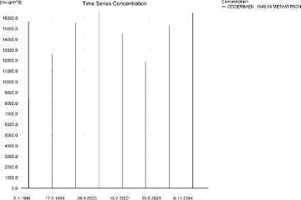
Figure 6.1. Concentration pattern over time for metamitron in the sandy catchment.
Figur 6.1. Koncentrationsmønster som funktion af tid for metamitron i det sandede opland.

Figure 6.2. Concentration of metamitron in the sandy catchment on 1. May, 2001.
Figur 6.2. Koncentrationer metamitron i det sandede opland den 1. maj 2001.
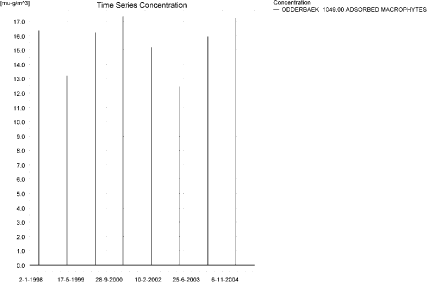
Figure 6.3. Concentration of metamitron on macrophytes in the sandy catchment.
Figur 6.3. Koncentration af metamitron sorberet på makrofytter i det sandede opland.
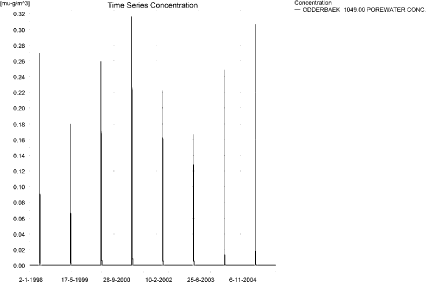
Figure 6.4. Pore water concentration of metamitron in the sandy catchment.
Figur 6.4. Porevandskoncentration for metamitron i det sandede opland.

Figure 6.5. Concentration of metamitron in sediment in the sandy catchment. The maximum concentration reached in the catchment is 4 ng/kg. Note that the unit is in µg/g and not µg/m³ as stated.
Figur 6.5. Koncentration af metamitron i sediment i det sandede opland. Maximumskoncentrationen i oplandet er 4 ng/kg. Bemærk at koncentrationen er i µg/g og ikke i µg/m³ som angivet.
The global maximum value calculated by PestSurf for the sandy catchment in the water phase is 16.6 µg/l. This is considerably more than what is found in the D3-ditch scenario (3.67 µg/l). 112 m from the upstream end, the maximum value reached is 590 ng/l, and thus lower than the value obtained in the ditch scenario.
A small amount of pesticide was sorbed to macrophytes in the stream. The concentration in sediment is 0.737 µg/kg in the ditch-scenario and 4 ng/kg in PestSurf.
Figure 6.6 shows the output of the PestSurf Excel template. The template works with pre-defined data extraction points. The plot requires specification of a “lowest detection value” (ldc) which defines when a pesticide occurrence is defined as an event. The time series plot is identical to the time series shown earlier, and the graph in the upper right corner resembles the plot in Figure 6.2, but takes into account a longer period of time. A curve is generated when a downstream point reaches a concentration higher than the ldc. The programme then tracks the highest concentration for each calculation point in the stream within the last 24 hours. The plot in the lower right corner shows how many events have concentrations higher than a given value for the selected monitoring points. The curves are rather flat, showing little variation from year to year.
Table 6.4 shows part of the result sheet generated by the PestSurf Excel sheet based on the ldc-value. The selected table shows the point along the stream (of the pre-defined points) with the highest concentration. This value was, however, only 9.06 µg/l. Thus, the pre-defined points have not caught the highest concentration of the simulation, which was 16.6 µg/l.
Table 6.3. Concentration of metamitron, ng/l, at selected points in the sandy stream.
Tabel 6.3. Koncentration af malathion, ng/l, på udvalgte lokaliteter i det sandede vandløb.
Figure 6.6. Overview for metamitron in the sandy catchment generated by the PestSurf excel template. The max concentrations generated over the 24 hours are similar to the overview in Figure 6.2. The graph to the lower right shows how many events have concentrations higher than a given value for the selected monitoring points. Detection value was set to 10 ng/l.
Figur 6.6. Oversigt for metamitron i det sandede opland genereret med PestSurf-excel-skabelonen. Den maximale koncentration genereret over 24 timer svarer til oversigten i Figur 6.2. Grafen nederst til højre viser hvor mange hændelser, der har koncentrationer højere end en given værdi i et udvalgt punkt. Detektionsgrænsen var sat til 10 ng/l.
Table 6.4. Part of the result sheet generated by the PestSurf Excel sheet. The selected table shows the point along the stream with the highest concentration recorded. The lowest detection valuε = 10 ng/l, toxicity to fish, daphnies and algae are set to 100, 1000 and 10000 ng/, respectively. The recorded peaks are shown in Figure 6.6.
Tabel 6.4. Uddrag af resultatpresentationen genereret af PestSurf-Excel-arket. Den udvalgte tabel viser det fordefinerede punkt langs med åen med højest koncentration. Detektionsgrænsen er sat til 10 mens toxicitetsværdierne for fisk, dafnier og alger er henholdsvis 100, 1000 og 10000 ng/l. De tabellerede hændelser er vist i Figur 6.6.
6.4.3 Sandy Catchment, pond
The concentration pattern is evaluated in the middle of the pond only, see Figure 6.7. The pond receives drift and a contribution from groundwater. The maximum concentration is 689 ng/l. The high peaks occurring at the end of June and beginning of July 1999 and 2003 are caused by 26 mm of rainfall on 12th June and 31.6 mm on 6th July.
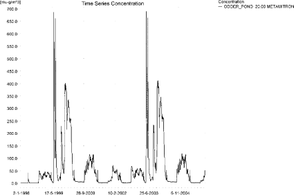
Figure 6.7. Concentration of Metamitron in the sandy pond.
Figur 6.7. Koncentration af metamitron i det sandede vandhul.
In Table 6.5, global maxima and time weighted concentrations (up to 7 days) were extracted. The presently used system of data storage stores data very frequently around the time of spray drift and extends the time period between data storage up to 1 day.
Table 6.5. Maximum concentrations (ng/l)of metamitron generated for the sandy pond.
Tabel 6.5. Maximumkoncentrationer af metamitron (ng/l) genereret for det sandede vandhul.
| Year | ODDER_POND 20.00, | |||
| Conc. | TWC | Date | ||
| 1998 | 1998 (global max) | 49 | 28/10/1998 | |
| 1 hour (after max) | ||||
| 1 day after sp.in. | 48 | 49 | ||
| 2 days | 48 | 48 | ||
| 4 days | 45 | 48 | ||
| 7 days | 37 | 45 | ||
| 1999 | 1999 (global max) | 686 | 14/06/1999 | |
| 1 hour (after max) | ||||
| 1 day after sp.in. | 639 | 663 | ||
| 2 days | 535 | 612 | ||
| 4 days | 484 | 587 | ||
| 7 days | 350 | 512 | ||
| 2000 | 2000 (global max) | 338 | 01/01/2000 | |
| 1 hour (after max) | ||||
| 1 day after sp.in. | 327 | 333 | ||
| 2 days | 287 | 318 | ||
| 4 days | 270 | 308 | ||
| 7 days | 231 | 275 | ||
| 2001 | 2001 (global max) | 114 | 26/02/2001 | |
| 1 hour (after max) | ||||
| 1 day after sp.in. | 113 | 114 | ||
| 2 days | 98 | 109 | ||
| 4 days | 87 | 105 | ||
| 7 days | 89 | 98 | ||
| 2002 | 2002 (global max) | 71 | 06/01/2002 | |
| 1 hour (after max) | ||||
| 1 day after sp.in. | 68 | 70 | ||
| 2 days | 63 | 67 | ||
| 4 days | 60 | 65 | ||
| 7 days | 56 | 62 | ||
| 2003 | 2003 (global max) | 689 | 14/06/2003 | |
| 1 hour (after max) | ||||
| 1 day after sp.in. | 642 | 666 | ||
| 2 days | 538 | 615 | ||
| 4 days | 487 | 590 | ||
| 7 days | 351 | 515 | ||
| 2004 | 2004 (global max) | 347 | 01/01/2004 | |
| 1 hour (after max) | ||||
| 1 day after sp.in. | 335 | 341 | ||
| 2 days | 294 | 326 | ||
| 4 days | 276 | 316 | ||
| 7 days | 237 | 282 | ||
| 2005 | 2005 (global max) | 117 | 02/01/2005 | |
| 1 hour (after max) | ||||
| 1 day after sp.in. | 115 | 116 | ||
| 2 days | 109 | 113 | ||
| 4 days | 105 | 111 | ||
| 7 days | 96 | 107 | ||
| Global max | 689 | |||
| 1 hour (after max) | ||||
| 1 day after sp.in. | 642 | 666 | ||
| 2 days | 538 | 615 | ||
| 4 days | 487 | 590 | ||
| 7 days | 351 | 515 | ||
The sorption to macrophytes is shown in Figure 6.8. The sorbed concentration is considerably lower than the concentration in the water. The maximum concentrations reached for pore water is 28.8 ng/l (see Figure 6.9). The concentration of metamitron adsorbed to sediment is shown in Figure 6.10. The maximum value reached is 0.105 µg/kg.
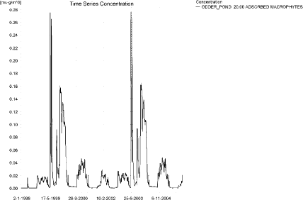
Figure 6.8. Sorption of metamitron to macrophytes in the sandy pond.
Figur 6.8. Sorption af metamitron til makrofytter i det sandede vandhul.
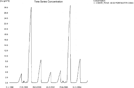
Figure 6.9. Pore water concentration of metamitron in the sandy pond.
Figur 6.9. Porevandskoncentration af metamitron i det sandede vandhul.
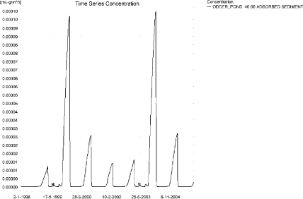
Figure 6.10. Sorption of metamitron to sediment in the sandy pond. The concentration is in µg/g sediment and not µg/m³ as stated.
Figur 6.10. Sorption af metamitron til sediment i det sandede vandhul. Koncentrationen er i µg/g og ikke i µg/m³ som angivet.
Compared to the FOCUS D3 ditch, the concentration in the PestSurf sandy pond is considerably lower, 0.689 µg/l compared to 3.67 µg/l. The concentration in the sediment is 0.737 µg/kg in the FOCUS SW-D3 ditch calculation and 0.105 µg/kg in the PestSurf-calculation.
In the pond-case, there is no difference between the results of PestSurf and the results extracted by the templates.
Figure 6.11 shows the output of the PestSurf Excel template. The template works with one pre-defined data extraction point for the pond (center of the pond). The plot requires specification of a “lowest detection value” (ldc) which defines when a pesticide occurrence is defined as an event. The time series plot is identical to the time series shown earlier. The plot to the right shows how many events have concentrations higher than a given toxicity value for the selected monitoring points.
Table 6.6 shows part of the result sheet generated by the PestSurf Excel sheet based on the ldc-value.
Click here to see Figure 6.11.
Figure 6.11. Overview for metamitron in the sandy pond generated by the PestSurf excel template. The time series shown is identical to the one in Figure 6.7. The detection value used for generation of the figures is 10 ng/l.
Figur 6.11. Oversigt for metamitron i det sandede vandhul genereret med PestSurf-excel-skabelonen. Den viste tidsserie er mage til den i Figur 6.7. Detektionsgrænsen anvendt til generering af figurer er sat til 10 ng/l.
Table 6.6. Part of the result sheet generated by the PestSurf Excel sheet, applied to metamitron. The detection value used for generation of the table is 10 ng/l. Toxicity to fish, daphnies and algae are set to 100, 1000 and 10000 ng/, respectively. The recorded peaks are shown in Figure 6.11.
Tabel 6.6. Uddrag af resultatpresentationen genereret af PestSurf-Excel-arket anvendt på metamitron. Grænseværdien anvendt til tabelgenerering er 10 ng/l mens toxicitetsværdierne for fisk, dafnier og alger er henholdsvis 100, 1000 og 10000 ng/l. De tabellerede hændelser er vist i Figur 6.11.
6.4.4 Sandy Loam Catchment, stream
The distribution of concentrations was assessed in several steps. First, the maximum concentrations at each calculation point were listed, and the dates for the occurrence of the maximum were assessed. The points, for which the maximum value also represents a local maximum were selected for further analysis (Table 6.7).
All points show the same type of time series pattern. The six points with highest maximum values were analysed further.
Table 6.7. Maximum concentrations (ng/l) of metamitron simulated for each calculation point in the sandy loam catchment.
Tabel 6.7. Maximumskoncentrationer (ng/l) af metamitron simuleret for hvert beregningspunkt i morænelersoplandet.
| METAMITRON | Maximum | Max.Time | Local Maxima |
| ALBJERGBAEK 0.00 | 172 | 12-12-1997 00:00 | |
| ALBJERGBAEK 150.00 | 1525 | 01-11-1998 00:00 | x |
| ALBJERGBAEK 300.00 | 521 | 01-11-1998 00:00 | |
| ALBJERGBAEK 450.00 | 469 | 01-11-1998 00:00 | |
| ALBJERGBAEK 600.00 | 12555 | 30-04-2001 09:49 | |
| ELHOLTBAEK 0.00 | 91 | 30-10-1998 00:00 | |
| ELHOLTBAEK 165.00 | 108 | 30-10-1998 00:00 | |
| ELHOLTBAEK 330.00 | 10085 | 30-04-2001 08:40 | |
| FREDLIGBAEK 0.00 | 257 | 18-09-1998 00:00 | |
| FREDLIGBAEK 100.00 | 407 | 18-09-1998 00:00 | |
| FREDLIGBAEK 200.00 | 438 | 18-09-1998 00:00 | |
| FREDLIGBAEK 300.00 | 435 | 18-09-1998 00:00 | |
| FREDLIGBAEK 400.00 | 457 | 18-09-1998 00:00 | |
| FREDLIGBAEK 500.00 | 387 | 18-09-1998 00:00 | |
| FREDLIGBAEK 600.00 | 576 | 18-09-1998 00:00 | |
| FREDLIGBAEK 667.50 | 361 | 17-09-1998 00:00 | |
| FREDLIGBAEK 735.00 | 20589 | 30-04-2001 08:49 | x |
| GROFTEBAEK 0.00 | 117 | 18-09-1998 00:00 | |
| GROFTEBAEK 155.00 | 176 | 17-09-1998 00:00 | |
| GROFTEBAEK 310.00 | 207 | 18-09-1998 00:00 | |
| GROFTEBAEK 465.00 | 115 | 26-09-1994 00:00 | |
| GROFTEBAEK 620.00 | 21155 | 30-04-2001 08:40 | |
| STENSBAEK 0.00 | 804 | 06-09-1996 00:00 | |
| STENSBAEK 125.00 | 1493 | 06-09-1996 00:00 | x |
| STENSBAEK 250.00 | 1199 | 06-09-1996 00:00 | |
| STENSBAEK 412.50 | 1414 | 06-09-1996 00:00 | |
| STENSBAEK 575.00 | 4127 | 01-05-1997 11:00 | |
| OVRELILLEBAEK 0.00 | 137 | 01-11-1998 00:00 | |
| OVRELILLEBAEK 125.00 | 23051 | 01-05-2000 00:30 | |
| OVRELILLEBAEK 250.00 | 21735 | 30-04-2001 08:30 | |
| OVRELILLEBAEK 290.00 | 27836 | 30-04-2001 08:40 | |
| OVRELILLEBAEK 330.00 | 12555 | 30-04-2001 09:49 | |
| OVRELILLEBAEK 330.00 | 12555 | 30-04-2001 09:49 | |
| OVRELILLEBAEK 352.50 | 16705 | 30-04-2001 10:00 | |
| OVRELILLEBAEK 375.00 | 4127 | 01-05-1997 11:00 | |
| OVRELILLEBAEK 375.00 | 4127 | 01-05-1997 11:00 | |
| OVRELILLEBAEK 437.50 | 5792 | 30-04-2001 08:30 | x |
| OVRELILLEBAEK 500.00 | 12572 | 30-04-2001 08:30 | |
| OVRELILLEBAEK 625.00 | 21612 | 30-04-2001 08:30 | X |
| OVRELILLEBAEK 750.00 | 14357 | 30-04-2001 08:30 | |
| OVRELILLEBAEK 855.00 | 19256 | 30-04-2001 08:30 | |
| OVRELILLEBAEK 960.00 | 10085 | 30-04-2001 08:40 | |
| OVRELILLEBAEK 960.00 | 10085 | 30-04-2001 08:40 | |
| OVRELILLEBAEK 980.00 | 10751 | 30-04-2001 08:49 | |
| OVRELILLEBAEK 1000.00 | 9056 | 30-04-2001 08:49 | |
| OVRELILLEBAEK 1062.50 | 8574 | 30-04-2001 08:49 | |
| OVRELILLEBAEK 1125.00 | 8388 | 30-04-2001 09:00 | |
| OVRELILLEBAEK 1187.50 | 10471 | 30-04-2001 08:30 | X |
| OVRELILLEBAEK 1250.00 | 10965 | 30-04-2001 08:30 | |
| OVRELILLEBAEK 1425.00 | 15204 | 30-04-2001 08:30 | |
| OVRELILLEBAEK 1600.00 | 12582 | 30-04-2001 08:30 | |
| OVRELILLEBAEK 1650.00 | 16338 | 30-04-2001 08:30 | X |
| OVRELILLEBAEK 1700.00 | 11499 | 30-04-2001 08:49 | |
| NEDRELILLEBAEK 0.00 | 11499 | 30-04-2001 08:49 | |
| NEDRELILLEBAEK 135.00 | 11186 | 30-04-2001 08:30 | |
| NEDRELILLEBAEK 270.00 | 16588 | 30-04-2001 08:30 | |
| NEDRELILLEBAEK 330.00 | 21151 | 30-04-2001 08:30 | |
| NEDRELILLEBAEK 390.00 | 22103 | 30-04-2001 08:30 | |
| NEDRELILLEBAEK 495.50 | 28323 | 30-04-2001 08:30 | X |
| NEDRELILLEBAEK 601.00 | 20589 | 30-04-2001 08:49 | |
| NEDRELILLEBAEK 601.00 | 20589 | 30-04-2001 08:49 | |
| NEDRELILLEBAEK 693.00 | 20270 | 30-04-2001 09:10 | |
| NEDRELILLEBAEK 785.00 | 20320 | 30-04-2001 09:10 | |
| NEDRELILLEBAEK 847.00 | 32767 | 30-04-2001 08:30 | X |
| NEDRELILLEBAEK 909.00 | 21155 | 30-04-2001 08:40 | |
| NEDRELILLEBAEK 909.00 | 21155 | 30-04-2001 08:40 | |
| NEDRELILLEBAEK 984.50 | 19824 | 30-04-2001 08:49 | |
| NEDRELILLEBAEK 1060.00 | 24046 | 30-04-2001 08:30 | |
| NEDRELILLEBAEK 1169.50 | 30722 | 30-04-2001 08:30 | |
| NEDRELILLEBAEK 1279.00 | 44935 | 30-04-2001 08:30 | |
| NEDRELILLEBAEK 1409.50 | 28579 | 30-04-2001 09:00 | |
| NEDRELILLEBAEK 1540.00 | 19097 | 30-04-2001 10:00 | |
| global max | 44935 |
All maximum concentrations are caused by drift events, but the picture differs somewhat between the upstream and the downstream end of the main stream. Figure 6.12 and Figure 6.13 show the concentration pattern in the upstream end of the sandy loam catchment. Some drainage events are visible, most importantly the 20-year event on 18. September 1998.
Figure 6.14 shows a concentration pattern which is characteristic for the lower part of the sandy loam catchment. The drainage event becomes less important at this end of the catchment.
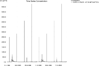
Figure 6.12. Concentration pattern for metamitron in the upstream part of the sandy loam catchment.
Figur 6.12. Koncentrationsmønster for metamitron i den opstrøms ende af morænelersoplandet.
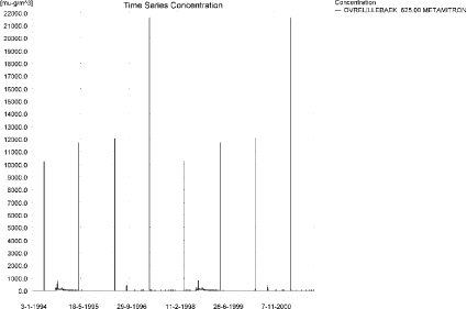
Figure 6.13. Concentration pattern for metamitron in the upper part of the sandy loam catchment, about 90 m further downstream than Figure 6.13.
Figur 6.13. Koncentrationsmønster for metamitron i den opstrøms ende af morænelersoplandet, ca 90 m nedstrøms for lokaliteten i Figur 6.13.
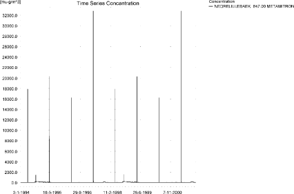
Figure 6.14. Concentration pattern for metamitron in the lower end of the sandy loam catchment.
Figur 6.14. Koncentrationsmønster for metamitron i den nedstrøms ende af morænelersoplandet.
The concentrations in the sandy loam catchment are shown in Figure 6.15 for 30. April 2001. The thin black line represents the concentration, while the thick black line shows the maximum concentrations obtained during the simulations. In addition, the outline of the stream is shown.
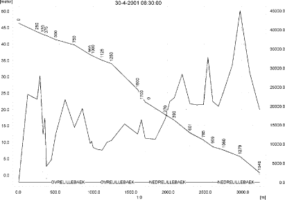
Figure 6.15. Concentrations in the sandy loam catchment on 30. April 2001. The concentrations are generated by drift.
Figur 6.15. Koncentrationer i morænelersoplandet den 30.april-2001. Koncentrationerne genereres af drift.
To be able to extract comparable values to FOCUS SW, the global maxima and time weighted concentrations (up to 7 days) were extracted when these were meaningful. The values are listed in Table 6.8.
Table 6.8. Maximum concentrations (ng/l) of metamitron simulated for selected calculation point in the sandy loam catchment.
Tabel 6.8. Maximumskoncentrationer (ng/l) af metamitron for udvalgte lokaliteter i morænelersoplandet.
Figure 6.16 and Figure 6.17 show the concentrations sorbed to macrophytes. The pattern follows the pattern of the water concentrations, and the maximum value recorded is 222 ng/l. This value is small compared to the concentrations in the water phase and the influence of the macrophytes on the concentration in the water phase is therefore negligible.
Porewater concentrations reached 3.90 ng/l (an example is shown in Figure 6.18), while sediment concentrations were 12.4 ng/kg at maximum (Figure 6.19).
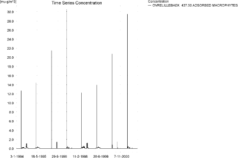
Figure 6.16. Concentration of metamitron on macrophytes in ng/l in the upstream part of the sandy loam catchment.
Figur 6.16. Koncentration af metamitron på makrofytter i den opstrøms ende af morænelersoplandet.
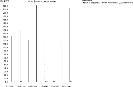
Figure 6.17. Concentration on macrophytes in ng/l in the downstream end of sandy loam catchment.
Figur 6.17. Koncentration af metamitron på makrofytter i den nedstrøms ende af morænelersoplandet.
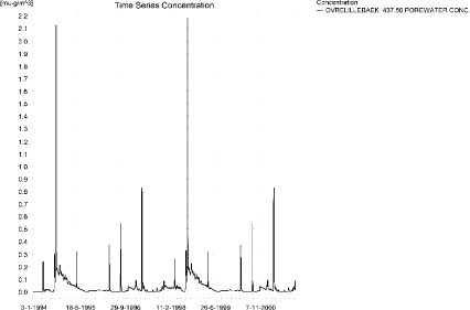
Figure 6.18. Maximum pore water concentration of metamitron for the main stream in the sandy loam catchment. The maximum value reached is 3.90 ng/l 125 m from the upstream end of the sandy loam catchment.
Figur 6.18. Maximale værdier for porevandskoncentrationen af metamitron i hovedvandløbet i morænelersoplandet. Den maximale værdi nået er 3.90 ng/l 125 m from the opstrøms ende af morænelersoplandet.
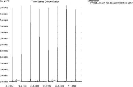
Figure 6.19. Sorption of metamitron on sediment in the sandy loam catchment. The concentration is in µg/g sediment and not µg/m³ as stated.
Figur 6.19. Sorption af metamitron til sediment i morænelersoplandet. Koncentrationen er i µg/g sediment og ikke µg/m³ som angivet.
Compared to the FOCUS SW-stream-scenario for D4, the concentration level in the sandy loam stream is much higher (44.9 µg/l compared to 3.05 µg/l). This value is found in the downstream end and thus affected by the simultaneous spraying of a long stretch of stream. 125 m from the upstream end, the concentration reaches 23.1 µg/l on 1.May 2005. The water depth in the upper 125 m is between 3.7 and 5.7 cm at the time of spraying, resulting in a factor of 6.4. In addition, the PestSurf stream is not rectangular.
The concentration in the sediment is considerably lower, 12.4 ng/kg compared to 149 ng/kg in the FOCUS SW-D4-stream. The flow velocity is a very important factor in limiting the diffusion from the water phase to the sediment.
Figure 6.20, Figure 6.21, Table 6.9 and
Table 6.10 show the results as generated by the PestSurf templates. The maximum value generated by the templates for the upper part of the stream is 16.3 µg/l, and for the lower part, 44.9 µg/l. The maximum value generated in the downstream part of the catchment by PestSurf is 44.9 µg/l. Thus, in this case, the templates did catch the maximum concentration of the PestSurf simulation.
Click here to see Figure 6.20.
Figure 6.20. Overview for metamitron in the sandy loam catchment generated by the PestSurf excel template for the upstream part of the catchment. The detection value was set to 10 ng/l.
Figur 6.20. Oversigt for metamitron i morænelersoplandet genereret med PestSurf-excel-skabelonen for den opstrøms del af oplandet. Detektionsgrænsen var sat til 10 ng/l.
Click here to see Figure 6.21.
Figure 6.21. Overview for metamitron in the sandy loam catchment generated by the PestSurf excel template for the downstream part of the catchment. The detection value was set to 10 ng/l.
Figur 6.21. Oversigt for metamitron i morænelersoplandet genereret med PestSurf-excel-skabelonen for den nedstrøms del af oplandet. Detektionsgrænsen var sat til 10 ng/l.
Table 6.9. Part of the result sheet generated by the PestSurf Excel sheet for the upstream part of the sandy loam catchment. The detection value for generation of the table is 10 ng/l, toxicity to fish, daphnies and algae are set to 100, 1000 and 10000 ng/, respectively. The recorded peaks are shown in Figure 6.20.
Tabel 6.9. Uddrag af resultatpresentationen genereret af PestSurf-Excel-arket for den opstrøms del af morænelersoplandet. Detektionsgrænsen for tabelgenerering er sat til 10 ng/l. Toxicitetsværdierne for fisk, dafnier og alger er henholdsvis 100, 1000 og 10000 ng/l. Hændelserne er vist i Figur 6.20.
Table 6.10. Part of the result sheet generated by the PestSurf Excel sheet for the downstream part of the sandy loam catchment. The detection value for generation of the table is 10 ng/l, toxicity to fish, daphnies and algae are set to 100, 1000 and 10000 ng/, respectively. The recorded peaks are shown in Figure 6.21.
Tabel 6.10. Uddrag af resultatpresentationen genereret af PestSurf-Excel-arket for den nedstrøms del af morænelersoplandet. Detektionsgrænsen for tabelgenerering er sat til 10 ng/l. Toxicitetsværdierne for fisk, dafnier og alger er henholdsvis 100, 1000 og 10000 ng/l. Hændelserne er vist i Figur 6.21.
6.4.5 Sandy Loam Catchment, pond
The concentration pattern is evaluated in the middle of the pond only, see Figure 6.22. The pond receives contributions through drift, in good correspondence with the fact that it is situated in the upper part of the sandy loam catchment. The maximum concentration is 0.355 µg/l.
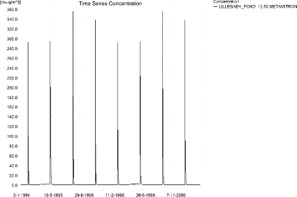
Figure 6.22. Concentrations of metamitron for the sandy loam pond.
Figur 6.22. Koncentration af metamitron i morænelersvandhullet.
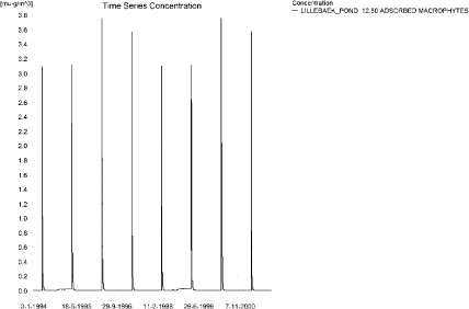
Figure 6.23. Metamitron sorbed to the macrophytes in the sandy loam pond.
Figur 6.23. Metamitron sorberet til makrofytter i morænelers-vandhullet.
Figure 6.23 shows the sorption of macrophytes in the pond. The concentrations are about 100 times lower than the concentrations in the water phase. The concentration in porewater is shown in Figure 6.24. As shown in Figure 6.25, the maximum concentration in sediment is quite small, 0.8 ng/kg.
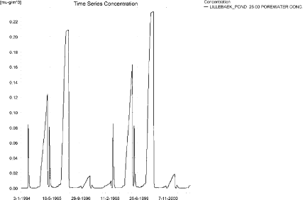
Figure 6.24. Pore water concentration of metamitron in the sandy loam pond.
Figur 6.24. Porevandskoncentration af metamitron i morænelersvandhullet.
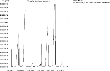
Figure 6.25. Metamitron sorbed to sediment in the sandy loam pond. The concentration is in µg/g sediment and not µg/m³ as stated.
Figur 6.25. Metamitron sorberet til sediment i morænelersvandhullet. Koncentrationen er i µg/g sediment og ikke µg/m³ som angivet.
In Table 6.11, global maxima and time weighted concentrations (up to 7 days) were extracted.
Table 6.11. Actual and time weighted concentrations (ng/l) of metamitron in the sandy loam pond.
Tabel 6.11. Beregnede og tidsvægtede koncentrationer (ng/l) af metamitron i morænelersvandhullet.
| Year | Metamitron | actual | Time-weighted | Date |
| 1994 | global max | 292 | 01-05-1994 | |
| 1 hour(after max) | 281 | 287 | ||
| 1 day after sp.in. | 204 | 232 | ||
| 3 days | 135 | 188 | ||
| 4 days | 109 | 171 | ||
| 7 days | 57 | 131 | ||
| 1995 | Global max | 294 | 01-05-1995 | |
| 1 hour | 283 | 289 | ||
| 1 day | 207 | 234 | ||
| 2 days | 137 | 190 | ||
| 4 days | 111 | 173 | ||
| 7 days | 59 | 134 | ||
| 1996 | global max | 355 | 02-05-1996 | |
| 1 hour | 338 | 346 | ||
| 1 day | 241 | 278 | ||
| 2 days | 158 | 223 | ||
| 4 days | 128 | 203 | ||
| 7 days | 69 | 157 | ||
| 1997 | global max | 337 | 01-05-1997 | |
| 1 hour | 323 | 330 | ||
| 1 day | 232 | 263 | ||
| 2 days | 155 | 214 | ||
| 4 days | 126 | 195 | ||
| 7 days | 68 | 151 | ||
| 1998 | global max | 292 | 30-04-1998 | |
| 1 hour | 281 | 287 | ||
| 1 day | 204 | 232 | ||
| 2 days | 134 | 187 | ||
| 4 days | 109 | 170 | ||
| 7 days | 57 | 131 | ||
| 1999 | global max | 294 | 30-04-1999 | |
| 1 hour | 283 | 289 | ||
| 1 day | 207 | 234 | ||
| 2 days | 136 | 189 | ||
| 4 days | 111 | 173 | ||
| 7 days | 59 | 133 | ||
| 2000 | global max | 355 | 01-05-2000 | |
| 1 hour | 338 | 346 | ||
| 1 day | 240 | 277 | ||
| 2 days | 158 | 222 | ||
| 4 days | 127 | 202 | ||
| 7 days | 68 | 156 | ||
| 2001 | global max | 337 | 30-04-2001 | |
| 1 hour | 323 | 330 | ||
| 1 day | 231 | 263 | ||
| 2 days | 154 | 213 | ||
| 4 days | 126 | 194 | ||
| 7 days | 67 | 150 | ||
| max values | ||||
| global max | 355 | |||
| 1 hour | 338 | 346 | ||
| 1 day | 241 | 278 | ||
| 2 days | 158 | 223 | ||
| 4 days | 128 | 203 | ||
| 7 days | 69 | 157 |
Figure 6.26 shows a page of the output from the PestSurf template, with a time series identical to Figure 6.22.
The FOCUS SW-scenario D4- pond generates a maximum concentration of 0.149 µg/l, while PestSurf reaches 0.355 µg/l. The difference can be explained by the difference in area of the two ponds.
The concentrations in the sediment differ substantially, being 62 ng/kg in the FOCUS-calculation and 0.8 ng/kg in the PestSurf calculation.
Click here to see Figure 6.26.
Figure 6.26. Overview for metamitron in the sandy loam pond generated by the PestSurf excel template. The time series shown is identical to the one in Figure 6.22. The lowest detection value was set to 10 ng/l.
Figur 6.26. Oversigt for metamitron i morænelersoplandet genereret med PestSurf-excel-skabelonen. Den viste tidsserie er mage til den i Figur 6.22. Detektionsgrænsen er sat til 10 ng/l.
Table 6.12. Part of the result sheet generated by the PestSurf Excel sheet. The lowest detection valuε = 10 ng/l, toxicity to fish, daphnies and algae are set to 100, 1000 and 10000 ng/, respectively. The recorded peaks are shown in Figure 6.26.
Tabel 6.12. Uddrag af resultatpresentationen genereret af PestSurf-Excel-arket. Detektionsgrænsen er sat til 10 ng/l. Toxicitetsværdierne for fisk, dafnier og alger er henholdsvis 100, 1000 og 10000 ng/l. De tabellerede hændelser er vist i Figur 6.26.
Table 6.13. Summary of simulation results for metamitron.
Tabel 6.13. Opsummerede resultater for metamitron.
6.5 Summary of Simulations
The maximum actual concentrations for all simulations are recorded in Table 6.13.
All maximum concentrations are generated by drift in the FOCUS SW-scenarios while in PestSurf, the maximum concentration for the sandy pond is generated by groundwater contributions.
The concentration in the sandy pond is smaller than the concentration in the D3 ditch, which again is smaller than in the sandy stream. For the pond, this is mainly due to lower exposure. For the stream, the higher concentration is due to the spraying along the whole stream within 30 minutes. 112 m from the upstream end of the stream, the concentration only reaches 0.590 µg/l, considerably less than the 3.67 µg/l reached further in the FOCUS SW D3-ditch. The difference is due to protection from a 20 m buffer zone. The water depth at the time of maximum concentration is 12.5 cm.
The D4 pond (149 ng/l) and the sandy loam pond (0.355 ng/l) differ in concentration level due to differences in pond characteristics. The difference in concentration is very close to a factor of 2.4.
With respect to the sandy loam stream, the concentration is considerably higher in the PestSurf simulation than in the D4-stream (44.9 µg/l compared to 3.05 µg/l). This is due to spraying along a long stretch of the stream and the very small water depth present at the time of spraying. 125 m from the upstream end, a maximum concentration of 23.1 µg/l is found. The corresponding water depth is around 5 cm. The maximum value on the 500-1700 m streach is 21.6 µg/l.
Macrophyte adsorption is low and does not play a role for the final concentration in the water phase.
The concentration in the sediment is considerably lower in the PestSurf-calculations. For the stream calculations, two major factors play a role. First of all, the water flow in the PestSurf streams is higher than in the FOCUS stream, leading much less diffusion into the sediment. Secondly, the description in PestSurf only contains one calculation layer for sediment, which is different from the FOCUS description. For the PestSurf ponds, the description of diffusion into sediment is similar to the description used in FOCUS. It is less clear why the concentrations are considerably lower in this case.
To judge the effect of the sorbed amounts on the water concentration, the amount per square meter can be calculated: For the D4-stream, the sediment concentration is 0.149 µg/kg. In 40 kg sediment[1]/m2,, the total amount is 5.96 mg. In the water phase, the concentration is 3.047 µg/l, in 300 l/m², resulting in 914 mg. The pesticide in sediment thus has a limited influence on the concentration in the water phase.
Footnotes
[1] The weight of sediment is calculated as 1m*1m*0.05 m * 800 kg/m³
Annex 7
7 Comparison of risk assessment data produced by spray drift assessments, FOCUS SW and PestSurf
7.1 Chemical characteristics of the compound
| Compound: | Pendimethalin |
| Dose: | 400 g ai./ha |
| Spraying time: | 1st May |
| Crop: | Spring barley |
| Dose: | 1600 g ai./ha |
| Spraying time: | 20th September |
| Crop: | Winter wheat |
Table 7.1. Overview of chemical properties of pendimethalin and the parameters used in the simulations.
Tabel 7.1. Oversigt over pendimethalin kemiske egenskaber og parametrene brugt i simuleringerne.
| Chemical property | Condition | Recalculated values | |||
| Cas-no. | 40487-42-1 | ||||
| Molecular weight | 281.3 | ||||
| Form (acid, basic, neutral) | neutral | ||||
| pKa | |||||
| Water solubility | 0.33 µg/l l | pH 7 | 20°C | ||
| log Kow | at pH | KowA- | |||
| log Kow | 5.2 | at pH | 7 | KowAH | 5.2 |
| log Kow | at pH | KowAH+ | |||
| Vapor pressure, Pa | 1.94 x 10⁻³ | 25°C | 330 (Boiling point) | vapor pressure, Pa, 20°C | 1.07 × 10⁻³ |
| Henry’s law constant | 2.728 × 10⁻³ (Kpa x m³ / mol) | 25°C | Recalculated value, dimensionless | 1.10 × 10⁻³ | |
| Sorption properties in soil | |||||
| Freundlich exp | 0.96 | ||||
| Koc, l/kg | 14471 | ||||
| DT50 in soil, days | 148 | ||||
| DT50water | Fast sorption | PestSurf input | |||
| DT50sedment | None mentioned | ||||
| DT50water/sediment | range: 4-28 days: 16 days | DT50, days | 16 | ||
| Sediment konc., µg/l | 80 (default in PestSurf) | ||||
| Hydrolysis | no hydrolysis | at pH 5 | (acid) | ||
| at pH 7 | (neutral) | ||||
| at pH 9 | (basic) | ||||
| Photolysis | |||||
| quantum yield | No relevant direct phototransformation observed, set to 0 | ? | |||
| Spectrum | 238 nm ε = 28775 l.mol-1.cm-1 | ||||
| 425 nm, ε = 5490 l.mol-1.cm-1 | |||||
| Other | DT50 = 21 days (under 24 h daily exposure) pH not stated | ||||
7.2 Concentration generated by spray
| Direct spray | FOCUS buffer zones | |||
| Ditch | Stream | Pond | ||
| mg l-1 | mg l-1 | mg l-1 | mg l-1 | |
| Pendimethalin | ||||
| -spring appl. | 133.3 | 3.679 | 2.475 | 1.081 |
| - autumn appl. | 533.3 | 14.716 | 9.900 | 4.323 |
7.3 Concentrations generated by FOCUS SW
7.3.1 D3 - Ditch
| Pendimethalin, spring appl. | Ditch, D3 | |||||||
| Water | Sediment | |||||||
| Date | PEC | Date | TWAEC | Date | PEC | Date | TWAEC | |
| mg l-1 | mg l-1 | mg l-1 | mg l-1 | |||||
| Global max | 04-May-92 | 2.511 | 06-May-92 | 1.514 | ||||
| 1 d | 05-May-92 | 0.938 | 05-May-92 | 1.779 | 07-May-92 | 1.437 | 06-May-92 | 1.501 |
| 2 d | 06-May-92 | 0.086 | 06-May-92 | 1.092 | 08-May-92 | 1.334 | 07-May-92 | 1.472 |
| 4 d | 08-May-92 | 0.005 | 08-May-92 | 0.556 | 10-May-92 | 1.151 | 09-May-92 | 1.394 |
| 7 d | 11-May-92 | 0.004 | 11-May-92 | 0.320 | 13-May-92 | 0.932 | 12-May-92 | 1.275 |
| Pendimethalin, autumn appl. | Ditch, D3 | |||||||
| Water | Sediment | |||||||
| Date | PEC | Date | TWAEC | Date | PEC | Date | TWAEC | |
| mg l-1 | mg l-1 | mg l-1 | mg l-1 | |||||
| Global max | 26-Sep-92 | 10.075 | 28-Sep-92 | 7.883 | ||||
| 1 d | 27-Sep-92 | 5.635 | 27-Sep-92 | 7.818 | 29-Sep-92 | 7.548 | 29-Sep-92 | 7.838 |
| 2 d | 28-Sep-92 | 1.441 | 28-Sep-92 | 5.598 | 30-Sep-92 | 7.029 | 29-Sep-92 | 7.716 |
| 4 d | 30-Sep-92 | 0.070 | 30-Sep-92 | 3.015 | 02-Okt-92 | 6.208 | 01-Okt-92 | 7.365 |
| 7 d | 03-Oct-92 | 0.034 | 03-Oct-92 | 1.741 | 05-Oct-92 | 5.233 | 04-Oct-92 | 6.835 |
7.3.2 D4 – Pond
| Pendimethalin, spring appl. | Pond, D4 | |||||||
| Water | Sediment | |||||||
| Date | PEC | Date | TWAEC | Date | PEC | Date | TWAEC | |
| mg l-1 | mg l-1 | mg l-1 | mg l-1 | |||||
| Global max | 30-May-85 | 0.087 | 12-Jun-85 | 0.308 | ||||
| 1 d | 31-May-85 | 0.080 | 31-May-85 | 0.083 | 13-Jun-85 | 0.307 | 12-Jun-85 | 0.308 |
| 2 d | 01-jun-85 | 0.073 | 01-jun-85 | 0.080 | 14-Jun-85 | 0.305 | 13-Jun-85 | 0.308 |
| 4 d | 03-jun-85 | 0.060 | 03-jun-85 | 0.073 | 16-Jun-85 | 0.298 | 14-Jun-85 | 0.307 |
| 7 d | 06-jun-85 | 0.046 | 06-jun-85 | 0.064 | 19-Jun-85 | 0.282 | 16-Jun-85 | 0.305 |
| Pendimethalin, autumn appl. | Pond, D4 | |||||||
| Water | Sediment | |||||||
| Date | PEC | Date | TWAEC | Date | PEC | Date | TWAEC | |
| mg l-1 | mg l-1 | mg l-1 | mg l-1 | |||||
| Global max | 28-Sep-85 | 0.216 | 14-Oct-85 | 0.882 | ||||
| 1 d | 29-Sep-85 | 0.198 | 29-Sep-85 | 0.207 | 15-Oct-85 | 0.881 | 15-Oct-85 | 0.882 |
| 2 d | 30-Sep-85 | 0.181 | 30-Sep-85 | 0.198 | 16-Oct-85 | 0.877 | 15-Oct-85 | 0.881 |
| 4 d | 02-okt-85 | 0.154 | 02-okt-85 | 0.182 | 18-Oct-85 | 0.865 | 16-Oct-85 | 0.880 |
| 7 d | 05-okt-85 | 0.124 | 05-okt-85 | 0.163 | 21-Oct-85 | 0.836 | 18-Oct-85 | 0.887 |
7.3.3 D4 – Stream
| Pendimethalin, spring appl | Stream, D4 | |||||||
| Water | Sediment | |||||||
| Date | PEC | Date | TWAEC | Date | PEC | Date | TWAEC | |
| mg l-1 | mg l-1 | mg l-1 | mg l-1 | |||||
| Global max | 30-May-85 | 2.072 | 30-May-85 | 1.516 | ||||
| 1 d | 31-May-85 | 0.002 | 31-May-85 | 0.23 | 31-May-85 | 0.362 | 31-May-85 | 0.684 |
| 2 d | 01-jun-85 | 0.001 | 01-jun-85 | 0.115 | 01-jun-85 | 0.253 | 01-jun-85 | 0.496 |
| 4 d | 03-jun-85 | 0 | 03-jun-85 | 0.058 | 03-jun-85 | 0.172 | 03-jun-85 | 0.352 |
| 7 d | 06-jun-85 | 0 | 06-jun-85 | 0.033 | 06-jun-85 | 0.12 | 06-jun-85 | 0.263 |
| Pendimethalin, autumn appl. | Stream, D4 | |||||||
| Water | Sediment | |||||||
| Date | PEC | Date | TWAEC | Date | PEC | Date | TWAEC | |
| mg l-1 | mg l-1 | mg l-1 | mg l-1 | |||||
| Global max | 28-sep-85 | 8.654 | 28-sep-85 | 9.492 | ||||
| 1 d | 29-sep-85 | 0.073 | 29-sep-85 | 2.4 | 29-sep-85 | 3.755 | 29-sep-85 | 6.554 |
| 2 d | 30-sep-85 | 0.018 | 30-sep-85 | 1.219 | 30-sep-85 | 2.628 | 30-sep-85 | 4.941 |
| 4 d | 02-okt-85 | 0.005 | 02-okt-85 | 0.614 | 02-okt-85 | 1.808 | 02-okt-85 | 3.59 |
| 7 d | 05-okt-85 | 0.002 | 05-okt-85 | 0.352 | 05-okt-85 | 1.299 | 05-okt-85 | 2.718 |
7.3.4 Conclusion – FOCUS SW
The highest concentration is generated in the ditch (D3), 2.51 µg/l for the spring application and 10.1 µg/l for the autumn-application. The D4-stream scenario and D3-ditch shows almost identical maximum sediment concentrations (1.51 µg/kg) for the spring application, while the D4-stream scenario has the highest sediment concentration 9.49 µg/kg for the autumn application. All maximum concentrations are drift-generated. For all scenarios, the concentrations are lower than what is generated by the simpler assessments.
7.4 PestSurf
7.4.1 Sandy Catchment, Stream
The distribution of concentrations was assessed in several steps. First, the maximum concentrations at each calculation point were listed, and the dates for the occurrence of the maximum were assessed. The points, for which the maximum value also represents a local maximum were selected for further analysis. The relevant values are listed in Table 7.2.
The pattern over time was dominated by drift for all calculation points and both application times, see Figure 7.1 and Figure 7.2.

Figure 7.1. Concentration pattern over time for spring application of pendimethalin in the sandy catchment.
Figur 7.1. Koncentrationsmønster som funktion af tid for forårsudbragt pendimethalin i det sandede opland.
Table 7.2. Maximum concentrations (ng/l) of pendimethalin simulated for each calculation point in the sandy catchment.
Tabel 7.2. Maximumkoncentrationer (ng/l) af pendimethalin simuleret for hvert beregningspunkt i det sandede opland.

Figure 7.2. Concentration pattern over time for autumn application of pendimethalin in the sandy catchment.
Figur 7.2. Koncentrationsmønster som funktion af tid for efterårsudbragt pendimenthalin i det sandede opland.
Each of the drift-events generated an almost identical pattern along the stream. Figure 7.3, Figure 7.4, Figure 7.5 and Figure 7.6 show two cases of high concentrations for the spring and autumn application, respectively, just at the end of a spraying event and some time later, where the compound starts moving downstream. The flow downstream is slower in the autumn case than in the spring case shown. The thin black line represents the concentration, while the thick black line shows the maximum concentrations obtained during the simulations. In addition, the outline of the stream is shown. In the middle of the catchment, the stream is protected by unsprayed areas.
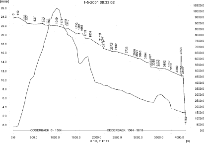
Figure 7.3. Concentrations of pendimethalin in the sandy catchment on the day of spraying (1. May, 2001, spring application).
Figur 7.3. Koncentrationer pendimethalin i det sandede opland på udbringningsdagen (1. maj 2001, forårsudbringning).
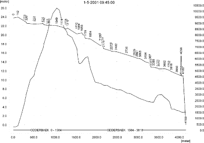
Figure 7.4. Concentrations of pendimethalin in the sandy catchment on the day of spraying (1. May, 2001, spring application); 75 minutes after the end of application.
Figur 7.4. Koncentrationer pendimethalin i det sandede opland på udbringningsdagen (1. maj 2001, forårsudbringning), 75 minutter efter endt udbringning.
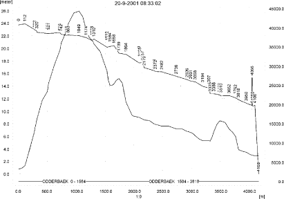
Figure 7.5. Concentrations of pendimethalin in the sandy catchment on the day of spraying (20. September, 2001, autumn application).
Figur 7.5. Koncentrationer pendimethalin i det sandede opland på udbringningsdagen (20. september 2001, efterårsudbringning).

Figure 7.6. Concentrations of pendimethalin in the sandy catchment on the day of spraying (20. Sept, 2001, autumn application); 75 minutes after the end of application.
Figur 7.6. Koncentrationer pendimethalin i det sandede opland på udbringningsdagen (20. september 2001, efterårsudbringning), 75 minutter efter endt udbringning.
In order to present the data in a similar fashion to the FOCUS SW-results, data were extracted and recalculated for the time series marked in Table 7.2. The global maxima and time weighted concentrations (up to 7 days) were extracted and are reported in Table 7.3 and Table 7.4 for the spring and autumn-concentrations, respectively. Note that the unit is ng/l.
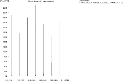
Figure 7.7. Sorption to macrophytes after spring application of pendimethalin in the sandy catchment.
Figur 7.7. Koncentration af forårsudbragt pendimethalin sorberet på makrofytter i det sandede opland.
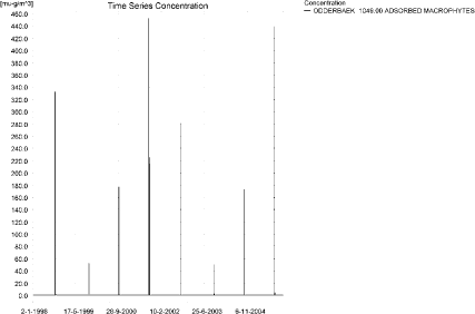
Figure 7.8. Sorption to macrophytes after autumn application of pendimethalin in the sandy catchment.
Figur 7.8. Koncentration af efterårsudbragt pendimethalin sorberet på makrofytter i det sandede opland.
Examples of sorption of pendimethalin to macrophytes is shown in Figure 7.7 and Figure 7.8 for the spring and the autumn application, respectively. The maximum values reached are 331 ng/l for the spring application and 511 ng/l for the autumn application, both values found 1421 m from the upstream end. The concentrations have limited influence on the concentrations in the water phase. The relative effect is slightly higher for the spring application than for the autumn application. The concentrations in porewater are shown in Figure 7.9 and Figure 7.10 for the spring and autumn application, respectively. The concentrations are quite small, and the concentrations of pendimethalin sorbed to sediment are about 3 and 21 ng/kg for the spring and autumn applications. Examples of sediment concentrations are shown in Figure 7.11 and Figure 7.12.
The global maximum value calculated by PestSurf for the sandy catchment in the water phase is 10.2 µg/l for the spring application and 44.3 µg/l for the autumn application. This is considerably more than what is found in the D3-ditch scenario (2.51 µg/l for the spring application and 10.1 µg/l for the autumn application). The major difference is the spraying along a long stretch of stream and a water depth that generally is lower than the 30 cm used in FOCUS SW (about 8 cm water depth at the point and time of maximum concentration). The sediment concentrations are considerably smaller (3 and 21 ng/kg) compared to 1.5 and 7.9 µg/kg calculated by FOCUS SW-D3 ditch.

Figure 7.9. Pore water concentrations of pendimethalin in the sandy catchment after spring-application.
Figur 7.9. Porevandskoncentration for forårsudbragt pendimethalin i det sandede opland.
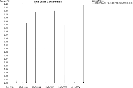
Figure 7.10. Pore water concentrations of pendimethalin in the sandy catchment after autumn-application.
Figur 7.10. Porevandskoncentration for efterårsårsudbragt pendimethalin i det sandede opland.

Figure 7.11. Example of sediment concentrations of pendimethalin in the sandy catchment after spring-application. The maximum value reached in the catchment is 2.9 ng/kg. Note that the concentrations are in µg/g and not µg/m³ as indicated.
Figur 7.11. Eksempel på sedimentkoncentration af forårsudbragt pendimethalin i det sandede opland. Maximumskoncentrationen i oplandet er 2.9 ng/kg. Bemærk at koncentrationen er i µg/g og ikke i µg/m³ som angivet.
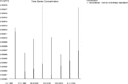
Figure 7.12. Example of sediment concentrations of pendimethalin in the sandy catchment after autumn-application. The maximum value reached is 20.9 ng/kg. Note that the concentrations are in µg/g and not µg/m³ as indicated.
Figur 7.12. Eksempel på sedimentkoncentration af efterårsudbragt pendimethalin i det sandede opland. Maximumskoncentrationen i oplandet er 20.9 ng/kg. Bemærk at koncentrationen er i µg/g og ikke i µg/m³ som angivet.
Figure 7.13, Figure 7.14, Table 7.5 and Table 7.6 show the output of the PestSurf Excel template. The template works with pre-defined data extraction points. The plot requires specification of a “lowest detection value” (ldc) which defines when a pesticide occurrence is defined as an event. The time series plot is identical to the time series shown earlier, and the graph in the upper right corner resembles the plots in Figure 7.3 - Figure 7.6, but takes into account a longer period of time. A curve is generated when a downstream point reaches a concentration higher than the ldc. The programme then tracks the highest concentration for each calculation point in the stream within the last 24 hours. The plot in the lower right corner shows how many events have concentrations higher than a given toxicity value for the selected monitoring points.
The tables show part of the result sheet generated by the PestSurf Excel sheet based on the ldc-value. The selected tables shows the point along the stream (of the pre-defined points) with the highest concentration. The highest concentration extracted by the PestSurf Excel sheet was 5.59 µg/l for the spring application and 2.493 µg/l for the autumn-application. Thus, the pre-defined points have not caught the highest concentrations of the simulations, which were 10.2 and 44.3 µg/l, respectively.
Table 7.3. Concentration of spring applied pendimethalin, ng/l, at selected points i in the sandy catchment.
Tabel 7.3. Koncentration af forårsudbragt pendimethalin, ng/l, på udvalgte lokaliteter i det sandede vandløb.
Table 7.4. Concentration of autumn applied pendimethalin, ng/l, at selected points i in the sandy catchment.
Tabel 7.4. Koncentration af efterårsudbragt, ng/l, på udvalgte lokaliteter i det sandede vandløb.
Click here to see Figure 7.13.
Figure 7.13. Overview for spring-applied pendimethalin in the sandy catchment generated by the PestSurf excel template. The max concentrations generated over the 24 hours are comparable to the overviews in Figure 7.3-Figure 7.4. Detection value was set to 10 ng/l.
Figur 7.13. Oversigt for forårsudbragt i det sandede opland genereret med PestSurf-excel-skabelonen. Den maximale koncentration genereret over 24 timer svarer til oversigterne i Figur 7.3-Figur 7.4. Detektionsgrænsen var sat til 10 ng/l.
Click here to see Figure 7.14.
Figure 7.14. Overview for autumn-applied pendimethalin in the sandy catchment generated by the PestSurf excel template. The max concentrations generated over the 24 hours are comparable to the overviews in Figure 7.5-Figure 7.6. Detection value was set to 10 ng/l.
Figur 7.14. Oversigt for forårsudbragt i det sandede opland genereret med PestSurf-excel-skabelonen. Den maximale koncentration genereret over 24 timer svarer til oversigterne i Figur 7.5-Figur 7.6. Detektionsgrænsen var sat til 10 ng/l.
Table 7.5. Part of the result sheet generated by the PestSurf Excel sheet for pendimethalin application during spring. The selected table shows the point along the stream with the highest concentration recorded. The detection limit is 10 ng/l, toxicity to fish is set to 100 ng/l. toxicity to daphnies and algae are set to 1000 and 10000 ng/, respectively. The recorded peaks are shown in Figure 7.13.
Tabel 7.5. Uddrag af resultatpresentationen genereret af PestSurf-Excel-arket for forårsudbragt pendimethalin. Den udvalgte tabel viser det fordefinerede punkt langs med åen med højest koncentration. Detektionsgrænsen er sat til 10 mens toxicitetsværdierne for fisk, dafnier og alger er henholdsvis 100, 1000 og 10000 ng/l. De tabellerede hændelser er vist i Figur 7.13.
Table 7.6. Part of the result sheet generated by the PestSurf Excel sheet for pendimethalin application during autumn. The selected table shows the point along the stream with the highest concentration recorded. The lowest detection value is 10 ng/l, toxicity to fish, daphnies and algae are set to 100, 1000 and 10000 ng/, respectively. The recorded peaks are shown in Figure 7.14.
Tabel 7.6. Uddrag af resultatpresentationen genereret af PestSurf-Excel-arket for efterårsudbragt pendimethalin. Den udvalgte tabel viser det fordefinerede punkt langs med åen med højest koncentration. Detektionsgrænsen er sat til 10 mens toxicitetsværdierne for fisk, dafnier og alger er henholdsvis 100, 1000 og 10000 ng/l. De tabellerede hændelser er vist i Figur 7.14.
7.4.2 Sandy catchment, pond
The concentration pattern is evaluated in the middle of the pond only, see Figure 7.15 and Figure 7.16, for the spring and autumn-application, respectively, and Table 7.7. The pond receives drift and a contribution from groundwater. The drift peaks are not visible. The baseflow contribution is dominating the picture. There is a considerable difference between concentrations reached from a spring and and autumn application, 0.145 and 7.17 µg/l, respectively.
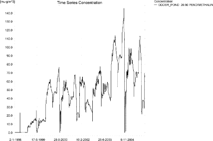
Figure 7.15. Concentrations of spring-applied pendimethalin in the sandy pond.
Figur 7.15. Koncentration af forårsudbragt pendimethalin i det sandede vandhul.
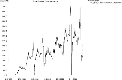
Figure 7.16. Concentrations of autumn-applied pendimethalin in the sandy pond.
Figur 7.16. Koncentration af efterårsudbragt pendimethalin i det sandede vandhul.
Table 7.7. Maximum concentrations of pendimethalin (ng/l) generated in the sandy pond for spring and autumn applications.
Tabel 7.7. Maximumkoncentrationer af forårs- og efterårsudbragt pendimethalin (ng/l) genereret for det sandede vandhul.
| Year | ODDER_POND 20.00, spring application | ODDER_POND 20.00, autumn application | |||||
| Conc. | TWC | Date | Conc. | TWC | Date | ||
| 1998 | 1998 (global max) | 23 | 01-05-1998 | 379 | 20-09-1998 | ||
| 1 hour (after max) | 15 | 16 | 231 | 274 | |||
| 1 day after sp.in. | 3 | 7 | 84 | 118 | |||
| 2 days | 0 | 3 | 75 | 91 | |||
| 4 days | 0 | 2 | 76 | 87 | |||
| 7 days | 0 | 1 | 83 | 84 | |||
| 1999 | 1999 (global max) | 47 | 28-12-1999 | 1387 | 30-12-1999 | ||
| 1 hour (after max) | |||||||
| 1 day after sp.in. | 47 | 47 | 1321 | 1354 | |||
| 2 days | 47 | 47 | 1311 | 1323 | |||
| 4 days | 47 | 47 | 1305 | 1319 | |||
| 7 days | 46 | 47 | 1265 | 1306 | |||
| 2000 | 2000 (global max) | 77 | 20-09-2000 | 3575 | 02-10-2000 | ||
| 1 hour (after max) | 2810 | 3011 | |||||
| 1 day after sp.in. | 72 | 74 | 2508 | 2562 | |||
| 2 days | 67 | 71 | 2391 | 2507 | |||
| 4 days | 66 | 70 | 2218 | 2456 | |||
| 7 days | 62 | 67 | 400 | 2120 | |||
| 2001 | 2001 (global max) | 67 | 16-09-2001 | 4509 | 20-09-2001 | ||
| 1 hour (after max) | 3728 | 3935 | |||||
| 1 day after sp.in. | 67 | 67 | 3315 | 3419 | |||
| 2 days | 67 | 67 | 3199 | 3306 | |||
| 4 days | 67 | 67 | 3159 | 3274 | |||
| 7 days | 66 | 67 | 3069 | 3204 | |||
| 2002 | 2002 (global max) | 65 | 06-03-2002 | 2834 | 06-03-2002 | ||
| 1 hour (after max) | |||||||
| 1 day after sp.in. | 65 | 65 | 2826 | 2830 | |||
| 2 days | 63 | 64 | 2592 | 2727 | |||
| 4 days | 62 | 64 | 2576 | 2691 | |||
| 7 days | 60 | 63 | 2477 | 2617 | |||
| 2003 | 2003 (global max) | 91 | 27-12-2003 | 3958 | 29-03-2003 | ||
| 1 hour (after max) | |||||||
| 1 day after sp.in. | 91 | 91 | 3850 | 3904 | |||
| 2 days | 91 | 91 | 3889 | 3855 | |||
| 4 days | 91 | 91 | 3780 | 3850 | |||
| 7 days | 91 | 91 | 3689 | 3809 | |||
| 2004 | 2004 (global max) | 145 | 20-09-2004 | 7170 | 11-09-2004 | ||
| 1 hour (after max) | |||||||
| 1 day after sp.in. | 137 | 141 | 6477 | 6824 | |||
| 2 days | 127 | 134 | 6040 | 6433 | |||
| 4 days | 125 | 132 | 5901 | 6318 | |||
| 7 days | 118 | 127 | 5605 | 6071 | |||
| 2005 | 2005 (global max) | 113 | 16-09-2005 | 6885 | 15-09-2005 | ||
| 1 hour (after max) | |||||||
| 1 day after sp.in. | 113 | 113 | 6687 | 6786 | |||
| 2 days | 112 | 113 | 5958 | 6436 | |||
| 4 days | 112 | 113 | 5785 | 6295 | |||
| 7 days | 111 | 112 | 5565 | 6041 | |||
| Global max | 145 | 7170 | |||||
| 1 hour (after max) | 15 | 16 | 3728 | 3935 | |||
| 1 day after sp.in. | 137 | 141 | 6687 | 6824 | |||
| 2 days | 127 | 134 | 6040 | 6436 | |||
| 4 days | 125 | 132 | 5901 | 6318 | |||
| 7 days | 118 | 127 | 5605 | 6071 | |||
As for the previous simulation, the sorption to macrophytes, see Figure 7.17 and Figure 7.18 is significant compared to the concentration in the water phase. The corresponding pore water and sediment concentrations are shown in Figure 7.19- Figure 7.22. For the spring application, the concentration reaches 0.054 µg/kg and for the autumn application, 2.27 µg/kg.
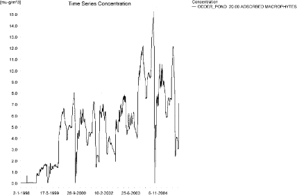
Figure 7.17. Sorption of spring-applied pendimethalin to macrophytes in the sandy pond.
Figur 7.17. Sorption af forårsudbragt pendimethalin til makrofytter i det sandede vandhul.
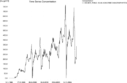
Figure 7.18. Sorption of autumn-applied pendimethalin to macrophytes in the sandy pond.
Figur 7.18. Sorption af efterårsudbragt pendimethalin til makrofytter i det sandede vandhul.
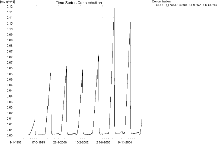
Figure 7.19. Pore water concentration of spring-applied pendimethalin in the sandy pond.
Figur 7.19. Porevandskoncentration af forårsudbragt pendimethalin i det sandede vandhul.
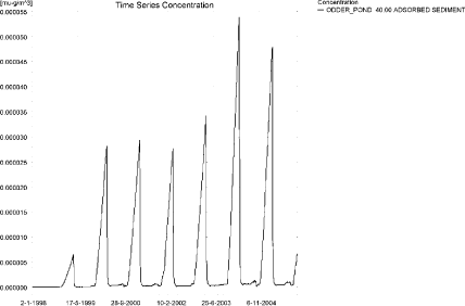
Figure 7.20. Sorption of spring-applied pendimethalin to sediment in the sandy pond. The concentration is in µg/g sediment and not µg/m³ as stated.
Figur 7.20. Sorption af forårsudbragt pendimethalin til sediment i det sandede vandhul. Koncentrationen er i µg/g og ikke i µg/m³ som angivet.
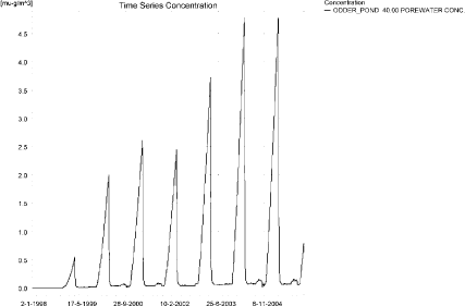
Figure 7.21. Pore water concentration of autumn-applied pendimethalin in the sandy pond.
Figur 7.21. Porevandskoncentration af efterårsudbragt pendimethalin i det sandede vandhul.
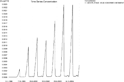
Figure 7.22. Sorption of autumn-applied pendimethalin to sediment in the sandy pond. The concentration is in µg/g sediment and not µg/m³ as stated.
Figur 7.22. Sorption af efterårsudbragt pendimethalin til sediment i det sandede vandhul. Koncentrationen er i µg/g og ikke i µg/m³ som angivet.
Compared to the FOCUS D3 ditch, the concentration in the PestSurf sandy pond generates lower values for the spring application but comparable values for the autumn application. For the spring application, PestSurf generates 0.145 µg/l, while the D3 ditch generates 2.51 µg/l. For the autumn application, PestSurf generates 7.17 µg/l and the D3-ditch 10.1 µg/l. The sediment concentrations generated by FOCUS SW-D3 ditch are 1.5 and 7.9 µg/kg, while PestSurf generates substantially smaller sediment concentrations of 0.05 and 2.3 µg/kg.
Figure 7.23 and Figure 7.24 show the output of the PestSurf Excel template. The template works with one pre-defined data extraction point for the pond (center of the pond). The plot requires specification of a “lowest detection value” (ldc) which defines when a pesticide occurrence is defined as an event. The time series plot is identical to the time series shown earlier. The plot to the right shows how many events have concentrations higher than a given toxicity value for the selected monitoring points.
Table 7.8 and Table 7.9 show part of the result sheet generated by the PestSurf Excel sheet based on the ldc-value. In the pond-case, there is no difference between the results of PestSurf and the results extracted by the templates.
Click here to see Figure 7.23.
Figure 7.23. Overview for spring-applied pendimethalin in the sandy pond generated by the PestSurf excel template. The time series shown is identical to the one in Figure 7.15. The detection value used for generation of the figure is 25 ng/l.
Figur 7.23. Oversigt for forårsudbragt i det sandede vandhul genereret med PestSurf-excel-skabelonen. Den viste tidsserie er mage til den i Figur 7.15. Detektionsgrænsen anvendt til generering af figurer er sat til 25 ng/l.
Click here to see Figure 7.24.
Figure 7.24. Overview for autumn-applied pendimethalin in the sandy pond generated by the PestSurf excel template. The time series shown is identical to the one in Figure 7.16. The detection value used for generation of the figure is 1000 ng/l.
Figur 7.24. Oversigt for forårsudbragt i det sandede vandhul genereret med PestSurf-excel-skabelonen. Den viste tidsserie er mage til den i Figur 7.16. Detektionsgrænsen anvendt til generering af figurer er sat til 1000 ng/l.
Table 7.8. Part of the result sheet generated by the PestSurf Excel sheet, applied to the spring application of pendimethalin. The lowest detection value is set to 25 ng/l, toxicity to fish, daphnies and algae are set to 50, 100 and 1000 ng/, respectively. The recorded peaks are shown in Figure 7.23. EOφ = End of File.
Tabel 7.8. Uddrag af resultatpresentationen genereret af PestSurf-Excel-arket anvendt på forårsudbragt pendimethalin. Grænseværdien anvendt til tabelgenerering er 25 ng/l mens toxicitetsværdierne for fisk, dafnier og alger er henholdsvis 50, 100 og 1000 ng/l. De tabellerede hændelser er vist iFigur 7.23. EOφ = filafslutning.
Table 7.9. Part of the result sheet generated by the PestSurf Excel sheet, applied to the autumn application of pendimethalin. The lowest detection value is set to 1000 ng/l, toxicity to fish, daphnies and algae are set to 4000, 6000 and 8000 ng/, respectively. The recorded peaks are shown in Figure 7.24.
Tabel 7.9. Uddrag af resultatpresentationen genereret af PestSurf-Excel-arket anvendt på efterårsudbragt pendimethalin. Grænseværdien anvendt til tabelgenerering er 1000 ng/l mens toxicitetsværdierne for fisk, dafnier og alger er henholdsvis 4000, 6000 og 8000 ng/l. De tabellerede hændelser er vist i Figur 7.24.
7.4.3 Sandy Loam catchment, Stream
The distribution of concentrations was assessed in several steps. First, the maximum concentrations at each calculation point were listed, and the dates for the occurrence of the maximum were assessed. The points, for which the maximum value also represents a local maximum were selected for further analysis. The relevant values are listed in Table 7.10.
The maximum concentrations are caused by drainage events, but the pattern differs markedly between the upstream and the downstream end. Figure 7.25 a and b represents the spring application in the upstream part of the catchment. Drift is the cause of high concentrations, but the extreme rainfall event around 18. September 1998 is visible and causes a peak to occur. Apart from these event, concentrations are very low.
Figure 7.26 shows the pattern for the lower part of the sandy loam catchment. The downstream points all show a different picture. The concentrations build up over the 8 years simulated and becomes very high at the end of the summer of 2000 and 2001 (corresponding to a very dry year and a normal year, respectively). During these periods, the flow in the stream consists of base flow contributions through drain only. This buildup is considered to be exaggerated by the model, and it is very high for pendimethalin due to the slow breakdown of the compound.
Figure 7.27 shows two time series for the autumn application in the upstream part of the system. The difference between years due to the actual water depth in the stream at the time of spraying is evident, particularly in Figure 7.27b.
Figure 7.28 shows a pattern for the lower part of the system. The pattern is comparable to the spring application, but the resulting concentrations are higher. However, also the drift contribution is more pronounced for the autumn application than for the spring application.
Table 7.10. Maximum concentrations (ng/l) of pendimethalin simulated for each calculation point in the sandy loam catchment for spring and autumn applications respectively.
Tabel 7.10. Maximumskoncentrationer (ng/l) af forårs- og efterårsudbragt pendimethalin simuleret for hvert beregningspunkt i morænelersoplandet.

a)
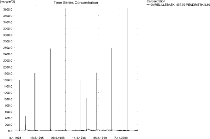
b)
Figure 7.25. Concentration pattern for the spring application of pendimethalin in the upper part of the sandy loam catchment.
Figur 7.25. Koncentrationsmønster for forårsudbragt pendimethalin i den opstrøms ende af morænelersoplandet.
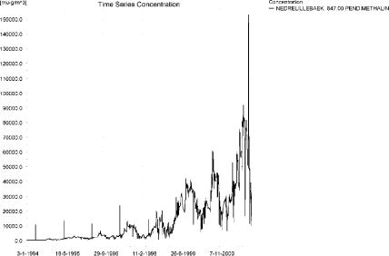
Figure 7.26. Concentration pattern for the spring application of pendimethalin in downstream end of the sandy loam catchment. This pattern is characteristic for the tributaries Fredligbaek and Groftebaek as well as the lower part of the sandy loam catchment.
Figur 7.26. Koncentrationsmønster for forårsudbragt pendimethalin i den nedstrøms ende af morænelersoplandet.Mønsteret er karakteristisk for tilløbene Fredligbæk og Grøftebæk, samt den nedre del af morænelersoplandet.
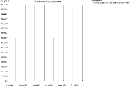
a)
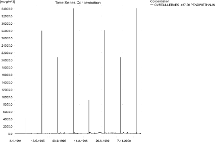
b)
Figure 7.27. Concentration pattern for the autumn application of pendimethalin in OvreLillebaek, in the upper part of the sandy loam catchment.
Figur 7.27. Koncentrationsmønster for efterårsudbragt pendimethalin i den opstrøms ende af morænelersoplandet.
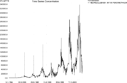
Figure 7.28. Concentration pattern for the autumn application of pendimethalin in the downstream end of the sandy loam catchment. This pattern is characteristic for the tributaries Fredligbaek and Groftebaek as well as the lower part of the sandy loam catchment.
Figur 7.28. Koncentrationsmønster for efterårsudbragt pendimethalin i den nedstrøms ende af morænelersoplandet.Mønsteret er karakteristisk for tilløbene Fredligbæk og Grøftebæk, samt den nedre del af morænelersoplandet.
Longitudinal concentrations profiles for the sandy loam catchment are shown in Figure 7.29 for the spring application and in Figure 7.30, Figure 7.31 and Figure 7.32 for the autumn application.
The thin black line represents the concentration, while the thick black line shows the maximum concentrations obtained during the simulations. In addition, the outline of the stream is shown.
The simulations are dominated by the contribution from baseflow to the lower end of the catchment. Figure 7.29 shows the longitudinal profile for the time of maximum concentration reached with spring application of pendimethalin. Figure 7.30 shows the similar case for the autumn application. In this case, the baseflow contribution and the drift contribution occur simultaneously and contributes to the very high values. Figure 7.31 and Figure 7.32 shows two other time periods where maximum values are reached for selected points in upstream parts of the catchment. These points are caused by wind drift.
It is generally thought that the model overestimates the transport to groundwater, and, as a consequence of this, it overestimates the contribution through groundwater flow in the lower part of the catchment. The particularly high level of baseflow in the lower part of this catchment is due to occurrence of a sandy layer that transports solute horizontally through the catchment to the lower part of the stream.
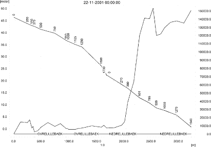
Figure 7.29. Pendimethalin concentrations in the sandy loam catchment on 22. November 2001 (spring application).The concentrations are generated by baseflow contribution to the downstream end of the system.
Figur 7.29. Pendimethalin-koncentrationer i morænelersoplandet den 22.november-2001 (forårsudbringning). Koncentrationerne genereres af grundvandstilstrømning i den nedre ende af systemet).
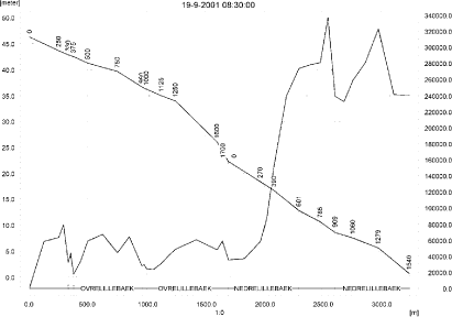
Figure 7.30. Concentrations in the sandy loam catchment on 19. September 2001, just after autumn application.The concentrations are generated by a mix of wind drift, producing the high concentrations in the upstream part of the catchment and wind drift plus groundwater contribution in the downstream end of the catchment.
Figur 7.30. Koncentrationer i morænelersoplandet den 19.september-2001, lige efter efterårsårsudbringning. Koncentrationerne genereres af et mix af vinddrift og grundvandstilstrømning i den nedre ende af systemet.

Figure 7.31. Concentrations in the sandy loam catchment on 20. September 1996 after autumn applications. The concentrations are generated by wind drift moving downstream after spraying.
Figur 7.31. Koncentrationer i morænelersoplandet den 20.september-1996 efter efterårsudbringning. Koncentrationerne genereres af vinddrift, der bevæger sig med strømmen efter sprøjtning.

Figure 7.32. Concentrations in the sandy loam catchment on 20. September 1997 after autumn applications. The concentrations are generated by wind drift in the upper part of the catchment and drift in combination with baseflow contribution to the downstream end of the system.
Figur 7.32. Koncentrationer i morænelersoplandet den 20.september-1997 efter efterårsudbringning. Koncentrationerne genereres af vinddrift i den øvre del af oplandet og drift i kombination med grundvandstilstrømning i den nedre ende af systemet.
To be able to extract comparable values to FOCUS SW, the global maxima and time weighted concentrations (up to 7 days) were extracted when these were meaningful (Table 7.11 and Table 7.12).
Concentrations of pendimethalin on macrophytes are very high in the simulations. Figure 7.33 and Figure 7.34 shows the concentrations in the upstream and downstream part of the catchment after spring application. The maximum value reached in the downstream end is 326 µg/l, a value that is about double the concentration in the water phase. Similar graphs are shown in Figure 7.35 and Figure 7.36 for the autumn application. The maximum value found in the catchment is 1211 µg/l, about four times the water concentration. In this case the macrophytes strongly influence the simulation results for the water phase. The concentrations are judget to be unrealistically high.
Table 7.11. Maximum concentrations (ng/l) of spring-applied pendimethalin simulated for selected calculation point in the sandy loam catchment.
Tabel 7.11. Maximumskoncentrationer (ng/l) af forårsudbragt pendimethalin for udvalgte lokaliteter i morænelersoplandet.
Table 7.12. Maximum concentrations (ng/l) of autumn-applied pendimethalin simulated for selected calculation point in the sandy loam catchment.
Tabel 7.12. Maximumskoncentrationer (ng/l) af efterårsudbragt pendimethalin for udvalgte lokaliteter i morænelersoplandet.
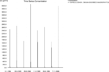
Figure 7.33. Concentration of spring-applied pendimethalin on macrophytes 290 m from the upstream end of the main stream.
Figur 7.33. Koncentration af forårsudbragt pendimethalin på makrofytter 290 m fra den opstrøms ende af morænelersoplandet.
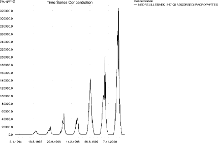
Figure 7.34. Concentration of spring-applied pendimethalin on macrophytes in the lower part of the stream. The pattern is representative of the spring application for the tributaries Fredligbaek, Groftebaek and the lower part of the sandy loam catchment.
Figur 7.34. Koncentration af forårsudbragt pendimethalin på makrofytter m i den nedstrøms ende af morænelersoplandet. Mønsteret er repræsenterer forårsudbringningen for tilløbene Fredligbæk, Grøftebæk og den nedstrøms del af morænlersoplandet.
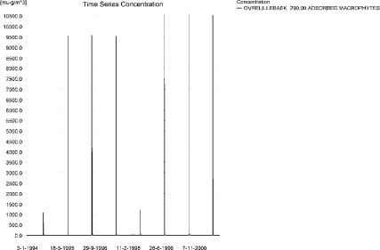
Figure 7.35. Concentration of autumn-applied pendimethalin on macrophytes 290 m from the upstream end of the sandy loam catchment.
Figur 7.35. Koncentration af efterårsudbragt pendimethalin på makrofytter 290 m fra den opstrøms ende af morænelersoplandet.
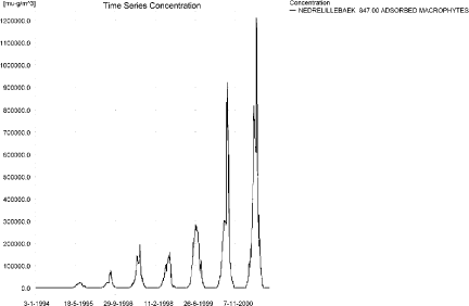
Figure 7.36. Concentration of autumn-applied pendimethalin on macrophytes in ng/l at the lower part of the stream. The pattern is representative of the autumn application for the tributaries Fredligbæk and Groftebæk and the lower part of the sandy loam catchment.
Figur 7.36. Koncentration af efterårsudbragt pendimethalin på makrofytter i den nedstrøms ende af morænelersoplandet. Mønsteret er repræsenterer efterårsudbringningen for tilløbene Fredligbæk, Grøftebæk og den nedstrøms del af morænlersoplandet.
The concentration of pendimethalin in porewater is shown in Figure 7.37 and Figure 7.38 and the corresponding concentrations of pendimethalin sorbed to sediment in Figure 7.39 and Figure 7.40. The sediment concentration reaches 1.29 µg/kg for the spring application and 2.34 µg/kg for the autumn application.
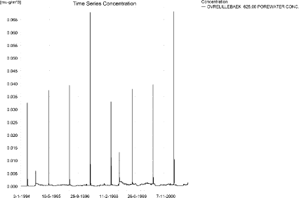
a)
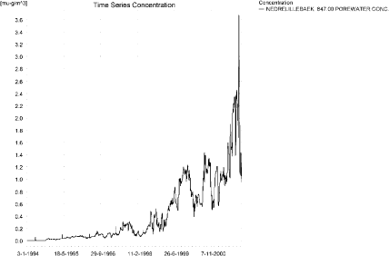
b)
Figure 7.37. Pore water concentration of spring-applied pendimethalin in the a) upper and b) lower part of the sandy loam catchment.
Figur 7.37. Porevandskoncentration for forårsudbragt pendimethalin i a) den øvre og b) den nedre del af morænelersoplandet.

a)
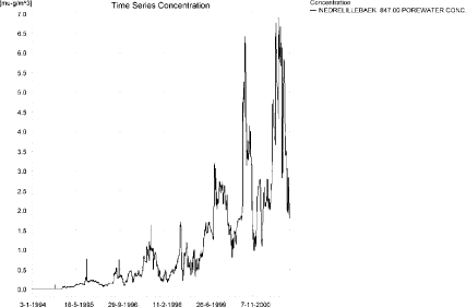
b)
Figure 7.38. Pore water concentration of autumn-applied pendimethalin in the a) upper and b) lower part of the sandy loam catchment.
Figur 7.38. Porevandskoncentration for efterårsudbragt pendimethalin i a) den øvre og b) den nedre del af morænelersoplandet.
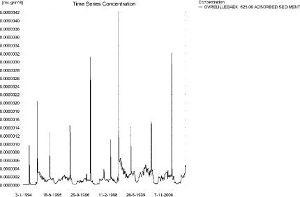
a)
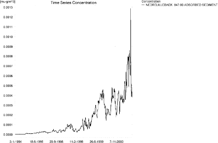
b)
Figure 7.39. Sorption of spring-applied pendimethalin to sediment in the a) upper and b) lower part of the sandy loam catchment. The concentration is in µg/g sediment and not µg/m³ as stated.
Figur 7.39. Sorption af forårsudbragt pendimethalin til sediment i a) den øvre og b) den nedre del af morænelersoplandet. Koncentrationen er i µg/g sediment og ikke µg/m³ som angivet.
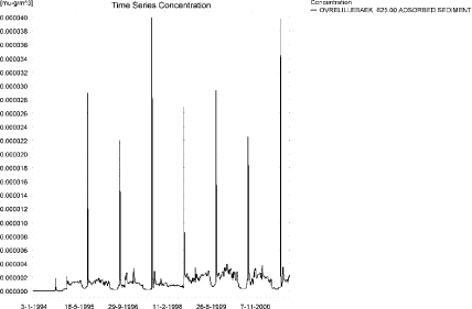
a)
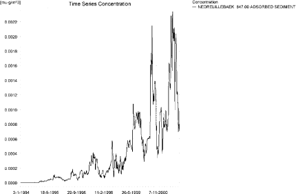
b)
Figure 7.40. Sorption of autumn-applied pendimethalin to sediment in the a) upper and b) lower part of the sandy loam catchment. The concentration is in µg/g sediment and not µg/m³ as stated.
Figur 7.40. Sorption af efterårsudbragt pendimethalin til sediment i a) den øvre og b) den nedre del af morænelersoplandet. Koncentrationen er i µg/g sediment og ikke µg/m³ som angivet.
FOCUS SW-stream-scenario for D4 generates concentrations of 2.07 and 8.65 µg/l, for spring and autumn applications, respectively. These values are much smaller than the values generated by PestSurf. 125 m from the upstream end, PestSurf generates concentrations of 14.4 and 58.6 µg/l, for the spring and autumn application, respectively. The difference of a factor 6-7 is mainly due to difference in water depth at the time of spraying.
The maximum values in the simulation reached 153 and 337 µg/l, respectively and these results are judged as unrealistic. They are caused by the accumulation of pendimethalin in the groundwater and contribution of baseflow to the lower part of the stream. For the autumn application, the baseflow contribution and the wind drift occurrence (from a long stretch and within a very short time) are present simultaneously.
The sediment concentrations in PestSurf only reaches 1.3 and 2.3 µg/kg, compared to 1.5 and 9.5 µg/kg calculated by the FOCUS SW-D4-stream scenario for the spring and the autumn application, respectively.
Figure 7.41 to Figure 7.45 and Table 7.13 to Table 7.16 show the results as generated by the PestSurf templates. The maximum value generated by the templates for the upper part of the stream is 10.4 and 59.2 µg/l, for the spring and the autumn-application respectively, and for the lower part, 138 and 323 µg/l, respectively. The maximum values for the upper part of the catchment found by the templates do not represent the maximum values simulated, which were 17.2 and 79.3 µg/l. For the lower part of the stream, however, the actual maximum values in the simulation are 153 and 337 µg/l for the spring and autumn-application, respectively.
Click here to see Figure 7.41.
Figure 7.41. Overview for spring-applied pendimethalin in the sandy loam catchment generated by the PestSurf excel template in the upstream part of the catchment. The detection value was set to 5 ng/l.
Figur 7.41. Oversigt for forårsudbragt pendimethalin i morænelersoplandet genereret med PestSurf-excel-skabelonen for den opstrøms del af oplandet. Detektionsgrænsen var sat til 5 ng/l.
Click here to see Figure 7.42.
Figure 7.42. Overview for spring applied pendimethalin in the sandy loam catchment generated by the PestSurf excel template in the upstream part of the catchment. The toxicity value was set to 10 ng/l spring. The figure is identical to Figure 7.41 except for the lower right figure.
Figur 7.42. Oversigt for forårsudbragt pendimethalin i morænelersoplandet genereret med PestSurf-excel-skabelonen for den opstrøms del af oplandet. Detektionsgrænsen var sat til 10 ng/l. Figuren er identisk med Figur 7.41 bortset fra figuren nederst til højre.
Click here to see Figure 7.43.
Figure 7.43. Overview for spring applied pendimethalin in the sandy loam catchment generated by the PestSurf excel template in the downstream part of the catchment. The detection value was set to 5 ng/l spring.
Figur 7.43. Oversigt for forårsudbragt pendimethalin i morænelersoplandet genereret med PestSurf-excel-skabelonen for den nedstrøms del af oplandet. Detektionsgrænsen var sat til 5 ng/l.
Click here to see Figure 7.44.
Figure 7.44. Overview for autumn-applied pendimethalin in the sandy loam catchment generated by the PestSurf excel template in the upstream part of the catchment. The detection value was set to 25 ng/l.
Figur 7.44. Oversigt for efterårsudbragt pendimethalin i morænelersoplandet genereret med PestSurf-excel-skabelonen for den opstrøms del af oplandet. Detektionsgrænsen var sat til 25 ng/l.
Click here to see Figure 7.45.
Figure 7.45. Overview for autumn-applied pendimethalin in the sandy loam catchment generated by the PestSurf excel template in the downstream part of the catchment. The detection value was set to 25 ng/l spring.
Figur 7.45. Oversigt for efterårsudbragt pendimethalin i morænelersoplandet genereret med PestSurf-excel-skabelonen for den nedstrøms del af oplandet. Detektionsgrænsen var sat til 25 ng/l.
Table 7.13. Part of the result sheet generated by the PestSurf Excel sheet for the upstream part of the sandy loam catchment for the spring application of pendimethalin. The detection values is set to 5 ng/l, toxicity to fish, daphnies and algae are set to 10, 100 and 1000 ng/, respectively. The recorded peaks are shown in Figure 7.41.
Tabel 7.13. Uddrag af resultatpresentationen genereret af PestSurf-Excel-arket for den opstrøms del af morænelersoplandet for forårsudbragt pendimethalin. Detektionsgrænsen for tabelgenerering er sat til 5 ng/l. Toxicitetsværdierne for fisk, dafnier og alger er henholdsvis 10, 100 og 1000 ng/l. Hændelserne er vist i Figur 7.41.
Table 7.14. Part of the result sheet generated by the PestSurf Excel sheet for the downstream part of the sandy loam catchment for the spring application of pendimethalin. The limiting values is set to 5 ng/l, toxicity to fish, daphnies and algae are set to 10, 100 and 1000 ng/, respectively. The recorded peaks are shown in Figure 7.43.
Tabel 7.14. Uddrag af resultatpresentationen genereret af PestSurf-Excel-arket for den nedstrøms del af morænelersoplandet for forårsudbringningen af pendimethalin. Detektionsgrænsen for tabelgenerering er sat til 5 ng/l. Toxicitetsværdierne for fisk, dafnier og alger er henholdsvis 10, 100 og 1000 ng/l. Hændelserne er vist i Figur 7.43.
Table 7.15. Part of the result sheet generated by the Pestsurf Excel sheet for the upstream part of the sandy loam catchment for the autumn application of pendimethalin. The limiting values is set to 25 ng/l, toxicity to fish, daphnies and algae are set to 50, 100 and 1000 ng/, respectively. The recorded peaks are shown in Figure 7.44. Tabel 7.15. Uddrag af resultatpresentationen genereret af PestSurf-Excel-arket for den opstrøms del af morænelersoplandet for efterårsudbragt pendimethalin. Detektionsgrænsen for tabelgenerering er sat til 25 ng/l. Toxicitetsværdierne for fisk, dafnier og alger er henholdsvis 50, 100 og 1000 ng/l. Hændelserne er vist i Figur 7.44.
Table 7.16. Part of the result sheet generated by the PestSurf Excel sheet for the downstream part of the sandy loam catchment for the autumn application of pendimethalin. The limiting values is set to 25 ng/l, toxicity to fish, daphnies and algae are set to 100, 1000 and 10000 ng/, respectively. The recorded peaks are shown in Figure 7.45.
Tabel 7.16. Uddrag af resultatpresentationen genereret af PestSurf-Excel-arket for den nedstrøms del af morænelersoplandet for efterårsudbringningen af pendimethalin. Detektionsgrænsen for tabelgenerering er sat til 25 ng/l. Toxicitetsværdierne for fisk, dafnier og alger er henholdsvis 100, 1000 og 10000 ng/l. Hændelserne er vist i Figur 7.45.
7.4.4 Sandy loam catchment, pond
The concentration pattern is evaluated in the middle of the pond only, see Figure 7.46 and Figure 7.47. For the spring application, the pond receives contributions mainly through drift, in good correspondence with the fact that it is situated in the upper part of the sandy loam catchment. The maximum concentration is 0.165 µg/l. For the autumn application, the maximum concentration is higher, around 1.514 µg/l. The peaks are still dominated by drift. Concentrations are diluted during winter.
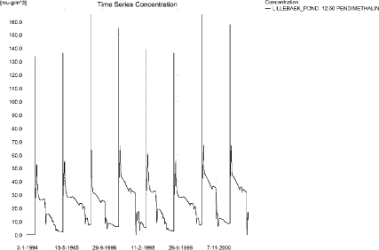
Figure 7.46. Concentrations of spring applied pendimethalin in the sandy loam pond.
Figur 7.46. Koncentration af forårsudbragt pendimethalin i morænelersvandhullet.
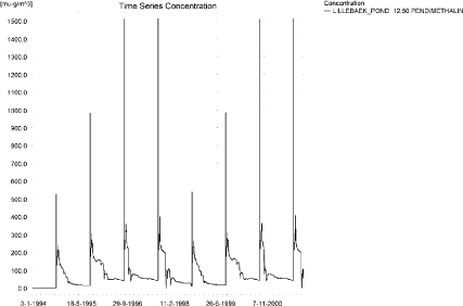
Figure 7.47. Concentrations of autumn applied pendimethalinin the sandy loam pond.
Figur 7.47. Koncentration af efterårsudbragt pendimethalin i morænelersvandhullet.
Figure 7.48 and Figure 7.49 show that the macrophytes participate in the regulation of the concentrations in the pond. The concentration level is similar to the concentration in the water phase. The concentration in the porewater is somewhat lower, as illustrated in Figure 7.50 and Figure 7.52. The corresponding concentration of pendimethalin sorbed to sediment is shown in Figure 7.51 and Figure 7.53. The concentrations reach 5.4 ng/kg and 144 ng/kg for the spring and autumn applications, respectively.
Figure 7.48. Spring-applied pendimethalin sorbed to the macrophytes in the sandy loam pond.
Figur 7.48. Forårsudbragt pendimethalin sorberet til makrofytter i morænelers-vandhullet.
Figure 7.49. Autumn-applied pendimethalin sorbed to the macrophytes in the sandy loam pond.
Figur 7.49. Efterårsudbragt pendimethalin sorberet til makrofytter i morænelers-vandhullet.
Figure 7.50. Pore water concentration of spring-applied pendimethalin in the sandy loam pond.
Figur 7.50. Porevandskoncentration af forårsudbragt pendimethalin i morænelersvandhullet.
Figure 7.51. Sorption of spring-applied pendimethalin to sediment in the sandy loam pond. The concentration is in µg/g sediment and not µg/m³ as stated.
Figur 7.51. Forårsudbragt pendimethalin sorberet til sediment i morænelersvandhullet. Koncentrationen er i µg/g sediment og ikke µg/m³ som angivet.
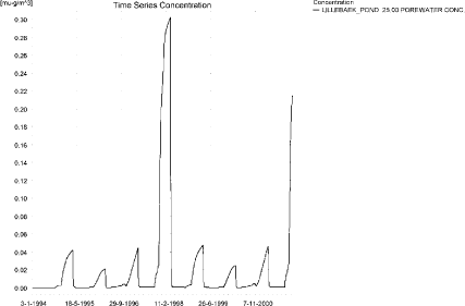
Figure 7.52. Pore water concentration of autumn-applied pendimethalin in the sandy loam pond.
Figur 7.52. Porevandskoncentration af efterårsudbragt pendimethalin i morænelersvandhullet.
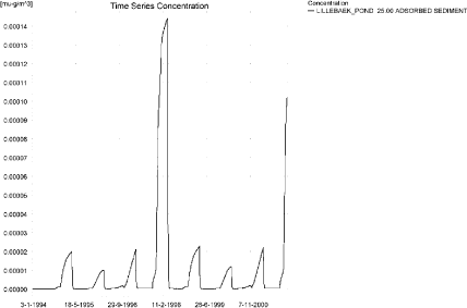
Figure 7.53. Sorption of autumn-applied pendimethalin to sediment in the sandy loam pond. The concentration is in µg/g sediment and not µg/m³ as stated.
Figur 7.53. Efterårsudbragt pendimethalin sorberet til sediment i morænelersvandhullet. Koncentrationen er i µg/g sediment og ikke µg/m³ som angivet.
In Table 7.17, global maxima and time weighted concentrations (up to 7 days) were extracted.
Table 7.17. Actual and time weighted concentrations (ng/l) of pendimethalin in the sandy loam pond.
Tabel 7.17. Beregnede og tidsvægtede koncentrationer (ng/l) af pendimethalin i morænelersvandhullet.
| Spring application | Autumn application | ||||||
| Year | Pendimethalin | actual | Time-weighted | Date | actual | Time-weighted | Date |
| 1994 | global max | 134 | 01-05-1994 | 525 | 20-09-1994 | ||
| 1 hour(after max) | 85 | 104 | 336 | 411 | |||
| 1 day after sp.in. | 28 | 37 | 113 | 147 | |||
| 3 days | 29 | 31 | 123 | 127 | |||
| 4 days | 30 | 31 | 130 | 127 | |||
| 7 days | 35 | 31 | 152 | 133 | |||
| 1995 | Global max | 136 | 01-05-1995 | 982 | 20-09-1995 | ||
| 1 hour | 87 | 107 | 511 | 675 | |||
| 1 day | 30 | 39 | 170 | 229 | |||
| 2 days | 31 | 33 | 171 | 188 | |||
| 4 days | 33 | 33 | 178 | 185 | |||
| 7 days | 37 | 34 | 201 | 187 | |||
| 1996 | global max | 165 | 02-05-1996 | 1510 | 20-09-1996 | ||
| 1 hour | 98 | 123 | 641 | 891 | |||
| 1 day | 44 | 52 | 225 | 304 | |||
| 2 (3*)days | 50 | 49 | 219 | 246 | |||
| 4 days | 54 | 49 | 226 | 240 | |||
| 7 (6*)days | 63 | 53 | 250 | 239 | |||
| 1997 | global max | 155 | 01-05-1997 | 1513 | 20-09-1997 | ||
| 1 hour | 98 | 120 | 641 | 892 | |||
| 1 day | 36 | 46 | 223 | 303 | |||
| 2 (3*)days | 38 | 40 | 214 | 243 | |||
| 4 days | 39 | 39 | 220 | 237 | |||
| 7 (6*)days | 45 | 41 | 242 | 234 | |||
| 1998 | global max | 139 | 30-04-1998 | 538 | 19-09-1998 | ||
| 1 hour | 90 | 110 | 349 | 425 | |||
| 1 day | 33 | 42 | 128 | 162 | |||
| 2 (3*)days | 35 | 37 | 139 | 142 | |||
| 4 days | 37 | 37 | 147 | 142 | |||
| 7 (6*)days | 42 | 38 | 170 | 149 | |||
| 1999 | global max | 137 | 30-04-1999 | 984 | 19-09-1999 | ||
| 1 hour | 88 | 107 | 514 | 678 | |||
| 1 day | 30 | 40 | 174 | 232 | |||
| 2 (3*)days | 32 | 34 | 177 | 192 | |||
| 4 days | 33 | 33 | 184 | 189 | |||
| 7 (6*)days | 37 | 34 | 209 | 192 | |||
| 2000 | global max | 165 | 01-05-2000 | 1512 | 19-09-2000 | ||
| 1 hour | 97 | 123 | 643 | 894 | |||
| 1 day | 39 | 49 | 228 | 307 | |||
| 2 (3*)days | 40 | 42 | 223 | 249 | |||
| 4 days | 41 | 42 | 230 | 244 | |||
| 7 (6*)days | 45 | 42 | 255 | 243 | |||
| 2001 | global max | 158 | 30-04-2001 | 1514 | 19-09-2001 | ||
| 1 hour | 101 | 123 | 643 | 892 | |||
| 1 day | 38 | 48 | 225 | 305 | |||
| 2 (3*)days | 40 | 42 | 217 | 246 | |||
| 4 days | 41 | 42 | 223 | 239 | |||
| 7 (6*)days | 46 | 42 | 246 | 237 | |||
| max values | |||||||
| global max | 165 | 1514 | |||||
| 1 hour | 101 | 123 | 643 | 894 | |||
| 1 day | 44 | 52 | 228 | 307 | |||
| 2 days | 50 | 49 | 223 | 249 | |||
| 4 days | 54 | 49 | 230 | 244 | |||
| 7 days | 63 | 53 | 255 | 243 | |||
Figure 7.54, Figure 7.55, Table 7.18 and Table 7.19 show the output from the PestSurf template (page- lowest detection limit), with a time series identical to Figure 7.46 and Figure 7.47.
Compared to the FOCUS SW-scenario D4, pond the concentration levels are higher. D4 generates a concentration of 0.087 µg/l for the spring application and 0.216 µg/l for the autum application while PestSurf reaches 0.165 and 1.51 µg/l for the spring and autumn application, respectively. The difference for the spring application is mainly due to the difference in exposure between the FOCUS and PestSurf ponds, while the very high value in September 2001 is because the water depth in the pond is about 25 cm.
The concentrations in the sediment are lower in the PestSurf calculations, 0.005 and 0.144 µg/kg against 0.308 and 0.882 µg/kg for the spring and autumn-application, respectively.
Click here to see Figure 7.54.
Figure 7.54. Overview for spring applied pendimethalin in the sandy loam pond generated by the PestSurf excel template. The time series shown is identical to the one in Figure 7.46. The detection value is set to 10 ng/l.
Figur 7.54. Oversigt for forårsudbragt pendimethalin i morænelersoplandet genereret med PestSurf-excel-skabelonen. Den viste tidsserie er mage til den i Figur 7.46. Detektionsgrænsen er sat til 10 ng/l.
Click here to see Figure 7.55.
Figure 7.55. Overview for autumn-applied pendimethalin in the sandy loam pond generated by the PestSurf excel template. The time series shown is identical to the one in Figure 7.47. The detection value is set to 50 ng/l.
Figur 7.55. Oversigt for efterårsudbragt pendimethalin i morænelersoplandet genereret med PestSurf-excel-skabelonen. Den viste tidsserie er mage til den iFigur 7.47. Detektionsgrænsen er sat til 50 ng/l.
Table 7.18. Part of the result sheet generated by the Pestsurf Excel sheet for spring applied pendimethalin. The lowest detection valuε = 10 ng/l, toxicity to fish, daphnies and algae are set to 50, 100 and 1000 ng/, respectively. The recorded peaks are shown in Figure 7.54.
Tabel 7.18. Uddrag af resultatpresentationen genereret af PestSurf-Excel-arket for forårsudbragt pendimethalin. Detektionsgrænsen er sat til 10 ng/l. Toxicitetsværdierne for fisk, dafnier og alger er henholdsvis 50, 100 og 1000 ng/l. De tabellerede hændelser er vist i Figur 7.54.
Table 7.19. Part of the result sheet generated by the Pestsurf Excel sheet for autumn applied pendimethalin. The lowest detection valuε = 50 ng/l, toxicity to fish, daphnies and algae are set to 100, 500 and 1000 ng/, respectively. The recorded peaks are shown in Figure 7.55.
Tabel 7.19. Uddrag af resultatpresentationen genereret af PestSurf-Excel-arket for efterårsudbragt pendimethalin. Detektionsgrænsen er sat til 50 ng/l. Toxicitetsværdierne for fisk, dafnier og alger er henholdsvis 100, 500 og 1000 ng/l. De tabellerede hændelser er vist i Figur 7.55.
Table 7.20. Summary of simulation results for Pendimethalin.
Tabel 7.20. Opsummerede resultater for metamitron.
7.5 Summary of simulations
The maximum actual concentrations for all simulations are recorded in Table 7.20.
The application rate for the autumn application is four times higher than for the spring application. This causes drift contributions to differ between the spring and autumn scenarios in all instances.
Macrophytes significantly influence the water concentration in most simulations, and most strongly in the sandy loam stream.
The sandy pond has lower concentrations than the D3-ditch, which has lower concentrations than the sandy stream. The concentration in the stream is strongly influenced by wind drift, due to the fact that the whole agricultural area is sprayed within 30 minutes. This causes very high concentrations. 112 m from the upstream end the spring and autumn-concentrations are 0.357 and 4.076 µg/l, both of which are lower than the D3-ditch concentrations of 2.511 and 10.075 µg/l respectively. It is clearly noticeable, that while the spring- and autumn-concentration in the D3-ditch differ by almost exactly a factor 4, the concentrations generated by pestSurf differ more, due to mixing in different amounts of water. The low concentrations at the top end of the sandy catchment is caused by a buffer zone of 20 m, combined with a water depth of 12.4 cm and 7 cm for the spring and autumn application, respectively.
The concentration in the sandy loam pond can be compared to the concentration in the D4-pond. The concentration in the PestSurf sandy loam pond is highest, and the difference is caused by the greater exposure (a smaller pond) and for the autumn application, a difference in water level at the time of spraying.
The concentrations in the sandy loam stream are very high (153 and 337 µg/l for the spring and autumn application, respectively), and much higher than what is found in the D4-stream (2.072 og 8.654 µg/l, respectively). For both applications in PestSurf, the highest concentrations are found in the lower end of the catchment and are caused by a baseflow contribution. A high DT50 value causes accumulation of pesticide in the aquifer, and the water drains to the stream. The amount leaching to the aquifer is judged as unrealistically high, and so is the sorption to macrophytes in this case. For the autumn application, the winddrift takes place at the same time as the high concentrations occur due to the baseflow contribution, resulting in even higher concentrations in the stream. In the upstream part of the sandy loam catchment, the concentrations also become high, 14.4 and 58.6 µg/l, respectively, 125 m from the upstream end. This is due to wind drift into a small flow of water (about 6 cm depth). The high concentration during autumn is due to a four times higher application dose at this time of year.
Sediment concentrations generated by PestSurf are lower in all cases, even when the concentrations in the water phase are considerably higher than what is generated by FOCUS SW.
Annex 8
8 Comparison of risk assessment data produced by spray drift assessments, FOCUS SW and PestSurf
8.1 Chemical characteristics of the compound
| Compound: | Propiconazol |
| Dose: | 0.125 kg |
| Spraying time: | 1st June |
| Crop: | Spring barley |
Table 8.1. Overview of chemical properties of propiconazol and the parameters used in the simulations.
Tabel 8.1. Oversigt over propiconazol s kemiske egenskaber og parametrene brugt i simuleringerne.
| Chemical property | Condition | Recalculated values | |||
| Cas-no. | 60207-90-1 | ||||
| Molecular weight | 342.2 | ||||
| Form (acid, basic, neutral) | Acid | ||||
| pKa | 1.09 at 20?C | ||||
| Water solubility | 150 µg/l | pH 5.2 | 20°C | ||
| log Kow | at pH | KowA- | |||
| log Kow | 3.72 | at pH | 6.6 | KowAH | 3.72 |
| log Kow | at pH | KowAH+ | 1 | ||
| Vapor pressure, Pa | 5.6 × 10⁻⁵ (99.1% pure) | 25°C | 355 (Decomposition) | vapor pressure, Pa, 20°C | 2.80 × 10⁻⁵ |
| Henry’s law constant | 9.2 × 10⁻⁵ Pa m³ mol -1 | Recalculated value, dimensionless | 3.78 × 10⁻⁸ | ||
| Sorption properties in soil | |||||
| Freundlich exp | 0.86 | ||||
| Koc, l/kg | 688 | ||||
| DT50 in soil, days | 61.5 | ||||
| DT50water | 77-85 d, 1% soil in Rhine water, 25-35 d, 1 % soil in pond water, study 2, 113 d. water+ 1% soil | PestSurf input | |||
| DT50sedment | None mentioned | ||||
| DT50water/sediment | 70 days, whole system. | method not described | DT50, days | 75 | |
| Sediment konc., mg/l | 10000 | ||||
| Hydrolysis | no hydrolysis | at pH 5 | (acid) | ||
| at pH 7 | (neutral) | ||||
| at pH 9 | (basic) | ||||
| Photolysis | |||||
| quantum yield | No absorption >290 nm, set to 0 | ||||
| Spectrum | λmax: 220 nm, emax: 11666 l.mol-1.cm-1 | ||||
| Other | λmax: 220 nm, emax: 11666 l.mol-1.cm-1 | ||||
8.2 Concentration generated by spray
| Direct spray | FOCUS buffer zones | |||
| ditch | Stream | Pond | ||
| µg l-1 | µg l-1 | µg l-1 | µg l-1 | |
| Propiconazol | 41.7 | 1.150 | 0.773 | 0.338 |
8.3 Concentrations generated by FOCUS SW
8.3.1 D3- Ditch
| Propiconazol | Ditch, D3 | |||||||
| Water | Sediment | |||||||
| Date | PEC | Date | TWAEC | Date | PEC | Date | TWAEC | |
| µg l-1 | µg l-1 | µg kg-1 | µg kg-1 | |||||
| Global max | 04-may-92 | 0.792 | 05-may-92 | 0.437 | ||||
| 1 d | 05-may-92 | 0.358 | 05-may-92 | 0.607 | 06-may-92 | 0.38 | 06-may-92 | 0.428 |
| 2 d | 06-may-92 | 0.046 | 06-may-92 | 0.388 | 07-may-92 | 0.317 | 07-may-92 | 0.406 |
| 4 d | 08-may-92 | 0.005 | 08-may-92 | 0.201 | 09-may-92 | 0.241 | 08-may-92 | 0.358 |
| 7 d | 11-may-92 | 0.002 | 11-may-92 | 0.116 | 12-may-92 | 0.184 | 11-may-92 | 0.304 |
8.3.2 D4 – Pond
| Propiconazol | Pond, D4 | |||||||
| Water | Sediment | |||||||
| Date | PEC | Date | TWAEC | Date | PEC | Date | TWAEC | |
| µg l-1 | µg l-1 | µg kg-1 | µg kg-1 | |||||
| Global max | 23-Dec-85 | 0.030 | 24-Feb-86 | 0.290 | ||||
| 1 d | 24- Dec-85 | 0.030 | 23- Dec-85 | 0.030 | 25-Feb-86 | 0.290 | 24-Feb-86 | 0.290 |
| 2 d | 25- Dec-85 | 0.029 | 24- Dec-85 | 0.030 | 26-Feb-86 | 0.290 | 25-Feb-86 | 0.290 |
| 4 d | 27- Dec-85 | 0.029 | 25- Dec-85 | 0.030 | 28-Feb-86 | 0.290 | 26-Feb-86 | 0.290 |
| 7 d | 30- Dec-85 | 0.029 | 28- Dec-85 | 0.029 | 03-Mar-86 | 0.290 | 27-Feb-86 | 0.290 |
8.3.3 D4 –Stream
| Propiconazol | Stream, D4 | |||||||
| Water | Sediment | |||||||
| Date | PEC | Date | TWAEC | Date | PEC | Date | TWAEC | |
| µg l-1 | µg l-1 | µg kg-1 | µg kg-1 | |||||
| Global max | 30-may-85 | 0.657 | 22-dec-85 | 0.102 | ||||
| 1 d | 31-may-85 | 0 | 31-may-85 | 0.074 | 23-dec-85 | 0.101 | 23-dec-85 | 0.102 |
| 2 d | 01-jun-85 | 0 | 06-dec-85 | 0.045 | 24-dec-85 | 0.099 | 23-dec-85 | 0.102 |
| 4 d | 03-jun-85 | 0 | 08-dec-85 | 0.039 | 26-dec-85 | 0.098 | 25-dec-85 | 0.101 |
| 7 d | 06-jun-85 | 0 | 11-dec-85 | 0.031 | 29-dec-85 | 0.096 | 28-dec-85 | 0.1 |
8.3.4 Conclusion – FOCUS SW
The highest concentration is generated in the ditch (D3). It is caused by wind drift and the concentration becomes 0.792 µg/l. The same scenario shows the highest concentration in the sediment, 0.437 µg/l. For all scenarios, the concentrations are lower than what is generated by the simpler assessments.
8.4 PestSurf
8.4.1 Sandy Catchment, stream
The distribution of concentrations were assessed in several steps. First, the maximum concentrations at each calculation point were listed, and the dates for the occurrence of the maximum was assessed. The points, for which the maximum value also represents a local maximum were selected for further analysis. The relevant values are listed in Table 8.2.
Table 8.2. Maximum concentrations (ng/l) of propiconazol simulated for each calculation point in the sandy catchment.
Tabel 8.2. Maximumkoncentrationer (ng/l) af propiconazol simuleret for hvert beregningspunkt i det sandede opland.
| PROPICONAZOL | Maximum | Max.Time | Local Maxima |
| ODDERBAEK 0.00 | 229 | 04-06-1998 09:18 | |
| ODDERBAEK 56.00 | 245 | 04-06-1998 09:18 | |
| ODDERBAEK 112.00 | 291 | 04-06-1998 09:00 | |
| ODDERBAEK 192.00 | 618 | 04-06-1998 08:41 | |
| ODDERBAEK 272.00 | 978 | 04-06-1998 08:33 | |
| ODDERBAEK 278.00 | 1023 | 04-06-1998 08:33 | |
| ODDERBAEK 282.00 | 1053 | 04-06-1998 08:33 | |
| ODDERBAEK 298.50 | 1133 | 04-06-1998 08:33 | |
| ODDERBAEK 315.00 | 1222 | 04-06-1998 08:33 | |
| ODDERBAEK 317.50 | 1236 | 04-06-1998 08:33 | |
| ODDERBAEK 320.00 | 1249 | 04-06-1998 08:33 | |
| ODDERBAEK 410.00 | 1635 | 04-06-1998 08:33 | |
| ODDERBAEK 500.00 | 1844 | 04-06-1998 08:33 | |
| ODDERBAEK 513.00 | 1938 | 04-06-1998 08:33 | |
| ODDERBAEK 521.00 | 2000 | 04-06-1998 08:33 | |
| ODDERBAEK 622.00 | 2375 | 04-06-1998 08:33 | |
| ODDERBAEK 723.00 | 2663 | 04-06-1998 08:33 | |
| ODDERBAEK 733.00 | 2748 | 04-06-1998 08:33 | |
| ODDERBAEK 742.00 | 2795 | 04-06-1998 08:33 | |
| ODDERBAEK 789.50 | 2930 | 04-06-1998 08:33 | |
| ODDERBAEK 837.00 | 3057 | 04-06-1998 08:33 | |
| ODDERBAEK 848.00 | 3110 | 04-06-1998 08:33 | |
| ODDERBAEK 863.00 | 3177 | 04-06-1998 08:33 | |
| ODDERBAEK 956.00 | 3392 | 04-06-1998 08:33 | |
| ODDERBAEK 1049.00 | 3420 | 04-06-1998 08:33 | X |
| ODDERBAEK 1111.50 | 3272 | 04-06-1998 08:33 | |
| ODDERBAEK 1174.00 | 2964 | 10-06-2000 08:33 | |
| ODDERBAEK 1226.00 | 2790 | 10-06-2000 08:41 | |
| ODDERBAEK 1278.00 | 2725 | 10-06-2000 08:41 | |
| ODDERBAEK 1293.50 | 2693 | 10-06-2000 08:41 | |
| ODDERBAEK 1310.00 | 2635 | 10-06-2000 08:41 | |
| ODDERBAEK 1421.00 | 2547 | 10-06-2000 08:50 | |
| ODDERBAEK 1532.00 | 2178 | 10-06-2000 09:00 | |
| ODDERBAEK 1558.06 | 1974 | 04-06-1998 08:41 | |
| ODDERBAEK 1584.12 | 1890 | 04-06-1998 08:41 | |
| ODDERBAEK 1584.12 | 1890 | 04-06-1998 08:41 | |
| ODDERBAEK 1621.06 | 1884 | 04-06-1998 08:41 | |
| ODDERBAEK 1658.00 | 1929 | 04-06-1998 08:33 | |
| ODDERBAEK 1698.50 | 2001 | 04-06-1998 08:33 | |
| ODDERBAEK 1739.00 | 2041 | 04-06-1998 08:33 | X |
| ODDERBAEK 1801.50 | 1979 | 04-06-1998 08:33 | |
| ODDERBAEK 1864.00 | 1614 | 10-06-2004 08:33 | |
| ODDERBAEK 1977.00 | 1323 | 10-06-2000 10:00 | |
| ODDERBAEK 2090.00 | 1294 | 10-06-2000 10:00 | |
| ODDERBAEK 2098.00 | 1293 | 10-06-2000 10:00 | |
| ODDERBAEK 2105.00 | 1289 | 10-06-2000 10:00 | |
| ODDERBAEK 2131.00 | 1280 | 10-06-2000 10:00 | |
| ODDERBAEK 2157.00 | 1264 | 10-06-2004 10:00 | |
| ODDERBAEK 2168.00 | 1257 | 10-06-2004 10:00 | |
| ODDERBAEK 2179.00 | 1251 | 10-06-2004 10:00 | |
| ODDERBAEK 2268.50 | 1230 | 10-06-2004 10:00 | |
| ODDERBAEK 2358.00 | 1161 | 10-06-2004 10:00 | |
| ODDERBAEK 2363.50 | 1156 | 10-06-2004 10:00 | |
| ODDERBAEK 2372.00 | 1150 | 10-06-2004 10:00 | |
| ODDERBAEK 2427.00 | 1139 | 10-06-2000 11:00 | |
| ODDERBAEK 2482.00 | 1125 | 10-06-2000 11:00 | |
| ODDERBAEK 2609.00 | 1132 | 10-06-2000 11:00 | |
| ODDERBAEK 2736.00 | 1068 | 10-06-2000 11:00 | |
| ODDERBAEK 2831.00 | 1057 | 10-06-2000 11:00 | |
| ODDERBAEK 2926.00 | 991 | 10-06-2004 11:00 | |
| ODDERBAEK 2958.50 | 978 | 10-06-2004 11:00 | |
| ODDERBAEK 2991.00 | 963 | 10-06-2004 11:00 | |
| ODDERBAEK 3029.50 | 931 | 10-06-2004 11:00 | |
| ODDERBAEK 3068.00 | 878 | 10-06-2004 11:00 | |
| ODDERBAEK 3131.00 | 814 | 01-06-2003 11:00 | |
| ODDERBAEK 3194.00 | 785 | 10-06-2000 12:00 | |
| ODDERBAEK 3250.50 | 780 | 10-06-2004 12:00 | |
| ODDERBAEK 3307.00 | 773 | 10-06-2004 12:00 | |
| ODDERBAEK 3315.00 | 773 | 10-06-2004 12:00 | |
| ODDERBAEK 3323.00 | 772 | 10-06-2004 12:00 | |
| ODDERBAEK 3355.50 | 808 | 04-06-1998 08:33 | |
| ODDERBAEK 3388.00 | 903 | 04-06-1998 08:33 | |
| ODDERBAEK 3438.50 | 1044 | 04-06-1998 08:33 | |
| ODDERBAEK 3489.00 | 1109 | 04-06-1998 08:33 | |
| ODDERBAEK 3499.50 | 1115 | 04-06-1998 08:33 | X |
| ODDERBAEK 3510.00 | 1115 | 04-06-1998 08:33 | |
| ODDERBAEK 3581.00 | 1101 | 04-06-1998 08:33 | |
| ODDERBAEK 3652.00 | 991 | 04-06-1998 08:33 | |
| ODDERBAEK 3707.00 | 937 | 04-06-1998 08:41 | |
| ODDERBAEK 3762.00 | 873 | 04-06-1998 08:41 | |
| ODDERBAEK 3790.00 | 771 | 04-06-1998 08:41 | |
| ODDERBAEK 3818.00 | 618 | 04-06-1998 08:41 | |
| ODDERBAEK 3818.00 | 618 | 04-06-1998 08:41 | |
| ODDERBAEK 3884.00 | 592 | 04-06-1998 08:51 | |
| ODDERBAEK 3950.00 | 570 | 04-06-1998 08:51 | |
| ODDERBAEK 3998.00 | 535 | 04-06-1998 08:51 | |
| ODDERBAEK 4046.00 | 506 | 04-06-1998 09:00 | |
| ODDERBAEK 4047.50 | 505 | 04-06-1998 09:00 | |
| ODDERBAEK 4049.00 | 505 | 04-06-1998 09:00 | |
| ODDERBAEK 4052.50 | 505 | 04-06-1998 09:00 | |
| ODDERBAEK 4056.00 | 505 | 04-06-1998 09:00 | |
| ODDERBAEK 4058.00 | 505 | 04-06-1998 09:00 | |
| ODDERBAEK 4060.00 | 504 | 04-06-1998 09:00 | |
| ODDERBAEK 4080.00 | 500 | 04-06-1998 09:00 | |
| ODDERBAEK 4100.00 | 496 | 04-06-1998 09:00 | |
| ODDERBAEK 4134.00 | 491 | 04-06-1998 09:00 | |
| ODDERBAEK 4168.00 | 492 | 04-06-1998 09:08 | |
| GISLUM_ENGE_AFLOEB 0.00 | 0 | 04-06-1998 08:06 | |
| GISLUM_ENGE_AFLOEB 50.00 | 0 | 04-06-1998 08:06 | |
| GISLUM_ENGE_AFLOEB 100.00 | 0 | 04-06-1998 08:06 | |
| GISLUM_ENGE_AFLOEB 150.00 | 0 | 04-06-1998 08:06 | |
| GISLUM_ENGE_AFLOEB 200.00 | 0 | 04-06-1998 08:06 | |
| GISLUM_ENGE_AFLOEB 250.00 | 0 | 10-02-2000 00:00 | |
| GISLUM_ENGE_AFLOEB 300.00 | 0 | 11-02-2000 00:00 | |
| GISLUM_ENGE_AFLOEB 340.00 | 0 | 13-02-2000 00:00 | |
| GISLUM_ENGE_AFLOEB 380.00 | 0 | 04-06-1998 08:06 | |
| GISLUM_ENGE_AFLOEB 430.00 | 0 | 04-06-1998 08:06 | |
| GISLUM_ENGE_AFLOEB 480.00 | 0 | 04-06-1998 08:06 | |
| GISLUM_ENGE_AFLOEB 530.00 | 0 | 04-06-1998 08:06 | |
| GISLUM_ENGE_AFLOEB 580.00 | 0 | 04-06-1998 08:06 | |
| GISLUM_ENGE_AFLOEB 630.00 | 0 | 04-06-1998 08:06 | |
| GISLUM_ENGE_AFLOEB 680.00 | 0 | 04-06-1998 08:06 | |
| GISLUM_ENGE_AFLOEB 730.00 | 0 | 04-06-1998 08:06 | |
| GISLUM_ENGE_AFLOEB 780.00 | 0 | 04-06-1998 09:18 | |
| GISLUM_ENGE_AFLOEB 830.00 | 0 | 04-06-1998 09:08 | |
| GISLUM_ENGE_AFLOEB 880.00 | 0 | 04-06-1998 09:08 | |
| GISLUM_ENGE_AFLOEB 915.00 | 0 | 04-06-1998 09:08 | |
| GISLUM_ENGE_AFLOEB 950.00 | 0 | 04-06-1998 09:08 | |
| GISLUM_ENGE_AFLOEB 985.00 | 0 | 04-06-1998 09:08 | |
| GISLUM_ENGE_AFLOEB 1020.00 | 0 | 04-06-1998 09:08 | |
| GISLUM_ENGE_AFLOEB 1045.00 | 0 | 04-06-1998 09:00 | |
| GISLUM_ENGE_AFLOEB 1070.00 | 0 | 04-06-1998 09:00 | |
| GISLUM_ENGE_AFLOEB 1110.00 | 0 | 04-06-1998 09:00 | |
| GISLUM_ENGE_AFLOEB 1150.00 | 0 | 04-06-1998 09:00 | |
| GISLUM_ENGE_AFLOEB 1190.00 | 0 | 04-06-1998 09:00 | |
| GISLUM_ENGE_AFLOEB 1230.00 | 1 | 04-06-1998 09:00 | |
| GISLUM_ENGE_AFLOEB 1271.00 | 4 | 04-06-1998 08:51 | |
| GISLUM_ENGE_AFLOEB 1312.00 | 11 | 04-06-1998 08:51 | |
| GISLUM_ENGE_AFLOEB 1422.00 | 122 | 04-06-1998 08:51 | |
| GISLUM_ENGE_AFLOEB 1532.00 | 618 | 04-06-1998 08:41 | |
| TILLOEB 0.00 | 1814 | 04-06-1998 08:41 | |
| TILLOEB 20.16 | 1860 | 04-06-1998 08:41 | |
| TILLOEB 40.31 | 1890 | 04-06-1998 08:41 | |
| Global max | 3420 |
The pattern over time was dominated by spraydrift contribution for all calculation points. The pattern is identical all through the stream, see Figure 8.1. There are only small differences between years.
Figure 8.2 shows the longitudinal profile of the stream on the date of maximum concentration of the stream in the sandy catchment. The thin black line represents the concentration, while the thick black line shows the maximum concentrations obtained during the simulations. In addition, the outline of the stream is shown.
Figure 8.1. Concentration pattern over time for propiconazol in the sandy catchment.
Figur 8.1. Koncentrationsmønster som funktion af tid for propiconazol i det sandede opland.
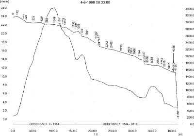
Figure 8.2. Concentrations of propiconazol in the sandy catchment on 4. June 1998 just after spraying.
Figur 8.2. Koncentrationer propiconazol i det sandede opland den 4. juni 1998 lige efter endt sprøjtning.
In order to present the data in a similar fashion to the FOCUS SW-results, data were extracted and recalculated for the time series marked in Table 8.2. The global maxima and time weighted concentrations (up to 7 days) were extracted and are reported in Table 8.3. Note that the unit is ng/l.
Table 8.3. Instantaneous and time weighted concentrations (ng/l) of propiconazol in the sandy catchment.
Tabel 8.3. Beregnet og tidsvægtet koncentration af propiconazol, ng/l, på udvalgte lokaliteter i det sandede vandløb.
Sorption to macrophytes are shown in Figure 8.3. The maximum value reached is 42 ng/l, and the concentration is thus somewhat lower than the concentration in the water phase. The concentration in pore water is shown in Figure 8.4. The concentration is very low and the concentration of propiconazol adsorbed to sediment is 3 ng/kg (Figure 8.5).

Figure 8.3. Concentration of propiconazol adsorbed to macrophytes.
Figur 8.3. Koncentration af propiconazol sorberet på makrofytter.
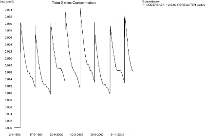
Figure 8.4. Pore water concentration of propiconazol in the sandy catchment. The maximum value of 0.039 ng/l is reached 1421 m from the upstream end.
Figur 8.4. Porevandskoncentration for propiconazol i det sandede opland. Maximumskoncentrationen på 0.039 ng/l opnås 1421 m fra den opstrøms ende.
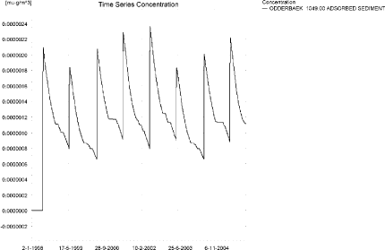
Figure 8.5. Concentration of propiconazol in sediment in the sandy catchment. The maximum value of 2.67 ng/kg is reached 1421 m from the upstream end. Note that the unit is µg/kg and not µg/m³ as indicated.
Figur 8.5. Koncentration af propiconazol i sediment i det sandede opland. Maximumskoncentrationen på 2.67 ng/kg opnås 1421 m fra den opstrøms ende. Bemærk at koncentrationen er i µg/g og ikke i µg/m³ som angivet.
The global maximum value calculated by PestSurf for the sandy catchment in the water phase is 3.42 µg/l. This is considerably more than what is found in the D3-ditch scenario (0.792 µg/l). However, 100 m from the upstream end, the concentration reached in PestSurf is 0.245 µg/l, which is more comparable to the D3-ditch. The high concentrations reached are a function of the simultaneous spraying of all agricultural land within 30 min.
Limited sorption to macrophytes and to sediment was found in PestSurf. FOCUS SW D3 ditch predicts a sediment concentration of 0.437 µg/kg.
Figure 8.6 shows the output of the PestSurf Excel template. The template works with pre-defined data extraction points. The plot requires specification of a “lowest detection value” (ldc) which defines when a pesticide occurrence is defined as an event. The time series plot is identical to the time series shown earlier, and the graph in the upper right corner resembles the plot in Figure 8.2, but takes into account a longer period of time. A curve is generated when a downstream point reaches a concentration higher than the ldc. The programme then tracks the highest concentration for each calculation point in the stream within the last 24 hours. The plot in the lower right corner shows how many events have concentrations higher than a given toxicity value for the selected monitoring points. The curves are rather flat, showing little variation from year to year.
Table 8.4 shows part of the result sheet generated by the PestSurf Excel sheet based on the ldc-value. The selected table shows the point along the stream (of the pre-defined points) with the highest concentration. The highest concentration extracted by the PestSurf Excel sheet was 1.88 µg/l. which is somewhat lower than the maximum concentration of the simulation, 3.42 µg/l. Thus the template did not catch the maximum concentration.
Figure 8.6. Overview for propiconazol in the sandy catchment generated by the PestSurf excel template. The max concentrations generated over the 24 hours are similar to the overview in Figure 8.2. Detection value was set to 1 ng/l.
Figur 8.6. Oversigt for propiconazol i det sandede opland genereret med PestSurf-excel-skabelonen. Den maximale koncentration genereret over 24 timer svarer til oversigten i Figur 8.2. Detektionsgrænsen var sat til 1 ng/l.
Table 8.4. Part of the result sheet generated by the PestSurf Excel sheet. The selected table shows the point along the stream with the highest concentration recorded. The lowest detection value is 1 ng/l, toxicity to fish, daphnies and algae are set to 10, 100 and 1000 ng/, respectively. The recorded peaks are shown in Figure 8.6.
Tabel 8.4. Uddrag af resultatpresentationen genereret af PestSurf-Excel-arket. Den udvalgte tabel viser det fordefinerede punkt langs med åen med højest koncentration. Detektionsgrænsen er sat til 1 ng/l mens toxicitetsværdierne for fisk, dafnier og alger er henholdsvis 10, 100 og 1000 ng/l. De tabellerede hændelser er vist i Figur 8.6.
8.4.2 Sandy Catchment, pond
The concentration pattern is evaluated in the middle of the pond only, see Figure 8.7. The pond receives the major contribution from groundwater. The drift peaks are not visible. The maximum concentration is 55 ng/l, and occurs at the beginning of autumn after a very dry summer.
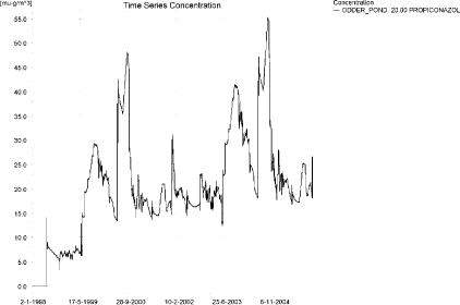
Figure 8.7. Concentrations of propiconazol in the sandy pond.
Figur 8.7. Koncentration af propiconazol i det sandede vandhul.
In Table 8.5, global maxima and time weighted concentrations (up to 7 days) were extracted.
Table 8.5. Maximum concentrations (ng/l) of propiconazol generated by drift and baseflow for the sandy pond.
Tabel 8.5. maximumkoncentrationer af propiconazol(ng/l) genereret for det sandede vandhul.
| Year | Bentazon | Actualmax | Time-weighted | Date of occurrence |
| 1998 | Global max | 14 | 04-06-1998 | |
| 1 hour(after max) | 10 | 11 | ||
| 1 day after sp.in. | 7 | 8 | ||
| 2 days | 7 | 7 | ||
| 4 days | 7 | 7 | ||
| 7 days | 9 | 8 | ||
| 1999 | Global max | 29 | 15-10-1999 | |
| 1 hour | ||||
| 1 day | 29 | 29 | ||
| 2 days | 29 | 29 | ||
| 4 days | 29 | 29 | ||
| 7 days | 29 | 29 | ||
| 2000 | Global max | 48 | 20-09-2000 | |
| 1 hour | ||||
| 1 day | 48 | 48 | ||
| 2 days | 48 | 48 | ||
| 4 days | 48 | 48 | ||
| 7 days | 48 | 48 | ||
| 2001 | Global max | 23 | 12-01-2001 | |
| 1 hour | ||||
| 1 day | 23 | 23 | ||
| 2 days | 22 | 23 | ||
| 4 days | 22 | 22 | ||
| 7 days | 20 | 22 | ||
| 2002 | Global max | 31 | 06-01-2002 | |
| 1 hour | ||||
| 1 day | 30 | 31 | ||
| 2 days | 28 | 30 | ||
| 4 days | 28 | 29 | ||
| 7 days | 28 | 28 | ||
| 2003 | Global max | 41 | 15-10-2003 | |
| 1 hour | ||||
| 1 day | 41 | 41 | ||
| 2 days | 41 | 41 | ||
| 4 days | 41 | 41 | ||
| 7 days | 41 | 41 | ||
| 2004 | Global max | 55 | 20-09-2004 | |
| 1 hour | ||||
| 1 day | 55 | 55 | ||
| 2 days | 55 | 55 | ||
| 4 days | 55 | 55 | ||
| 7 days | 55 | 55 | ||
| 2005 | Global max | 28 | 12-01-2005 | |
| 1 hour | ||||
| 1 day | 28 | 28 | ||
| 2 days | 27 | 28 | ||
| 4 days | 27 | 28 | ||
| 7 days | 25 | 27 | ||
| max values | ||||
| Global max | 55 | |||
| 1 hour | 10 | 11 | ||
| 1 day | 55 | 55 | ||
| 2 days | 55 | 55 | ||
| 4 days | 55 | 55 | ||
| 7 days | 55 | 55 |
The sorption of propiconazol to macrophytes is shown in Figure 8.8. The amount of sorption is limited and does not significantly affect the concentration in the water phase. The porewater concentration reaches a concentration of 2.6 ng/l, coinciding with the highest concentration in the pond, see Figure 8.9. Figure 8.10 shows the concentration of propiconazol adsorbed to sediment. The maximum amount is 60 ng/kg.
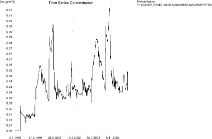
Figure 8.8. Sorption of propiconazol to macrophytes in the sandy pond
Figur 8.8. Sorption af propiconazol til makrofytter i det sandede vandhul.
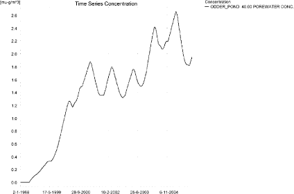
Figure 8.9. Pore water concentration of propiconazol in the sandy pond.
Figur 8.9. Porevandskoncentration af propiconazol i det sandede vandhul.
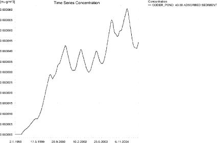
Figure 8.10. Sorption of propiconazol to sediment in the sandy pond. The concentration is in µg/g sediment and not µg/m³ as stated.
Figur 8.10. Sorption af propiconazol til sediment i det sandede vandhul. Koncentrationen er i µg/g og ikke i µg/m³ som angivet.
Compared to the FOCUS D3-ditch, the concentration in the PestSurf sandy pond is lower, 0.055 µg/l compared to 0.792 µg/l. Similarly the concentration in sediment is much lower, 0.060 µg/kg compared to 0.437 µg/kg.
Figure 8.11 shows the output of the PestSurf Excel template. The template works with one pre-defined data extraction point for the pond (center of the pond). The plot requires specification of a “lowest detection value” (ldc) which defines when a pesticide occurrence is defined as an event. The time series plot is identical to the time series shown earlier. The plot in the right corner shows how many events have concentrations higher than a given toxicity value for the selected monitoring points.
Table 8.6 shows part of the result sheet generated by the PestSurf Excel sheet based on the ldc-value.
Click here to see Figure 8.11.
Figure 8.11. Overview for propiconazol in the sandy pond generated by the PestSurf excel template. The time series shown is identical to the one in Figure 8.7. The lowest detection value used for the graph is 20 ng/l.
Figur 8.11. Oversigt for propiconazol i det sandede vandhul genereret med PestSurf-excel-skabelonen. Den viste tidsserie er mage til den i Figur 8.7. Detektionsgrænsen er sat til 20 ng/l.
Table 8.6. Part of the result sheet generated by the PestSurf Excel sheet. The lowest detection value for generation of the table is 20 ng/l, toxicity to fish, daphnies and algae are set to 25, 30 and 40 ng/, respectively. The recorded peaks are shown in Figure 8.11.
Tabel 8.6. Uddrag af resultatpresentationen genereret af PestSurf-Excel-arket. Grænseværdien anvendt til tabelgenerering er sat til 20 ng/l mens toxicitetsværdierne for fisk, dafnier og alger er henholdsvis 25, 30 og 40 ng/l. De tabellerede hændelser er vist i Figur 8.11.
8.4.3 Sandy Loam Catchment, stream
The distribution of concentrations was assessed in several steps. First, the maximum concentrations at each calculation point were listed, and the dates for the occurrence of the maximum was assessed (Table 8.7). The points, for which the maximum value also represents a local maximum were selected for further analysis.
Table 8.7. Maximum concentrations (ng/l) of propiconazol simulated for each calculation point in the sandy loam catchment.
Tabel 8.7. Maximumskoncentrationer (ng/l) af propiconazol simuleret for hvert beregningspunkt i morænelersoplandet.
| PROPICONAZOL | Maximum | Max.Time | Local maxima |
| ALBJERGBAEK 0.00 | 6 | 16-09-1998 00:00 | |
| ALBJERGBAEK 150.00 | 38 | 16-09-1998 00:00 | |
| ALBJERGBAEK 300.00 | 21 | 01-11-1998 00:00 | |
| ALBJERGBAEK 450.00 | 27 | 01-11-1998 00:00 | |
| ALBJERGBAEK 600.00 | 2602 | 31-05-2000 13:00 | |
| ELHOLTBAEK 0.00 | 5 | 31-05-2000 09:49 | |
| ELHOLTBAEK 165.00 | 0 | 09-12-1999 00:00 | |
| ELHOLTBAEK 330.00 | 2270 | 31-05-2000 08:49 | |
| FREDLIGBAEK 0.00 | 25 | 18-09-1998 00:00 | |
| FREDLIGBAEK 100.00 | 39 | 18-09-1998 00:00 | |
| FREDLIGBAEK 200.00 | 42 | 18-09-1998 00:00 | |
| FREDLIGBAEK 300.00 | 42 | 18-09-1998 00:00 | |
| FREDLIGBAEK 400.00 | 44 | 18-09-1998 00:00 | |
| FREDLIGBAEK 500.00 | 36 | 18-09-1998 00:00 | |
| FREDLIGBAEK 600.00 | 58 | 18-09-1998 00:00 | |
| FREDLIGBAEK 667.50 | 17 | 18-09-1994 00:00 | |
| FREDLIGBAEK 735.00 | 4257 | 31-05-2000 09:40 | X |
| GROFTEBAEK 0.00 | 13 | 26-10-1998 00:00 | |
| GROFTEBAEK 155.00 | 43 | 10-10-2001 00:00 | |
| GROFTEBAEK 310.00 | 53 | 11-10-2001 00:00 | |
| GROFTEBAEK 465.00 | 40 | 09-10-2001 00:00 | |
| GROFTEBAEK 620.00 | 5534 | 31-05-2000 08:49 | |
| STENSBAEK 0.00 | 23 | 02-09-1998 00:00 | |
| STENSBAEK 125.00 | 81 | 02-09-1998 00:00 | |
| STENSBAEK 250.00 | 28 | 30-10-1998 00:00 | |
| STENSBAEK 412.50 | 167 | 18-09-1998 00:00 | |
| STENSBAEK 575.00 | 1520 | 31-05-2000 14:00 | |
| OVRELILLEBAEK 0.00 | 1 | 17-09-1998 00:00 | |
| OVRELILLEBAEK 125.00 | 4464 | 31-05-1998 08:30 | x |
| OVRELILLEBAEK 250.00 | 4742 | 31-05-2000 08:40 | |
| OVRELILLEBAEK 290.00 | 6095 | 31-05-2000 10:00 | x |
| OVRELILLEBAEK 330.00 | 2602 | 31-05-2000 13:00 | |
| OVRELILLEBAEK 330.00 | 2602 | 31-05-2000 13:00 | |
| OVRELILLEBAEK 352.50 | 3398 | 31-05-2000 13:00 | |
| OVRELILLEBAEK 375.00 | 1520 | 31-05-2000 14:00 | |
| OVRELILLEBAEK 375.00 | 1520 | 31-05-2000 14:00 | |
| OVRELILLEBAEK 437.50 | 2711 | 31-05-2000 08:30 | |
| OVRELILLEBAEK 500.00 | 4272 | 31-05-2000 08:30 | |
| OVRELILLEBAEK 625.00 | 5016 | 31-05-2000 08:40 | x |
| OVRELILLEBAEK 750.00 | 3256 | 31-05-2000 08:30 | |
| OVRELILLEBAEK 855.00 | 4778 | 31-05-2000 08:30 | |
| OVRELILLEBAEK 960.00 | 2270 | 31-05-2000 08:49 | |
| OVRELILLEBAEK 960.00 | 2270 | 31-05-2000 08:49 | |
| OVRELILLEBAEK 980.00 | 2472 | 31-05-2000 08:49 | |
| OVRELILLEBAEK 1000.00 | 1972 | 31-05-2000 08:49 | |
| OVRELILLEBAEK 1062.50 | 1899 | 31-05-2000 09:00 | |
| OVRELILLEBAEK 1125.00 | 2384 | 31-05-2000 08:30 | |
| OVRELILLEBAEK 1187.50 | 3212 | 31-05-2000 08:30 | |
| OVRELILLEBAEK 1250.00 | 3446 | 31-05-2000 08:30 | |
| OVRELILLEBAEK 1425.00 | 4328 | 31-05-2000 08:30 | X |
| OVRELILLEBAEK 1600.00 | 3352 | 31-05-2000 08:30 | |
| OVRELILLEBAEK 1650.00 | 4282 | 31-05-2000 08:30 | |
| OVRELILLEBAEK 1700.00 | 2531 | 31-05-2000 09:10 | |
| NEDRELILLEBAEK 0.00 | 2531 | 31-05-2000 09:10 | |
| NEDRELILLEBAEK 135.00 | 2624 | 31-05-2000 08:30 | |
| NEDRELILLEBAEK 270.00 | 4428 | 01-06-1996 08:30 | |
| NEDRELILLEBAEK 330.00 | 5273 | 31-05-2000 08:30 | |
| NEDRELILLEBAEK 390.00 | 4936 | 31-05-2000 08:30 | |
| NEDRELILLEBAEK 495.50 | 5785 | 31-05-2000 08:49 | X |
| NEDRELILLEBAEK 601.00 | 4257 | 31-05-2000 09:40 | |
| NEDRELILLEBAEK 601.00 | 4257 | 31-05-2000 09:40 | |
| NEDRELILLEBAEK 693.00 | 4070 | 31-05-2000 10:00 | |
| NEDRELILLEBAEK 785.00 | 6142 | 31-05-2000 08:30 | |
| NEDRELILLEBAEK 847.00 | 8949 | 31-05-2000 08:30 | X |
| NEDRELILLEBAEK 909.00 | 5534 | 31-05-2000 08:49 | |
| NEDRELILLEBAEK 909.00 | 5534 | 31-05-2000 08:49 | |
| NEDRELILLEBAEK 984.50 | 5034 | 31-05-2000 09:10 | |
| NEDRELILLEBAEK 1060.00 | 7044 | 31-05-2000 08:30 | |
| NEDRELILLEBAEK 1169.50 | 8660 | 31-05-2000 08:30 | |
| NEDRELILLEBAEK 1279.00 | 11786 | 31-05-2000 08:30 | X |
| NEDRELILLEBAEK 1409.50 | 5764 | 31-05-2000 09:30 | |
| NEDRELILLEBAEK 1540.00 | 3984 | 31-05-1999 09:49 | |
| Global max | 11786 |
All maximum concentrations are caused by drift events. Two selected time series are shown in Figure 8.12 and Figure 8.13, representing the upstream and downstream end of the system, respectively. The upstream end of the system is dominated by drift, but the extreme rainfall event around 16-17. September 1998 is visible in most points. Due to a rather low degradation rate (a DT50 value around 62 days) there is a limited degree of buildup in the downstream end of the stream. The drift contribution is high, due to the simultaneous spraying of the whole agricultural area within 30 minutes.

a)

b)
Figure 8.12. Concentration pattern for propiconazol in OvreLillebaek (290 m and 625 m from upstream), in the upper end of the sandy loam catchment.
Figur 8.12. Koncentrationsmønster for propiconazol i Øvre Lillebæk (290 m og 625 m fra opstrøms ende ) i den øvre del af morænelersoplandet.

Figure 8.13. Concentration pattern for propiconazol in the lower part of the sandy loam catchment.
Figur 8.13. Koncentrationsmønster for propiconazol i i den nedre del af morænelersoplandet.
Longitudinal profiles of the concentrations in the sandy loam catchment on selected dates (31. May 1998 and 31. May 2000) are shown in Figure 8.14 to Figure 8.18. For the last date, four figures shows how the peaks move downstream. The thin black line represents the concentration, while the thick black line shows the maximum concentrations obtained during the simulations. In addition, the outline of the stream is shown.
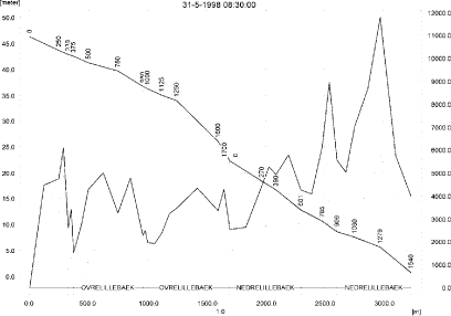
Figure 8.14. Concentrations in the sandy loam catchment on 31. May 1998, just after spraying.
Figur 8.14. Koncentrationer i morænelersoplandet den 31. maj-1998, lige efter sprøjtning.

Figure 8.15. Concentrations in the sandy loam catchment on 31. May 2000 at 8.30 hours, just after spraying.
Figur 8.15. Koncentrationer i morænelersoplandet den 31. maj-2000, 8.30, lige efter sprøjtning.

Figure 8.16. Concentrations in the sandy loam catchment on 31. May 2000 at 8.40 hours.
Figur 8.16. Koncentrationer i morænelersoplandet den 31. maj-200, kl. 8.40.
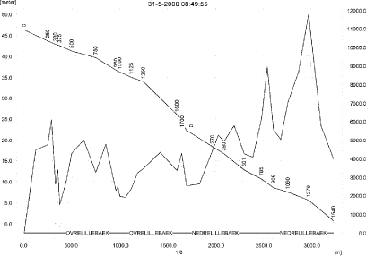
Figure 8.17. Concentrations in the sandy loam catchment on 31. May 2000 at 8.50 hours.
Figur 8.17. Koncentrationer i morænelersoplandet den 31. maj-200, kl. 8.50.

Figure 8.18. Concentrations in the sandy loam catchment on 31. May 2000 at 10.00 hours.
Figur 8.18. Koncentrationer i morænelersoplandet den 31. maj-200, kl. 10.00.
To be able to extract comparable values to FOCUS SW, the global maxima and time weighted concentrations (up to 7 days) were extracted when these were meaningful.
Figure 8.19 and Figure 8.20 show the concentrations sorbed to macrophytes. The maximum value reached is 646 ng/l. The concentration is relatively low compared to the concentration in the water phase. The pattern follows the pattern of the water concentrations.
The concentration of propiconazol in porewater in the sediment reached 17 ng/l the lower end of the catchment, see Figure 8.21. Concentrations in sediment is shown in Figure 8.22. A maximum value of 339 ng/kg is reached.
The FOCUS SW D4-stream-scenario generates a concentration of 0.657 µg/l, while the PestSurf simulation reaches 11.786 µg/l. In both simulations, the maximum concentrations are generated by wind drift.
The maximum concentrations in PestSurf are reached because a long stretch of stream receives drift simultaneously. 100 m from the upstream end, a concentration of 4.5 µg/l is reached. The water depth at this time is only about 5 cm in 1998 and 3.5 cm in 2000. There is therefore a factor of 6-9 hidden in the difference in water depth alone.
The sediment concentration of 339 ng/kg is about 3 times the concentration generated by FOCUS SW-D4 stream (102 ng/kg).
Figure 8.23, Figure 8.24, Table 8.9 and Table 8.10 show the results as generated by the PestSurf templates. The maximum value generated by the templates for the upper part of the stream is 4.28 µg/l, and for the lower part, 11.8 µg/l. The maximum value generated by PestSurf in the upstream part of the catchment is 6.10 µg/l in OvreLillebaek and in the lower part 11.8 µg/l. The templates thus captures the maximum concentration in the lower part but not in the upper part of the catchment.
Figure 8.19. Concentration on macrophytes in ng/l 290 m from the upstream end. The pattern is representative of the upper part of the sandy loam catchment.
Figur 8.19. Koncentration på makrofytter 290 m fra den opstrøms ende af morænelersoplandet. Mønsteret representerer hele åen.
Figure 8.20. Concentration on macrophytes in ng/l in the lower part of the sandy loam catchment.
Figur 8.20. Koncentration på makrofytter i den nedstrøms ende af morænelersoplandet. Mønsteret representerer hele åen.
Figure 8.21. Pore water concentration of propiconazol in the sandy loam catchment.
Figur 8.21. Porevandskoncentration af propiconazol i morænelersoplandet.
Figure 8.22. Sorption of propiconazol to sediment in the sandy loam catchment. The concentration is in µg/g sediment and not µg/m³ as stated.
Figur 8.22. Sorption af propiconazol til sediment i morænelersoplandet i Koncentrationen er i µg/g sediment og ikke µg/m³ som angivet.
Table 8.8. Instantaneous and time weighted concentrations (ng/l)of propiconazol for selected points in the sandy loam catchment.
Tabel 8.8. Beregnede og tidsvægtede maximumskoncentrationer (ng/l) af propiconazol for udvalgte lokaliteter i morænelersoplandet.
Click here to see Figure 8.23.
Figure 8.23. Overview for propiconazol for the upstream part of the sandy loam catchment generated by the PestSurf excel template. The detection value was set to 1 ng/l.
Figur 8.23. Oversigt for propiconazol i den opstrøms del af morænelersoplandet genereret med PestSurf-excel-skabelonen. Detektionsgrænsen var sat til 1 ng/l.
Click here to see Figure 8.24.
Figure 8.24. Overview for propiconazol in the downstream part of the sandy loam catchment generated by the PestSurf excel template. The detection value was set to 300 ng/l.
Figur 8.24. Oversigt for propiconazol i den nedstrøms del af morænelersoplandet genereret med PestSurf-excel-skabelonen. Detektionsgrænsen var sat til 300 ng/l.
Table 8.9. Part of the result sheet generated by the PestSurf Excel sheet for the upstream part of the sandy loam catchment. The lowest detection value is 1 ng/l, toxicity to fish, daphnies and algae are set to 10, 100 and 1000 ng/, respectively. The recorded peaks are shown in Figure 8.23.
Tabel 8.9. Uddrag af resultatpresentationen genereret af PestSurf-Excel-arket for den opstrøms del af morænelersoplandet. Detektionsgrænsen for tabelgenerering er sat til 1 ng/l. Toxicitetsværdierne for fisk, dafnier og alger er henholdsvis 10, 100 og 1000 ng/l. Hændelserne er vist i Figur 8.23.
Table 8.10. Part of the result sheet generated by the Pestsurf Excel sheet for the downstream part of the sandy loam catchment. The lowest detection value is 300 ng/l, toxicity to fish, daphnies and algae are set to 1000, 5000 and 10000 ng/, respectively. The recorded peaks are shown in Figure 8.24.
Tabel 8.10. Uddrag af resultatpresentationen genereret af PestSurf-Excel-arket for den nedstrøms del af morænelersoplandet. Detektionsgrænsen for tabelgenerering er sat til 300 ng/l. Toxicitetsværdierne for fisk, dafnier og alger er henholdsvis 1000, 5000 og 10000 ng/l. Hændelserne er vist i Figur 8.24.
8.4.4 Sandy Loam Catchment, pond
The concentration pattern is evaluated in the middle of the pond only, see Figure 8.25. The pond receives contributions mainly through drift, in good correspondence with the fact that it is situated in the upper part of the sandy loam catchment. The concentration generated by drift is concentrated during the summer due to evaporation. The maximum concentration becomes 171 ng/l.
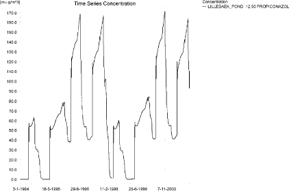
Figure 8.25. Concentrations of propiconazol for the sandy loam pond.
Figur 8.25. Koncentration af propiconazol i morænelersvandhullet.
Figure 8.26 shows the concentration of propiconazol on macrophytes in the pond. It follows the concentration pattern in the water phase, the maximum concentration reaching around 9.1 ng/l. The pore water concentration reaches 1.6 ng/l, see Figure 8.27. The concentration of propiconazol adsorbed to sediment is shown in Figure 8.28. The maximum value reached is 36.7 ng/kg.
In Table 8.11, global maxima and time weighted concentrations (up to 7 days) are extracted.
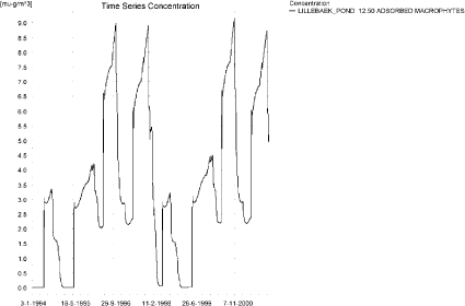
Figure 8.26. Propiconazol sorbed to the macrophytes in the sandy loam pond.
Figur 8.26. Propiconazol sorberet til makrofytter i morænelersvandhullet.
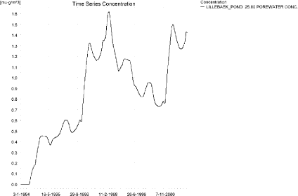
Figure 8.27. Pore water concentration of propiconazol in the sandy loam pond.
Figur 8.27. Porevandskoncentration af propiconazol i morænelersvandhullet.
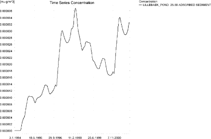
Figure 8.28. Propiconazol sorbed to sediment in the sandy loam pond. Note that the concentration is µg/g sediment and not µg/m³ as indicated.
Figur 8.28. Propiconazol sorberet til sediment i morænelersoplandet i Bemærk at enheden er µg/g sediment og ikke µg/m³ som angivet.
Table 8.11. Actual and time weighted concentrations (ng/l) of propiconazol in the sandy loam pond.
Tabel 8.11. Beregnede og tidsvægtede koncentrationer (ng/l) af propiconazol i morænelersvandhullet.
| Year | LILLEBAEK_POND 12.50 | |||
| Conc. | TWC | Date | ||
| 1994 | (global max) | 63 | 03-09-1994 | |
| 1 hour (after max) | ||||
| 1 day after sp.in. | 60 | 62 | ||
| 2 days | 61 | 61 | ||
| 4 days | 61 | 61 | ||
| 7 days | 59 | 60 | ||
| 1995 | (global max) | 54 | 08-06-1995 | |
| 1 hour (after max) | 54 | 54 | ||
| 1 day after sp.in. | 52 | 53 | ||
| 2 days | 52 | 52 | ||
| 4 days | 52 | 52 | ||
| 7 days | 51 | 52 | ||
| 1996 | (global max) | 168 | 05-11-1996 | |
| 1 hour (after max) | ||||
| 1 day after sp.in. | 152 | 160 | ||
| 2 days | 137 | 149 | ||
| 4 days | 135 | 145 | ||
| 7 days | 132 | 140 | ||
| 1997 | (global max) | 167 | 12-12-1997 | |
| 1 hour (after max) | ||||
| 1 day after sp.in. | 142 | 155 | ||
| 2 days | 114 | 135 | ||
| 4 days | 116 | 130 | ||
| 7 days | 115 | 124 | ||
| 1998 | (global max) | 102 | 16-01-1998 | |
| 1 hour (after max) | ||||
| 1 day after sp.in. | 102 | 102 | ||
| 2 days | 102 | 102 | ||
| 4 days | 102 | 102 | ||
| 7 days | 100 | 101 | ||
| 1999 | (global max) | 58 | 07-06-1999 | |
| 1 hour (after max) | 58 | 58 | ||
| 1 day after sp.in. | 56 | 57 | ||
| 2 days | 55 | 56 | ||
| 4 days | 55 | 56 | ||
| 7 days | 55 | 55 | ||
| 2000 | (global max) | 171 | 04-11-2000 | |
| 1 hour (after max) | ||||
| 1 day after sp.in. | 155 | 163 | ||
| 2 days | 140 | 151 | ||
| 4 days | 138 | 148 | ||
| 7 days | 135 | 143 | ||
| 2001 | (global max) | 164 | 11-12-2001 | |
| 1 hour (after max) | ||||
| 1 day after sp.in. | 139 | 152 | ||
| 2 days | 112 | 132 | ||
| 4 days | 113 | 127 | ||
| 7 days | 113 | 121 | ||
| global max | 171 | |||
| 1 hour (after max) | 58 | 58 | ||
| 1 day after sp.in. | 155 | 163 | ||
| 2 days | 140 | 151 | ||
| 4 days | 138 | 148 | ||
| 7 days | 135 | 143 | ||
Figure 8.29 and Table 8.12 show output from the PestSurf template, with a time series identical to Figure 8.25.
Compared to the FOCUS SW-scenario D4- pond the concentration levels generated by PestSurf are higher; 171 ng/l compared to 30 ng/l. The ponds differ in size, and that factor alone accounts for part of the difference. The difference in water depth accounts for the rest. The fact that the pond evaporates during the summer leads to an increase in concentration, which is not seen in the FOCUS simulations.
The sediment concentrations differ substantially between the two models, 290 ng/kg in FOCUS SW D4-pond and 37 ng/kg in the PestSurf simulation.
Click here to see Figure 8.29.
Figure 8.29. Overview for propiconazol in the sandy loam pond generated by the PestSurf excel template. The time series shown is identical to the one in Figure 8.25. The detection value was set to 50 ng/l.
Figur 8.29. Oversigt for propiconazol i morænelersvandhullet genereret med PestSurf-excel-skabelonen. Den viste tidsserie er mage til den i Figur 8.25. Detektionsgrænsen er sat til 1 ng/l.
Table 8.12. Part of the result sheet generated by the PestSurf Excel sheet. The lowest detection value is 50 ng/l, toxicity to fish, daphnies and algae are set to 100, 500 and 1000 ng/, respectively. The recorded peaks are shown in Figure 8.29.
Tabel 8.12. Uddrag af resultatpresentationen genereret af PestSurf-Excel-arket. Detektionsgrænsen er sat til 50 ng/l. Toxicitetsværdierne for fisk, dafnier og alger er henholdsvis 100, 500 og 1000 ng/l. De tabellerede hændelser er vist i Figur 8.29.
Table 8.13. Summary of simulation results for propiconazol.
Tabel 8.13. Opsummerede resultater for propiconazol.
8.5 Summary of simulations
The maximum actual concentrations for all simulations are recorded in Table 8.13.
For the sandy conditions, the PestSurf sandy pond generates lower concentrations than the ditch, which again generates lower concentrations than the stream. The global maximum value calculated by PestSurf for the sandy catchment in the water phase is 3.42 µg/l compared to 0.792 µg/l in the D3-ditch scenario. The high concentrations reached are a function of the simultaneous spraying of all agricultural land within 30 min. However, 100 m from the upstream end, the concentration reached in PestSurf is 0.245 µg/l, which is more comparable to the D3-ditch. These values are, however, not directly comparable as the top end of the sandy stream is protected by a 20 m buffer zone. The water depth at the time of maximum concentration is about 7 cm.
Compared to the FOCUS SW D4- pond the concentration levels generated by PestSurf are higher; 171 ng/l compared to 30 ng/l. The ponds differ in size, and that factor alone accounts for part of the difference. The difference in water depth accounts for the rest. The fact that the pond evaporates during the summer leads to an increase in concentration, which is not seen in the FOCUS simulations.
The FOCUS SW D4-stream-scenario for generates a concentration of 0.657 µg/l, while the PestSurf simulation reaches 11.8 µg/l. In both simulations, the maximum concentrations are generated by wind drift. The maximum concentrations in PestSurf are reached because a long stretch of stream receives drift simultaneously. 125 m from the upstream end, a concentration of 4.46 µg/l is reached. The water depth at this time is only about 5.2 cm, and the cross section is triangular. There is therefore a factor of 11.5 hidden in the difference in water depth and shape. The maximum concentration reached on the stretch from 500 to 1700 m from the upstream end is 5.02 µg/l.
The macrophyte concentrations were in all cases small compared to the concentration in the water phase.
Sediment concentrations are systematically lower in PestSurf than in FOCUS SW.
Annex 9
9 Comparison of risk assessment data produced by spray drift assessments, FOCUS SW and PestSurf
9.1 Chemical characteristics of the compound
| Compound: | Prosulfocarb |
| Dose: | 2400 g ai/ha |
| Spraying time: | 25. September |
| Crop: | Winter wheat |
Table 9.1. Overview of chemical properties of prosulfocarb and the parameters used in the simulations.
Tabel 9.1. Oversigt over prosulfocarb s kemiske egenskaber og parametrene brugt i simuleringerne.
| Chemical property | Condition | Recalculated values | |||
| Cas-no. | 52888-80-9 | ||||
| Molecular weight | 251.4 | ||||
| Form (acid, basic, neutral) | neutral | ||||
| pKa | |||||
| Water solubility | 13.0 µg/l | at 20.0 ± 0.5°C | |||
| log Kow | at pH | KowA- | |||
| log Kow | 4.48 | at pH | KowAH | 4.48 | |
| log Kow | at pH | KowAH+ | |||
| Vapor pressure, Pa | 7.9 × 10⁻⁴ | 20°C | 270°C (Decomposition) | vapor pressure, Pa, 20°C | |
| Henry’s law constant | 1.52 × 10⁻² Pa m³ mol-1 | Recalculated value, dimensionless | 6.24 × 10⁻⁶ | ||
| Sorption properties in soil | |||||
| Freundlich exp | 0.96 | ||||
| Koc, l/kg | 1637 | ||||
| DT50 in soil, days | 13.8 | ||||
| DT50water | 1.5day | PestSurf input | |||
| DT50sedment | None mentioned | ||||
| DT50water/sediment | 381 days | method not described | DT50, days | 1.5 | |
| Sediment konc., µg/l | 0 | ||||
| Hydrolysis | no hydrolysis | at pH 5 | (acid) | ||
| at pH 7 | (neutral) | ||||
| at pH 9 | (basic) | ||||
| Photolysis | |||||
| quantum yield | Set to 0 due to too little information | ||||
| Spectrum | |||||
| Other | Half-life of 25.5 days with a rate constant of 2.72 x 10⁻² day-1 | ||||
9.2 Concentration generated by spray
| Direct spray | FOCUS buffer zones | |||
| Ditch | Stream | Pond | ||
| µg l-1 | µg l-1 | µg l-1 | µg l-1 | |
| Prosulfocarb | 800.0 | 22.074 | 14.850 | 6.485 |
9.3 Concentrations generated by FOCUS SW
9.3.1 D3- Ditch
| Prosulfocarb | Ditch, D3 | |||||||
| Water | Sediment | |||||||
| Date | PEC | Date | TWAEC | Date | PEC | Date | TWAEC | |
| µg l-1 | µg l-1 | µg kg-1 | µg kg-1 | |||||
| Global max | 26-sep-92 | 15.231 | 28-sep-92 | 8.232 | ||||
| 1 d | 27-sep-92 | 7.395 | 27-sep-92 | 11.057 | 29-sep-92 | 7.319 | 28-sep-92 | 8.096 |
| 2 d | 28-sep-92 | 1.775 | 28-sep-92 | 7.692 | 30-sep-92 | 6.094 | 29-sep-92 | 7.751 |
| 4 d | 30-sep-92 | 0.157 | 30-sep-92 | 4.144 | 02-okt-92 | 4.553 | 30-sep-92 | 6.888 |
| 7 d | 03-okt-92 | 0.054 | 03-okt-92 | 2.407 | 05-okt-92 | 3.463 | 03-okt-92 | 5.833 |
9.3.2 D4 – Stream
| Prosulfocarb | Stream, D4 | |||||||
| Water | Sediment | |||||||
| Date | PEC | Date | TWAEC | Date | PEC | Date | TWAEC | |
| µg l-1 | µg l-1 | µg kg-1 | µg kg-1 | |||||
| Global max | 28-sep-85 | 13.139 | 28-sep-85 | 2.486 | ||||
| 1 d | 29-sep-85 | 0.016 | 29-sep-85 | 3.673 | 29-sep-85 | 1.914 | 29-sep-85 | 2.29 |
| 2 d | 30-sep-85 | 0.009 | 30-sep-85 | 1.843 | 30-sep-85 | 1.515 | 30-sep-85 | 2.05 |
| 4 d | 02-okt-85 | 0.004 | 02-okt-85 | 0.924 | 02-okt-85 | 1.082 | 02-okt-85 | 1.697 |
| 7 d | 05-okt-85 | 0.002 | 05-okt-85 | 0.529 | 05-okt-85 | 0.795 | 05-okt-85 | 1.379 |
9.3.3 D4 - Pond
| Prosulfocarb | Pond, D4 | |||||||
| Water | Sediment | |||||||
| Date | PEC | Date | TWAEC | Date | PEC | Date | TWAEC | |
| µg l-1 | µg l-1 | µg kg-1 | µg kg-1 | |||||
| Global max | 28-sep-85 | 0.524 | 03-okt-85 | 0.568 | ||||
| 1 d | 29-sep-85 | 0.392 | 29-sep-85 | 0.453 | 04-okt-85 | 0.563 | 03-okt-85 | 0.568 |
| 2 d | 30-sep-85 | 0.295 | 30-sep-85 | 0.396 | 05-okt-85 | 0.549 | 04-okt-85 | 0.566 |
| 4 d | 02-okt-85 | 0.182 | 02-okt-85 | 0.314 | 07-okt-85 | 0.511 | 05-okt-85 | 0.559 |
| 7 d | 05-okt-85 | 0.096 | 05-okt-85 | 0.238 | 10-okt-85 | 0.449 | 07-okt-85 | 0.543 |
9.3.4 Conclusion – FOCUS SW
The highest concentration is generated in the ditch (D3). It is caused by wind drift and the concentration becomes 15.2 µg/l. The same scenario shows the highest concentration in the sediment, 8.23 µg/l. For all scenarios, the concentrations are lower than what is generated by the simpler assessments, but for the ditch and stream-scenarios the difference between the simple drift calculation and the FOCUS SW-simulation is rather small.
9.4 PestSurf
9.4.1 Sandy Catchment, stream
The distribution of concentrations was assessed in several steps. First, the maximum concentrations at each calculation point were listed, and the dates for the occurrence of the maximum were assessed. The points, for which the maximum value also represents a local maximum, were selected for further analysis. The relevant values are listed in Table 9.2.
Table 9.2. Maximum concentrations (ng/l) of prosulfocarb simulated for each calculation point in the sandy catchment.
Tabel 9.2. Maximumkoncentrationer (ng/l) af prosulfocarb simuleret for hvert beregningspunkt i det sandede opland.
| PROSULFOCARB | Maximum | Max. Time | Local maxima |
| ODDERBAEK 0.00 | 5224 | 25-09-2001 09:18 | |
| ODDERBAEK 56.00 | 5554 | 25-09-2001 09:18 | |
| ODDERBAEK 112.00 | 6506 | 25-09-2001 09:09 | |
| ODDERBAEK 192.00 | 12787 | 25-09-2001 08:41 | |
| ODDERBAEK 272.00 | 19469 | 25-09-2001 08:33 | |
| ODDERBAEK 278.00 | 20338 | 25-09-2001 08:33 | |
| ODDERBAEK 282.00 | 20897 | 25-09-2001 08:33 | |
| ODDERBAEK 298.50 | 22419 | 25-09-2001 08:33 | |
| ODDERBAEK 315.00 | 24117 | 25-09-2001 08:33 | |
| ODDERBAEK 317.50 | 24379 | 25-09-2001 08:33 | |
| ODDERBAEK 320.00 | 24617 | 25-09-2001 08:33 | |
| ODDERBAEK 410.00 | 31926 | 25-09-2001 08:33 | |
| ODDERBAEK 500.00 | 35584 | 25-09-2001 08:33 | |
| ODDERBAEK 513.00 | 37468 | 25-09-2001 08:33 | |
| ODDERBAEK 521.00 | 38700 | 25-09-2001 08:33 | |
| ODDERBAEK 622.00 | 46160 | 25-09-2001 08:33 | |
| ODDERBAEK 723.00 | 51924 | 25-09-2001 08:33 | |
| ODDERBAEK 733.00 | 53602 | 25-09-2001 08:33 | |
| ODDERBAEK 742.00 | 54516 | 25-09-2001 08:33 | |
| ODDERBAEK 789.50 | 57139 | 25-09-2001 08:33 | |
| ODDERBAEK 837.00 | 59651 | 25-09-2001 08:33 | |
| ODDERBAEK 848.00 | 60708 | 25-09-2001 08:33 | |
| ODDERBAEK 863.00 | 62047 | 25-09-2001 08:33 | |
| ODDERBAEK 956.00 | 66140 | 25-09-2001 08:33 | |
| ODDERBAEK 1049.00 | 66867 | 25-09-2001 08:33 | X |
| ODDERBAEK 1111.50 | 64498 | 25-09-2005 08:32 | |
| ODDERBAEK 1174.00 | 59319 | 25-09-2005 08:32 | |
| ODDERBAEK 1226.00 | 56475 | 25-09-2005 08:42 | |
| ODDERBAEK 1278.00 | 55135 | 25-09-2005 08:51 | |
| ODDERBAEK 1293.50 | 54626 | 25-09-2005 08:51 | |
| ODDERBAEK 1310.00 | 53783 | 25-09-2005 08:51 | |
| ODDERBAEK 1421.00 | 50723 | 25-09-2005 09:00 | |
| ODDERBAEK 1532.00 | 43302 | 02-10-2000 09:00 | |
| ODDERBAEK 1558.06 | 39138 | 25-09-2001 09:00 | |
| ODDERBAEK 1584.12 | 37470 | 25-09-2001 08:41 | |
| ODDERBAEK 1584.12 | 37470 | 25-09-2001 08:41 | |
| ODDERBAEK 1621.06 | 37316 | 25-09-2001 08:41 | |
| ODDERBAEK 1658.00 | 38123 | 25-09-2001 08:33 | |
| ODDERBAEK 1698.50 | 39546 | 25-09-2001 08:33 | |
| ODDERBAEK 1739.00 | 40230 | 25-09-2001 08:33 | X |
| ODDERBAEK 1801.50 | 38324 | 25-09-2001 08:33 | |
| ODDERBAEK 1864.00 | 31033 | 02-10-2004 08:33 | |
| ODDERBAEK 1977.00 | 26022 | 02-10-2000 09:54 | |
| ODDERBAEK 2090.00 | 25388 | 02-10-2000 10:00 | |
| ODDERBAEK 2098.00 | 25360 | 02-10-2000 10:00 | |
| ODDERBAEK 2105.00 | 25251 | 02-10-2000 10:00 | |
| ODDERBAEK 2131.00 | 25046 | 02-10-2000 10:00 | |
| ODDERBAEK 2157.00 | 24676 | 02-10-2000 10:00 | |
| ODDERBAEK 2168.00 | 24557 | 02-10-2000 10:00 | |
| ODDERBAEK 2179.00 | 24456 | 02-10-2000 10:00 | |
| ODDERBAEK 2268.50 | 24112 | 02-10-2000 10:00 | |
| ODDERBAEK 2358.00 | 22862 | 02-10-2000 10:00 | |
| ODDERBAEK 2363.50 | 22751 | 02-10-2000 10:00 | |
| ODDERBAEK 2372.00 | 22646 | 01-10-1998 11:00 | |
| ODDERBAEK 2427.00 | 22576 | 01-10-2002 11:00 | |
| ODDERBAEK 2482.00 | 22330 | 01-10-2002 11:00 | |
| ODDERBAEK 2609.00 | 22338 | 01-10-2002 11:00 | |
| ODDERBAEK 2736.00 | 21221 | 02-10-2000 11:00 | |
| ODDERBAEK 2831.00 | 21163 | 02-10-2000 11:00 | |
| ODDERBAEK 2926.00 | 20227 | 02-10-2000 11:00 | |
| ODDERBAEK 2958.50 | 20034 | 02-10-2000 11:00 | |
| ODDERBAEK 2991.00 | 19791 | 02-10-2000 11:00 | |
| ODDERBAEK 3029.50 | 19261 | 02-10-2000 11:00 | |
| ODDERBAEK 3068.00 | 18339 | 02-10-2004 11:00 | |
| ODDERBAEK 3131.00 | 17205 | 02-10-2004 11:00 | |
| ODDERBAEK 3194.00 | 16441 | 02-10-2000 12:00 | |
| ODDERBAEK 3250.50 | 16445 | 02-10-2000 12:00 | |
| ODDERBAEK 3307.00 | 16371 | 02-10-2000 12:00 | |
| ODDERBAEK 3315.00 | 16368 | 02-10-2000 12:00 | |
| ODDERBAEK 3323.00 | 16356 | 02-10-2000 12:00 | |
| ODDERBAEK 3355.50 | 17590 | 25-09-2001 08:33 | |
| ODDERBAEK 3388.00 | 19786 | 25-09-2001 08:33 | |
| ODDERBAEK 3438.50 | 22644 | 25-09-2001 08:33 | |
| ODDERBAEK 3489.00 | 23851 | 25-09-2001 08:33 | |
| ODDERBAEK 3499.50 | 23936 | 25-09-2001 08:33 | X |
| ODDERBAEK 3510.00 | 23851 | 25-09-2001 08:33 | |
| ODDERBAEK 3581.00 | 23281 | 25-09-2001 08:33 | |
| ODDERBAEK 3652.00 | 20635 | 25-09-2001 08:33 | |
| ODDERBAEK 3707.00 | 19679 | 25-09-2001 08:41 | |
| ODDERBAEK 3762.00 | 17819 | 25-09-2001 08:41 | |
| ODDERBAEK 3790.00 | 15548 | 01-10-1998 08:42 | |
| ODDERBAEK 3818.00 | 12510 | 01-10-1998 08:42 | |
| ODDERBAEK 3818.00 | 12510 | 01-10-1998 08:42 | |
| ODDERBAEK 3884.00 | 12147 | 01-10-1998 08:51 | |
| ODDERBAEK 3950.00 | 11574 | 01-10-1998 08:51 | |
| ODDERBAEK 3998.00 | 10775 | 01-10-1998 08:51 | |
| ODDERBAEK 4046.00 | 10297 | 01-10-1998 09:00 | |
| ODDERBAEK 4047.50 | 10291 | 01-10-1998 09:00 | |
| ODDERBAEK 4049.00 | 10289 | 01-10-1998 09:00 | |
| ODDERBAEK 4052.50 | 10284 | 01-10-1998 09:00 | |
| ODDERBAEK 4056.00 | 10277 | 01-10-1998 09:00 | |
| ODDERBAEK 4058.00 | 10273 | 01-10-1998 09:00 | |
| ODDERBAEK 4060.00 | 10263 | 01-10-1998 09:00 | |
| ODDERBAEK 4080.00 | 10161 | 01-10-1998 09:00 | |
| ODDERBAEK 4100.00 | 10066 | 01-10-1998 09:00 | |
| ODDERBAEK 4134.00 | 10080 | 01-10-1998 09:08 | |
| ODDERBAEK 4168.00 | 10101 | 01-10-1998 09:08 | |
| GISLUM_ENGE_AFLOEB 0.00 | 0 | 01-10-1998 08:06 | |
| GISLUM_ENGE_AFLOEB 50.00 | 0 | 01-10-1998 08:06 | |
| GISLUM_ENGE_AFLOEB 100.00 | 0 | 01-10-1998 08:06 | |
| GISLUM_ENGE_AFLOEB 150.00 | 0 | 01-10-1998 08:06 | |
| GISLUM_ENGE_AFLOEB 200.00 | 0 | 01-10-1998 08:06 | |
| GISLUM_ENGE_AFLOEB 250.00 | 0 | 01-10-1998 08:06 | |
| GISLUM_ENGE_AFLOEB 300.00 | 0 | 09-02-2000 00:00 | |
| GISLUM_ENGE_AFLOEB 340.00 | 0 | 13-02-2000 00:00 | |
| GISLUM_ENGE_AFLOEB 380.00 | 0 | 18-10-2002 01:00 | |
| GISLUM_ENGE_AFLOEB 430.00 | 0 | 01-10-1998 08:06 | |
| GISLUM_ENGE_AFLOEB 480.00 | 0 | 01-10-1998 08:06 | |
| GISLUM_ENGE_AFLOEB 530.00 | 0 | 01-10-1998 08:06 | |
| GISLUM_ENGE_AFLOEB 580.00 | 0 | 01-10-1998 08:06 | |
| GISLUM_ENGE_AFLOEB 630.00 | 0 | 01-10-1998 09:17 | |
| GISLUM_ENGE_AFLOEB 680.00 | 0 | 01-10-1998 09:17 | |
| GISLUM_ENGE_AFLOEB 730.00 | 0 | 01-10-1998 09:17 | |
| GISLUM_ENGE_AFLOEB 780.00 | 0 | 01-10-1998 09:17 | |
| GISLUM_ENGE_AFLOEB 830.00 | 0 | 01-10-1998 09:08 | |
| GISLUM_ENGE_AFLOEB 880.00 | 0 | 01-10-1998 09:08 | |
| GISLUM_ENGE_AFLOEB 915.00 | 0 | 01-10-1998 09:08 | |
| GISLUM_ENGE_AFLOEB 950.00 | 0 | 01-10-1998 09:08 | |
| GISLUM_ENGE_AFLOEB 985.00 | 0 | 01-10-1998 09:08 | |
| GISLUM_ENGE_AFLOEB 1020.00 | 0 | 01-10-1998 09:08 | |
| GISLUM_ENGE_AFLOEB 1045.00 | 0 | 01-10-1998 09:08 | |
| GISLUM_ENGE_AFLOEB 1070.00 | 1 | 01-10-1998 09:00 | |
| GISLUM_ENGE_AFLOEB 1110.00 | 2 | 01-10-1998 09:00 | |
| GISLUM_ENGE_AFLOEB 1150.00 | 5 | 01-10-1998 09:00 | |
| GISLUM_ENGE_AFLOEB 1190.00 | 15 | 01-10-1998 09:00 | |
| GISLUM_ENGE_AFLOEB 1230.00 | 43 | 01-10-1998 09:00 | |
| GISLUM_ENGE_AFLOEB 1271.00 | 123 | 01-10-1998 09:00 | |
| GISLUM_ENGE_AFLOEB 1312.00 | 342 | 01-10-1998 08:51 | |
| GISLUM_ENGE_AFLOEB 1422.00 | 3043 | 01-10-1998 08:51 | |
| GISLUM_ENGE_AFLOEB 1532.00 | 12510 | 01-10-1998 08:42 | |
| TILLOEB 0.00 | 36013 | 25-09-2001 08:41 | |
| TILLOEB 20.16 | 36884 | 25-09-2001 08:41 | |
| TILLOEB 40.31 | 37470 | 25-09-2001 08:41 | X |
| global max | 66867 |
The pattern over time was the same for all calculation points. The peak values were generated by wind drift, see Figure 9.1.
Each of the events generated an almost identical pattern along the stream. Figure 9.2 to Figure 9.5 show longitidunal profiles from 25 September 2001, from the end of spraying at 8.30 till 12.00. The concentrations move through the catchment and it takes almost 24 hours before the solute has left the downstream end.
The thin black line represents the concentration, while the thick black line shows the maximum concentrations obtained during the simulations. In addition, the outline of the stream is shown. In the middle of the catchment, unsprayed areas protect the stream. The maximum values at the center of the catchment are obtained when the peak from upstream moves through the catchment during the hour following spraying.
In order to present the data in a similar fashion to the FOCUS SW-results, data were extracted and recalculated for the time series marked in Table 9.2. The global maxima and time-weighted concentrations (up to 7 days) were extracted and are reported in Table 9.3. Note that the unit is ng/l.
The concentration of prosulfocarb on macrophytes is shown on Figure 9.6 and reaches 0.212 ng/l. The concentration is relatively low and will not influence the stream concentration markedly. The maximum porewater concentration is shown in Figure 9.7. The concentration of prosulfocarb sorbed to sediment was 15 ng/kg.

Figure 9.1. Concentration pattern over time for prosulfocarb in the sandy catchment.
Figur 9.1. Koncentrationsmønster som funktion af tid for prosulfocarb i det sandede opland.
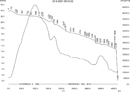
Figure 9.2. Concentrations of prosulfocarb in the sandy catchment on 25. September 2001, 8.30.
Figur 9.2. Koncentrationer prosulfocarb i det sandede opland den 25. september 2001, 8.30.

Figure 9.3. Concentrations of prosulfocarb in the sandy catchment on 25. September 2001, 9.00.
Figur 9.3. Koncentrationer prosulfocarb i det sandede opland den 20. october 2001, 9.00.

Figure 9.4. Concentrations of prosulfocarb in the sandy catchment on 25. September 2001, 10.00.
Figur 9.4. Koncentrationer prosulfocarb i det sandede opland den 25. september 2001, 10.00.
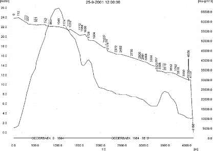
Figure 9.5. Concentrations of prosulfocarb in the sandy catchment on 25. September 2001, 12.00.
Figur 9.5. Koncentrationer prosulfocarb i det sandede opland den 25. september 2001, 12.00.
Table 9.3. Actual and time weighted concentration (ng/l) of prosulfocarb at selected points in the sandy stream.
Tabel 9.3. Beregnet og tidsvægtet koncentration af prosulfocarb, ng/l, på udvalgte lokaliteter i det sandede vandløb.
Figure 9.6. Typical concentration pattern for prosulfocarb sorbed on macrophytes.
Figur 9.6. Koncentration af prosufocarb sorberet på makrofytter.

Figure 9.7. Pore water concentration of prosulfocarb in the sandy catchment.
Figur 9.7. Porevandskoncentration for prosulfocarb i det sandede opland.
Figure 9.8. Sediment concentration of prosulfocarb in the sandy catchment. Note that the concentration is in µg/g and not µg/m³ as indicated.
Figur 9.8. Sedimentkoncentration af prosulfocarb i det sandede opland. Bemærk at koncentrationen er i µg/g og ikke i µg/m³ som angivet.
The global maximum value calculated by PestSurf for the sandy catchment in the water phase is 66.9 µg/l. This is considerably more than what is found in the D3-ditch scenario (15.2 µg/l). The sediment concentration is also very different (15 ng/kg compared to 8.23 µg/kg).
Figure 9.9 shows the output of the PestSurf Excel template. The template works with pre-defined data extraction points. The plot requires specification of a “lowest detection value” (ldc) which defines when a pesticide occurrence is defined as an event. The time series plot is identical to the time series shown earlier, and the graph in the upper right corner resembles the plots in Figure 9.2 and Figure 9.3, but takes into account a longer period of time. A curve is generated when a downstream point reaches a concentration higher than the ldc. The programme then tracks the highest concentration for each calculation point in the stream within the last 24 hours. The plot in the lower right corner shows how many events have concentrations higher than a given value (ldc) for the selected monitoring points.
Table 9.4 shows part of the result sheet generated by the PestSurf Excel sheet based on the ldc-value. The selected table shows the point along the stream (of the pre-defined points) with the highest concentration. This value was, however, only 37.3 µg/l. Thus, the pre-defined points have not caught the highest concentration of the simulation, which was 66.9 µg/l.
Figure 9.9. Overview for prosulfocarb in the sandy catchment generated by the PestSurf excel template. The max concentrations generated over the 24 hours are similar to to the overviews in Figure 9.2 and Figure 9.3. The graph to the lower right shows how many events have concentrations higher than a given value for the selected points. Detection value was set to 10 ng/l.
Figur 9.9. Oversigt for prosulfocarb i det sandede opland genereret med PestSurf-excel-skabelonen. Den maximale koncentration genereret over 24 timer svarer til oversigten i Figur 9.2 and Figur 9.3. Grafen nederst til højre viser hvor mange hænderlser, der har koncentrationer størrre end end given værdi for de fordefinerede lokaliteter. Detektionsgrænsen var sat til 10 ng/l.
Table 9.4. Part of the result sheet generated by the PestSurf Excel sheet. The selected table shows the pre-defined point along the stream with the highest concentration recorded. The lowest detection value is 10 ng/l, toxicity to fish, daphnies and algae are set to 100, 1000 and 10000 ng/, respectively. The recorded peaks are shown in Figure 9.9.
Tabel 9.4. Uddrag af resultatpresentationen genereret af PestSurf-Excel-arket. Den udvalgte tabel viser det fordefinerede punkt langs med åen med højest koncentration. Detektionsgrænsen er sat til 10 ng/l mens toxicitetsværdierne for fisk, dafnier og alger er henholdsvis 100, 1000 og 10000 ng/l. De tabellerede hændelser er vist i Figur 9.9.
9.4.2 Sandy Catchment, pond
The concentration pattern is evaluated in the middle of the pond only, see Figure 9.10. The pond receives drift but the contribution through groundwater dominates the picture during the whole simulation period. The maximum concentration is 4.04 µg/l.
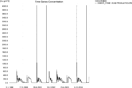
Figure 9.10. Concentrations of prosulfocarb in the sandy pond.
Figur 9.10. Koncentration af prosulfocarb i det sandede vandhul.
In Table 9.5, global maxima and time-weighted concentrations (up to 7 days) were extracted.
Table 9.5. Maximum concentrations (ng/l) of prosulfocarb generated for the sandy pond.
Tabel 9.5. maximumkoncentrationer af prosulfocarb(ng/l) genereret for det sandede vandhul.
| Year | ODDER_POND 20.00, | |||
| Conc. | TWC | Date | ||
| 1998 | 1998 (global max) | 679 | 01-10-1998 | |
| 1 hour (after max) | 531 | 566 | ||
| 1 day after sp.in. | 463 | 461 | ||
| 2 days | 538 | 490 | ||
| 4 days | 559 | 505 | ||
| 7 days | 586 | 536 | ||
| 1999 | 1999 (global max) | 390 | 15-10-1999 | |
| 1 hour (after max) | 293 | 310 | ||
| 1 day after sp.in. | 243 | 252 | ||
| 2 days | 259 | 251 | ||
| 4 days | 264 | 254 | ||
| 7 days | 269 | 260 | ||
| 2000 | 2000 (global max) | 4036 | 02-10-2000 | |
| 1 hour (after max) | 2099 | 2684 | ||
| 1 day after sp.in. | 1009 | 1189 | ||
| 2 days | 1055 | 1084 | ||
| 4 days | 1061 | 1078 | ||
| 7 days | 944 | 1059 | ||
| 2001 | 2001 (global max) | 4036 | 25-09-2001 | |
| 1 hour (after max) | 1981 | 2614 | ||
| 1 day after sp.in. | 288 | 696 | ||
| 2 days | 71 | 326 | ||
| 4 days | 44 | 258 | ||
| 7 days | 17 | 159 | ||
| 2002 | 2002 (global max) | 680 | 01-10-2002 | |
| 1 hour (after max) | 532 | 567 | ||
| 1 day after sp.in. | 464 | 462 | ||
| 2 days | 540 | 492 | ||
| 4 days | 561 | 507 | ||
| 7 days | 588 | 537 | ||
| 2003 | 2003 (global max) | 390 | 15-10-2003 | |
| 1 hour (after max) | 293 | 311 | ||
| 1 day after sp.in. | 244 | 253 | ||
| 2 days | 260 | 252 | ||
| 4 days | 265 | 255 | ||
| 7 days | 270 | 261 | ||
| 2004 | 2004 (global max) | 4036 | 02-10-2004 | |
| 1 hour (after max) | 2099 | 2686 | ||
| 1 day after sp.in. | 1009 | 1189 | ||
| 2 days | 1055 | 1084 | ||
| 4 days | 1061 | 1078 | ||
| 7 days | 945 | 1059 | ||
| 2005 | 2005 (global max) | 4036 | 25-09-2005 | |
| 1 hour (after max) | 1981 | 2611 | ||
| 1 day after sp.in. | 288 | 696 | ||
| 2 days | 71 | 326 | ||
| 4 days | 44 | 258 | ||
| 7 days | 17 | 159 | ||
| Global max | 4036 | |||
| 1 hour (after max) | 2099 | 2686 | ||
| 1 day after sp.in. | 1009 | 1189 | ||
| 2 days | 1055 | 1084 | ||
| 4 days | 1061 | 1078 | ||
| 7 days | 945 | 1059 | ||
As for the previous simulation, the sorption to the macrophytes is limited, see Figure 9.11.The maximum concentration reached is 19 ng/l, which does not influence the water concentration significantly. The maximum concentrations reached for pore water is 2.0 ng/l, as shown in Figure 9.12. The amount of prosulfocarb adsorbed to sediment reaches 0.108 µg/kg, as shown in Figure 9.13.
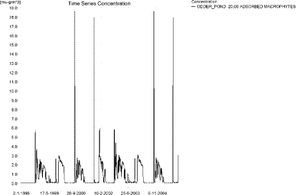
Figure 9.11. Sorption of prosulfocarb to macrophytes in the sandy pond.
Figur 9.11. Sorption af prosulfocarb til makrofytter i det sandede vandhul.
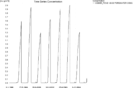
Figure 9.12. Pore water concentration of prosulfocarb in the sandy pond.
Figur 9.12. Porevandskoncentration af prosulfocarb i det sandede vandhul.
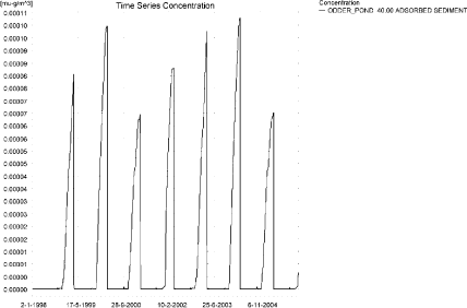
Figure 9.13. Sorption of prosulfocarb to sediment in the sandy pond. The concentration is in µg/g sediment and not µg/m³ as stated.
Figur 9.13. Sorption af prosulfocarb til sediment i det sandede vandhul. Koncentrationen er i µg/g og ikke i µg/m³ som angivet.
Compared to the FOCUS D3 ditch, the concentration in the PestSurf sandy pond is lower, 4.04 µg/l compared to 15.2 µg/l. The maximum concentrations in both models are caused by wind drift, but the sandy pond also receives some contribution from groundwater. The sediment concentrations also differ considerably, 0.108 µg/kg compared to 8.23 µg/kg.
Figure 9.14 shows the output of the PestSurf Excel template. The template works with one pre-defined data extraction point for the pond (center of the pond). The plot requires specification of a “lowest detection value” (ldc) which defines when a pesticide occurrence is defined as an event. The time series plot is identical to the time series shown earlier. The plot to the right shows how many events have concentrations higher than a given toxicity value for the selected monitoring points.
Table 9.6 shows part of the result sheet generated by the PestSurf Excel sheet based on the ldc-value. In the pond-case, there is no difference between the results of PestSurf and the results extracted by the templates.
Click here to see Figure 9.14.
Figure 9.14. Overview for prosulfocarb in the sandy pond generated by the PestSurf excel template. The time series shown is identical to the one in Figure 9.10. The detectionvalue used for generation of the graph is 1 ng/l.
Figur 9.14. Oversigt for prosulfocarb i det sandede vandhul genereret med PestSurf-excel-skabelonen. Den viste tidsserie er mage til den i Figur 9.10. Detektionsgrænsen er sat til 1 ng/l.
Table 9.6. Part of the result sheet generated by the PestSurf Excel sheet, applied to prosulfocarb. The detection value used for generation of the table is 1 ng/l. The toxicity values were set to 10,100 and 1000 ng/l, respectively. The recorded peaks are shown in Figure 9.14.
Tabel 9.6. Uddrag af resultatpresentationen genereret af PestSurf-Excel-arket. Grænseværdien anvendt til tabelgenerering er sat til 1 ng/l mens toxicitetsværdierne for fisk, dafnier og alger er henholdsvis 10, 100 og 1000 ng/l. De tabellerede hændelser er vist i Figur 9.14.
9.4.3 Sandy Loam catchment, Stream
The distribution of concentrations was assessed in several steps. First, the maximum concentrations at each calculation point were listed (Table 9.7), and the dates for the occurrence of the maximum were assessed. The points, for which the maximum value also represents a local maximum, were selected for further analysis.
All points show the same type of time series pattern. The six points with highest maximum values were analysed further.
Table 9.7. Maximum concentrations (ng/l) of prosulfocarb simulated for each calculation point in the sandy loam catchment.
Tabel 9.7. Maximumskoncentrationer (ng/l) af prosulfocarb simuleret for hvert beregningspunkt i morænelersoplandet.
| PROSULFOCARB | Maximum | Max.Time | Local Maxima |
| ALBJERGBAEK 0.00 | 104 | 17-11-2000 00:00 | |
| ALBJERGBAEK 150.00 | 194 | 19-11-2000 00:00 | |
| ALBJERGBAEK 300.00 | 120 | 19-11-2000 00:00 | |
| ALBJERGBAEK 450.00 | 380 | 28-12-2001 00:00 | |
| ALBJERGBAEK 600.00 | 52012 | 25-09-1997 12:00 | |
| ELHOLTBAEK 0.00 | 112 | 24-09-1999 09:30 | |
| ELHOLTBAEK 165.00 | 17 | 08-10-2001 06:00 | |
| ELHOLTBAEK 330.00 | 44102 | 25-09-1997 08:50 | |
| FREDLIGBAEK 0.00 | 1585 | 17-11-2000 00:00 | |
| FREDLIGBAEK 100.00 | 2518 | 17-11-2000 00:00 | |
| FREDLIGBAEK 200.00 | 2695 | 17-11-2000 00:00 | |
| FREDLIGBAEK 300.00 | 2750 | 17-11-2000 00:00 | |
| FREDLIGBAEK 400.00 | 2688 | 17-11-2000 00:00 | |
| FREDLIGBAEK 500.00 | 2771 | 17-11-2000 00:00 | |
| FREDLIGBAEK 600.00 | 2377 | 17-11-2000 00:00 | |
| FREDLIGBAEK 667.50 | 3296 | 17-11-2000 00:00 | |
| FREDLIGBAEK 735.00 | 82036 | 24-09-1999 09:19 | X |
| GROFTEBAEK 0.00 | 346 | 26-12-2001 00:00 | |
| GROFTEBAEK 155.00 | 619 | 26-12-2001 00:00 | |
| GROFTEBAEK 310.00 | 557 | 26-12-2001 00:00 | |
| GROFTEBAEK 465.00 | 209 | 16-02-1995 00:00 | |
| GROFTEBAEK 620.00 | 107249 | 25-09-1997 09:00 | X |
| STENSBAEK 0.00 | 13720 | 09-10-2001 04:00 | |
| STENSBAEK 125.00 | 10607 | 09-10-2001 05:00 | |
| STENSBAEK 250.00 | 4453 | 09-10-2001 06:00 | |
| STENSBAEK 412.50 | 3065 | 09-10-2001 07:00 | |
| STENSBAEK 575.00 | 30382 | 25-09-1997 14:00 | |
| OVRELILLEBAEK 0.00 | 291 | 26-12-2001 00:00 | |
| OVRELILLEBAEK 125.00 | 88021 | 25-09-1996 08:30 | |
| OVRELILLEBAEK 250.00 | 95062 | 25-09-1996 08:39 | |
| OVRELILLEBAEK 290.00 | 122241 | 25-09-1996 10:00 | |
| OVRELILLEBAEK 330.00 | 52012 | 25-09-1997 12:00 | |
| OVRELILLEBAEK 330.00 | 52012 | 25-09-1997 12:00 | |
| OVRELILLEBAEK 352.50 | 70568 | 25-09-1996 13:00 | x |
| OVRELILLEBAEK 375.00 | 30382 | 25-09-1997 14:00 | |
| OVRELILLEBAEK 375.00 | 30382 | 25-09-1997 14:00 | |
| OVRELILLEBAEK 437.50 | 52418 | 25-09-1997 08:30 | |
| OVRELILLEBAEK 500.00 | 89026 | 25-09-1997 08:30 | |
| OVRELILLEBAEK 625.00 | 101722 | 25-09-1997 08:50 | x |
| OVRELILLEBAEK 750.00 | 66507 | 25-09-1997 08:30 | |
| OVRELILLEBAEK 855.00 | 97125 | 25-09-1997 08:30 | |
| OVRELILLEBAEK 960.00 | 44102 | 25-09-1997 08:50 | |
| OVRELILLEBAEK 960.00 | 44102 | 25-09-1997 08:50 | |
| OVRELILLEBAEK 980.00 | 47421 | 25-09-1997 08:50 | |
| OVRELILLEBAEK 1000.00 | 38981 | 25-09-1997 08:50 | |
| OVRELILLEBAEK 1062.50 | 37897 | 25-09-1997 09:00 | |
| OVRELILLEBAEK 1125.00 | 49033 | 25-09-1997 08:30 | |
| OVRELILLEBAEK 1187.50 | 63633 | 25-09-1997 08:30 | |
| OVRELILLEBAEK 1250.00 | 77111 | 25-09-1997 08:30 | |
| OVRELILLEBAEK 1425.00 | 95033 | 25-09-1997 08:30 | x |
| OVRELILLEBAEK 1600.00 | 74074 | 25-09-1997 08:30 | |
| OVRELILLEBAEK 1650.00 | 91622 | 25-09-1997 08:39 | |
| OVRELILLEBAEK 1700.00 | 53881 | 25-09-1997 09:09 | |
| NEDRELILLEBAEK 0.00 | 53881 | 25-09-1997 09:09 | |
| NEDRELILLEBAEK 135.00 | 54565 | 25-09-1997 08:30 | |
| NEDRELILLEBAEK 270.00 | 92070 | 25-09-1997 08:30 | |
| NEDRELILLEBAEK 330.00 | 106139 | 25-09-1997 08:30 | |
| NEDRELILLEBAEK 390.00 | 94968 | 25-09-1997 08:39 | |
| NEDRELILLEBAEK 495.50 | 112354 | 25-09-1996 08:39 | X |
| NEDRELILLEBAEK 601.00 | 82036 | 24-09-1999 09:19 | |
| NEDRELILLEBAEK 601.00 | 82036 | 24-09-1999 09:19 | |
| NEDRELILLEBAEK 693.00 | 79313 | 25-09-1996 09:30 | |
| NEDRELILLEBAEK 785.00 | 126371 | 25-09-1997 08:30 | |
| NEDRELILLEBAEK 847.00 | 177511 | 25-09-1997 08:30 | X |
| NEDRELILLEBAEK 909.00 | 107249 | 25-09-1997 09:00 | |
| NEDRELILLEBAEK 909.00 | 107249 | 25-09-1997 09:00 | |
| NEDRELILLEBAEK 984.50 | 100458 | 25-09-1997 09:09 | |
| NEDRELILLEBAEK 1060.00 | 142424 | 25-09-1997 08:30 | |
| NEDRELILLEBAEK 1169.50 | 173367 | 25-09-1997 08:30 | |
| NEDRELILLEBAEK 1279.00 | 234524 | 25-09-1997 08:39 | X |
| NEDRELILLEBAEK 1409.50 | 113207 | 24-09-1999 09:10 | |
| NEDRELILLEBAEK 1540.00 | 72207 | 25-09-1995 11:00 | |
| global max | 234524 |
Figure 9.15 to Figure 9.16 show the concentration pattern as it appears for the whole stream. Wind drift events dominate the picture. With respect to drainage events, which are hardly visible on the plots, two sets of events stand out in the simulations – the 18 November 1996 and similarly in 2000, and an event around 10-17 October 1997 and 2001. The first peak is most important in the upstream part and it is diluted as the peak moves through the catchment. It generates concentrations of about 2 µg/l. It is caused by an increase in drainwater starting slowly on 12 November and accentuated by 12 mm of rain falling on 16 November. The second event occurs all over the catchment and produces the highest drainage concentrations observed. It is caused by several days of rainfall (see Table 9.8) and consists of two peaks, one on 11 October and one on 17 October. It is visible on Figure 9.16.
Table 9.8. Rainfall causing the largest drainage concentrations in the majority of the stream.
Tabel 9.8. Nedbør, der giver anledning til de højeste drænvandskoncentrationer i størstedelen af åen.
| Date | Rainfall, mm |
| 7th Oct 1997 | 8.6 |
| 8th Oct | 19.4 |
| 9th Oct | 28.9 |
| 10th Oct | 25.4 |
| 11th Oct | 7.7 |
| 13th Oct | 2.0 |
| 17th Oct | 8.3 |
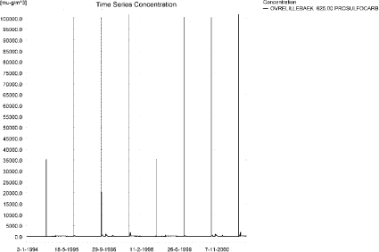
Figure 9.15. Concentration pattern for prosulfocarb in OvreLillebaek, 625 m from upstream end of the sandy loam stream.
Figur 9.15. Koncentrationsmønster for prosulfocarb i Øvre Lillebæk (625 m fra opstrøms ende ) i den øvre del af morænelersoplandet.
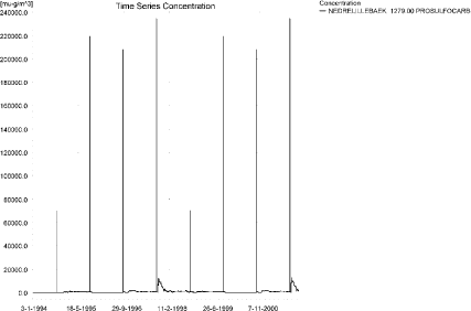
Figure 9.16. Concentration pattern for prosulfocarb in the lower part of the sandy loam catchment.
Figur 9.16. Koncentrationsmønster for prosulfocarb i i den nedre del af morænelersoplandet.
The concentrations in the sandy loam catchment are shown in Figure 9.17 to Figure 9.20 for 25 September at 08:39, 09:00, 10:00 and 12:00 hours after spraying, respectively. It takes about 1.3 day before all pesticide has left the catchment.
The thin black line represents the concentration, while the thick black line shows the maximum concentrations obtained during the simulations. In addition, the outline of the stream is shown.

Figure 9.17. Concentrations in the sandy loam catchment on 25. September 1997, 08:40.
Figur 9.17. Koncentrationer i morænelersoplandet den 25. september-1997, 08.40.
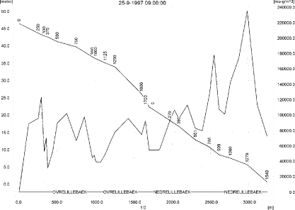
Figure 9.18. Concentrations in the sandy loam catchment on 25. September 1997, 09:00.
Figur 9.18. Koncentrationer i morænelersoplandet den 25. september-1997, 09.00.
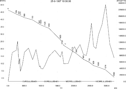
Figure 9.19. Concentrations in the sandy loam catchment on 25 September 1997, 10:00.
Figur 9.19. Koncentrationer i morænelersoplandet den 25. september-1997, 10.00.

Figure 9.20. Concentrations in the sandy loam catchment on 25 September 1997, 12:00.
Figur 9.20. Koncentrationer i morænelersoplandet den 25. september-1997, 12.00.
To be able to extract comparable values to FOCUS SW, the global maxima and time weighted concentrations (up to 7 days) were extracted when these were meaningful. The extracted figures are recorded in Table 9.9.
Figure 9.21 and Figure 9.22 show the concentrations sorbed to macrophytes in the upper and lower part of the sandy loam catchment, respectively.
During periods of the simulation the concentration is significant compared to the concentration in the water phase. The concentration reached is 3.12 µg/l.
Figure 9.23 and Figure 9.24 show the concentration of prosulfocarb in porewater and Figure 9.25 and Figure 9.26 the concentration of pesticide adsorbed to sediment. The maximum concentration reached is quite small, 53 ng/kg. The pattern of sorption to macrophytes follows the pattern of the water concentrations, and the adsorption to sediment follows the concentration in porewater.
Compared to the FOCUS SW D4-stream-scenario, the maximum concentration of PestSurf is much higher, 235 µg/l compared to 13.1 µg/l. The highest concentration reached in both models is caused by drift. The very high concentrations are caused by simultaneous spraying on the total agricultural area within 30 minutes. If the concentration is evaluated 125 m from the upstream end, the concentration reaches 88.0 µg/l. The water depth at the time of spraying is below 3.4 cm.
The sediment concentration reached by the two models differ considerably, 568 ng/kg by FOCUS SW and 53 ng/kg by PestSurf.
Figure 9.27, Figure 9.28, Table 9.10 and Table 9.11 show the results as generated by the PestSurf templates. The maximum value generated by the templates for the upper part of the stream is 2.30 µg/l, and for the lower part is 12.6 µg/l. The maximum value generated in the (upstream part of the) catchment is 3.092 µg/l and for the lower part is 15.4 µg/l. Thus, the templates did not catch the maximum concentration of the PestSurf simulation.
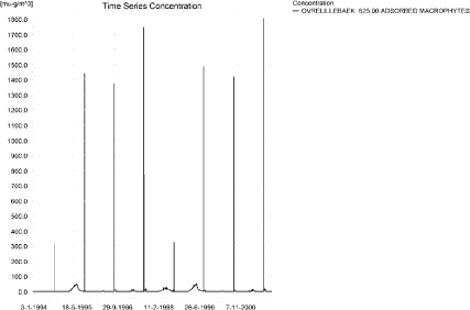
Figure 9.21. Concentration on macrophytes in ng/l in the upper part of the sandy loam catchment.
Figur 9.21. Koncentration på makrofytter i den opstrøms ende af morænelersoplandet.
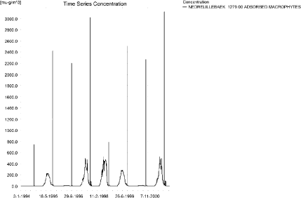
Figure 9.22. Concentration on macrophytes in ng/l in the lower part of the sandy loam catchment.
Figur 9.22. Koncentration på makrofytter i den nedstrøms ende af morænelersoplandet.
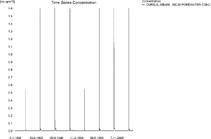
Figure 9.23. Concentration of prosulfocarb in porewater in the upper part of the sandy loam catchment.
Figur 9.23. Porevandskoncentration af prosulfocarb i den øvre del af morænelersoplandet.
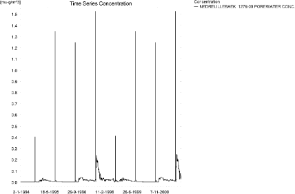
Figure 9.24. Concentration of prosulfocarb in porewater in the lower part of the sandy loam catchment.
Figur 9.24. Porevandskoncentration af prosulfocarb i den nedre del af morænelersoplandet.
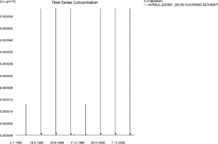
Figure 9.25. Concentration of prosulfocarb on sediment i in the upper part of the sandy laom catchment. The concentration is in µg/g sediment and not µg/m³ as stated.
Figur 9.25. Koncentration af prosulfocarb i sediment i den øvre del af morænelersoplandet. Koncentrationen er i µg/g sediment og ikke µg/m³ som angivet.
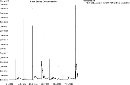
Figure 9.26. Concentration of prosulfocarb on sediment in the lower part of the sandy loam catchment. The concentration is in µg/g sediment and not µg/m³ as stated.
Figur 9.26. Koncentration af prosulfocarb i sediment iden øvre del af morænelersoplandet. Koncentrationen er i µg/g sediment og ikke µg/m³ som angivet.
Table 9.9. Maximum concentrations (ng/l) of prosulfocarb simulated for selected calculation point in the sandy loam catchment.
Tabel 9.9. Maximumskoncentrationer (ng/l) af prosulfocarb for udvalgte lokaliteter i morænelersoplandet.
Click here to see Figure 9.27.
Figure 9.27. Overview for prosulfocarb in the sandy loam catchment generated by the PestSurf excel template for the upstream part of the sandy laom catchment. The detection value was set to 100 ng/l.
Figur 9.27. Oversigt for prosulfocarb genereret med PestSurf-excel-skabelonen for den opstrøms del af morænelersoplandet. Detektionsgrænsen var sat til 100 ng/l.
Click here to see Figure 9.28.
Figure 9.28. Overview for prosulfocarb in the sandy loam catchment generated by the PestSurf excel template for the downstream part of the catchment. The detection value was set to 100 ng/l.
Figur 9.28. Oversigt for prosulfocarb i den nedstrøms del af morænelersoplandet genereret med PestSurf-excel-skabelonen for den opstrøms del af morænelersoplandet. Detektionsgrænsen var sat til 100 ng/l.
Table 9.10. Part of the result sheet generated by the PestSurf Excel sheet for the upstream part of the sandy loam catchment. The lowest detection value is 100 ng/l, toxicity to fish, daphnies and algae are set to 1000, 10000 and 100000 ng/, respectively. The recorded peaks are shown in Figure 9.27.
Tabel 9.10. Uddrag af resultatpresentationen genereret af PestSurf-Excel-arket for den opstrøms del af morænelersoplandet. Detektionsgrænsen for tabelgenerering er sat til 100 ng/l. Toxicitetsværdierne for fisk, dafnier og alger er henholdsvis 1000, 10000 og 100000 ng/l. Hændelserne er vist i Figur 9.27.
Table 9.11. Part of the result sheet generated by the PestSurf Excel sheet for the downstream part of the sandy loam catchment. The lowest detection value is 100 ng/l, toxicity to fish, daphnies and algae are set to 1000, 10000 and 100000 ng/, respectively. The recorded peaks are shown in Figure 9.28.
Tabel 9.11. Uddrag af resultatpresentationen genereret af PestSurf-Excel-arket for den nedstrøms del af morænelersoplandet. Detektionsgrænsen for tabelgenerering er sat til 100 ng/l. Toxicitetsværdierne for fisk, dafnier og alger er henholdsvis 1000, 5000 og 10000 ng/l. Hændelserne er vist i Figur 9.28.
9.4.4 Sandy loam catchment, pond
The concentration pattern is evaluated in the middle of the pond only, see Figure 9.29. The pond receives contributions mainly through drift. The maximum concentration reaches, 4.17 µg/l.

Figure 9.29. Concentrations of prosulfocarb for the sandy loam pond.
Figur 9.29. Koncentration af prosulfocarb i morænelersvandhullet.
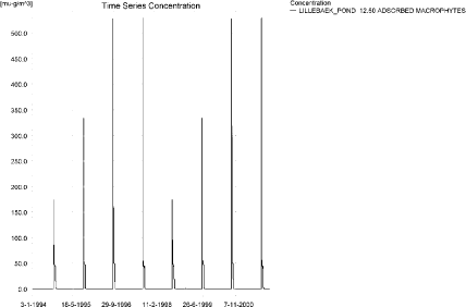
Figure 9.30. Prosulfocarb sorbed to the macrophytes in the sandy loam pond.
Figur 9.30. Prosulfocarb sorberet til makrofytter i morænelersvandhullet.
Figure 9.30 shows that the macrophytes participate in the regulation of the concentrations in the pond, as the concentration level is significant compared to the concentration level in the water phase. The pore water concentration reaches 1.42 ng/l and is shown in Figure 9.31. The concentration in the sediment is shown in Figure 9.32. The maximum concentration reached is 77 ng/kg.
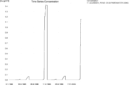
Figure 9.31. Concentration of prosulfocarb in porewater in the sandy loam pond.
Figur 9.31. Porevandskoncentration af prosulfocarb i morænelersvandhullet.
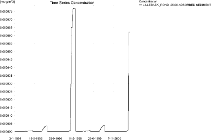
Figure 9.32. Prosulfocarb sorbed to the sediment in the sandy loam pond. The concentration is in µg/g sediment and not µg/m³ as stated.
Figur 9.32. Prosulfocarb sorberet til sediment i morænelersvandhullet i Koncentrationen er i µg/g sediment og ikke µg/m³ som angivet.
In Table 9.12, global maxima and time weighted concentrations (up to 7 days) were extracted.
Table 9.12. Actual and time weighted concentrations (ng/l) of prosulfocarb in the sandy loam pond.
Tabel 9.12. Beregnede og tidsvægtede koncentrationer (ng/l) af prosulfocarb i morænelersvandhullet.
| Year | Prosulfocarb | actual | Time-weighted | Date |
| 1994 | global max | 955 | 25-09-1994 | |
| 1 hour(after max) | 772 | 848 | ||
| 1 day after sp.in. | 421 | 536 | ||
| 3 days | 271 | 398 | ||
| 4 days | 238 | 362 | ||
| 7 days | 193 | 297 | ||
| 1995 | Global max | 2172 | 25-09-1995 | |
| 1 hour | 1515 | 1770 | ||
| 1 day | 505 | 798 | ||
| 2 days | 266 | 498 | ||
| 4 days | 230 | 435 | ||
| 7 days | 190 | 336 | ||
| 1996 | global max | 4158 | 25-09-1996 | |
| 1 hour | 2270 | 2917 | ||
| 1 day | 503 | 947 | ||
| 2 days | 259 | 540 | ||
| 4 days | 229 | 465 | ||
| 7 days | 198 | 355 | ||
| 1997 | global max | 4170 | 25-09-1997 | |
| 1 hour | 2271 | 2921 | ||
| 1 day | 490 | 939 | ||
| 2 days | 241 | 526 | ||
| 4 days | 209 | 450 | ||
| 7 days | 177 | 338 | ||
| 1998 | global max | 956 | 24-09-1998 | |
| 1 hour | 773 | 849 | ||
| 1 day | 421 | 536 | ||
| 2 days | 271 | 398 | ||
| 4 days | 239 | 362 | ||
| 7 days | 193 | 298 | ||
| 1999 | global max | 2172 | 24-09-1999 | |
| 1 hour | 1515 | 1770 | ||
| 1 day | 505 | 799 | ||
| 2 days | 267 | 499 | ||
| 4 days | 231 | 436 | ||
| 7 days | 191 | 337 | ||
| 2000 | global max | 4158 | 24-09-2000 | |
| 1 hour | 2270 | 2919 | ||
| 1 day | 501 | 945 | ||
| 2 days | 256 | 538 | ||
| 4 days | 225 | 463 | ||
| 7 days | 194 | 352 | ||
| 2001 | global max | 4170 | 24-09-2001 | |
| 1 hour | 2271 | 2919 | ||
| 1 day | 489 | 938 | ||
| 2 days | 239 | 525 | ||
| 4 days | 208 | 449 | ||
| 7 days | 176 | 337 | ||
| max values | ||||
| global max | 4170 | |||
| 1 hour | 2271 | 2921 | ||
| 1 day | 505 | 947 | ||
| 2 days | 271 | 540 | ||
| 4 days | 239 | 465 | ||
| 7 days | 198 | 355 |
Figure 9.33 and Table 9.13 show output from the PestSurf template, with a time series identical to Figure 9.29.
The FOCUS SW-scenario D4-pond generates a concentration of 0.524 µg/l, which is considerably lower than the PestSurf sandy loam pond-concentration of 4.17 µg/l. The water depth at the time of maximum concentration is 23 cm. The difference in exposure and depth accounts for a factor of about 10, and the difference between the two models is therefore justified.
With respect to sediment concentrations the difference is also substantial, 0.568 µg/kg against 0.077 µg/kg in PestSurf.
The water concentration is influenced by macrophytes in this case – about 1/8 of the total concentration above the sediment is present in the macrophytes.
Click here to see Figure 9.33.
Figure 9.33. Overview for prosulfocarb in the sandy loam pond generated by the PestSurf excel template. The time series shown is identical to the one in Figure 9.29. The lowest detection value used is 1 ng/l.
Figur 9.33. Oversigt for prosulfocarb i morænelersvandhullet genereret med PestSurf-excel-skabelonen. Den viste tidsserie er mage til den i Figur 9.29. Detektionsgrænsen er sat til 1 ng/l.
Click here to see Figure 9.34.
Figure 9.34. Overview for prosulfocarb in the sandy loam pond generated by the PestSurf excel template. The time series shown is identical to the one in Figure 9.29. The lower right figure differs from Figure 9.33. The toxicity value used for the lower right figure is 10 ng/l.
Figur 9.34. Oversigt for prosulfocarb i morænelersvandhullet genereret med PestSurf-excel-skabelonen. Den viste tidsserie er mage til den i Figur 9.29. Figuren nederst til højre afviger fra Figur 9.33. Toxicitetsværdien anvendt i figuren nederst til højre er sat til 10 ng/l.
Table 9.13. Part of the result sheet generated by the PestSurf Excel sheet. The detection value was set to 1 ng/l and the toxicity values for fish, daphnies and algae were set to 10, 100 and 1000 ng/l, respectively. The recorded peaks are shown in Figure 9.33.
Tabel 9.13. Uddrag af resultatpresentationen genereret af PestSurf-Excel-arket. Detektionsgrænsen er sat til 1 ng/l. Toxicitetsværdierne for fisk, dafnier og alger er henholdsvis 10, 100 og 1000 ng/l. De tabellerede hændelser er vist i Figur 9.33.
Table 9.14. Summary of simulation results for Prosulfocarb.
Tabel 9.14. Opsummerede resultater for prosulfocarb.
9.5 Summary of simulations
The maximum actual concentrations for all simulations are recorded in Table 9.14.
The concentration in the sandy pond is lower than for the D3 ditch, which is lower than for the sandy stream. The high concentration in the sandy stream is caused by simultaneous spraying of all agricultural areas within 30 minutes. The concentration 112 m from the upstream end reaches 6.50 µg/l, which is more comparable to the 15.2 µg/l found in the D3-ditch. The PestSurf concentration is, however, caused by a combination of a reduced dose due to a buffer zone of 20 m and a water depth of 6-7 cm.
The FOCUS SW-scenario D4-pond generates a concentration of 0.524 µg/l, which is considerably lower than the PestSurf sandy loam pond-concentration of 4.17 µg/l. The water depth at the time of maximum concentration is 23 cm. The difference in exposure and depth accounts for a factor of about 10, and the difference between the two models is therefore justified.
Compared to the FOCUS SW D4- stream-scenario, the maximum concentration of PestSurf is much higher, 235 µg/l compared to 13.1 µg/l. The highest concentration reached in both models are caused by drift. The very high concentrations are caused by simultaneous spraying on the total agricultural area within 30 minutes. If the concentration is evaluated 125 m from the upstream end, the concentration reaches 88.0 µg/l. The water depth at the time of spraying is below 3.4 cm. The maximum concentration reached between 500 and 1700 m from the upstream end is 102 µg/l.
Macrophytes do influence the concentrations but only to a small extent. The concentrations in sediment are substantially lower than what is calculated by FOCUS SW.
Annex 10
10 Comparison of risk assessment data produced by spray drift assessments, FOCUS SW and PestSurf
10.1 Chemical characteristics of the compound
| Compound: | Rimsulfuron |
| Dose: | 30 g ai/ha |
| Spraying time: | 17th June |
| Crop: | Potatoes |
Table 10.1. Overview of chemical properties of rimsulfuron and the parameters used in the simulations.
Tabel 10.1. Oversigt over rimsulfuron s kemiske egenskaber og parametrene brugt i simuleringerne.
| Chemical property | Condition | Recalculated values | |||
| Cas-no. | 122931-48-0 | ||||
| Molecular weight | 431.45 | ||||
| Form (acid, basic, neutral) | acid | ||||
| pKa | 4 | ||||
| Water solubility | 7.3 g/l | pH 7 | |||
| log Kow | 0.288 | at pH | 5 | KowA- | -1.87 |
| log Kow | -1.46 | at pH | 7 | KowAH | 1.32 |
| log Kow | at pH | KowAH+ | |||
| Vapor pressure, Pa | 8.9 × 10⁻⁷ | 20°C | 270°C (Decomposition) | vapor pressure, Pa, 20°C | |
| Henry’s law constant | 4.6 × 10⁻⁶ Pa m³ mol-1 | 25°C | pH 5 | Recalculated value, dimensionless | |
| 8,3 × 10⁻⁸ Pa m³ mol-1 | 25°C | pH 7 | 3.35 x 10⁻¹¹ | ||
| 1.1 × 10⁻⁷ Pa m³ mol-1 | 25°C | pH 9 | |||
| Sorption properties in soil | |||||
| Freundlich exp | 1 | ||||
| Koc, l/kg | 42.4 | ||||
| DT50 in soil, days | 16.8 | ||||
| DT50water | 4 days | PestSurf input | |||
| DT50sedment | 10.5 days | ||||
| DT50water/sediment | 6 days | method not described | DT50, days | 6 | |
| Sediment konc., µg/l | 80 (default in PestSurf) | ||||
| Hydrolysis | 4.7 | at pH 5 | (acid) | 7.49 × 10⁻⁵ | |
| 7.3 | at pH 7 | (neutral) | 12.6 | ||
| 4.2 | at pH 9 | (basic) | 1.77 × 10⁻⁶ | ||
| Photolysis | |||||
| quantum yield | |||||
| Spectrum | pH 5.0 ε | ||||
| λ: 240: 2.24e4 l.mol-1.cm-1 λ 290: 4.81e2 l.mol-1.cm-1 PestSurf allows spectrum to be defined from 295-300 nm: so 481 is specified for this range. |
|||||
| Other | Rimsulfuron (25°C, natural sunlight: 39° 40’ N): pH 5: 1.1 d, pH 7: 11.7 d, pH 9: 11.1 h | ||||
10.2 Concentration generated by spray
| Direct spray | FOCUS buffer zones | |||
| Ditch | Stream | Pond | ||
| µg l-1 | µg l-1 | µg l-1 | µg l-1 | |
| Rimsulfuron | 10.0 | 0.213 | 0.155 | 0.075 |
10.3 Concentrations generated by FOCUS SW
10.3.1 D3- Ditch
| Rimsulfuron | Ditch, D3 | |||||||
| Water | Sediment | |||||||
| Date | PEC | Date | TWAEC | Date | PEC | Date | TWAEC | |
| µg l-1 | µg l-1 | µg kg-1 | µg kg-1 | |||||
| Global max | 26-jun-92 | 0.159 | 27-jun-92 | 0.018 | ||||
| 1 d | 27-jun-92 | 0.063 | 27-jun-92 | 0.117 | 28-jun-92 | 0.012 | 27-jun-92 | 0.017 |
| 2 d | 28-jun-92 | 0.007 | 28-jun-92 | 0.072 | 29-jun-92 | 0.009 | 28-jun-92 | 0.015 |
| 4 d | 30-jun-92 | 0.002 | 30-jun-92 | 0.038 | 01-jul-92 | 0.006 | 30-jun-92 | 0.012 |
| 7 d | 03-jul-92 | 0.002 | 03-jul-92 | 0.022 | 04-jul-92 | 0.004 | 03-jul-92 | 0.009 |
10.3.2 D4 – Stream
| Rimsulfuron | Stream, D4 | |||||||
| Water | Sediment | |||||||
| Date | PEC | Date | TWAEC | Date | PEC | Date | TWAEC | |
| µg l-1 | µg l-1 | µg kg-1 | µg kg-1 | |||||
| Global max | 21-jun-85 | 0.132 | 25-jul-85 | 0.023 | ||||
| 1 d | 22-jun-85 | 0.008 | 24-jul-85 | 0.069 | 26-jul-85 | 0.022 | 26-jul-85 | 0.023 |
| 2 d | 23-jun-85 | 0.008 | 24-jul-85 | 0.067 | 27-jul-85 | 0.022 | 26-jul-85 | 0.023 |
| 4 d | 25-jun-85 | 0.008 | 26-jul-85 | 0.059 | 29-jul-85 | 0.021 | 04-aug-85 | 0.022 |
| 7 d | 28-jun-85 | 0.007 | 29-jul-85 | 0.049 | 01-aug-85 | 0.023 | 05-aug-85 | 0.022 |
10.3.3 D4 - Pond
| Rimsulfuron | Pond, D4 | |||||||
| Water | Sediment | |||||||
| Date | PEC | Date | TWAEC | Date | PEC | Date | TWAEC | |
| µg l-1 | µg l-1 | µg kg-1 | µg kg-1 | |||||
| Global max | 02-aug-85 | 0.012 | 02-jan-86 | 0.007 | ||||
| 1 d | 03-aug-85 | 0.012 | 03-aug-85 | 0.012 | 03-jan-86 | 0.007 | 03-jan-86 | 0.007 |
| 2 d | 04-aug-85 | 0.011 | 03-aug-85 | 0.012 | 04-jan-86 | 0.007 | 03-jan-86 | 0.007 |
| 4 d | 06-aug-85 | 0.01 | 04-aug-85 | 0.011 | 06-jan-86 | 0.007 | 04-jan-86 | 0.007 |
| 7 d | 09-aug-85 | 0.007 | 06-aug-85 | 0.011 | 09-jan-86 | 0.006 | 06-jan-86 | 0.007 |
10.3.4 Conclusion – FOCUS SW
The highest concentration is generated in the ditch (D3). It is caused by wind drift and the concentration becomes 0.159 µg/l. The D4-stream scenario shows the highest concentration in the sediment, 0.023 µg/l. For all scenarios, the concentrations are lower than what is generated by the simpler assessments, but for the ditch and stream-scenarios the difference between the simple drift calculation and the FOCUS SW-simulation is rather small.
10.4 PestSurf
10.4.1 Sandy Catchment, stream
The distribution of concentrations was assessed in several steps. First, the maximum concentrations at each calculation point were listed, and the dates for the occurrence of the maximum were assessed. The points, for which the maximum value also represents a local maximum were selected for further analysis. The relevant values are listed in Table 10.2.
Table 10.2. Maximum concentrations (ng/l) of rimsulfuron simulated for each calculation point in the sandy catchment.
Tabel 10.2. Maximumkoncentrationer (ng/l) af rimsulfuron simuleret for hvert beregningspunkt i det sandede opland.
| RIMSULFURON | Maximum | Max. Time | Local maxima |
| ODDERBAEK 0.00 | 50 | 19-06-1998 09:18 | |
| ODDERBAEK 56.00 | 53 | 19-06-1998 09:08 | |
| ODDERBAEK 112.00 | 64 | 19-06-1998 09:00 | |
| ODDERBAEK 192.00 | 136 | 19-06-1998 08:41 | |
| ODDERBAEK 272.00 | 216 | 19-06-1998 08:33 | |
| ODDERBAEK 278.00 | 225 | 19-06-1998 08:33 | |
| ODDERBAEK 282.00 | 232 | 19-06-1998 08:33 | |
| ODDERBAEK 298.50 | 249 | 19-06-1998 08:33 | |
| ODDERBAEK 315.00 | 268 | 19-06-1998 08:33 | |
| ODDERBAEK 317.50 | 271 | 19-06-1998 08:33 | |
| ODDERBAEK 320.00 | 274 | 19-06-1998 08:33 | |
| ODDERBAEK 410.00 | 359 | 19-06-1998 08:33 | |
| ODDERBAEK 500.00 | 404 | 19-06-1998 08:33 | |
| ODDERBAEK 513.00 | 424 | 19-06-1998 08:33 | |
| ODDERBAEK 521.00 | 438 | 19-06-1998 08:33 | |
| ODDERBAEK 622.00 | 519 | 19-06-1998 08:33 | |
| ODDERBAEK 723.00 | 582 | 19-06-1998 08:33 | |
| ODDERBAEK 733.00 | 600 | 19-06-1998 08:33 | |
| ODDERBAEK 742.00 | 610 | 19-06-1998 08:33 | |
| ODDERBAEK 789.50 | 639 | 19-06-1998 08:33 | |
| ODDERBAEK 837.00 | 667 | 19-06-1998 08:33 | |
| ODDERBAEK 848.00 | 679 | 19-06-1998 08:33 | |
| ODDERBAEK 863.00 | 693 | 19-06-1998 08:33 | |
| ODDERBAEK 956.00 | 741 | 19-06-1998 08:33 | |
| ODDERBAEK 1049.00 | 747 | 19-06-1998 08:33 | x |
| ODDERBAEK 1111.50 | 723 | 25-06-2001 08:33 | |
| ODDERBAEK 1174.00 | 657 | 25-06-2005 08:32 | |
| ODDERBAEK 1226.00 | 616 | 25-06-2005 08:32 | |
| ODDERBAEK 1278.00 | 599 | 25-06-2005 08:42 | |
| ODDERBAEK 1293.50 | 591 | 25-06-2005 08:42 | |
| ODDERBAEK 1310.00 | 578 | 25-06-2005 08:42 | |
| ODDERBAEK 1421.00 | 551 | 25-06-2005 08:51 | |
| ODDERBAEK 1532.00 | 477 | 19-06-1998 08:33 | |
| ODDERBAEK 1558.06 | 433 | 19-06-1998 08:33 | |
| ODDERBAEK 1584.12 | 414 | 19-06-1998 08:41 | |
| ODDERBAEK 1584.12 | 414 | 19-06-1998 08:41 | |
| ODDERBAEK 1621.06 | 414 | 19-06-1998 08:33 | |
| ODDERBAEK 1658.00 | 425 | 19-06-1998 08:33 | |
| ODDERBAEK 1698.50 | 440 | 19-06-1998 08:33 | |
| ODDERBAEK 1739.00 | 449 | 19-06-1998 08:33 | x |
| ODDERBAEK 1801.50 | 435 | 19-06-1998 08:33 | |
| ODDERBAEK 1864.00 | 356 | 17-06-2004 08:33 | |
| ODDERBAEK 1977.00 | 271 | 17-06-2000 09:54 | |
| ODDERBAEK 2090.00 | 265 | 17-06-2000 10:00 | |
| ODDERBAEK 2098.00 | 265 | 17-06-2000 10:00 | |
| ODDERBAEK 2105.00 | 264 | 17-06-2000 10:00 | |
| ODDERBAEK 2131.00 | 263 | 17-06-2000 10:00 | |
| ODDERBAEK 2157.00 | 260 | 17-06-2000 10:00 | |
| ODDERBAEK 2168.00 | 258 | 17-06-2000 10:00 | |
| ODDERBAEK 2179.00 | 257 | 17-06-2000 10:00 | |
| ODDERBAEK 2268.50 | 253 | 17-06-2004 10:00 | |
| ODDERBAEK 2358.00 | 239 | 17-06-2004 10:00 | |
| ODDERBAEK 2363.50 | 238 | 17-06-2004 10:00 | |
| ODDERBAEK 2372.00 | 237 | 17-06-2004 10:00 | |
| ODDERBAEK 2427.00 | 234 | 17-06-2004 10:00 | |
| ODDERBAEK 2482.00 | 228 | 17-06-2004 10:00 | |
| ODDERBAEK 2609.00 | 225 | 25-06-2001 11:00 | |
| ODDERBAEK 2736.00 | 213 | 17-06-2000 11:00 | |
| ODDERBAEK 2831.00 | 211 | 17-06-2000 11:00 | |
| ODDERBAEK 2926.00 | 198 | 17-06-2000 11:00 | |
| ODDERBAEK 2958.50 | 195 | 17-06-2004 11:00 | |
| ODDERBAEK 2991.00 | 193 | 17-06-2004 11:00 | |
| ODDERBAEK 3029.50 | 187 | 17-06-2004 11:00 | |
| ODDERBAEK 3068.00 | 177 | 17-06-2004 11:00 | |
| ODDERBAEK 3131.00 | 165 | 17-06-2004 11:00 | |
| ODDERBAEK 3194.00 | 154 | 17-06-2000 12:00 | |
| ODDERBAEK 3250.50 | 153 | 17-06-2004 12:00 | |
| ODDERBAEK 3307.00 | 153 | 19-06-1998 08:33 | |
| ODDERBAEK 3315.00 | 155 | 19-06-1998 08:33 | |
| ODDERBAEK 3323.00 | 161 | 19-06-1998 08:33 | |
| ODDERBAEK 3355.50 | 179 | 19-06-1998 08:33 | |
| ODDERBAEK 3388.00 | 200 | 19-06-1998 08:33 | |
| ODDERBAEK 3438.50 | 231 | 19-06-1998 08:33 | |
| ODDERBAEK 3489.00 | 246 | 19-06-1998 08:33 | |
| ODDERBAEK 3499.50 | 247 | 19-06-1998 08:33 | x |
| ODDERBAEK 3510.00 | 247 | 19-06-1998 08:33 | |
| ODDERBAEK 3581.00 | 244 | 19-06-1998 08:33 | |
| ODDERBAEK 3652.00 | 219 | 19-06-1998 08:33 | |
| ODDERBAEK 3707.00 | 206 | 19-06-1998 08:41 | |
| ODDERBAEK 3762.00 | 192 | 19-06-1998 08:41 | |
| ODDERBAEK 3790.00 | 170 | 19-06-1998 08:41 | |
| ODDERBAEK 3818.00 | 137 | 19-06-1998 08:41 | |
| ODDERBAEK 3818.00 | 137 | 19-06-1998 08:41 | |
| ODDERBAEK 3884.00 | 131 | 19-06-1998 08:41 | |
| ODDERBAEK 3950.00 | 125 | 19-06-1998 08:51 | |
| ODDERBAEK 3998.00 | 117 | 19-06-1998 08:51 | |
| ODDERBAEK 4046.00 | 109 | 19-06-1998 09:00 | |
| ODDERBAEK 4047.50 | 109 | 19-06-1998 09:00 | |
| ODDERBAEK 4049.00 | 109 | 19-06-1998 09:00 | |
| ODDERBAEK 4052.50 | 109 | 19-06-1998 09:00 | |
| ODDERBAEK 4056.00 | 109 | 19-06-1998 09:00 | |
| ODDERBAEK 4058.00 | 109 | 19-06-1998 09:00 | |
| ODDERBAEK 4060.00 | 109 | 19-06-1998 09:00 | |
| ODDERBAEK 4080.00 | 108 | 25-06-2005 09:00 | |
| ODDERBAEK 4100.00 | 108 | 25-06-2005 09:00 | |
| ODDERBAEK 4134.00 | 109 | 25-06-2005 09:00 | |
| ODDERBAEK 4168.00 | 109 | 25-06-2005 09:00 | |
| GISLUM_ENGE_AFLOEB 0.00 | 5 | 01-04-1999 00:00 | |
| GISLUM_ENGE_AFLOEB 50.00 | 7 | 01-04-1999 00:00 | |
| GISLUM_ENGE_AFLOEB 100.00 | 6 | 01-04-1999 00:00 | |
| GISLUM_ENGE_AFLOEB 150.00 | 7 | 31-03-1999 00:00 | |
| GISLUM_ENGE_AFLOEB 200.00 | 6 | 25-03-1999 00:00 | |
| GISLUM_ENGE_AFLOEB 250.00 | 7 | 25-03-1999 00:00 | |
| GISLUM_ENGE_AFLOEB 300.00 | 7 | 01-04-1999 00:00 | |
| GISLUM_ENGE_AFLOEB 340.00 | 7 | 01-04-1999 00:00 | |
| GISLUM_ENGE_AFLOEB 380.00 | 7 | 01-04-1999 00:00 | |
| GISLUM_ENGE_AFLOEB 430.00 | 7 | 31-03-1999 00:00 | |
| GISLUM_ENGE_AFLOEB 480.00 | 7 | 31-03-1999 00:00 | |
| GISLUM_ENGE_AFLOEB 530.00 | 7 | 31-03-1999 00:00 | |
| GISLUM_ENGE_AFLOEB 580.00 | 7 | 31-03-1999 00:00 | |
| GISLUM_ENGE_AFLOEB 630.00 | 7 | 02-04-1999 00:00 | |
| GISLUM_ENGE_AFLOEB 680.00 | 7 | 02-04-1999 00:00 | |
| GISLUM_ENGE_AFLOEB 730.00 | 7 | 02-04-1999 00:00 | |
| GISLUM_ENGE_AFLOEB 780.00 | 7 | 02-04-1999 00:00 | |
| GISLUM_ENGE_AFLOEB 830.00 | 7 | 02-04-1999 00:00 | |
| GISLUM_ENGE_AFLOEB 880.00 | 7 | 02-04-1999 00:00 | |
| GISLUM_ENGE_AFLOEB 915.00 | 8 | 02-04-1999 00:00 | |
| GISLUM_ENGE_AFLOEB 950.00 | 8 | 02-04-1999 00:00 | |
| GISLUM_ENGE_AFLOEB 985.00 | 8 | 02-04-1999 00:00 | |
| GISLUM_ENGE_AFLOEB 1020.00 | 8 | 02-04-1999 00:00 | |
| GISLUM_ENGE_AFLOEB 1045.00 | 8 | 02-04-1999 00:00 | |
| GISLUM_ENGE_AFLOEB 1070.00 | 8 | 02-04-1999 00:00 | |
| GISLUM_ENGE_AFLOEB 1110.00 | 8 | 02-04-1999 00:00 | |
| GISLUM_ENGE_AFLOEB 1150.00 | 8 | 02-04-1999 00:00 | |
| GISLUM_ENGE_AFLOEB 1190.00 | 8 | 02-04-1999 00:00 | |
| GISLUM_ENGE_AFLOEB 1230.00 | 7 | 02-04-1999 00:00 | |
| GISLUM_ENGE_AFLOEB 1271.00 | 7 | 02-04-1999 00:00 | |
| GISLUM_ENGE_AFLOEB 1312.00 | 7 | 02-04-1999 00:00 | |
| GISLUM_ENGE_AFLOEB 1422.00 | 29 | 19-06-1998 08:51 | |
| GISLUM_ENGE_AFLOEB 1532.00 | 137 | 19-06-1998 08:41 | |
| TILLOEB 0.00 | 399 | 19-06-1998 08:41 | |
| TILLOEB 20.16 | 408 | 19-06-1998 08:41 | |
| TILLOEB 40.31 | 414 | 19-06-1998 08:41 | x |
| global max | 747 |
The pattern over time was the same for all calculation points. The peak values are generated by wind drift contributions, see Figure 10.1. However, small drainage contributions are visible, particularly after wet winters. The concentrations reach 747 ng/l.
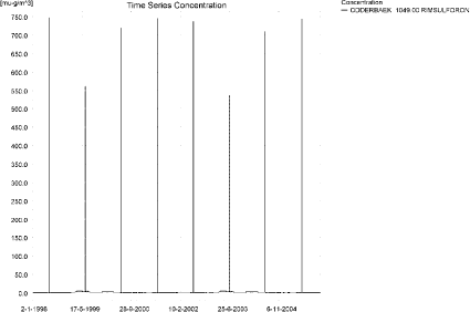
Figure 10.1. Concentration pattern over time for rimsulfuron in the sandy catchment, 1049 m from the upstream end. The concentration patterne is representative for the entire catchment.
Figur 10.1. Koncentrationsmønster som funktion af tid for rimsulfuron i det sandede opland, 1049 m fra den opstrøms ende. Koncentrationsmønsteret er repræsentativt for hele oplandet.
The time of maximum concentration differ along the stream, see Figure 10.2 to Figure 10.5 and Table 10.2. The thin black line represents the concentration, while the thick black dotted line shows the maximum concentrations obtained during the simulations. In addition, the outline of the stream is shown. Four plots of 19 June 1998, producing maximum concentrations in the upper and middle section of the stream are shown.
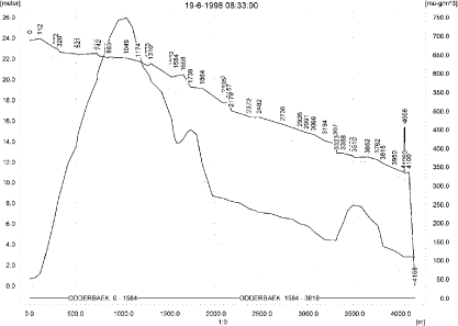
Figure 10.2. Concentrations of rimsulfuron in the sandy catchment on 19. June, 1998, 8.33. The concentration peaks in the upstream end
Figur 10.2. Koncentrationer rimsulfuron i det sandede opland den 19. juni 1998, 8.33.

Figure 10.3. Concentrations of rimsulfuron in the sandy catchment on 19. June, 1998, 8.51.
Figur 10.3. Koncentrationer rimsulfuron i det sandede opland den 19. juni 1998, 8.51.
Figure 10.4. Concentrations of rimsulfuron in the sandy catchment on 19. June, 1998, 9.00.
Figur 10.4. Koncentrationer Rimsulfuron i det sandede opland den 19. juni 1998, 9.00.
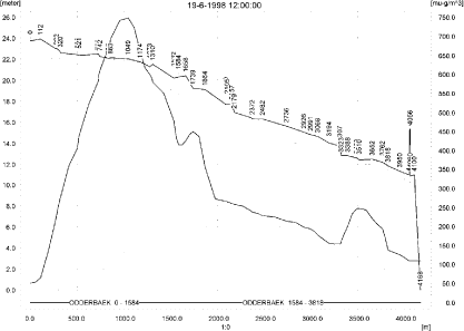
Figure 10.5. Concentrations of rimsulfuron in the sandy catchment on 19. June, 1998, 12.00.
Figur 10.5. Koncentrationer rimsulfuron i det sandede opland den 19. juni 1998, 12.00.
In order to present the data in a similar fashion to the FOCUS SW-results, data were extracted and recalculated for the time series marked in Table 10.2. The global maxima and time weighted concentrations (up to 7 days) were extracted and are reported in Table 10.3. Note that the unit is ng/l.
Table 10.3. Instantaneous and time-weighted concentration (ng/l) of rimsulfuron at selected points in the sandy stream.
Tabel 10.3. Beregnet og tidsvægtet koncentration af rimsulfuron, ng/l, på udvalgte lokaliteter i det sandede vandløb.
The pattern of pesticide sorbed to macrophytes can be seen in Figure 10.6. The pattern more or less follows the concentration in the water and the maximum concentration reached is 44 ng/l. The pattern of concentrations in pore water and sediment is shown in Figure 10.7 and Figure 10.8. The maximum concentration in sediment was calculated to be 0.51 ng/kg.

Figure 10.6. Typical concentration pattern for rimsulfuron sorbed on macrophytes.
Figur 10.6. Typisk koncentrationsmønster for rimsulfuron sorberet på makrofytter.
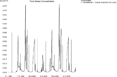
Figure 10.7. Example of concentration pattern for rimsulfuron in pore water in the sandy catchment. The highest concentration reached is 0.121 ng/l 56 m from the upstream end.
Figur 10.7. Eksempel på koncentrationsmønstre for for rimsulfuron i porevand i det sandede opland. Den højest opnåede koncentration er 0.121 ng/l 56 m fra den opstrøms ende.
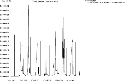
Figure 10.8. Concentration pattern for rimsulfuron sorbed to sediment in the sandy catchment. The concentration is in µg/g sediment and not µg/m³ as stated. The maximum concentration, 0.51 ng/kg, is reached 56 m from the upstream end.
Figur 10.8. Koncentrationsmønster for rimsulfuron sorberet til sediment i det sandede vandløb. Koncentrationen er i µg/g og ikke i µg/m³ som angivet. Maximumskoncentrationen, 0.51 ng/kg opnås 56 m fra den opstrøms ende.
The global maximum value calculated by PestSurf for the sandy catchment in the water phase is 747 ng/l. This is more than what is found in the D3-ditch scenario (159 ng/l). The concentration in sediment is low in both cases, but very low in the PestSurf calculation, 0.51 ng/kg against 18 ng/kg in the FOCUS D3-ditch.
Figure 10.9 shows the output of the PestSurf Excel template. The template works with pre-defined data extraction points. The plot requires specification of a “lowest detection value” (ldc) which defines when a pesticide occurrence is defined as an event. The time series plot is identical to the time series shown earlier, and the graph in the upper right corner resembles the plots in Figure 10.2 to Figure 10.5, but takes into account a longer period of time. A curve is generated when a downstream point reaches a concentration higher than the ldc. The programme then tracks the highest concentration for each calculation point in the stream within the last 24 hours. The plot in the lower right corner shows how many events have concentrations higher than a given value (ldc) for the selected monitoring points.
Table 10.4 shows part of the result sheet generated by the PestSurf Excel sheet based on the ldc-value. The selected table shows the point along the stream (of the pre-defined points) with the highest concentration. This value was, however, only 414 ng/l. Thus, the pre-defined points have not caught the highest concentration of the simulation, which was 747 ng/l.
Click here to see Figure 10.9.
Figure 10.9. Overview for rimsulfuron in the sandy catchment generated by the PestSurf excel template. The maximum concentrations generated over the 24 hours are similar to to the overviews in Figure 10.2 to Figure 10.5. The graph to the lower right shows how many events have concentrations higher than a given value for the selected monitoring points. Detection value was set to 0.5 ng/l.
Figur 10.9. Oversigt for rimsulfuron i det sandede opland genereret med PestSurf-excel-skabelonen. Den maximale koncentration genereret over 24 timer svarer til oversigten i Figur 10.2 til Figur 10.5. Grafen nederst til højre viser hvor mange hænderlser, der har koncentrationer størrre end end given værdi for de fordefinerede lokaliteter. Detektionsgrænsen var sat til 0.5 ng/l.
Table 10.4. Part of the result sheet generated by the PestSurf Excel sheet. The selected table shows the point along the stream with the highest concentration recorded. The lowest detection value is 0.5 ng/l, toxicity to fish, daphnies and algae are set to 1, 10 and 100 ng/l, respectively. The recorded peaks are shown in Figure 10.9.
Tabel 10.4. Uddrag af resultatpresentationen genereret af PestSurf-Excel-arket. Den udvalgte tabel viser det fordefinerede punkt langs med åen med højest koncentration. Detektionsgrænsen er sat til 0.5 ng/l mens toxicitetsværdierne for fisk, dafnier og alger er henholdsvis 1, 10 og 100 ng/l. De tabellerede hændelser er vist i Figur 10.9.
10.4.2 Sandy Catchment, pond
The concentration pattern is evaluated in the middle of the pond only, see Figure 10.10. The pond receives drift but the contribution through groundwater dominates the picture during the whole simulation period. The maximum concentration is 32.1 ng/l. The top occurs 6-7. July 1999. Spraying was carried out the 22 June, and it rained every day from 25 June to 6 July, notably on 27 June (14.7 mm), 30 June (8.7 mm) and 6 July (31.6 mm), in total 78 mm.
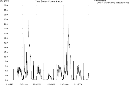
Figure 10.10. Concentrations of rimsulfuron in the sandy pond.
Figur 10.10. Koncentration af rimsulfuoron i det sandede vandhul.
In Table 10.5, global maxima and time weighted concentrations (up to 7 days) were extracted.
Table 10.5. Maximum concentrations of rimsulfuron (ng/l) generated in the sandy pond.
Tabel 10.5. maximumkoncentrationer af rimsulfuron (ng/l) genereret for det sandede vandhul.
| Year | ODDER_POND 20.00, | |||
| Conc. | TWC | Date | ||
| 1998 | 1998 (global max) | 6 | 22-10-1998 | |
| 1 hour (after max) | ||||
| 1 day after sp.in. | 6 | 6 | ||
| 2 days | 6 | 6 | ||
| 4 days | 6 | 6 | ||
| 7 days | 5 | 6 | ||
| 1999 | 1999 (global max) | 32 | 08-07-1999 | |
| 1 hour (after max) | 32 | 32 | ||
| 1 day after sp.in. | 28 | 31 | ||
| 2 days | 20 | 26 | ||
| 4 days | 17 | 24 | ||
| 7 days | 10 | 19 | ||
| 2000 | 2000 (global max) | 17 | 02-01-2000 | |
| 1 hour (after max) | ||||
| 1 day after sp.in. | 16 | 17 | ||
| 2 days | 14 | 16 | ||
| 4 days | 14 | 16 | ||
| 7 days | 15 | 15 | ||
| 2001 | 2001 (global max) | 7 | 25-06-2001 | |
| 1 hour (after max) | 6 | 6 | ||
| 1 day after sp.in. | 4 | 5 | ||
| 2 days | 2 | 3 | ||
| 4 days | 1 | 3 | ||
| 7 days | 0 | 2 | ||
| 2002 | 2002 (global max) | 7 | 22-10-2002 | |
| 1 hour (after max) | ||||
| 1 day after sp.in. | 7 | 7 | ||
| 2 days | 6 | 6 | ||
| 4 days | 6 | 6 | ||
| 7 days | 6 | 6 | ||
| 2003 | 2003 (global max) | 32 | 08-07-2003 | |
| 1 hour (after max) | 32 | 32 | ||
| 1 day after sp.in. | 28 | 31 | ||
| 2 days | 20 | 26 | ||
| 4 days | 17 | 24 | ||
| 7 days | 10 | 19 | ||
| 2004 | 2004 (global max) | 17 | 02-01-2004 | |
| 1 hour (after max) | ||||
| 1 day after sp.in. | 17 | 17 | ||
| 2 days | 15 | 16 | ||
| 4 days | 15 | 16 | ||
| 7 days | 15 | 15 | ||
| 2005 | 2005 (global max) | 7 | 25-06-2005 | |
| 1 hour (after max) | 6 | 6 | ||
| 1 day after sp.in. | 4 | 5 | ||
| 2 days | 2 | 3 | ||
| 4 days | 1 | 3 | ||
| 7 days | 0 | 2 | ||
| Global max | 32 | |||
| 1 hour (after max) | 32 | 32 | ||
| 1 day after sp.in. | 28 | 31 | ||
| 2 days | 20 | 26 | ||
| 4 days | 17 | 24 | ||
| 7 days | 15 | 19 | ||
Sorption to macrophytes and sediment is shown in Figure 10.11 and Figure 10.13, while the porewater concentration is shown in Figure 10.12. The sorption to macrophytes is small compared to the concentration in the water phase. The sorption to sediment reaches 1.35 ng/kg.
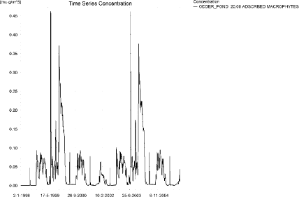
Figure 10.11. Sorption of rimsulfuron to macrophytes in the sandy pond.
Figur 10.11. Sorption af rimsulforon til makrofytter i det sandede vandhul.
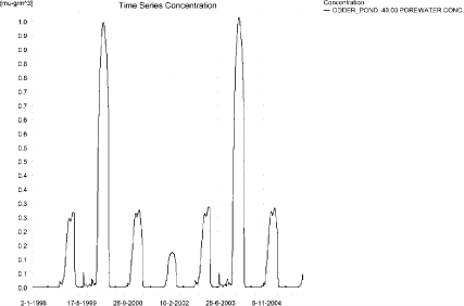
Figure 10.12. Concentration of rimsulfuron in porewater the sandy pond.
Figur 10.12. Porevandskoncentration af rimsulfuron i det sandede vandhul.
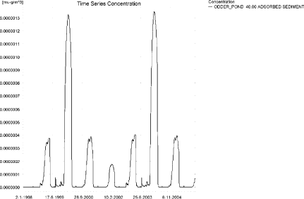
Figure 10.13. Sorption of rimsulfuron to sediment in the sandy pond. The concentration is in µg/g sediment and not µg/m³ as stated.
Figur 10.13. Sorption af rimsulfuron til sediment i det sandede vandhul. Koncentrationen er i µg/g og ikke i µg/m³ som angivet.
Compared to the FOCUS D3 ditch, the concentration in the PestSurf sandy pond is considerably lower, 32 µg/l compared to 159 ng/l. The ditch-concentration is caused by wind drift while the concentration in the sandy pond is caused by groundwater contribution. The sediment concentrations also differ, PestSurf reaching 1.4 ng/kg while the FOCUS D3-ditch reaches 1.8 ng/kg. In both cases the figures are small.
In the pond-case, there is no difference between the results of PestSurf and the results extracted by the templates.
Figure 10.14 shows the output of the PestSurf Excel template. The template works with one pre-defined data extraction point for the pond (center of the pond). The plot requires specification of a “lowest detection value” (ldc) which defines when a pesticide occurrence is defined as an event. The time series plot is identical to the time series shown earlier. The plot to the right shows how many events have concentrations higher than a given toxicity value for the selected monitoring points.
Table 10.9 shows part of the result sheet generated by the PestSurf Excel sheet based on the ldc-value.
Click here to see Figure 10.14.
Figure 10.14. Overview for rimsulfuron in the sandy pond generated by the PestSurf excel template. The time series shown is identical to the one in Figure 10.10. Lowest detection concentration was set to 1 ng/l.
Figur 10.14. Oversigt for rimsulfuron i det sandede vandhul genereret med PestSurf-excel-skabelonen. Den viste tidsserie er mage til den i Figur 10.10. Detektionsgrænsen er sat til 1 ng/l.
Table 10.6. Part of the result sheet generated by the PestSurf Excel sheet, applied to Rimsulfuron. The limiting value used for generation of the table is 1 ng/l. The toxicity values were set to 10,100 and 1000 ng/l, respectively. The recorded peaks are shown in Figure 10.14. EOF = End Of File.
Tabel 10.6. Uddrag af resultatpresentationen genereret af PestSurf-Excel-arket. Grænseværdien anvendt til tabelgenerering er sat til 1 ng/l mens toxicitetsværdierne for fisk, dafnier og alger er henholdsvis 10, 100 og 1000 ng/l. De tabellerede hændelser er vist i Figur 10.14. EOF = slutning af fil.
10.4.3 Sandy Loam catchment, Stream
The distribution of concentrations was assessed in several steps. First, the maximum concentrations at each calculation point were listed, and the dates for the occurrence of the maximum were assessed (Table 10.7). The points, for which the maximum value also represents a local maximum were selected for further analysis.
All points show the same type of time series pattern. The eight points with highest maximum values were analysed further.
Table 10.7. Maximum concentrations (ng/l) of rimsulfuron simulated for each calculation point in the sandy loam catchment.
Tabel 10.7. Maximumskoncentrationer (ng/l) af rimsulfuron simuleret for hvert beregningspunkt i morænelersoplandet.
| RIMSULFURON | Maximum | Max.Time | Local Maxima |
| ALBJERGBAEK 0.00 | 26 | 28-12-2001 00:00 | |
| ALBJERGBAEK 150.00 | 63 | 14-11-1998 00:00 | |
| ALBJERGBAEK 300.00 | 74 | 12-12-1997 00:00 | |
| ALBJERGBAEK 450.00 | 57 | 11-12-2001 00:00 | |
| ALBJERGBAEK 600.00 | 336 | 16-06-2001 11:00 | |
| ELHOLTBAEK 0.00 | 13 | 17-09-1998 00:00 | |
| ELHOLTBAEK 165.00 | 16 | 29-08-1998 00:00 | |
| ELHOLTBAEK 330.00 | 411 | 16-06-2000 08:40 | |
| FREDLIGBAEK 0.00 | 205 | 18-09-1998 00:00 | |
| FREDLIGBAEK 100.00 | 326 | 18-09-1998 00:00 | |
| FREDLIGBAEK 200.00 | 347 | 18-09-1998 00:00 | |
| FREDLIGBAEK 300.00 | 353 | 18-09-1998 00:00 | |
| FREDLIGBAEK 400.00 | 349 | 18-09-1998 00:00 | |
| FREDLIGBAEK 500.00 | 359 | 18-09-1998 00:00 | |
| FREDLIGBAEK 600.00 | 333 | 18-09-1998 00:00 | |
| FREDLIGBAEK 667.50 | 403 | 18-09-1998 00:00 | |
| FREDLIGBAEK 735.00 | 712 | 16-06-1998 08:40 | x |
| GROFTEBAEK 0.00 | 20 | 18-09-1998 00:00 | |
| GROFTEBAEK 155.00 | 31 | 17-09-1998 00:00 | |
| GROFTEBAEK 310.00 | 37 | 18-09-1998 00:00 | |
| GROFTEBAEK 465.00 | 25 | 22-09-1998 00:00 | |
| GROFTEBAEK 620.00 | 1043 | 16-06-2000 08:49 | x |
| STENSBAEK 0.00 | 15 | 01-09-1998 00:00 | |
| STENSBAEK 125.00 | 374 | 18-09-1998 00:00 | |
| STENSBAEK 250.00 | 220 | 18-09-1998 00:00 | |
| STENSBAEK 412.50 | 386 | 18-09-1998 00:00 | |
| STENSBAEK 575.00 | 258 | 18-09-1998 00:00 | |
| OVRELILLEBAEK 0.00 | 27 | 30-10-1998 00:00 | |
| OVRELILLEBAEK 125.00 | 909 | 16-06-1999 08:30 | |
| OVRELILLEBAEK 250.00 | 951 | 16-06-2000 08:30 | |
| OVRELILLEBAEK 290.00 | 1058 | 16-06-1998 08:30 | x |
| OVRELILLEBAEK 330.00 | 336 | 16-06-2001 11:00 | |
| OVRELILLEBAEK 330.00 | 336 | 16-06-2001 11:00 | |
| OVRELILLEBAEK 352.50 | 634 | 16-06-2000 08:30 | |
| OVRELILLEBAEK 375.00 | 258 | 18-09-1998 00:00 | |
| OVRELILLEBAEK 375.00 | 258 | 18-09-1998 00:00 | |
| OVRELILLEBAEK 437.50 | 535 | 16-06-2000 08:30 | |
| OVRELILLEBAEK 500.00 | 859 | 16-06-2000 08:30 | |
| OVRELILLEBAEK 625.00 | 1009 | 16-06-2001 08:30 | x |
| OVRELILLEBAEK 750.00 | 652 | 16-06-2000 08:30 | |
| OVRELILLEBAEK 855.00 | 952 | 16-06-2000 08:30 | |
| OVRELILLEBAEK 960.00 | 411 | 16-06-2000 08:40 | |
| OVRELILLEBAEK 960.00 | 411 | 16-06-2000 08:40 | |
| OVRELILLEBAEK 980.00 | 438 | 16-06-2000 08:49 | |
| OVRELILLEBAEK 1000.00 | 358 | 16-06-2000 08:49 | |
| OVRELILLEBAEK 1062.50 | 361 | 16-06-2000 08:30 | |
| OVRELILLEBAEK 1125.00 | 470 | 16-06-2000 08:30 | |
| OVRELILLEBAEK 1187.50 | 619 | 16-06-2000 08:30 | |
| OVRELILLEBAEK 1250.00 | 688 | 16-06-2000 08:30 | |
| OVRELILLEBAEK 1425.00 | 865 | 16-06-2000 08:30 | x |
| OVRELILLEBAEK 1600.00 | 677 | 16-06-2000 08:30 | |
| OVRELILLEBAEK 1650.00 | 864 | 16-06-2000 08:30 | |
| OVRELILLEBAEK 1700.00 | 456 | 16-06-2000 09:00 | |
| NEDRELILLEBAEK 0.00 | 456 | 16-06-2000 09:00 | |
| NEDRELILLEBAEK 135.00 | 531 | 16-06-2000 08:30 | |
| NEDRELILLEBAEK 270.00 | 900 | 16-06-2000 08:30 | |
| NEDRELILLEBAEK 330.00 | 1078 | 16-06-2000 08:30 | |
| NEDRELILLEBAEK 390.00 | 997 | 16-06-2000 08:30 | |
| NEDRELILLEBAEK 495.50 | 1119 | 16-06-2001 08:40 | x |
| NEDRELILLEBAEK 601.00 | 712 | 16-06-1998 08:40 | |
| NEDRELILLEBAEK 601.00 | 712 | 16-06-1998 08:40 | |
| NEDRELILLEBAEK 693.00 | 750 | 16-06-2000 08:30 | |
| NEDRELILLEBAEK 785.00 | 1252 | 16-06-2000 08:30 | |
| NEDRELILLEBAEK 847.00 | 1854 | 16-06-2000 08:30 | x |
| NEDRELILLEBAEK 909.00 | 1043 | 16-06-2000 08:49 | |
| NEDRELILLEBAEK 909.00 | 1043 | 16-06-2000 08:49 | |
| NEDRELILLEBAEK 984.50 | 920 | 16-06-2000 09:00 | |
| NEDRELILLEBAEK 1060.00 | 1366 | 16-06-2000 08:30 | |
| NEDRELILLEBAEK 1169.50 | 1696 | 16-06-2000 08:30 | |
| NEDRELILLEBAEK 1279.00 | 2348 | 16-06-2000 08:30 | x |
| NEDRELILLEBAEK 1409.50 | 999 | 16-06-2001 09:00 | |
| NEDRELILLEBAEK 1540.00 | 586 | 16-06-1999 09:30 | |
| global max | 2348 |
All maximum concentrations in the main stream are caused by wind drift events. Figure 10.15 and Figure 10.16 show the concentration pattern as it appears for the whole stream. Apart from the drift contribution, a high concentration is reached due to the extreme event in September 1998 (and 1994).
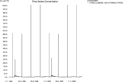
Figure 10.15. Concentration pattern for rimsulfuron in OvreLillebaek, 625 m from upstream, in the upstream end of the sandy loam catchment.
Figur 10.15. Koncentrationsmønster for rimsulfuron i Øvre Lillebæk (625 m fra opstrøms ende ) i den øvre del af morænelersoplandet.
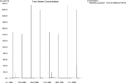
Figure 10.16. Concentration pattern for rimsulfuron in the lower end of the sandy loam catchment.
Figur 10.16. Koncentrationsmønster for rimsulfuron i i den nedre del af morænelersoplandet.
The concentrations in the sandy loam catchment on the 16 June 2000 at 8:30, 8:49, 9:00 and 12:00 hours after spraying, respectively, are shown in Figure 10.17 to Figure 10.20.
The thin black line represents the concentration, while the thick black line shows the maximum concentrations obtained during the simulations. In addition, the outline of the stream is shown.

Figure 10.17. Concentrations in the sandy loam catchment on 16. June 2000, 8.30.
Figur 10.17. Koncentrationer i morænelersoplandet den 16. juni-2000, 08.30.

Figure 10.18. Concentrations in the sandy loam catchment on 16. June 2000, 8.50.
Figur 10.18. Koncentrationer i morænelersoplandet den 16. juni-2000, 08.50.
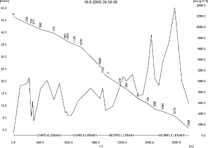
Figure 10.19. Concentrations in the sandy loam catchment on 16. June 2000, 9.00.
Figur 10.19. Koncentrationer i morænelersoplandet den 16. juni-2000, 09.00.

Figure 10.20. Concentrations in the sandy loam catchment on 16. June 2000, 12.00.
Figur 10.20. Koncentrationer i morænelersoplandet den 16. juni-2000, 12.00.
To be able to extract comparable values to FOCUS SW, the global maxima and time weighted concentrations (up to 7 days) were extracted when these were meaningful.
Figure 10.21 shows the concentrations sorbed to macrophytes and Figure 10.23 the concentration of pesticide adsorbed to sediment. The pattern of sorption to macrophytes follows the pattern of the water concentrations. The concentration in the water phase is slightly lowered by the presence of mycrophytes. The concentration in sediment is quite low, 0.75 ng/kg. The concentration in porewater is given in Figure 10.22.
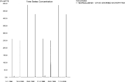
Figure 10.21. Concentration of rimsulfuron on macrophytes at the point of maximum concentration. The pattern follows the pattern of concentrations (in the water) in the stream.
Figur 10.21. Koncentration af rimsulfuron på makrofytter i punktet med maximumskoncentration. Mønsteret følger mønsteret for koncentrationer (i vandfasen) i vandløbet.
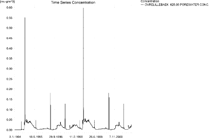
Figure 10.22. Concentration pattern of rimsulfuron in porewater in the sandy loam catchment. The highest concentration reached in a tributary is 0.86 ng/l and 0.61 ng/l in the main stream.
Figur 10.22. Koncentrationsmønster for rimsulfuron i porevand i morænelersoplandet. Den højeste koncentration opnået i et tilløb er 0.86 ng/l og i hovedvandløbet 0.61 ng/l.
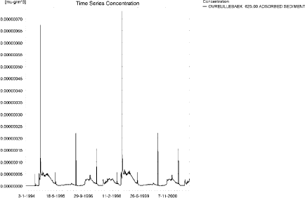
Figure 10.23. Concentration of rimsulfuron on sediment in the sandy loam catchment. The concentration is in µg/g sediment and not µg/m³ as stated. The maximum concentration of 0.75 ng/kg is reached upstream of this point.
Figur 10.23. Koncentration af rimsulfuron i sediment i morænelersoplandet. Koncentrationen er i µg/g sediment og ikke µg/m³ som angivet. Maximums-koncentrationen på 0.75 ng/kg opnås opstrøms for den viste lokalitet.
Compared to the FOCUS SW D4-stream, the maximum concentration of PestSurf is higher, 2.348 µg/l compared to 132 ng/l. The highest concentrations reached are caused by drift in both models, but drainage after an extreme event does cause high concentrations to occur in PestSurf. The sediment concentration calculated by FOCUS is 23 ng/kg, while PestSurf yields 0.75 ng/kg.
Figure 10.24, Figure 10.25, Table 10.9 and Table 10.10 show the results as generated by the PestSurf templates. The maximum value generated by the templates for the upper part of the stream is 864 ng/l, and for the lower part, 2.35 µg/l. The maximum value generated in the (upstream part of the) catchment is 1.06 µg/l and for the lower part, 2.35 µg/l. Thus, the templates did catch the maximum concentration of the PestSurf simulation.
Table 10.8. Maximum concentrations (ng/l) of rimsulfuron simulated for selected calculation point in the sandy loam catchment.
Tabel 10.8. Maximumskoncentrationer (ng/l) af rimsulfuron for udvalgte lokaliteter i morænelersoplandet.
Click here to see Figure 10.24.
Figure 10.24. Overview for rimsulfuron in the sandy loam catchment generated by the PestSurf excel template for the upstream part of the catchment. The detection value was set to 10 ng/l.
Figur 10.24. Oversigt for rimsulfuron genereret med PestSurf-excel-skabelonen for den opstrøms del af morænelersoplandet. Detektionsgrænsen var sat til 10 ng/l.
Click here to see Figure 10.25.
Figure 10.25. Overview for rimsulfuron in the sandy loam catchment generated by the PestSurf excel template for the downstream part of the catchment. The detection value was set to 10 ng/l.
Figur 10.25. Oversigt for rimsulfuron genereret med PestSurf-excel-skabelonen for den nedstrøms del af morænelersoplandet. Detektionsgrænsen var sat til 10 ng/l.
Table 10.9. Part of the result sheet generated by the PestSurf Excel sheet for the upstream part of the sandy loam catchment. The lowest detection value is 10 ng/l, toxicity to fish, daphnies and algae are set to 100, 1000 and 10000 ng/, respectively. The recorded peaks are shown in Figure 10.24.
Tabel 10.9. Uddrag af resultatpresentationen genereret af PestSurf-Excel-arket for den opstrøms del af morænelersoplandet. Detektionsgrænsen for tabelgenerering er sat til 10 ng/l. Toxicitetsværdierne for fisk, dafnier og alger er henholdsvis 100, 1000 og 10000 ng/l. Hændelserne er vist i Figur 10.24.
Table 10.10. Part of the result sheet generated by the PestSurf Excel sheet for the downstream part of the sandy loam catchment. The lowest detection value is 10 ng/l, toxicity to fish, daphnies and algae are set to 100, 1000 and 10000 ng/, respectively. The recorded peaks are shown in Figure 10.25.
Tabel 10.10. Uddrag af resultatpresentationen genereret af PestSurf-Excel-arket for den nedstrøms del af morænelersoplandet. Detektionsgrænsen for tabelgenerering er sat til 10 ng/l. Toxicitetsværdierne for fisk, dafnier og alger er henholdsvis 100, 1000 og 10000 ng/l. Hændelserne er vist i Figur 10.25.
Click here to see Table 10.10.
10.4.4 Sandy loam catchment, pond
The concentration pattern is evaluated in the middle of the pond only, see Figure 10.26. The pond receives contributions mainly drift, in good correspondence with the fact that it is situated in the upper part of the sandy loam catchment, but in wet periods, significant amounts of rimsulfuron arrives with drainage water. The maximum concentration is quite low, 22 ng/l.
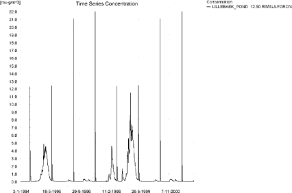
Figure 10.26. Concentrations of rimsulfuron for the sandy loam pond.
Figur 10.26. Koncentration af rimsulfuron i morænelersvandhullet.
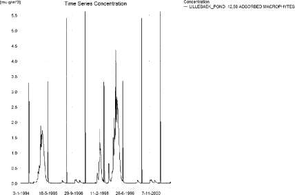
Figure 10.27. Rimsulfuron sorbed to the macrophytes in the sandy loam pond.
Figur 10.27. Rimsulfuron sorberet til makrofytter i morænelersvandhullet.
Figure 10.27 shows that the macrophytes participate in the regulation of the concentrations in the pond. The concentration level of 5.6 ng/l is significant compared to the concentrations in the water phase. The porewater concentration reaches 0.20 ng/l (Figure 10.28) and the concentrations in the sediment are shown in Figure 10.29. The maximum concentration reaches 0.27 ng/kg.
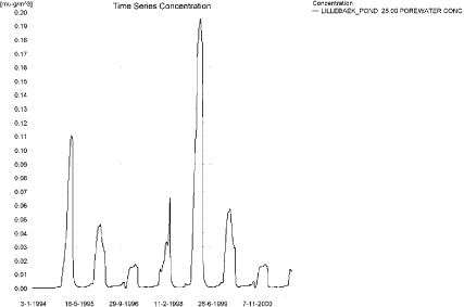
Figure 10.28.Pore water concentration of rRimsulfuron in the sandy loam pond.
Figur 10.28. Porevandskoncentration af rimsulfuron i morænelersvandhullet.
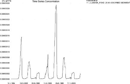
Figure 10.29. Rimsulfuron sorbed to sediment in the sandy loam pond. The concentration is in µg/g sediment and not µg/m³ as stated.
Figur 10.29. Rimsulfuron sorberet til sediment i morænelersvandhullet. Koncentrationen er i µg/g sediment og ikke µg/m³ som angivet.
In global maxima and time weighted concentrations (up to 7 days) were extracted.
Table 10.11. Actual and time weighted concentrations (ng/l) of rimsulfuron in the sandy loam pond.
Tabel 10.11. Beregnede og tidsvægtede koncentrationer (ng/l) af rimsulfuron i morænelersvandhullet.
| Year | Rimsulfuron | actual | Time-weighted | Date |
| 1994 | global max | 12 | 17-06-1994 | |
| 1 hour(after max) | 10 | 11 | ||
| 1 day after sp.in. | 7 | 8 | ||
| 3 days | 4 | 6 | ||
| 4 days | 3 | 5 | ||
| 7 days | 1 | 4 | ||
| 1995 | Global max | 12 | 17-06-1995 | |
| 1 hour | 11 | 11 | ||
| 1 day | 7 | 8 | ||
| 2 days | 4 | 6 | ||
| 4 days | 3 | 5 | ||
| 7 days | 1 | 4 | ||
| 1996 | global max | 21 | 17-06-1996 | |
| 1 hour | 18 | 19 | ||
| 1 day | 10 | 12 | ||
| 2 days | 4 | 9 | ||
| 4 days | 3 | 7 | ||
| 7 days | 1 | 5 | ||
| 1997 | global max | 22 | 17-06-1997 | |
| 1 hour | 18 | 20 | ||
| 1 day | 10 | 13 | ||
| 2 days | 4 | 9 | ||
| 4 days | 3 | 8 | ||
| 7 days | 1 | 5 | ||
| 1998 | global max | 12 | 16-06-1998 | |
| 1 hour | 11 | 11 | ||
| 1 day | 7 | 8 | ||
| 2 days | 4 | 6 | ||
| 4 days | 3 | 5 | ||
| 7 days | 1 | 4 | ||
| 1999 | global max | 12 | 16-06-1999 | |
| 1 hour | 11 | 11 | ||
| 1 day | 7 | 8 | ||
| 2 days | 4 | 6 | ||
| 4 days | 3 | 5 | ||
| 7 days | 1 | 4 | ||
| 2000 | global max | 21 | 16-06-2000 | |
| 1 hour | 18 | 19 | ||
| 1 day | 10 | 12 | ||
| 2 days | 4 | 9 | ||
| 4 days | 3 | 7 | ||
| 7 days | 1 | 5 | ||
| 2001 | global max | 22 | 16-06-2001 | |
| 1 hour | 18 | 20 | ||
| 1 day | 10 | 13 | ||
| 2 days | 4 | 9 | ||
| 4 days | 3 | 8 | ||
| 7 days | 1 | 5 | ||
| max values | ||||
| global max | 22 | |||
| 1 hour | 18 | 20 | ||
| 1 day | 10 | 13 | ||
| 2 days | 4 | 9 | ||
| 4 days | 3 | 8 | ||
| 7 days | 1 | 5 |
Figure 10.30 and Table 10.12 show output from the PestSurf template, with a time series identical to Figure 10.26.
The FOCUS SW-scenario D4-pond generates a concentration of 0.012 µg/l, which is quite close to the PestSurf sandy loam pond-concentration of 0.022 µg/l. The maximum concentration of FOCUS SW is reached through drainage, while the maximum value in PestSurf is reached through wind drift during a dry period. However, the drainage contribution is visible in the PestSurf simulation too. The higher drift contribution in PestSurf may be attributed to the smaller dimensions of the pond.
The FOCUS-calculation results in a sediment concentration of 7 ng/kg, while PestSurf produces 0.27 ng/kg in the sediment.
Click here to see Figure 10.30.
Figure 10.30. Overview for rimsulfuron in the sandy loam pond generated by the PestSurf excel template. The time series shown is identical to the one in Figure 10.26. The lowest detection value was set to 0.5 ng/l.
Figur 10.30. Oversigt for rimsulfuron i morænelersvandhullet genereret med PestSurf-excel-skabelonen. Den viste tidsserie er mage til den i Figur 10.26. Detektionsgrænsen er sat til 0.05 ng/l.
Table 10.12. Part of the result sheet generated by the PestSurf Excel sheet. The detection value is set to 0.5 ng/l. The toxicity values for fish, daphnies and algae were set to 10, 100 and 1000 ng/l, respectively. The recorded peaks are shown in Figure 10.30.
Tabel 10.12. Uddrag af resultatpresentationen genereret af PestSurf-Excel-arket. Detektionsgrænsen er sat til 1 ng/l. Toxicitetsværdierne for fisk, dafnier og alger er henholdsvis 10, 100 og 1000 ng/l. De tabellerede hændelser er vist i Figur 10.30.
Click here to see Tabel 10.12.
Table 10.13. Summary of simulation results for rimsulfuron.
Tabel 10.13. Opsummerede resultater for rimsulfuron.
Click here to see Tabel 10.13.
10.5 Summary of simulations
The maximum actual concentrations for all simulations are recorded in Table 10.13.
The concentration in the sandy pond is lower than for the D3-ditch, which is lower than for the sandy stream. The ditch-concentration is caused by wind drift, while the concentration in the sandy pond is caused by groundwater contribution. The sediment concentrations also differ, PestSurf reaching 1.8 ng/kg while FOCUS reaches 1.4 ng/kg. In both cases the figures are small.
The concentration in the sandy stream is strongly influenced by the fact that the whole agricultural area is sprayed within 30 minutes. This results in high concentrations. The maximum concentration reached 112 m from the upstream end is 64 ng/l, which is less than what is found in the D3 ditch (159 ng/l). The low concentration in PestSurf is, however, due to a combination of a buffer zone of 20 m width and a water depth of about 7 cm.
The concentration in the sandy loam pond is 22 ng/l, compared to 12 ng/l in the D4-pond. This difference can be explained by the difference in exposure between the ponds in the two systems.
Compared to the FOCUS SW-D4-stream, the maximum concentration of PestSurf is higher, 2.35 µg/l compared to 132 ng/l. The highest concentrations reached is caused by drift in both models, but drainage after the 20-year rain event does cause high concentrations to occur in PestSurf. The maximum concentration reached 125 m from the upstream end is 909 ng/l. The water depth at the time of spraying is about 4.5 cm, and the depth difference between the two models thus explains most of the difference. In addition, the PestSurf stream is triangular. The maximum concentration reached between 500 and 1700 m from the upstream end is 1.01 µg/l.
Macrophytes play a minor role for the concentration in the water phase in the sandy scenarios, but the role is significant for the sandy loam scenarios, because the concentration of macrophytes is considerably higher here than in the sandy scenarios.
Sediment concentrations are low in all simulations, but always higher in the FOCUS SW scenarios than in the PestSurf scenarios.
Annex 11
11 Comparison of risk assessment data produced by spray drift assessments, FOCUS SW and PestSurf
11.1 Chemical characteristics of the compound
| Compound: | Terbutylazin |
| Dose: | 500 g ai./ha |
| Spraying time: | 15th May |
| Crop: | Maize |
Table 11.1. Overview of chemical properties of terbutylazin and the parameters used in the simulations.
Tabel 11.1. Oversigt over terbutylazin s kemiske egenskaber og parametrene brugt i simuleringerne.
| Chemical property | Condition | Recalculated values | |||
| Cas-no. | 5915-41-3 | ||||
| Molecular weight | 229.71 | ||||
| Form (acid, basic, neutral) | basic | ||||
| pKa | 2 | ||||
| Water solubility | 8.5 µg/l | ||||
| log Kow | at pH | KowA- | |||
| log Kow | 3.21 | at pH | KowAH | 3.21 | |
| log Kow | at pH | KowAH+ | |||
| Vapor pressure, Pa | 1.5 × 10⁻⁴ | 20°C | 270°C (Decomposition) | vapor pressure, Pa, 20°C | |
| Henry’s law constant | Calculated in Pestsurf | Recalculated value, dimensionless | |||
| Sorption properties in soil | |||||
| Freundlich exp | 0.9 | ||||
| Koc, l/kg | 251 | ||||
| DT50 in soil, days | 63.8 | ||||
| DT50water | 6.5 days | PestSurf input | |||
| DT50sedment | No degradation | ||||
| DT50water/sediment | 33 (220 g sed+ 550 ml water), 33 (220 g sed+ 550 ml water) | DT50, days | 57 | ||
| Sediment konc., µg/l | 425000 | ||||
| Hydrolysis | 73 | at pH 5 | (acid) | 9.90 × 10⁻⁴ | |
| 204.6 | at pH 7 | (neutral) | 279 | ||
| 194 | at pH 9 | (basic) | 8.32 × 10⁻⁵ | ||
| Photolysis | |||||
| quantum yield | Set to 0. DT50 = 172 d, practically 0 | ||||
| Spectrum | |||||
| Other | |||||
11.2 Concentration generated by spray
| Direct spray | FOCUS buffer zones | |||
| Ditch | Stream | Pond | ||
| µg l-1 | µg l-1 | µg l-1 | µg l-1 | |
| Terbutylazin | 166.7 | 3.558 | 2.589 | 1.247 |
11.3 Concentrations generated by FOCUS SW
11.3.1 D3 - Ditch
| Terbutylazin | Ditch, D3 | |||||||
| Water | Sediment | |||||||
| Date | PEC | Date | TWAEC | Date | PEC | Date | TWAEC | |
| µg l-1 | µg l-1 | µg kg-1 | µg kg-1 | |||||
| Global max | 14-maj-92 | 2.620 | 15-maj-92 | 0.864 | ||||
| 1 d | 15-maj-92 | 1.160 | 15-maj-92 | 1.968 | 16-maj-92 | 0.656 | 16-maj-92 | 0.826 |
| 2 d | 16-maj-92 | 0.154 | 16-maj-92 | 1.259 | 17-maj-92 | 0.487 | 16-maj-92 | 0.747 |
| 4 d | 18-maj-92 | 0.008 | 18-maj-92 | 0.651 | 19-maj-92 | 0.347 | 18-maj-92 | 0.608 |
| 7 d | 21-maj-92 | 0.002 | 21-maj-92 | 0.374 | 22-maj-92 | 0.261 | 21-maj-92 | 0.487 |
11.3.2 D4 – Pond
| Terbutylazin | Pond, D4 | |||||||
| Water | Sediment | |||||||
| Date | PEC | Date | TWAEC | Date | PEC | Date | TWAEC | |
| µg l-1 | µg l-1 | µg kg-1 | µg kg-1 | |||||
| Global max | 21-dec-85 | 0.903 | 07-jan-86 | 2.127 | ||||
| 1 d | 22-dec-85 | 0.897 | 22-dec-85 | 0.902 | 08-jan-86 | 2.126 | 08-jan-86 | 2.127 |
| 2 d | 23-dec-85 | 0.884 | 22-dec-85 | 0.9 | 09-jan-86 | 2.124 | 08-jan-86 | 2.127 |
| 4 d | 25-dec-85 | 0.849 | 23-dec-85 | 0.895 | 11-jan-86 | 2.116 | 09-jan-86 | 2.126 |
| 7 d | 28-dec-85 | 0.792 | 24-dec-85 | 0.887 | 14-jan-86 | 2.095 | 11-jan-86 | 2.124 |
11.3.3 D4 – Stream
| Terbutylazin | Stream, D4 | |||||||
| Water | Sediment | |||||||
| Date | PEC | Date | TWAEC | Date | PEC | Date | TWAEC | |
| µg l-1 | µg l-1 | µg kg-1 | µg kg-1 | |||||
| Global max | 30-maj-85 | 2.277 | 20-dec-85 | 1.857 | ||||
| 1 d | 31-maj-85 | 0.016 | 10-dec-85 | 1.273 | 21-dec-85 | 1.853 | 21-dec-85 | 1.855 |
| 2 d | 01-jun-85 | 0.015 | 08-dec-85 | 1.208 | 22-dec-85 | 1.836 | 22-dec-85 | 1.853 |
| 4 d | 03-jun-85 | 0.014 | 10-dec-85 | 1.174 | 24-dec-85 | 1.792 | 22-dec-85 | 1.851 |
| 7 d | 06-jun-85 | 0.013 | 11-dec-85 | 1.145 | 27-dec-85 | 1.722 | 23-dec-85 | 1.845 |
11.3.4 Conclusion – FOCUS SW
The highest concentration is generated in the ditch (D3). It is caused by wind drift and the concentration becomes 2.62 µg/l. The pond scenario shows the highest concentration in the sediment, 2.13 µg/l. For all scenarios, the concentrations are lower than what is generated by the simpler assessments.
11.4 PestSurf
11.4.1 Sandy Catchment, Stream
The distribution of concentrations was assessed in several steps. First, the maximum concentrations at each calculation point were listed, and the dates for the occurrence of the maximum were assessed. The points, for which the maximum value also represents a local maximum were selected for further analysis. The relevant values are listed in Table 11.2.
Table 11.2. Maximum concentrations (ng/l) of terbutylazin simulated for each calculation point in the sandy catchment.
Tabel 11.2. Maximumkoncentrationer (ng/l) af terbutylazin simuleret for hvert beregningspunkt i det sandede opland.
| TERBUTYLAZIN | Maximum | Max.Time | Local maxima |
| ODDERBAEK 0.00 | 519 | 15-05-1998 09:08 | |
| ODDERBAEK 56.00 | 560 | 15-05-1998 09:00 | |
| ODDERBAEK 112.00 | 695 | 15-05-1998 08:51 | |
| ODDERBAEK 192.00 | 1845 | 15-05-1998 08:33 | |
| ODDERBAEK 272.00 | 3155 | 15-05-1998 08:33 | |
| ODDERBAEK 278.00 | 3310 | 15-05-1998 08:33 | |
| ODDERBAEK 282.00 | 3410 | 15-05-1998 08:33 | |
| ODDERBAEK 298.50 | 3691 | 15-05-1998 08:33 | |
| ODDERBAEK 315.00 | 4006 | 15-05-1998 08:33 | |
| ODDERBAEK 317.50 | 4055 | 15-05-1998 08:33 | |
| ODDERBAEK 320.00 | 4099 | 15-05-1998 08:33 | |
| ODDERBAEK 410.00 | 5455 | 15-05-1998 08:33 | |
| ODDERBAEK 500.00 | 6063 | 15-05-1998 08:33 | |
| ODDERBAEK 513.00 | 6333 | 15-05-1998 08:33 | |
| ODDERBAEK 521.00 | 6526 | 15-05-1998 08:33 | |
| ODDERBAEK 622.00 | 7848 | 15-05-1998 08:33 | |
| ODDERBAEK 723.00 | 8840 | 15-05-1998 08:33 | |
| ODDERBAEK 733.00 | 9117 | 15-05-1998 08:33 | |
| ODDERBAEK 742.00 | 9304 | 15-05-1998 08:33 | |
| ODDERBAEK 789.50 | 9892 | 15-05-1998 08:33 | |
| ODDERBAEK 837.00 | 10449 | 15-05-1998 08:33 | |
| ODDERBAEK 848.00 | 10690 | 15-05-1998 08:33 | |
| ODDERBAEK 863.00 | 10994 | 15-05-1998 08:33 | |
| ODDERBAEK 956.00 | 12012 | 15-05-1998 08:33 | |
| ODDERBAEK 1049.00 | 12315 | 15-05-1998 08:33 | x |
| ODDERBAEK 1111.50 | 11944 | 15-05-1998 08:33 | |
| ODDERBAEK 1174.00 | 10827 | 16-05-2001 08:33 | |
| ODDERBAEK 1226.00 | 10157 | 16-05-2001 08:33 | |
| ODDERBAEK 1278.00 | 9860 | 16-05-2001 08:41 | |
| ODDERBAEK 1293.50 | 9739 | 16-05-2001 08:41 | |
| ODDERBAEK 1310.00 | 9509 | 16-05-2001 08:41 | |
| ODDERBAEK 1421.00 | 9176 | 16-05-2001 08:50 | |
| ODDERBAEK 1532.00 | 7978 | 16-05-2001 08:33 | |
| ODDERBAEK 1558.06 | 7062 | 15-05-1998 08:33 | |
| ODDERBAEK 1584.12 | 6595 | 15-05-1998 08:33 | |
| ODDERBAEK 1584.12 | 6595 | 15-05-1998 08:33 | |
| ODDERBAEK 1621.06 | 6597 | 15-05-1998 08:33 | |
| ODDERBAEK 1658.00 | 6733 | 15-05-1998 08:33 | |
| ODDERBAEK 1698.50 | 6989 | 15-05-1998 08:33 | |
| ODDERBAEK 1739.00 | 7188 | 15-05-1998 08:33 | |
| ODDERBAEK 1801.50 | 7233 | 16-05-2001 08:33 | x |
| ODDERBAEK 1864.00 | 5942 | 16-05-2005 08:33 | |
| ODDERBAEK 1977.00 | 4702 | 16-05-2000 09:45 | |
| ODDERBAEK 2090.00 | 4602 | 16-05-2000 09:54 | |
| ODDERBAEK 2098.00 | 4599 | 16-05-2000 09:54 | |
| ODDERBAEK 2105.00 | 4587 | 16-05-2000 09:54 | |
| ODDERBAEK 2131.00 | 4557 | 16-05-2000 09:54 | |
| ODDERBAEK 2157.00 | 4501 | 16-05-2000 10:00 | |
| ODDERBAEK 2168.00 | 4481 | 16-05-2000 10:00 | |
| ODDERBAEK 2179.00 | 4462 | 16-05-2000 10:00 | |
| ODDERBAEK 2268.50 | 4408 | 16-05-2000 10:00 | |
| ODDERBAEK 2358.00 | 4179 | 16-05-2000 10:00 | |
| ODDERBAEK 2363.50 | 4163 | 16-05-2000 10:00 | |
| ODDERBAEK 2372.00 | 4142 | 16-05-2000 10:00 | |
| ODDERBAEK 2427.00 | 4087 | 16-05-2000 10:00 | |
| ODDERBAEK 2482.00 | 3975 | 16-05-2004 10:00 | |
| ODDERBAEK 2609.00 | 3895 | 16-05-2004 10:00 | |
| ODDERBAEK 2736.00 | 3614 | 16-05-2001 11:00 | |
| ODDERBAEK 2831.00 | 3586 | 16-05-2001 11:00 | |
| ODDERBAEK 2926.00 | 3382 | 16-05-2001 11:00 | |
| ODDERBAEK 2958.50 | 3339 | 16-05-2001 11:00 | |
| ODDERBAEK 2991.00 | 3299 | 16-05-2000 11:00 | |
| ODDERBAEK 3029.50 | 3224 | 16-05-2000 11:00 | |
| ODDERBAEK 3068.00 | 3078 | 16-05-2004 11:00 | |
| ODDERBAEK 3131.00 | 2925 | 16-05-2004 11:00 | |
| ODDERBAEK 3194.00 | 2763 | 16-05-2004 11:00 | |
| ODDERBAEK 3250.50 | 2672 | 16-05-2004 11:00 | |
| ODDERBAEK 3307.00 | 2648 | 15-05-1998 12:00 | |
| ODDERBAEK 3315.00 | 2646 | 15-05-1998 12:00 | |
| ODDERBAEK 3323.00 | 2641 | 15-05-1998 12:00 | |
| ODDERBAEK 3355.50 | 2662 | 15-05-1998 08:33 | |
| ODDERBAEK 3388.00 | 2945 | 15-05-1998 08:33 | |
| ODDERBAEK 3438.50 | 3422 | 15-05-1998 08:33 | |
| ODDERBAEK 3489.00 | 3661 | 15-05-1998 08:33 | |
| ODDERBAEK 3499.50 | 3689 | 15-05-1998 08:33 | |
| ODDERBAEK 3510.00 | 3699 | 15-05-1998 08:33 | x |
| ODDERBAEK 3581.00 | 3694 | 15-05-1998 08:33 | |
| ODDERBAEK 3652.00 | 3382 | 15-05-1998 08:33 | |
| ODDERBAEK 3707.00 | 3185 | 15-05-1998 08:33 | |
| ODDERBAEK 3762.00 | 2983 | 15-05-1998 08:41 | |
| ODDERBAEK 3790.00 | 2677 | 15-05-1998 08:41 | |
| ODDERBAEK 3818.00 | 2171 | 15-05-1998 08:41 | |
| ODDERBAEK 3818.00 | 2171 | 15-05-1998 08:41 | |
| ODDERBAEK 3884.00 | 2121 | 15-05-1998 08:41 | |
| ODDERBAEK 3950.00 | 2001 | 15-05-1998 08:51 | |
| ODDERBAEK 3998.00 | 1927 | 15-05-1998 08:51 | |
| ODDERBAEK 4046.00 | 1786 | 15-05-1998 09:00 | |
| ODDERBAEK 4047.50 | 1787 | 15-05-1998 09:00 | |
| ODDERBAEK 4049.00 | 1787 | 15-05-1998 09:00 | |
| ODDERBAEK 4052.50 | 1787 | 15-05-1998 09:00 | |
| ODDERBAEK 4056.00 | 1786 | 15-05-1998 09:00 | |
| ODDERBAEK 4058.00 | 1786 | 15-05-1998 09:00 | |
| ODDERBAEK 4060.00 | 1786 | 15-05-1998 09:00 | |
| ODDERBAEK 4080.00 | 1786 | 15-05-1998 09:00 | |
| ODDERBAEK 4100.00 | 1783 | 15-05-1998 09:00 | |
| ODDERBAEK 4134.00 | 1779 | 15-05-1998 09:00 | |
| ODDERBAEK 4168.00 | 1776 | 15-05-1998 09:00 | |
| GISLUM_ENGE_AFLOEB 0.00 | 0 | 04-03-2005 00:00 | |
| GISLUM_ENGE_AFLOEB 50.00 | 1 | 04-03-2005 00:00 | |
| GISLUM_ENGE_AFLOEB 100.00 | 1 | 04-03-2005 00:00 | |
| GISLUM_ENGE_AFLOEB 150.00 | 1 | 03-03-2005 00:00 | |
| GISLUM_ENGE_AFLOEB 200.00 | 1 | 03-03-2005 00:00 | |
| GISLUM_ENGE_AFLOEB 250.00 | 1 | 03-03-2005 00:00 | |
| GISLUM_ENGE_AFLOEB 300.00 | 1 | 03-03-2005 00:00 | |
| GISLUM_ENGE_AFLOEB 340.00 | 1 | 03-03-2005 00:00 | |
| GISLUM_ENGE_AFLOEB 380.00 | 1 | 03-03-2005 00:00 | |
| GISLUM_ENGE_AFLOEB 430.00 | 1 | 03-03-2005 00:00 | |
| GISLUM_ENGE_AFLOEB 480.00 | 1 | 05-03-2005 00:00 | |
| GISLUM_ENGE_AFLOEB 530.00 | 1 | 05-03-2005 00:00 | |
| GISLUM_ENGE_AFLOEB 580.00 | 1 | 06-03-2005 00:00 | |
| GISLUM_ENGE_AFLOEB 630.00 | 1 | 06-03-2005 00:00 | |
| GISLUM_ENGE_AFLOEB 680.00 | 1 | 06-03-2005 00:00 | |
| GISLUM_ENGE_AFLOEB 730.00 | 1 | 06-03-2005 00:00 | |
| GISLUM_ENGE_AFLOEB 780.00 | 1 | 06-03-2005 00:00 | |
| GISLUM_ENGE_AFLOEB 830.00 | 1 | 06-03-2005 00:00 | |
| GISLUM_ENGE_AFLOEB 880.00 | 1 | 06-03-2005 00:00 | |
| GISLUM_ENGE_AFLOEB 915.00 | 1 | 06-03-2005 00:00 | |
| GISLUM_ENGE_AFLOEB 950.00 | 1 | 06-03-2005 00:00 | |
| GISLUM_ENGE_AFLOEB 985.00 | 1 | 06-03-2005 00:00 | |
| GISLUM_ENGE_AFLOEB 1020.00 | 1 | 06-03-2005 00:00 | |
| GISLUM_ENGE_AFLOEB 1045.00 | 1 | 06-03-2005 00:00 | |
| GISLUM_ENGE_AFLOEB 1070.00 | 1 | 06-03-2005 00:00 | |
| GISLUM_ENGE_AFLOEB 1110.00 | 1 | 06-03-2005 00:00 | |
| GISLUM_ENGE_AFLOEB 1150.00 | 1 | 06-03-2005 00:00 | |
| GISLUM_ENGE_AFLOEB 1190.00 | 1 | 06-03-2005 00:00 | |
| GISLUM_ENGE_AFLOEB 1230.00 | 2 | 15-05-1998 08:51 | |
| GISLUM_ENGE_AFLOEB 1271.00 | 6 | 15-05-1998 08:51 | |
| GISLUM_ENGE_AFLOEB 1312.00 | 17 | 15-05-1998 08:51 | |
| GISLUM_ENGE_AFLOEB 1422.00 | 307 | 15-05-1998 08:51 | |
| GISLUM_ENGE_AFLOEB 1532.00 | 2171 | 15-05-1998 08:41 | |
| TILLOEB 0.00 | 6302 | 15-05-1998 08:41 | |
| TILLOEB 20.16 | 6477 | 15-05-1998 08:41 | |
| TILLOEB 40.31 | 6595 | 15-05-1998 08:33 | x |
| Max | 12315 |
The pattern over time was dominated by drift for most calculation points, see Figure 11.1.
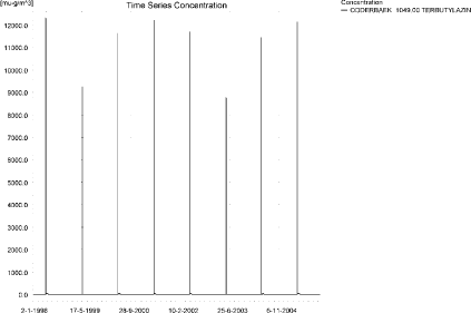
Figure 11.1. Concentration pattern over time for terbutylazin in the sandy Catchment.
Figur 11.1. Koncentrationsmønster som funktion af tid for terbutylazin i det sandede opland.
Each of the drift-events generated an almost identical pattern along the stream. Figure 11.2 to Figure 11.5 show the concentrations of terbutylazin in the sandy catchment.
The thin black line represents the concentration, while the thick black line shows the maximum concentrations obtained during the simulations. In addition, the outline of the stream is shown. In the middle of the catchment, the stream is protected by unsprayed areas.

Figure 11.2. Concentrations of terbutylazin in the sandy catchment on 15. May 1998, 8.33.
Figur 11.2. Koncentrationer terbutylazin i det sandede opland den 15. maj 1998, 8.33.
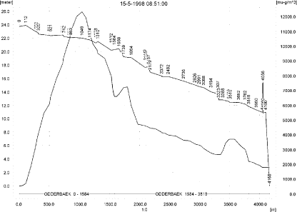
Figure 11.3. Concentrations of terbutylazin in the sandy catchment on 15. May 1998, 8.51.
Figur 11.3. Koncentrationer terbutylazin i det sandede opland den 15. maj 1998, 8.51.

Figure 11.4. Concentrations of terbutylazin in the sandy catchment on 15. May 1998, 9.00.
Figur 11.4. Koncentrationer terbutylazin i det sandede opland den 15. maj 1998, 9.00.

Figure 11.5. Concentrations of terbutylazin in the sandy catchment on 15. May 1998, 12.00.
Figur 11.5. Koncentrationer terbutylazin i det sandede opland den 15. maj 1998, 12.00.
In order to present the data in a similar fashion to the FOCUS SW-results, data were extracted and recalculated for the time series marked in Table 11.2. The global maxima and time weighted concentrations (up to 7 days) were extracted and are reported in Table 11.3. Note that the unit is ng/l.
The maximum amount of terbutylazin sorbed to macrophytes is shown in Figure 11.6. The concentrations are relatively low and have limited influence on the concentration in the water phase. The maximum value reached is 302 ng/l. The concentration of terbutylazin in porewater is shown in Figure 11.7. The maximum value is 0.772 ng/l, and a clear buildup is seen over time. The corresponding sorption to sediment in Figure 11.8. The maximum concentration equals 19.4 ng/kg.

Figure 11.6. Concentration of terbutylazin sorbed to macrophytes in the sandy catchment. The maximum value reached is 302 ng/l 1421 m from the upstream end.
Figur 11.6. Typisk koncentration af terbutylazin sorberet på makrofytter i det sandede opland. Den maximalt opnåede værdi er 302 ng/l 1421 m fra den opstrøms ende.
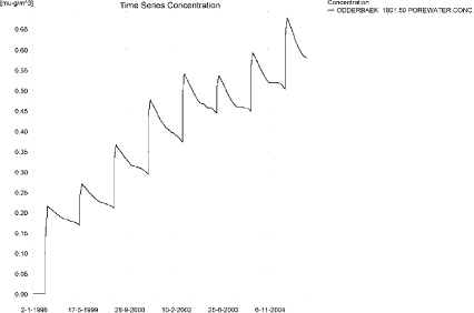
Figure 11.7. Pore water concentrations of terbutylazin in the sandy catchment.
Figur 11.7. Porevandskoncentrationer af terbutylazin i det sandede opland.
Figure 11.8. Sorption of terbutylazin to sediment in the sandy catchment. The concentration is in µg/g sediment and not µg/m³ as stated. The maximum value of 19.4 ng/kg is found 1421 m from the upstream end.
Figur 11.8. Sorption af terbutylazin til sediment i det sandede vandløb. Koncentrationen er i µg/g og ikke i µg/m³ som angivet. Maximumskoncentrationen, 19.4 ng/kg opnås 1421 m fra den opstrøms ende.
Table 11.3. Concentration (ng/l) of terbutylazin at selected points in the sandy stream.
Tabel 11.3. koncentration af terbutylazin, ng/l, på udvalgte lokaliteter i det sandede vandløb.
The global maximum value calculated by PestSurf for the sandy catchment in the water phase is 12.3 µg/l. This is considerably more than what is found in the D3-ditch scenario (2.62 µg/l). However, 112 m from the upstream end, the concentration is only 695 ng/l in the sandy catchment, and thus considerably lower than in the D3-ditch scenario. The macrophytes have a marginal influence on the water concentration. The sediment concentrations also differ considerably: 0.864 µg/kg compared to 0.019 µg/kg in PestSurf.
Figure 11.9 shows the output of the PestSurf Excel template. The template works with pre-defined data extraction points. The plot requires specification of a “lowest detection value” (ldc), which defines when a pesticide occurrence is defined as an event. The time series plot is identical to the time series shown earlier, and the graph in the upper right corner resembles the plots in Figure 11.2 but takes into account a longer period of time. A curve is generated when a downstream point reaches a concentration higher than the ldc. The programme then tracks the highest concentration for each calculation point in the stream within the last 24 hours. The plot in the lower right corner shows how many events have concentrations higher than a given value (ldc) for the selected monitoring points.
Table 11.4 shows part of the result sheet generated by the PestSurf Excel sheet based on the ldc-value. The selected table shows the point along the stream (of the pre-defined points) with the highest concentration. This value was, however, only 6.60 µg/l. Thus, the pre-defined points have not caught the highest concentration of the simulation, which was 12.3 µg/l.
Click here to see Figure 11.9.
Figure 11.9. Overview for terbutylazin in the sandy catchment generated by the PestSurf excel template. The max concentrations generated over the 24 hours are similar to the overviews in Figure 11.2 toFigure 11.5. Detection value was set to 1 ng/l.
Figur 11.9. Oversigt for terbutylazin i det sandede opland genereret med PestSurf-excel-skabelonen. Den maximale koncentration genereret over 24 timer svarer til oversigten i Figur 11.2 til Figur 11.5.. Detektionsgrænsen var sat til 1 ng/l.
Table 11.4. Part of the result sheet generated by the PestSurf Excel sheet. The selected table shows the point along the stream with the highest concentration recorded The lowest detection value is 1 ng/l, toxicity to fish, daphnies and algae are set to 10, 100 and 1000 ng/, respectively. The recorded peaks are shown in Figure 11.9.
Tabel 11.4. Uddrag af resultatpresentationen genereret af PestSurf-Excel-arket. Den udvalgte tabel viser det fordefinerede punkt langs med åen med højest koncentration. Detektionsgrænsen er sat til 1 ng/l mens toxicitetsværdierne for fisk, dafnier og alger er henholdsvis 10, 100 og 1000 ng/l. De tabellerede hændelser er vist i Figur 11.9.
11.4.2 Sandy catchment, pond
The concentration pattern is evaluated in the middle of the pond only, see Figure 11.10. The pond receives drift and a contribution from groundwater. The drift peaks are not visible. The baseflow contribution is dominating the picture. The maximum concentration is quite high, 2.99 µg/l.
Figure 11.10. Concentrations of terbutylazin in the sandy pond.
Figur 11.10. Koncentration af terbutylazin i det sandede vandhul.
In Table 11.5, global maxima and time weighted concentrations (up to 7 days) were extracted.
Table 11.5. Maximum concentrations (ng/l) of terbutylazin generated by drift and baseflow for the sandy pond.
Tabel 11.5. maximumkoncentrationer af terbutylazin (ng/l) genereret for det sandede vandhul.
| Year | Terbutylazin | Actualmax | Time-weighted | Date of occurrence |
| 1998 | Global max | 712 | 14/12/1998 | |
| 1 hour(after max) | ||||
| 1 day after sp.in. | 710 | 711 | ||
| 2 days | 702 | 708 | ||
| 4 days | 695 | 706 | ||
| 7 days | 570 | 681 | ||
| 1999 | Global max | 2229 | 04/12/1999 | |
| 1 hour | ||||
| 1 day | 2219 | 2224 | ||
| 2 days | 2178 | 2208 | ||
| 4 days | 2166 | 2199 | ||
| 7 days | 2134 | 2179 | ||
| 2000 | Global max | 2164 | 10/02/2000 | |
| 1 hour | ||||
| 1 day | 2158 | 2161 | ||
| 2 days | 2130 | 2143 | ||
| 4 days | 2131 | 2140 | ||
| 7 days | 1989 | 2108 | ||
| 2001 | Global max | 2265 | 31/12/2001 | |
| 1 hour | ||||
| 1 day | 2216 | 2240 | ||
| 2 days | 2798 | 2472 | ||
| 4 days | 2811 | 2555 | ||
| 7 days | 2750 | 2665 | ||
| 2002 | Global max | 2875 | 06/01/2002 | |
| 1 hour | ||||
| 1 day | 2750 | 2813 | ||
| 2 days | 2673 | 2759 | ||
| 4 days | 2592 | 2728 | ||
| 7 days | 2354 | 2621 | ||
| 2003 | Global max | 2990 | 04/12/2003 | |
| 1 hour | ||||
| 1 day | 2984 | 2987 | ||
| 2 days | 2951 | 2976 | ||
| 4 days | 2942 | 2968 | ||
| 7 days | 2917 | 2953 | ||
| 2004 | Global max | 2868 | 10/02/2004 | |
| 1 hour | ||||
| 1 day | 2860 | 2864 | ||
| 2 days | 2835 | 2845 | ||
| 4 days | 2832 | 2842 | ||
| 7 days | 2681 | 2808 | ||
| 2005 | Global max | 2681 | 26/02/2005 | |
| 1 hour | ||||
| 1 day | 2671 | 2676 | ||
| 2 days | 2512 | 2625 | ||
| 4 days | 2388 | 2581 | ||
| 7 days | 2369 | 2488 | ||
| max values | ||||
| Global max | 2990 | |||
| 1 hour | 0 | 0 | ||
| 1 day | 2984 | 2987 | ||
| 2 days | 2951 | 2976 | ||
| 4 days | 2942 | 2968 | ||
| 7 days | 2917 | 2953 |
The sorption to macrophytes in the pond is shown in Figure 11.11. Although the value is relatively high, it is much lower than the concentration in the water phase. The concentration of terbutylazin in the porewater is steadily increasing throughout the simulation and reaches 811 ng/l, see Figure 11.12. The corresponding concentration of terbutylazin sorbed to sediment is shown in Figure 11.13. The concentration reaches 6.72 µg/kg.
Figure 11.11. Sorption of terbutylazin to macrophytes in the sandy pond.
Figur 11.11. Sorption af terbutylazin til makrofytter i det sandede vandhul.
Figure 11.12. Pore water concentration of terbutylazin in the sandy pond.
Figur 11.12. Porevandskoncentration af terbutylazin i det sandede vandhul.
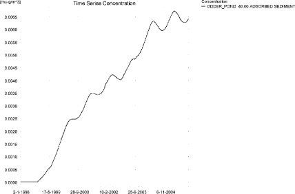
Figure 11.13. Sorption of terbutylazin to sediment in the sandy pond. The concentration is in µg/g sediment and not µg/m³ as stated.
Figur 11.13. Sorption af terbutylazin til sediment i det sandede vandhul. Koncentrationen er i µg/g og ikke i µg/m³ som angivet.
Compared to the FOCUS D3-ditch, the concentration in the PestSurf sandy pond is slightly higher, 2.99 µg/l compared to 2.62 µg/l. For once, the sediment concentration in PestSurf is considerably higher than in the D3-scenario, 6.72 µg/kg compared to 0.864 in FOCUS SW D3-ditch. The high value is due to a considerable buildup over time.
Figure 11.14 shows the output of the PestSurf Excel template. The template works with one pre-defined data extraction point for the pond (center of the pond). The plot requires specification of a “lowest detection value” (ldc) which defines when a pesticide occurrence is defined as an event. The time series plot is identical to the time series shown earlier. The plot in the right corner shows how many events have concentrations higher than a given toxicity value for the selected monitoring points.
Table 11.6 shows part of the result sheet generated by the PestSurf Excel sheet based on the ldc-value.
Click here to see Figure 11.14.
Figure 11.14. Overview for terbutylazin in the sandy pond generated by the PestSurf excel template. The time series shown is identical to the one in Figure 11.10. The lowest detection limit used for generation of the graph is 1500 ng/l.
Figur 11.14. Oversigt for terbutylazin i det sandede vandhul genereret med PestSurf-excel-skabelonen. Den viste tidsserie er mage til den i Figur 11.10. Detektionsgrænsen er sat til 1500 ng/l.
Table 11.6. Part of the result sheet generated by the PestSurf Excel sheet. The lowest detection value used for generation of the table is 1500 ng/l, toxicity to fish, daphnies and algae are set to 1501, 10000 and 100000 ng/, respectively. The recorded peaks are shown in Figure 11.14. EOF = End of file.
Tabel 11.6. Uddrag af resultatpresentationen genereret af PestSurf-Excel-arket. Grænseværdien anvendt til tabelgenerering er sat til 1500 ng/l mens toxicitetsværdierne for fisk, dafnier og alger er henholdsvis 1501, 10000 og 100000 ng/l. De tabellerede hændelser er vist i Figur 11.14. EOF = slutning af fil.
11.4.3 Sandy Loam catchment, Stream
The distribution of concentrations was assessed in several steps. First, the maximum concentrations at each calculation point were listed, and the dates for the occurrence of the maximum were assessed (Table 11.7). The points, for which the maximum value also represents a local maximum were selected for further analysis.
Table 11.7. Maximum concentrations (ng/l) of terbutylazin simulated for each calculation point in the sandy loam catchment.
Tabel 11.7. Maximumskoncentrationer (ng/l) af terbutylazin simuleret for hvert beregningspunkt i morænelersoplandet.
| TERBUTYLAZIN | Maximum | Max.Time | Local Maxima |
| ALBJERGBAEK 0.00 | 698 | 02-04-2000 00:00 | |
| ALBJERGBAEK 150.00 | 2033 | 16-09-1998 00:00 | x |
| ALBJERGBAEK 300.00 | 1339 | 16-09-1998 00:00 | |
| ALBJERGBAEK 450.00 | 1884 | 16-09-1998 00:00 | |
| ALBJERGBAEK 600.00 | 7916 | 14-05-2001 09:10 | x |
| ELHOLTBAEK 0.00 | 535 | 17-09-1998 00:00 | |
| ELHOLTBAEK 165.00 | 326 | 09-12-1999 00:00 | |
| ELHOLTBAEK 330.00 | 7191 | 14-05-2000 08:40 | x |
| FREDLIGBAEK 0.00 | 1067 | 17-09-1998 00:00 | |
| FREDLIGBAEK 100.00 | 1700 | 17-09-1998 00:00 | |
| FREDLIGBAEK 200.00 | 1805 | 17-09-1998 00:00 | |
| FREDLIGBAEK 300.00 | 1862 | 17-09-1998 00:00 | x |
| FREDLIGBAEK 400.00 | 1840 | 18-09-1998 00:00 | |
| FREDLIGBAEK 500.00 | 1722 | 18-09-1998 00:00 | |
| FREDLIGBAEK 600.00 | 2037 | 18-09-1998 00:00 | x |
| FREDLIGBAEK 667.50 | 1584 | 17-09-1998 00:00 | |
| FREDLIGBAEK 735.00 | 15574 | 14-05-1999 08:49 | x |
| GROFTEBAEK 0.00 | 1021 | 26-10-1998 00:00 | |
| GROFTEBAEK 155.00 | 1880 | 26-10-1998 00:00 | x |
| GROFTEBAEK 310.00 | 1621 | 26-10-1998 00:00 | |
| GROFTEBAEK 465.00 | 941 | 04-12-1998 00:00 | |
| GROFTEBAEK 620.00 | 15525 | 14-05-2000 08:40 | x |
| STENSBAEK 0.00 | 4017 | 05-09-2000 00:00 | |
| STENSBAEK 125.00 | 7727 | 07-09-2000 00:00 | x |
| STENSBAEK 250.00 | 5620 | 05-09-2000 00:00 | |
| STENSBAEK 412.50 | 7920 | 05-09-2000 00:00 | x |
| STENSBAEK 575.00 | 2783 | 07-09-2000 00:00 | |
| OVRELILLEBAEK 0.00 | 444 | 29-08-1998 00:00 | |
| OVRELILLEBAEK 125.00 | 15830 | 14-05-1998 08:30 | x |
| OVRELILLEBAEK 250.00 | 14694 | 14-05-2000 08:30 | |
| OVRELILLEBAEK 290.00 | 18742 | 14-05-2000 08:40 | x |
| OVRELILLEBAEK 330.00 | 7916 | 14-05-2001 09:10 | |
| OVRELILLEBAEK 330.00 | 7916 | 14-05-2001 09:10 | |
| OVRELILLEBAEK 352.50 | 10493 | 14-05-2001 09:30 | x |
| OVRELILLEBAEK 375.00 | 2783 | 07-09-2000 00:00 | |
| OVRELILLEBAEK 375.00 | 2783 | 07-09-2000 00:00 | |
| OVRELILLEBAEK 437.50 | 4489 | 14-05-2000 08:30 | |
| OVRELILLEBAEK 500.00 | 9161 | 14-05-2000 08:30 | |
| OVRELILLEBAEK 625.00 | 15546 | 14-05-2000 08:30 | x |
| OVRELILLEBAEK 750.00 | 9814 | 14-05-2000 08:30 | |
| OVRELILLEBAEK 855.00 | 13224 | 14-05-2000 08:30 | x |
| OVRELILLEBAEK 960.00 | 7191 | 14-05-2000 08:40 | |
| OVRELILLEBAEK 960.00 | 7191 | 14-05-2000 08:40 | |
| OVRELILLEBAEK 980.00 | 7579 | 14-05-2000 08:40 | x |
| OVRELILLEBAEK 1000.00 | 6307 | 14-05-1999 08:49 | |
| OVRELILLEBAEK 1062.50 | 6300 | 14-05-1999 08:49 | |
| OVRELILLEBAEK 1125.00 | 6208 | 14-05-2000 08:30 | |
| OVRELILLEBAEK 1187.50 | 7711 | 14-05-2000 08:30 | |
| OVRELILLEBAEK 1250.00 | 7877 | 14-05-2000 08:30 | |
| OVRELILLEBAEK 1425.00 | 10840 | 14-05-2000 08:30 | x |
| OVRELILLEBAEK 1600.00 | 8828 | 14-05-2000 08:30 | |
| OVRELILLEBAEK 1650.00 | 11352 | 14-05-2000 08:30 | x |
| OVRELILLEBAEK 1700.00 | 7770 | 14-05-1999 08:40 | |
| NEDRELILLEBAEK 0.00 | 7770 | 14-05-1999 08:40 | |
| NEDRELILLEBAEK 135.00 | 8022 | 14-05-2000 08:30 | |
| NEDRELILLEBAEK 270.00 | 11691 | 14-05-2000 08:30 | |
| NEDRELILLEBAEK 330.00 | 14891 | 14-05-2000 08:30 | |
| NEDRELILLEBAEK 390.00 | 16077 | 14-05-2000 08:30 | |
| NEDRELILLEBAEK 495.50 | 20847 | 14-05-2000 08:30 | x |
| NEDRELILLEBAEK 601.00 | 15574 | 14-05-1999 08:49 | |
| NEDRELILLEBAEK 601.00 | 15574 | 14-05-1999 08:49 | |
| NEDRELILLEBAEK 693.00 | 15433 | 14-05-1999 08:49 | |
| NEDRELILLEBAEK 785.00 | 15453 | 14-05-1999 09:00 | |
| NEDRELILLEBAEK 847.00 | 23982 | 14-05-2000 08:30 | x |
| NEDRELILLEBAEK 909.00 | 15525 | 14-05-2000 08:40 | |
| NEDRELILLEBAEK 909.00 | 15525 | 14-05-2000 08:40 | |
| NEDRELILLEBAEK 984.50 | 14383 | 14-05-2000 08:49 | |
| NEDRELILLEBAEK 1060.00 | 18021 | 14-05-2000 08:30 | |
| NEDRELILLEBAEK 1169.50 | 22591 | 14-05-2000 08:30 | |
| NEDRELILLEBAEK 1279.00 | 32148 | 14-05-2000 08:30 | x |
| NEDRELILLEBAEK 1409.50 | 20891 | 14-05-1999 08:49 | |
| NEDRELILLEBAEK 1540.00 | 14517 | 14-05-1999 09:40 | |
| Global max | 32148 |
For terbutylazin, drift is the most important contributor to maximum concentrations, but drainage events do play a role. Figure 11.15 shows the concentration pattern in Ovrelillebaek. The eight drift applications are clearly visible, but in addition, four peaks of 2-3 µg/l are found. The extreme rainfall event around 16-17. September 1998 and 1994 causes two of these peaks. The high concentrations observed in Ovrelillebaek during autumn 1996 and 2000 (around 7th September) are observed after a dry year close to the start of the drainage period. The flows are very small, in Lillebaek 10-12 cm, and in some of the tributaries, where the same peak is observed, only 4-5 cm (Steensbaek). Steensbaek is dry until around 1. September and Lillebaek until 15. August.
Figure 11.16 shows the pattern in the downstream end of the sandy loam catchment. In the downstream part of the system the picture is totally dominated by drift and contributions through the groundwater (reaching the stream system via drains). The concentrations build up over the 8 years simulated and becomes very high at the end of the summer of 2000 and 2001 (corresponding to a very dry year and a normal year, respectively). During these periods, the flow in the stream consists of base flow contributions through drain only. The drift contributions become relatively more important further downstream because the contributions accumulate.
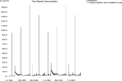
Figure 11.15. Concentration pattern for terbutylazin in the upstream end of the sandy loam catchment.
Figur 11.15. Koncentrationsmønster for terbutylazin i den øvre del af morænelersoplandet.
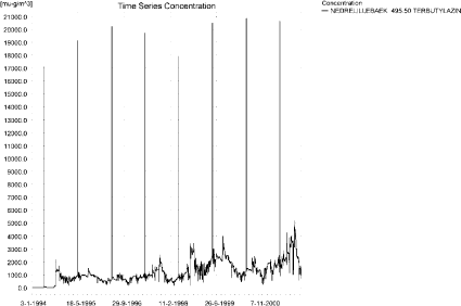
a)
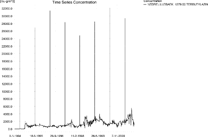
b)
Figure 11.16. Concentration pattern for terbutylazin in the lower end of the sandy loam catchment, at calculation point NedreLillebaek 495.5 and 1279.
Figur 11.16. Koncentrationsmønster for terbutylazin i den nedre del af morænelersoplandet, i bergningspunkterne Nedre Lillebæk 495.5 og 1279.
Longitudinal concentration profiles of the sandy loam catchment are shown in Figure 11.17 and Figure 11.18 for 18 September 1998 and 26 October 2001, respectively. Figure 11.19 shows the pattern for a drift contribution, just after spraying and 3.5 hours later. The thin black line represents the concentration, while the thick black line shows the maximum concentrations obtained during the simulations. In addition, the outline of the stream is shown.
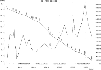
Figure 11.17. Concentrations in the sandy loam catchment on 18. September 1998. The concentrations are generated by the extreme rainfall this year.
Figur 11.17. Koncentrationer i morænelersoplandet den 18. september-1998. Koncentrationerne skyldes det ekstreme nedbørstilfælde dette år.
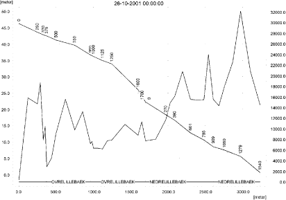
Figure 11.18. Concentrations in the sandy loam catchment on 26. October 2001. The concentrations are generated by baseflow contribution to the downstream end of the stream.
Figur 11.18. Koncentrationer i morænelersoplandet den 26. oktober-2001. Koncentrationerne er genereret af grundvandstilstrømning til den nedstrøms ende af vandløbet.

a)
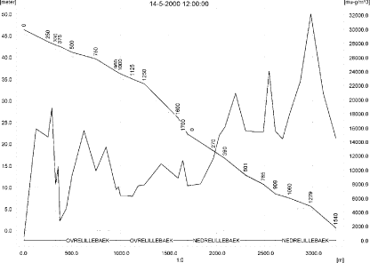
b)
Figure 11.19. Concentrations in the sandy loam catchment on 14. May 2000, at 8.30 (just after spraying) and at 12.00. The concentrations are generated by Drift contribution to the stream.
Figur 11.19. Koncentrationer i morænelersoplandet den 14.maj-2000, 08.30 (lige efter sprøjtning) og kl. 12.00. Koncentrationerne er genereret af vinddrift til vandløbet.
It is generally thought that the model overestimates the transport to groundwater, and, as a consequence of this, it overestimates the contribution through groundwater flow in the lower part of the catchment. The particularly high level of baseflow in the lower part of this catchment is due to occurrence of a sandy layer that transports solute horizontally through the catchment to the lower part of the stream. The high concentrations seen upstream just after a dry summer, however, are not considered an artefact.
To be able to extract comparable values to FOCUS SW, the global maxima and time weighted concentrations (up to 7 days) were extracted when these were meaningful. The results are recorded in Table 11.8.
Figure 11.20 and Figure 11.21 show the concentrations sorbed to macrophytes. The pattern follows the pattern of the water concentrations. In this case, the amount sorbed to macrophytes is significant and will influence the concentration of terbutylazin in the water phase. The maximum value of 3.18 µg/l is reached at the outlet of the catchment. The amount sorbed to macrophytes is in the order of 1/5-1/11 in the upstream part and up to half of the terbutylazin amount present above the sediment in the lower part of the catchment.
The concentration of terbutylazin in porewater in the sediment reached 169 ng/l in the upstream part and 902 ng/l in the lower part of Lillebaek. Figure 11.22 and Figure 11.24 show the pattern in the upstream and downstream end of the catchment. The concentrations increase over time, but in the upstream end, it reaches a maximum during spring of 1999. In the downstream end the concentration increases all through the simulation. The same pattern is visible for the concentration of terbutylazin adsorbed to sediment, see Figure 11.23 and Figure 11.25. The maximum concentration reached is 1.23 µg/kg in the upstream part and 6.56 µg/kg.
Compared to the FOCUS SW-stream-scenario for D4, the concentration level is higher, 32.1 µg/l compared to 2.28 µg/l. The highest values are found downstream where both a build up in groundwater concentrations and drift contributes. The buildup in groundwater is not represented by FOCUS SW. The same goes for the extreme event and the high concentrations seen in the upstream part after a dry summer.
125 m from the upstream end of the sandy loam catchment, the concentration reaches 15.8 µg/l. The corresponding water depth is about 4 cm. This difference explains the difference found between the two models.
For once the maximum sediment concentrations are of the same order of magnitude, 1.86 µg/kg calculated by FOCUS SW D4-stream and 6.56 µg/kg calculated by PestSurf.
Table 11.8. Instantaneous and time weighted concentrations (ng/l) of terbutylazin in the sandy loam catchment.
Tabel 11.8. Beregnedede og tidsvægtede koncentrationer (ng/l) af terbutylazin for udvalgte lokaliteter i morænelersoplandet.

Figure 11.20. Concentration of terbutylazin on macrophytes 625 m from the upstream end. The pattern is representative of the upper part of the sandy loam catchment.
Figur 11.20. Koncentration af terbutylazin på makrofytter 625 m fra den opstrøms ende af morænelersoplandet. Mønsteret er repræsentativt for den øvre del af oplandet.
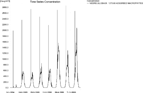
Figure 11.21. Concentration of terbutylazinon macrophytes at the lower part of the stream. The pattern is representative of the lower part of the sandy loam catchment.
Figur 11.21. Koncentration af terbutylazin på makrofytter i den nedstrøms ende af morænelersoplandet. Mønsteret er repræsentativt for den øvre del af oplandet.
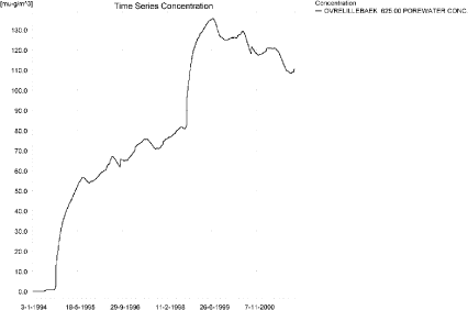
Figure 11.22. Example of porewater concentration of terbutylazin at the upstream part of the sandy loam catchment.
Figur 11.22. Eksempel på porevandskoncentration af terbutylazin i den opstrøms ende af morænelersoplandet.
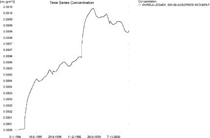
Figure 11.23. Example of sorption of terbutylazin on sediment in the upstream part of the sandy loam catchment. The concentration is in µg/g sediment and not µg/m³ as stated.
Figur 11.23. Eksempel på sorption af terbutylazin til sediment i den opstrøms del af morænelersoplandet. Koncentrationen er i µg/g sediment og ikke µg/m³ som angivet.
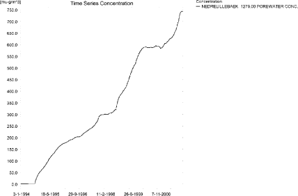
Figure 11.24. Pore water concentration of terbutylazin in the lower end of the sandy loam catchment. The maximum value reached in the lower end of the catchment is 902 ng/l.
Figur 11.24. Porevandskoncentration af terbutylazin i den nedstrøms ende af morænelersoplandet. Den maximale værdi opnået i den nedre del af oplandet er 902 ng/l.
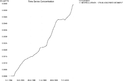
Figure 11.25. Sorption of terbutylazin on sediment in downstream end of the the sandy loam catchment. The concentration is in µg/g sediment and not µg/m³ as stated. The maximum value reached in the lower end is 6.56 µg/kg.
Figur 11.25. Sorption af terbutylazin til sediment i den nedstrøms del af morænelersoplandet. Koncentrationen er i µg/g sediment og ikke µg/m³ som angivet. Den maximalt opnåede værdi i den nedre ende er 6.56 µg/kg.
Figure 11.26 to Figure 11.28, Table 11.9 and Table 11.10 show the results as generated by the PestSurf templates. The maximum value generated by the templates for the upper part of the stream is 11.4 µg/l, and for the lower part, 32.1 µg/l. The maximum value generated in the upstream part of the catchment is 15.8 µg/l while the maximum in the spreadsheet and in the main stream is 32.1 µg/l. The template therefore did not catch the maximum concentration in the upstream end of the catchment, but it did catch the maximum value in the lower part of the catchment.
Click here to see Figure 11.26.
Figure 11.26. Overview for terbutylazin in the sandy loam catchment generated by the PestSurf excel template for the upstream part of the catchment. The detection value was set to 100 ng/l.
Figur 11.26. Oversigt for terbutylazin genereret med PestSurf-excel-skabelonen for den opstrøms del af morænelersoplandet. Detektionsgrænsen var sat til 100 ng/l.
Click here to see Figure 11.27.
Figure 11.27. Overview for terbutylazin in the sandy loam catchment generated by the PestSurf excel template for the upstream part of the catchment. The detection value for the graph to the lower right was set to 1000 ng/l. The figure to the lower right differs from Figure 11.26.
Figur 11.27. Oversigt for terbutylazin genereret med PestSurf-excel-skabelonen for den opstrøms del af morænelersoplandet. Detektionsgrænsen for grafen nederst til højre er sat til var sat til 1000 ng/l. Figuren nederst til højre er forskellig fra figur Figur 11.26.
Click here to see Figure 11.28.
Figure 11.28. Overview for terbutylazin in the sandy loam catchment generated by the PestSurf excel template for the downstream part of the catchment. The detection value was set to 1000 ng/l.
Figur 11.28. Oversigt for terbutylazin genereret med PestSurf-excel-skabelonen for den nedstrøms del af morænelersoplandet. Detektionsgrænsen var sat til 1000 ng/l.
Table 11.9. Part of the result sheet generated by the PestSurf Excel sheet for the upstream part of the sandy loam catchment. The lowest detection value for table generation is 100 ng/l, toxicity to fish, daphnies and algae are set to 1000, 10000 and 100000 ng/, respectively. The recorded peaks are shown in Figure 11.26.
Tabel 11.9. Uddrag af resultatpresentationen genereret af PestSurf-Excel-arket for den opstrøms del af morænelersoplandet. Detektionsgrænsen for tabelgenerering er sat til 100 ng/l. Toxicitetsværdierne for fisk, dafnier og alger er henholdsvis 1000, 10000 og 100000 ng/l. Hændelserne er vist i Figur 11.26.
Table 11.10. Part of the result sheet generated by the PestSurf Excel sheet for the downstream part of the sandy loam catchment. The lowest detection value is 1000 ng/l, toxicity to fish, daphnies and algae are set to 1001, 10000 and 100000 ng/, respectively. The recorded peaks are shown in Figure 11.28.
Tabel 11.10. Uddrag af resultatpresentationen genereret af PestSurf-Excel-arket for den nedstrøms del af morænelersoplandet. Detektionsgrænsen for tabelgenerering er sat til 1000 ng/l. Toxicitetsværdierne for fisk, dafnier og alger er henholdsvis 1001, 10000 og 100000 ng/l. Hændelserne er vist i Figur 11.28.
Click here to see Table 11.10.
11.4.4 Sandy loam catchment, pond
The concentration pattern is evaluated in the middle of the pond only, see Figure 11.29. The pond receives contributions through drift, in good correspondence with the fact that it is situated in the upper part of the sandy loam catchment. However, some contribution with drain flow appears to influence the concentration too. The maximum concentration is, 1.194 µg/l, and the highest concentrations are reached in dry and normal years.
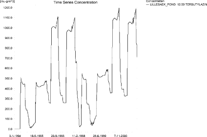
Figure 11.29. Concentrations of terbutylazin for the sandy loam pond.
Figur 11.29. Koncentration af terbutylazin i morænelersvandhullet.
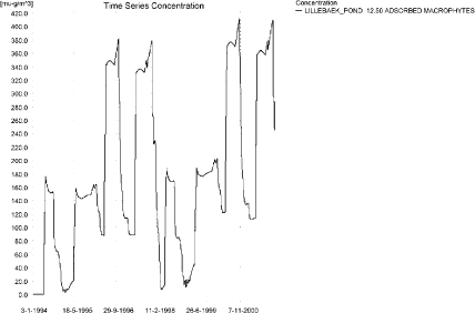
Figure 11.30. Terbutylazin sorbed to the macrophytes in the sandy loam pond.
Figur 11.30. Terbutylazin sorberet til makrofytter i morænelersvandhullet.
Figure 11.30 shows that the macrophytes participate in the regulation of the concentrations in the pond. The concentrations reach about a third of the level of the concentration in the water phase.
The pore water concentration is shown in Figure 11.31. It reaches 84 ng/l and seems to continue to increase. The concentration of terbutylazin in the sediment is shown in Figure 11.32. It reaches 0.694 µg/kg in the simulation period.
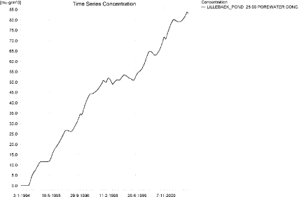
Figure 11.31. Pore water concentration of terbutylazin in the sandy loam pond.
Figur 11.31. Porevandskoncentration af terbutylazin i morænelersvandhullet.

Figure 11.32. Terbutylazin sorbed to sediment in the sandy loam pond. The concentration is in µg/g sediment and not µg/m³ as stated.
Figur 11.32. Terbutylazin sorberet til sediment i morænelersvandhullet. Koncentrationen er i µg/g sediment og ikke µg/m³ som angivet.
In Table 11.11, global maxima and time weighted concentrations (up to 7 days) were extracted.
Table 11.11. Actual and time weighted concentrations (ng/l) of terbutylazin in the sandy loam pond.
Tabel 11.11. Beregnede og tidsvægtede koncentrationer (ng/l) af terbutylazin i morænelersvandhullet.
| Year | Terbutylazin | Actual | Time-weighted | Date |
| 1994 | global max | 511 | 05-06-1994 | |
| 1 hour(after max) | 510 | 511 | ||
| 1 day after sp.in. | 506 | 508 | ||
| 3 days | 500 | 504 | ||
| 4 days | 497 | 503 | ||
| 7 days | 490 | 499 | ||
| 1995 | Global max | 462 | 05-06-1995 | |
| 1 hour | 461 | 462 | ||
| 1 day | 458 | 460 | ||
| 2 days | 455 | 457 | ||
| 4 days | 453 | 457 | ||
| 7 days | 448 | 454 | ||
| 1996 | global max | 1106 | 04-11-1996 | |
| 1 hour | ||||
| 1 day | 1101 | 1104 | ||
| 2 days | 973 | 1059 | ||
| 4 days | 939 | 1033 | ||
| 7 days | 892 | 981 | ||
| 1997 | global max | 1098 | 12-12-1997 | |
| 1 hour | ||||
| 1 day | 1021 | 1060 | ||
| 2 days | 840 | 966 | ||
| 4 days | 804 | 930 | ||
| 7 days | 781 | 871 | ||
| 1998 | global max | 665 | 16-01-1998 | |
| 1 hour | ||||
| 1 day | 664 | 665 | ||
| 2 days | 662 | 663 | ||
| 4 days | 662 | 663 | ||
| 7 days | 652 | 661 | ||
| 1999 | global max | 548 | 04-06-1999 | |
| 1 hour | 547 | 548 | ||
| 1 day | 544 | 546 | ||
| 2 days | 541 | 544 | ||
| 4 days | 540 | 543 | ||
| 7 days | 536 | 541 | ||
| 2000 | global max | 1194 | 03-11-2000 | |
| 1 hour | ||||
| 1 day | 1189 | 1191 | ||
| 2 days | 1051 | 1143 | ||
| 4 days | 1014 | 1116 | ||
| 7 days | 965 | 1060 | ||
| 2001 | global max | 1188 | 11-12-2001 | |
| 1 hour | ||||
| 1 day | 1104 | 1146 | ||
| 2 days | 910 | 1045 | ||
| 4 days | 870 | 1006 | ||
| 7 days | 846 | 942 | ||
| max values | ||||
| global max | 1194 | |||
| 1 hour | 548 | |||
| 1 day | 1189 | 1191 | ||
| 2 days | 1051 | 1143 | ||
| 4 days | 1014 | 1116 | ||
| 7 days | 965 | 1060 |
The FOCUS SW D4-pond-scenario and the PestSurf sandy loam pond generates comparable concentration levels. D4 generates a concentration of 0.903 µg/l while PestSurf reaches 1.19 µg/l. The concentration difference is less than what is the case when the main source of pesticide to the pond is drift.
However, the concentration in sediment is 1.857 µg/kg in FOCUS and only 0.694 µg/kg in the PestSurf simulation.
Figure 11.33 and Table 11.12 show output from the PestSurf template, with a time series identical to Figure 11.29.
Click here to see Figure 11.33.
Figure 11.33. Overview for terbutylazin in the sandy loam pond generated by the PestSurf excel template. The time series shown is identical to the one in Figure 11.29. The plot is generated with a lowest detection value of 400 ng/l.
Figur 11.33. Oversigt for terbutylazin i morænelersvandhullet genereret med PestSurf-excel-skabelonen. Den viste tidsserie er mage til den i Figur 11.29. Detektionsgrænsen er sat til 400 ng/l.
Table 11.12. Part of the result sheet generated by the PestSurf Excel sheet. The lowest detection value is 400 ng/l, toxicity to fish, daphnies and algae are set to 800, 1200 and 10000 ng/, respectively. The recorded peaks are shown in Figure 11.33.
Tabel 11.12. Uddrag af resultatpresentationen genereret af PestSurf-Excel-arket. Detektionsgrænsen er sat til 400 ng/l. Toxicitetsværdierne for fisk, dafnier og alger er henholdsvis 800, 1200 og 10000 ng/l. De tabellerede hændelser er vist i Figur 11.33.
Click here to see Table 11.12.
Table 11.13. Summary of simulation results for terbutylazin.
Tabel 11.13. Opsummerede resultater for terbutylazin.
Click here to see Table 11.13.
11.5 Summary of simulations
The maximum actual concentrations for all simulations are recorded in Table 11.13.
The maximum concentration reached for the D3-ditch is lower than the concentration reached for the sandy pond and for the sandy stream. The concentration reached in the D3-ditch and the sandy stream is caused by drift, while the concentration reached in the pond is caused by shallow groundwater. The high concentration reached in the sandy stream is caused by spraying of the total agricultural area within 30 minutes. However, 112 m from the upstream end, the concentration is only 695 ng/l in the sandy catchment, and thus considerably lower than in the D3-ditch scenario (2.62 µg/l). The difference is, however, due to a combination of a bufferzone of 20 m width and a water depth of 8-9 cm.
The concentration reached in D4-pond and the sandy loam pond are of the same level of magnitude. Both concentrations are reached during the drainage season and are caused by drainage contributions to the pond.
The concentrations reached in the D4 stream and the sandy loam stream are considerably different. PestSurf generates a maximum concentration of 32.1 µg/l compared to 2.28 µg/l generated by FOCUS SW. The highest values in PestSurf are found downstream where both a build up in groundwater concentrations and drift contributes. The buildup in groundwater is not represented by FOCUS SW. The same goes for the extreme rainfall event and the high concentrations seen in the upstream part after a dry summer. These events generate high- but not the highest concentrations. 125 m from the upstream end of the sandy loam catchment, the concentration reaches 15.8 µg/l. The corresponding water depth is about 4 cm. This difference explains the difference found between the two models.
With respect to the sediment concentrations, the concentration reached in the sandy pond is considerably higher than the concentration reached in the D3-ditch (6.72 compared to 0.864 µg/kg). Also for the sandy loam stream, the sediment concentration is much higher (6.56 µg/l) than the concentration reached in the D4-stream (1.86 µg/kg). However, for the sandy loam pond, the sediment concentration is lower (0.694 µg/kg) than for the D4-pond (2.13 µg/kg). If the maximum concentration is evaluated on the stretch between 500-1700 m, the maximum concentration is 15.5 µg/l.
The models differ substantially due to presence or absence of macrophytes. Particularly for the sandy loam pond and stream, the concentrations in the water phase are influenced by the presence of macrophytes.
Annex 12
12 Comparison of risk assessment data produced by spray drift assessments, FOCUS SW and PestSurf
12.1 Chemical characteristics of the compound
| Compound: | Tribenuron methyl |
| Dose: | 15 g ai/ha |
| Spraying time: | 1. April |
| Crop: | Winter wheat |
Table 12.1. Overview of chemical properties of tribenuron-methyl and the parameters used in the simulations.
Tabel 12.1. Oversigt over tribenuron-methyl s kemiske egenskaber og parametrene brugt i simuleringerne.
| Chemical property | Condition | Recalculated values | |||
| Cas-no. | 101200-48-0 | ||||
| Molecular weight | 395.4 | ||||
| Form (acid, basic, neutral) | acid | ||||
| pKa | 4.7 | ||||
| Water solubility | 2.04 g/l | pH 7 | at 20°C | ||
| log Kow | 2.6 | at pH | 5 | KowA- | 0.0094 |
| log Kow | 0.78 | at pH | 7 | KowAH | 3.08 |
| log Kow | 0.3 | at pH | 9 | KowAH+ | |
| Vapor pressure, Pa | 5.3x10⁻⁸ | 25°C | 175 (Decomposition) | vapor pressure, Pa, 20°C | 1.25 × 10⁻⁸ |
| Henry’s law constant | 1.0 × 10⁻⁸ Pa m³ mol-1 | pH7 | Recalculated value, dimensionless | 4.11 × 10⁻¹² | |
| Sorption properties in soil | |||||
| Freundlich exp | 0.95 | ||||
| Koc, l/kg | 22.2 | ||||
| DT50 in soil, days | 9.01 | ||||
| DT50water | 23.5 days | PestSurf input | |||
| DT50sedment | None mentioned | ||||
| DT50water/sediment | 25.5 days | DT50, days | 25.5 | ||
| Sediment konc., mg/l | 80 (default in PestSurf) | ||||
| Hydrolysis | Very fast | at pH 5 | (acid) | 5.25 × 10⁻⁶ | |
| <1 day | at pH 7 | (neutral) | 19.9 | ||
| >200 | at pH 9 | (basic) | indef | ||
| Photolysis | |||||
| quantum yield | n.a. | ||||
| Spectrum | 201 nm (log ε = 4.57) 256 nm (log ε = 4.26) no maxima beyond 290 nm |
||||
| Other | stable | ||||
12.2 Concentration generated by spray
| Direct spray | FOCUS buffer zones | |||
| Ditch | Stream | Pond | ||
| µg l-1 | µg l-1 | µg l-1 | µg l-1 | |
| Tribenuron methyl | 5.0 | 0.138 | 0.093 | 0.041 |
12.3 Concentrations generated by FOCUS SW
12.3.1 D3- Ditch
| Tribenuron methyl | Ditch, D3 | |||||||
| Water | Sediment | |||||||
| Date | PEC | Date | TWAEC | Date | PEC | Date | TWAEC | |
| µg l-1 | µg l-1 | µg kg-1 | µg kg-1 | |||||
| Global max | 04-apr-92 | 0.095 | 05-apr-92 | 0.011 | ||||
| 1 d | 05-apr-92 | 0.042 | 05-apr-92 | 0.073 | 06-apr-92 | 0.007 | 05-apr-92 | 0.01 |
| 2 d | 06-apr-92 | 0.004 | 06-apr-92 | 0.046 | 07-apr-92 | 0.005 | 06-apr-92 | 0.009 |
| 4 d | 08-apr-92 | 0 | 08-apr-92 | 0.024 | 09-apr-92 | 0.004 | 08-apr-92 | 0.007 |
| 7 d | 11-apr-92 | 0 | 11-apr-92 | 0.013 | 12-apr-92 | 0.003 | 11-apr-92 | 0.005 |
12.3.2 D4 – Stream
| Tribenuron methyl | Stream, D4 | |||||||
| Water | Sediment | |||||||
| Date | PEC | Date | TWAEC | Date | PEC | Date | TWAEC | |
| µg l-1 | µg l-1 | µg kg-1 | µg kg-1 | |||||
| Global max | 18-apr-85 | 0.076 | 18-apr-85 | 0.002 | ||||
| 1 d | 19-apr-85 | 0 | 19-apr-85 | 0.005 | 19-apr-85 | 0 | 19-apr-85 | 0.001 |
| 2 d | 20-apr-85 | 0 | 19-apr-85 | 0.003 | 20-apr-85 | 0 | 20-apr-85 | 0.001 |
| 4 d | 22-apr-85 | 0 | 18-apr-85 | 0.001 | 22-apr-85 | 0 | 22-apr-85 | 0 |
| 7 d | 25-apr-85 | 0 | 18-apr-85 | 0.001 | 25-apr-85 | 0 | 25-apr-85 | 0 |
12.3.3 D4 - Pond
| Tribenuron methyl | Pond, D4 | |||||||
| Water | Sediment | |||||||
| Date | PEC | Date | TWAEC | Date | PEC | Date | TWAEC | |
| µg l-1 | µg l-1 | µg kg-1 | µg kg-1 | |||||
| Global max | 18-apr-85 | 0.003 | 16-maj-85 | 0.002 | ||||
| 1 d | 19-apr-85 | 0.003 | 19-apr-85 | 0.003 | 17-maj-85 | 0.002 | 17-maj-85 | 0.002 |
| 2 d | 20-apr-85 | 0.003 | 20-apr-85 | 0.003 | 18-maj-85 | 0.002 | 17-maj-85 | 0.002 |
| 4 d | 22-apr-85 | 0.003 | 22-apr-85 | 0.003 | 20-maj-85 | 0.002 | 18-maj-85 | 0.002 |
| 7 d | 25-apr-85 | 0.003 | 25-apr-85 | 0.003 | 23-maj-85 | 0.002 | 20-maj-85 | 0.002 |
12.3.4 Conclusion – FOCUS SW
The highest concentration is generated in the ditch (D3). It is caused by wind drift and the concentration becomes 0.095 µg/l. The same scenario shows the highest concentration in the sediment, 0.011 µg/l. For all scenarios, the concentrations are lower than what is generated by the simpler assessments, but for the ditch and stream-scenarios the difference between the simple drift calculation and the FOCUS SW-simulation is rather small.
12.4 PestSurf
12.4.1 Sandy Catchment, stream
The distribution of concentrations was assessed in several steps. First, the maximum concentrations at each calculation point were listed, and the dates for the occurrence of the maximum were assessed. The points, for which the maximum value also represents a local maximum were selected for further analysis. The relevant values are listed in Table 12.2.
Table 12.2. Maximum concentrations (ng/l) of tribenuron methyl simulated for each calculation point in the sandy catchment.
Tabel 12.2. Maximumkoncentrationer (ng/l) af tribenuron-methyl simuleret for hvert beregningspunkt i det sandede opland.
| TRIBENURON | Maximum | Max.Time | Local maxima |
| ODDERBAEK 0.00 | 7 | 01-04-2001 08:41 | |
| ODDERBAEK 56.00 | 8 | 01-04-2001 08:41 | |
| ODDERBAEK 112.00 | 10 | 01-04-2001 08:33 | |
| ODDERBAEK 192.00 | 33 | 01-04-2001 08:33 | |
| ODDERBAEK 272.00 | 63 | 01-04-2001 08:33 | |
| ODDERBAEK 278.00 | 66 | 01-04-2001 08:33 | |
| ODDERBAEK 282.00 | 68 | 01-04-2001 08:33 | |
| ODDERBAEK 298.50 | 75 | 01-04-2001 08:33 | |
| ODDERBAEK 315.00 | 85 | 01-04-2001 08:24 | |
| ODDERBAEK 317.50 | 87 | 01-04-2001 08:24 | |
| ODDERBAEK 320.00 | 89 | 01-04-2001 08:24 | |
| ODDERBAEK 410.00 | 125 | 01-04-2001 08:33 | |
| ODDERBAEK 500.00 | 132 | 01-04-2001 08:33 | |
| ODDERBAEK 513.00 | 137 | 01-04-2001 08:33 | |
| ODDERBAEK 521.00 | 141 | 01-04-2001 08:33 | |
| ODDERBAEK 622.00 | 177 | 01-04-2001 08:33 | |
| ODDERBAEK 723.00 | 198 | 01-04-2001 08:33 | |
| ODDERBAEK 733.00 | 204 | 01-04-2001 08:33 | |
| ODDERBAEK 742.00 | 209 | 01-04-2001 08:33 | |
| ODDERBAEK 789.50 | 228 | 01-04-2001 08:33 | |
| ODDERBAEK 837.00 | 243 | 01-04-2001 08:33 | |
| ODDERBAEK 848.00 | 249 | 01-04-2001 08:33 | |
| ODDERBAEK 863.00 | 259 | 01-04-2001 08:33 | |
| ODDERBAEK 956.00 | 297 | 01-04-2001 08:33 | |
| ODDERBAEK 1049.00 | 318 | 01-04-2001 08:33 | x |
| ODDERBAEK 1111.50 | 321 | 01-04-2001 08:33 | |
| ODDERBAEK 1174.00 | 300 | 01-04-2001 08:33 | |
| ODDERBAEK 1226.00 | 287 | 01-04-2001 08:33 | |
| ODDERBAEK 1278.00 | 275 | 01-04-2001 08:33 | |
| ODDERBAEK 1293.50 | 270 | 01-04-2001 08:33 | |
| ODDERBAEK 1310.00 | 261 | 01-04-2001 08:41 | |
| ODDERBAEK 1421.00 | 263 | 01-04-2001 08:33 | |
| ODDERBAEK 1532.00 | 237 | 01-04-2001 08:33 | |
| ODDERBAEK 1558.06 | 208 | 01-04-2001 08:33 | |
| ODDERBAEK 1584.12 | 189 | 01-04-2001 08:33 | |
| ODDERBAEK 1584.12 | 189 | 01-04-2001 08:33 | |
| ODDERBAEK 1621.06 | 187 | 01-04-2001 08:33 | |
| ODDERBAEK 1658.00 | 187 | 01-04-2001 08:33 | |
| ODDERBAEK 1698.50 | 191 | 01-04-2001 08:33 | |
| ODDERBAEK 1739.00 | 195 | 01-04-2001 08:33 | |
| ODDERBAEK 1801.50 | 197 | 01-04-2001 08:33 | x |
| ODDERBAEK 1864.00 | 173 | 01-04-2001 08:33 | |
| ODDERBAEK 1977.00 | 143 | 01-04-2000 09:18 | |
| ODDERBAEK 2090.00 | 138 | 01-04-2000 09:26 | |
| ODDERBAEK 2098.00 | 138 | 01-04-2000 09:26 | |
| ODDERBAEK 2105.00 | 138 | 01-04-2000 09:26 | |
| ODDERBAEK 2131.00 | 136 | 01-04-2000 09:26 | |
| ODDERBAEK 2157.00 | 133 | 01-04-2000 09:26 | |
| ODDERBAEK 2168.00 | 132 | 01-04-2000 09:35 | |
| ODDERBAEK 2179.00 | 132 | 01-04-2000 09:35 | |
| ODDERBAEK 2268.50 | 130 | 01-04-2000 09:35 | |
| ODDERBAEK 2358.00 | 125 | 01-04-2001 09:45 | |
| ODDERBAEK 2363.50 | 124 | 01-04-2001 09:45 | |
| ODDERBAEK 2372.00 | 124 | 01-04-2001 09:45 | |
| ODDERBAEK 2427.00 | 123 | 01-04-2001 09:45 | |
| ODDERBAEK 2482.00 | 120 | 01-04-2001 09:54 | |
| ODDERBAEK 2609.00 | 119 | 01-04-2001 09:54 | |
| ODDERBAEK 2736.00 | 114 | 01-04-2001 10:00 | |
| ODDERBAEK 2831.00 | 113 | 01-04-2001 10:00 | |
| ODDERBAEK 2926.00 | 107 | 01-04-2001 10:00 | |
| ODDERBAEK 2958.50 | 106 | 01-04-2001 10:00 | |
| ODDERBAEK 2991.00 | 105 | 07-04-1998 09:53 | |
| ODDERBAEK 3029.50 | 104 | 07-04-1998 10:00 | |
| ODDERBAEK 3068.00 | 101 | 07-04-1998 10:00 | |
| ODDERBAEK 3131.00 | 95 | 07-04-1998 10:00 | |
| ODDERBAEK 3194.00 | 87 | 01-04-2001 11:00 | |
| ODDERBAEK 3250.50 | 88 | 01-04-2001 11:00 | |
| ODDERBAEK 3307.00 | 87 | 01-04-2001 11:00 | |
| ODDERBAEK 3315.00 | 87 | 01-04-2001 11:00 | |
| ODDERBAEK 3323.00 | 87 | 01-04-2001 11:00 | |
| ODDERBAEK 3355.50 | 87 | 01-04-2001 11:00 | |
| ODDERBAEK 3388.00 | 86 | 01-04-2001 11:00 | |
| ODDERBAEK 3438.50 | 86 | 01-04-2001 11:00 | |
| ODDERBAEK 3489.00 | 90 | 01-04-2001 08:33 | |
| ODDERBAEK 3499.50 | 91 | 01-04-2001 08:33 | |
| ODDERBAEK 3510.00 | 92 | 01-04-2001 08:33 | |
| ODDERBAEK 3581.00 | 94 | 01-04-2001 08:33 | x |
| ODDERBAEK 3652.00 | 89 | 01-04-2001 08:33 | |
| ODDERBAEK 3707.00 | 85 | 01-04-2001 08:33 | |
| ODDERBAEK 3762.00 | 78 | 01-04-2001 08:33 | |
| ODDERBAEK 3790.00 | 71 | 01-04-2001 08:41 | |
| ODDERBAEK 3818.00 | 59 | 07-04-1998 08:41 | |
| ODDERBAEK 3818.00 | 59 | 07-04-1998 08:41 | |
| ODDERBAEK 3884.00 | 60 | 07-04-1998 08:41 | |
| ODDERBAEK 3950.00 | 58 | 07-04-1998 11:00 | |
| ODDERBAEK 3998.00 | 58 | 07-04-1998 11:00 | |
| ODDERBAEK 4046.00 | 57 | 07-04-1998 11:00 | |
| ODDERBAEK 4047.50 | 57 | 07-04-1998 11:00 | |
| ODDERBAEK 4049.00 | 57 | 07-04-1998 11:00 | |
| ODDERBAEK 4052.50 | 57 | 07-04-1998 11:00 | |
| ODDERBAEK 4056.00 | 57 | 07-04-1998 11:00 | |
| ODDERBAEK 4058.00 | 57 | 07-04-1998 11:00 | |
| ODDERBAEK 4060.00 | 57 | 07-04-1998 11:00 | |
| ODDERBAEK 4080.00 | 57 | 07-04-1998 11:00 | |
| ODDERBAEK 4100.00 | 56 | 07-04-1998 11:00 | |
| ODDERBAEK 4134.00 | 56 | 07-04-1998 11:00 | |
| ODDERBAEK 4168.00 | 56 | 07-04-1998 11:00 | |
| GISLUM_ENGE_AFLOEB 0.00 | 0 | 13-02-2000 00:00 | |
| GISLUM_ENGE_AFLOEB 50.00 | 0 | 12-02-2000 00:00 | |
| GISLUM_ENGE_AFLOEB 100.00 | 0 | 13-02-2000 00:00 | |
| GISLUM_ENGE_AFLOEB 150.00 | 0 | 12-02-2000 00:00 | |
| GISLUM_ENGE_AFLOEB 200.00 | 0 | 12-02-2000 00:00 | |
| GISLUM_ENGE_AFLOEB 250.00 | 0 | 12-02-2000 00:00 | |
| GISLUM_ENGE_AFLOEB 300.00 | 0 | 12-02-2000 00:00 | |
| GISLUM_ENGE_AFLOEB 340.00 | 0 | 12-02-2000 00:00 | |
| GISLUM_ENGE_AFLOEB 380.00 | 0 | 12-02-2000 00:00 | |
| GISLUM_ENGE_AFLOEB 430.00 | 0 | 12-02-2000 00:00 | |
| GISLUM_ENGE_AFLOEB 480.00 | 0 | 13-02-2000 00:00 | |
| GISLUM_ENGE_AFLOEB 530.00 | 0 | 13-02-2000 00:00 | |
| GISLUM_ENGE_AFLOEB 580.00 | 0 | 13-02-2000 00:00 | |
| GISLUM_ENGE_AFLOEB 630.00 | 0 | 13-02-2000 00:00 | |
| GISLUM_ENGE_AFLOEB 680.00 | 0 | 13-02-2000 00:00 | |
| GISLUM_ENGE_AFLOEB 730.00 | 0 | 13-02-2000 00:00 | |
| GISLUM_ENGE_AFLOEB 780.00 | 0 | 13-02-2000 00:00 | |
| GISLUM_ENGE_AFLOEB 830.00 | 0 | 13-02-2000 00:00 | |
| GISLUM_ENGE_AFLOEB 880.00 | 0 | 13-02-2000 00:00 | |
| GISLUM_ENGE_AFLOEB 915.00 | 0 | 12-02-2000 00:00 | |
| GISLUM_ENGE_AFLOEB 950.00 | 0 | 12-02-2000 00:00 | |
| GISLUM_ENGE_AFLOEB 985.00 | 0 | 12-02-2000 00:00 | |
| GISLUM_ENGE_AFLOEB 1020.00 | 0 | 12-02-2000 00:00 | |
| GISLUM_ENGE_AFLOEB 1045.00 | 0 | 12-02-2000 00:00 | |
| GISLUM_ENGE_AFLOEB 1070.00 | 0 | 12-02-2000 00:00 | |
| GISLUM_ENGE_AFLOEB 1110.00 | 0 | 12-02-2000 00:00 | |
| GISLUM_ENGE_AFLOEB 1150.00 | 0 | 12-02-2000 00:00 | |
| GISLUM_ENGE_AFLOEB 1190.00 | 0 | 12-02-2000 00:00 | |
| GISLUM_ENGE_AFLOEB 1230.00 | 0 | 02-04-2003 08:41 | |
| GISLUM_ENGE_AFLOEB 1271.00 | 0 | 02-04-2003 08:41 | |
| GISLUM_ENGE_AFLOEB 1312.00 | 0 | 02-04-2003 08:41 | |
| GISLUM_ENGE_AFLOEB 1422.00 | 2 | 07-04-1998 08:41 | |
| GISLUM_ENGE_AFLOEB 1532.00 | 59 | 07-04-1998 08:41 | |
| TILLOEB 0.00 | 178 | 01-04-2001 08:33 | |
| TILLOEB 20.16 | 184 | 01-04-2001 08:33 | |
| TILLOEB 40.31 | 189 | 01-04-2001 08:33 | x |
| global max | 321 |
The pattern over time was the same for all calculation points. The peak values are generated by wind drift, see Figure 12.1.
Each of the events generated an almost identical pattern along the stream. Figure 12.2 to Figure 12.5 show the peak concentrations of tribenuron methyl moving through the sandy catchment after spraying.
The thin black line represents the concentration, while the thick black line shows the maximum concentrations obtained during the simulations. In addition, the outline of the stream is shown. In the middle of the catchment, the stream is protected by unsprayed areas.The maximum values at the center of the catchment are obtained when the peak from upstream move through the catchment during the hours following spraying.
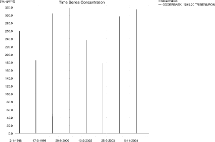
Figure 12.1. Concentration pattern over time for tribenuron methyl in the sandy Catchment.
Figur 12.1. Koncentrationsmønster som funktion af tid for tribenuron-methyl i det sandede opland.
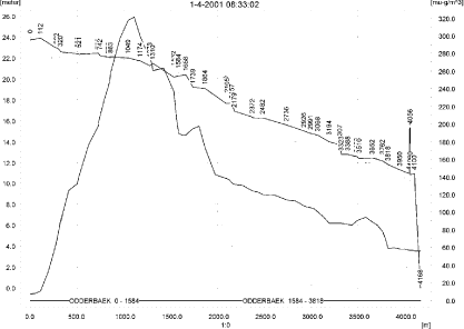
Figure 12.2. Concentrations of tribenuron methyl in the sandy catchment on 1. April 2001, 8.33.
Figur 12.2. Koncentrationer tribenuron-methyl i det sandede opland den 1. april 2001, 8.33.
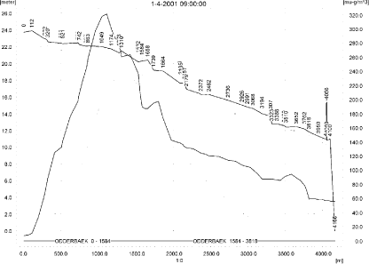
Figure 12.3. Concentrations of tribenuron methyl in the sandy catchment on 1. April 2001, 9.00.
Figur 12.3. Koncentrationer tribenuron-methyl i det sandede opland den 1. april 2001, 9.00.
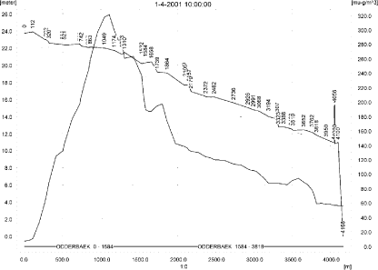
Figure 12.4. Concentrations of tribenuron methyl in the sandy catchment on 1. April 2001, 10.00.
Figur 12.4. Koncentrationer tribenuron-methyl i det sandede opland den 1. april 2001, 10.00.

Figure 12.5. Concentrations of tribenuron methyl in the sandy catchment on 1. April 2001, 12.00.
Figur 12.5. Koncentrationer tribenuron-methyl i det sandede opland den 1. april 2001, 12.00.
In order to present the data in a similar fashion to the FOCUS SW-results, data were extracted and recalculated for the time series marked in Table 12.2. The global maxima and time weighted concentrations (up to 7 days) were extracted and are reported in Table 12.3. Note that the unit is ng/l.
Table 12.3. Concentration (ng/l) of tribenuron methyl at selected points in the sandy stream.
Tabel 12.3. koncentration af tribenuron-methyl, ng/l, på udvalgte lokaliteter i det sandede vandløb.
An example of the amount of pesticide sorbed to macrophytes is shown in Figure 12.6. The maximum value of 1.7 ng/l is reached 1421 m from the upstream end. The concentration does not significantly influence the concentration in the water phase- The porewater concentrations are shown in Figure 12.7. The sorption to sediment is <0.01 ng/kg.
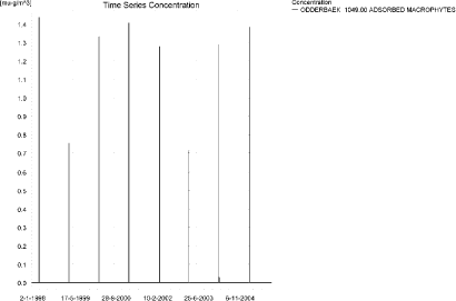
Figure 12.6. Typical concentration pattern for tribenuron methyl sorbed on macrophytes in the sandy catchment. The maximum value (1.71 ng/l) is reached 1421 m from the upstream end.
Figur 12.6. Typisk koncentrationsmønster af tribenuron-methyl sorberet på makrofytter i det sandede opland. Den maximalt opnåede værdi, ( 1.71 ng/l) is reached 1421 m fra den opstrøms ende.
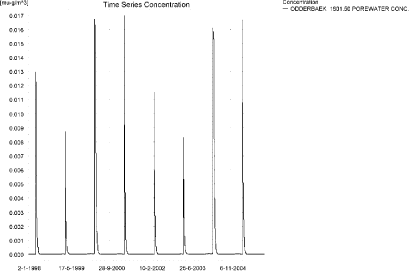
Figure 12.7. Pore water concentration of tribenuron methyl in the sandy catchment. The maximum concentration reached is 0.019 ng/l 1421 m from the upstream end.
Figur 12.7. Porevandskoncentrationer af tribenuron-methyl i det sandede opland. Den maximale koncentration (0.019 ng/l) er fundet 1421 m fra den opstrøms ende.
The global maximum value calculated by PestSurf for the sandy catchment in the water phase is 321 ng/l. This is considerably more than what is found in the D3-ditch scenario (95 ng/l). However, 112 m from the upstream end, the concentration only reaches 10 ng/l, which is considerably less than what is found in the D3-ditch.
Sediment concentrations are 11 ng/kg in the D3-ditch scenaro and below 0.01 ng/kg in the PestSurf sandy catchment.
Figure 12.8 shows the output of the Pestsurf Excel template. The template works with pre-defined data extraction points. The plot requires specification of a “lowest detection value” (ldc), which defines when a pesticide occurrence is defined as an event. The time series plot is identical to the time series shown earlier, and the graph in the upper right corner resembles the plot in Figure 12.2, but takes into account a longer period of time. A curve is generated when a downstream point reaches a concentration higher than the ldc. The programme then tracks the highest concentration for each calculation point in the stream within the last 24 hours. The plot in the lower right corner shows how many events have concentrations higher than a given value (ldc) for the selected monitoring points.
Table 12.4 shows part of the result sheet generated by the PestSurf Excel sheet. The selected table shows the point along the stream (of the pre-defined points) with the highest concentration. This value was, however, only 187 ng/l. Thus, the pre-defined points have not caught the highest concentration of the simulation, which was 321 ng/l.
Click here to see Figure 12.8.
Figure 12.8. Overview for tribenuron methyl in the sandy catchment generated by the PestSurf excel template. The max concentrations generated over the 24 hours are similar to the overviews in Figure 12.2 and Figure 12.3. The graph to the lower right shows how many events have concentrations higher than a given value for the selected monitoring points. Detection value was set to 0.05 ng/l.
Figur 12.8. Oversigt for tribenuron-methyl i det sandede opland genereret med PestSurf-excel-skabelonen. Den maximale koncentration genereret over 24 timer svarer til oversigten i Figur 12.2 og Figur 12.3. Grafen nederst til højre viser hvorm mange hændelser, der har koncentrationern højere end en given værdi for de prædefinerede lokaliteter. Detektionsgrænsen var sat til 0.05 ng/l.
Table 12.4. Part of the result sheet generated by the PestSurf Excel sheet. The selected table shows the point along the stream with the highest concentration recorded. The lowest detection value is 0.05 ng/l, toxicity to fish, daphnies and algae are set to 2, 10 and 20 ng/, respectively. The recorded peaks are shown in Figure 12.8.
Tabel 12.4. Uddrag af resultatpresentationen genereret af PestSurf-Excel-arket. Den udvalgte tabel viser det fordefinerede punkt langs med åen med højest koncentration. Detektionsgrænsen er sat til 0.05 ng/l mens toxicitetsværdierne for fisk, dafnier og alger er henholdsvis 2, 10 og 20 ng/l. De tabellerede hændelser er vist i Figur 12.8.
12.4.2 Sandy Catchment, pond
The concentration pattern is evaluated in the middle of the pond only, see Figure 12.9. The pond receives drift but the contribution through groundwater dominates the picture during the wet years 1998-1999, repeated in 2002-2003. The maximum concentration is 289 ng/l. Between the time of spraying and the max concentration occurring in the pond is 27 mm of rainfall in 1998 (2002) and 50 mm in 1999 (2003). The general water level in the catchment must be high during these periods to cause such a quick response.
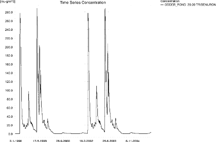
Figure 12.9. Concentrations of tribenuron methyl in the sandy pond.
Figur 12.9. Koncentration af tribenuron-methyl i det sandede vandhul.
In Table 12.5, global maxima and time-weighted concentrations (up to 7 days) were extracted.
Table 12.5. Maximum concentrations (ng/l) of tribenuron methyl generated in the sandy pond.
Tabel 12.5. maximumkoncentrationer af tribenuron-methyl (ng/l) genereret for det sandede vandhul.
| Year | ODDER_POND 20.00, | |||
| Conc. | TWC | Date | ||
| 1998 | 1998 (global max) | 278 | 19-04-1998 | |
| 1 hour (after max) | ||||
| 1 day after sp.in. | 273 | 276 | ||
| 2 days | 269 | 273 | ||
| 4 days | 264 | 271 | ||
| 7 days | 266 | 267 | ||
| 1999 | 1999 (global max) | 289 | 19-04-1999 | |
| 1 hour (after max) | 288 | 288 | ||
| 1 day after sp.in. | 284 | 287 | ||
| 2 days | 267 | 279 | ||
| 4 days | 261 | 275 | ||
| 7 days | 269 | 271 | ||
| 2000 | 2000 (global max) | 14 | 01-01-2000 | |
| 1 hour (after max) | ||||
| 1 day after sp.in. | 13 | 14 | ||
| 2 days | 12 | 13 | ||
| 4 days | 12 | 13 | ||
| 7 days | 11 | 12 | ||
| 2001 | 2001 (global max) | 3 | 27-12-2001 | |
| 1 hour (after max) | ||||
| 1 day after sp.in. | 3 | 3 | ||
| 2 days | 3 | 3 | ||
| 4 days | 2 | 3 | ||
| 7 days | 3 | 3 | ||
| 2002 | 2002 (global max) | 278 | 19-04-2002 | |
| 1 hour (after max) | ||||
| 1 day after sp.in. | 273 | 276 | ||
| 2 days | 269 | 273 | ||
| 4 days | 264 | 271 | ||
| 7 days | 266 | 268 | ||
| 2003 | 2003 (global max) | 289 | 19-04-2003 | |
| 1 hour (after max) | 289 | 289 | ||
| 1 day after sp.in. | 284 | 287 | ||
| 2 days | 267 | 279 | ||
| 4 days | 261 | 276 | ||
| 7 days | 269 | 271 | ||
| 2004 | 2004 (global max) | 15 | 01-01-2004 | |
| 1 hour (after max) | ||||
| 1 day after sp.in. | 14 | 15 | ||
| 2 days | 13 | 14 | ||
| 4 days | 12 | 14 | ||
| 7 days | 11 | 13 | ||
| 2005 | 2005 (global max) | 3 | 27-12-2005 | |
| 1 hour (after max) | ||||
| 1 day after sp.in. | 3 | 3 | ||
| 2 days | 3 | 3 | ||
| 4 days | 3 | 3 | ||
| 7 days | ||||
| Global max | 289 | |||
| 1 hour (after max) | 289 | 289 | ||
| 1 day after sp.in. | 284 | 287 | ||
| 2 days | 269 | 279 | ||
| 4 days | 264 | 276 | ||
| 7 days | 269 | 271 | ||
The sorption to macrophytes is shown in Figure 12.10. The pattern follows closely the concentration in the water. The water concentration is marginally influenced by the presence of macrophytes. Time series of porewater concentration and tribenuron methyl sorbed to sediment is shown in Figure 12.11 and Figure 12.12. The maximum concentration reached in sediment is 3.1 ng/kg.
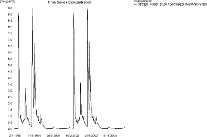
Figure 12.10. Sorption of tribenuron methyl to macrophytes in the sandy pond.
Figur 12.10. Sorption af tribenuron-methyl til makrofytter i det sandede vandhul.
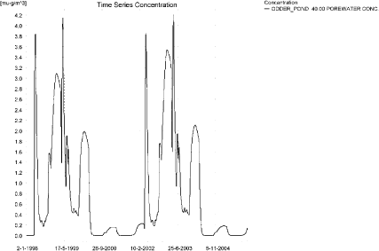
Figure 12.11. Tribenuron methyl concentration in the pore water in the sandy pond.
Figur 12.11. Porevandskoncentration af tribenuron-methyl i det sandede vandhul.
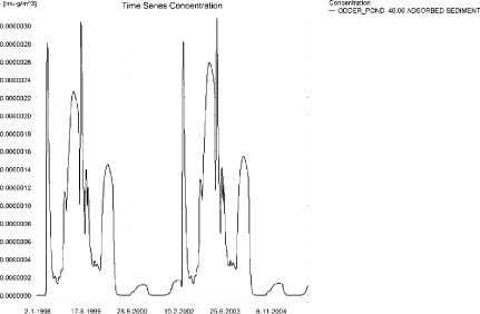
Figure 12.12. Sorption of tribenuron methyl to sediment in the sandy pond. The concentration is in µg/g sediment and not µg/m³ as stated.
Figur 12.12. Sorption af tribenuron-methyl til sediment i det sandede vandhul. Koncentrationen er i µg/g og ikke i µg/m³ som angivet.
Compared to the FOCUS D3-ditch, the concentration in the PestSurf sandy pond is considerably higher, 0.289 µg/l compared to 0.095 µg/l. The ditch-concentration is caused by wind drift, while the concentration in the sandy pond is caused by groundwater contribution.
With respect to sediment concentrations, it is opposite. The concentration in the D3-ditch reaches 11 ng/kg while PestSurf only reaches 3.1 ng/kg.
In the pond-case, there is no difference between the results of PestSurf and the results extracted by the templates. Figure 12.13 shows the output of the PestSurf Excel template. The template works with one pre-defined data extraction point for the pond (center of the pond). The plot requires specification of a “lowest detection value” (ldc) which defines when a pesticide occurrence is defined as an event. The time series plot is identical to the time series shown earlier. The plot to the right shows how many events have concentrations higher than a given toxicity value for the selected monitoring points.
Table 12.6 shows part of the result sheet generated by the PestSurf Excel sheet based on the ldc-value.
Click here to see Figure 12.13.
Figure 12.13. Overview for tribenuron methyl in the sandy pond generated by the PestSurf excel template. The time series shown is identical to the one in Figure 12.9. The detection value is set to 25 ng/l.
Figur 12.13. Oversigt for tribenuron-methyl i det sandede vandhul genereret med PestSurf-excel-skabelonen. Den viste tidsserie er mage til den i Figur 12.9. Detektionsgrænsen er sat til 25 ng/l.
Table 12.6. Part of the result sheet generated by the PestSurf Excel sheet, applied to Tribenuron methyl. The limiting value used for generation of the table is 25 ng/l. The toxicity values were set to 50,100 and 1000 ng/l, respectively. The recorded peaks are shown in Figure 12.13.
Tabel 12.6. Uddrag af resultatpresentationen genereret af PestSurf-Excel-arket. Grænseværdien anvendt til tabelgenerering er sat til 25 ng/l mens toxicitetsværdierne for fisk, dafnier og alger er henholdsvis 50, 100 og 1000 ng/l. De tabellerede hændelser er vist i Figur 12.13.
12.4.3 Sandy Loam catchment, Stream
The distribution of concentrations was assessed in several steps. First, the maximum concentrations at each calculation point were listed, and the dates for the occurrence of the maximum were assessed (Table 12.7). The points, for which the maximum value also represents a local maximum were selected for further analysis.
All points show the same type of time series pattern. The six points with highest maximum values were analysed further.
Table 12.7. Maximum concentrations (ng/l) of tribenuron methyl simulated for each calculation point in the sandy loam catchment.
Tabel 12.7. Maximumskoncentrationer (ng/l) af tribenuron-methyl simuleret for hvert beregningspunkt i morænelersoplandet.
| TRIBENURON METHYL | Maximum | Max.Time | Local Maxima |
| ALBJERGBAEK 0.00 | 11 | 02-04-1996 20:00 | |
| ALBJERGBAEK 150.00 | 33 | 05-04-1996 20:00 | |
| ALBJERGBAEK 300.00 | 56 | 05-04-1996 20:00 | |
| ALBJERGBAEK 450.00 | 62 | 04-04-2000 21:00 | |
| ALBJERGBAEK 600.00 | 255 | 31-03-2000 09:00 | |
| ELHOLTBAEK 0.00 | 6 | 02-04-1996 17:00 | |
| ELHOLTBAEK 165.00 | 7 | 02-04-1996 18:00 | |
| ELHOLTBAEK 330.00 | 205 | 31-03-2001 08:40 | |
| FREDLIGBAEK 0.00 | 13 | 29-04-1996 12:00 | |
| FREDLIGBAEK 100.00 | 20 | 29-04-1996 12:00 | |
| FREDLIGBAEK 200.00 | 22 | 28-04-2000 12:00 | |
| FREDLIGBAEK 300.00 | 22 | 28-04-2000 12:00 | |
| FREDLIGBAEK 400.00 | 22 | 28-04-2000 12:00 | |
| FREDLIGBAEK 500.00 | 21 | 28-04-2000 13:00 | |
| FREDLIGBAEK 600.00 | 22 | 28-04-2000 12:00 | |
| FREDLIGBAEK 667.50 | 22 | 28-04-2000 14:00 | |
| FREDLIGBAEK 735.00 | 426 | 31-03-2000 08:40 | x |
| GROFTEBAEK 0.00 | 5 | 02-04-1996 17:00 | |
| GROFTEBAEK 155.00 | 8 | 02-04-1996 18:00 | |
| GROFTEBAEK 310.00 | 9 | 02-04-1996 17:00 | |
| GROFTEBAEK 465.00 | 6 | 02-04-1996 18:00 | |
| GROFTEBAEK 620.00 | 353 | 31-03-2000 08:40 | x |
| STENSBAEK 0.00 | 29 | 02-04-1996 17:00 | |
| STENSBAEK 125.00 | 40 | 03-04-1996 05:00 | |
| STENSBAEK 250.00 | 12 | 02-04-1996 18:00 | |
| STENSBAEK 412.50 | 16 | 18-09-1998 00:00 | |
| STENSBAEK 575.00 | 85 | 31-03-2000 09:19 | |
| OVRELILLEBAEK 0.00 | 14 | 02-04-1996 22:00 | |
| OVRELILLEBAEK 125.00 | 553 | 31-03-2000 08:30 | x |
| OVRELILLEBAEK 250.00 | 434 | 31-03-2000 08:30 | |
| OVRELILLEBAEK 290.00 | 627 | 31-03-2000 08:30 | x |
| OVRELILLEBAEK 330.00 | 255 | 31-03-2000 09:00 | |
| OVRELILLEBAEK 330.00 | 255 | 31-03-2000 09:00 | |
| OVRELILLEBAEK 352.50 | 322 | 31-03-2000 09:10 | |
| OVRELILLEBAEK 375.00 | 85 | 31-03-2000 09:19 | |
| OVRELILLEBAEK 375.00 | 85 | 31-03-2000 09:19 | |
| OVRELILLEBAEK 437.50 | 95 | 31-03-2001 09:10 | |
| OVRELILLEBAEK 500.00 | 198 | 31-03-2000 08:30 | |
| OVRELILLEBAEK 625.00 | 390 | 31-03-2000 08:30 | x |
| OVRELILLEBAEK 750.00 | 255 | 31-03-2000 08:30 | |
| OVRELILLEBAEK 855.00 | 339 | 31-03-2000 08:30 | |
| OVRELILLEBAEK 960.00 | 205 | 31-03-2001 08:40 | |
| OVRELILLEBAEK 960.00 | 205 | 31-03-2001 08:40 | |
| OVRELILLEBAEK 980.00 | 217 | 31-03-2000 08:40 | |
| OVRELILLEBAEK 1000.00 | 181 | 31-03-2001 08:40 | |
| OVRELILLEBAEK 1062.50 | 183 | 31-03-2001 08:49 | |
| OVRELILLEBAEK 1125.00 | 170 | 31-03-2001 08:49 | |
| OVRELILLEBAEK 1187.50 | 197 | 31-03-2000 08:30 | |
| OVRELILLEBAEK 1250.00 | 190 | 31-03-2000 08:30 | |
| OVRELILLEBAEK 1425.00 | 275 | 31-03-2000 08:30 | x |
| OVRELILLEBAEK 1600.00 | 237 | 31-03-2000 08:30 | |
| OVRELILLEBAEK 1650.00 | 288 | 31-03-2000 08:30 | |
| OVRELILLEBAEK 1700.00 | 227 | 31-03-2000 08:40 | |
| NEDRELILLEBAEK 0.00 | 227 | 31-03-2000 08:40 | |
| NEDRELILLEBAEK 135.00 | 247 | 31-03-2000 08:30 | |
| NEDRELILLEBAEK 270.00 | 322 | 31-03-2000 08:30 | |
| NEDRELILLEBAEK 330.00 | 390 | 31-03-2000 08:30 | |
| NEDRELILLEBAEK 390.00 | 393 | 31-03-2000 08:30 | |
| NEDRELILLEBAEK 495.50 | 546 | 31-03-2000 08:30 | x |
| NEDRELILLEBAEK 601.00 | 426 | 31-03-2000 08:40 | |
| NEDRELILLEBAEK 601.00 | 426 | 31-03-2000 08:40 | |
| NEDRELILLEBAEK 693.00 | 427 | 31-03-2000 08:49 | |
| NEDRELILLEBAEK 785.00 | 404 | 31-03-2000 09:00 | |
| NEDRELILLEBAEK 847.00 | 513 | 31-03-2000 08:30 | x |
| NEDRELILLEBAEK 909.00 | 353 | 31-03-2000 08:40 | |
| NEDRELILLEBAEK 909.00 | 353 | 31-03-2000 08:40 | |
| NEDRELILLEBAEK 984.50 | 343 | 31-03-2000 09:19 | |
| NEDRELILLEBAEK 1060.00 | 425 | 31-03-2000 08:30 | |
| NEDRELILLEBAEK 1169.50 | 525 | 31-03-2000 08:30 | |
| NEDRELILLEBAEK 1279.00 | 747 | 31-03-2000 08:30 | x |
| NEDRELILLEBAEK 1409.50 | 614 | 31-03-2000 08:40 | |
| NEDRELILLEBAEK 1540.00 | 432 | 31-03-2000 09:19 | |
| global max | 747 |
All maximum concentrations are caused by drift events. Small drainage events are visible, particularly in the upstream part of the catchment. Figure 12.14 shows the concentration pattern for the upstream part of the catchment and Figure 12.15 for the lower part.
At the top end, two drainage events stand out in the simulations, 2-28 April 1996 and 2002, and the extreme event in September 1998. The April event is caused by 33 mm of rainfall on 2. April, the day after spraying and rain during the following period, see Table 12.8. This causes a drainage event on the 2. April, and the pesticide peak appears at its tail. The event on the 28 April causes another drainage event with pesticide occurrence.
Table 12.8. Rainfall in connection with tribenuron methyl peak in April 1996 and 2000.
Tabel 12.8. Nedbør i forbindelse med tribenuron-methyl-forekomst i april 1996 og 2000.
| April 1996 and 2002 | mm rainfall |
| 2 April | 33 |
| 5 April | 2.4 |
| 13 April l | 0.9 |
| 14 April | 0.6 |
| 15 April | 9.3 |
| 18 April | 4.8 |
| 25 April | 10.8 |
| 26 April | 6.6 |
| 27 April | 1.8 |
| 28 April | 13.5 |
| 29 April | 3.9 |
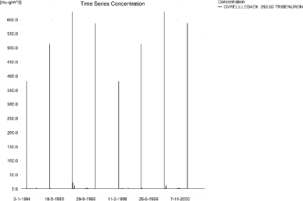
a)
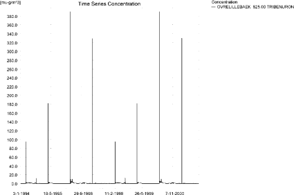
b)
Figure 12.14. Concentration pattern for tribenuron methyl in Ovrelillebaek, 290 and 625 n m from the upstream end of the main stream in the upstream part of the sandy loam catchment.
Figur 12.14. Koncentrationsmønster for tribenuron-methyl i Øvre Lillebæk, 290 og 625 m frden øvre del af morænelersoplandet.
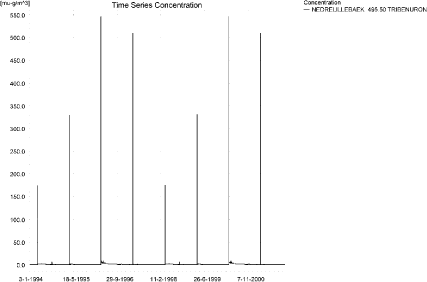
a)
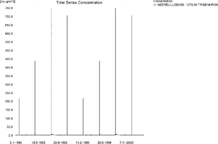
b)
Figure 12.15. Concentration pattern for tribenuron methyl in the lower end of the sandy loam catchment.
Figur 12.15. Koncentrationsmønster for tribenuron-methyl i den nedre del af morænelersoplandet.
Three longitudinal profiles from a drift event are shown in Figure 12.16-Figure 12.18 depicts the concentrations on 31st March 2000. The thin black line represents the concentration, while the thick black line shows the maximum concentrations obtained during the simulations. In addition, the outline of the stream is shown.
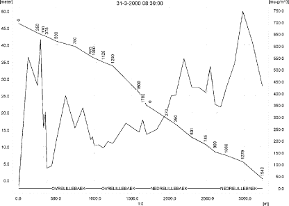
Figure 12.16. Concentrations in the the main stream of the sandy loam catchment on 31. March 2000, 8.30. The concentrations are generated by drift.
Figur 12.16. Koncentrationer i morænelersoplandet den 31. marts-2000, 8.30. Koncentrationerne skyldes drift.
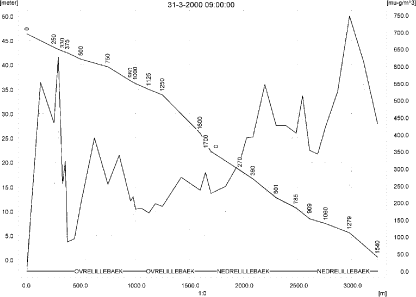
Figure 12.17 .Concentrations in the the main stream of the sandy loam catchment on 31. March 2000, 9.00.
Figur 12.17. Koncentrationer i morænelersoplandet den 31. marts-2000, kl. 9.00.
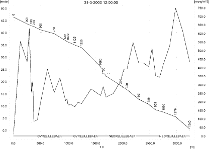
Figure 12.18. Concentrations in the the main stream of the sandy loam catchment on 31. March 2000, 12.00. The concentrations are negligible in most of the catchment.
Figur 12.18. Koncentrationer i morænelersoplandet den 31. marts-2000, kl. 12.00. Koncentrationerne er ubetydelige i det meste af oplandet.
To be able to extract comparable values to FOCUS SW, the global maxima and time weighted concentrations (up to 7 days) were extracted when these were meaningful (Table 12.9).
Figure 12.19 and b)
Figure 12.20 show the concentrations sorbed to macrophytes in the upper and lower part of the catchment. The highest value reached is 28 ng/l 125 m from the upstream end of the main stream. Figure 12.21 shows the concentration of pesticide in porewater. The highest concentration reached is 0.279 ng/l 125 m from the upstream end of the main stream.
Due to low sorption, the amount of tribenuron methyl adsorbed to sediment is <0.01 ng/kg in most of the catchment. The maximum concentration in sediment (0.18 ng/kg) is shown in Figure 12.22.
The pattern of sorption to macrophytes follows the pattern of the water concentrations. The concentration influences the concentration in the water phase significantly, particularly outside the periods of drift contributions.
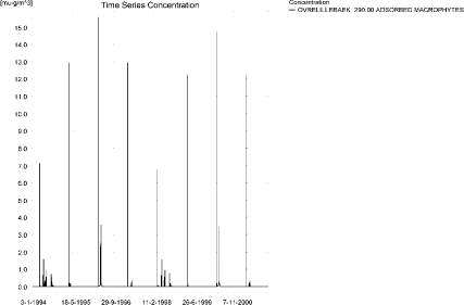
Figure 12.19. Concentration on macrophytes in OvreLillebaek. The pattern follows the pattern of concentrations in the stream.
Figur 12.19. Koncentration af tribenuron-methyl på makrofytter i Øvre Lillebæk. Mønsteret følger samme mønster som vandkoncentrationerne.
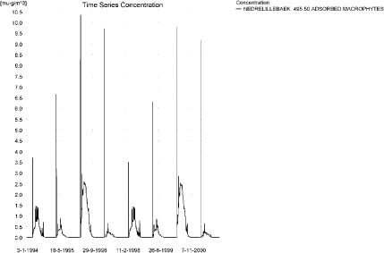
a)
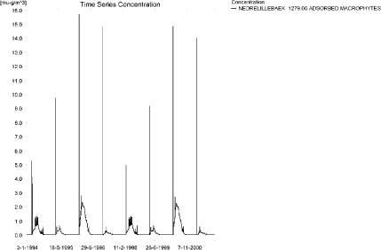
b)
Figure 12.20. Concentration on macrophytes in ng/l in two points in NedreLillebaek. The pattern follows the pattern of concentrations in the stream.
Figur 12.20. Koncentration af tribenuron-methyl på makrofytter i to punkter i Nedre Lillebæk. Mønsteret følger samme mønster som vandkoncentrationerne.
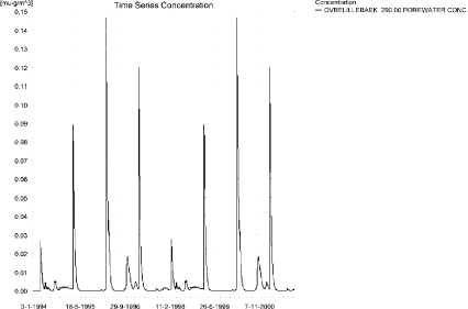
a)
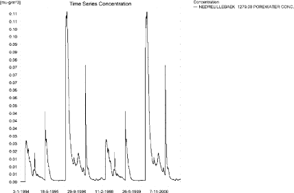
b)
Figure 12.21. Concentration of tribenuron methyl in porewater in the upstream and downstream ends of the sandy loam catchment. The maximum concentration reached in the catchment is 0.28 ng/l.
Figur 12.21. Koncentration af tribenuron-methyl i porevand i den opstrøms og nedstrøms ende af morænelersoplandet. Den maximale koncentration fundet i oplandet er 0.28 ng/l.

Figure 12.22. Maximum sediment concentration of tribenuron methyl in the sandy loam catchment. Note that the concentration is in µg/g and not µg/m³ as indicated.
Figur 12.22. Maximal sedimentkoncentration af tribenuron-methyl i morænelersoplandet. Bemærk at koncentrationen er i µg/g sediment og ikke µg/m³ som angivet.
FOCUS SW D4-stream reaches 76 ng/l while PestSurf generates 747 ng/l. Both models generate the maximum concentrations through wind drift. However, some drainage contribution does take place in the sandy loam stream. 125 m from the upstream end, the concentration reaches 553 ng/l. The water depth at the time of maximum concentration is around 4.8 cm. This, and the fact that the PestSurf stream is not rectangular, accounts for the difference between the two models.
For the sediment, the D4-simulations reach 2 ng/kg while PestSurf predicts a maximum of 0.18 ng/kg.
Figure 12.23, Figure 12.24, Table 12.10 and Table 12.11 show the results as generated by the PestSurf templates. The maximum value generated by the templates for the upper part of the stream is 288 ng/l, and for the lower part 747 ng/l. The maximum value generated in the (upstream part of the) catchment is 627 ng/l and for the lower part, 747 ng/l. Thus, the templates did catch the maximum concentration of the PestSurf simulation.
Table 12.9. Maximum concentrations (ng/l) of tribenuron methyl simulated for selected calculation point in the sandy loam catchment.
Tabel 12.9. Maximums koncentrationer (ng/l) af tribenuron-methyl for udvalgte lokaliteter i morænelersoplandet.
Click here to see Figure 12.23.
Figure 12.23. Overview for tribenuron methyl in the sandy loam catchment generated by the PestSurf excel template for the upstream part of the catchment. The detection value was set to 1 ng/l.
Figur 12.23. Oversigt for tribenuron-methyl genereret med PestSurf-excel-skabelonen for den opstrøms del af morænelers-oplandet. Detektionsgrænsen var sat til 1 ng/l.
Click here to see Figure 12.24.
Figure 12.24. Overview for tribenuron methyl in the sandy loam catchment generated by the PestSurf excel template for the downstream part of the catchment. The detection value was set to 1 ng/l.
Figur 12.24. Oversigt for tribenuron-methyl genereret med PestSurf-excel-skabelonen for den nedstrøms del af morænelers-oplandet. Detektionsgrænsen var sat til 1 ng/l.
Table 12.10. Part of the result sheet generated by the PestSurf Excel sheet for the upstream part of the sandy loam catchment. The lowest detection value is for generation of the table is 1 ng/l, toxicity to fish, daphnies and algae are set to 5, 10 and 100 ng/, respectively. The recorded peaks are shown in Figure 12.23.
Tabel 12.10. Uddrag af resultatpresentationen genereret af PestSurf-Excel-arket for den opstrøms del af morænelersoplandet. Detektionsgrænsen for tabelgenerering er 1 ng/l. Toxicitetsværdierne for fisk, dafnier og alger er henholdsvis 5, 10 og 100 ng/l. Hændelserne er vist i Figur 12.23.
Click here to see Table 12.10.
Table 12.11. Part of the result sheet generated by the PestSurf Excel sheet for the downstream part of the sandy loam catchment. The lowest detection value for generation of the table is 1 ng/l, toxicity to fish, daphnies and algae are set to 5, 10 and 100 ng/, respectively. The recorded peaks are shown in Figure 12.24.
Tabel 12.11. Uddrag af resultatpresentationen genereret af PestSurf-Excel-arket for den nedstrøms del af morænelersoplandet. Detektionsgrænsen for tabelgenerering er sat til 1 ng/l. Toxicitetsværdierne for fisk, dafnier og alger er henholdsvis5, 10 og 100 ng/l. Hændelserne er vist i Figur 12.24.
Click here to see Table 12.11.
12.4.4 Sandy loam catchment, pond
The concentration pattern is evaluated in the middle of the pond only, see Figure 12.25. The pond receives contributions mainly through drift, in good correspondence with the fact that it is situated in the upper part of the sandy loam catchment. However, some drainage contributions are visible in the wet periods. The maximum concentration is quite low, 10.3 ng/l.
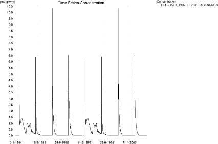
Figure 12.25. Concentrations of tribenuron methyl for the sandy loam pond.
Figur 12.25. Koncentration af tribenuron-methyl i morænelersvandhullet.
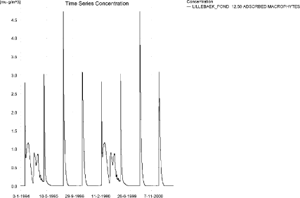
Figure 12.26. Tribenuron methyl sorbed to the macrophytes in the sandy loam pond.
Figur 12.26. Tribenuron-methyl sorberet til makrofytter i morænelers-vandhullet.
Figure 12.26 shows that the macrophytes participate in the regulation of the concentrations in the pond. The concentrations on macrophytes and in the water phase are comparable. The concentration in the porewater is shown in Figure 12.27. The adsorption to sediment is <0.01 ng/kg.
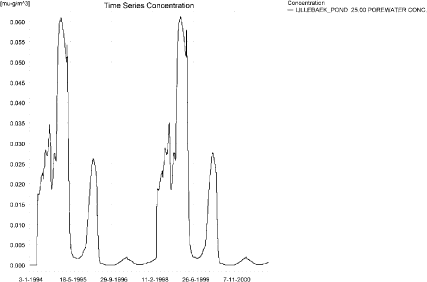
Figure 12.27. Tribenuron methyl in porewater in the sandy loam pond.
Figur 12.27. Tribenuron-methyl i porevand i morænelersvandhullet.
In Table 12.12, global maxima and time weighted concentrations (up to 7 days) were extracted.
Table 12.12. Actual and time weighted concentrations (ng/l) of tribenuron methyl in the sandy loam pond.
Tabel 12.12. Beregnede og tidsvægtede koncentrationer (ng/l) af tribenuron-methyl i morænelersvandhullet.
| Year | Tribenuron methyl | ActualConc. | Time-weightedConc. | Date |
| 1994 | global max | 6 | 02-04-1994 | |
| 1 hour(after max) | 5 | 5 | ||
| 1 day after sp.in. | 3 | 3 | ||
| 3 days | 2 | 3 | ||
| 4 days | 2 | 3 | ||
| 7 days | 1 | 2 | ||
| 1995 | Global max | 6 | 01-04-1995 | |
| 1 hour | 5 | 6 | ||
| 1 day | 3 | 4 | ||
| 2 days | 3 | 3 | ||
| 4 days | 3 | 3 | ||
| 7 days | 2 | 3 | ||
| 1996 | global max | 10 | 01-04-1996 | |
| 1 hour | 8 | 9 | ||
| 1 day | 5 | 6 | ||
| 2 days | 5 | 5 | ||
| 4 days | 4 | 5 | ||
| 7 days | 4 | 5 | ||
| 1997 | global max | 7 | 01-04-1997 | |
| 1 hour | 5 | 6 | ||
| 1 day | 3 | 4 | ||
| 2 days | 3 | 3 | ||
| 4 days | 3 | 3 | ||
| 7 days | 3 | 3 | ||
| 1998 | global max | 6 | 01-04-1998 | |
| 1 hour | 5 | 5 | ||
| 1 day | 3 | 3 | ||
| 2 days | 2 | 3 | ||
| 4 days | 2 | 3 | ||
| 7 days | 1 | 2 | ||
| 1999 | global max | 6 | 31-03-1999 | |
| 1 hour | 5 | 6 | ||
| 1 day | 3 | 4 | ||
| 2 days | 3 | 3 | ||
| 4 days | 3 | 3 | ||
| 7 days | 2 | 3 | ||
| 2000 | global max | 10 | 31-03-2000 | |
| 1 hour | 8 | 9 | ||
| 1 day | 5 | 6 | ||
| 2 days | 5 | 5 | ||
| 4 days | 4 | 5 | ||
| 7 days | 4 | 5 | ||
| 2001 | global max | 7 | 31-03-2001 | |
| 1 hour | 5 | 6 | ||
| 1 day | 3 | 4 | ||
| 2 days | 3 | 3 | ||
| 4 days | 3 | 3 | ||
| 7 days | 3 | 3 | ||
| max values | ||||
| global max | 10 | |||
| 1 hour | 8 | 9 | ||
| 1 day | 5 | 6 | ||
| 2 days | 5 | 5 | ||
| 4 days | 4 | 5 | ||
| 7 days | 4 | 5 |
The FOCUS SW-scenario D4-pond generates a concentration of 3 ng/l, which is in the same order of magnitude as the PestSurf sandy loam pond-concentration of 10 ng/l. Both maximum concentrations are generated through drift. The difference between the results of the two models is partly due to the higher exposure of the the PestSurf sandy loam pond and the fact that the water depth at the time of spraying is 0.75 cm.
With respect to sediment, the D4-scenario reaches 2 ng/kg while PestSurf predicts values < 0.01 ng/kg.
Figure 12.28 and Table 12.13 show output from the PestSurf template, with a time series identical to Figure 12.25.
Click here to see Figure 12.28.
Figure 12.28. Overview for Tribenuron in the sandy loam pond generated by the PestSurf excel template. The time series shown is identical to the one in Figure 12.25. The detection value used is 1 ng/l.
Figur 12.28. Oversigt for tribenuron-methyl i morænelersvandhullet genereret med PestSurf-excel-skabelonen. Den viste tidsserie er mage til den i Figur 12.25. Detektionsgrænsen er sat til 1 ng/l.
Table 12.13. Part of the result sheet generated by the PestSurf Excel sheet. The limiting value is set to 1 ng/l. The toxicity values for fish, daphnies and algae were set to 2, 10 and 100 ng/l, respectively. The recorded peaks are shown in Figure 12.28.
Tabel 12.13. Uddrag af resultatpresentationen genereret af PestSurf-Excel-arket. Detektionsgrænsen er sat til 1 ng/l. Toxicitetsværdierne for fisk, dafnier og alger er henholdsvis 2, 10 og 100 ng/l. De tabellerede hændelser er vist i Figur 12.28.
Click here to see Table 12.13.
Table 12.14. Summary of simulation results for tribenuron methyl.
Tabel 12.14. Opsummerede resultater for tribenuron-methyl.
Click here to see Table 12.14.
12.5 Summary of simulations
The maximum actual concentrations for all simulations are recorded in Table 12.14.
The concentrations generated for the sandy pond and stream are about a factor 3 higher than the concentrations generated for the FOCUS SW D3-ditch. The pond is influenced by groundwater, while the D3-ditch and the sandy stream are influenced by wind drift. The high concentration generated in the stream is caused by the fact that the total agricultural area is sprayed within 30 minutes. However, 112 m from the upstream end, the concentration only reaches 10 ng/l, which is considerably less than what is found in the D3-ditch (95 ng/l). The low concentration in PestSurf, however, is due to a combination of a 20 m wide buffer zone and a water depth at the time of maximum concentration of 13-14 cm.
The FOCUS SW D4-pond and the PestSurf sandy loam pond differ by a factor of 3. The diffence is caused by the higher exposure of the sandy loam pond and a lower water level during the dry year of the simulation.
With respect to the D4-stream and the sandy loam stream, FOCUS SW generates 76 ng/l while PestSurf generates 747 ng/l. Both models generate the maximum concentrations through wind drift. However, some drainage contribution does take place in the sandy loam stream. The high concentrations in PestSurf are generated due to accumulation of drift contributions along the stream. 125 m from the upstream end, the concentration reaches 553 ng/l. The water depth at the time of maximum concentration is around 4.8 cm. This, and the fact that the PestSurf stream is triangular, accounts for the difference between the two models.
The maximum value obtained between 500 and 1700 m from the upstream end is 390 ng/l.
Macrophytes influence the concentrations, particularly in the sandy loam pond, but to some extent also in the sandy loam stream.
With respect to sediment concentrations, the maximum value generated by FOCUS is 11 ng/kg and the maximum value generated by PestSurf 3.1 ng/kg. PestSurf values are consistently lower than the FOCUS-SW-values but both models results in low sorption values.
Annex 13
13 Short guide to MIKE VIEW-extraction of PestSurf results
13.1 Opening a file
When MIKE VIEW is started, it requests for a file. Specify file type as MIKE 11 DFS (*.res11) and browse to find the result directory. PestSurf result files are usually found under ”pesticide”_”Scenario”\MIKE11. The relevant files are ”pesticide”_”Scenario”.res11 for the pesticide and ”scenario”_”crop”.res11 with respect to water depth and flow.
A menu allowing selection of input data appears on the screen suggesting to load all timesteps and all available results. Click ok to load the data, or unclick data that may not be relevant.
The program responds by loading the data and presenting the outline of the loaded stream on the screen.
By choosing ”View” on the top menu, it is possible to add lables to the stream (names of the different stretches). Calculation points are shown automatically.
Other files can be opened by clicking ”File” on the top menu and ”open” or “add”. From there, follow the description from above. If “add” is used, the time series from the different files can be viewed in the same plots.
13.2 Time series plots
Time series for single points can be seen by selecting ”Plot” in top menu and ”TS in Grid Points”. A menu appears, allowing the user to select result file and data type to be plotted. The user may now click ”ok” and be allowed to select the point to be plotted on the stream outline. When the program is in the selection mode, the chainage number for the point near the selection arrow is shown in the status line at the bottom of the screen.
If ”list” is selected, a list of all calculation points is produced, with minimum and maximum values for each point and the time of occurrence. One or more calculation points can be selected, and a graph can be drawn if ”draw graph” is selected, or a table may be produced of all the values for the selected calculation points if ”show values” is selected. When a time series plot is generated, additional time series can be added by left-clicking on the plot and selecting “add TS”. The result file can then be selected together with the data type and the location to plot.
Selected lists of information can be copied and pasted from MIKE VIEW to Excel.
When the graph is plotted on the screen, a menu can be added by right-clicking on the mouse and selecting ”options”. On the page ”axis and fonds” ”legend” can be selected and will be added to the plot. The plot can be saved to a file by right-clicking on the plot and selecting ”metafile” – ”copy to file”. The plot is stored in *emf-format.
Another way to store a plot is to select “File” and “Print”. A printer menu appears than allows the user to select a printer driver. If Microsoft Office Document Image Writer or other Image writers are installed on the computer, they may be selected and allow the user to store plots in other formats.
When extracting sediment and pore water data from the ponds, it should be noted that the multilayer model used for the ponds is associated with every other calculation point. Data are thus extracted at the end of the pond rather than in the middle.
The water depth may be calculated in MIKE VIEW: Open the file with water flow and depth information, click on “Tools” on the top menu and select “compute and “depth”. The record now appears a data type when data are to be plotted.
13.3 Longitudinal plots
A longitudinal plot is generated by selecting ”Plot” on the top menu and ”longitudinal plot” on the drop-down menu. Click with the mouse on the sections of the stream to be plotted and end with ”control” and mouse-click. The programme responds by asking ”close profile selection and draw profile”. Click yes. A menu appears that allows the user to select the result file and the data type to plot. The plot that appears shows the outline of the stream with the height difference (left axis). The bottom of the stream is shown and the level of the right and left bank is indicated. In addition the data type is shown, - a red punctuated line shows the maximum values obtained for the data type (use left axis). To see the changes in values of the ”data type” over time, click with the mouse on the black triangle ![]() on the toolbar. The time indicated on the top of the plot starts running, and the values of the ”data type” changes. The symbol
on the toolbar. The time indicated on the top of the plot starts running, and the values of the ”data type” changes. The symbol ![]() may be used to stop the display, while
may be used to stop the display, while ![]() pauses the display and a second click on the mouse on this symbol restarts the time series.
pauses the display and a second click on the mouse on this symbol restarts the time series.
If a time series is open at the same time as a longitudinal plot, a click on the time series will move the longitudinal plot to the selected date and time.
Plots can be saved as pictures when paused. The symbols showing magnifying glasses on the tool bar can be used to magnify (+) or the opposite (-), P is ”zoom to previous” while E is ”zoom to full extent”.
13.4 Units
A number of units are defined in MIKEVIEW. Before a file is opened in MIKEVIEW, units can be changed by selecting ”File” from the top menu and ”Edit Unit Base Groups”. 386 items are available. The most relevant unit for the PestSurf-simulations is for ”Concentration” (unit 60). The default concentration is µg/m³ equal to ng/l. By clicking on the concentration unit, a drop-down menu becomes visible with other units that may be selected. These units will then be used on the axes of the plots and the plot scaled accordingly.
Water levels can be calculated from absolute water levels extracted as time series in MIKE VIEW and the level of the stream bottom in the given point, found from a longitudinal plot of the river stretch to be analysed – or by an analysis of the longitudinal plot at the time of interest.
13.5 PestSurf-files
The PestSurf result files consists of concentration levels for each stored time step in each calculation point in the stream models (133 in the sandy catchment and 72 in the sandy loam catchment). The pond models only contain three points each within the pond (First three points in the simulation equal to 0, 12.5 and 25 m in Lillepond and 0, 20 and 40 m in Odderpond). The simulations cover 2 * 4 years and data are saved every 10 minutes (or less) the first two hours after spraying, every hour up to 30 days after spraying and every day for the rest of the simulation.
Data can be extracted concerning the concentration of active substance in the water phase, the concentration on suspended matter and the concentration on macrophytes. These concentrations are given as µg/m³ (equal to ng/l), and is calculated per m³ of water column.
Data also exists for pesticide sorbed on colloids, but the value is negligible in the simulations carried out. The amount of suspended matter is generally 0. The depth of the sediment layer is given in mm, meaning that 20,000 equals 2 cm.
For all substances, there is a close correlation between the concentrations in the water phase and the concentration in macrophytes. The macrophyte concentration is assumed constant in the ponds and vary over the year in the streams (scaled with a factor 0-1[1]). The maximum concentration of biomass in the water is calculated to be 33 g/m³ for the sandy pond, 875 g/m³ for the sandy loam pond, 276 g/m³ for the sandy stream and 1380 g/m³ for the sandy loam stream. The concentration of active substance in the biomass can be obtained by dividing the concentration with the amount of biomass at the particular time.
Furthermore, the concentration of pesticide is calculated for the pore water (µg/m³) and the sediment (µg/g, meaning that the value should be multiplied by 1000 to get µg/kg or 106 to get ng/kg).
The concentration of active substance in pore water is determined by diffusion. The sediment layer is 2 cm in the stream and 10 cm in the ponds. However, the concentration in the pond is given for the top 2 cm’s only. The porosity is 0.75 except for the eutrophic ponds, where it is 0.95. Sediment concentrations and pore water concentrations show the same pattern, and the amount of adsorbed pesticide is calculated as a function of the pore water concentration.
Footnotes
[1] The function is found in the ”Scenario”_Biomass.dfs0 file in the TIME.directory.
Annex 14
14 Corrections to earlier documentation
In connection with the calculation of 56 scenarios in PestSurf, some errors/inconsistencies were identified in the stream model and in the setup of the stream model. These are listed in the following, together with the suggested changes to the relevant reports. At the same time questions arose that may be considered if the model is to be updated.
14.1 Model errors
- It was discovered that the wind drift contribution (in mg/m²) was multiplied with the cross section of the water body and not the surface area of the water body. This error was corrected during the project.
14.2 Errors in the model setup
- Sediment in streams and ponds. The sediment thickness is the streams is stated in the documentation to be 2 cm. No sediment thickness is reported for the ponds in the documentation. In the model, the sediment thickness was implemented as 10 cm in the stream and 10 cm in the pond. The sediment thickness in the streams has been changed to 2 cm. The sediment thickness in the pond is still 10 cm, but the concentration in sediment in the ponds is calculated over the top 2 cm.
14.3 Errors in the translation of data between the user interface and the model
- With respect to calculation of Kd for the water bodies, an error was identified. The translation of data between the user interface and the model followed the description in the technical report. However, the described equations were not correct when the amount of organic C is specified for the scenarios and not the amount of organic matter. The correct equations written below. The error was corrected.
If the input is Koc
Kd_Water = Kd_sediment = (Koc*LOI_Scen/ 1*106), where
LOI_Scen =NVOC, weight % for the specific scenario.
If the input is Kom
Kd_Water = Kd_sediment = (Kom*LOI_Scen*1.724)/1*106, where
LOI_SCEN =NVOC, weight% for the specific scenario.
If the input is Kclay
Kd_Water = Kd_sediment = (Kclay*(Clay_content))/1*106
where
Clay_content = Clay content for the specific scenario (5 % for sediment in stream, 20 % for sediment in pond).
14.4 Other changes implemented
- The minimum storage frequency for pesticide concentrations in the stream has been changed from 3 days to one day.
14.5 D. Changes required to the documentation
Re. 1.3.1. Required corrections regarding Kd-calculations
Corrections to ”Scenarios and Model describing fate and transport of pesticides in surface water for Danish conditions
Table 4.4 requires updating. The table shows the ignition loss of the sediments, but not the non-volatile organic carbon (NVOC) which is actually implemented in the model. The figures implemented in the model stem from Helweg et al. (2003) and are the experimentally derived values. It seems, however, that the all implications of the change from Loss of ignition to NVOC were not taken into account. The formulation used at present multiplies the Koc-value with 1.724, resulting in a sorption that is too high by this factor.
New table 4.4:
Scenario Loss of ignition NVOC Porosity g/kg D.W. g/kg D.W. Lillebæk pond- macrophyt dom. 82 33 0.75 Lillebæk pond, phytoplan.dom. 600 348** 0.95 Lillebæk stream 25 29 0.75 Odderbæk pond- macrophyt dom. 82 33* 0.75 Odderbæk pond, phytoplan.dom. 600 348** 0.95 Odderbæk stream 197 100 0.75
Explanatory note, not to be included in the scenario-report:
* 29 was implemented in the model but this appears to be an error.
** The value “600” was implemented in the model. The value “348” is 600/1.724 and thus the estimated carbon content of the specified material.Additional text concerning clay content in the scenarios to be added in section 4.7:
“The clay content of the sediment in the scenarios is specified as 20 % for the ponds and 5 % for the streams. The values have not been measured but 20 % is the value found in the experimental ponds used in the project. Due to flow conditions in the stream, the clay content in the stream is likely to be much lower than .the conditions in the ponds, and 5 % is considered a high estimate”.
Correction to “Technical report” page 63
“If the input is Koc
Kd_Water = Kd_sediment = (Koc*LOI_Scen/ 1*106), where
LOI_Scen =NVOC, weight % for the specific scenario.If the input is Kom
Kd_Water = Kd_sediment = (Kom*LOI_Scen*1.724)/1*106, where
LOI_SCEN =NVOC, weight% for the specific scenario.If the input is Kclay
Kd_Water = Kd_sediment = (Kclay*(Clay_content))/1*106where
Clay_content = Clay content for the specific scenario (5 % for sediment in stream, 20 % for sediment in pond)”.
Re. 1.4.1.Storage frequency
Corrections to ”Scenarios and Model describing fate and transport of pesticides in surface water for Danish conditions
Page 60, 3. para from the bottom, 5th line: “The rest of the period, data are stored daily.
Version 1.0 December 2006, © Danish Environmental Protection Agency