|
Denmark's Third National Communication on Climate Change Appendix E: Denmarks’s report on systematic observations for the Global Climate Observing System (GCOS)Denmark's report on systematic climate observations for the Global Climate Observing System (GCOS) for the third national communication to the conference of the parties to the United Nations Framework Convention on Climate Change (UNFCCC)
Yearly mean Temperature, Denmark, 1873-2000 Chapter 1 Introduction Chapter
2 Meteorological and Atmospheric Observations Chapter 3
Oceanographic Observations Chapter 4 Terrestrial Observations Chapter 5 Space-based
Observing Chapter 6 Activities in Developing Countries relating to Observations.
Editor: Lillian Wester-Andersen (DMI) Chapter 1 IntroductionThis report is prepared to give a status on the Danish contribution to the systematic climate observations for the Global Climate Observing System (GCOS). The report is part of the Third National Communication to the Conference of the Parties to the United Nations Framework Convention on Climate Change (UNFCCC). Climate research and the generation of climate-related observations are carried out by various government departments in order for them to meet their responsibilities. Currently, no national plan exists for the whole area of climate research and observations. Many agencies in Denmark engage in the systematic observation of elements of the climate system. Invariably the capture, quality control and archiving of such data are designed to meet the integrated needs of these agencies, deriving from their overall missions. Typically the drivers for longterm systematic observation of environmental or ecological characteristics arise from an operational, regulatory or research need. Examples of the former are to be found in the capture of meteorological data for predictive and statistical services by the Danish Meteorological Institute (DMI). The resulting observation programmes tend to be long term, but the resulting individual data may be seen as perishable and focus might not always be on maintaining stability and reliability in the records. The general need for systematic and reliable time series is increasingly understood in the scientific community and incorporated in the collection and data handling procedures. In this report relevant climate observations for Denmark, Greenland and the Faroe Islands will be described. In general the data are available from the institution operating the observing station / collecting the data, but many can also be found on the web, for instance www.dmi.dk. Where data such as contributions to GCOS are submitted to the appropriate Data Centres, they are also available from these centres. Additionally, all meteorological data and products that are produced by WMO Members (national meteorological services) to the WMO programmes such as the WWW are available under the terms of WMO Resolution 40 (WMO policy and practice for the exchange of meteorological and related data and products including guidelines on relationships in commercial meteorological activities). Such data are "freely" available "without charge" (i.e. at no more cost than the cost of reproduction and delivery, without charge for the data and products themselves and with no condition on their use). Similarly hydrological data and products are covered under WMO Resolution 25. Further the IOC are expected to adopt a data policy which provides for free and open access to data that are collected, produced or exchanged as part of oceanographic programmes conducted in association with the IOC. Chapter 2 Meteorological and Atmospheric ObservationsDenmark participates fully in the GCOS Surface Network (GSN) and the GCOS Upper Air Network (GUAN), and in the Global Ozone Observing System (GO3OS) as part of the Global Atmosphere Watch (GAW). GCOS Surface Network / GSN Stations The designated 7 GSN stations in Denmark, Greenland and on the Faroe Islands are all run by DMI and consists of:
All of these currently meet the GCOS standard for surface observing. GCOS Upper Air Network / GUAN Stations Only one GUAN station is designated for Denmark, Greenland and the Faroe Islands and it is situated in Narsarsuaq, Greenland. The station is run by DMI and is operated to GCOS standard. A survey of the performance in 2000 shows that 92% of the soundings reached an altitude of 30 hPa. GCOS Global Atmospheric Watch / GAW Stations Denmark contributes to the Global Ozone Observing System (GO3OS) as part of the GAW programme with three stations in Greenland and one in Denmark. The stations in Kangerlussuaq (Greenland) and Copenhagen (Denmark) are equipped with Brewer spectrometers, the station in Pituffik (Greenland) is equipped with a Dobson and a SAOZ spectrometer and the station in Illoqqortoormiut (Greenland) is equipped with a SAOZ spectrometer. The spectrometer in Illoqqortoormiut is operated by Service d'Aeronomie (France) in cooperation with DMI while all other spectrometers are operated by DMI. All data are available from DMI. Table 1.
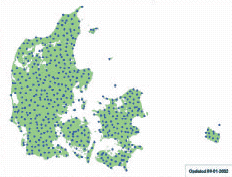
1 The Danish participation is in the GO3OS of GAW Other National and Meteorological and Atmospheric Observations: Surface Climatological/ Meteorological Network DMI operates and receives data from a network of approximately 100 automatic meteorological stations in Denmark, Greenland and on the Faroe Islands. Measurements are made in accordance with the WMO recommendations.
Figure 1: As from 2001 a special dedicated network of (manual) stations for climatological observations has been discontinued, due the convergence of the different network technologies. The objectives behind this decision are to eliminate human errors, to benefit from potential savings in the rationalisation and to reach a higher observation frequency. Climatological data are now obtained from the automatic network described above. Climatological data are collected to define the climate in Denmark, Greenland and on the Faroe Islands and to create a national database for a wide range of enquiries and research activities. Most climatological work involves the production of annual or monthly statistics including means, percentiles and standard deviations.
Figure 2:
Figure 3: Long records are needed to establish reliable averages and trends. In 2001 the daily inflow of data from Denmark, Greenland and the Faroe Islands was 75,000 and in all 245,000,000 observations are currently stored in the database. The observations are stored in a central database at DMI, where data from several meteorological stations are stored as far back as 1872. A monthly summary is prepared for three stations in Denmark, one on the Faroe Islands and 8 in Greenland on the CLIMAT format. These data are routinely submitted on the GTS. Rainfall Observing Network (Stations and Radar) The need for rainfall data is greater than what is generated from the overall surface climatological and meteorological network described in the above paragraph. In Denmark the rainfall network consists of approximately 575 stations. Roughly 75 of these provide continuous data on rainfall intensity. They are operated jointly by DMI and The Water Pollution Committee of the Society of Danish Engineers (SVK). The remaining 500 stations collect daily values on rainfall and from approximately 100 of these data are transmitted to DMI on a daily basis, whereas the remaining data are received as monthly sums.
Figure 4:
Figure 5: On the Faroe Islands a rainfall network of 22 stations collects daily information about the precipitation. Information on precipitation can also be obtained from weather radar data. In Denmark DMI runs a network of three weather radars which provides nearly 100% coverage. In the early part of 2002, an additional radar on the island of Bornholm will further improve this coverage. The network has an unsurpassed high spatial resolution, and hence provides very detailed climatological information about precipitation both on national, regional and local scale. By calibrating radar data against pointmeasurements of precipitation the latest scientific results show a high absolute accuracy. The present radar network has a data frequency of 6 pictures / hour, and a spatial resolution of 2 km x 2 km. Surface Radiation and Sunshine Observing Network Regarding observations of hours of bright sunshine DMI runs a network of 30 stations in Denmark, 6 in Greenland and one on the Faroe Islands. Radiation is measured at 23 stations in Denmark, of which 15 are operated by DMI and 8 by the Danish Institute of Agricultural Sciences (DIAS). The measurements of radiation are carried out as 10- minute mean values of global radiation at the DMI operated stations and as hourly mean values of global radiation at the stations operated by DIAS. Solar Ultraviolet Radiation and Stratospheric Ozone stations The Solar Ultraviolet (UV) radiation at different wavelenghts is measured by DMI at two sites in Greenland, namely Pittufik and Kangerlussuaq. Besides the GO3OS described earlier weekly ozone soundings are made at Illoqqortoormiut and sporadic ozone soundings are made during the winter months in Pituffik by DMI. Upper Air Measurements - Radiosounding Observations DMI runs radiosounding stations in the following 7 locations: Copenhagen (Denmark),Tórshavn (the Faroe Islands), Danmarkshavn, Illoqqortoormiit, Tasiilaq, Narsarsuaq and Aasiaat (Greenland). Two soundings are made every day at these stations. From all 7 radiosounding stations a monthly summary (CLIMAT TEMP) is prepared and transmitted routinely on the GTS. DMI has the responsibility of systematic surveillance of the sea ice conditions in the Greenland waters. Observations on the ice conditions have been collected for approximately 125 years and an extensive volume of data is available in a graphic format as monthly summaries, ice maps etc. Since 1959 special emphasis has been put on the waters south of Cape Farewell (the southern tip of Greenland) in order to improve the navigation safety. Ice maps are prepared more than weekly containing detailed information on the relevant ice conditions. Recent maps are available on vector graphic format. Since 2000 weekly summaries of the ice conditions for all Greenland waters have been prepared. These summaries are based on satellite data and are generated automatically and are primarily intended for analysis of the climatology in the Greenland waters. Over the years several long term climatological series have been established by DMI representing Denmark, Greenland and the Faroe Islands. The main accomplishments in this area in recent years are: - Observed Daily Precipitation,Temperature and Cloud Cover for Seven Danish Sites, 1874-2000 (DMI technical report no. 01-10) and Observed Daily Precipitation, Maximum Temperature and Minimum Temperature from Ilulissat and Tasiilaq, 1873-2000 (DMI technical report no. 01-11). Both reports (incl. datasets) are available at DMI's website (http://www.dmi.dk/eng/f+u/index.ht ml) under the headings Publications / Technical Reports. Automatic monitoring takes place near ground level in both urban and rural locations across Denmark. A monitoring network is operated by the National Environmental Research Institute (NERI), Denmark, and measures a wide range of pollutants:
Figure 6 shows the types and distribution of air quality monitoring stations across Denmark and in table 2 the measurements taken at the different stations are listed. Besides the above measured ozone DMI operates an ozone measurement station at Jægersborg a suburban environment near Copenhagen. Real-time hourly data are presented on DMI's website (http://www.dmi.dk). Data with a time resolution of 10 minutes are available from DMI. It is intended to establish one more real-time ozone measurement station in 2002.
Figure 6: Table 2:
Chapter 3 Oceanographic ObservationsFor the oceanographic observations GCOS is based upon the open ocean (climate) module of GOOS, which comprises the following programmes: drifting and moored buoy programmes managed by the DBCP (Data Buoy Co-operation Panel), the Ship of Opportunity Programme (SOOP), the Argo array of profiling floats, the Global Sea Level Observing System (GLOSS), the Voluntary Observing Ships Programme (VOS) and the Automated Shipboard Aerological Programme (ASAP). Denmark participates in the VOS, GLOSS and ASAP programmes as summarised in table 3 below. Table 3:
VOS is an international scheme, first developed almost 150 years ago, by which ships plying the various oceans and seas of the world are recruited for taking and transmitting meteorological observations.VOS ships make a highly important contribution to the Global Observing System (GOS) of the World Weather Watch (WWW), and increasingly, through the VOS Climate Project (VOSClim), to global climate studies.VOS is disseminated on the GTS and are archived by many national meteorological services. At the end of 2000 the Danish fleet of voluntary observing ships consisted of 47 ships. DMI has the operational and professional responsibility for the observations, which are made every third hour from the ships. GLOSS is an international programme coordinated by the IOC for the establishment of high quality global and regional sea level networks for application to climate, oceanographic, and coastal sea level research. The main component of GLOSS is the Global Core Network (GCN) of 287 sea level stations around the world for long-term climate change and oceanographic sea level monitoring. GLOSS stations are established in Torshavn (Faroe Islands), Nuuk (Greenland) and Ammassalik (Greenland). The former GLOSS stations in Ittoqqortoormiit and Danmarkshavn (both in Greenland) have been abolished. The station in Ammassalik is operated by the Royal Danish Administration for Navigation and Hydrography, whereas the other two stations are operated by DMI. The relevant mean values from the stations are transmitted to the Permanent Service for Mean Sea Level (PSMSL) hosted by the Proudman Oceanographic Laboratory in the UK. The PSMSL was established in 1933, and is the global data bank for long-term sea level change information from tide gauges. Information on monthly and annual mean sea level is transmitted to PMSLS from 15 stations in Denmark, 5 in Greenland and one on the Faroe Islands. Automated Shipboard Aerological Programme /ASAP The ASAP in its present form began in the mid-1980. It involves the generation of upper air profile data from data sparse ocean areas using automated sounding systems carried on board merchant ships plying regular ocean routes. Several National Meteorological Services operate ASAP units and the profile data are made available in real time on the GTS. ASAP data are archived alongside other radiosounding data by many national meteorological services. ASAP is an important contribution to both the WWW and GCOS. Most of the soundings are presently from the North Atlantic and NorthWest Pacific Oceans, but the programme is expanding to other ocean basins, through a new, co-operative Worldwide Recurring ASAP Project (WRAP). Denmark operates two ASAP units, mounted on ships plying routes from Denmark to Greenland. The European meteorological cooperation EUMETNET started a special E-ASAP programme December 2000. Currently two ASAP units are operated under this programme, one in the Mediterranean and one in the Atlantic. DMI is the responsible member for this programme. Other National Oceanographic and Marine Observations In Denmark a Network exists for the collection of sea temperatures at 13 coastal stations around Denmark. The stations are operated by DMI, the Royal Danish Administration for Navigation and Hydrograhy and local authorities respectively. Data are available from each of the responsible bodies. In Greenland a total of 7 stations measure sea temperatures. DMI and the Royal Danish Administration for Navigation and Hydrograhy operates the stations. In Denmark an extensive national network of tide gauges are operated jointly by DMI, the Royal Danish Administration for Navigation and Hydrograhy, local authorities and the Danish Coastal Authority. The network consists of 82 automatic stations. In Greenland a total of 7 tide gauge stations are operated by DMI and the Royal Danish Administration for Navigation and Hydrograhy. On the Faroe Islands one station is operated in Torshavn by DMI. Data are available from the responsible bodies. Hydrographic and Marine Surveys The National Environmental Research Institute has the overall responsibility for surveillance of the Danish Waters. Regular Surveys are carried out with the objectives of:
Surveys are part of the Danish nationwide monitoring programme NOVA 2003, the HELCOM monitoring programme for the Baltic Sea area (Arkona Sea, Sound, Belt Sea, Kattegat), and the OSPARCOM monitoring programme for the Greater North Sea (Kattegat, Skagerrak, North Sea). The Danish Institute for Fisheries Research carries out yearly surveys in the Danish Waters, primarily in the North Sea and the Baltic Sea, and in that relevant oceanographic parameters are measured and recorded. Furthermore, DMI is involved in the following projects: Biogeochemical cycling of Carbon and Ocean circulation in the northern North Atlantic The overall aim of the project is to describe the effect of high latitude carbon dynamics on the global ocean atmosphere carbon system, in general, and on atmospheric pCO2 in particular. At present, knowledge concerning the seasonal differences in turnover rates of organic material in Polar and sub-polar regions is limited. Thus, in order to achieve the aim of this project it is necessary to obtain biological and chemical rate measurements for the production and destruction of dissolved and particulate organic material at high latitudes and relate these to the convection occurring at different times of the year. Measurements of water transports across the Greenland-Scotland Ridge During the Nordic WOCE programme (1993-97) observations of the water transport across the Greenland Scotland Ridge was initiated and the measurements have been continued after the closing of the Nordic WOCE programme. The goal of the observation campaign was to put reliable numbers on the volume transports of the various current components flowing in and out of the Nordic Seas, and especially to investigate possible seasonal and interannual variability, which might reflect changes in the global thermohaline circulation. Monitoring of the oceanographic conditions along West Greenland Denmark/Greenland has in relation to the North Atlantic Fisheries Organisation (NAFO) the responsibility for monitoring the physical oceanographic conditions along the westcoast of Greenland. The formal responsibility for performing these measurements is placed at the Greenland Institute for Natural Resources, Nuuk which since 1998 has allocated the work by contract to the Danish Meteorological Institute.
Figure 7: The temperature and salinity is measured on standard stations along the Greenland westcoast with the purpose of obtaining knowledge about the marine climate in the area which has a great impact on the recruitment and survival of the fish species living in the area of which some is living close the limit of survival. The data therefore are of great importance to the fisheries' assessment work. Monitoring of the oceanographic conditions around the Faroe Islands. The Fisheries Laboratory in Thorshavn monitors the oceanographic conditions around the Faroe Islands on four standard sections four times a year. The purpose of the monitoring is to study the water mass composition and its variability in the area. Chapter 4 Terrestrial ObservationsExcept monitoring of snow cover, sea ice and surface radiation Denmark does not carry out further terrestrial observations that can be related to climate change. However, Denmark's climate related research includes monitoring and studying the effect of terrestrial conditions. Chapter 5 Space-based ObservingDenmark contributes to space based observations through the European agencies ESA (a partnership of 15 European Member Governments, with Canada affiliated), EUMETSAT (a partnership of 17 European Member Governments, with three Cooperating States) and by the utilisation of national small satellites. As such, details of the platforms and sensors are not given in this section, which focuses on Danish specific needs and efforts. The Danish strategy for earth observations (EO) is delivered, largely, through participation in international programmes and to some extent through national programmes such as the Ørsted satellite. The Danish space activities are not coordinated by one central institution. The Ministry for Science,Technology and Innovation represents Denmark in ESA, whereas the responsibility for the meteorological observation aspects (EUMETSAT) lies with the Ministry of Transport. The actual activities are carried out by several organisations, such as DMI, the Technical University of Denmark, Danish Space Research Institute and of course private industry. ESA and EUMETSAT Platforms and Programmes ESA EO platforms that are either operational now or due for launch before the end of 2005 and the projects where Denmark is participating, include:
It can further be mentioned that Denmark has been involved in the preparation for new programmes under the ESA-EO:WATS as a core mission and ACE+ as an opportunity mission. The purpose of these missions is to obtain reliable data on the temperature, pressure and humidity of the atmosphere amongst others to secure a better understanding of climate variations. DMI represents Denmark in EUMETSAT, which has the following current programmes:
As part of its distributed application ground segment EUMETSAT has a network of Satellite Application Facilities (SAFs), as specialised development and processing centres (see http://www.eumetsat.de for details). These utilise the specific expertise available in EUMETSAT's Member States, and complement the production of standard meteorological products derived from satellite data at EUMETSAT's Central Facilities in Darmstadt. Seven SAF projects are undergoing development, focusing on the following applications:
A number of these are relevant to aspects of GCOS monitoring. DMI hosts the GRAS meteorology SAF and also contributes the Ocean and sea ice SAF and the Ozone monitoring SAF. GPS data from the Ørsted, SACC and CHAMP satellites Measurements of GPS radio occultations are important in use both for numerical weather prediction and to monitoring of climate change processes and their identification. This has been demonstrated first by the American proof-of-concept mission GPS/MET. The research satellites Ørsted, SAC-C and CHAMP all have the capability of the required high precision reception of GPS signals to perform radio occultation measurements. The GPS data from the Danish Ørsted satellite, launched in 1999, has been used in the EU project CLIMAP (CLImate and environment Monitoring with GPS based Atmospheric Profiling) to study the impact on numerical weather prediction. Further, since the data needs no calibration, they will prove very valuable for climate monitoring purposes by combining several data sets and model forecasts. The primary objective of the CLIMAP project was to establish endtoend demonstrations of the operational derivation and usage in Numerical Weather Prediction (NWP) of atmospheric parameters on basis of the reception of GPS signals through the atmosphere. This included data from GPS reception on ground and Radio Occultations from Low Earth Orbiting (LEO) satellite based GPS reception. An "end-to-end" chain for processing of satellite based GPS radio occultation data was developed: From GPS signal reception to assimilation into the NWP models. The chain included operational reception of tracking data from the Ørsted satellite with associated level 0 processing and archiving (operational and prepared by the Danish company TERMA and DMI). This Ørsted processing chain will be further used by DMI on the new GPS occultation data received by the German CHAMP and the Argentinean SACC satellite. Chapter 6 Activities in Developing Countries relating to Observations.DMI has since 1997 participated in a project at the Meteorological Services Department of Ghana (MSD). The aim of the project is primarily to re-establish the meteorological observing network in the country and ensure the collection of data. Another part of the project is the communication and utilisation of the data. The Project will continue to the end of 2003, and by that time MSD should operate a well-functioning network of approximately 300 stations recording the basic meteorological parameters. The project is funded by the Danish State aid organisation DANIDA. List of Acronyms
|